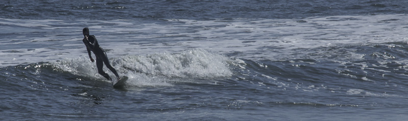
Al: I never served in the military; I know that I don’t have a soldier’s “headset,” for lack of a better word. I have high respect and admiration for those who have.
I considered not writing about Gettysburg. The scope is too large. Being on the battleground is completely overwhelming; I don’t know really where to begin.
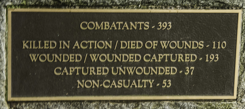
One way could be to look at the sobering statistics. In three days of fighting, July 1 – 3, 1863, approximately 7000 soldiers were killed. There were approximately 51,000 casualties (soldiers killed, wounded, captured, or missing). There are many estimates of the casualty count; we have seen higher and lower estimates. Some units lost two thirds or more of the men who were present at the start of the battle. 158,000 were engaged in the battle across the three days.
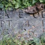
Casualty figures for a unit
Amazingly for a battle that surrounded a city, there was only one civilian casualty; a twenty-year-old woman named Jenny Wade was killed by a stray shot. How times have changed.
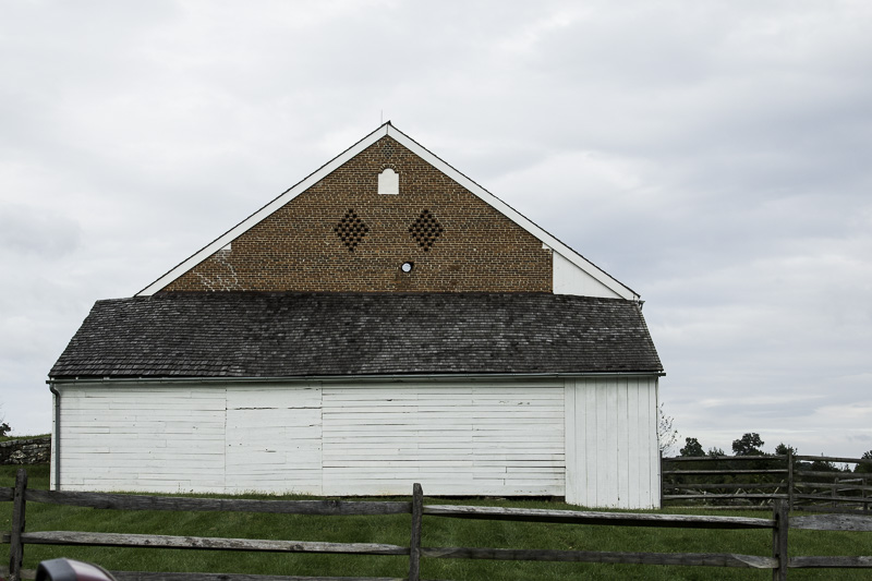
The civilian structures were damaged, though, and some still bear the scars.
Occasionally we’ll include a reference, “(NPS)”. This indicates that a particular statistic or comment came from the National Park Service’s Gettysburg FAQ web page.
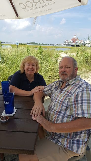
Kathe: I’ve been to Gettysburg in recent years but Al had never been; I couldn’t wait to share it with him.
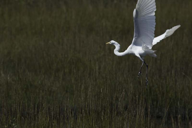
When we entered the visitors’ center, we headed right for the ticket booth and decided to purchase the three-way pass that comprises the Cyclorama, the museum, and a two-hour bus tour of the battlefields. As we always do with every National Park we visit, we started with the orientation film. It gave an overview of the three days in July 1863 — narrated by Morgan Freeman — and I was already in tears.
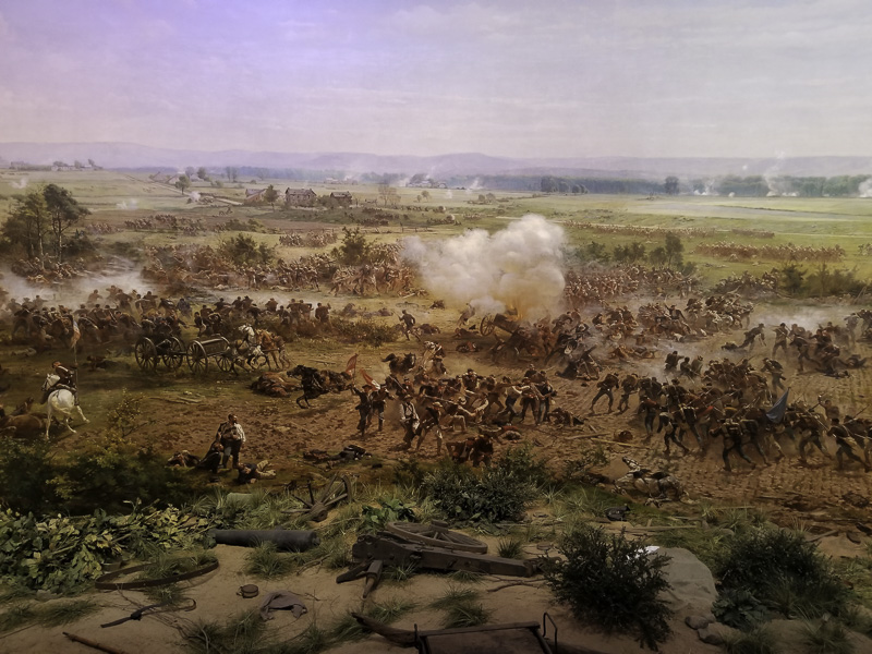
From the overview film, we were shepherded upstairs to the Cyclorama. It’s breathtaking – a 360-degree painting of the Gettysburg Battlefield that was painted in 1883 (it’s one of four that have been created – this one was acquired and restored a few decades ago). It is 42 feet tall and 377 feet around. We all stood on a raised platform in the middle of the room and were surrounded by images, lights, sounds, and narration that made it all come to life. We were in the midst of the battle. It was sobering. More tears.
Detail from the cyclorama
Us:Later while on the battlefield, one of the things that surprised us was the terrain. This is open, mostly flat, land. In 1863 it was even more open; many of the trees now present were not there. Then it was agricultural fields. The National Park Service has an ongoing program to restore the area to the conditions at the time of the battle, removing trees, planting orchards, and restoring walls and fencing. Local farmers have access to the land to plant crops.
According to our tour guide, the tactics had not changed much from the days of the Revolutionary War, with the soldiers often marching in a line across an open field toward the opposing side. A rise of only 100 feet (sometimes less) could give a dominant position.
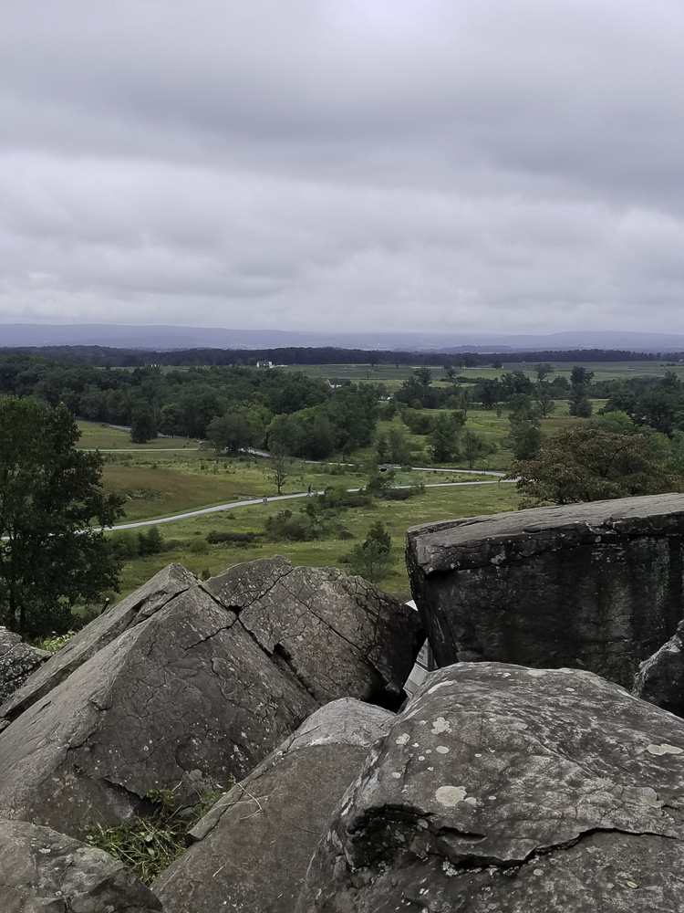
The key high point was Little Round Top, at 150 feet above the fields. The higher rise next to it, Big Round Top, was not useful militarily because it was (and remains) completely wooded.
View from the top of Little Round Top; only 150′ gives a strategic “high ground” advantage
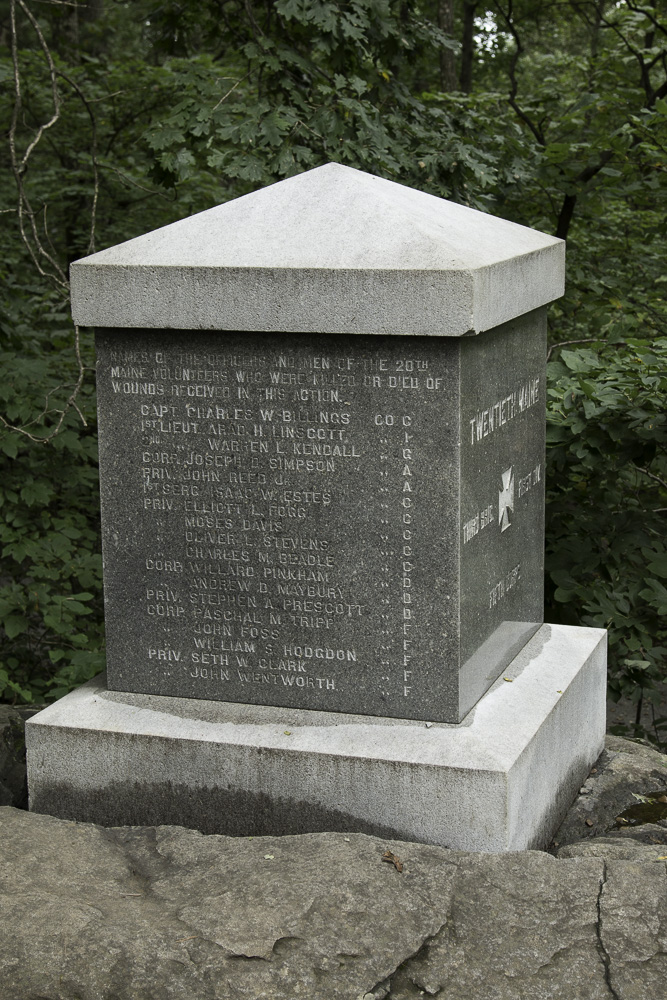
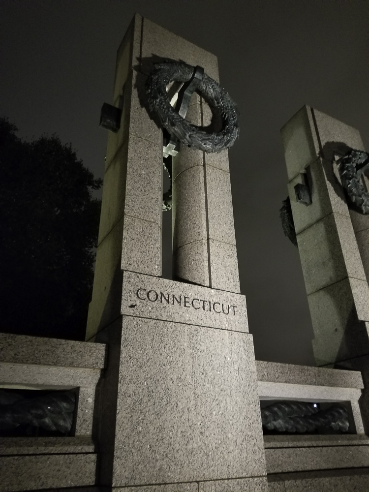
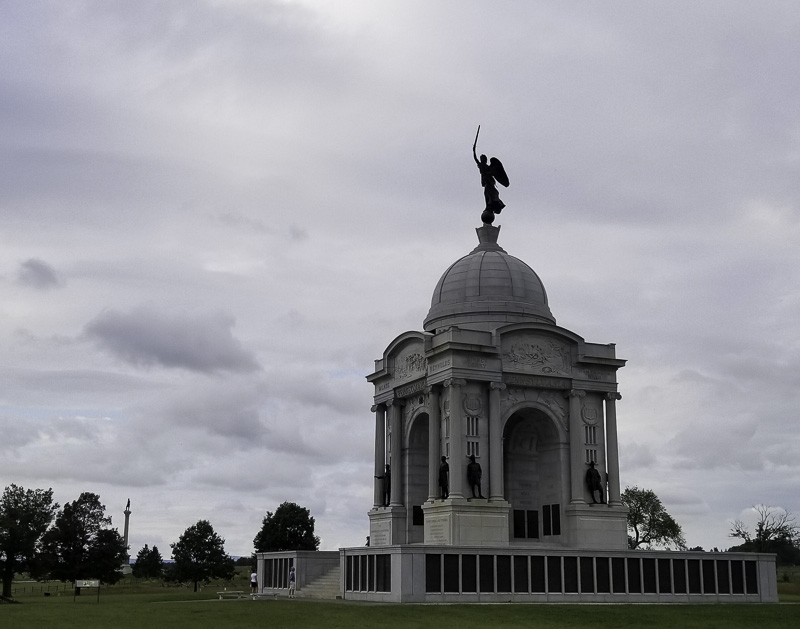
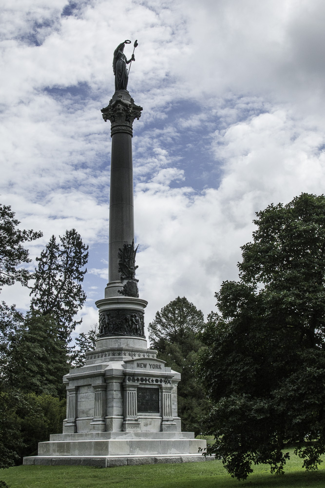
Shortly after the war, various groups began placing bronze and stone (mostly granite and marble) monuments on the battlefield honoring regiments, divisions, corps, and armies. Now there are approximately 1328 (NPS) monuments within the park. They range in size from gargantuan (Pennsylvania and New York) to diminutive and hidden in the woods (Maine 20th). The brigade monuments had either round (Confederate) or square bases (Union).
The Pennsylvania monumentOne of many New York monuments, this one in the cemetery
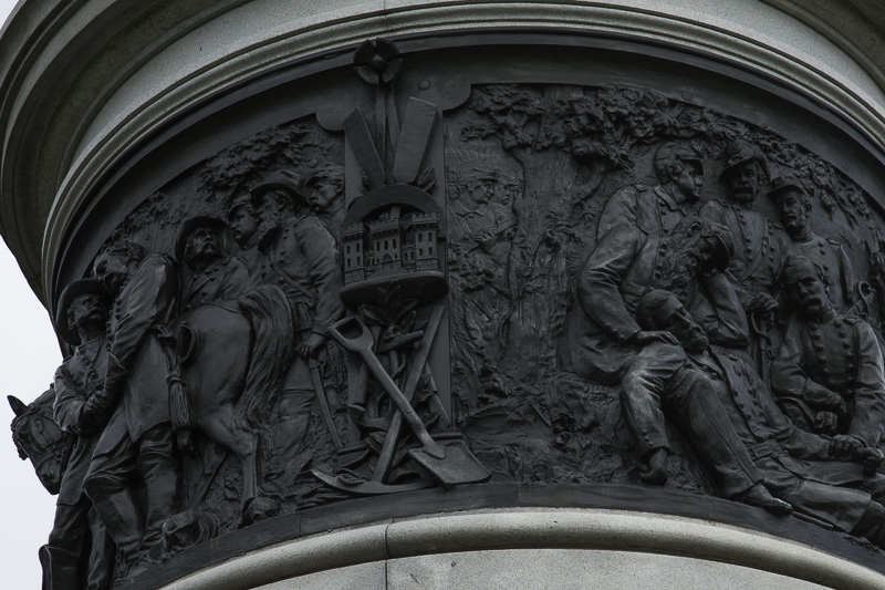
Detail of the New York monument
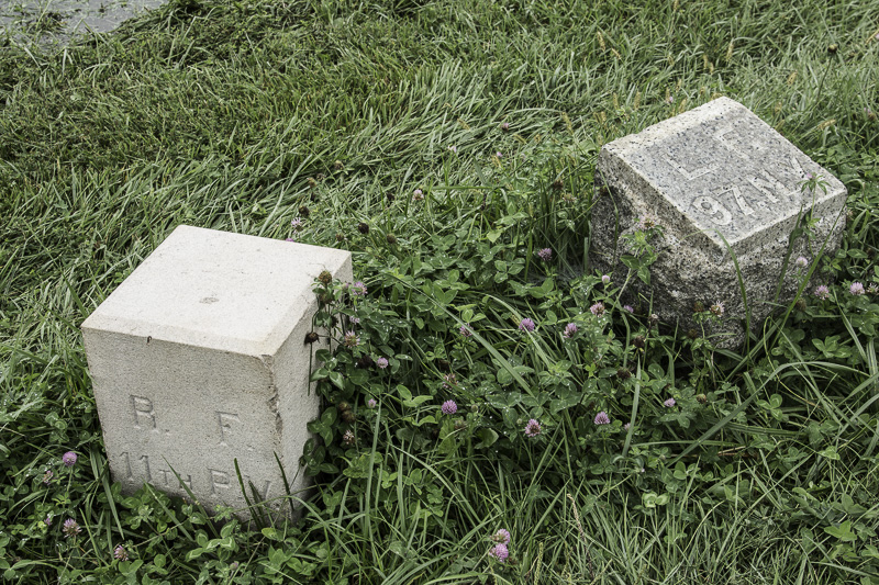
There were also many markers across the battlefield that indicated the midpoint of each regiment and their right and left flanks (ends). You can see how closely the units were deployed.
Markers indicating the right flank of one unit and the left flank of the next
We walked the range that the Maine 20th Regiment had spread across on Little Round Top; it was amazingly short. Due to where they were deployed, their monument is a short walk into the woods. The inscriptions on the sides of the monument list the soldiers who were killed or died of their wounds inflicted during the defense of Little Round Top.
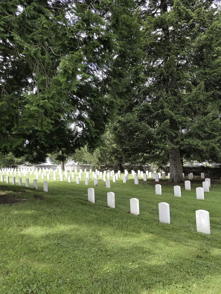
We took advantage of a free Ranger Program in the park on our last morning there: a tour of the National Soldiers’ Cemetery on Cemetery Hill. This area was known as Cemetery Hill at the time of the battle and was one of the contested regions. The Soldiers’ Cemetery is adjacent to a pre-existing public cemetery which gave the hill its name.
Soldiers were originally buried in shallow graves on the battlefield. They were then re-interred with great effort at the Soldiers’ Cemetery.
Originally set aside by the state of Pennsylvania, it was for the Union dead only. Most of the Confederate dead were interred in the Hollywood Cemetery in Richmond, VA, in a special section set aside for Gettysburg casualties (NPS). Now it is a national cemetery and is still in active use.
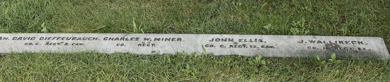
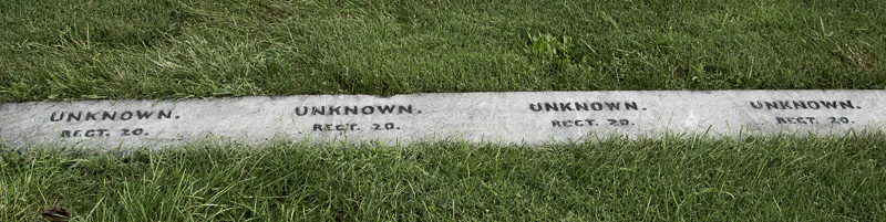
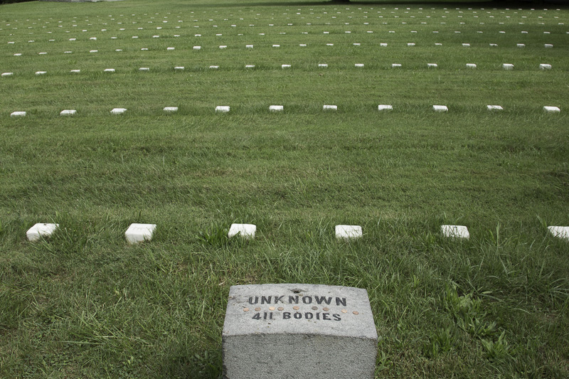
Initially the plan was to bury soldiers without regard to rank or unit. However it was decided to bury them in sections, according to the state they were from—still without regard to rank. Remarkably, most of the graves have names. Each state section has some graves marked “Unknown.”
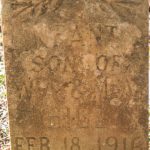
Most graves are identifiedSometimes the state and even the regiment were known, but the soldier’s identity was not
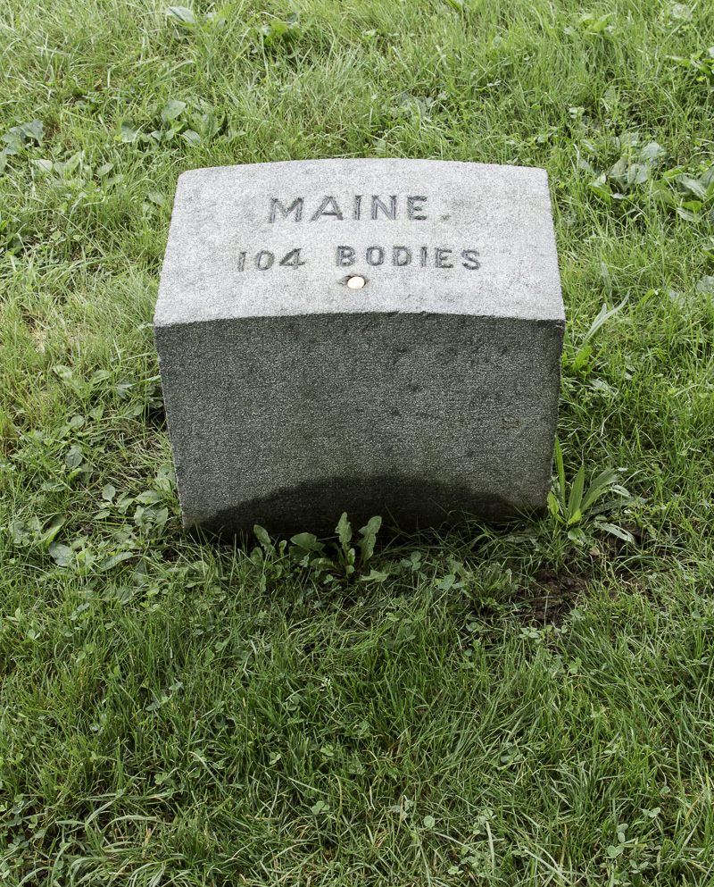
Each state had a marker indicating the number of soldiers buried here.
The marker for the Maine section
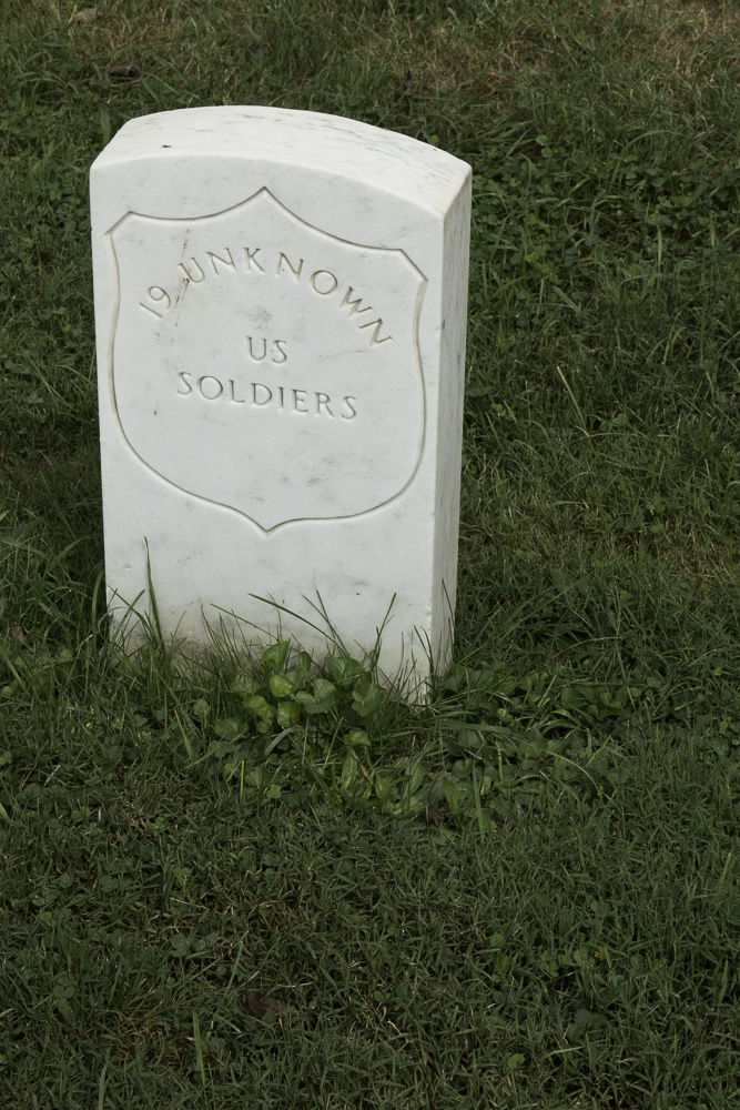
Additionally, there are many simple numbered marble markers for soldiers for whom their state was unable to be determined.
One section of graves of unknown soldiers
All of the soldiers are arranged in a semicircle around the Soldiers Monument that is the focus of the cemetery. The way they are buried seemed unusual; they are buried behind their headstone with their heads toward the center. In this way should they rise they will be facing outward, ready to defend Cemetery Hill again.
The cemetery is still in use; here are some graves from the Spanish-American War, and World Wars I and II. Still newer graves are in an adjacent annex.
Graves of soldiers from the Spanish-American War and World Wars I and IIMarking newer graves of unknown soldiers
Being on the battlefields of Gettysburg gave us a deeper understanding and reverence for the words of Lincoln’s Gettysburg Address. It is an awe-inspiring and humbling place that we hope each of you will have an opportunity to experience.
Four score and seven years ago our fathers brought forth on this continent, a new nation, conceived in Liberty, and dedicated to the proposition that all men are created equal.
Now we are engaged in a great civil war, testing whether that nation, or any nation so conceived and so dedicated, can long endure. We are met on a great battle field of that war. We have come to dedicate a portion of that field, as a final resting place for those who here gave their lives that that nation might live. It is altogether fitting and proper that we should do this.
But, in a larger sense, we can not dedicate—we can not consecrate—we can not hallow—this ground. The brave men, living and dead, who struggled here, have consecrated it, far above our poor power to add or detract. The world will little note, nor long remember what we say here, but it can never forget what they did here. It is for us the living, rather, to be dedicated here to the unfinished work which they who fought here have thus far so nobly advanced. It is rather for us to be here dedicated to the great task remaining before us—that from these honored dead we take increased devotion to that cause for which they gave the last full measure of devotion—that we here highly resolve that these dead shall not have died in vain—that this nation, under God, shall have a new birth of freedom—and that government of the people, by the people, for the people, shall not perish from the earth.
Abraham Lincoln. November 19, 1863.
Delivered at the Soldiers’ Cemetery in Gettysburg, Pennsylvania
Just before the time we’re writing about here (we’re a bit behind the times) Hurricane Florence hit North Carolina and affected so many people in the southeast. We’re very thankful that those we know who were in the area are safe, and are keeping those more seriously affected in our prayers.
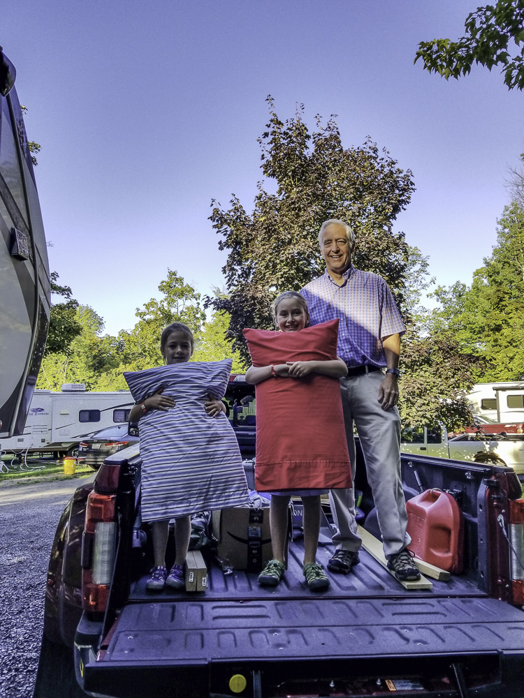
Grandkids
We’ve had our first “house guests!” (RV guests?)
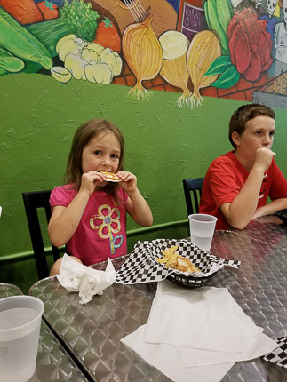
We traveled to Watkins Glen, NY, to spend some time with our son Mike, our daughter-in-law Laurelyn, and four of our grandkids in Corning, about 20 minutes away.
Friday night dinner — delicious Mexican food.
The two boys, Dean, 10, and Graham, almost 13, spent Friday night with us. They were the first to use the convertible couch in the RV as a bed. They reported it to be comfortable (phew!).
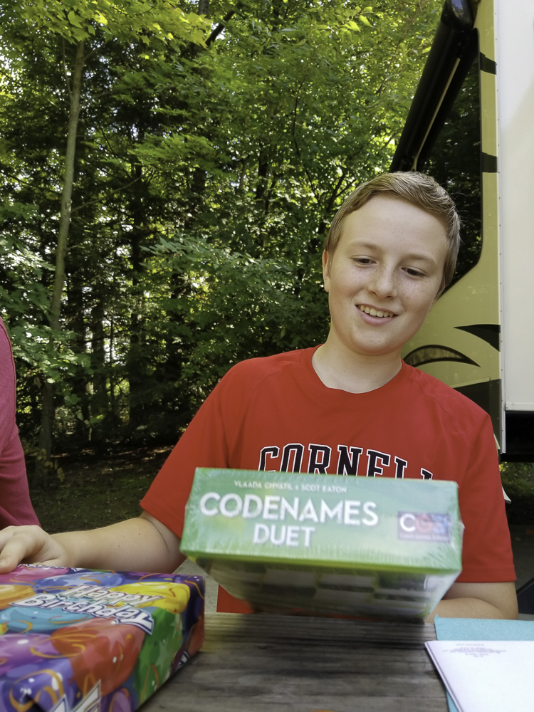
We had an early birthday for Graham, and then played one of his new games. Graham will soon be a teenager! How did that happen so quickly?
Early birthday!
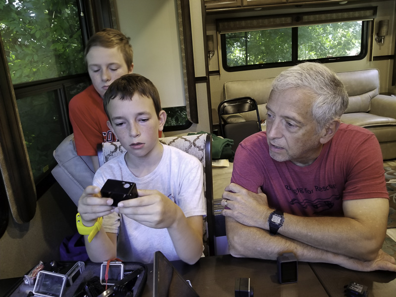
Also Grandpa got a lesson in GoPro from Dean!
Saturday morning, Graham and Dean’s sisters, Mira, 7, and Brynn, 5, joined us—Saturday night was the girls’ night to sleep in the camper and boy, were they excited!
No, they didn’t ride over in the back of the truck!
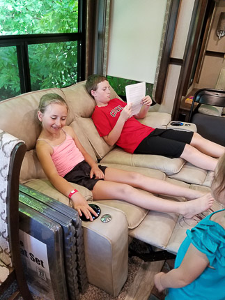
The plan for the day was to enjoy the features at the campground. But before we headed out, everyone had to try (again and again!) the magic recliners in the camper — they’re powered to recline, heat, and massage and were a BIG hit!
We lost count of how many turns each of the kids had trying out the recliners.
Time to play! Grandma and all four kids took advantage of the campground’s mini-golf course.
Ready for the U.S. Open! Look out, Tiger…
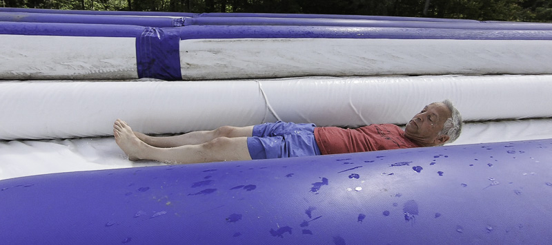
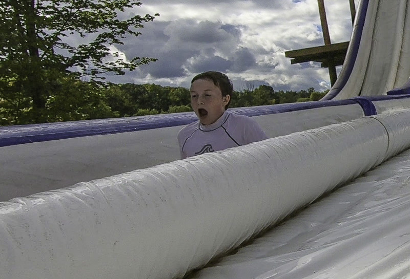
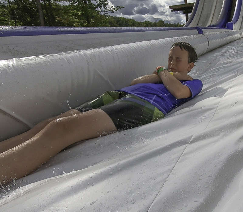
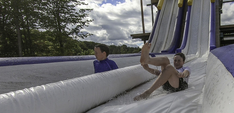
Then we all made use of the on-site water park. The big hit was the water slide. Grandpa L. also gave the slide a try! Graham just about wore the slide out…
Grandpa was happier about the ride than he looked!Oh, my goodness!Some serious concentration. Go, Dean!
What’s happening here?
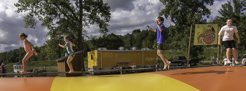
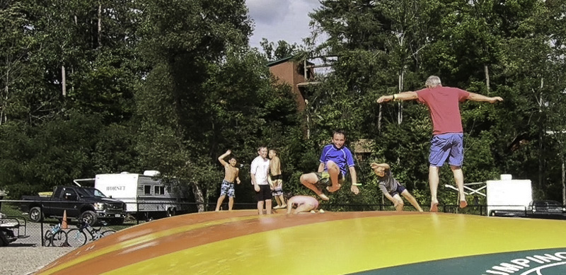
We also made use of bumper boats and the jumping pillow. Grandpa L. tried the jumping pillow, much to the amusement of those watching. By getting back off the pillow very quickly, he avoided permanent injury! (Note to GL: you’re not 14 any more!)
Mira, Brynn, Dean, and Graham on the jumping pillowGrandpa L, just before he failed miserably!
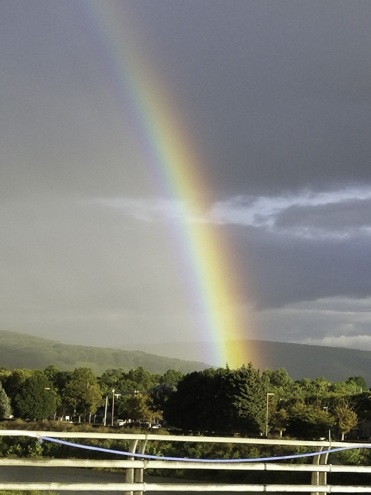
In Corning Sunday night, we saw what we all agreed was the most intense rainbow we had ever seen!
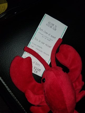
May we introduce Lolly Lobster, our traveling mascot.
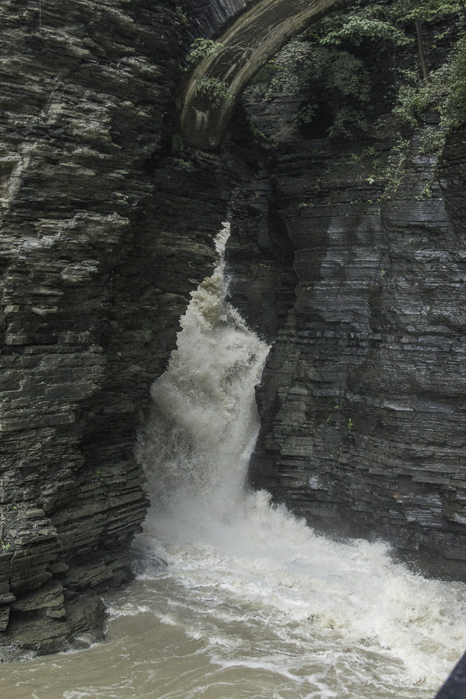
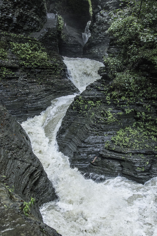
The remnants of Hurricane Florence came through our area on Monday. We were scheduled to leave on Tuesday, but the weather between there and our next destination, French Creek State Park in PA was predicted to be lousy for driving. We delayed our departure by a day and took advantage of the extra day to visit Watkins Glen State Park which we had never been to before.
Wow!
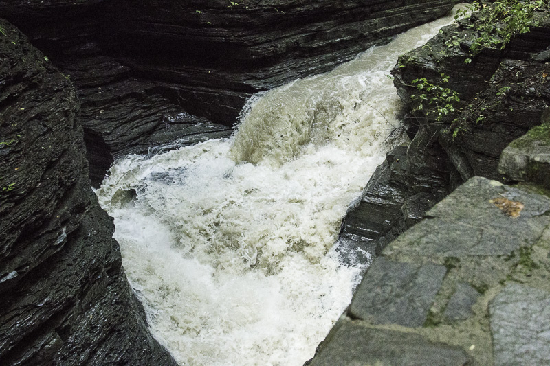
One fall, near the start of the walk.
The heavy rain of the day and night before gave us some spectacular scenery as we walked up the gorge path along Glen Creek.
A torrent
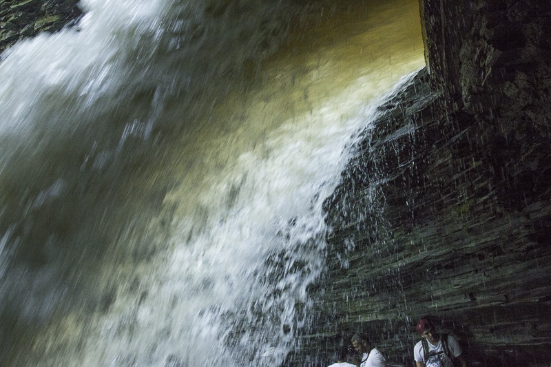
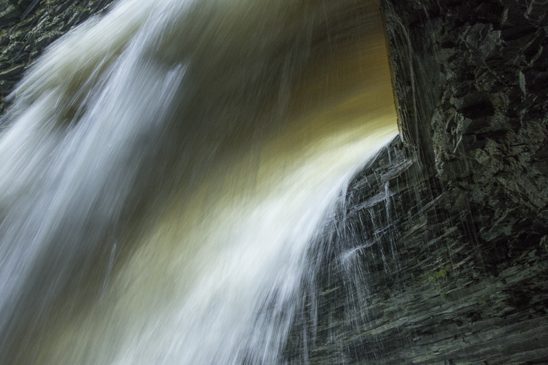
They claim that there are 19 waterfalls along this mile and a half path. We have no idea how they count. It looked like one continuous cascade to us!
What number is this, honey?
Yes, the trail goes behind several of the waterfalls!
Awe-full to have all that water cascading over your head!Fun playing with shutter speeds…Another waterfall to go behind!We’re embarrassed that this was our FIRST visit to the park — what an amazing spot!
We rounded out our visit to Corning and Watkins Glen with a lovely dinner out overlooking Seneca Lake. It was a sensational visit, albeit all too quick. We’ll be back!
We were giddy when we realized we could spend the better part of a week in Washington, D.C. We’d only ever been with kids or as kids ourselves. We were long overdue for an opportunity to experience our nation’s capital as adults with no real responsibilities for anyone else!
We camped at the Cherry Hill Park Campground, in College Park MD. If you’re coming this way in an RV, we highly recommend it. It’s the nicest place we’ve stayed so far, and by no means the most expensive. The Metro bus comes right to the campground and it’s a quick ride to the train station. And then just a 20-25 minute ride into the heart of D.C. It was SO easy to navigate.
And… the campground has single-stream recycling!
Each day at 4 PM, the campground offers a great orientation to the D.C. transportation system and an intro to two tours—we signed up for both. Terrific.
A week in Washington Is not nearly enough! We didn’t have even that much time, but we had a wonderful time. We went into the city four times; twice on our own and twice as part of the tours organized by the campground.
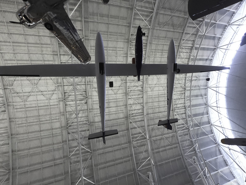
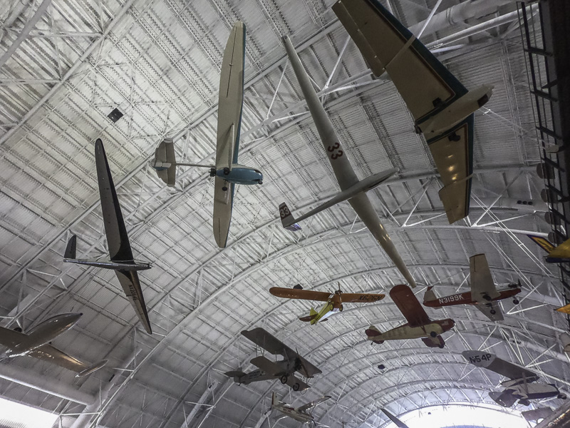
The first day we were there, we went into the city on our own and split up. I (Al) went to the Steven F. Udvar-Hazy Center of the Smithsonian’s Air and Space museum near Dulles Airport. If you are into the history of aviation and space exploration at all, this is a must see.
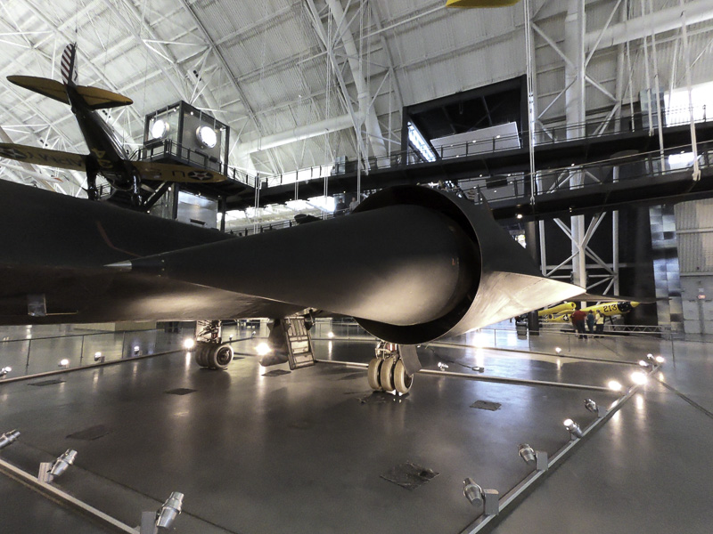
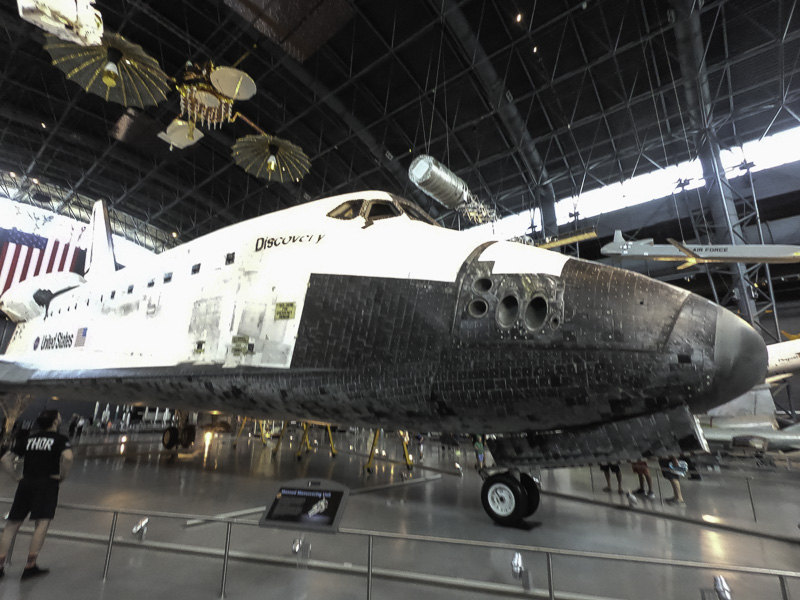
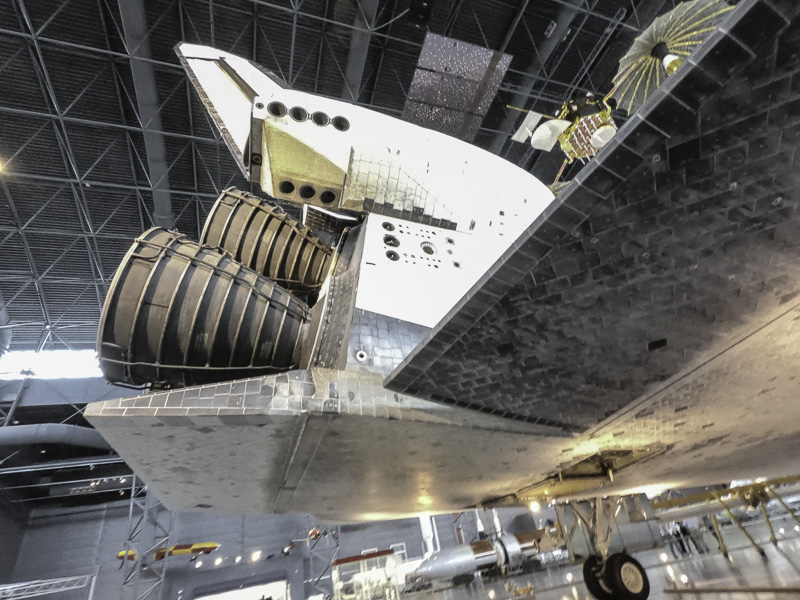
The museum is in a huge hangar, and has a wide range of planes and space craft from very early days to recent history. Main displays include a Concorde SST, an SR-71 (the fastest—2000 MPH—and highest flying—80,000 ft—jet ever built — 32 were built in all), the space shuttle Discovery, and the Enola Gay. Beside those four, there are aircraft and space craft densely packed in the hanger, in three layers: one on the hangar floor and two layers creatively suspended in the air from the ceiling. I spent over three hours there and only scratched the surface. The density actually is a problem in trying to get good pictures of the craft because of the visual clutter in the background.
The SR-71 is very difficult to photograph in its entirety in this setting. It is huge. It is jet black (get it?). It is crowded by other craft. Here is the port engine, a marvel of slide rule engineering—it was designed in the late 50’s—early 60’s— with NO computers!
SR-71’s engine and “spike”
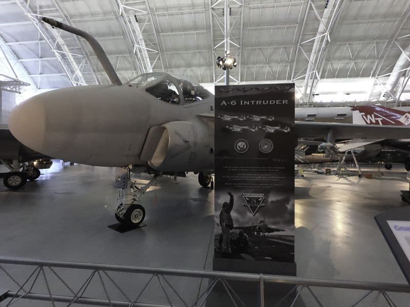
The A-6 was one of the key bombers of the Vietnam era.
A-6
The Discovery has a prime place on the display floor.
Discovery. Thank you for living up to your name…The engine nozzles. This thing is BIG!
If I had to have an Airstream instead of our current trailer, this is the one I would want!
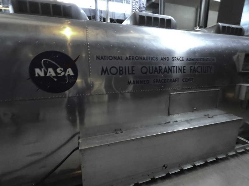
The NASA “RV”
(Actually, it wasn’t made by Airstream. Sure looks like one, though!)
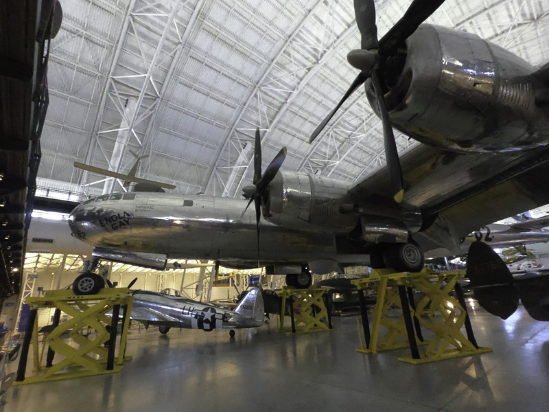
One of the most famous airplanes in history:
Enola Gay–it dropped the first atomic bomb , on Hiroshima.
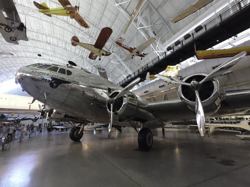
The Boeing 307 was one of the, if not the, first commercial airliners. It was based on the B-17C bomber from World War II.
Boeing 307
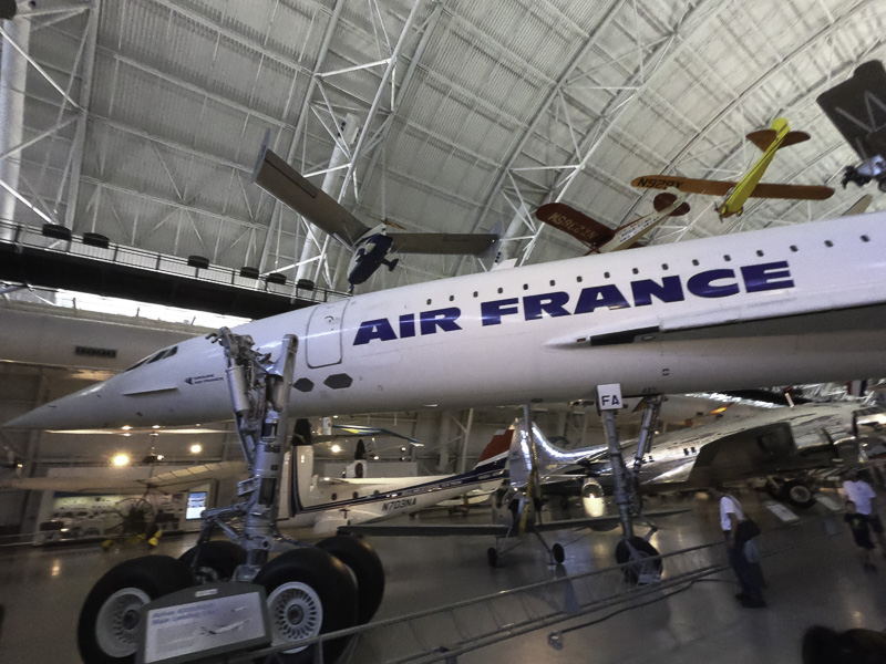
I wonder whether or when we’ll have another supersonic passenger plane.
The Concorde
The Global Flyer accomplished the first solo, non-stop circumnavigation of the world. Sixty seven hours and one minute.
Global Flyer . The wingspan is HUGE!
A sampling of the planes suspended from the ceiling.
Too many planes to keep straight!
The museum is quite a distance from downtown area, but is well worth the trip!
Kathe: While Al was at the museum, I visited several museums on and near the National Mall. Within just a couple of blocks of wandering, I came upon a very long queue of folks waiting to get into the Newseum. As it turned out, it was FREE MUSEUM day in D.C. I hopped into line and immediately started chatting with a couple of women. Before long I realized that even though it was a free entry day (usually $25), I still needed a ticket. One of the women I was in line with graciously offered me a second free ticket that she had. Score!
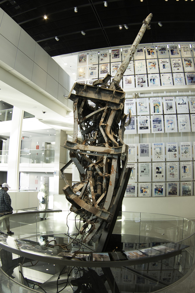
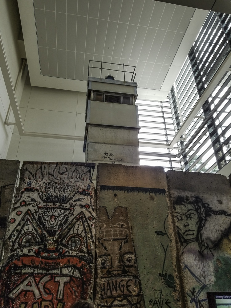
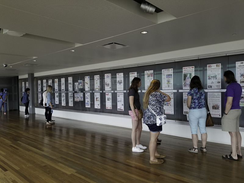
I stayed at the Newseum for two solid hours and thought my head would explode! This museum focuses on the world of journalism and promotes first amendment rights through exhibits that include (among many others): 9/11, the Berlin Wall, a special FBI exhibit, a daily display of 80 first pages of newspapers from around the US and the world, a wide range of films documenting important world events, and an extraordinary gallery of decades of Pulitzer Prize winning photos.
The remains of the antenna tower from the top of the World Trade Center. Front pages of international newspapers reporting on 9/11.This display includes eight panels from the Berlin Wall and the guard tower from Checkpoint Charlie – extraordinary!During the overnight hours, the Newseum receives copies of the front page of more than 80 newspapers. They are printed oversized and displayed – fascinating to see how the same story can be reported from so many perspectives. An important display!
What is striking is that each of the exhibits includes a range of short videos by journalists who covered the story. It is without a doubt the most current, dynamic, compelling, and thought-provoking museum I’ve visited; I considered suggesting that they hand out Kleenex as you come through the main door — and yes, I took Al back to it later in the week! I can’t recommend this one highly enough.
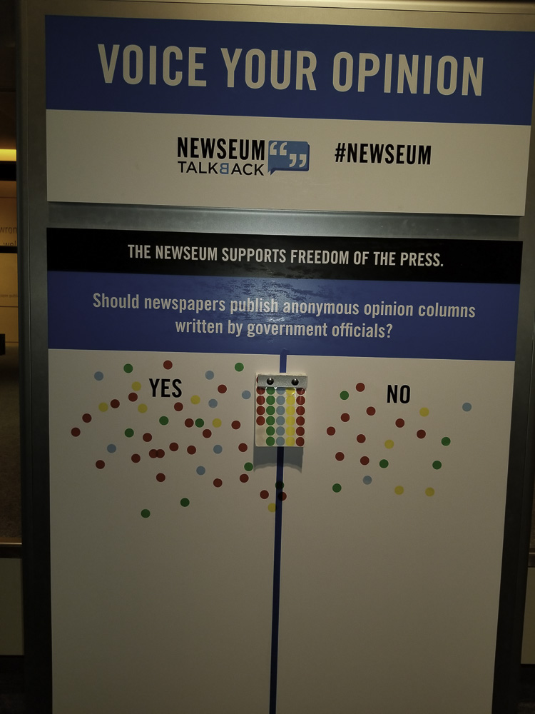
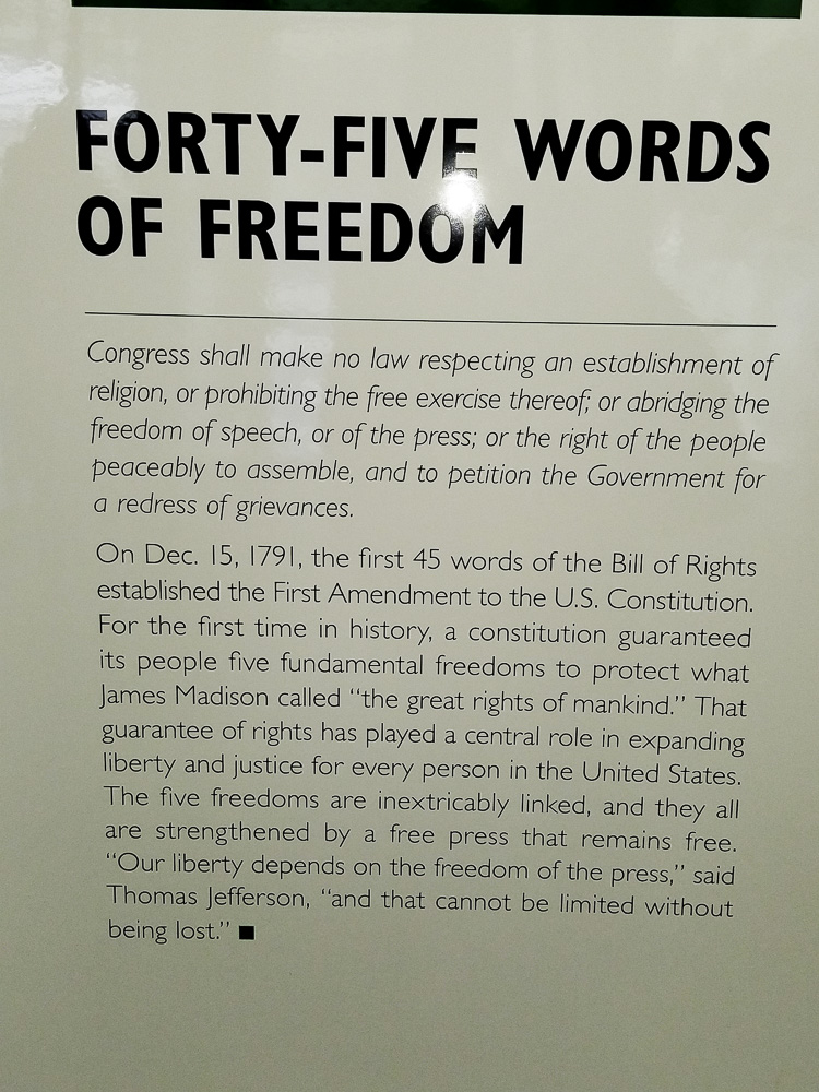
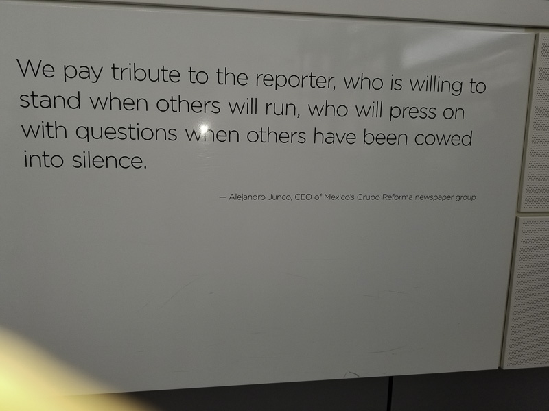
You can also make YOUR opinions known at the Newseum. The opinion poll question is always related to the current day’s news.It was refreshing to reread the First Amendment. Do you know what the five rights are?A sobering memorial (at least two stories high) of journalists who have given their lives in their pursuit of the truth.
Just in! The Newseum set its all-time single-day visitor record on Saturday, Sept. 22, 2018, with 11,815 people visiting the one-of-a-kind institution. (Guess it helped that I was there!)
I also visited (somewhat briefly) the National Gallery of Art, the National Museum of Natural History, and the Hirshhorn Sculpture Garden. It was a whirlwind and honestly, I could have spent days upon days visiting so many more museums — alas, I needed to meet Al and we needed to figure out where we would eat dinner.
Never underestimate the power of Google! We searched “Restaurants near Me” and found an Indian restaurant nearby — what a find! It turns out that Rasika is a restaurant which has won a James Beard award and we can see why. It was amazing!
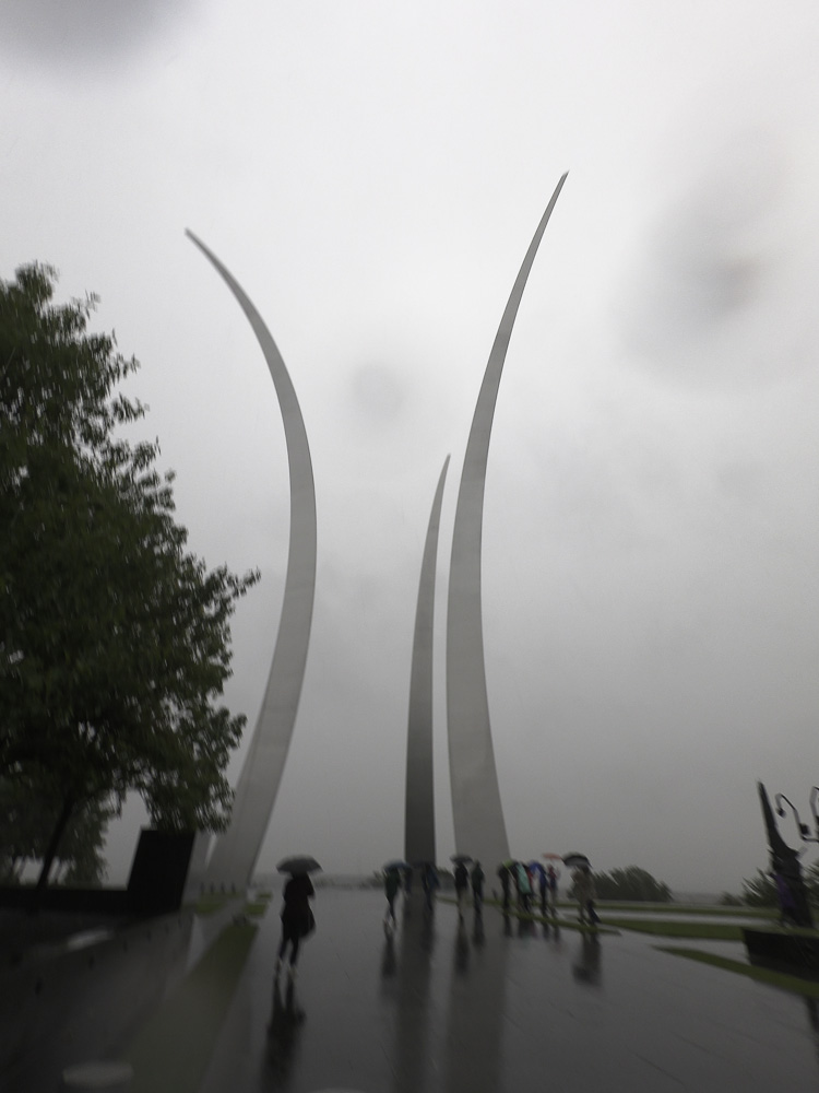
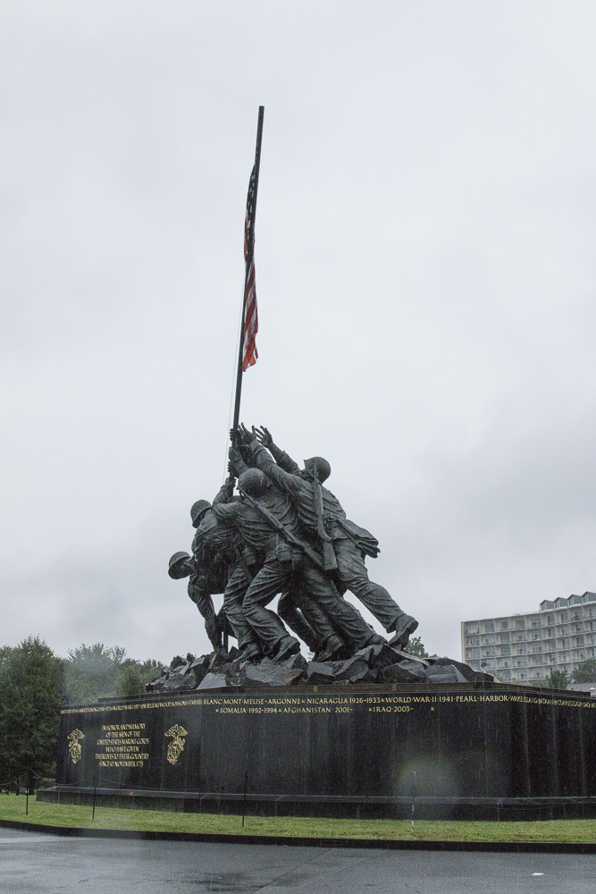
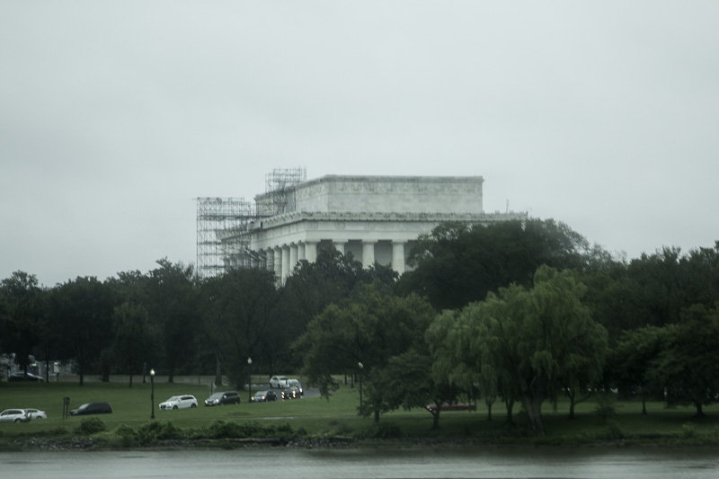
On the second day we took a day-long guided tour of the city with a very knowledgeable guide. We visited the Air Force Memorial and the Marine War Memorial (also called the Iwo Jima memorial). Then we took a water taxi ride from the wharf near the Lincoln Memorial to Georgetown.
“Bomb burst” maneuver, missing man formationThe Marine War Memorial, “Iwo Jima”Lincoln Memorial from the Potomac River
We stopped at the Pentagon City Mall for lunch, and found a stand offering a wide variety of baklava squares that were imported directly from Lebanon. They were incredibly delicious and oh, so sweet. We got several and were able to make them last for several days, but it was tough. It would have been so easy to eat all of them before the end of the tour!
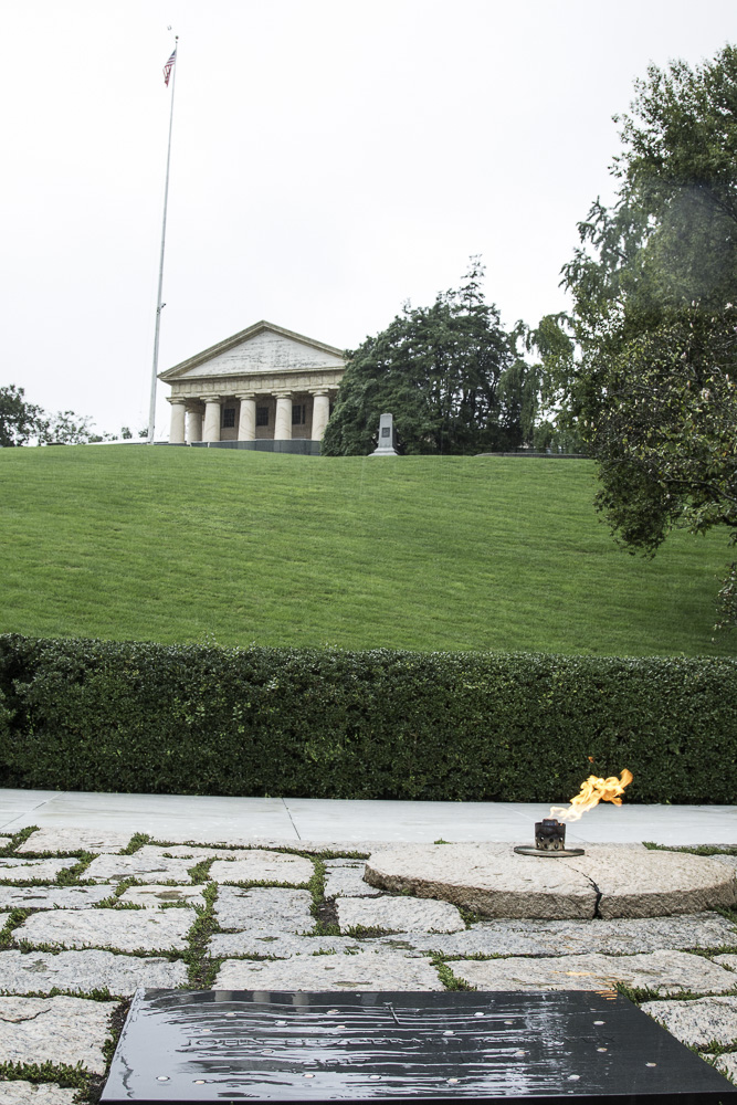
After lunch we went to Arlington National Cemetery, and took their tram tour. We hadn’t known that Arlington was originally the estate of Robert E. Lee, which was confiscated after the Civil War. The very first graves (Union soldiers) had been interred in Mrs. Lee’s garden (making a clear statement to Lee). We stopped at the grave of President Kennedy, where Jackie Kennedy Onassis and two of their children are also buried. The site is directly below Lee’s house, and was actually selected by the president when he visited the cemetery. Admiring the view, he was heard to say, “I could stay here forever.”
JFK’s grave and RE Lee’s house
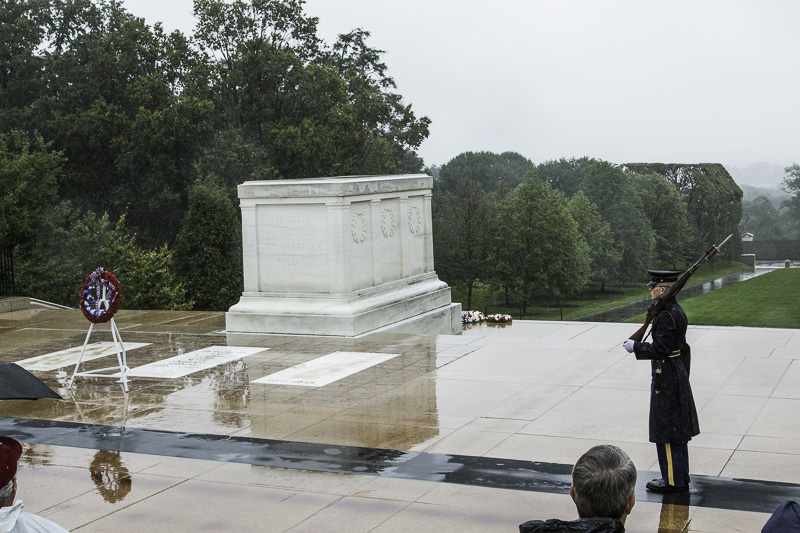
Next we went to the Tomb of the Unknown Soldier, a very sobering place. We had both been to this site before but it was good to revisit it. We were present for the changing of the guard ceremony. The guard has been present 24/7/365 since it was initiated on April 6, 1948. The markings of so many years of the sentries’ precise steps were visible in the dark orange on the granite platform. It is an incredible honor to be chosen for this highly competitive post.
The Tomb of the Unknown Soldier
There are graves for one soldier each from World War I, World War II, the Korean War, and the Vietnam War. The crypt for the Vietnam War unknown soldier is now empty, as the entombed soldier was identified in 1998 as Air Force 1st Lt. Michael Joseph Blassie through mitochondrial DNA.
Here is Kathe’s video of the Changing of the Guard ceremony.
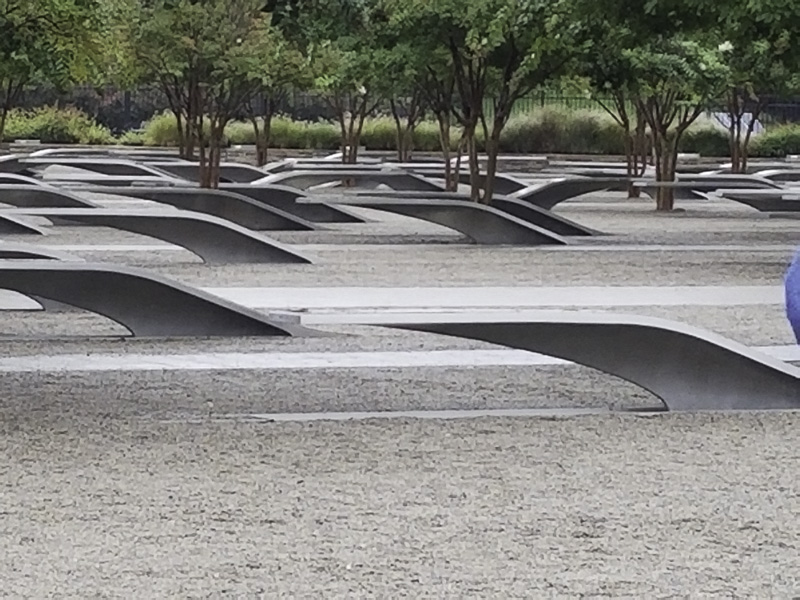
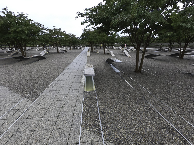
Since the rain had picked up and no one really wanted to get off the trolley, the tour of Arlington was a bit shorter than usual. Our tour guide asked if we would like to visit the Pentagon Memorial. Yes! Several others on the tour had already seen the NYC 9/11 Memorial and the Flight 93 National Memorial in Shanksville, PA and were eager to see this 9/11 memorial as well.
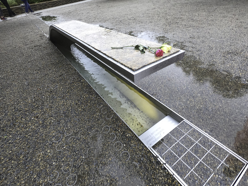
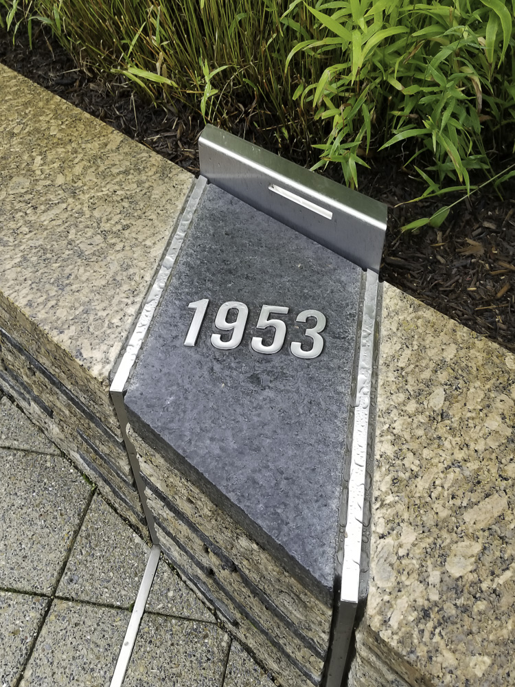
The Pentagon Memorial is breathtaking — and a feat of imagination. There is a stainless steel cantilevered bench inlaid with granite for each of the 184 victims with their name engraved on it. The bench has a lighted pool of water underneath which reflects light onto the gravel field at night. Each bench resembles an airplane wing and points one of two ways depending on if the victim worked at the Pentagon or was on the ill-fated plane that crashed into the building. All of the benches for people born in the same year are arranged in a line going diagonally across the large area.
If the base points toward the Pentagon, it commemorates an employee. If the base points in the opposite direction, the victim was on the plane.The victim’s name is engraved on the edge of the bench. However, in this case, three other names and birth years are engraved below; this represents four members of the same family who were all victims aboard the hijacked plane.
Commemorative benches in line with this marker represented those born in 1953.You can follow the stainless steel tracks across the memorial to count how many victims were born in a particular year. It was harrowing.
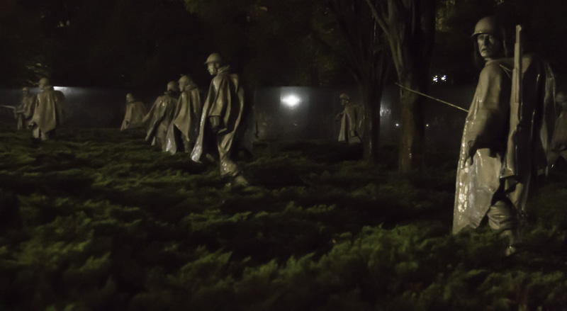
The third day we took a night tour to several memorials including the Jefferson, Lincoln, FDR, MLK, World War II, the Korean War, and the Vietnam War memorials. While we had been to several of those before, those visits had not been at night nor in the rain. Washington looks different at night!
Two of the memorials that really struck us were the Korean War Memorial and the FDR Memorial. The nineteen statues of soldiers in the Korean War Memorial were all facing in different directions, on guard, each wearing a rain poncho, and some in full combat gear. It was fitting that we visited the memorial at night and in the rain. The statues were surrounded by low shrubs that gave the sense that they were standing in rice patties. It was striking.
The bronze statues seemed to come to life.
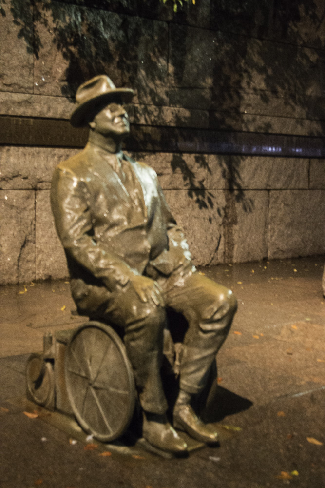
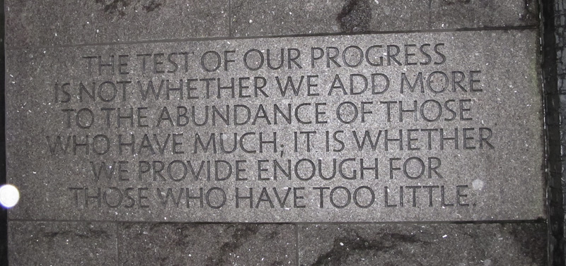
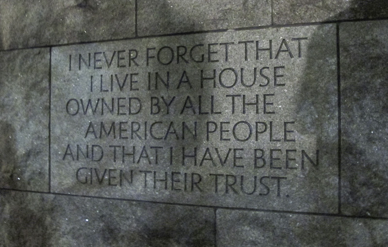
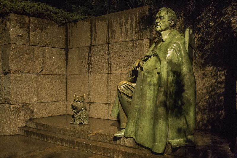
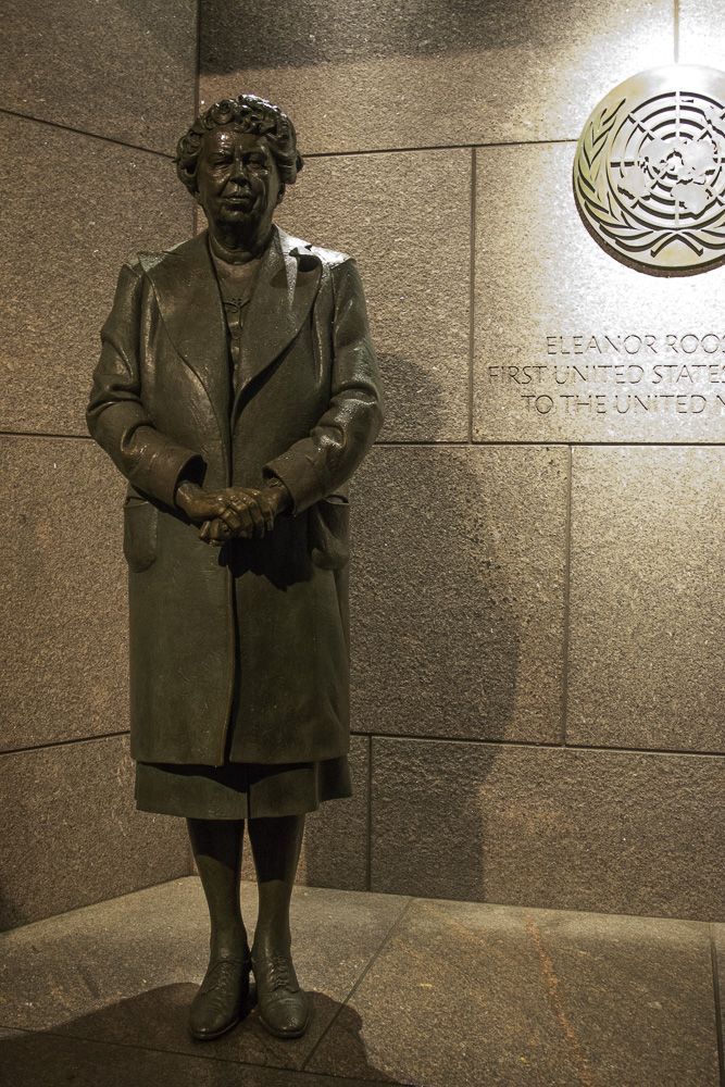
The FDR Memorial was huge—it’s the largest memorial on the National Mall. There was a large open air room that depicted each of FDR’s four terms as President. The pathway through the memorial was meandering and featured bronze statues, water installations, stirring wall art, and FDR quotes. Near the end of the walkway was a beautiful statue of First Lady Eleanor Roosevelt. It was hard to take it all in; we’ll certainly visit it again. You can learn more about this monument here.
The first statue in the memorial depicts FDR in his wheelchair.FDR was in office during the Great Depression.FDR was a man who took his role as President seriously and with great humility.One can see how tired FDR looks during his third term in office. His beloved dog, Fala, was always at his side.Eleanor Roosevelt, the only First Lady depicted in a presidential memorial in D.C. She was a steadfast adviser to her husband and also served as our first ambassador to the United Nations.
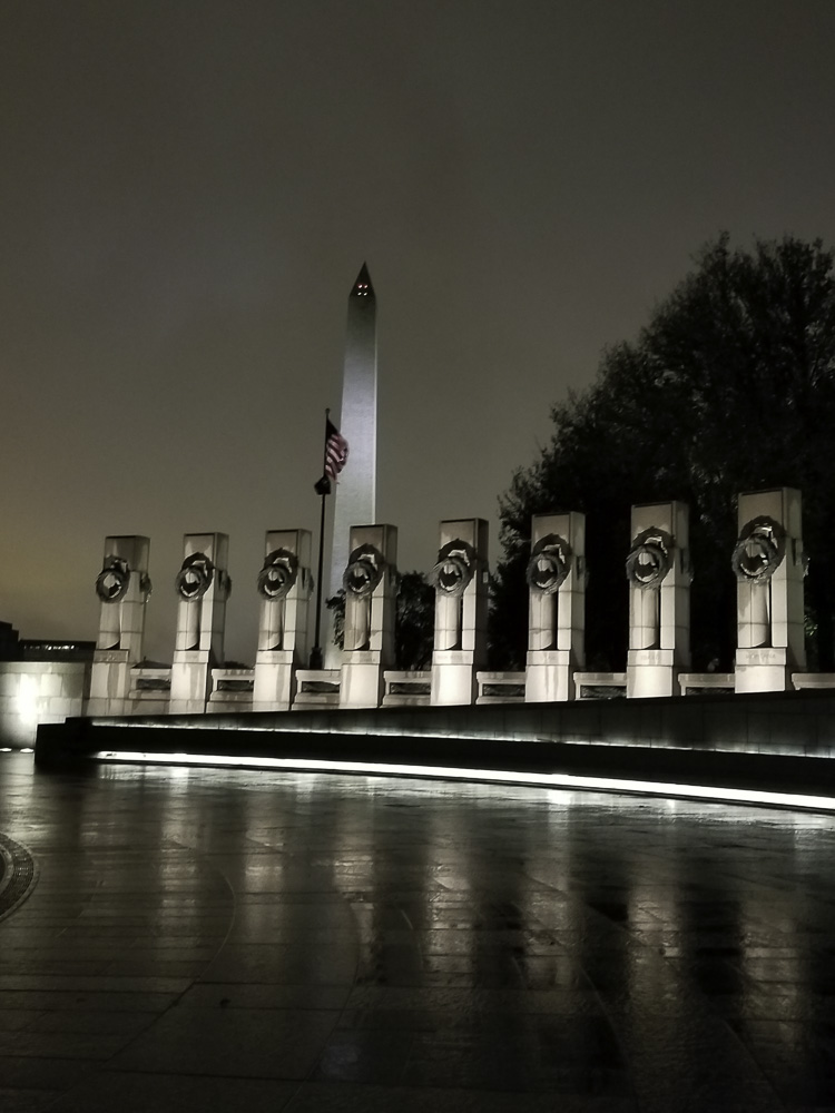
The World War II Memorial was impressive and particularly beautiful lit up at night.
The World War II Memorial.
At the WW2 Memorial
Our last day in the city we visited two keystones in the federal government, and then re-visited the Newseum so that Al could see several of the exhibits that wowed Kathe on the first day.
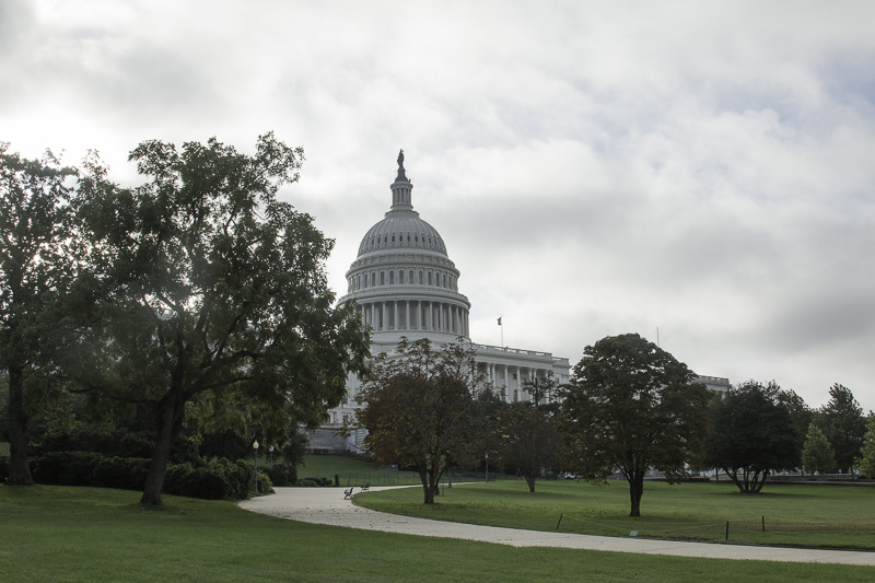
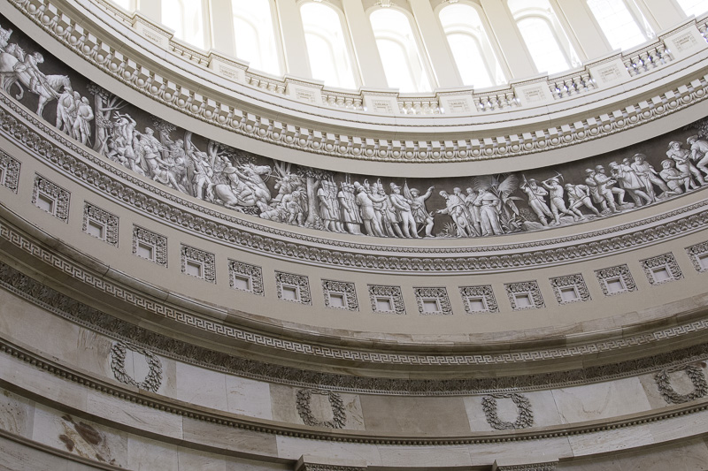
We first visited the Capitol, which requires a guided tour unless you contact your Representative or Senator. The guided tour was slightly disappointing to Al. It covers just the crypt below the Rotunda, the Rotunda itself, and the Statuary Hall. All of these were very crowded and we were not allowed to separate at all from the tour group, so that good photography was not possible.
Walking from the mall to the Capitol, you have to go to the far side to reach the visitors’ center. When you get to approximately the front side of the Capitol, the sign says “Average walking time: 8 minutes.”
Walking past the building you get several views of the Capitol.
On the side away from the mall, you pass the main (ceremonial?) entrance to the Senate building, which is a wing added to the original Capitol building.
Here is the original Capitol building. Until Reagan, presidents were inaugurated on these stairs. Starting with Reagan, the inaugurations switched to the other side because the crowds could overflow onto the National Mall.
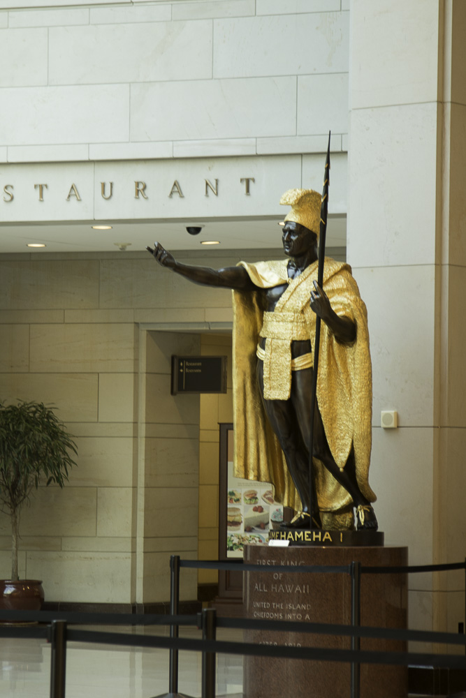
Every state can send two statues depicting important (dead) people from the state. Most are in Statuary Hall, but some are in the main hall of the visitors’ center. Here is King Kamehameha I from Hawaii, the largest of the 100 state statues.
After an introductory film, we began the tour in the crypt, just below the Rotunda. The crypt is so named because it was intended to be the burial place for George Washington. Washington’s express wishes in his will were to be buried in his Mount Vernon estate, which eventually were acceded to. In the center of the crypt is a marker which is the geographic center of the original extents of the District of Columbia. If it were not roped off, here you could stand simultaneously in Northeast, Northwest, Southwest, and Southeast DC!.
The Rotunda has eight murals depicting historic moments. It also has a circular mural around the dome opening showing 400 years of American history.
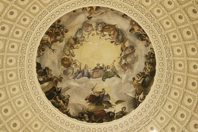
The ceiling of the Rotunda has a painting named “The Apotheosis of Washington.” Apotheosis means to elevate someone to the status of a god. Washington, who twice voluntarily relinquished power, would have hated it.
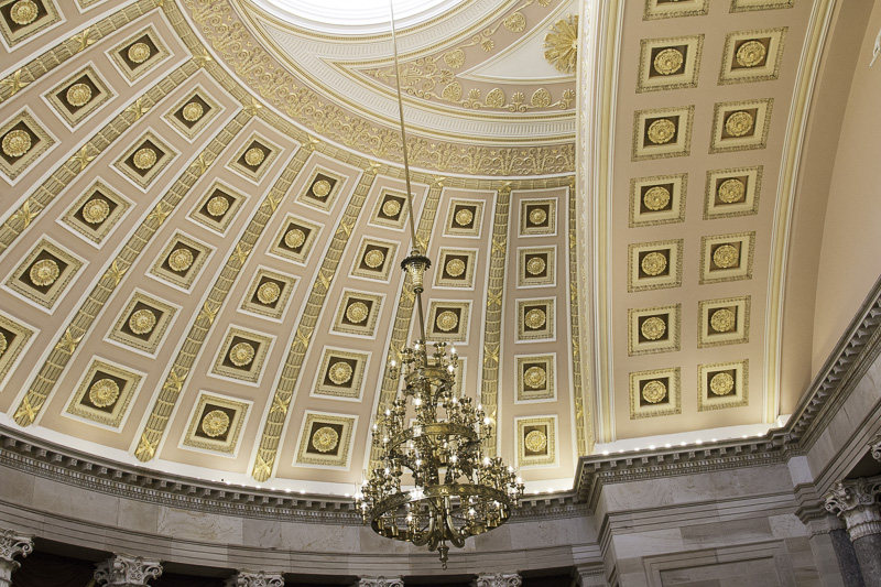
The Statuary Hall was originally the House Chamber until the members could no longer fit, at which point the separate House building was added.
The ornate ceiling of the National Statuary Hall, formerly the House chamber
The spherical shape of the ceiling caused the room to have terrible acoustics, making it very difficult to conduct business. The solution? Build a new House chamber!
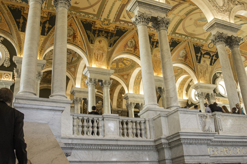
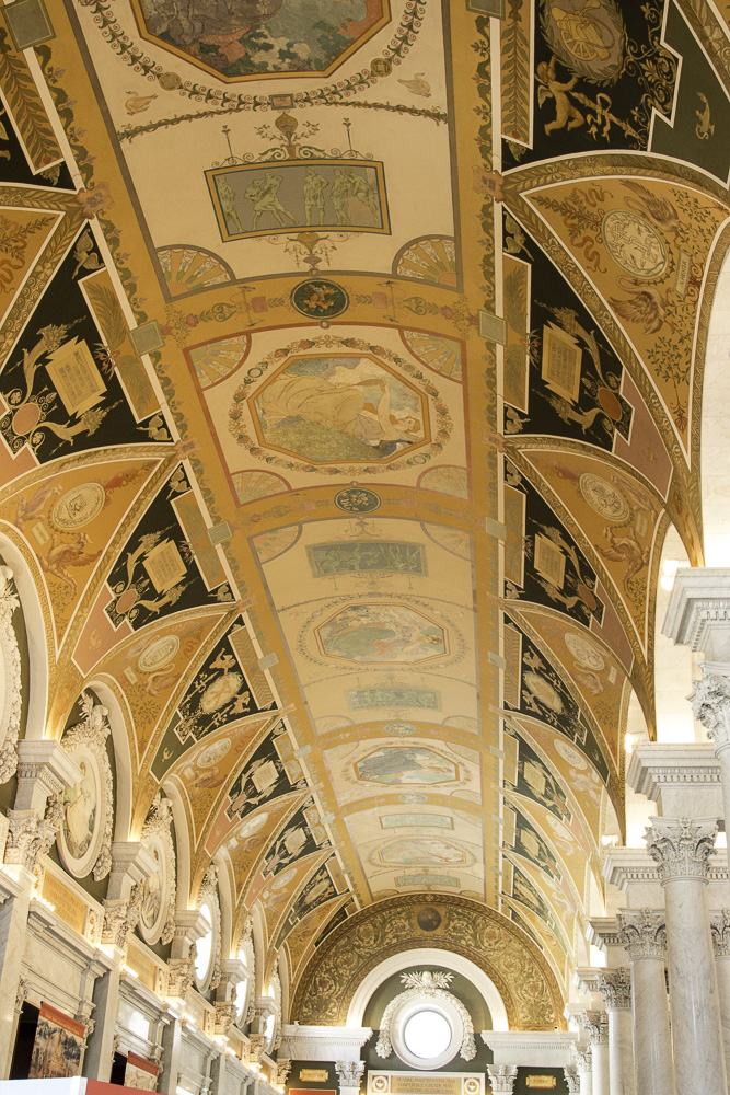
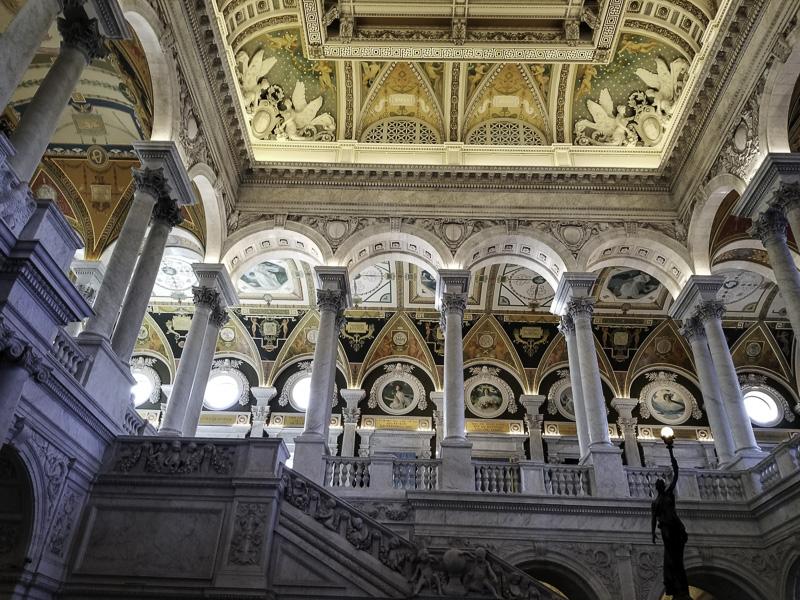
We then walked through the tunnel from the Capitol to the Library of Congress, specifically the original Jefferson building. The Library currently comprises four buildings: three adjacent ones in the Capitol district, Jefferson, Adams, and Madison, and one at Fort Meade.
The Jefferson building’s interior is overwhelmingly beautiful. Whereas the Capitol required one to take a guided tour, here we opted for one which was leaving as we emerged from the tunnel. We’re glad that we did.
Our tour guide was an older gentleman who was so engaging and knowledgeable. He was overwhelmingly proud to be able to share the LOC with us. His main message to us was that there is no happenstance about ANYTHING in the LOC — every ceiling, wall, mural, stairway, statue, inscription, etc. tells a story about the pursuit of knowledge and the importance of reading and learning.
It is an inspirational place and yet one more place in D.C. that you couldn’t possible take in in just one visit.
One of many inscriptions throughout the Library of Congress.
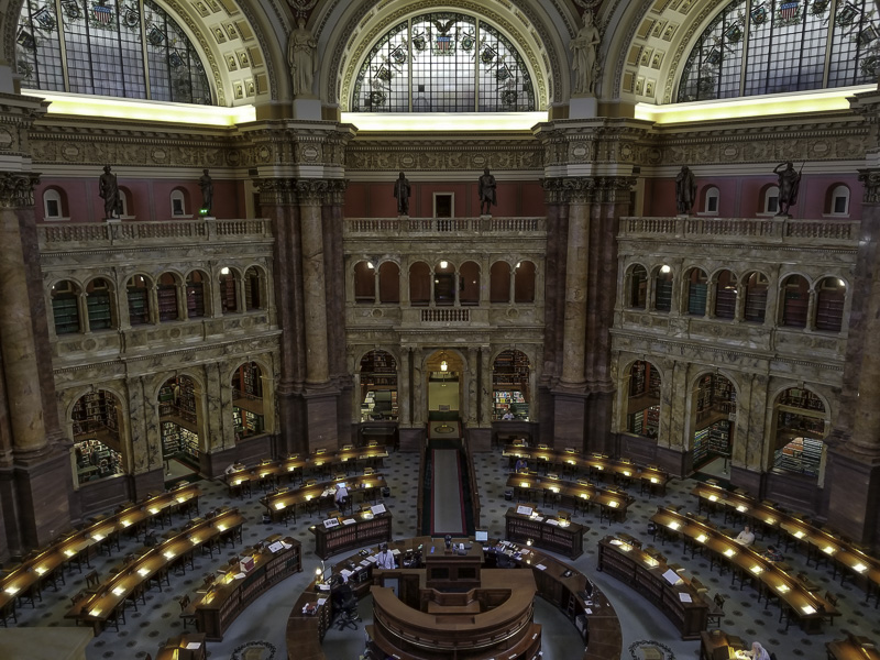
The main reading room seen from the balcony above.
The Library of Congress is the largest library in the world (in terms of its collection), the official research arm of Congress, and also home of the U.S. Copyright Office. It comprises more than 167 million items, and adds 12,000 items to its collection each working day. It is considered our national library. It has more than 838 miles of bookshelves!
We left our nation’s capital with such a sense of awe and deep reverence and appreciation, especially for those who have served our country in the military and in service to our country. Perhaps it’s being a bit “older” that helped us to appreciate this beautiful city in a humbling way. We will certainly visit again!
When we first started building our itinerary and knew we’d want to be in Delaware early in October, I thought it would be fun to get back to Assateague Island — and maybe my brother, Richard and sister-in-law, Carol could join us! They made hotel reservations as soon as we told them our plans. They come to Chincoteague Island annually and were just looking for a good excuse to come back this fall. We’re SO glad they did!
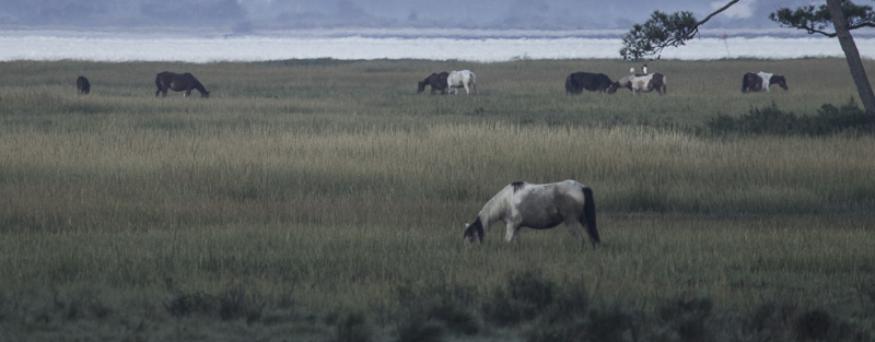
Chincoteague National Wildlife Refuge is on Assateague Island, abutting Assateague Island National Seashore. One of the primary draws to come here was the two herds of Assateague ponies, one in Maryland and one in Virginia. We remembered coming here about 30 years ago when our kids were young. Of course, neither of us remembered too many details. It was great to return.
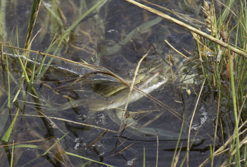
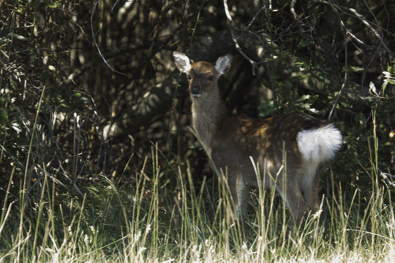
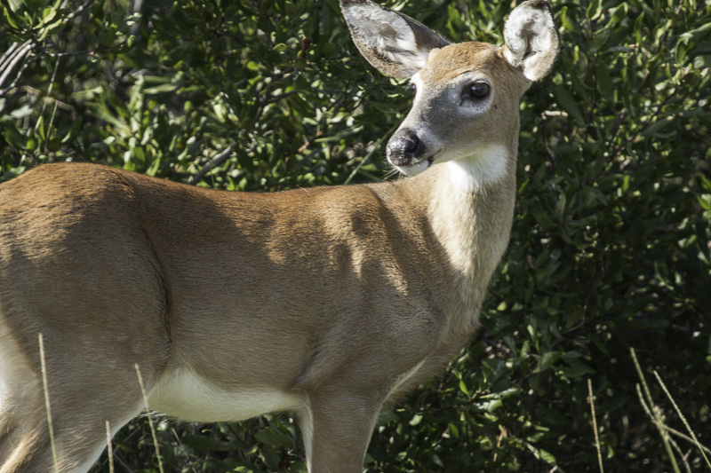
The refuge has much to offer in addition to the ponies, with many varieties of birds, sika deer–actually a small type of elk, not a deer–rabbits, and many other species.
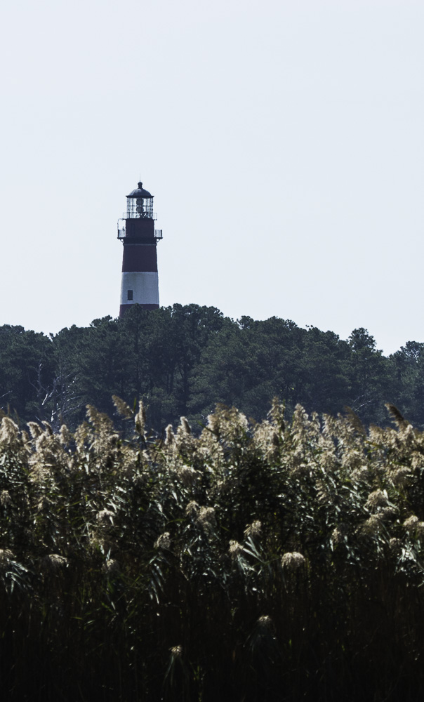
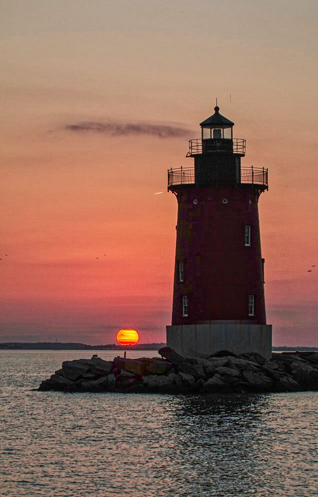
We stayed at a campground a very short distance from the refuge on Chincoteague Island (VA) so we could bike in. We can see the Assateague light from our “living room” (and kitchen, and dining room, since they’re all the same).
Assateague light from our campsite
Assateague Light was built at the southern tip of Assateague Island, but the island is basically a sand dune, and every storm moves it. It is now significantly south and west of where it was when the light was built, so the light is now 1.5 miles from the current southern tip of the island.
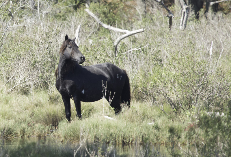
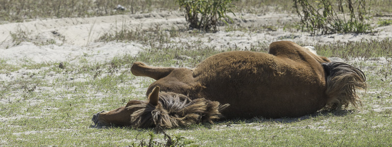
Southern Herd
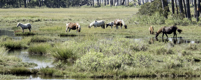
The southern pony herd in Virginia is the larger of the two, at about 150 ponies. They are owned by the Chincoteague Volunteer Fire Department. The department has a special use agreement with the Wildlife Refuge to use a large fenced-off marshy area where the horses are kept. This area is so large that even with a 540mm lens, the horses at the far side are not able to be reasonably photographed. These horses are less than 1/2 way across the marsh.
Ponies at dawn (540mm lens)Same area, later in the day.
Sometimes they do indeed come closer. The road into the refuge goes along one side of the marsh where I got the pictures below, and there is a mosquito-infested trail that goes along another. We didn’t last long on that one.
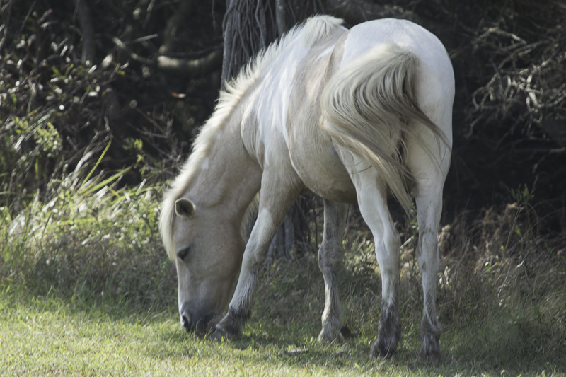
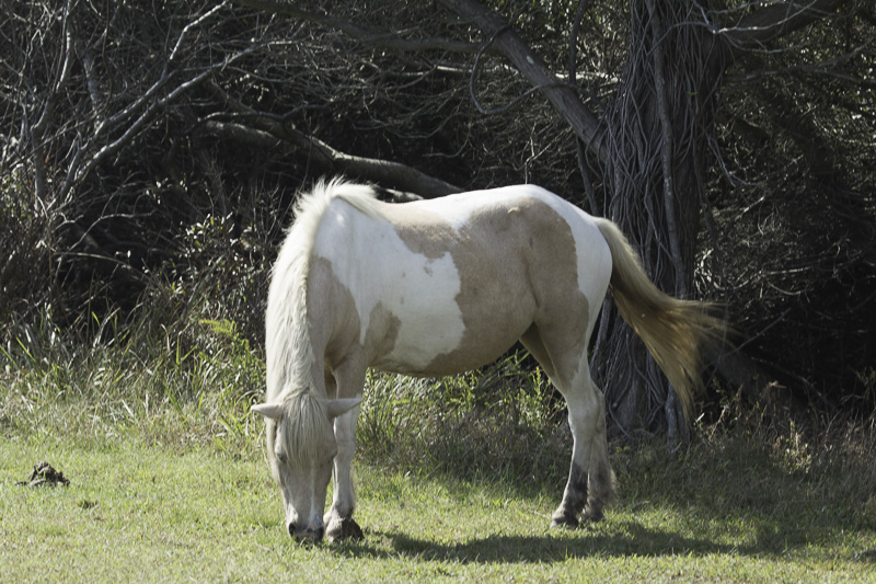
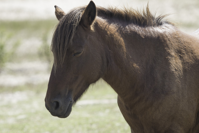
Chincoteague Pony
Whether they’re in the Chincoteague or Assateague herds, the breed is Chincoteague Pony. The reference I saw said “All colors.”
Another that came close-ish.I called this one, “Black Beauty”Mare and foal
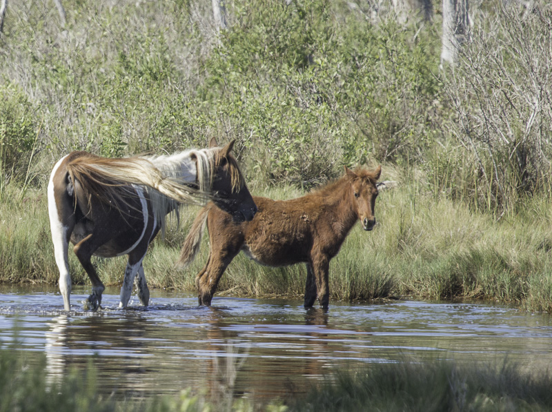
And sometimes they get even closer. Notice the brown and white mare and the smaller pony just to the right in the picture below. They are the same as in the picture above, but somehow they got out of the enclosed marsh area!
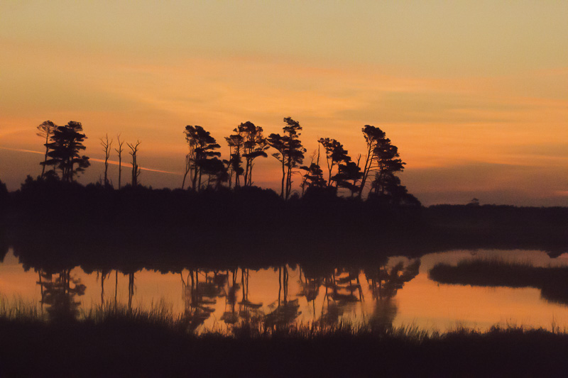
When out early one morning getting some of these pony pictures, I saw a wonderful sunrise across the street from the marsh area.
A few minutes before sunrisePanning to the right a little bit…
“Our” Herd
We hadn’t made too many plans ahead of time with Richard and Carol but knew we’d be sharing many restaurant meals together, and boy, DID we! Our first day together, I offered to drive us all to the northern end of the island so we could visit both the Assateague State Park (run by MD) and the Assateague National Seashore. (Don’t worry — it took us all week to be able to get it all straight!).
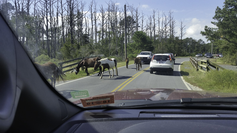
We piled into Scarlett (our F350) and headed out. It only took a bit over an hour to get there and with all the conversation in the car, it seemed like a very short ride. The Visitor’s Center for the national park is quite large and just before the bridge that heads onto the actual island. And of course, there were ponies on the side of the road as we approached the bridge —- Move on! Move on! No stopping! scolded a park employee. We ducked briefly into the state park and then onto the adjoining road into the national park.
The speed limit is only 25 MPH so it allows you to peer into the woods and toward the beach looking for ponies. We found a beautiful long (!) boardwalk that lead out over a brackish marsh in one direction and out to the bay on the other. It was so peaceful.
We spotted quite a few RV’s parked (camping) in the parking lots adjacent to the beach. It piqued our curiosity and it looks like we’ve put camping at either the state park or the national seashore in the future.
Richard and Carol suggested we share dinner at one of their favorite restaurants followed by amazing ice cream! Who can say no to fresh crab cakes and an ice cream sundae? And so, over the next few days, we shared dinner at a different restaurant each evening. Wow!
The next day, Al and I returned to the northern side of the island but brought our bikes. The part of the park that you can access by car and bike isn’t all that long (maybe 3 or 4 miles) and beyond that, it’s all OSV (over-sand vehicles) —- a permit is required, and alas, Scarlett weighs too much. The biking was perfect and we had our PB&J sandwiches at the beach. A mare and foal were there along with many surfers!
Northern Herd
The ponies in the northern herd in Maryland are owned by the US Government, and are free to roam wherever they want to in the Maryland section of the island; there is a fence at the state line to keep the two herds separate. This herd is smaller, estimated at 70-80 ponies. They can be hard to find, but there are “leavings” everywhere!
There are “Pony Patrols,” volunteers who are charged with keeping visitors at least 40′ away from the ponies when they roam into heavy tourist areas like the beach. But a long lens can bridge that 40′ gap pretty easily! Since these are wild animals, I didn’t want to be any nearer—but I guess there are a lot of people who aren’t as smart.
We saw this mother and colt pair next to a restroom at the beach of the National Seashore.
Mother, ever so sanguine.
The colt seemed to be bothered by the bugs in the area (mosquitoes and biting flies), and was squirming on the sand.
Man, quit bugging me!Aaahhhhhh!
Birds on the island
This island is on a major migration flyway for many species of birds. Later in the fall, apparently the ground looks like it has snowed when several tens of thousands of snow geese congregate on the island!
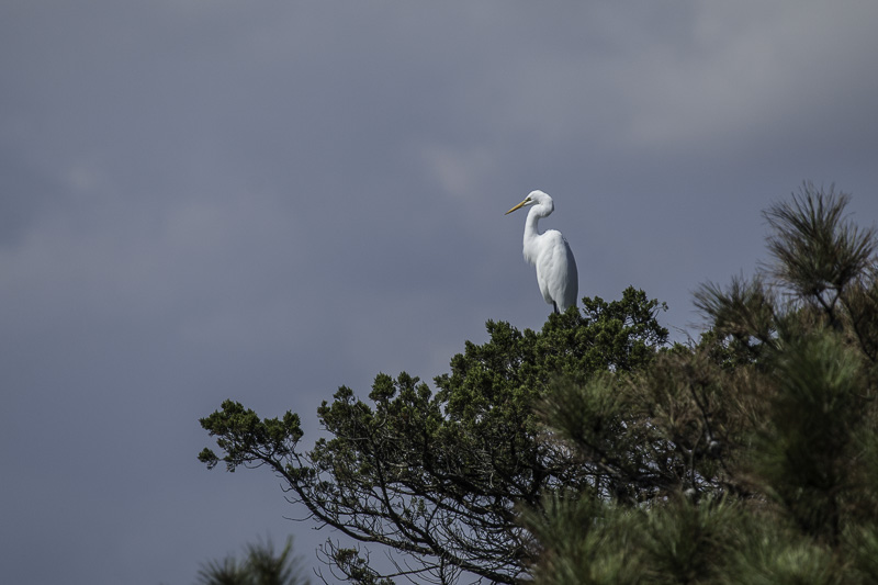
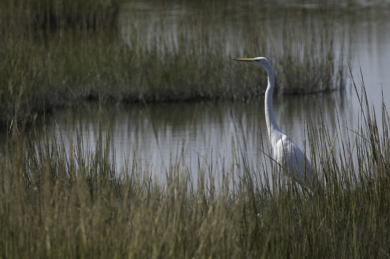
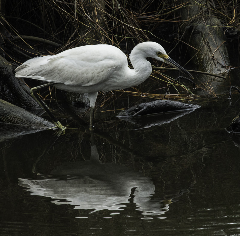
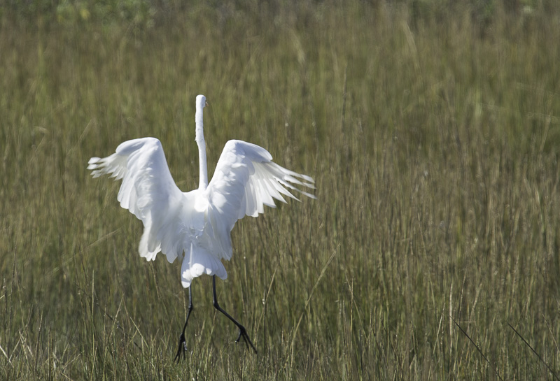
Here are some of the birds we saw on the island. Egrets of several subtypes are everywhere!
Why don’t sailboats have an egrets’nest instead of a crows nest?Not sure what this one is looking at or for!Fishing, definitely fishing!Flying too fast for me to keep framed properly. Oh, well.Flight attendants, prepare for landing!
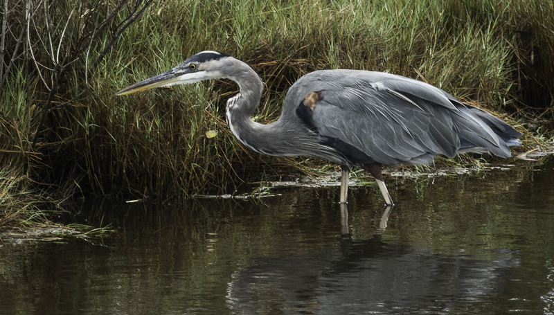
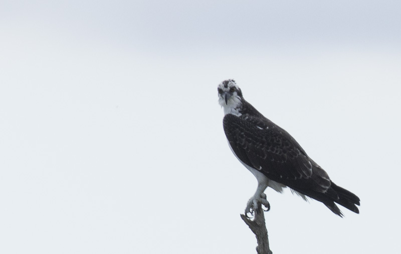
We saw several other species too.
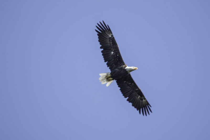
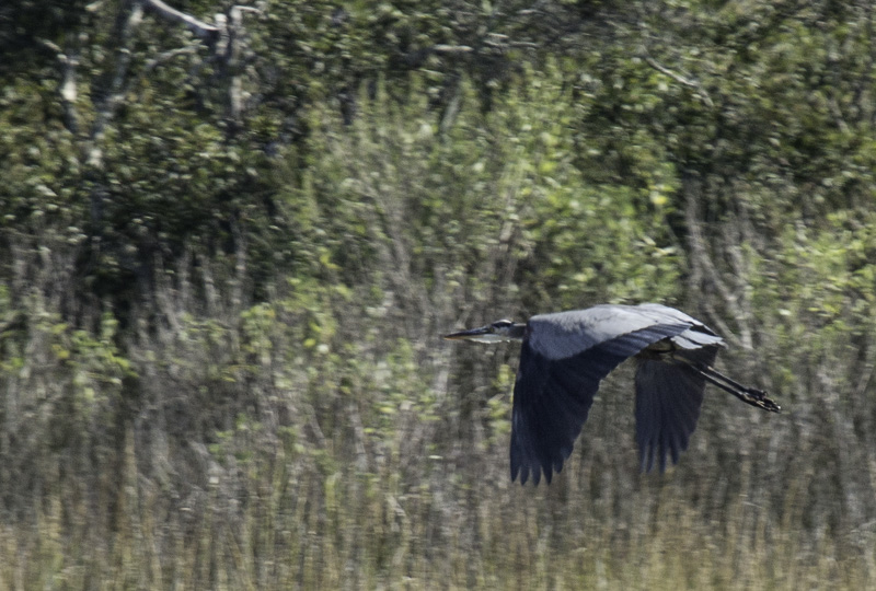
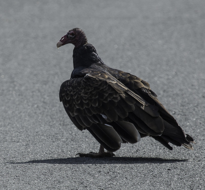
Great Blue HeronOsprey; look at the talons!Bald EagleGreat Blue HeronTurkey Vulture
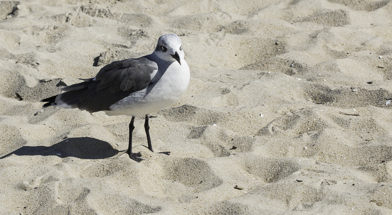
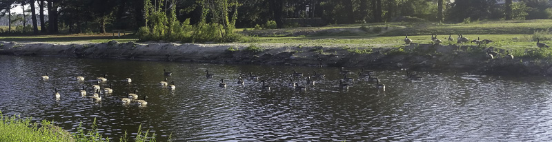
And of course, we have the ever-present seagulls and Canada Geese.
Don’t even think about taking my sandwich!Geese at our campground
We spent a couple of days at the beach with Richard and Carol on the Chincoteague Island side. It was lovely! So much long-overdue visiting while being serenaded by the surf and warmed by the sun.
Having never vacationed with any of our siblings as adults, we were so happy to get so much time with Richard and Carol. We had a blast and we’re already making plans for the next time!
Other animals in the Refuge and at the Seashore
Lo and behold, there are animals other than ponies and birds here! Some are very well hidden like this crab.
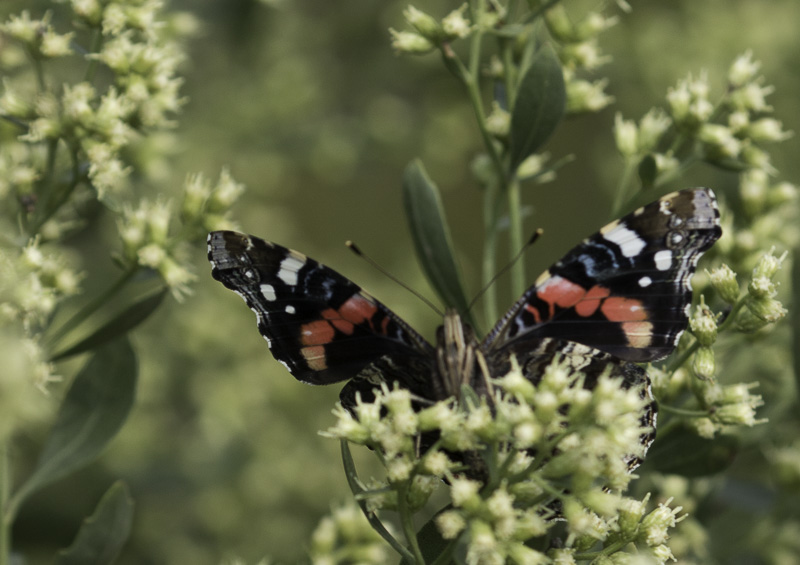
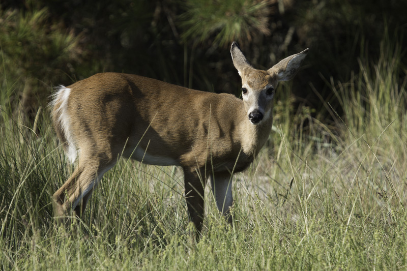
Maryland crab hiding in the grasses.Don’t know what kind of butterfly this is…Sika “deer,” actually a type of small elkHomo Sapiens SurfarisAnyone know what this moth is?White tailed deer
Camping, the beach, wildlife, photography, and family — what a winning combination! We look forward to returning to Assateague and hope that Richard and Carol can join us the next time.
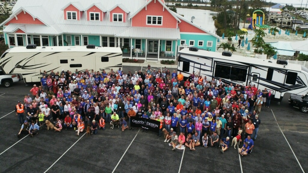
Another rally – yay! This time we were at the Massey’s Landing RV Resort in Millsboro, Delaware. Set on the Rehoboth Bay, this gem of a campground was a perfect spot for the Grand Design Northeast Owner’s Rally (can you say white sand, lagoons, pool bar, and ice cream sundaes?). There were approximately 200 rigs and about 500 attendees; we broke a record for an owner’s rally (a rally not sponsored by the manufacturer, but organized by a community of owners).
A record-breaking owner’s rally
Once again, a number of workshops were offered. We didn’t attend too many this time since they were ones we’d already attended at the Hershey RV Show last fall or at the recent Indiana rally. However, there was a really important session on RV fire safety which was sobering. A husband/wife team both of whom are firefighters shared the story of a recent RV trip they took. Upon arrival at their campsite, they discovered a drawer in their kitchen that was completely charred as were the two drawers above it! This was the results of loose batteries in the drawer that had sparked a fire while they were bouncing around while underway—yikes! You can bet that every one of us went right back to our RV to tape the ends of every battery that wasn’t in its original package — I know I did!
The best part of this rally was the new friends we made! THIS is the best part of traveling the country — meeting wonderful, interesting people who share a sense of wanderlust. We spent plenty of time sitting around the campfire or picnic table sharing ideas about modifications we’ve made to our RV, making suggestions about where to camp, and just getting to know each other. Here are some of the folks we met …
Patti and Steve
Patti and Steve have recently ordered a new Grand Design RV (their second!) and were trying to decide on what brand of truck to purchase; this is a common quandary. And RV owners are often eager to share, opinionated, pushy, overbearing, obnoxious, enthusiastic about which brand of truck to purchase. Patti had lots of questions and took lots of notes. She was looking for as many ideas, suggestions, and tips as she could. It was great fun to show her a few of the modifications we’ve already made. Steve has a wicked sense of humor and we had a great time visiting and laughing with them both!
Paula and Chuck
Here are Paula and Chuck. We got to know them when we went on an evening cruise up the Broadkill River. We really *clicked* and enjoyed our time together throughout the weekend. It turns out that Paula had actually discovered us on the Grand Design Owner’s Forum online—Al’s been very active on the forum for a year and lists our address as Bass Harbor, ME. She was searching for us at the rally because they’ve vacationed in Maine, in fact in BAR HARBOR for many, many years. We had fun comparing notes (and we couldn’t help but mention that we may have a home for sale there next year!).
We went out for breakfast together and on our last evening at the rally, Paula and Chuck invited us over to their RV to watch a beautiful slide show of their walk on the Camino. They encouraged us to think about it. Paula and I have so much in common (separated at birth?) and have already texted each other a couple dozen times since we left Delaware. Such fun to make new friends!
Cruisin’
As we travel to new places, we try to take advantage of as many new activities as we can—who knows if we’ll ever be back this way? There were several offerings at the rally (shopping trip, casino visit, and boat trips) and we signed up for two evening cruises — the first was on the Broadkill River and the second was on the Delaware Bay.
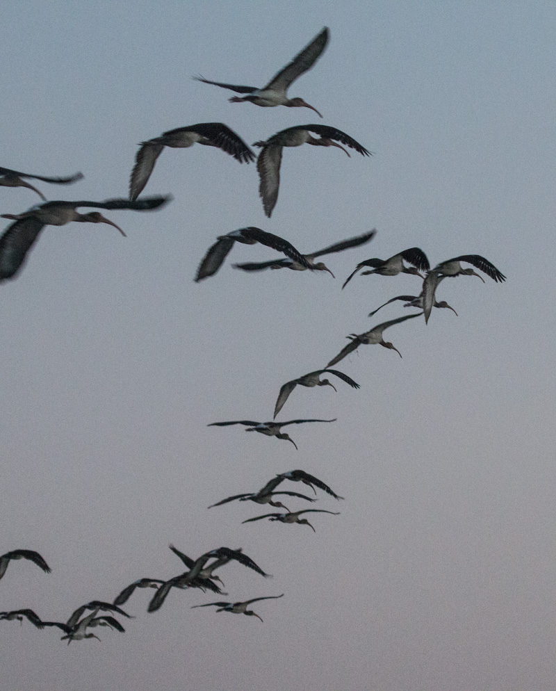
A flock of ibis overhead
We were thoroughly entertained by some dancing dolphins!
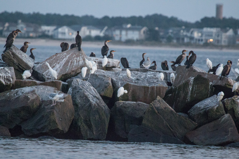
Breakwater birds serenade usSunset at Delaware Breakwater East End Light
Making new friends as we travel — it’s like finding a lighthouse out on the bay. It’s a beacon that reassures us that we’re on the right course. Full speed ahead!
As “Tim the Toolman” used to say on TV, “More power!”
We are planning to spend a good portion of the winter in the desert southwest. Three main requirements for “boondocking,” also called “dry camping,” are having:
self-contained fresh water,
adequate waste storage, and
electrical power.
While many people carry portable (or installed) generators (as do we), using generators on a continuous basis isn’t very tenable. So we’ve added solar power capabilities.
This is an unusual post for us, in that it is fairly technical (also called “geeky”): nuts and bolts (and wires).
We wanted to be able to use all the devices we normally do, some of which use 12 volts DC (battery power): the lights, radio, water pump, ceiling fans, etc., while others use 120 volts AC (household power): the TV, Instant Pot, microwave/convection oven, etc. We also knew that we wouldn’t be able to use our air conditioners, at least for any extended period. They simply draw too much power.
The basics of a solar system for an RV are:
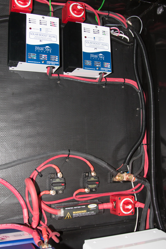
solar (“photo voltaic”) panels to gather energy, and their controllers;
12 volt batteries to store the collected energy; and
an “inverter,” which changes the stored 12V DC energy into 120V AC, for those components which need it.
First, some pretty (or pretty geeky) pictures. Then for those who are interested, the details.
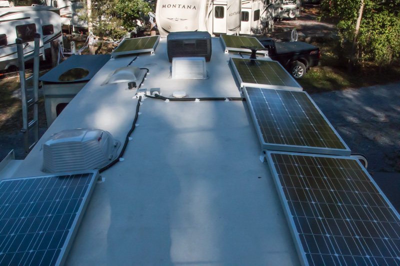
Our solar panels are mounted on the roof. They can be flat for travel and we will leave them flat when we’re somewhere that we will only be staying briefly, or where we can’t orient the trailer to be on an east-west axis so that tilted panels can face south.
Six of our eight panels, without tilt
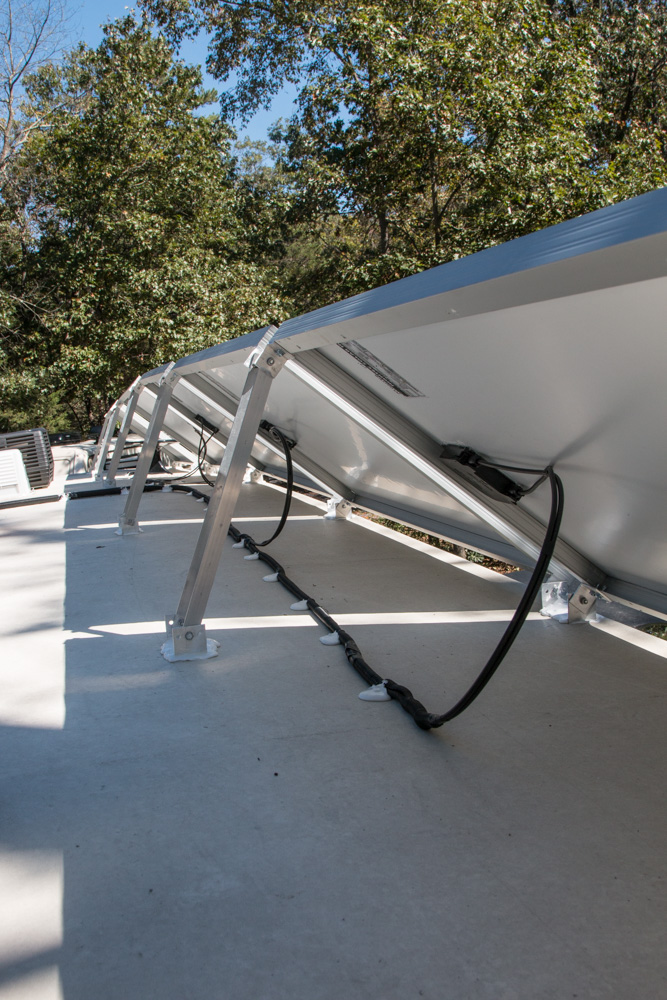
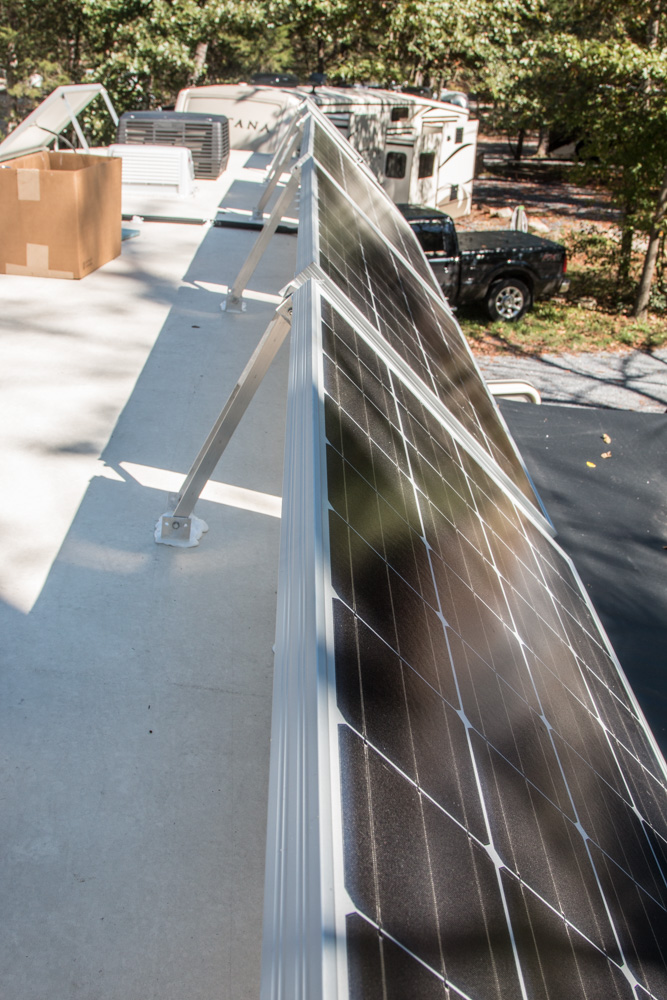
When we will be somewhere for a while and can orient the trailer properly, we can tilt the panels to more directly face the sun.
Panels can be tilted to capture more solar energyThree panels, tilted to face the sun
The solar panels can generate a range of voltages. We need controllers to change the incoming voltage into the proper voltage to charge the batteries.
Controllers for the solar charging system
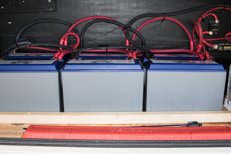
One hundred seventy four pounds of batteries equals 600 amp hours of lithium storage.
600 amp hours of Lithium batteries
Our inverter changes the 12 volts DC into 120 volts AC.
Our inverter for 120 VAC–household current.
Now the details… only two more detail pictures below. Feel free to stop reading if you don’t want to dive into those details.
Watts measures the amount of electrical power in use right now; it is analogous to speed. Think “60 miles an hour.” If you want to know how far you’ve traveled, you need to know how long you have been traveling at 60 miles an hour. The electrical equivalent to distance is watt hours. If you turn on a 60 watt light bulb, you are using electricity at the rate of 60 watts. If you leave the bulb on for an hour, you have used 60 watt hours of power. The electric meter on your house measures the number of watt hours your activities consumed.
With our eight 180-watt panels, we theoretically have the ability to generate 1440 watts of power from the sun, under “standard conditions,” which are not often equaled in real use. The amount of watt hours we can generate will depend on how many hours of sunlight we have (and whether it is cloudy or sunny, winter or summer, etc., etc.)
We’ll get back to watt hours below when we talk about our batteries.
Batteries
Two of the primary characteristics of batteries are the chemistry used, e.g., lead-acid, alkaline, or lithium-ion, and their capacity—the amount of energy they can store.
Chemistry
Until recently the standard battery chemistry for use in RVs was lead-acid, the same as in your car’s battery if you don’t have an electric car. They are still very popular, primarily because of initial cost, but they have several disadvantages when compared to a newer chemistry, lithium iron phosphate which is abbreviated LiFePo4—say that 3 times fast! In the comparison LiFePo4 batteries:
store more energy in the same size battery;
are much lighter, at 29 pounds per battery instead of 61 pounds;
can charge more quickly;
have a much longer lifespan (in terms of the number of charge/discharge cycles and years); and
can be discharged much more deeply. Lead-acid batteries can only discharged to the 50% point without damaging the battery; LiFePo4 batteries can be discharged to the 20% point. This gives much more usable energy.
The LiFePo4 batteries have some downsides as well. They can’t be charged below freezing, and they are very expensive.
For us, the advantages outweighed the disadvantages, so we bit the bullet and got six 100 amp hour LiFePo4 batteries. Ouch!
Finally, although both battery chemistries have “lithium” in their name, the LiFePo4 batteries are not the same as the Lithium Ion (Li-ion) batteries that are in your cell phone and in my Chevy Volt. Our batteries are slightly less energy-dense than Li-ion, but our chemistry is intrinsically fire-safe.
Capacity: amps and amp hours
Batteries are measured in terms of amp hours of energy that can be stored. There is probably a reason the industry doesn’t use watt hours, but I don’t know what it is.
Amperage is the measurement of how much electricity is moving through a wire. It is similar to the amount of water coming out of a hose. Like watts, it has a corresponding measurement for use across time, which is amp hours. In our water hose analogy, this would correspond to gallons of water.
Fortunately, amps and watts are related by a third factor, voltage. Voltage is like the pressure inside the water hose. Watts is amps times voltage. If our battery is a 12 volt battery, then a one amp flow delivers 12 watts of power. I hope I didn’t lose you there. Our 600 amp hours of 12 volt batteries stores nominally 7200 watt hours of power. (I’m ignoring complications like “12” volt batteries are actually 13.2 – 14.4 volts.)
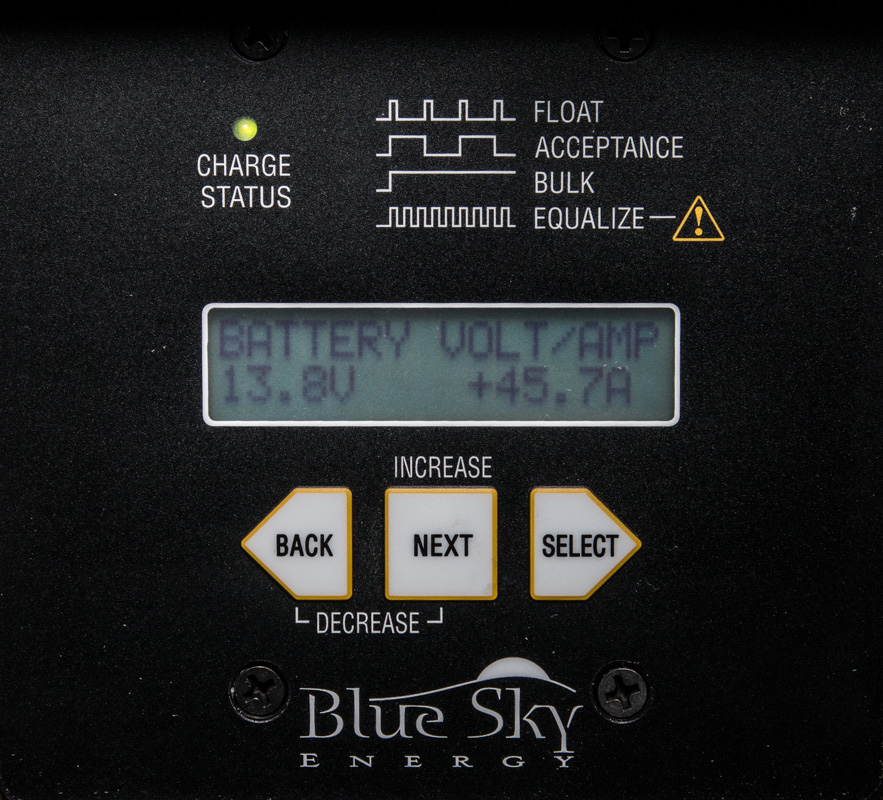
This picture shows the panels generating 42.7 amps of power at a voltage that is too high to apply to the batteries. The controllers change it to a lower voltage at higher amps–retaining almost the same number of watts (there is a slight loss caused by the controller’s operation).
Lower voltage and higher amperage out–same watts.
And here is the current battery state. Fewer amps going into the batteries because the RV is consuming some.
Bringing it all together, since our panels generate (nominally) 1440 watts of power, and our batteries store (nominally) 7200 watt hours, we can completely charge our batteries in five hours on nominally perfect days!
“Your our mileage may vary.”
The inverter
The last major component in our system is a 3000 watt inverter. This can supply about 25 amps of 120 volts AC power. However, to do that it has to consume over 250 amps of 12 volts DC from our batteries (inverters are not 100% efficient). Remember that we have only about 480 amp hours of usable storage (80% of 600 amp hours). So obviously we wouldn’t be using that much power for very long!
The inverter is sized large enough that we can run one air conditioner from it for a while, especially in the peak of daylight where we can pull power from both the solar panels and the batteries. But if we need to run it continuously, we’ll have to spin up one of the generators!
To the desert!
So that is the package that we are counting on to keep us going in the desert this winter. We’ll see how it goes… After all, this trip is an adventure!
I remember a small cave in the woods out behind my Nanny and Pop-pop’s house when I was a little girl. My brother told me about it; I decided to take his word for it.
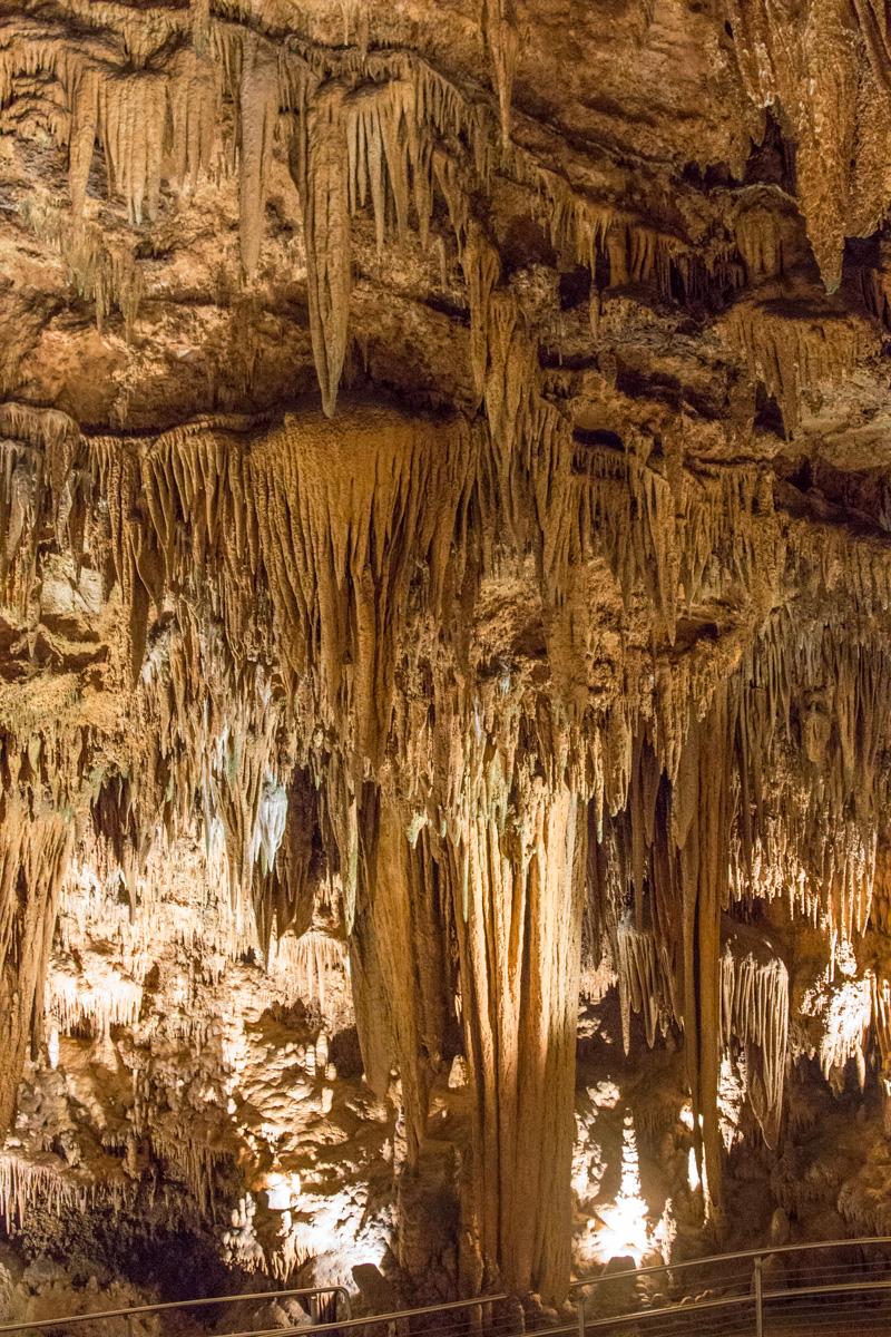
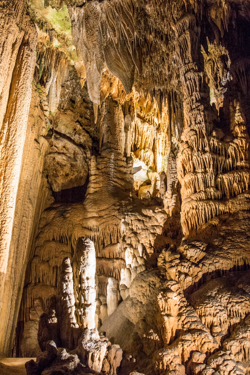
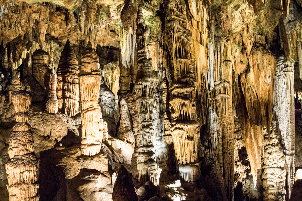
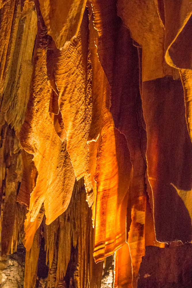
Two weeks ago, while in the Shenandoah Valley (Virginia), we visited Luray Caverns. Luray is a commercial attraction and not part of Shenandoah National Park. We signed up for a tour and were led down a long, fairly steep staircase to an amazing underground world. I remember seeing stalactites and stalagmites in Howe Caverns in New York State as a youngster. But these…
Stalactites hang ‘tight’ to the ceiling.Stalagmites (bottom left) ‘might’ reach the ceiling some day.
The young man who toured us thru the caverns seemed to be in training for some kind of footrace; we wanted to take lots of photographs but he kept insisting that we stay together and keep up with him. It was frustrating and we finally decided we’d take our time and take the photos we wanted to—we had paid dearly for the tour and wanted our money’s worth.
Sometimes the stalagmites reach up to join the stalactites to form pillars or columns.
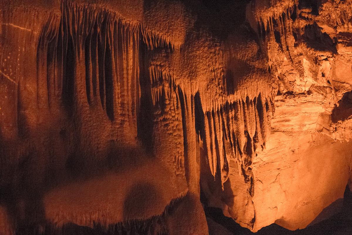
The stalactites are formed by water coming down through the roof of the cavern carrying dissolved limestone. The limestone is left behind when the water evaporates. Stalagmites are formed when those drips of water drop off and hit the ground; as the water evaporates, the stalagmites grow upward. Many experts claim that the stalactites and stalagmites grow as slowly as 10cm every 1000 years. They are precious.
We were fascinated to learn that until the 1920s, tourists were allowed to snap off the end of a stalactite as a souvenir. Once the tip is broken off, the stalactite will cease to grow. It was sad to see so many broken, flat ends as we worked our way through the passages.
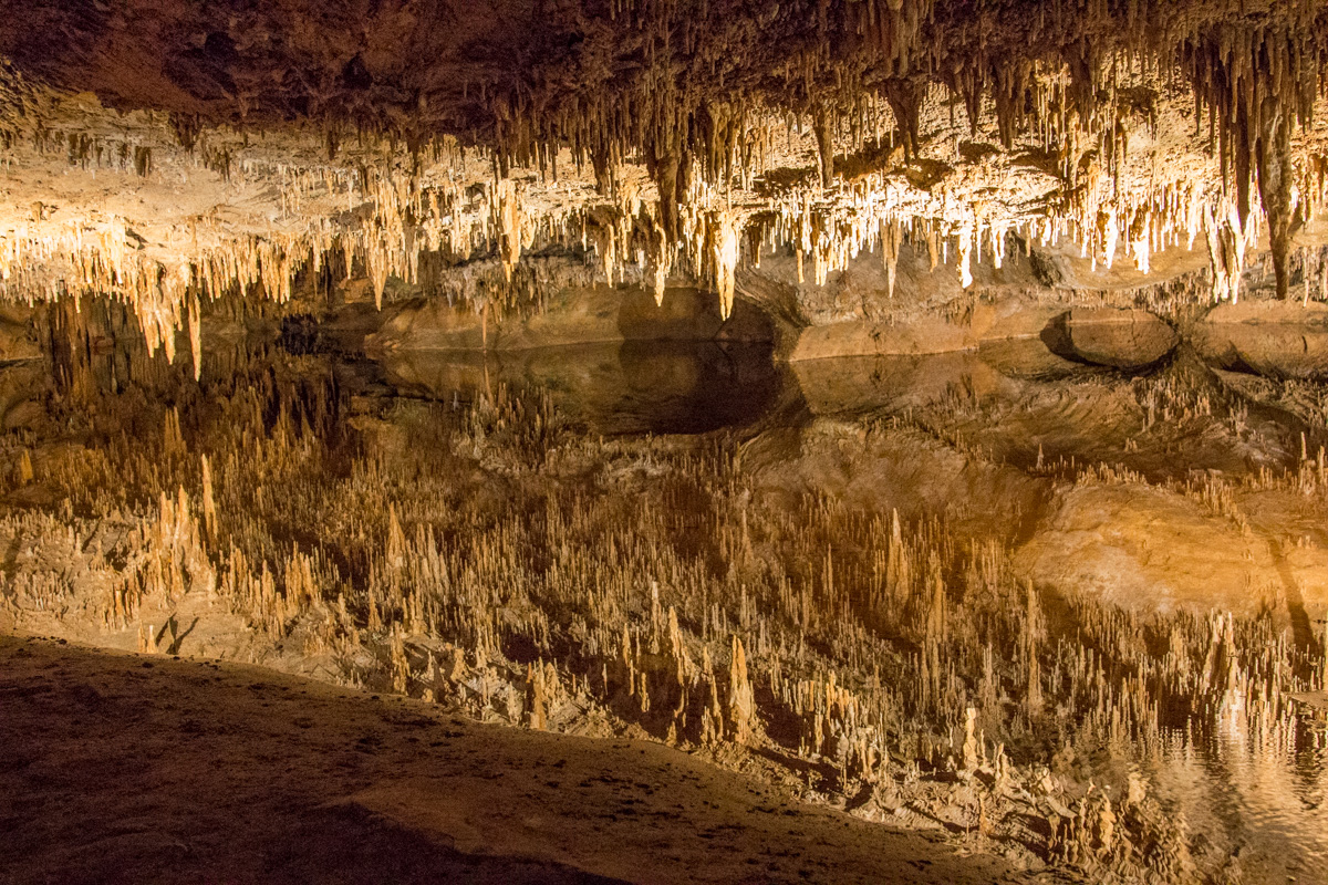
The old expression “A picture just doesn’t do it justice!” came to mind when we downloaded our pictures of the reflecting pool. It was pure magic; footsteps ceased and all you could hear was the intake of air as each tourist rounded the passage and gasped as they faced the pool head-on.
Can you find the waterline? See the perfect other-worldly reflection?
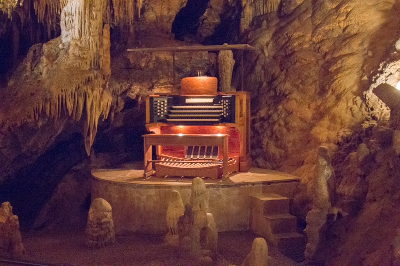
On our way to Luray, we passed dozens of billboards (and I mean dozens!) advertising the caverns. Many of them called attention to ‘The Great Stalacpipe Organ’—what could that be?
Sure enough as we were nearing the end of our tour, we came into a huge room within the cave that had an organ console up on a landing. Apparently you can make arrangements to get MARRIED in this room, complete with a pipe organ accompaniment. (It’s a bargain at $1900 for just 12 guests!)
The famous stalacpipe organ in Luray Caverns.
The organ is actually an electrically actuated lithophone that produces tapping of a large number of pipes (stalactites) throughout 3-1/2 acres of the cave. You can see the wires along the walls, weaving in and out of the limestone appendages. The tour guide pushed a button and we were regaled with the limestone version of “A Mighty Fortress is Our God”—you could almost make out the tune! Because of the enclosed space of the cavern itself, the song can apparently be heard throughout the entire cavern.
One of the most magnificent features in Luray Caverns are the ‘curtains’— they are beautifully translucent stalactite formations that drape down from the ceiling —almost like long sheets of beautiful linen. Glorious!
Stalactite curtains
During our stop in the Shenandoah Valley, we had the solar panels installed which required Al to be at the campsite all day. He encouraged me to go out into Shenandoah National Park by myself. The first day I went out, I missed a sign and ended up driving across the width of the park into the next town before I realized what I’d done (without my trusty navigator with me). So I turned around (I’m getting really good at those twisty-turny mountainside roads) and found the turn I’d missed.
When I finally got through the gate, I drove up to the first viewpoint. It actually involved a 4 mile loop hike and it was not something I was up for. So I stopped into the ladies’ room—The woman at the sink reminded me of someone from back home. “Wait! I know you!” I exclaimed. It was Dot—I’ve known her for a couple of decades — we attended the same rughooking retreat for many, many years back in Maine. What were the chances? We had a great time catching up for a few minutes. Back to the park . . .
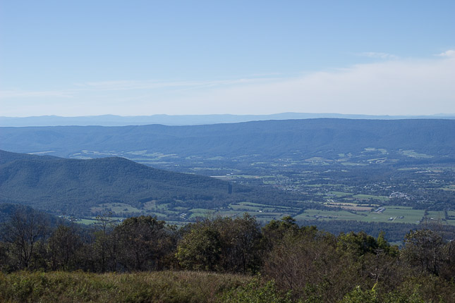
Shenandoah NP boasts its centerpiece Skyline Drive as one of the VERY BEST places to see beautiful fall foliage (don’t worry, Mainers —I don’t believe anything can top autumn in Maine); it runs the entire length of the park. Unfortunately, there was not a smidgen of fall color. There were, however, some beautiful overlooks with views that reminded me of the Great Smokies—I stopped a number of times and made a stop at the Visitor’s Center just as a few spritzes of rain appeared on my windshield.
From Skyline Drive in Shenandoah NP–no fall foliage in sight
By the time I got back to the truck, the clouds and fog had really socked in—and it was raining more steadily. Yeah, doing twisty roads—steep and downhill—and not being able to see past a very few feet in front of my bumper was NOT FUN.
I went back to the national park on the second day of the solar install and was able to spot just a few more leaves giving way to a touch of dark yellow. Many leaves appeared just brown and shriveled. Disappointing. We’ll go back another year— and for Al, it will be his first time IN the park.
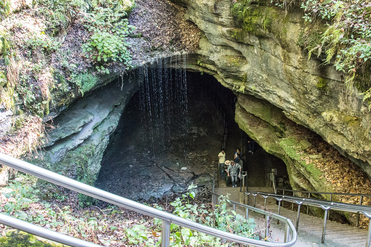
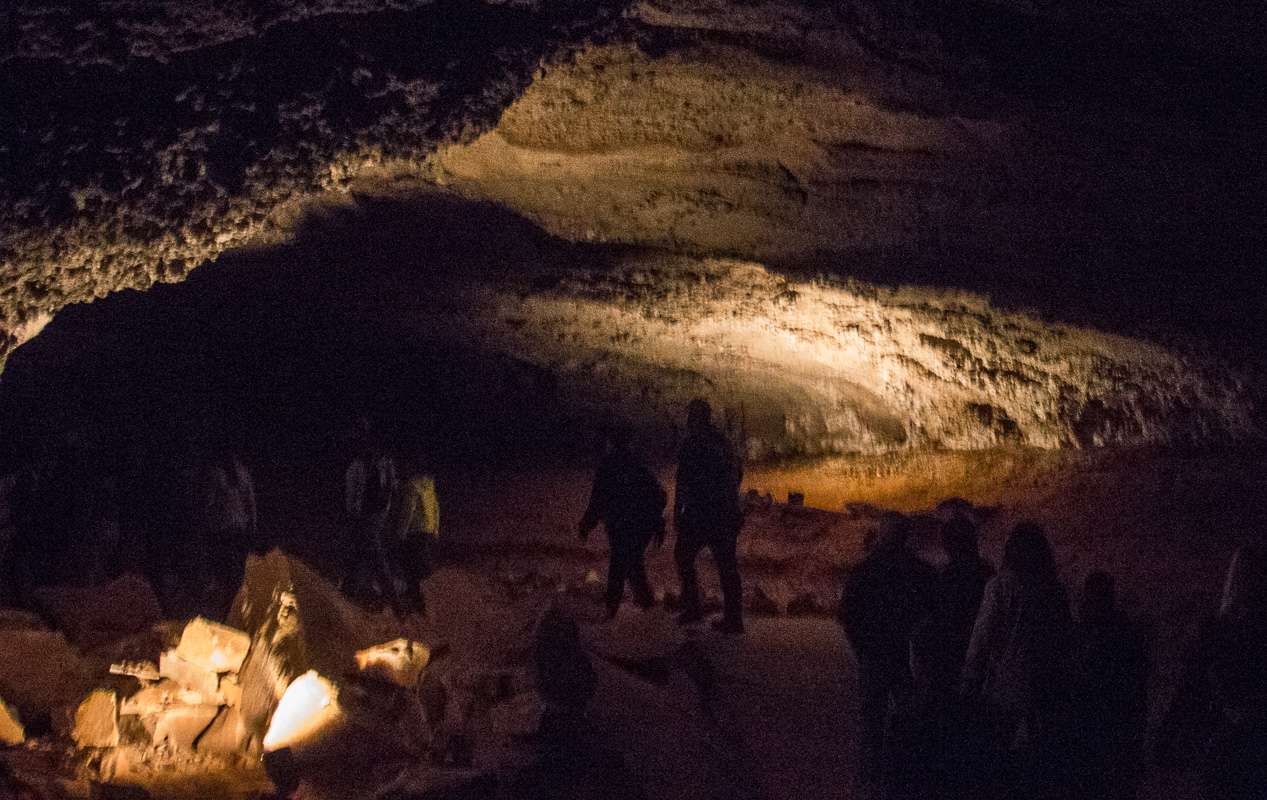
Fast forward five days — poof! We’re in Cave City, Kentucky, the home of Mammoth Cave National Park.
Imagine a series underground caves and tunnels that layer, twist, and intersect for more than 400 miles! We stopped at the stunning visitors’ center and learned quite a bit about the cave system.O.K., I knew about the bats but not about the cave crickets and cave rats!
The descent into the Historic Entrance
We had pre-purchased tour tickets online for the Grand Avenue Tour for the next day so this first day in the park, we decided to venture into the self-guided “Historic Entrance.” It comprises two huge rooms with numerous placards with all kinds of information; you can read your way right through. There were lights — just enough so you could see your way around and read the signage (kind of). There were three rangers on duty. Al’s great about asking questions and learning as much as he can from the rangers. Interestingly, one of the rangers told us that since those placards have gone up, it’s rare for anyone to talk to the rangers anymore. How sad! She explained that they have so much knowledge to share but if no one approaches them . . .
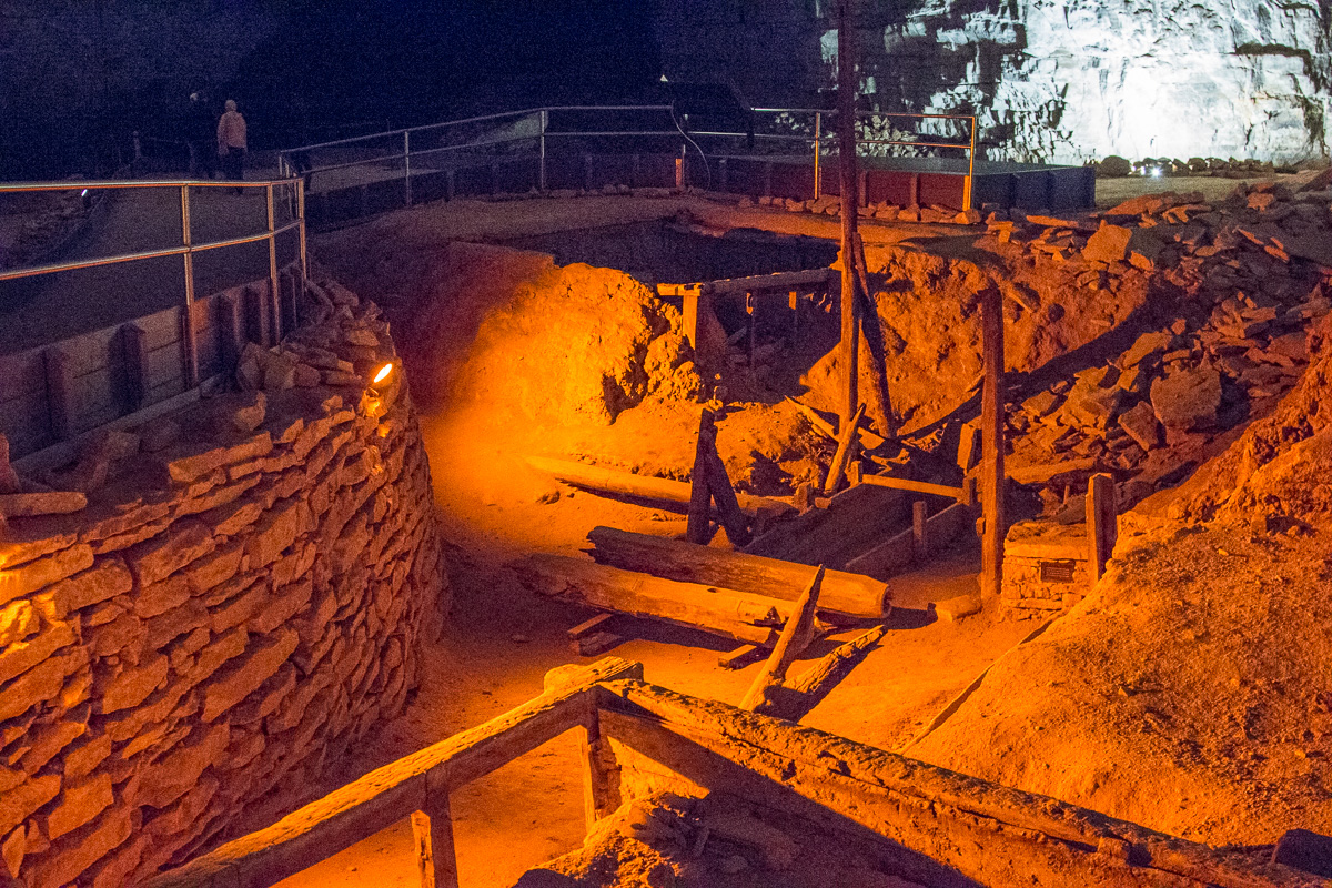
During the revolutionary war, much saltpeter was mined from the cave to make gunpowder.
We stopped to speak to another ranger on the way out. I asked about the bats. They’ve lost about 90% of the bat population due to the White Nose Syndrome; it’s a fungus that has killed millions of bats across the U.S. It came from Europe and Howe Caverns was where it was first detected here. The ranger said he’d only spotted two bats today and he pointed his flashlight to a tiny black spot high up on the cavern wall. So small.
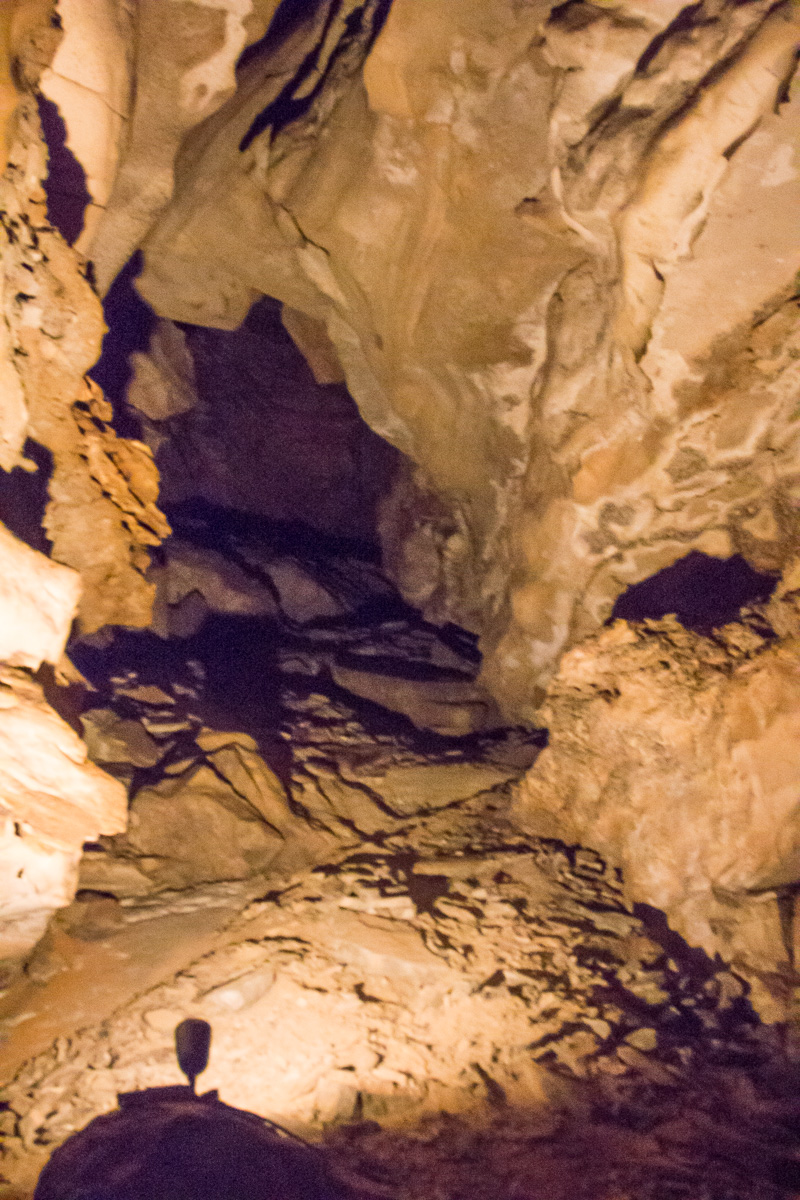
The next day’s Grand Avenue Tour comprised four miles of strenuous walking and climbing—-all at 260+ feet underground!
Two rangers accompanied us —one at the front who flipped light switches ahead of us and who taught us so much along the way. The second ranger brought up the rear and switched lights off as we moved on.
It was magnificent—see for yourself!
Notice no stalactites or stalagmites! A sandstone layer above the cave’s limestone prevents water infiltration through most of the cave.
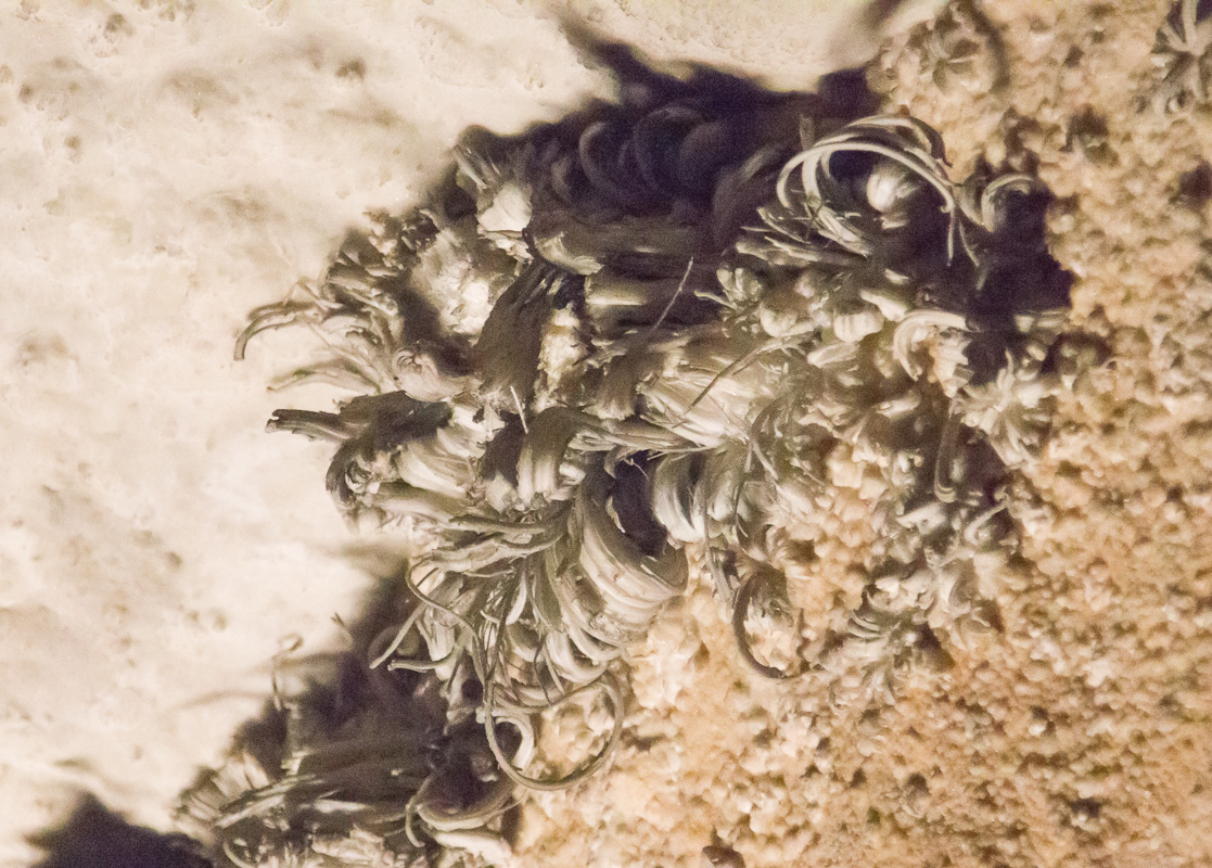
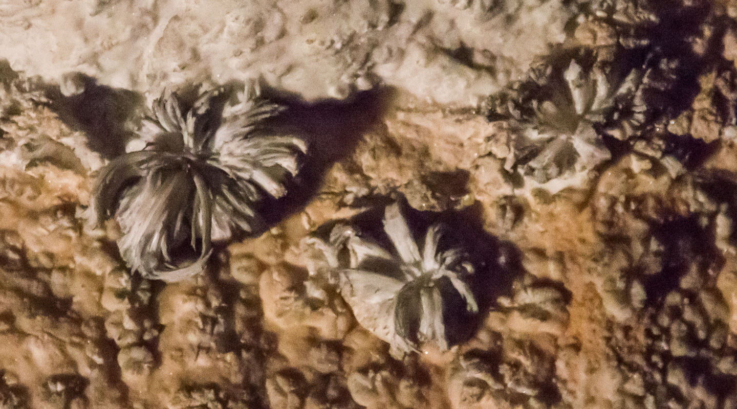
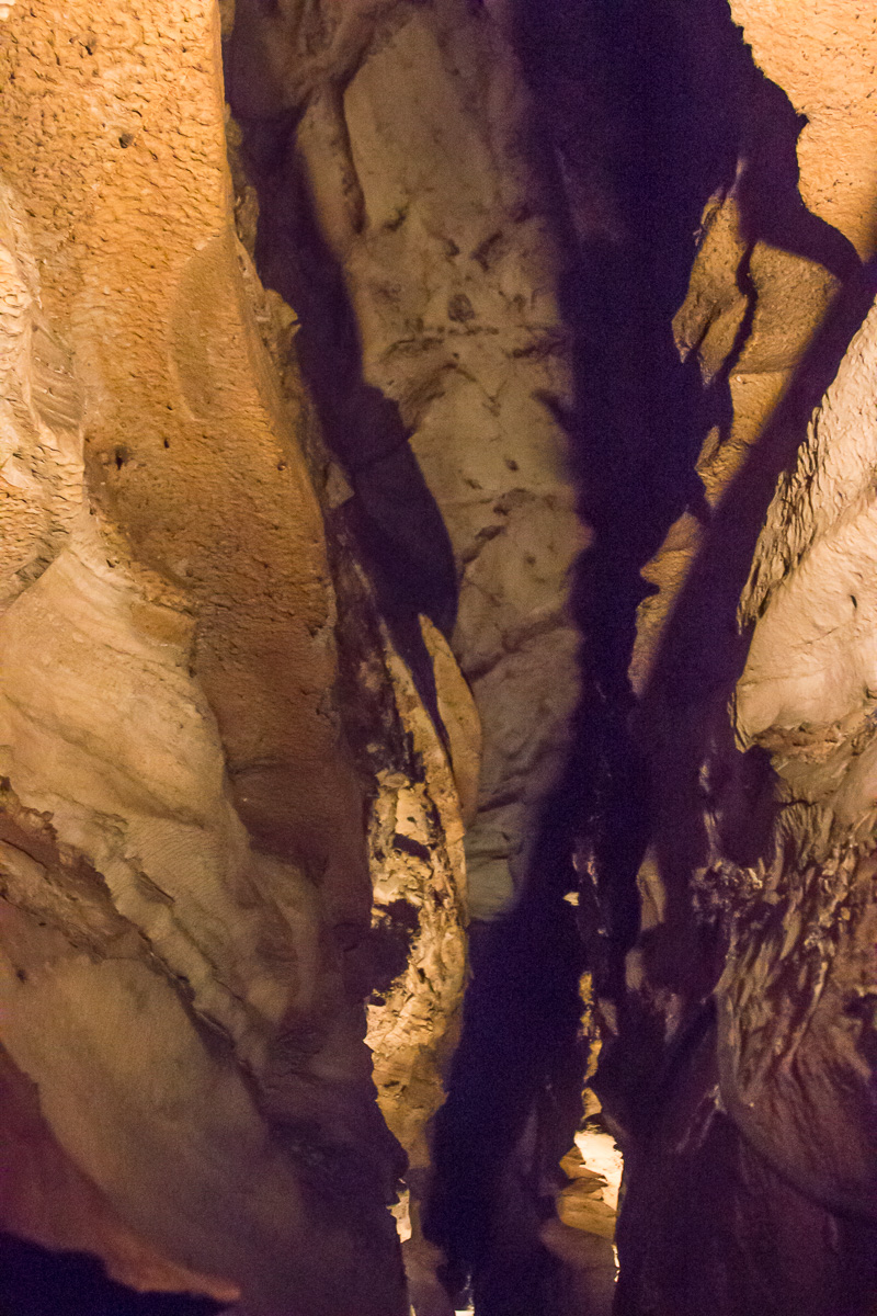
Gypsum (calcium sulfate) “flowers” grow throughout the cave.
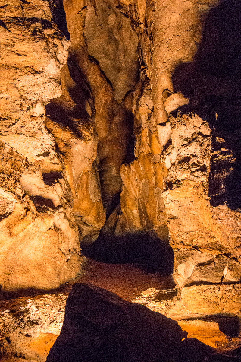
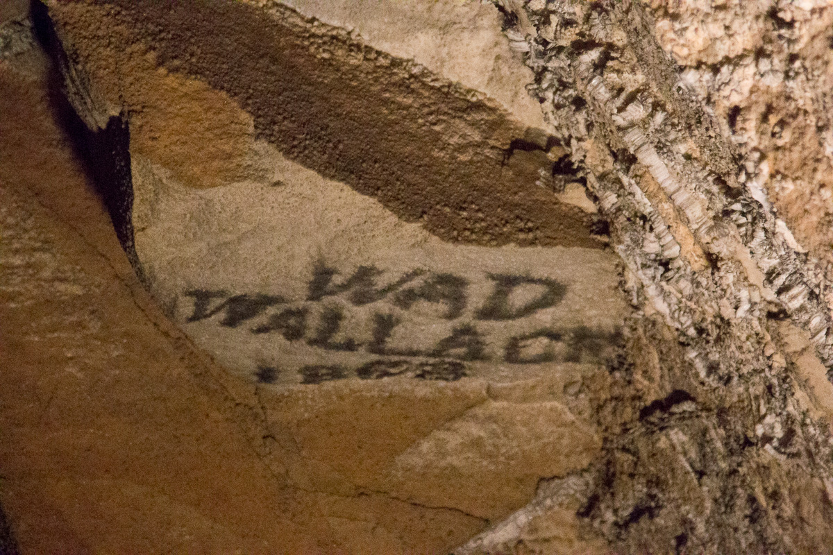
The gypsum takes on many different appearances but yes, it’s the same gypsum that is in the wallboard of our homes.Sometimes the passages are wide and low; other times tall and (very) narrow.They reminded us of the slot canyons we saw in Arizona.The cave was a commercial attraction in the 1800s. People were encouraged to put their names on the cave ceiling, using candle soot!
At one point during the tour, the rangers had us sit at on benches along the sides of the path. They wanted us to experience TOTAL DARKNESS and turned off all the lights and just listen. It was amazing.
Can you see my hand? Neither could I!There were side passages everywhere!
As we neared the end of our Grand Avenue Tour, I asked the lead ranger what the difference is between a cave and a cavern; having visited both, I was curious. He gave me a very simple answer: “RN!”
Toward the end of the tour we reached a section without the sandstone cap, resulting in some stalactites. Places that are moist are lit with amber light to cut down on algae growth.
As we approached the exit, the ranger stopped us and shined his light on the ceiling so we could see a large group of cave crickets. They hang out there and only leave the cave every 7-14 days to eat. Cute little critters, eh? I told the ranger I was glad to see the crickets and was REALLY glad I HADN’T seen any cave rats. “Don’t look over to your right then,” he told me. “I can’t guarantee they’re aren’t some over there.” Aaaaaand, I made a very quick exit!
The cave crickets are about 1.5 to 2 inches across.
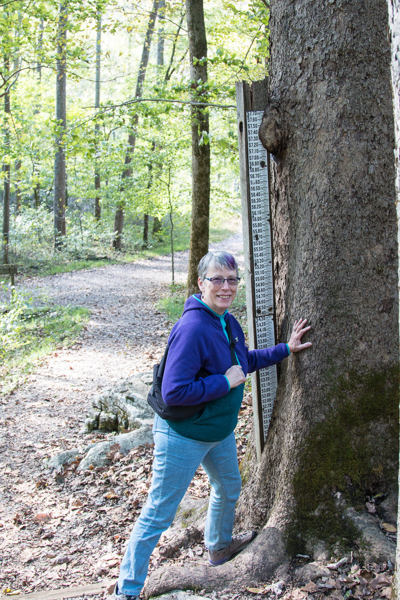
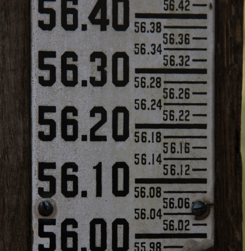
Water, water, everywhere! It’s what carved the magnificent cave system. The Green River and its tributaries did most of the work and it still runs several layers below the tunnels that we traveled.
We hiked a trail near the historic entrance, and found river height / flood gauges…Don’t want to be anywhere near here when there is a 56 foot flood!
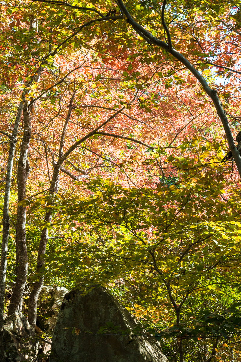
Finally starting to see some color!
The cave systems we visited were magnificent and very different from each other; Luray was commercialized with a very quick, pricey tour while Mammoth Caves had a huge range of tours and with our Senior Park Pass, it was a steal! We’re so glad that we got to experience both of these amazing places. And, yes, we’re still on the prowl for some fall foliage!
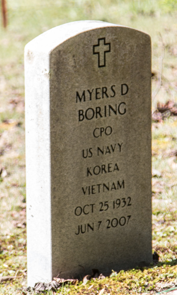
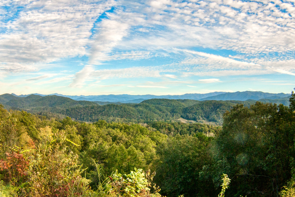
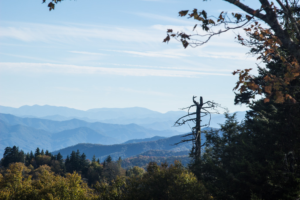
From Shenandoah we went to Great Smoky Mountains National Park (GSMNP). We stayed in Big Meadow Family Campground, in Townsend, TN—about two miles from an entrance to the park. The park owners were very friendly and accommodating (we had several large packages delivered there), and the park was maintained meticulously. Highly recommended if you travel that way.
I (Al) had been to GSMNP many times, always the weekend before Memorial Day weekend, and had several places I wanted to go with Kathe. Late May was usually somewhat crowded, but not so much as to make getting to what you wanted to see difficult. I was hoping that the park would again be fairly quiet now, being “after season.” Maybe it was fairly quiet with respect to the summer crowds, but it certainly wasn’t quiet.
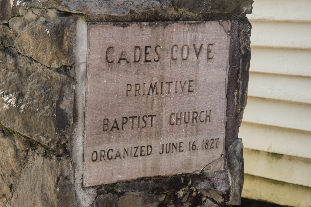
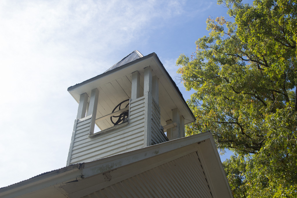
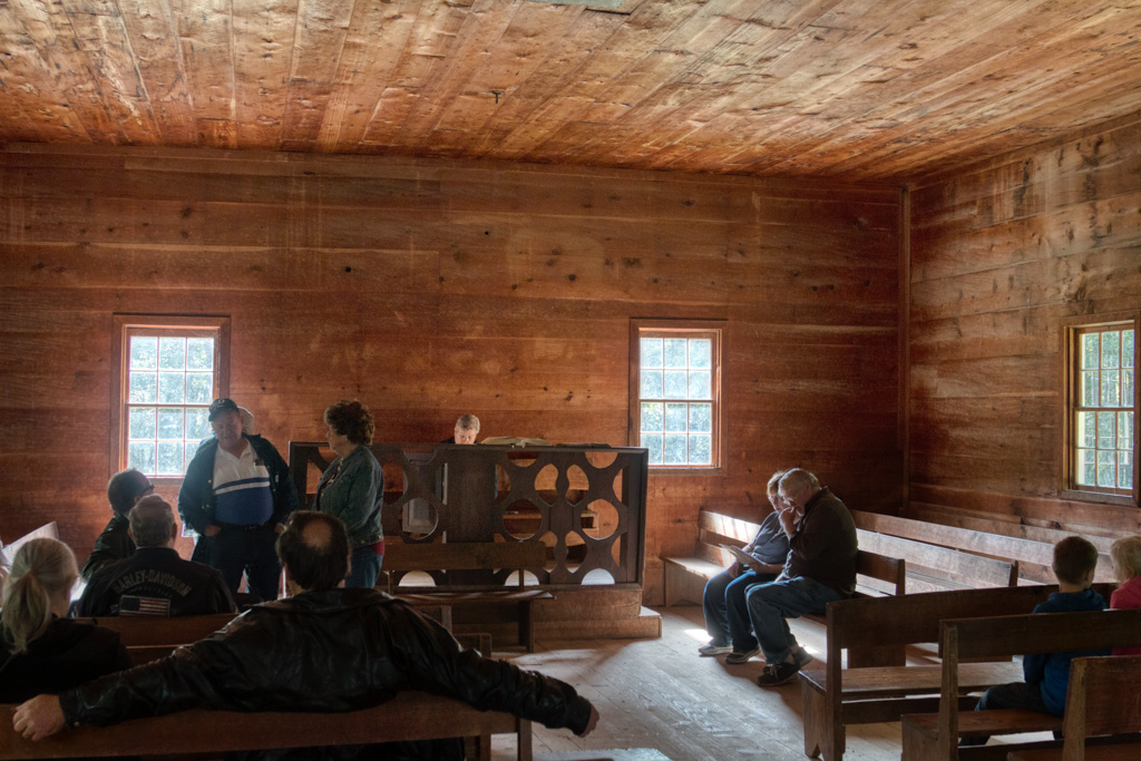
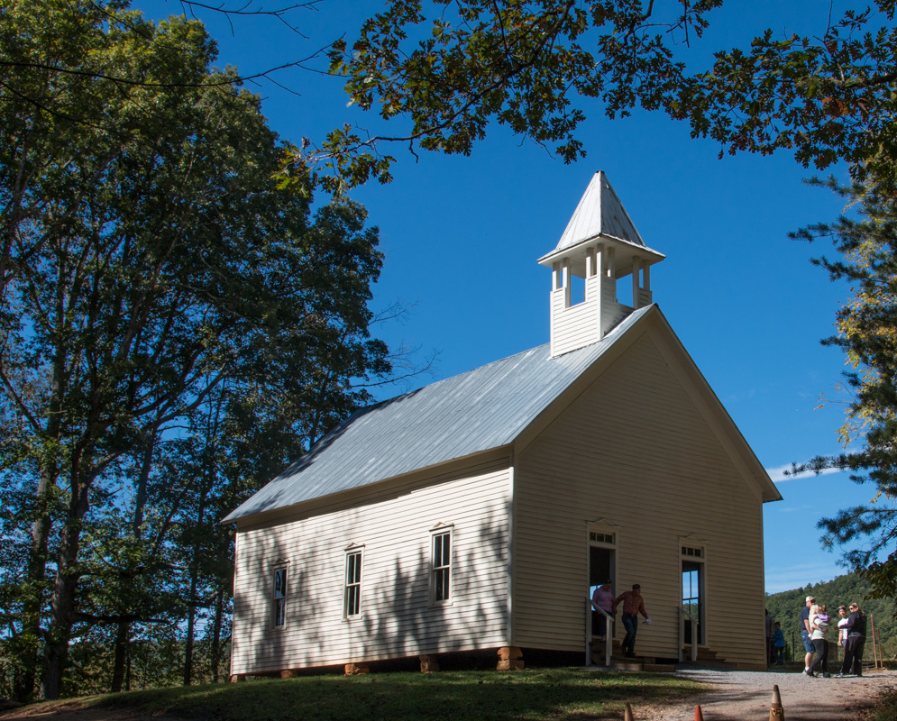
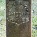
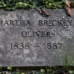
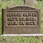
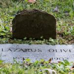
On our first day in the park, we went to Cades Cove. This is a roughly 11 mile one-way loop through an area that was settled for about 100 years before the creation of the park. Kathe and I enjoy trying to understand something of small communities by looking at their graveyards. There are several in the Cades Cove area, along with several small churches.
There are three churches in the cove: Primitive Baptist, Missionary Baptist, and Methodist.
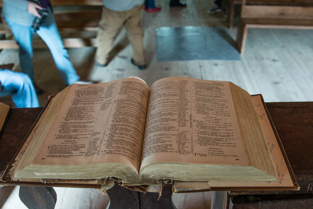
We think that the Primitive Baptist church is the oldest in the cove.The steeple and bell of the Primitive Baptist churchInterior of the Primitive Baptist churchPulpit Bible in the Primitive Baptist Church. Note the vandalism / graffiti on the inside back cover.
Traditionally, Methodist churches had two doors, one for men and one for women. Although the Methodist church in the cove has two doors, the practice of separating men and women was not practiced in this church.
The Methodist ChurchThe Methodist cemetery
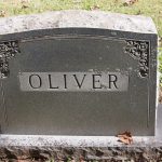
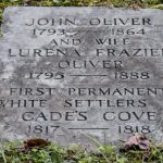
We were able to see several generations of the cove’s families, and marriages between them. We noticed that families would sometimes switch denominations with part of the family being buried in the Baptist cemetery and others in the Methodist.
The Oliver family was one of the founding families of this settlement, and remained a presence there. (Click on a picture in the gallery to see the larger, uncropped, version.)
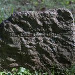
It was hard to see the infant graves with only a single date on the headstone, or a span of only a few weeks or months.
Infant graves
Especially heartbreaking was to find several groupings of three infant headstones from the same family.
The cemeteries are still active, despite being in a National Park. People who lived in the cove before the creation of the park are still able to be buried there.
Two of the things we wanted to see in the cove—Abrams Falls and the mill—we had to pass on due to the crowding. By the time we got to the parking area for the falls we didn’t have enough time for the hike, and when we got to the mill area, there was no available parking. So we headed back to camp.
Afternoon in the Smoky Mountains
After dinner we went to Look Rock to see the sunset. This is several miles out the Foothills Parkway, a separate part of the park. Right at the parking lot, there is a short walk to a viewpoint to the south. While very pretty, it wasn’t going to be the best for sunsets. As we were walking back to the car to try to find another place, a young couple asked if we were looking for the tower. Yes! They showed us the start of the path across the road from the parking. After a short (uphill!) hike, we were set for some good sunset photography.
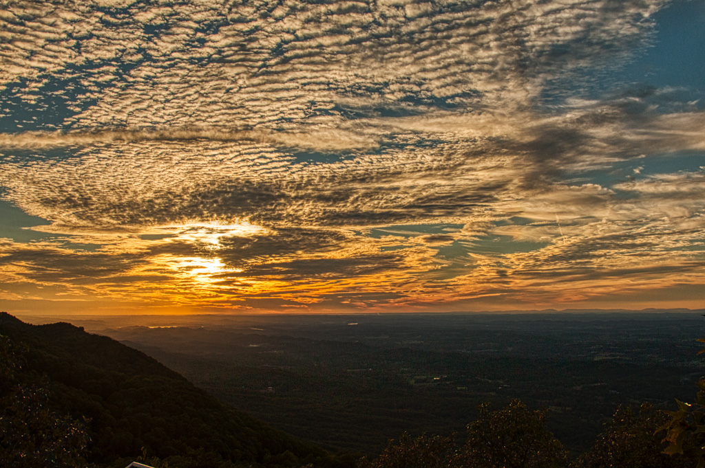
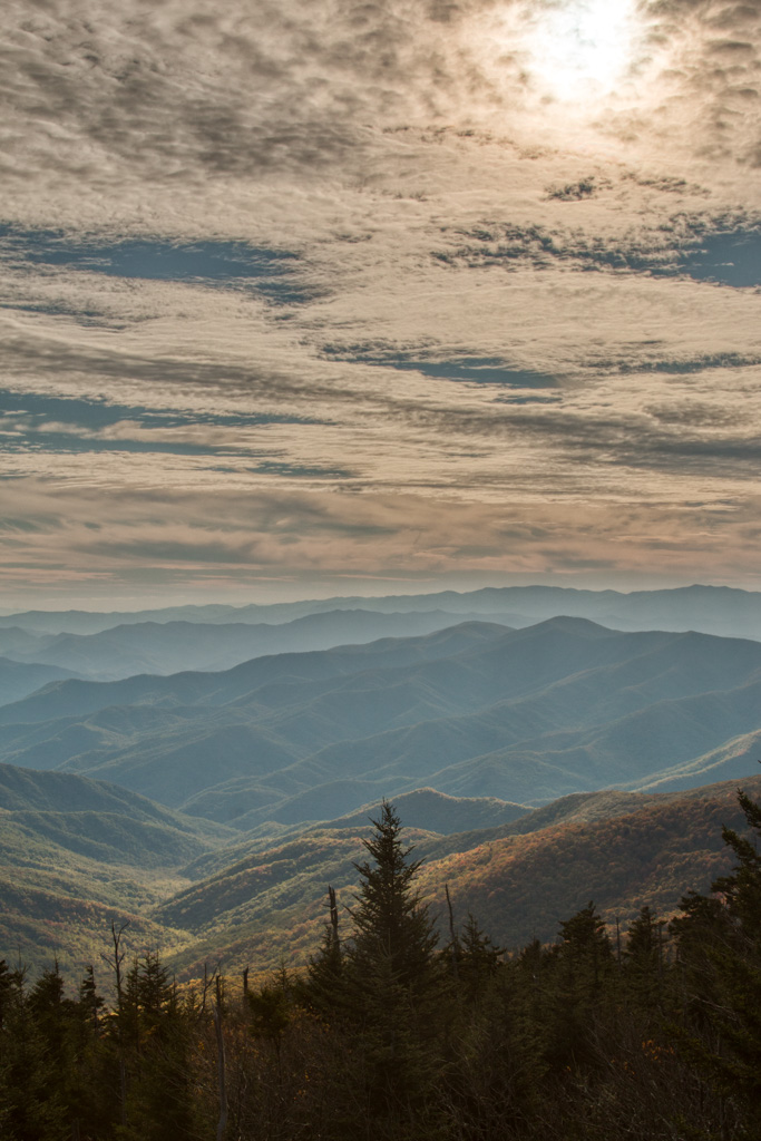
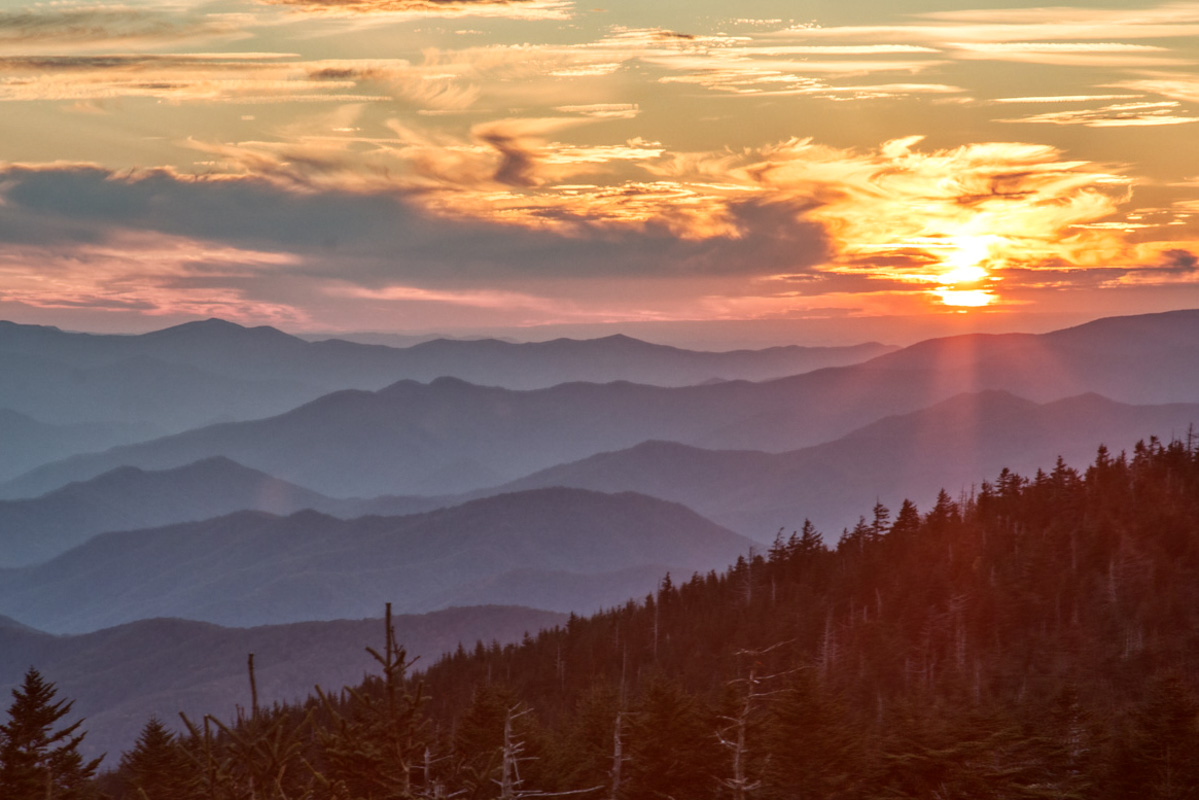
The next day we decided to drive to Clingmans Dome for sunset.
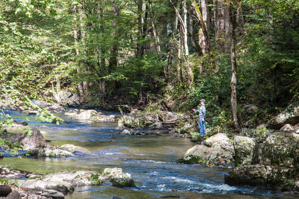
The first part of the drive is along the Little River, which has many cascades and is quite pretty. One of the disadvantages of driving a large pickup truck is that there are very few places you can pull over for a photo stop. We did find a few though.
A small cascade along the Little RiverThe Little River can also be serene
Eventually the road leaves the river and heads into the mountains. Here we saw our first hints of fall colors, although we missed the bright reds of Maine.
This is a long drive (the Dome is in North Carolina, and the road is a twisty mountain road). The drive was worth it! At many points there are good views of the mountain range that we are in.
The Appalachian Trail passes directly under the tower we watched the sunset from, so I guess I can now say I’ve been on the AT! (Nah. I wouldn’t do that to my friends who have hiked the AT.)
Row after row of Appalachian mountains at sunset
In addition to sampling sunsets wherever we land, we love to eat, too! We eat out fairly often, possibly more than we should. But here we “had” to eat lunch twice at the Black Bear Cafe in Townsend. Their fried grouper sandwich was outstanding!
We continue to find that meeting people is one of the most enjoyable aspects of RV life. At Big Meadow, we met Joe and Judy, and two of Judy’s sisters, Jo and Rachel. We enjoyed comparing our RVs and the modifications we each have made (their rig is a larger version of ours), and talking about favorite places to visit. The sisters are three of seven sisters. When we left the park the three, who were roughly in their late 70s, were heading out to have lunch with some of their friends…they hadn’t seen since elementary school!
From here, we went to Mammoth Cave, which Kathe already covered in her spelunking post. We’ll catch you again from Memphis!
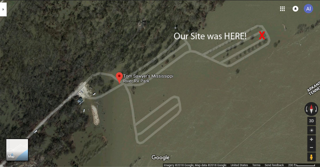
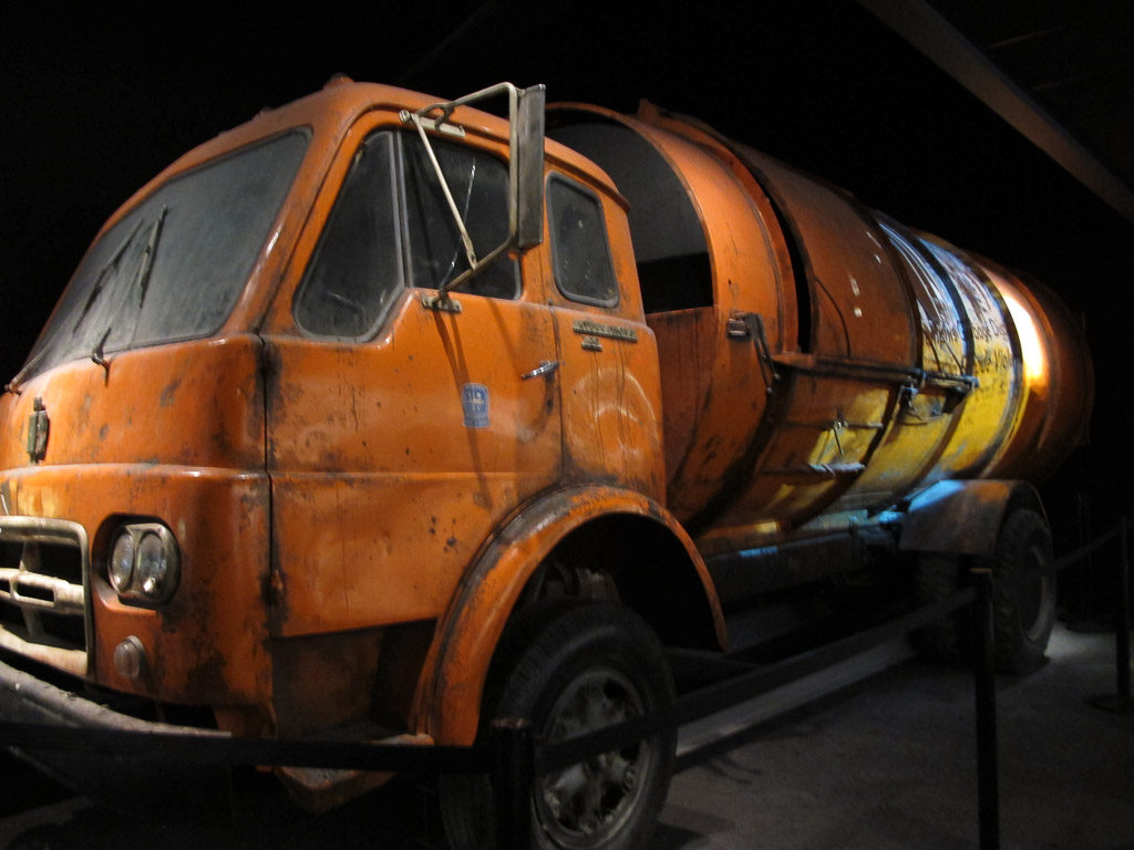
When we were looking for a campground near Memphis, several folks suggested the Tom Sawyer RV Park (actually in W. Memphis, Arkansas). We learned that it is RIGHT on the banks of the Mississippi and this totally intrigued us. The park’s website includes information about the importance of monitoring the Mississippi Riveras your camping time approaches; they’re closed when the river overflows its banks. Yikes! We checked and it looked like we’d be just fine; it takes a couple of weeks for rain far north to really affect the height of the river. We knew we didn’t want to approach when THIS was happening!
Here’s our site where it would be during a flood!
High water! Camping on the flood plain.
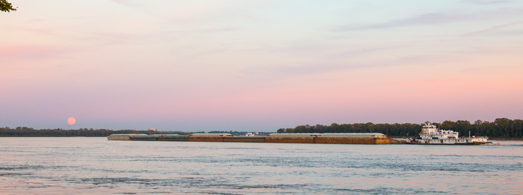
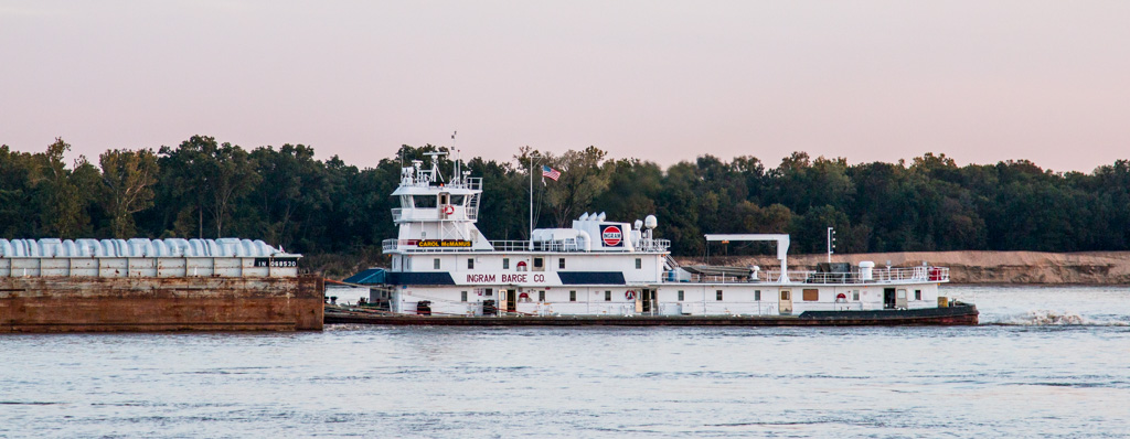
During our first hour at the campground, we were drawn to the river (actually only about 50 yards from our site) as a huge collection of barges (all attached, 7 barges long, and 3 across) was pushed along by ONE boat (that looked quite a bit like an oversized tugboat).
Can you count all the barges? Most of the loads were three barges across and anywhere from three to ten barges long!
One of the best parts of moving around the country is how much we love being so close to different forms of transportation. In Indiana, we camped very close to a very active train track — it ran all day and night (never kept us awake) and reminded us of how much our nation’s commerce depends on different modes of transport. Then, of course, there are the thousands and thousands of tractor trailers (some pulling two or even THREE trailers!) that we share the road with as we move along the nation’s interstates. And while on the Mississippi for several days, a low rumble accompanied us much of the time — we could look out the bedroom window and watch the barges moving through as we fell asleep—and then again, when we woke up the next morning. Sometimes we could tell what they were hauling, and other times, hmmm… They were mesmerizing. It’s fun to watch our nation’s commerce on the go!
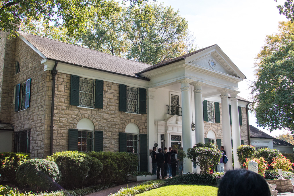
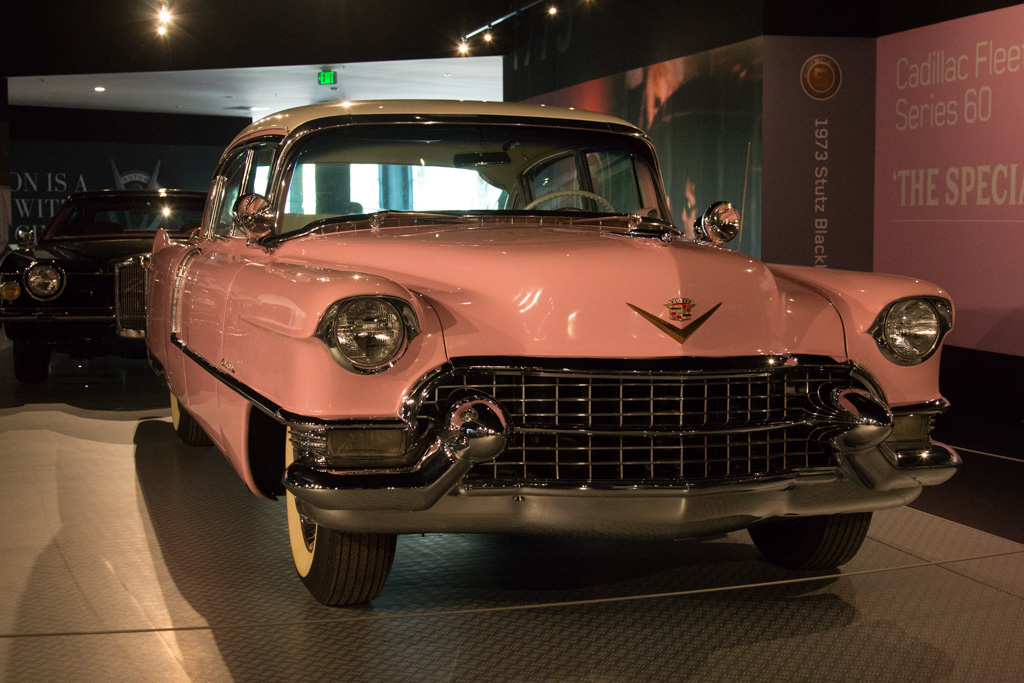
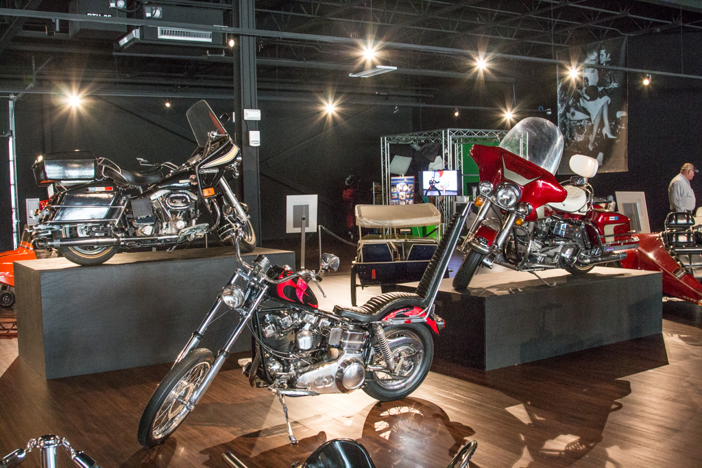
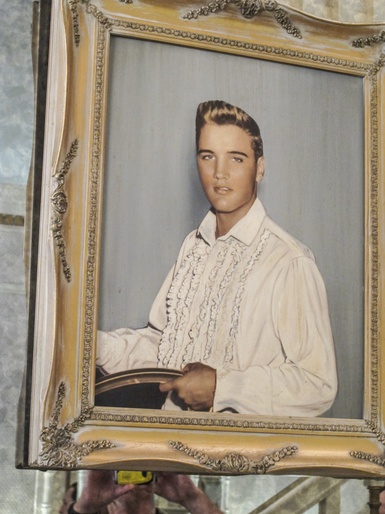
So, why Memphis? Graceland, of course! We’ve learned to take others’ recommendations, whether positive or negative, with a grain of salt. We like to experience what we can and draw our own conclusions—sometimes a place that someone else told us to not waste our time with, is a favorite of ours!
So we drove to Graceland our first morning there—and spent hours poring over building after building of memorabilia not just about Elvis but also about many other musicians. We started with a tour of the mansion—and were quite impressed by all that we were able to see. I’ll let the pictures tell the story:
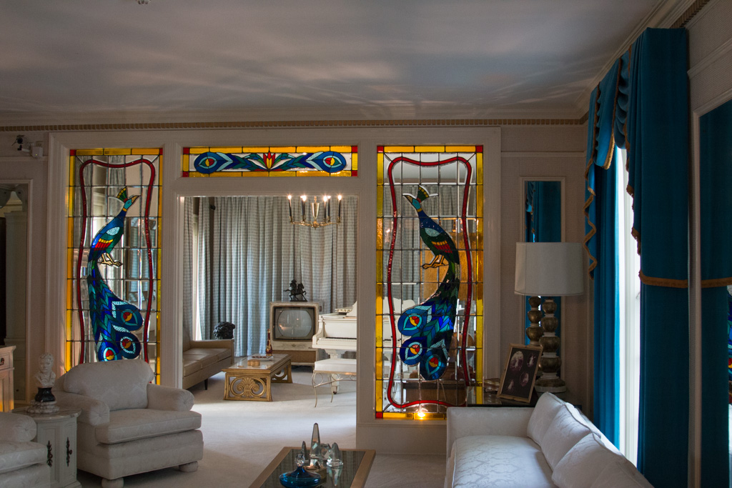
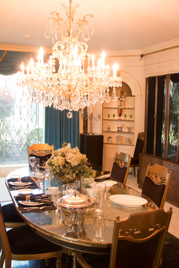
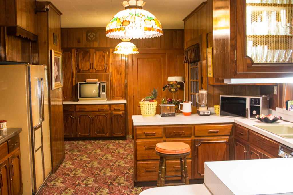
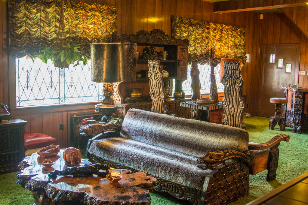
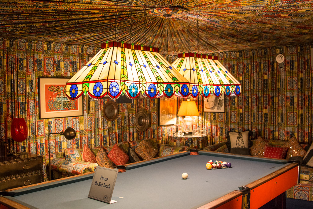
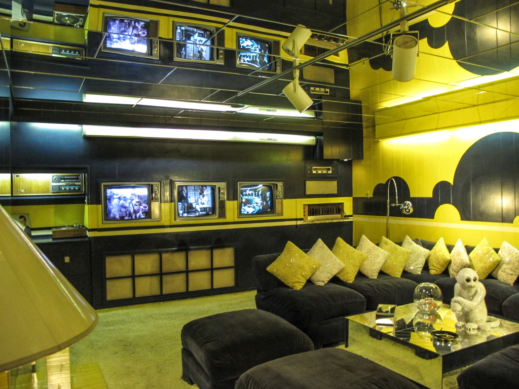
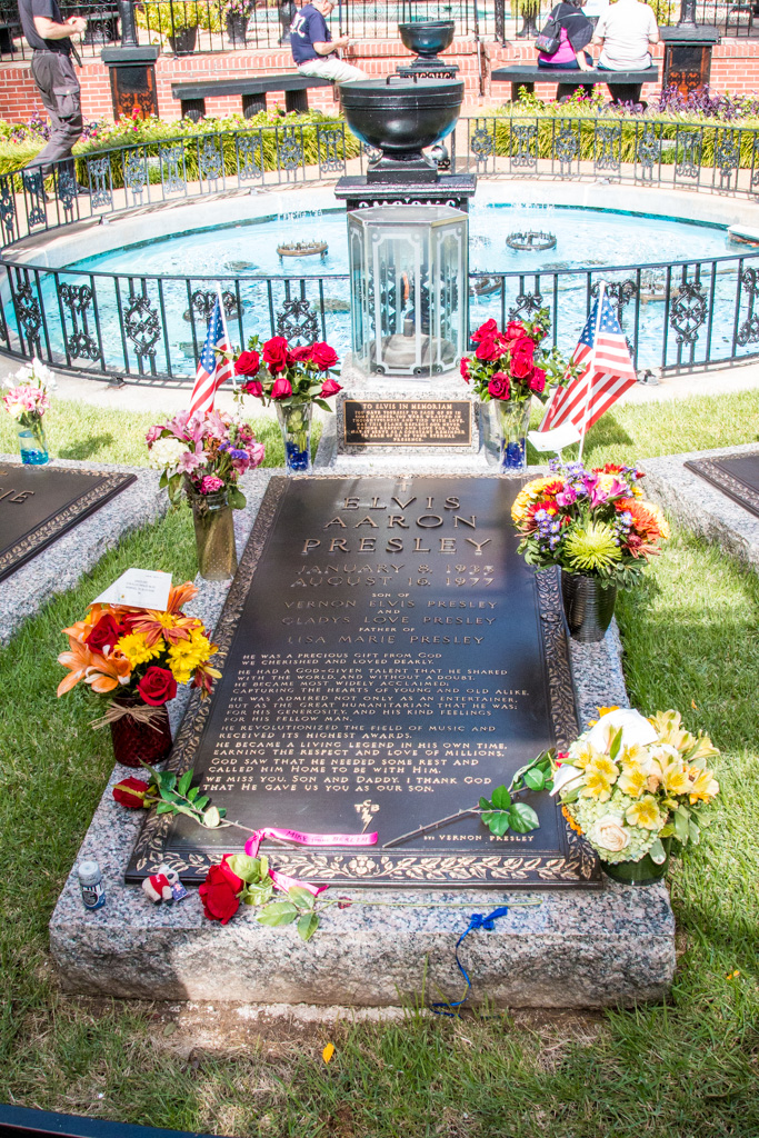
The Presley’s home — treasured and beautifully maintained.The living room and music room beyond — the 12 foot couch was specially orderedThe dining roomThe heart of the homeElvis’ jungle room–his favoriteElvis designed this pool room himself — nearly EVERY surface was covered with fabric — the walls (pleated), much of the furniture, and yup–the ceiling!Elvis’ media room hurt our eyes!Family graves in the memorial garden on the grounds of the mansion
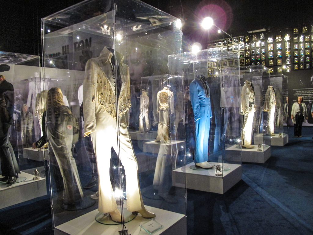
But Graceland comprises much more than the house! There were a number of buildings that featured everything from Elvis’ car and motorcycle collections, gold records, a gallery featuring dozens of musicians who were/are influenced by Elvis, a huge archive of all things Elvis including items related to his military service, and, oh yes, an incredible array of bedazzled jumpsuits!
It took us at least a couple of hours to get through all of the extra buildings. We were pretty impressed and Elvis’ music serenaded us throughout the entire complex. Not having ever been huge Elvis fans, we had a lot of fun and found ourselves humming Elvis tunes for several days!
I admit it. I’ve been thinking about this post for several weeks and needed time to let it percolate.
Truthfully, I’ve been procrastinating. I’m not sure I can do this experience the justice it deserves but I’ll try.
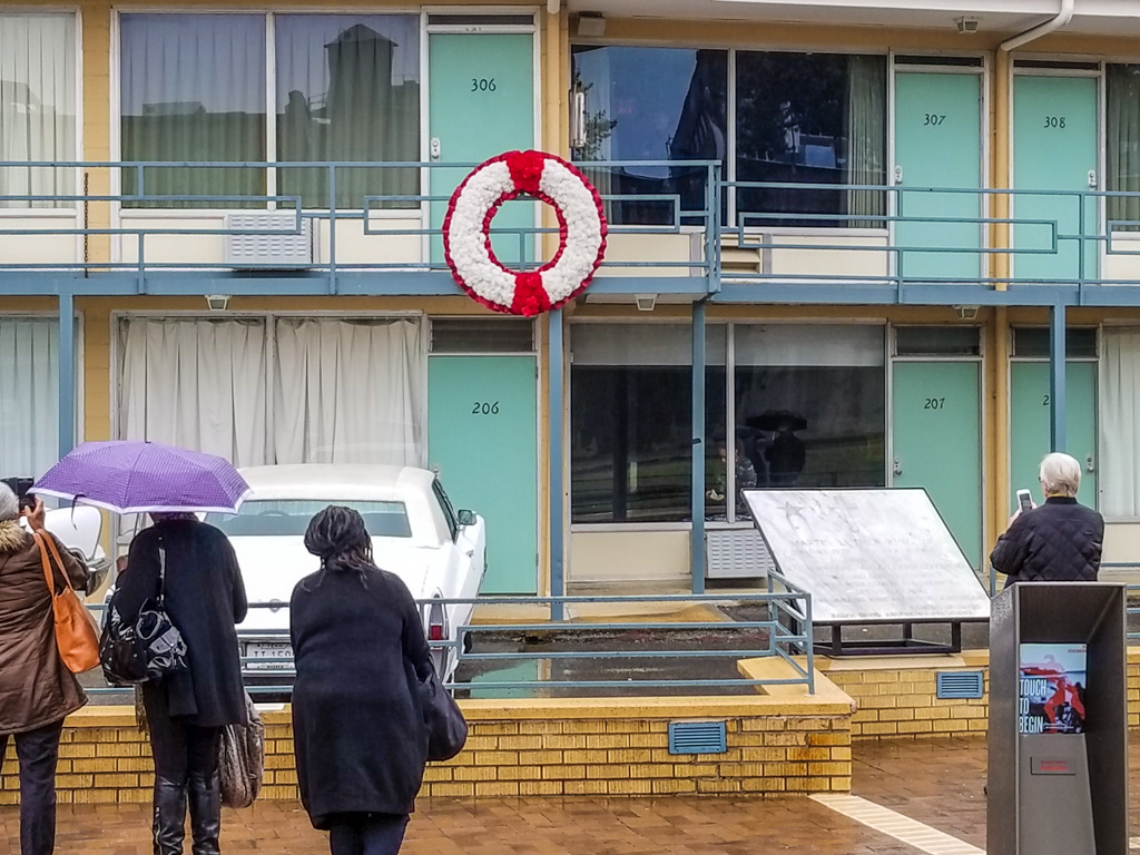
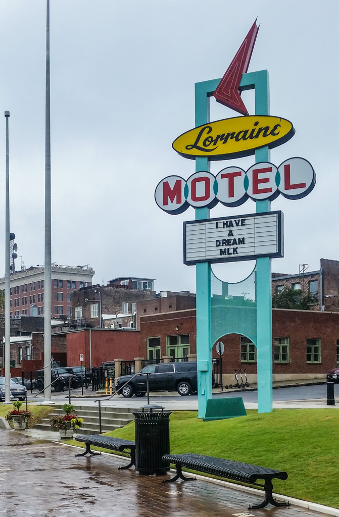
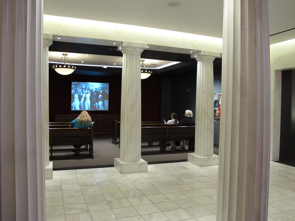
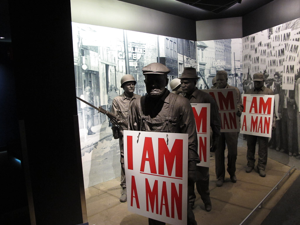
While exploring what to see in Memphis, we learned that it is the home of the National Civil Rights Museum. The museum is actually on the site of the the Lorraine Motel, where Martin Luther King, Jr. was assassinated. This destination jumped to the top of our list for our Memphis stay.
We had no idea.
The balcony where MLK was murdered. Notice the small kiosk on the right; there were a half dozen of these spread out on the plaza — you could lean into one and learn important details about the time and place. The shape of the kiosk kept the sound enclosed so as not to disturb others’ experience while taking it all in.
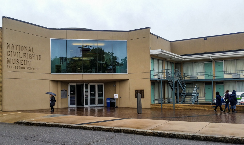
The NCRM has two large buildings— the Lorraine Building (the motel) and the Legacy Building across the street, which was the boarding house from where the assassin James Early Ray took aim. The path of the bullet is depicted in the pavement that runs between the two buildings.
Notice the path of the bullet, the dark stripe in the sidewalk.
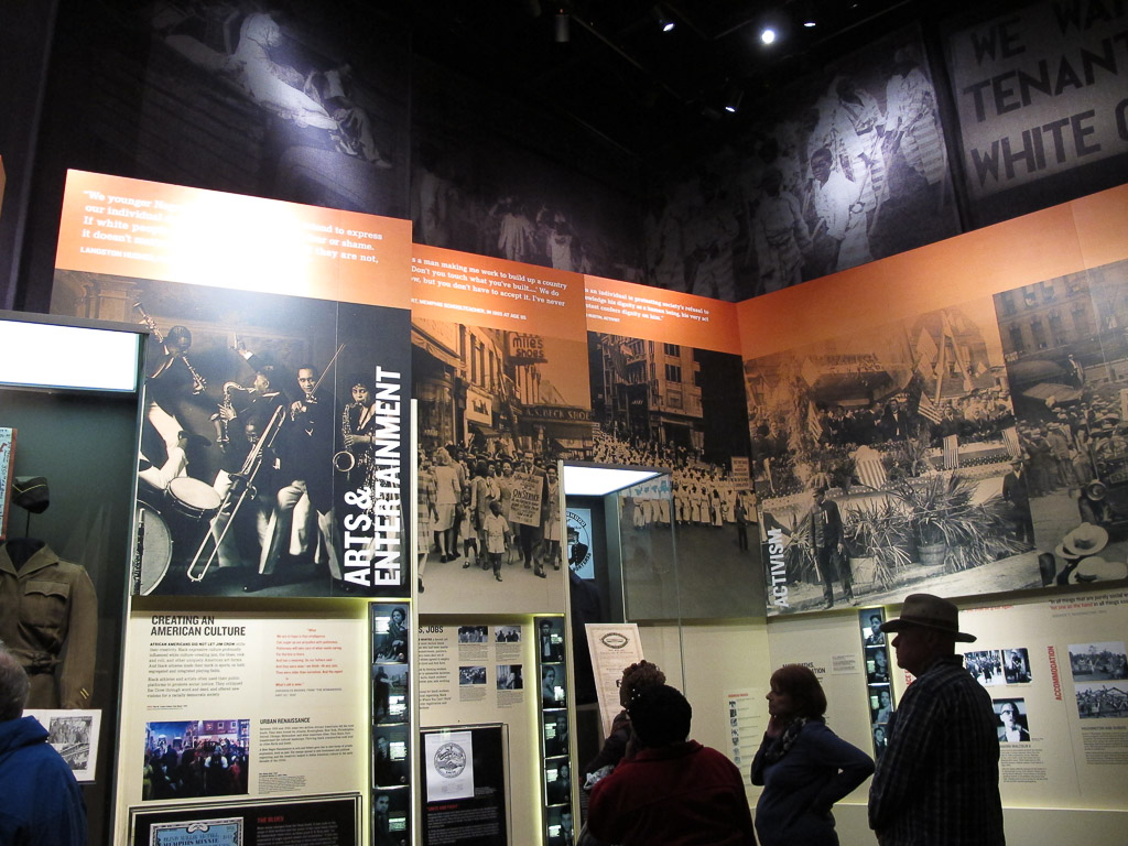
From the moment we stepped inside the museum, it was very clear that it had been designed with incredible precision and purpose.
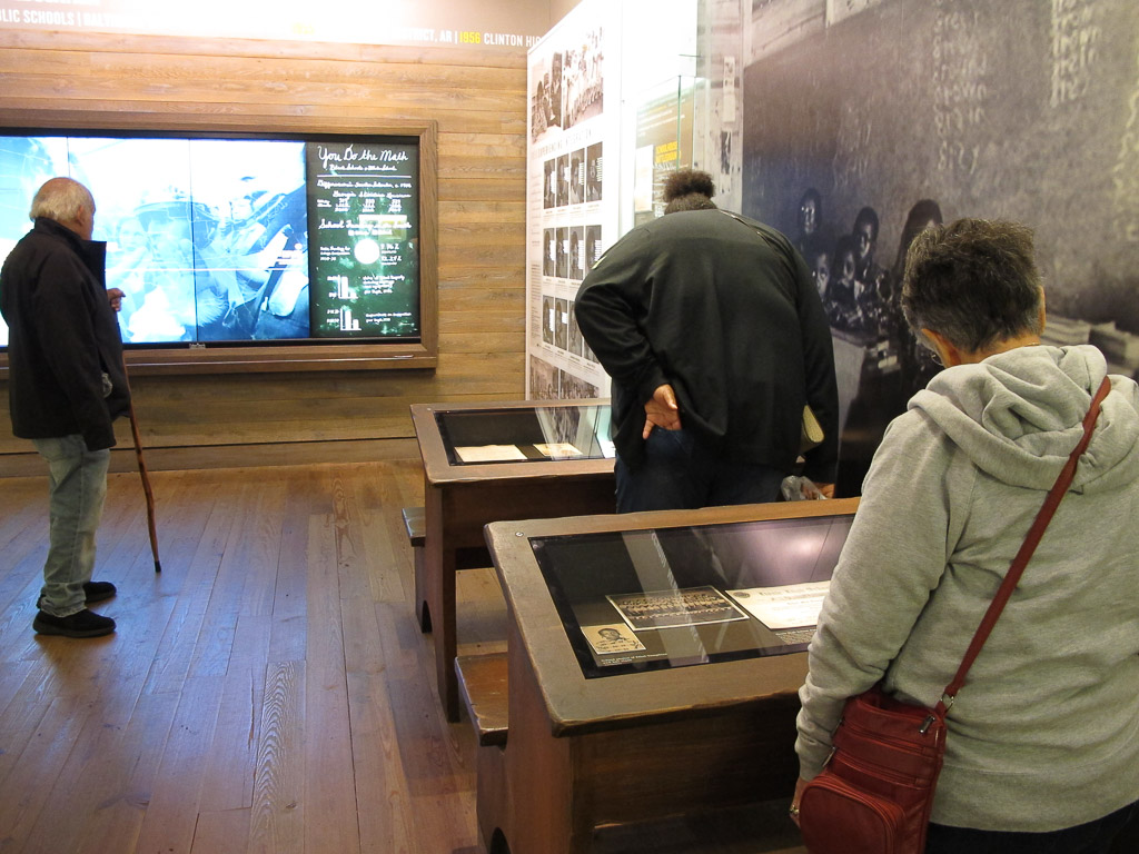
The museum was incredibly text rich—it took us several hours to read our way through the museum and I’m sure we didn’t read all that was posted. (It did make me wonder how someone who isn’t able to read English well would experience the museum.)
The expanse of coverage was overwhelming both in size and scope—the museum’s floor-to-high-ceiling exhibits span the Civil Rights Movement in the United States beginning in the 1700s with resistance to slavery and continuing into the current day with worldwide events that not only conjure inequality but also call us to work for equality—for all.
We were overwhelmed by the impact the exhibits had on us. I felt a combination of breathlessness, anxiety, regret, and anger. There was so much to take in. So much to learn.
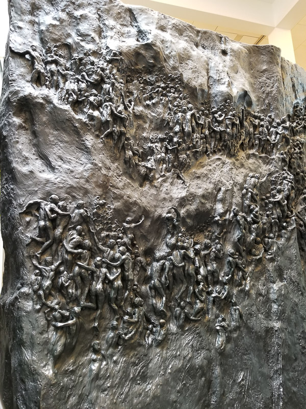
This stunning two-sided bronze sculpture, Movement to Overcome (Michael Pavlovsky, sculptor), stands 14 ft high, 21 ft wide, and 6 ft deep. It depicts the slow, uphill struggle for Civil Rights.
The powerful introductory movie concluded with shadows of people marching across the screen. As the theater was dimly relighted, we were asked to exit by climbing a few stairs onto the stage and exiting behind the screen. We became part of the march. Chills.
It was difficult to witness some of the bone-chilling exhibits. In a large room focused on slavery, an alcove depicted the innards of a slave ship where life-sized bronze statues wrapped in chains were crowded together on the floor. Their agonizing screams and groans played on a continuous loop. It felt disrespectful to even consider taking a photograph. We were there to learn. And we were humbled.
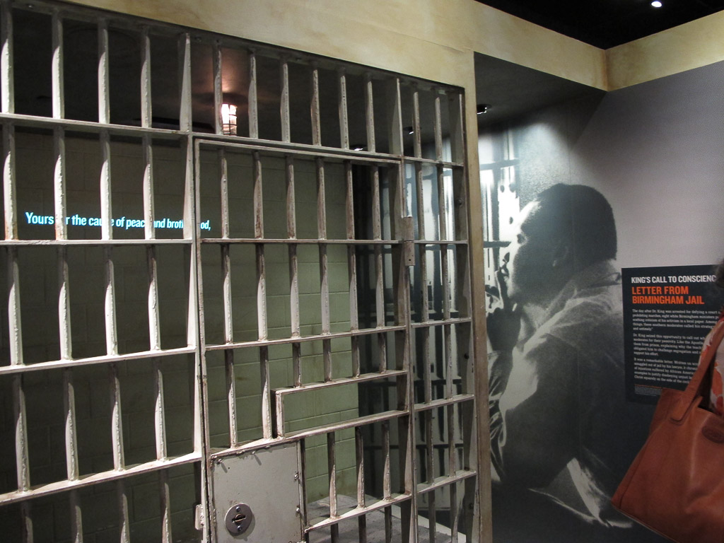
As we tried to take it all in, the displays continued to draw us into each scene as if we were present. The story of school desegregation was displayed in a courtroom and a classroom. Martin Luther King Jr.’s experience in the Birmingham Jail was told in a jail cell.
We agreed that our own public education had been tremendously lacking in U.S. history past the Civil War. The school curriculum in Stamford, CT in the 1960’s did not include anything past the beginning of the Reconstruction era. Current events were glossed over and never put into an historical context.
I felt ashamed as I realized how little I knew. We should all know this history. Why weren’t we taught this?
I won’t presume to be the one to teach others this history that is so new to me; hopefully you already know much of it yourself.
The Rise of Jim Crow began in the late 1800’s and continued well into the 20th century. The 15th amendment and legislation were passed to guarantee rights to African Americans and were then destroyed by a series of new laws and Supreme Court decisions that made “Separate but Equal” the law of the land. Segregated schools. Separate water fountains. Separate. Separate. But never Equal.
The Jim Crow era led to. . .
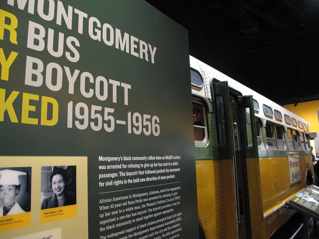
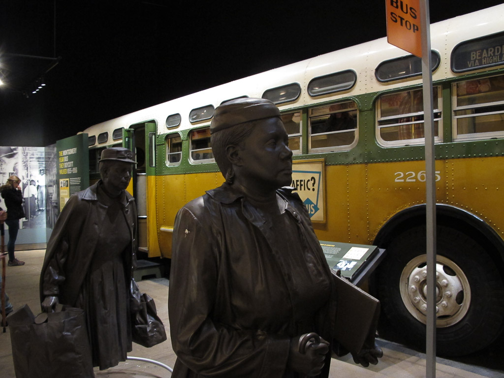
The Montgomery Bus Boycott
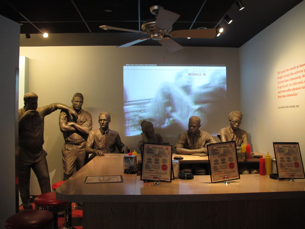
The Student Sit-ins
A lunch counter sit-in.
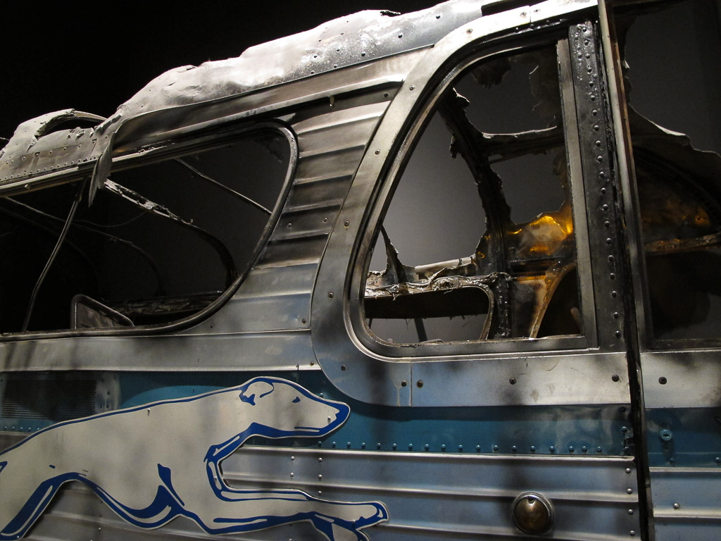
The Freedom Riders of 1961
A burned out bus used by the Freedom RidersIncarcerated Freedom Riders in the early ’60s.
The Sanitation Workers’ Strike in Memphis
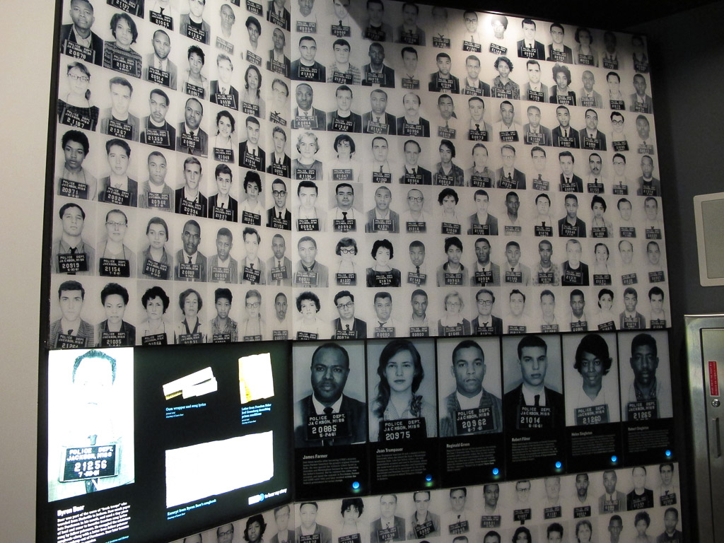
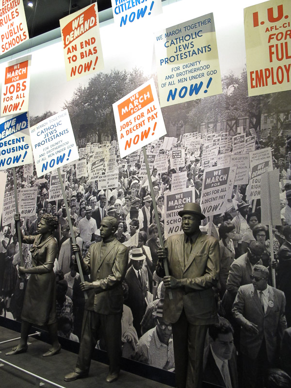
Civil Rights Marches
In the afternoon we visited the three-story Legacy Building across the street. On the 3rd floor, a timeline tells the story of the American Civil Right Movement up to the time of MLK’s assassination. The entire second floor is dedicated to the investigation of the crime: the conspiracy theories, extensive evidence , and the actual spot where James Earl Ray took aim.
I felt unsettled. Is this where the museum leaves us? I was glad when the tour ended on the first floor. Here we learned more about how the Civil Rights Movement here in the US has impacted human rights and civil rights throughout the world. We were left with the voices of many who have been called into action and who are making huge impacts globally to work toward equality for all. In the dimly lit room, a mural of silhouetted men, women, and children led us out; again, we became part of the story.

 Detail of the New York monument