We had the good fortune to spend a week on Washington’s Olympic Peninsula. We visited four major areas on the peninsula, each one very different.
Sol Duc
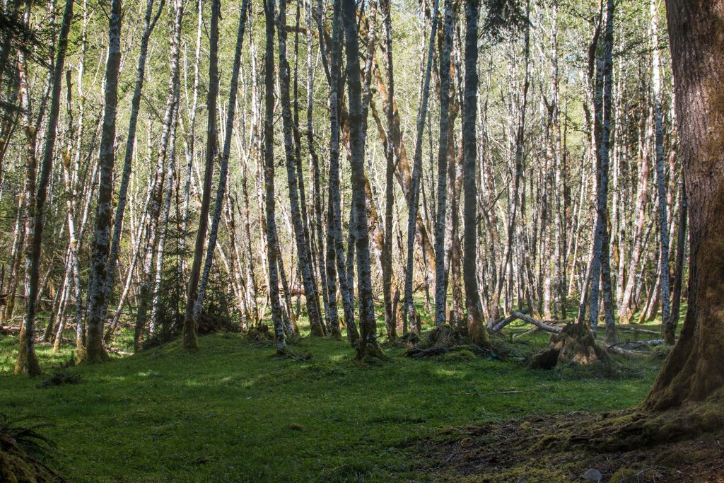
We started out by camping in Sol Duc (Sole Duck), deep in Olympic National Park. The campground was run by the concessionaire, and was part of the Sol Duc Resort. We sort of lucked into this one via Sir Google; there are actually two campgrounds in Sol Duc that take RVs. The other one was heavily wooded and we would probably not have been successful getting Scarlet and Rhett in there. The one we had was small (about 15 sites), but wide open. The site was nestled in a grove of birch trees.
It was also a short walk to one of Sol Duc’s main attractions: thermal springs! We spent quite a bit of time soaking… The spring water is 150°, and is mixed with the river water to the desired temp for each of three pools. The hot one was hot enough that even I couldn’t stay in it for more than about 10 minutes—and I love hot baths! Just like in the Three Bears, the middle one (temperature) was just right.
Ummm. Sorry. No pictures; we were too busy relaxing!
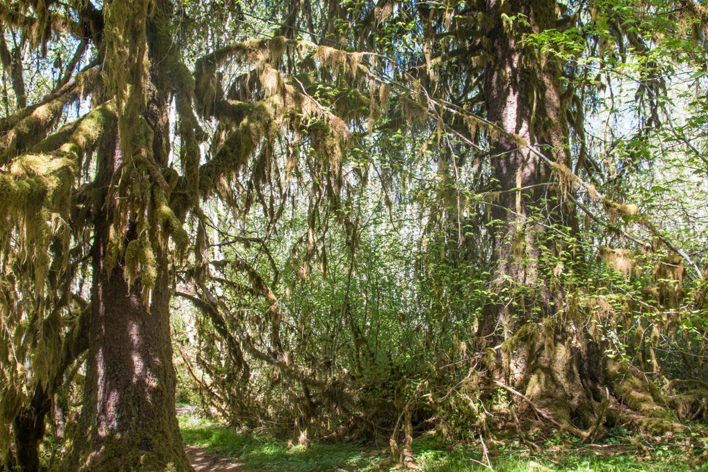
You may have heard that the Pacific Northwest (PNW) gets a LOT of rain. There are several rainforests within the park. We were not in one, but looking around at the trees it sure looked like it. The older trees were covered in moss!
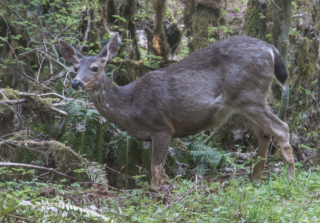
There are several trails leading out of the Sol Duc campgrounds; we encountered some deer browsing just off one of the trails.
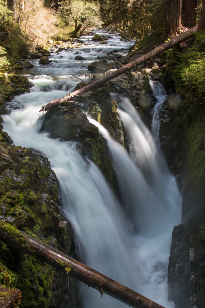
We followed one of the trails out to the Sol Duc waterfall.
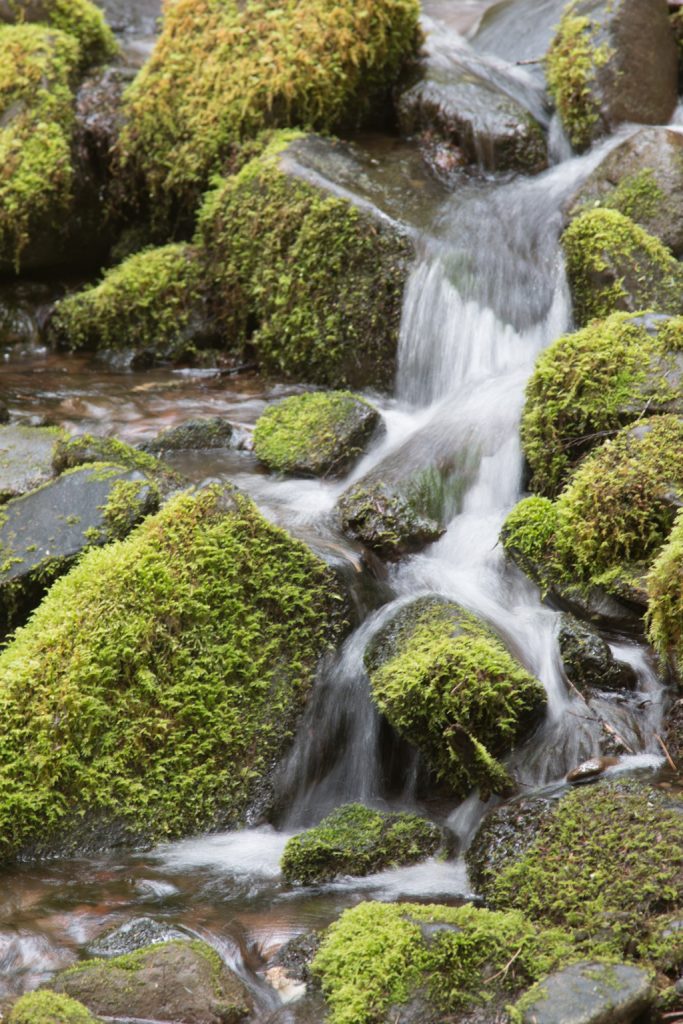
On the way back home (yes, the trailer really is “home”) we found another waterfall, albeit not quite as large.
Sol Duc is completely surrounded by mountains. Nice scenery! Lousy connectivity! For the first time ever, we had to send a text message out through the Garmin Inreach satellite communicator that we carry for back country emergencies. (It wasn’t an emergency…)
Crescent Beach
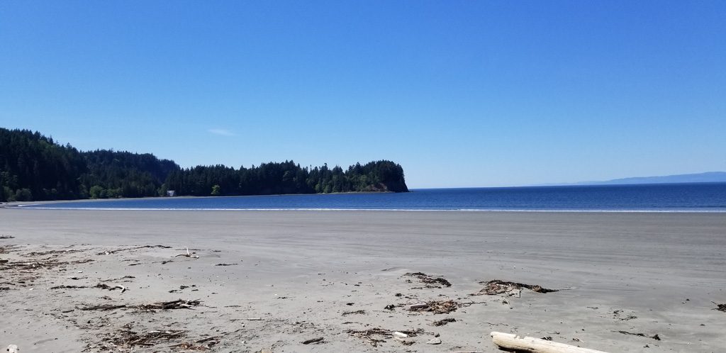
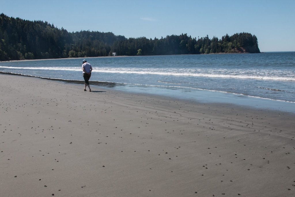
Sol Duc is southwest of Port Angeles, which seems to be the major town on the Strait of Juan de Fuca, the northern boundary of the Olympic Peninsula. Crescent Beach is a little west of Port Angeles, but is on the shore of the Strait.
Being here made us appreciate Oregon’s beach access law. Directly across the road from the campground was “their” beach, but “don’t go past the rainbow pole! That’s not our beach and you’ll be trespassing.”
About 1/2 way toward the trees in the distance, the beach belongs to someone else, and campers can’t go there. Sigh.
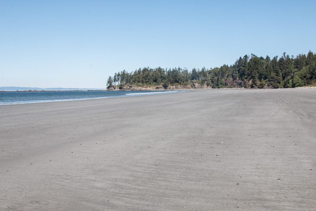
Nevertheless, it was a beautiful setting and we enjoyed strolling on the sand.
Kathe normally beachcombs for sea glass, but we haven’t been successful finding any in the PNW. Here she was looking for…
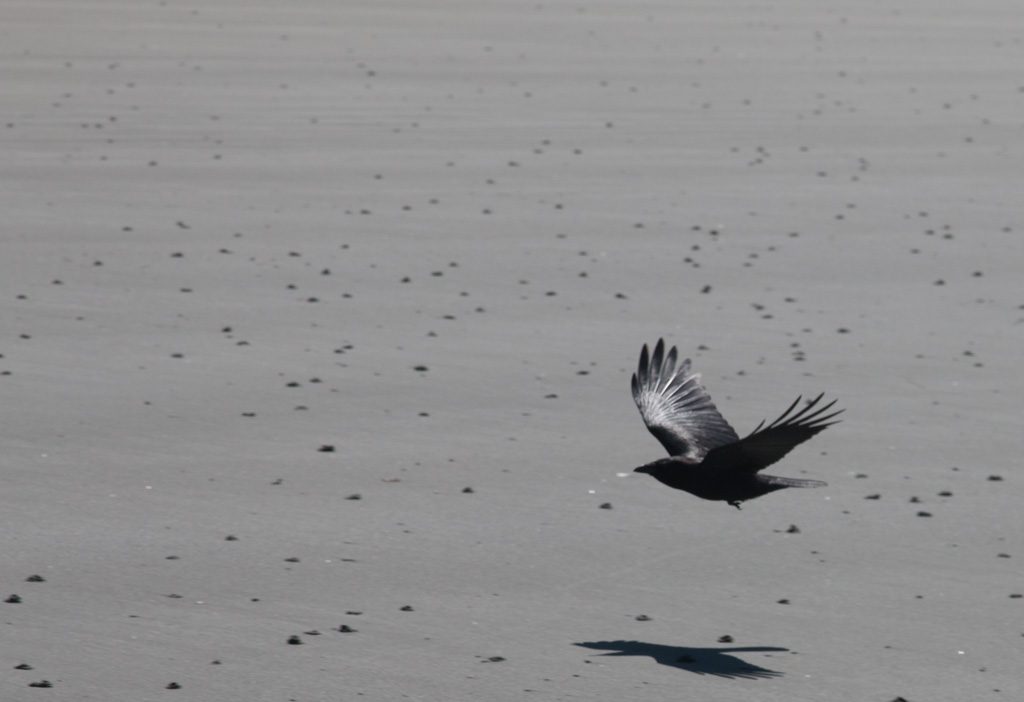
We had a visitor.
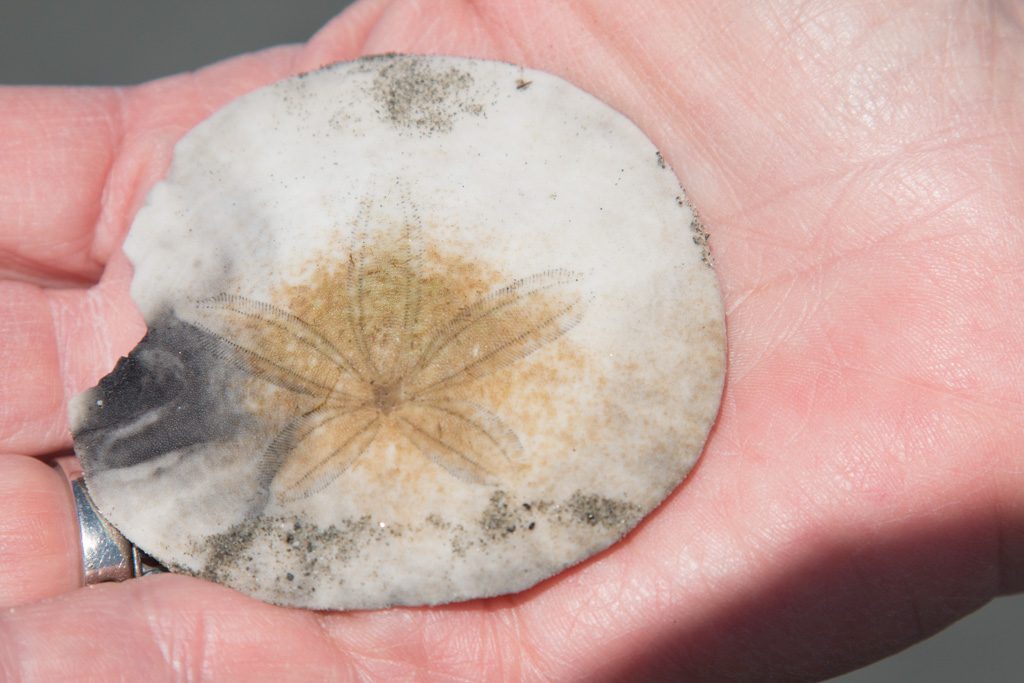
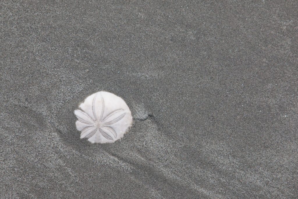
But what are all those dark spots on the beach? Something is living in the sand (clams?). It leaves two kinds of markings.
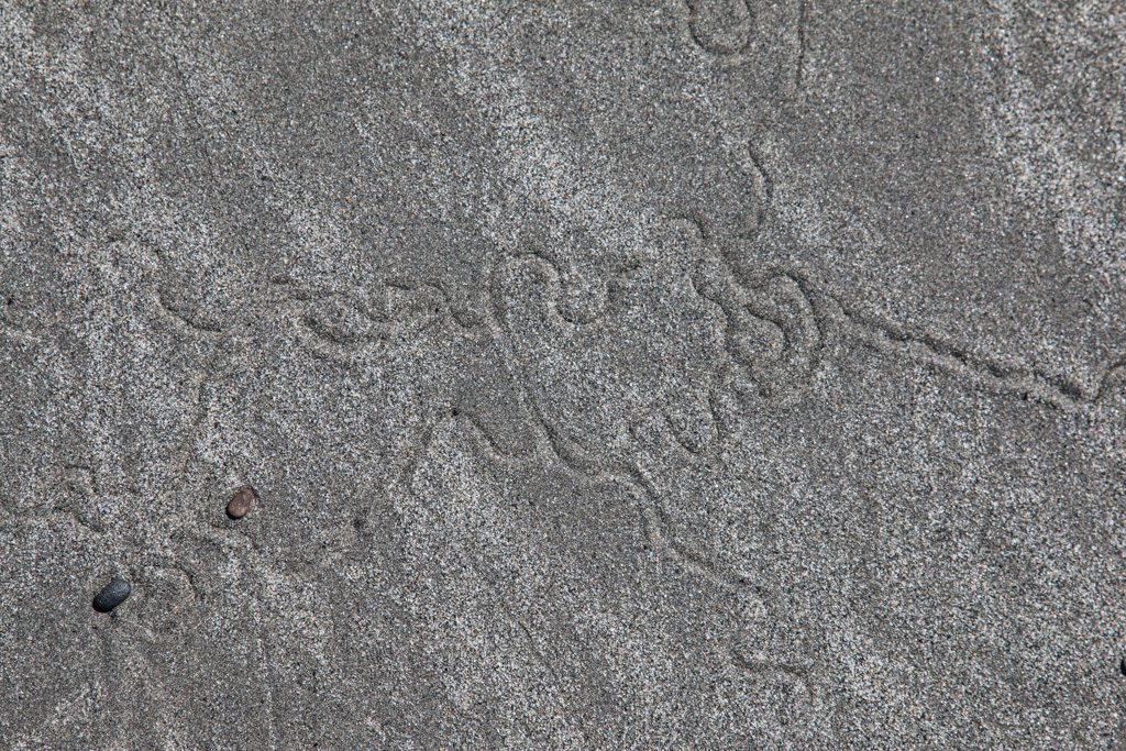
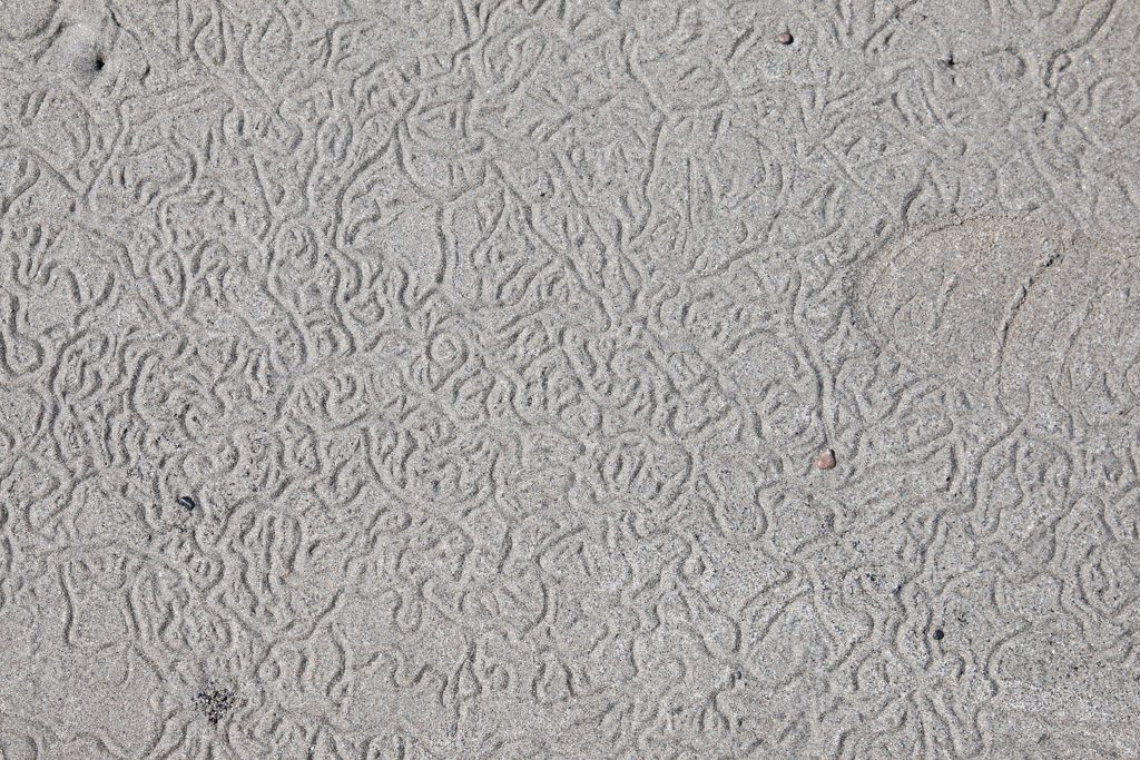
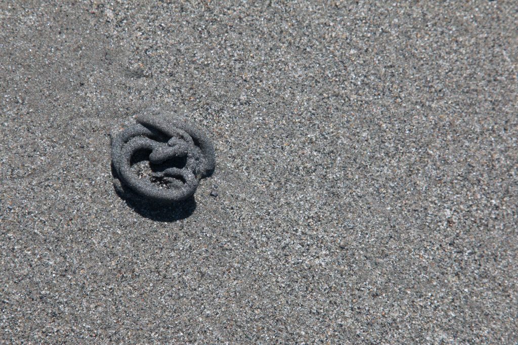
Please leave a comment if you know what animal is creating these tracks and the… what shall I call them?
Sometimes I wonder about the people who lay out campgrounds. Who would think that putting the sewer connection at the highest point in the site would be a good idea? Remember: it flows downhill!
Hurricane Ridge
Crescent Beach isn’t part of Olympic National Park, but we went back into the park to visit Hurricane Ridge on the recommendation of a friend who is a former park ranger there. So, so, so glad!
Also we were so glad that we didn’t have our trailer hooked up to our truck for this one! The road up the ridge is steep and twisty. But the views are worth it. Down at sea level the skies were gray and cloudy, so we almost didn’t go. (Note to self as a future reminder… Always go!) Up top? Take a look!
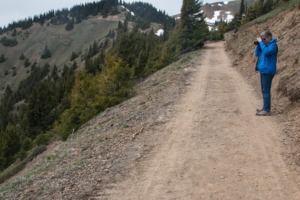
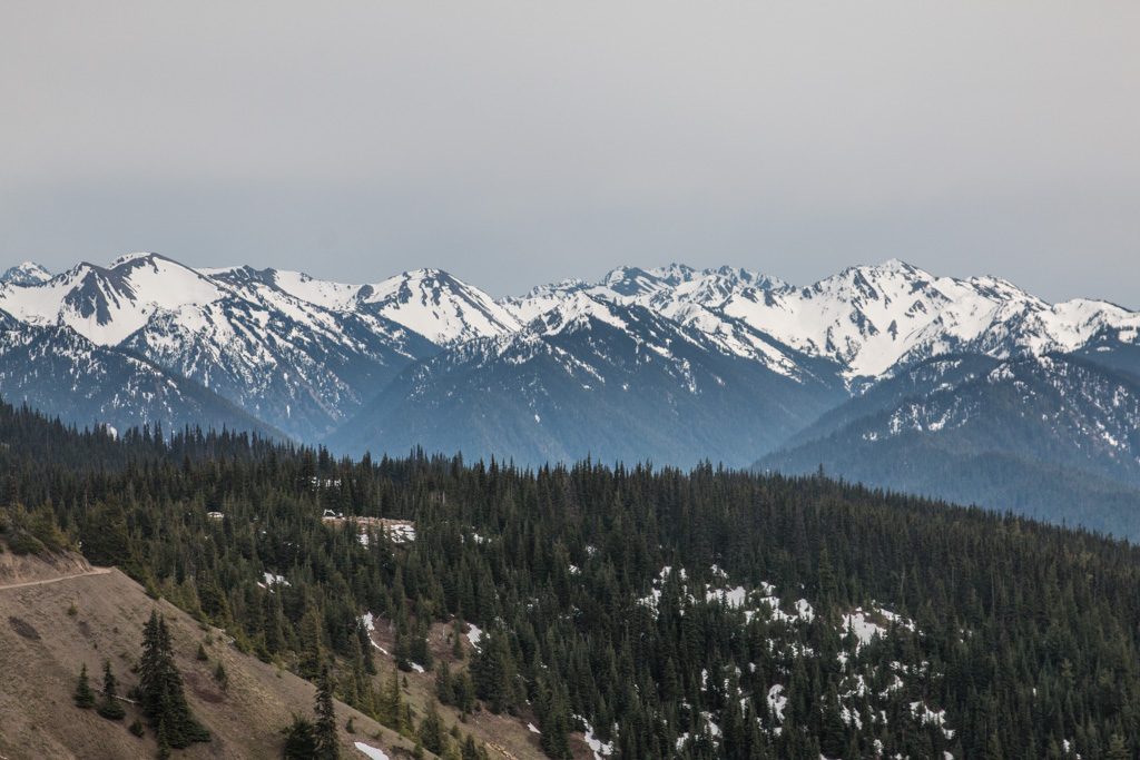
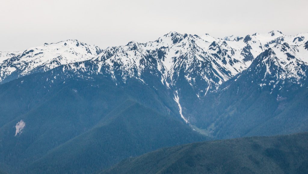
Despite the name, the weather was quite mild with calm winds. We enjoyed our hike to the end of the currently open trail. The remaining trail to the peak of Hurricane Hill was still closed due to snow.
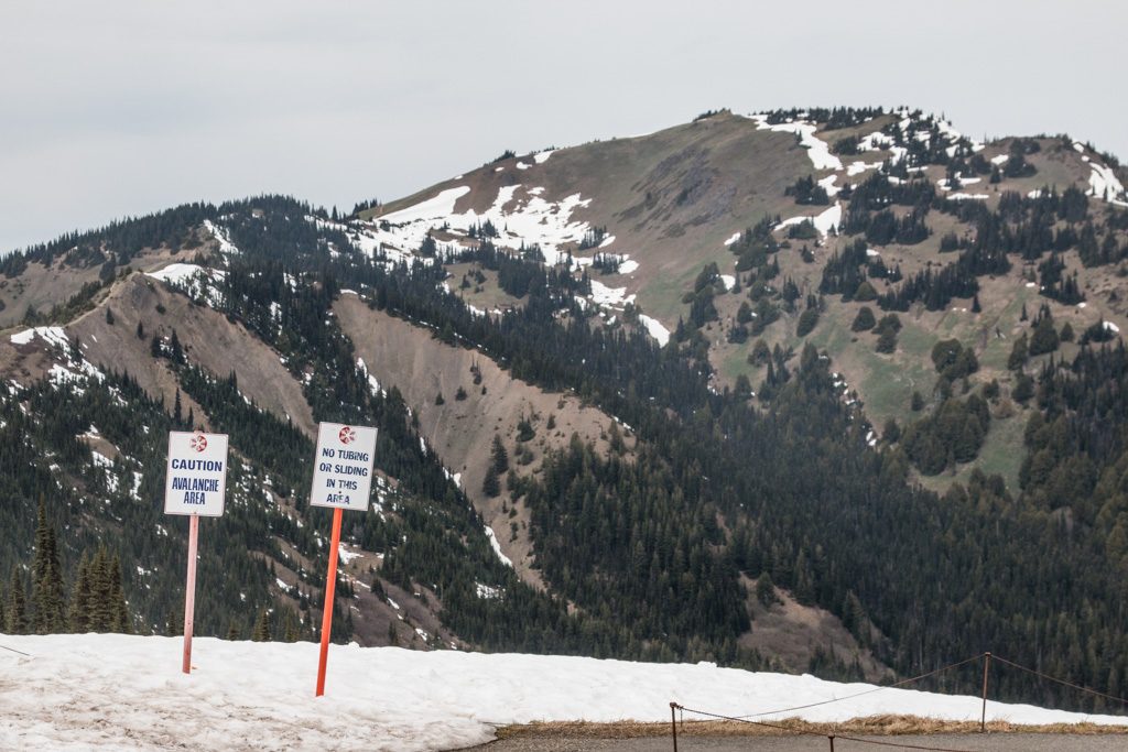
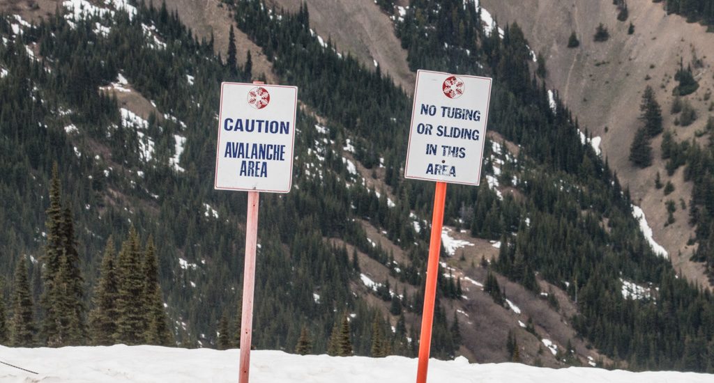
And there was still lots of snow on the ridge. Some people like to fight with Darwin’s attempts to clean the gene pool. The pictures below are at the top of a very steep slope down into the valley.
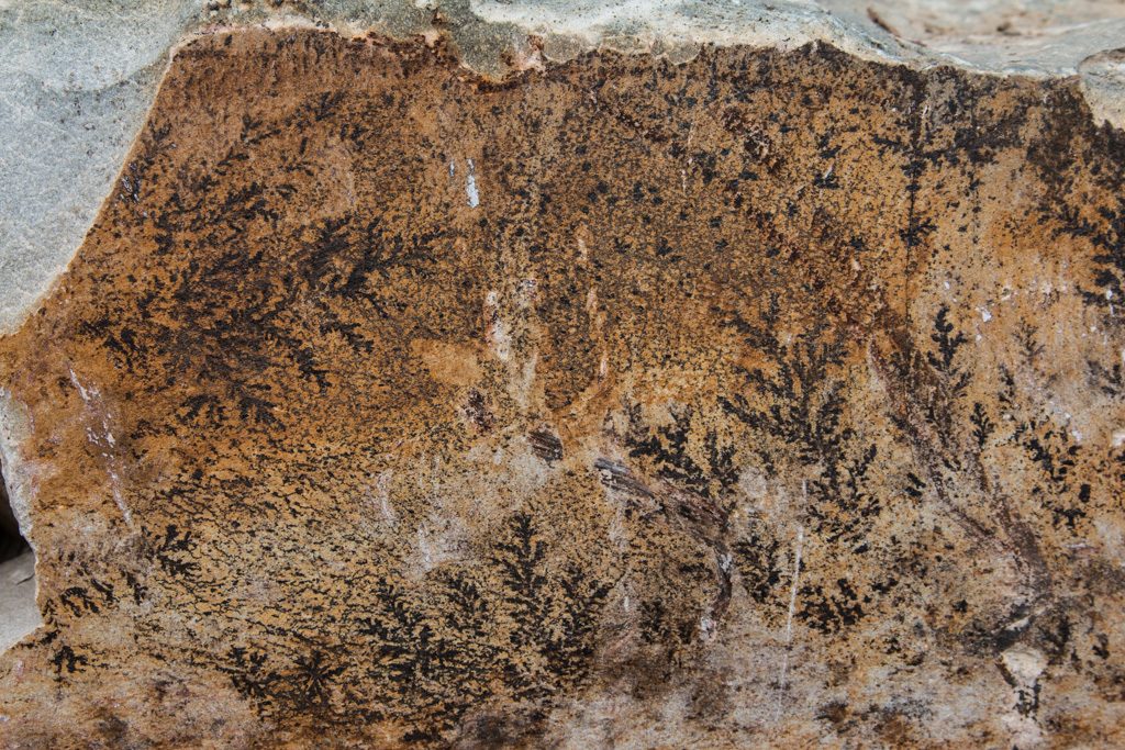
They are doing a lot of work on the trail up to Hurricane Mountain. It seems like they are widening it, and are using a lot of large rocks along the up-slope edge of the trail. I was quite surprised to see what appear to be ferns on this rock. I don’t know whether they are fossilized in the rocks, or somehow imprinted on the rock after it was split. I suspect the latter, but…
Fort Worden State Park
Unexpectedly, Fort Worden turned out to be the highlight of our time on the peninsula. Located on the northeast corner of the peninsula, with the Strait of Juan de Fuca to the north and west, and Puget Sound to the east and south, it was the main one of three forts that guarded Puget Sound Naval Shipyard in Bremerton, and Seattle. The driving force for the creation of the fort was the shipyard, not the city! Fort Worden was built between 1898 and 1917 in the second wave of the Endicott Board forts; the first wave (of which Fort Stevens was part) was built before the establishment of the shipyard when defense of the Sound was not deemed critical. The fort was activated with the arrival of the first troops in 1902, and served in both World Wars I and II. The gun emplacements were never used; the guns were removed in WWI, for use in Europe. The primary use for the fort after that was training.
Reduce, reuse, recycle! Fort Worden is a poster child for reuse. Decommissioned by the Army in 1953, it was purchased by the State of Washington in 1957 to become “Fort Worden Juvenile Diagnostic and Treatment Center,” for troubled youth. This center closed in 1971, and in 1973, Washington re-created it as the current state park. For a more detailed history of this fascinating fort, read Fort Worden: Rebirth Through Decay, by Peter St. George.
What makes Fort Worden special, compared, for instance, to Fort Stevens, is that a large number of its original buildings are intact. Most other forts of this era have had their (mostly wooden) structures torn down leaving only the foundations.
A Public Development Authority (PDA) was created by the city of PortTownsend, WA, to
The state still owns the property; the PDA has a 99 year lease on the buildings. The PDA is renovating the existing buildings to enable other uses. The base hospital is now a remote campus for Goddard College. Local businesses at the fort include two publishing / printing companies, a yoga studio, a massage therapist, the Port Townsend School of the Arts, and Centrum Arts Foundation. There are concert series, with some of the larger concerts held in the WWI-era balloon hangar!
The officers’ and NCOs’ residences and a dormitory are being refurbished and furnished with antique period furniture. These are available for rental, from 30 beds down to three or four. Apparently many family reunions and some weddings book there. We were taken on a tour by one of the PDA board members! We were so gobsmacked by what we were walking through that we forgot to take any pictures. (Us? Forget pictures???) But you can see some of the refurbished officer’s houses and other residences on the PDA’s website. (You can also reserve time in them on those pages, if you will be in the PNW.)
Finally, not all of the buildings remain. There are foundations here too, all that is left of some of the quarters. The PDA is in the process of building new structures there, within the original building footprints.
The state park also includes the remains of the gun emplacements, in pretty much the same state as those we found in Fort Stevens. However, we found some types that we didn’t see in Oregon.
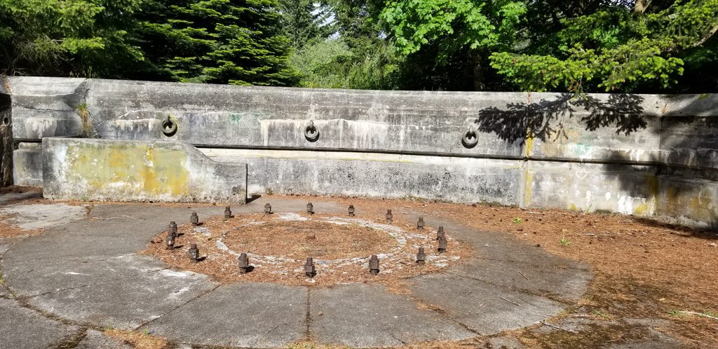
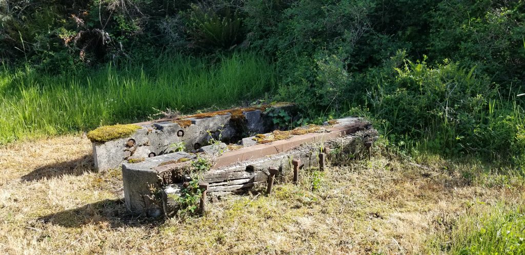
The fort was constructed by the Army Corps of Engineers. Being engineers, they were very detailed. Being the Army, meticulous records were kept. Here are some pictures of the plan for the three inch anti-aircraft gun mounts pictured above.
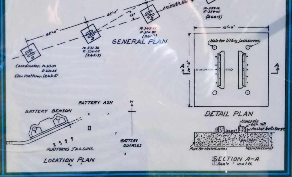
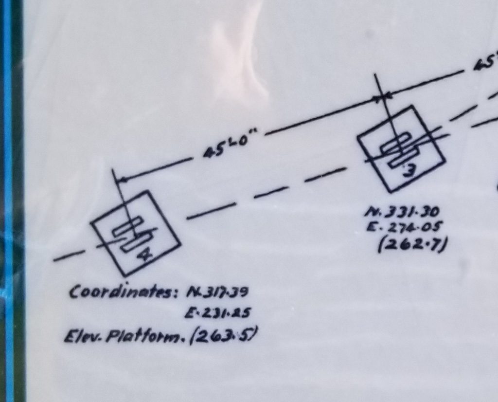
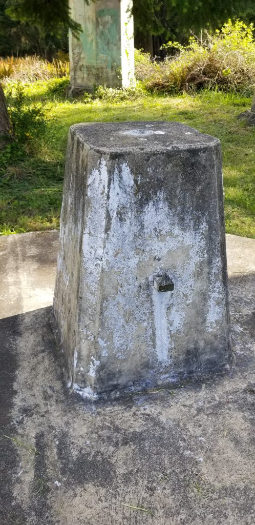
North 317.39 feet, East 231.25 feet. But from where? The entire fort was laid out from a single benchmark, which still exists.
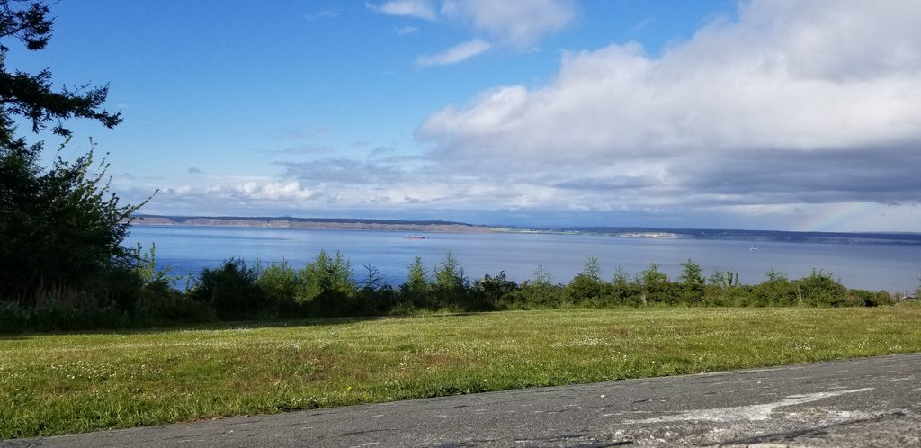
The trees have grown in the many years since the fort was active, but in some places you can still see what the soldiers would have seen.
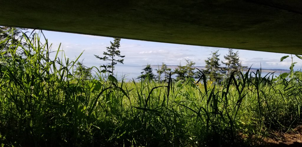
In other areas, you can’t.
We’re now over 20,000 miles into our adventure, and are still having a great time.
Love this post!! We explored the Peninsula at the end of April, and traced a lot of your steps. We also happened upon Fort Casey (just across the bay from Port Townsend), which was an unexpected treat. (We were using the ferries in/out of Mulkiteo/Everette via Whidbey Island, for whale watching and Boeing plant, and had extra time to drive around the fort). Beautiful area!!
Hi guys, I love getting your posts in my email! Starting from the bottom, I think that’s a dendritic rock formation, not a fern fossil. I’ve seen them in agate, this is new to me. https://geology.com/minerals/crystal-habit/ – scroll down until you see ‘dendritic.’
The swirly piles look like marine worm castings – I see them here a lot too. This might be the species you’re seeing: http://askanaturalist.com/what-made-these-swirls-in-the-sand/
And the tracks in the sand look like snail tracks – periwinkles leave tracks like that here, not sure what would do it there.
Hope that’s useful, keep the stories coming!
Jenn
Thanks, Jenn! We didnt know you were following our blog. If we’d known, we knew you’d come to the rescue. Thanks for reading.
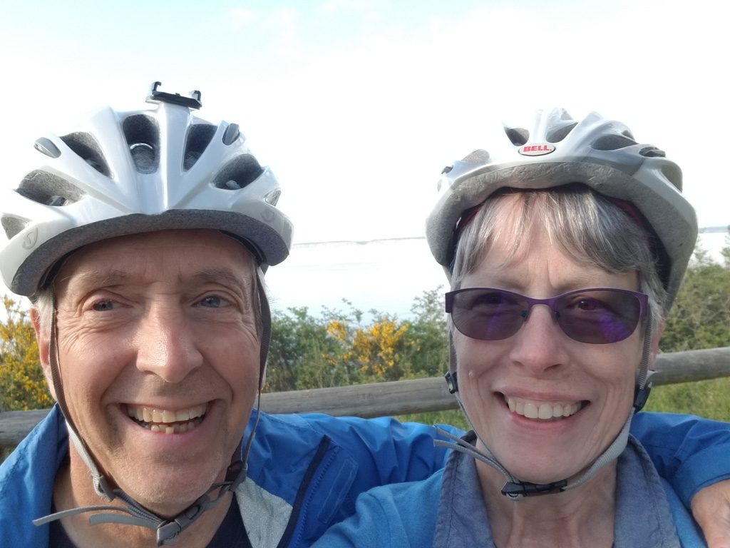
So glad you posted a pic of you two lovelies! Can’t wait to see you!
I loved the Olympic peninsula when I visited a few years ago. Did you get a chance to go to the Hoh rain forest? That’s where you can see incredible moss on all the trees. It is simply stunning. I am glad you enjoyed your time there! I really love your photos,they all tell a story.
No, we didnt get there this time but we think we were there the last time (years ago).