Category Archives: Nature

Posts about places showing the beauty of the natural world.

Maps, Mileage, Mountains, Mines!

Exploring KOFA

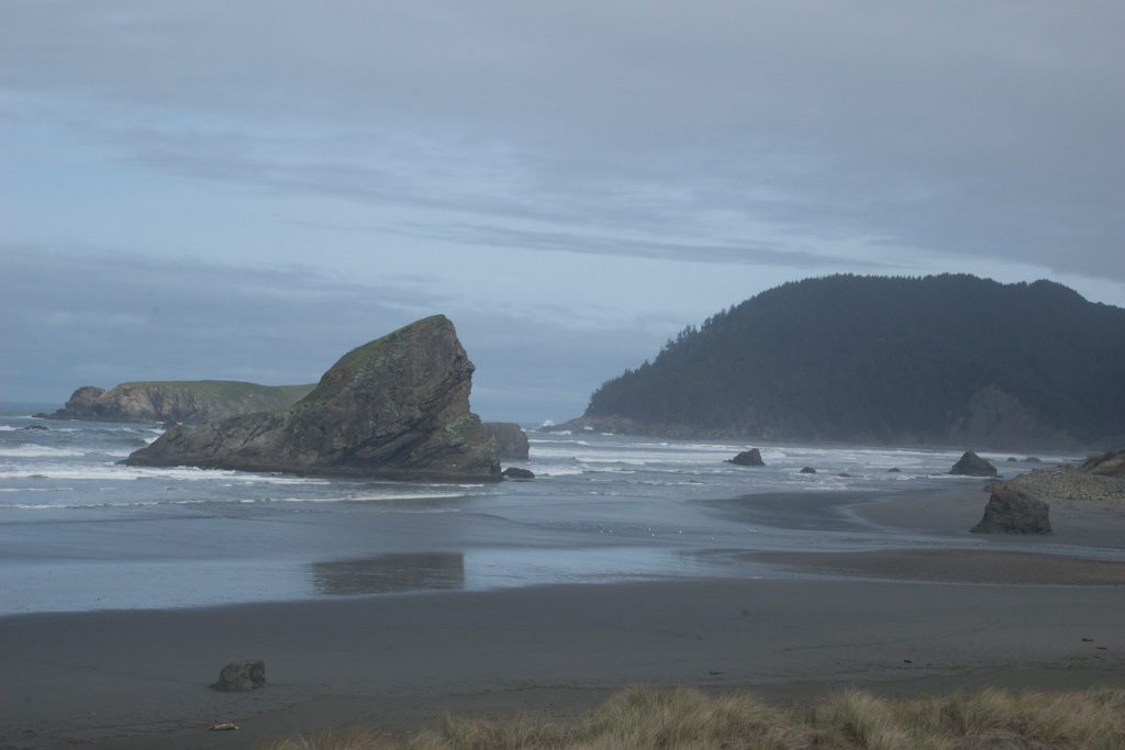
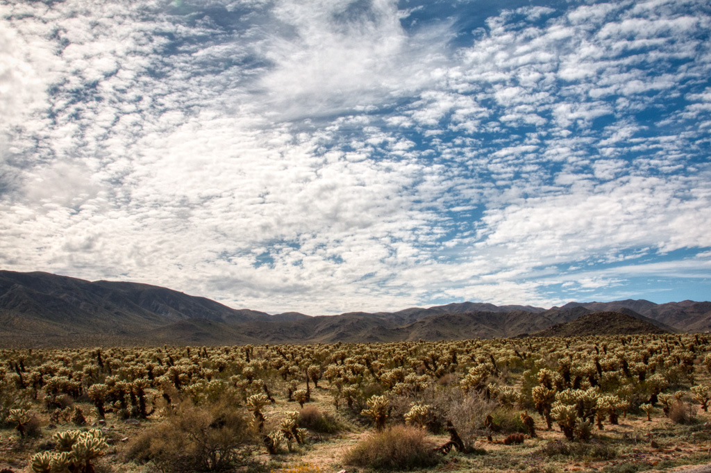
Near us is the KOFA National Wildlife Refuge. KOFA stands for King of Arizona, the name of one of the abandoned mines within the Refuge. We’ve written about KOFA NWR before, here and here. But now we can explore it more with Clark. And it is unbelievably pretty.

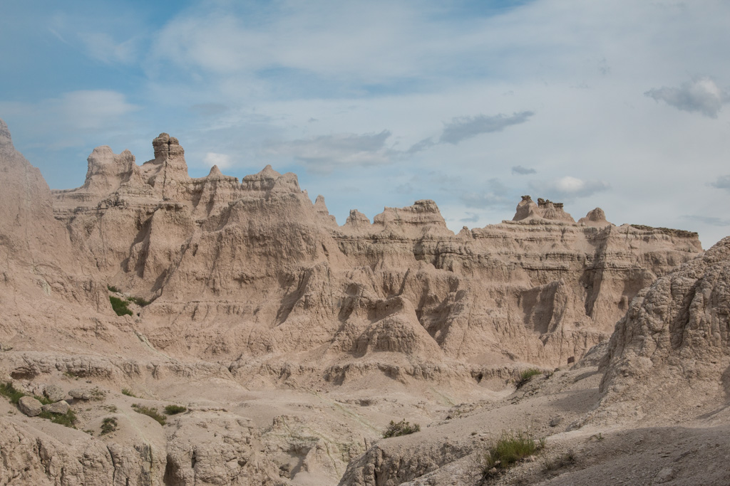
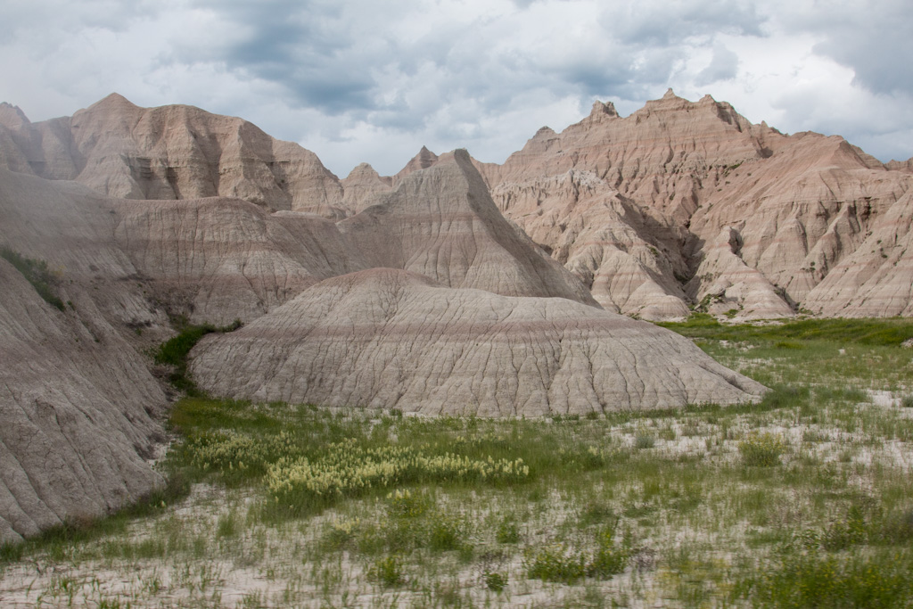
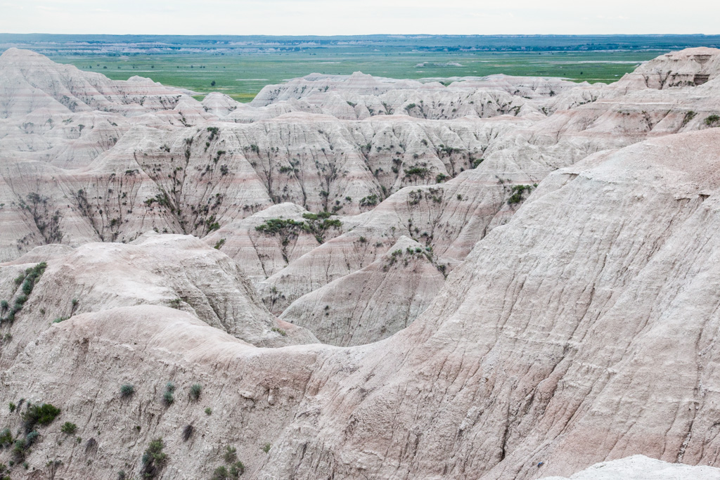
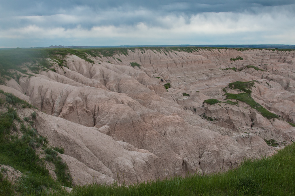
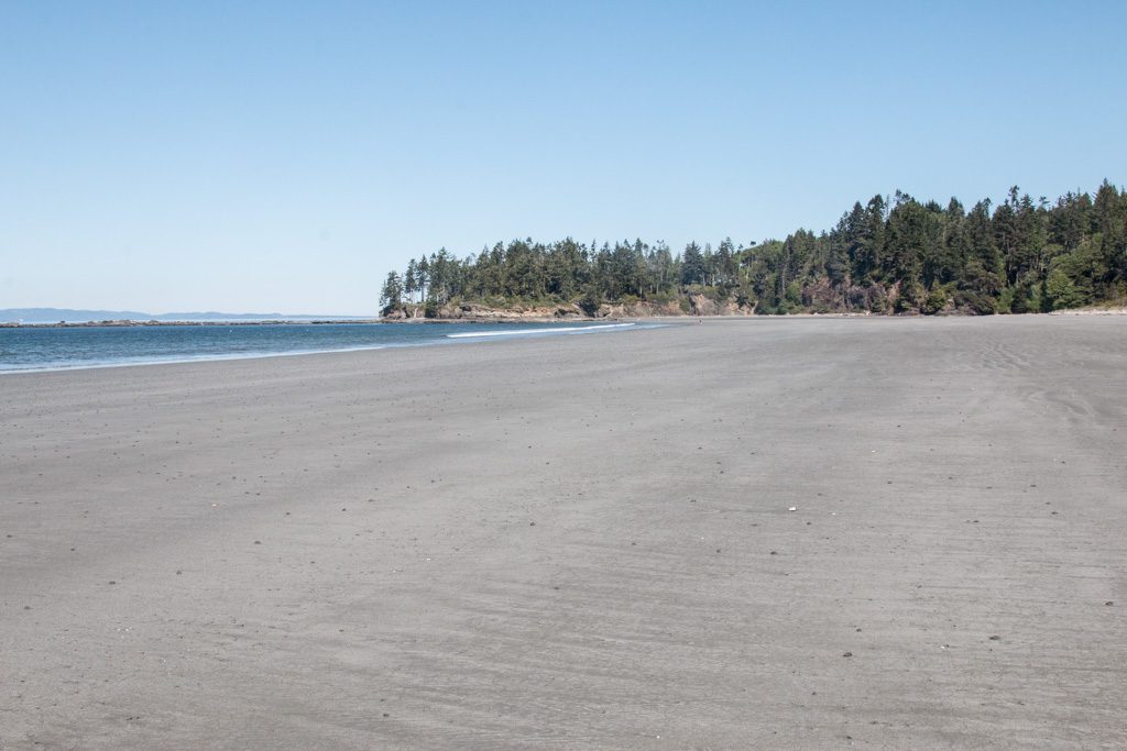
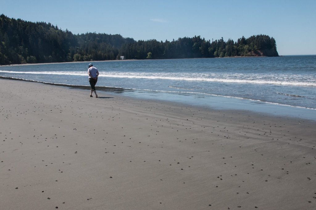
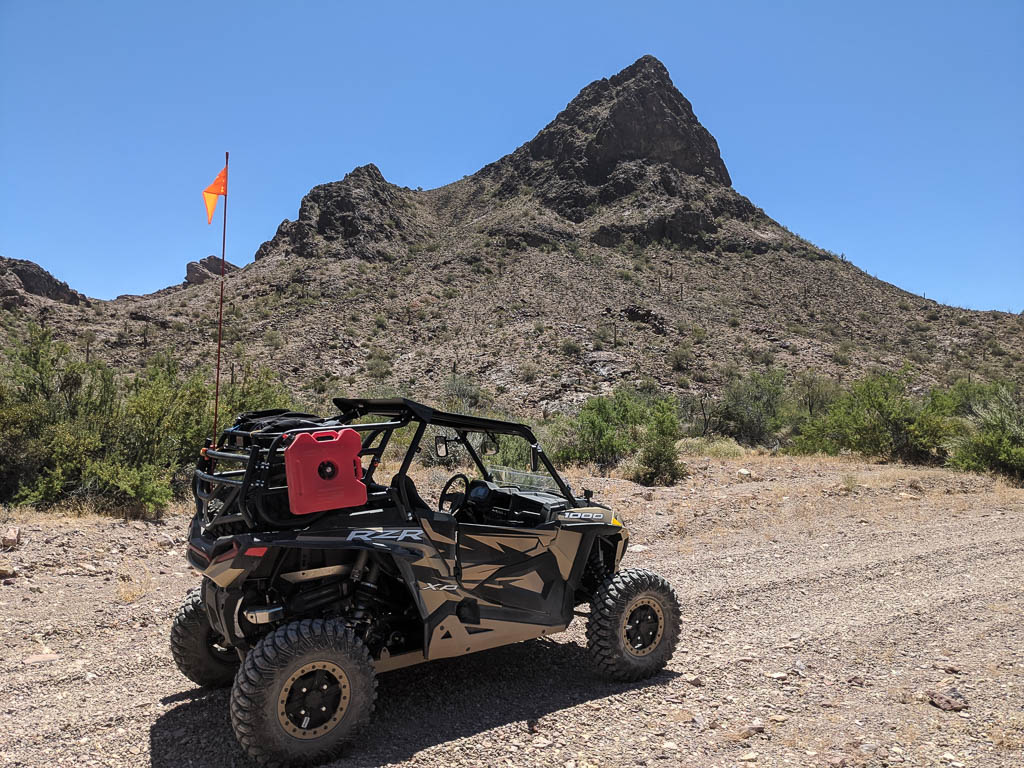
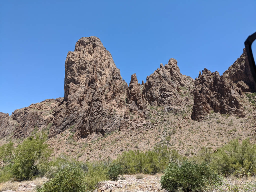
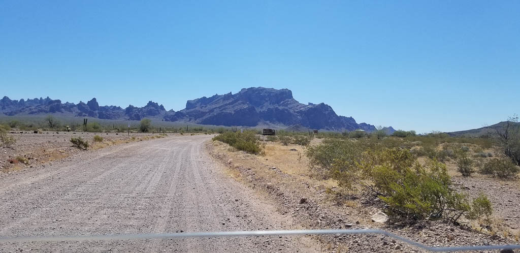
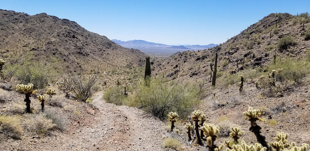
Recently we went to the KOFA Queen Canyon Road, which starts a little down the Palm Canyon Road. Palm Canyon road is accessible to normal vehicles. The Queen Canyon road most definitely is not, with narrow tracks, and steep descents and rises, sometimes without a level section in between. To traverse the Queen Canyon Road, you need something like our chariot, Clark.

Clark in its element!

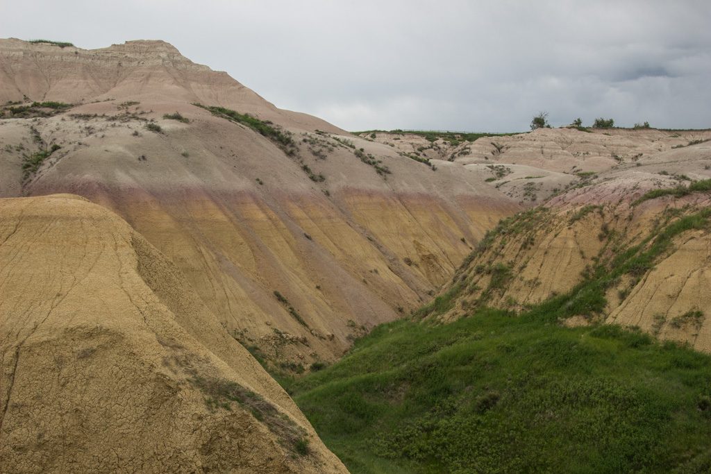
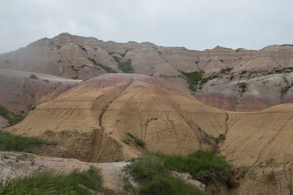
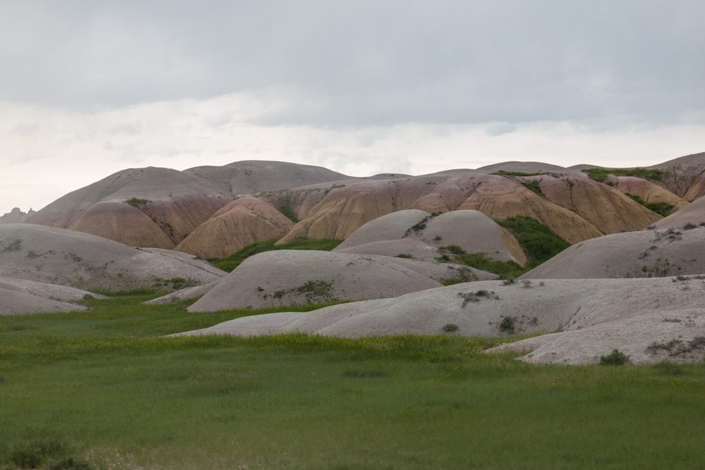
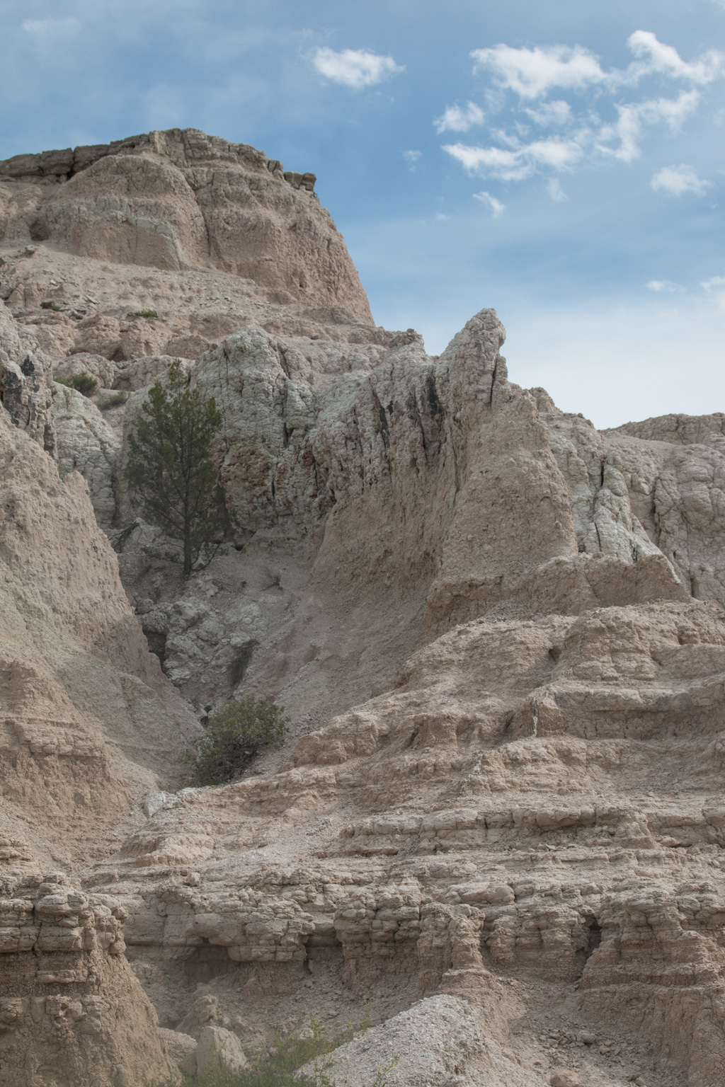
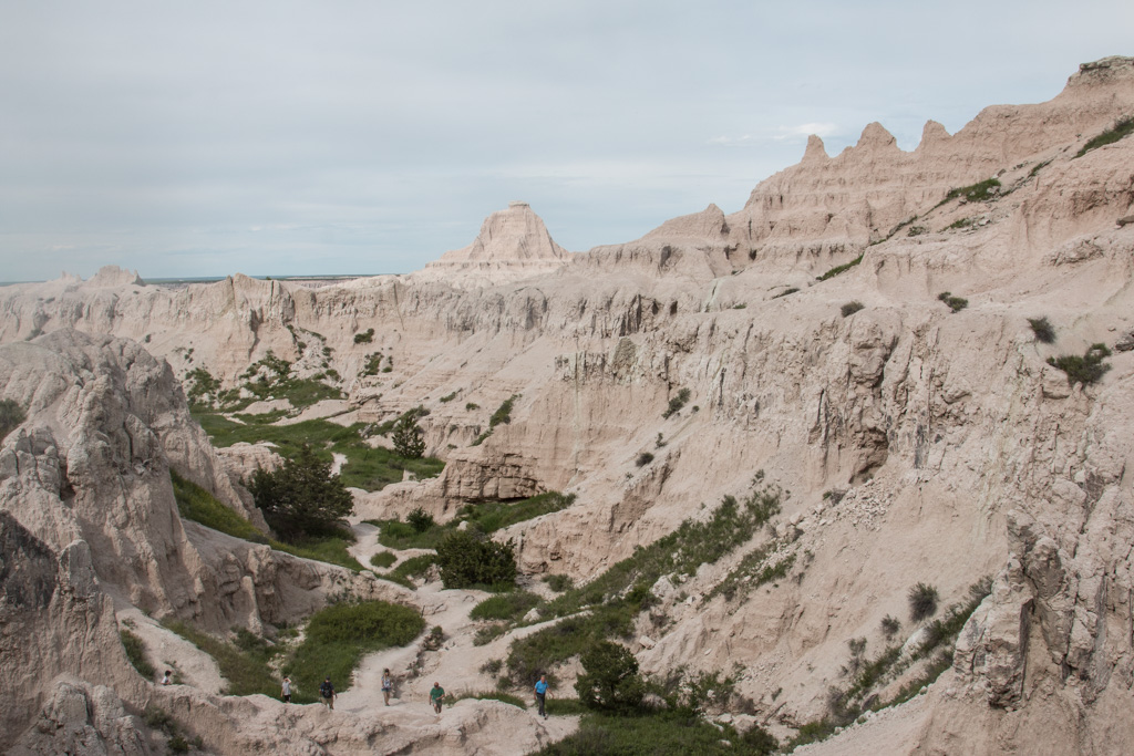
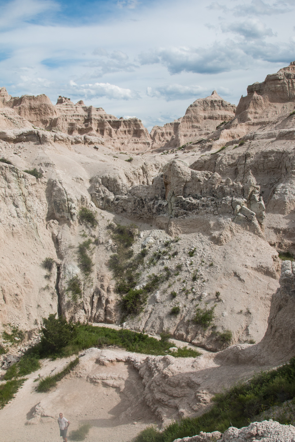
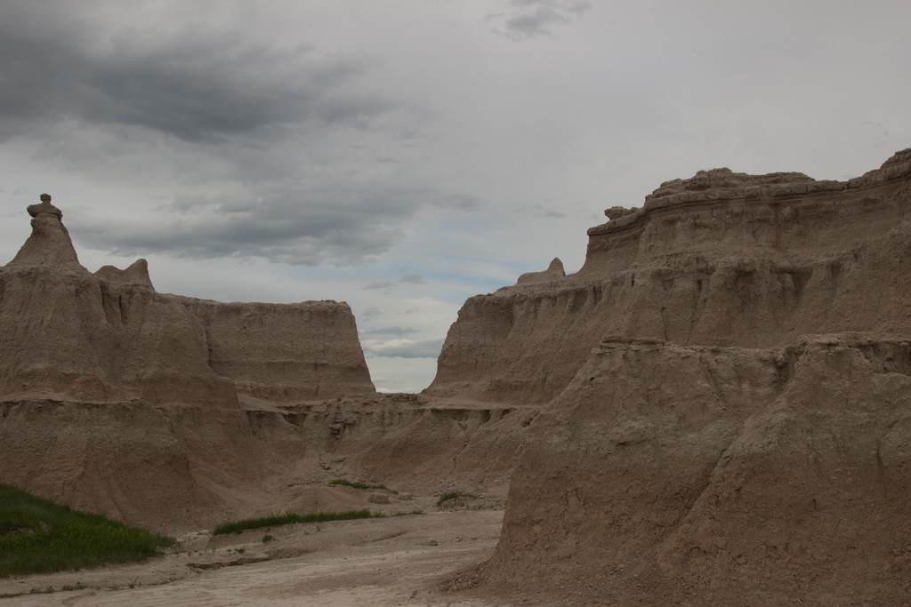
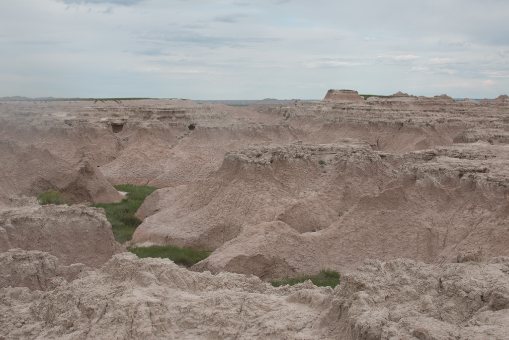
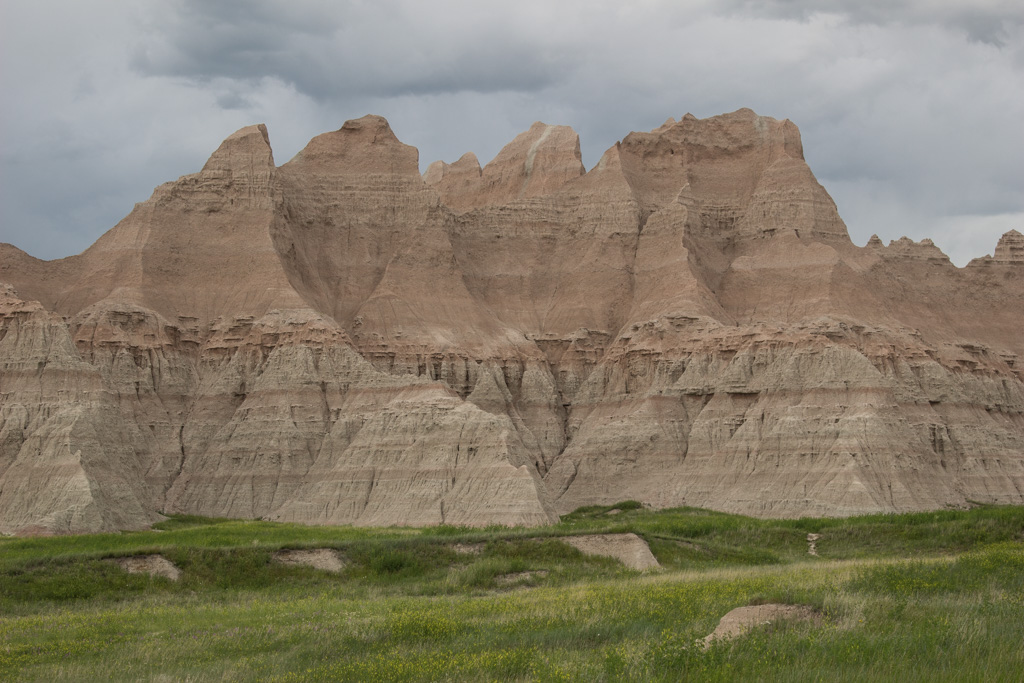
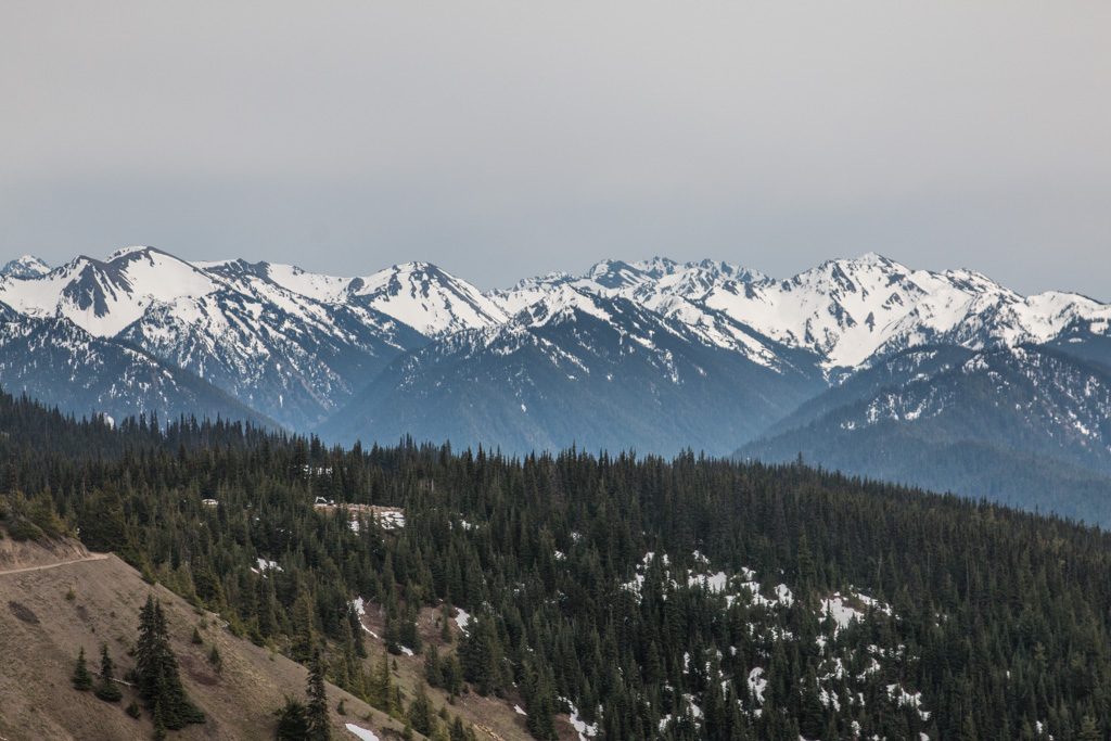
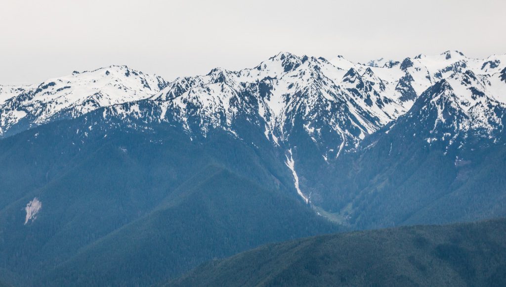
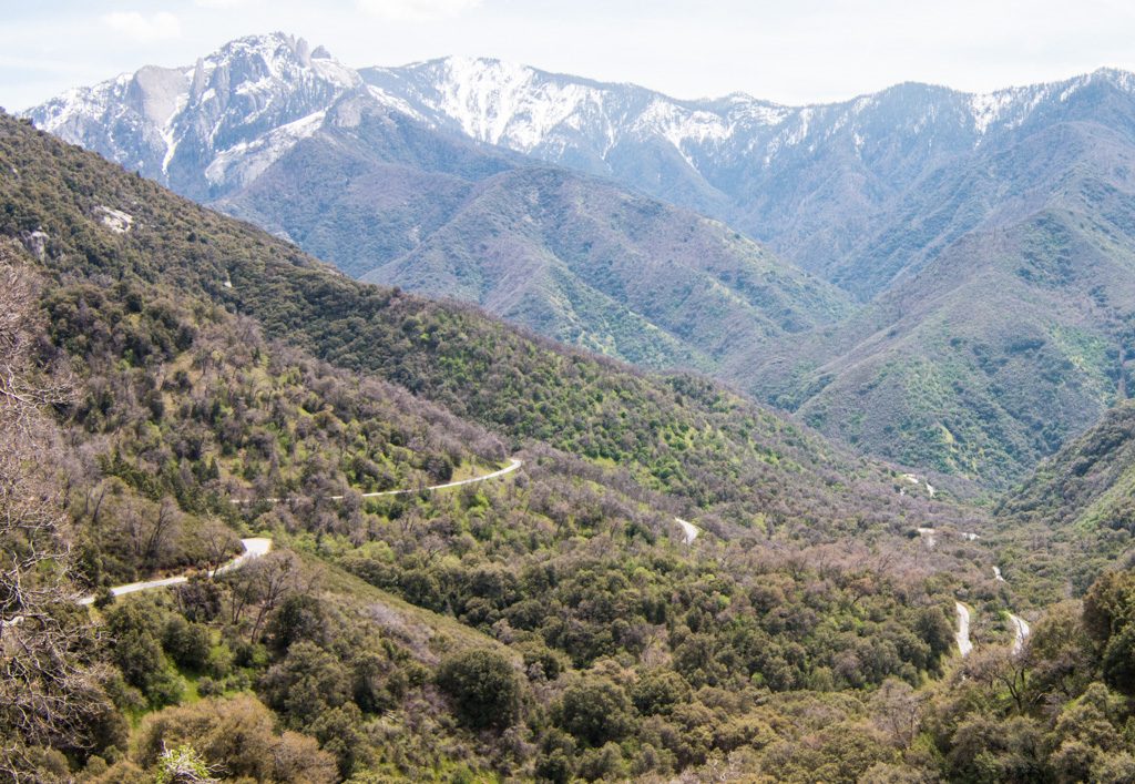
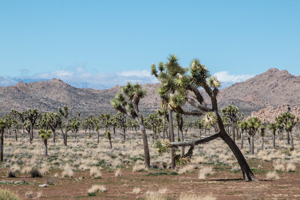
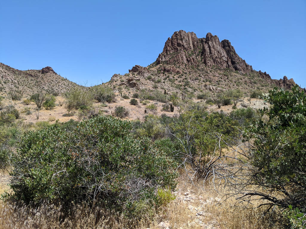
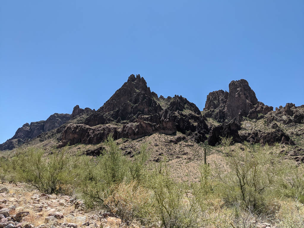
Slightly to the north of Palm Canyon, Queen Canyon goes farther back, behind the mountains you can see from the road. These are much different than those in and near Quartzsite, just thirty miles to the north. Quartzsite’s are fairly gentle; the mountains in KOFA are more jagged. We’ll again apologize to our friends in the Rocky Mountain states. We know that these aren’t real mountains; one of the taller ones in the area, Cunningham Mountain, tops out around 3,280 feet ASL, or about 2,400 feet above town. But that’s the local terminology, so we’ll use it.

On KOFA Queen Canyon Road

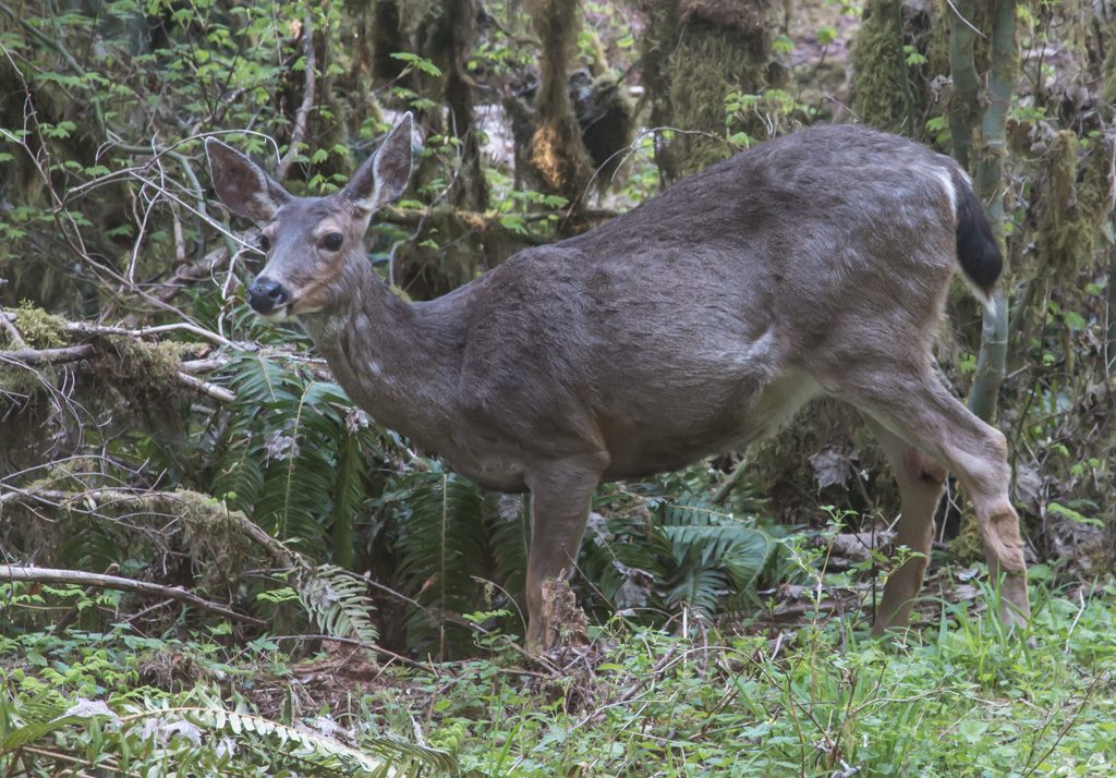
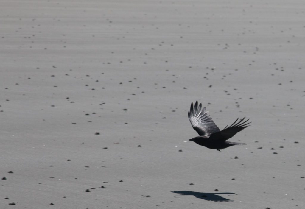
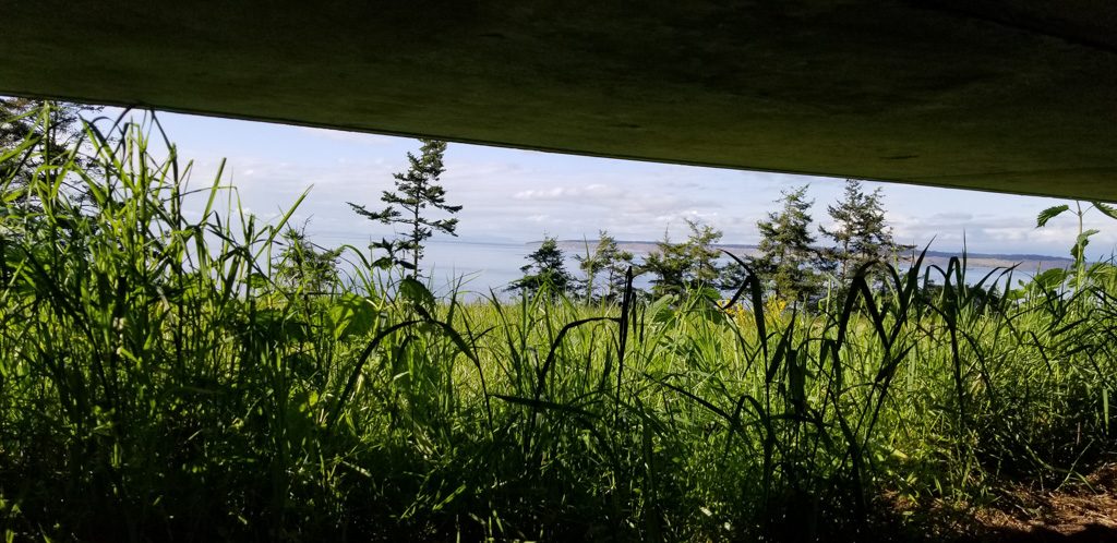
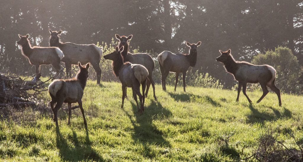
Kathe mused, “How long would we need to stop and wait in order to see some wildlife?” We didn’t stop and wait, but shortly thereafter six mule deer ran across the trail a short distance ahead of us. They climbed the bank on the opposite side and four of them stopped part way up and turned back to look at us. After several minutes they turned and ran up the rest of the hill to join their friends. They were the only large wildlife we have seen in the Reserve so far.

Four Mule Deer in KOFA NWR
Four of the mule deer that crossed our path

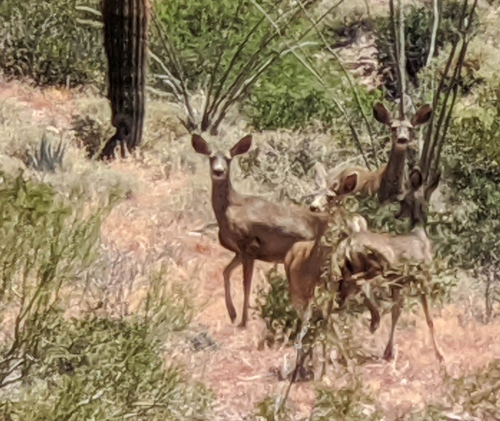
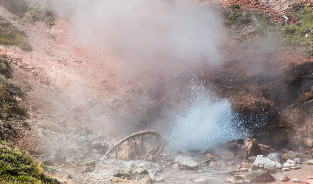
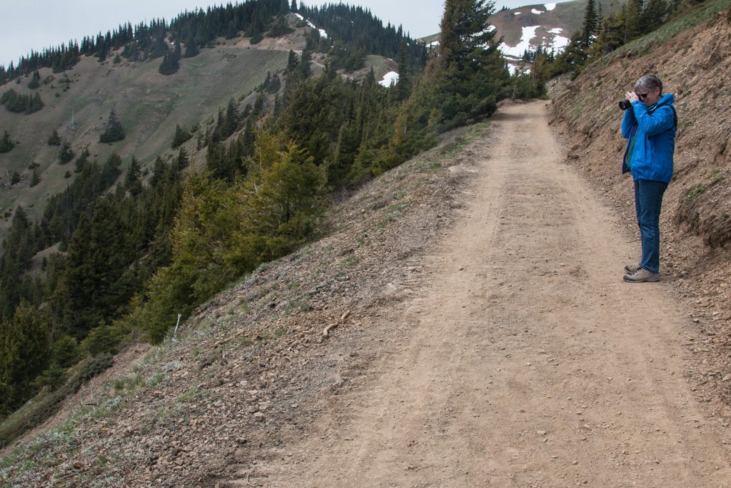
Please excuse the lack of focus. That’s cropped way down from my phone camera. It is a good camera, but has problems when the interesting subject is not in the foreground. I have to figure a way to keep my real camera handy without killing it with the fine dust that gets everywhere.

Fortunately, the GoPro was on, so we captured their dash across the trail. It is in the video at the end of the post.

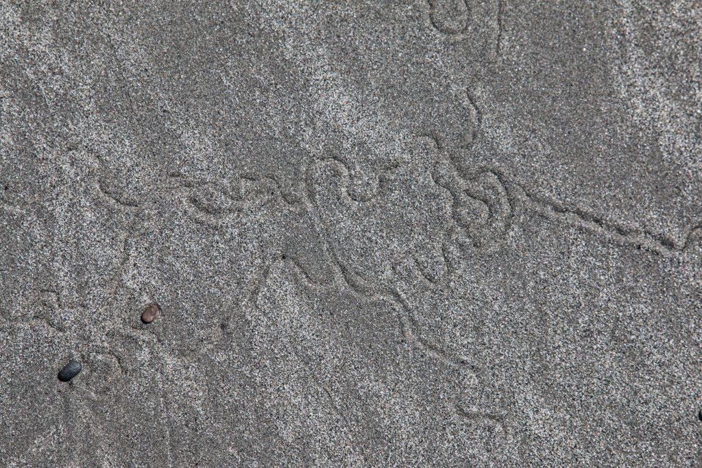
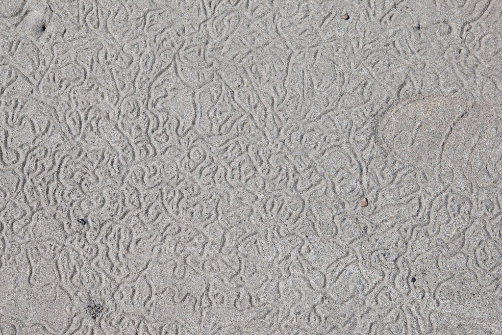
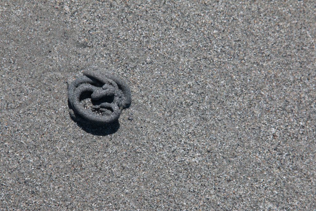
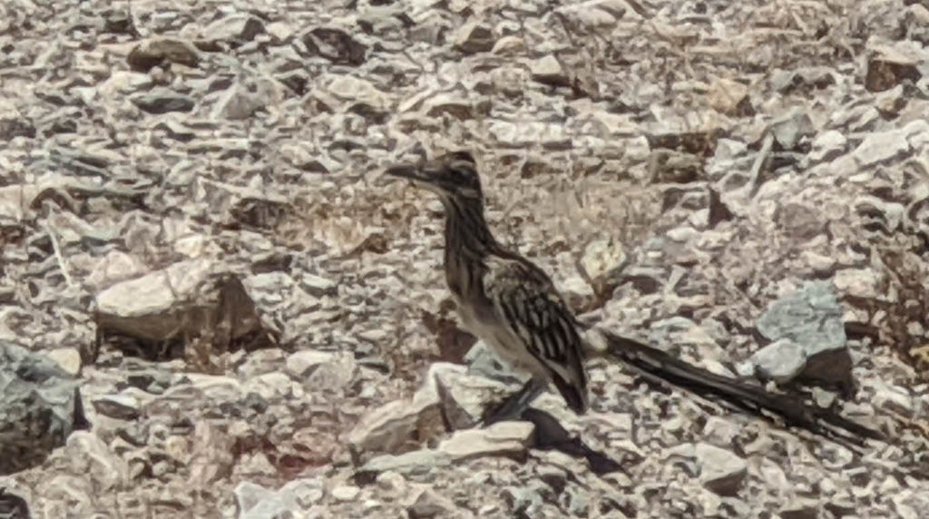
We see quail everywhere, including family groups of mama and up to twenty chicks. We’ve seen some as small as about an inch and a half tall—doing well at keeping up with mama as she hurries across the trail. We see road runners less often; again, apologies for the focus problem here. Same excuse.

A roadrunner on the edge of the trail.

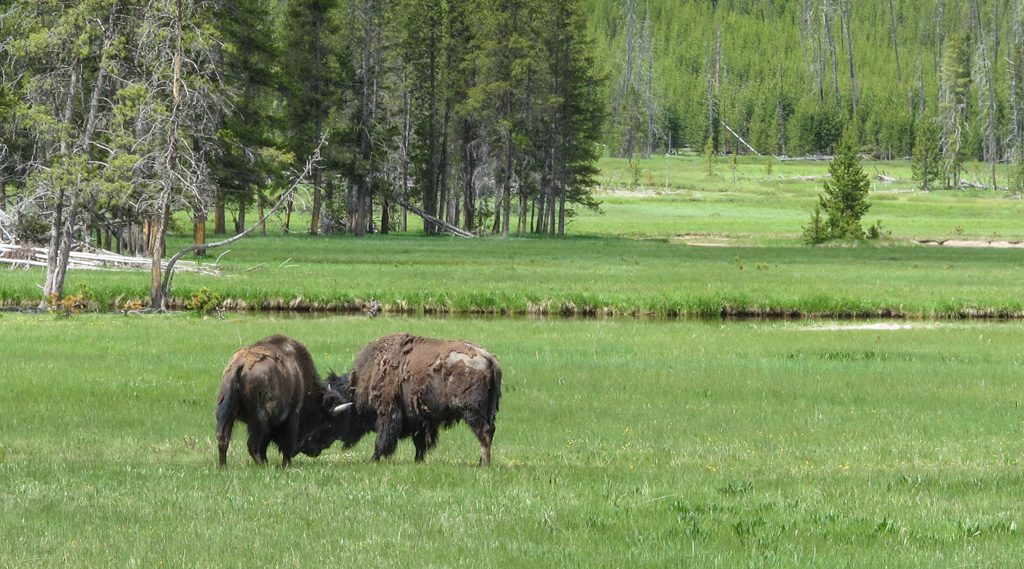
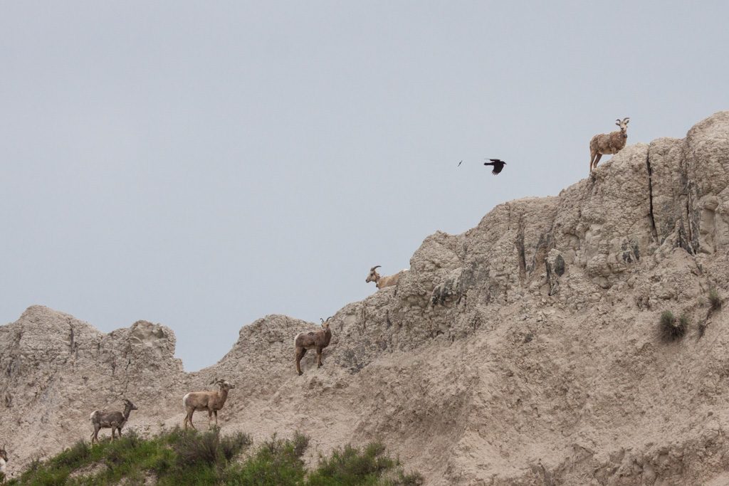
KOFA is known for its Bighorn Sheep and Sonoran Pronghorn, but they seem to be elusive. You can also look at the Bighorn Sheep pamphlet [PDF] that is available at all the entrances to the Reserve.

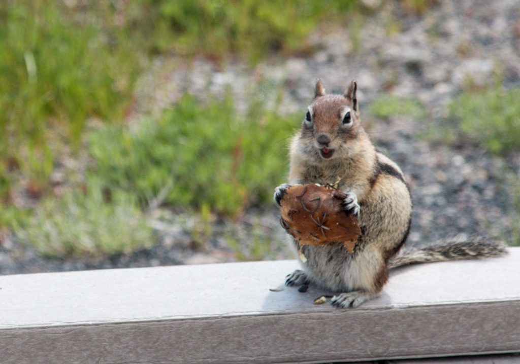
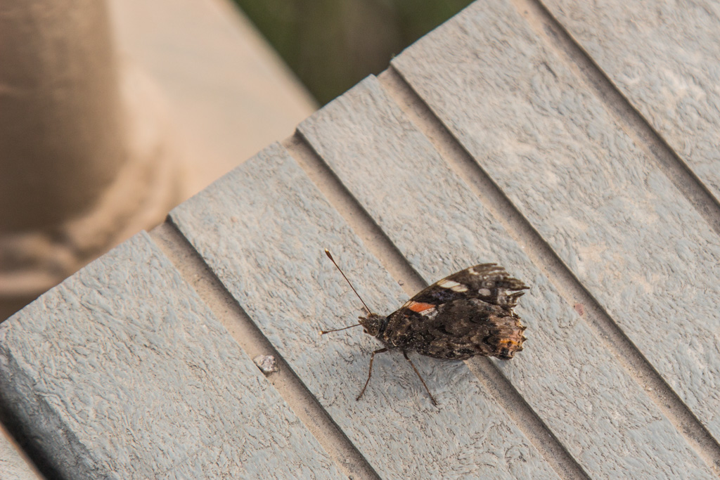
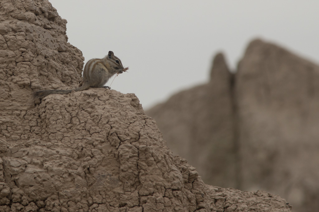
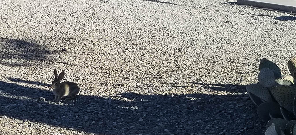
And we have “wild” life in the campground as well!

Peter cottontail in the campground

The prospector

When traveling the trails into and behind the mountains near here, it is easy to convince yourself that you are the only person.

Anywhere.

I stopped on a trail to take a picture of an “Abandoned Mine” sign to show you, when from behind me I heard a booming voice, “Good afternoon, friend!”

Definitely not what I expected there! He came over and explained that I was on his mining claim; he had heard me ride in (Clark is loud) and wanted to know what I was doing. It was obvious to him that I was just riding the trails and the conversation was entirely amiable. He is prospecting for gold; he said that he has been successful so far on this claim. According to him gold is the reason for most, if not all, of the claims in this part of Arizona. I asked him about the process of staking a claim. He said that he really doesn’t know. Apparently virtually all the land in the area is claimed by someone (many someones); he had to buy his claim from another person. “I got it used.”

Mining claim signs are everywhere!

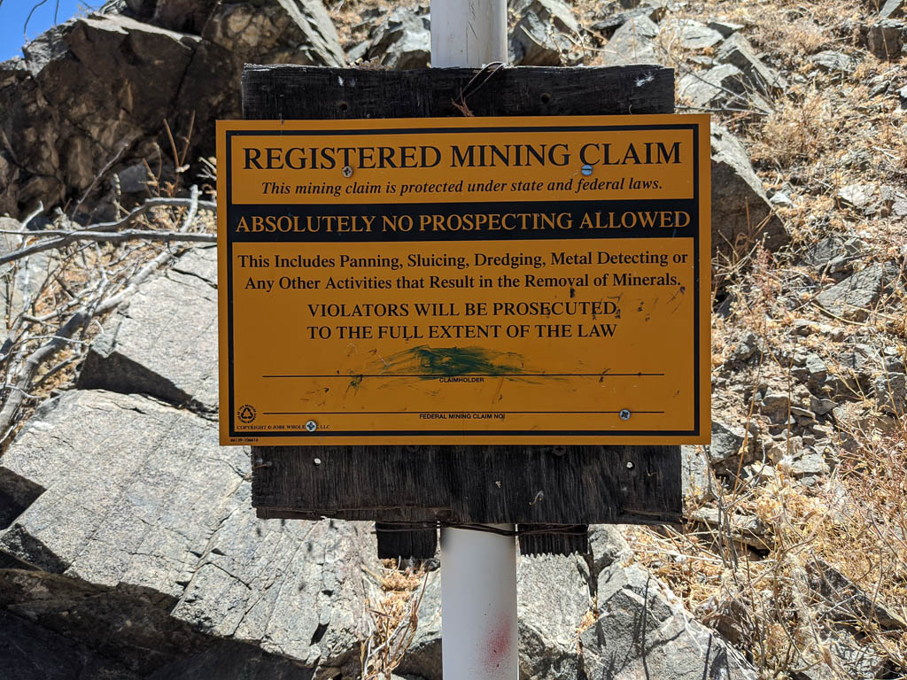
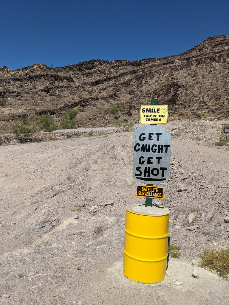
Some people post their claim in a little stronger manner…

Satellite? Nah. Don’t think so!

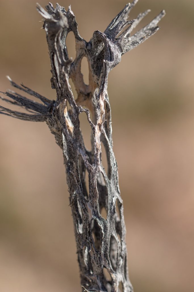
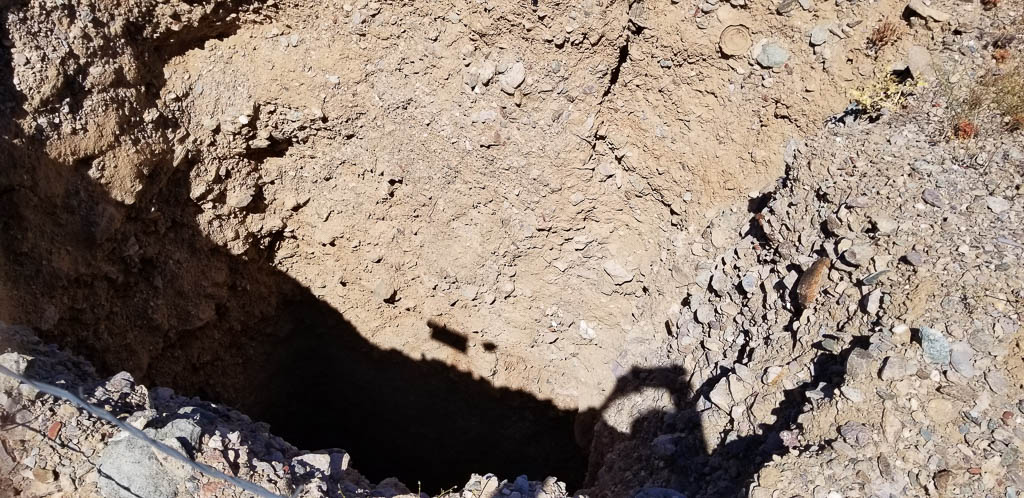
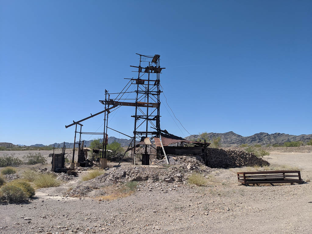
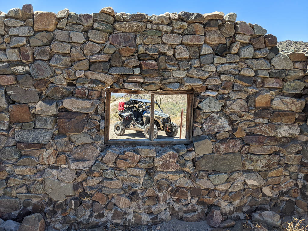
Abandoned mines are all over the place—open holes in the ground from ten feet deep to…many. Some still have structures that survive…sort of.

One of several designs of warning signs.
Another; this one has more modern design, but who knows—they may both be in use.

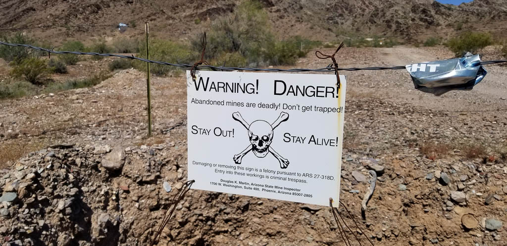
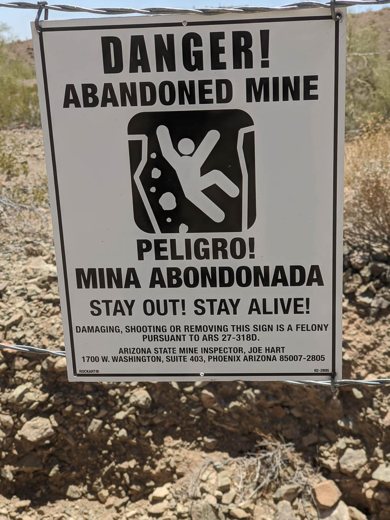
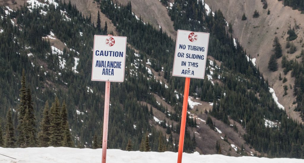
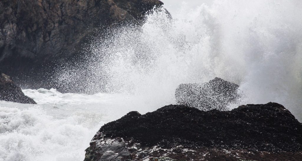
Most of the abandoned mines that are just holes in the ground are fenced off with warning signs, but not all. Just another danger to be aware of, along with the scorpions, rattle snakes, and roadrunners (beware of falling anvils). No, we haven’t seen any scorpions or rattle snakes. Yet. Be sure that we’ll let you know here if we do!

Just an open hole in the ground—at least as far as I can see from here.
Surviving abandoned mine structure
Abandoned “stamp mill.” Look it up; we had to!
Stamp mill from the top.
A nearby mine. Not sure whether it was associated with the stamp mill.

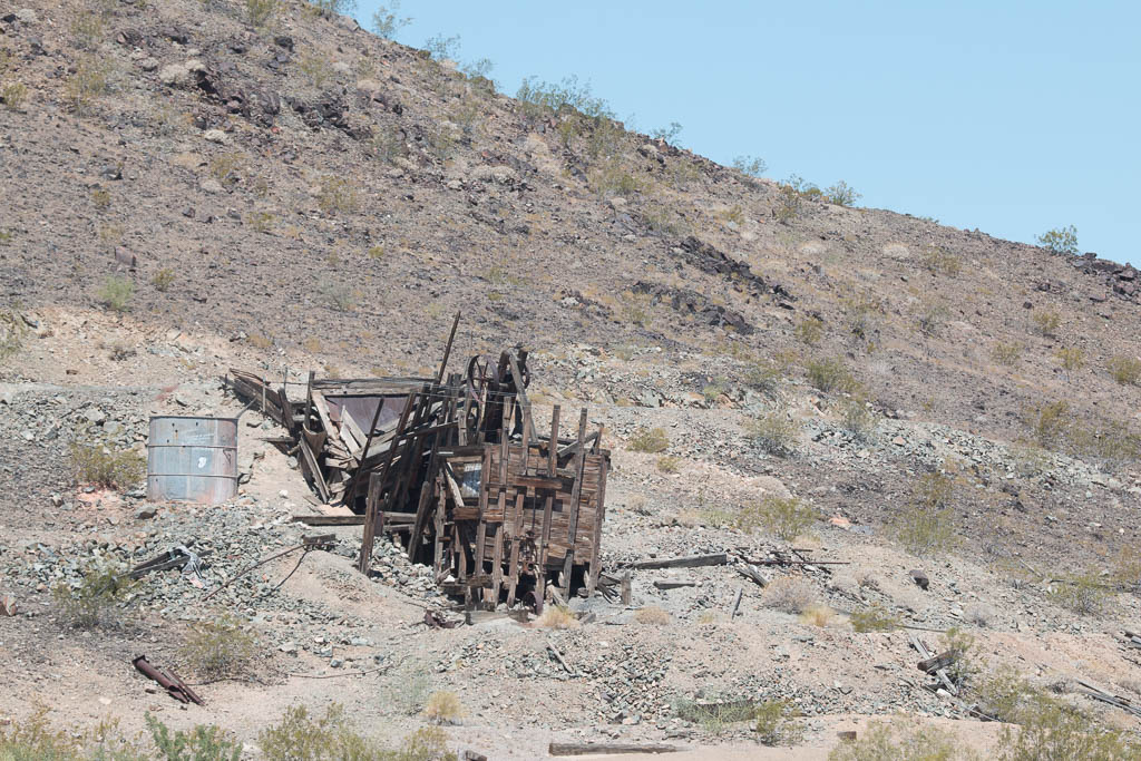
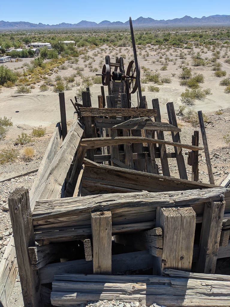
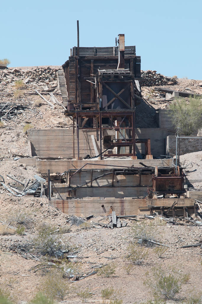
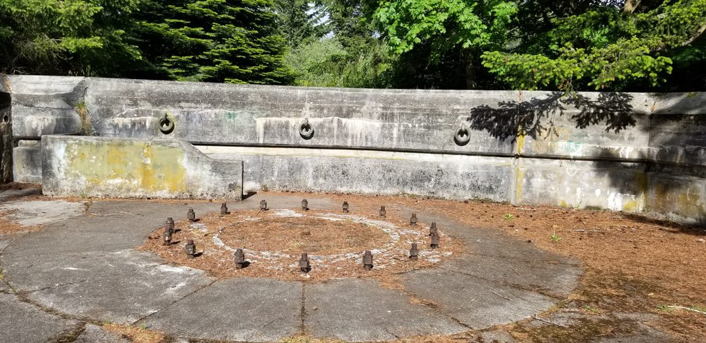
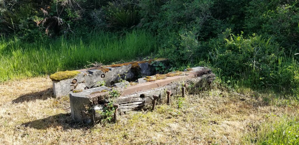
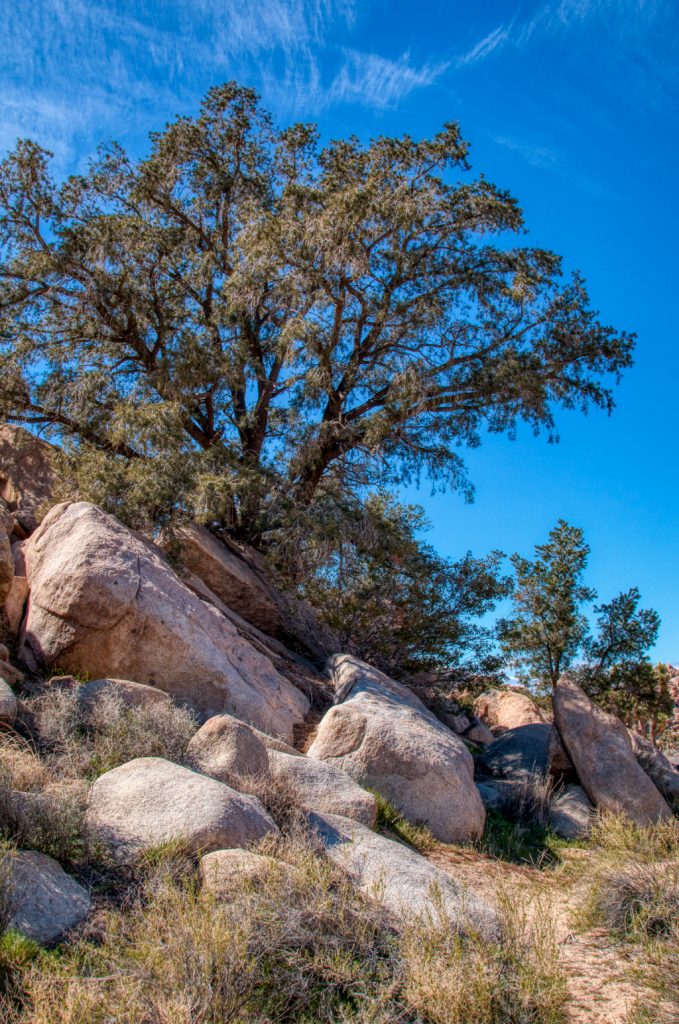
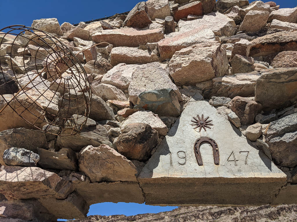
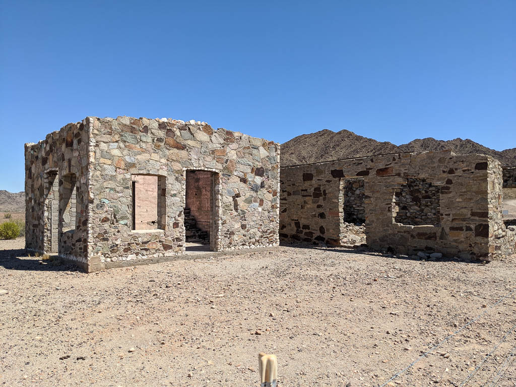
There isn’t much timber out here for building shelters. One thing miners had lots of, is rock. So quite a few stone cabins remain; some in better condition than others. It seems that very little mortar was used; we’ve seen a few with no sign of mortar at all.

Rough exterior,smooth(er) interior.
The cabin above is seventy three years old
Smooth exterior, rough interior.
With a framed picture of Clark! Most of the wood in these cabins is long gone, but some remains.

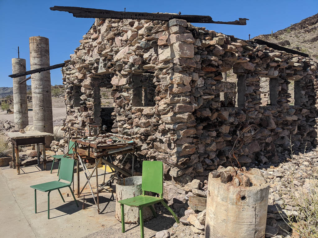
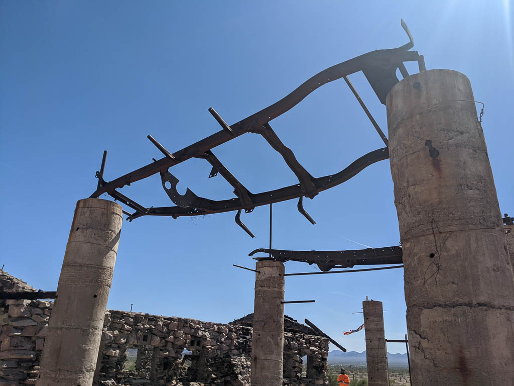
Reduce, reuse, recycle. When the old truck dies, it becomes a hardware store, providing parts and equipment for other mining camp needs. Here, some roof rafters.

Steel roof rafters!

Driving the trails

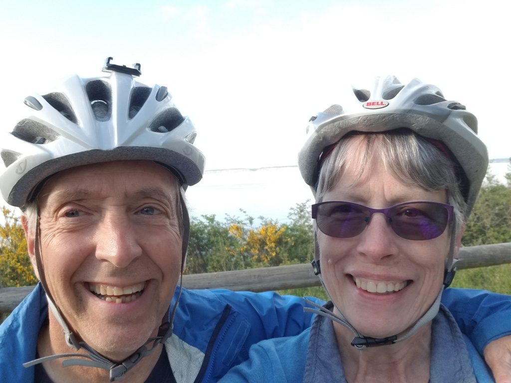
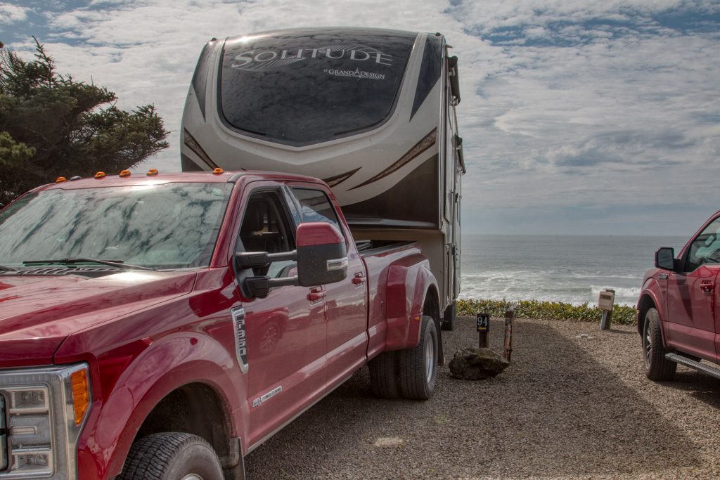
We’ve been out on Clark nearly every day; usually both of us go (and Kathe drives), sometimes Al goes out alone. We’re becoming more comfortable with Clark’s mountain-goat-like abilities. So far we have clocked almost 600 miles of fun in the immediate area. The dealer we bought Clark from offers a discounted service that we picked up. They call it a “two year” plan, but it is based on hours of use: X services at Y hour intervals. We’ll probably use it up by early fall at this rate!

Back in the dark days of computing before GUIs, there was a command-line game called “Adventure.” It had two key phrases: “You are in a maze of twisty passages, all alike,” and “You are in a maze of twisty passages, all different.” If you went into a twisty passage going north, you might come out in a different room going south. Or east. (It is still available on github!)

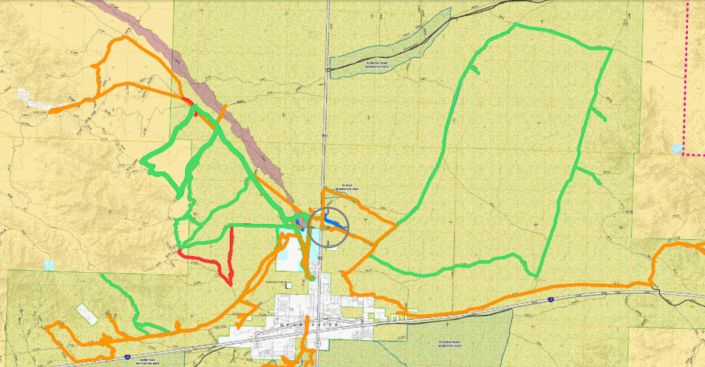
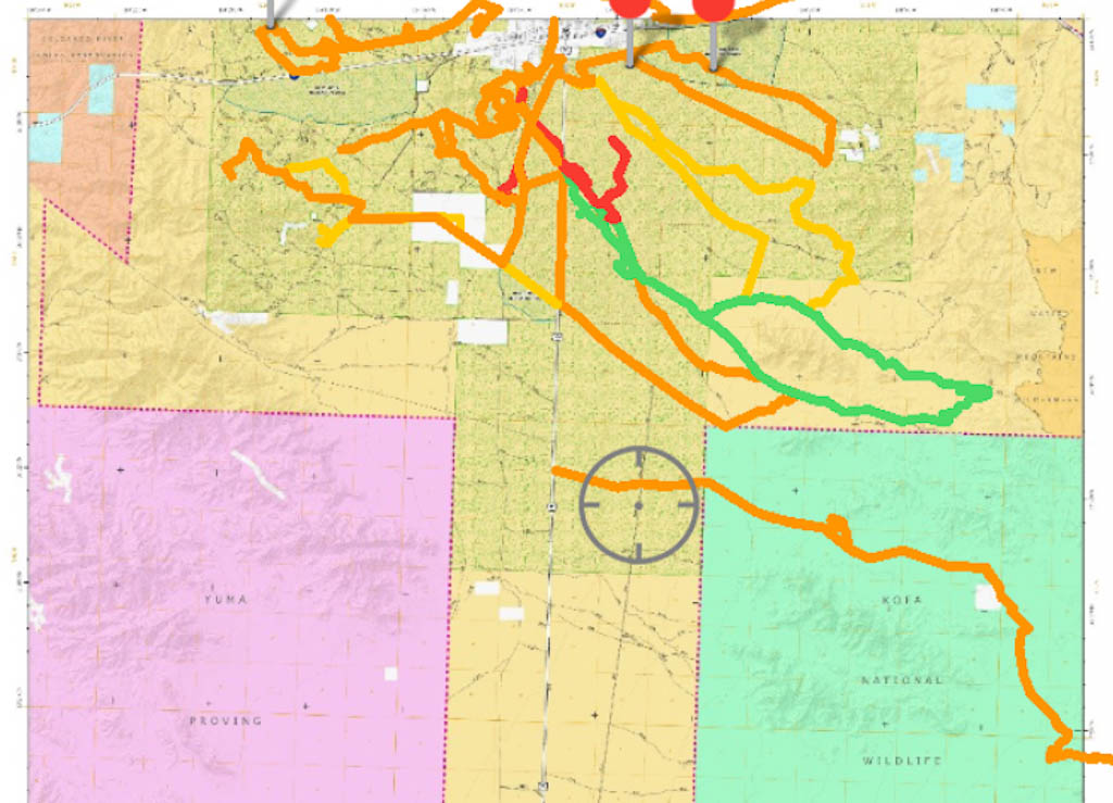
The trails here are like that. There are hundreds of them; only a small subset are marked. They twist and turn and intersect and head who knows where! We use a GPS-enabled tablet running the Avenza mapping program to navigate, so we feel secure about not getting lost, but I wouldn’t want to go too far here without it. (We also run Avenza on our phones as backup.) Here are some of of our tracks.

Some of our tracks north of town; the map is 17.4 miles across (BLM map)
And some of our tracks south of town; the map is 21 miles across (BLM map)

Some friends have asked how we try to stay safe when riding on the desert.

We carry another backup GPS in the form of a Garmin inReach satellite communicator, with which we can send and receive text messages while out of cell phone range. It also has an SOS function to contact a 24/7/365 rescue dispatch center should the need arise. Needless to say we hope we never need that! But it is nice to be able to send texts to let someone know, for instance, that we’re OK, but taking longer than expected so they don’t worry.

We also carry a fairly capable trauma first aid kit, some spare parts, a tool kit to take apart / repair much of the machine, and ropes, pulleys, etc., to extract ourselves by using Clark’s winch if we get stuck.

And water. Lots and lots of water.

And when one of us goes out alone, we always let the other know roughly where we will be.

A recent conversation:

Al: The only way you can find out what Clark can do is to try more and more challenging things.

Kathe: And what happens when what you try is outside its capabilities and you’re stuck (or rolled, or…)?

She’s so practical.

But we haven’t been stuck yet. (And haven’t rolled it!) For the most part, we stay on well traveled trails. Yes, that rise may look very steep, but from looking at the tracks, many, many people have traveled it successfully. Onward!

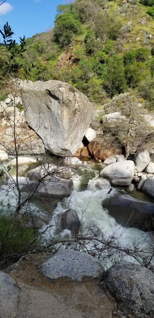
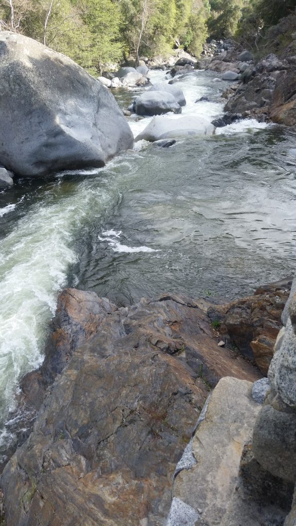
Sometimes, the trails are wide, flat, and smooth:
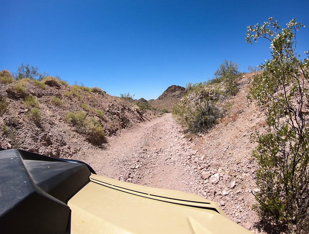
You occasionally see regular cars on roads like this.

Sometimes, narrow:

Narrow track. Don’t meet someone coming the other way! It is one vehicle wide.

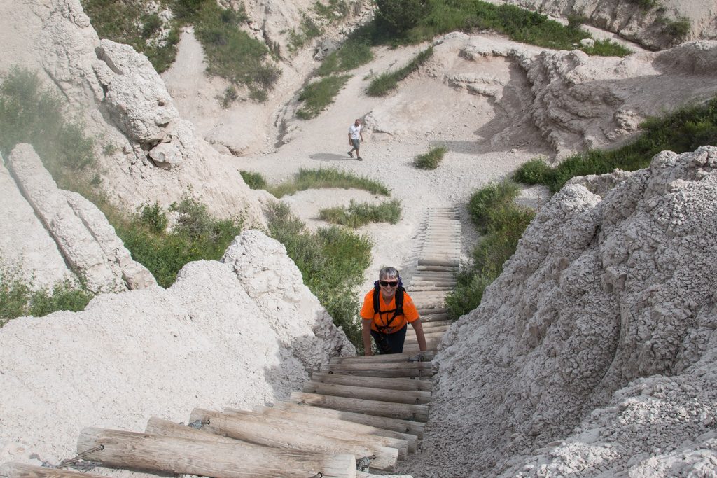
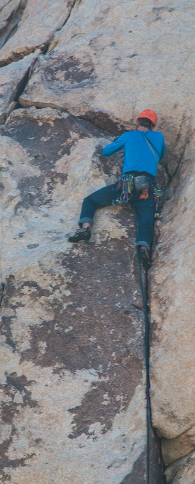
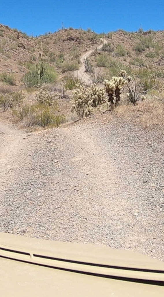
Sometimes hilly and steep (and sometimes much steeper than they appear from the bottom).

Yes, we’re going up that. MUCH steeper than it looked from here!

To really appreciate that hill, please watch the video at the end of this post which tries to give an example of what we’ve been enjoying from Clark.

And, sometimes, they just aren’t. Visible, that is. There are some BLM-designated trails that look like just bare unmolested desert surface stretching into the distance, or that appear to simply be a tangle of desert shrubbery. Our GPS-enabled mapping tablet has let us traverse some of these “non-trails” (my term). Others, we just couldn’t figure out at all.

Some trails proceed in washes instead of across them. We are fortunate: a wash that is part of the local trail system is right behind our RV Park, so we can access the trails by going through a gate at the rear of the property.

Driving in a wash with a deep, loose, gravel bed reminds me of sailing with a strong following sea. The rudder is more like a hint to the boat of where you’d like it to point, instead of a strong command. When driving in the deep gravel, even in four wheel drive, pointing the front tires is merely a hint to Clark. Which it usually (eventually) obeys.

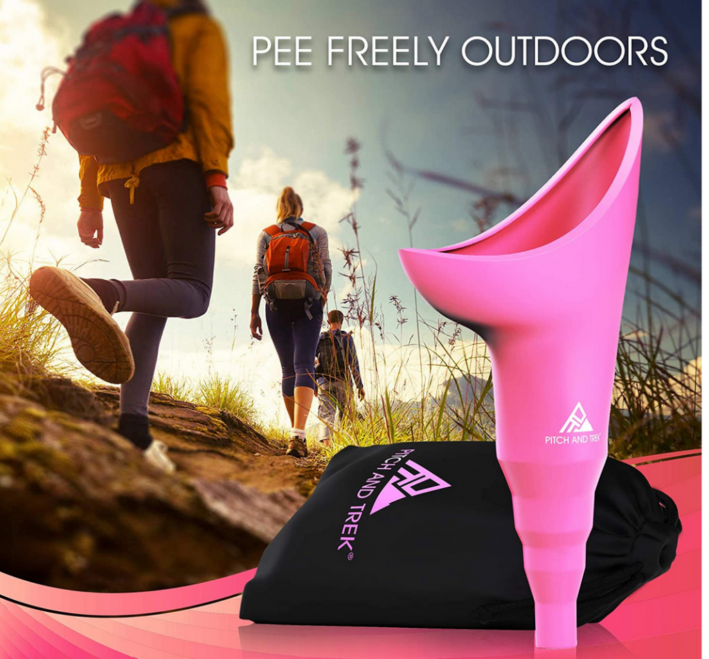
Caution: This might make you blush

Kathe here. When we first started riding out onto the desert, I prided myself in the fact that I can go for hours without peeing. Women, you know what I mean! Right?

But soon I realized some of our trips might get long. And hydrating while we’re out on the desert is ESSENTIAL. However, peeing behind a bush (cactus!) just wouldn’t cut it. Ouch! But what could I do? I didn’t want to be the cause of foreshortening a planned excursion.

Enter FUD — the feminine urinary director. Yup. It’s a thing. A REAL thing. And it works GREAT! I can stand up and pee away from me. Now we can be out for a number of hours and I can be comfortable. Why didn’t I know about these years ago? Here’s what it looks like.
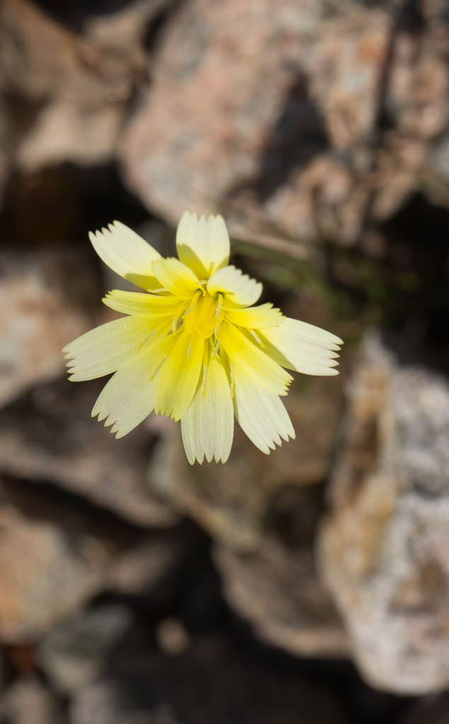
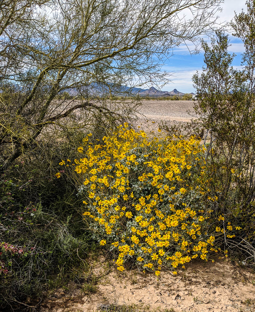
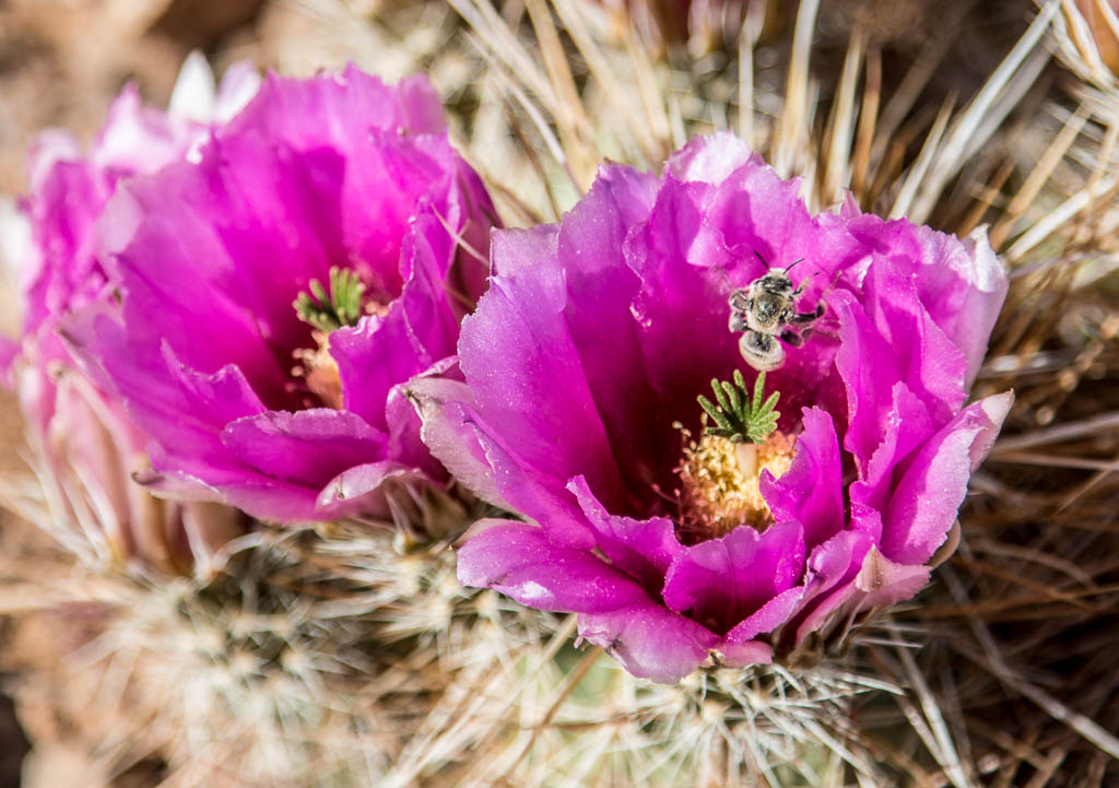
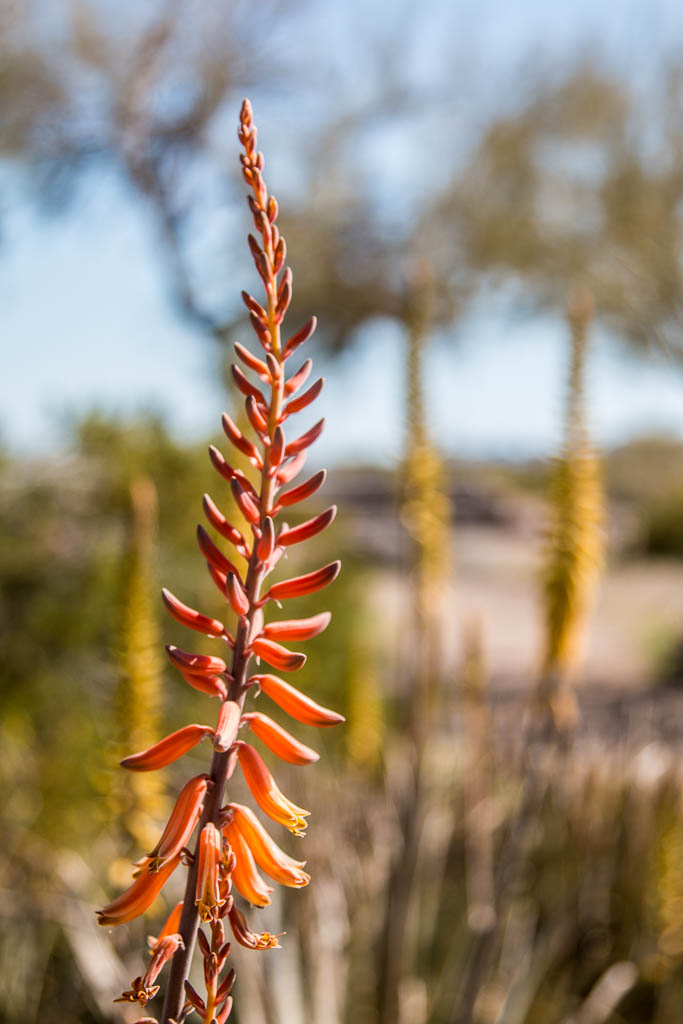
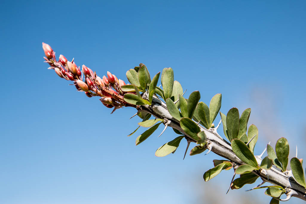
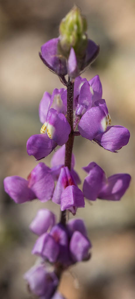
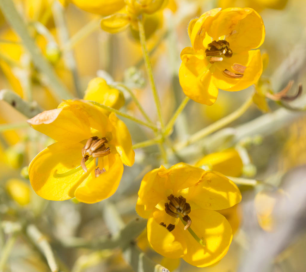
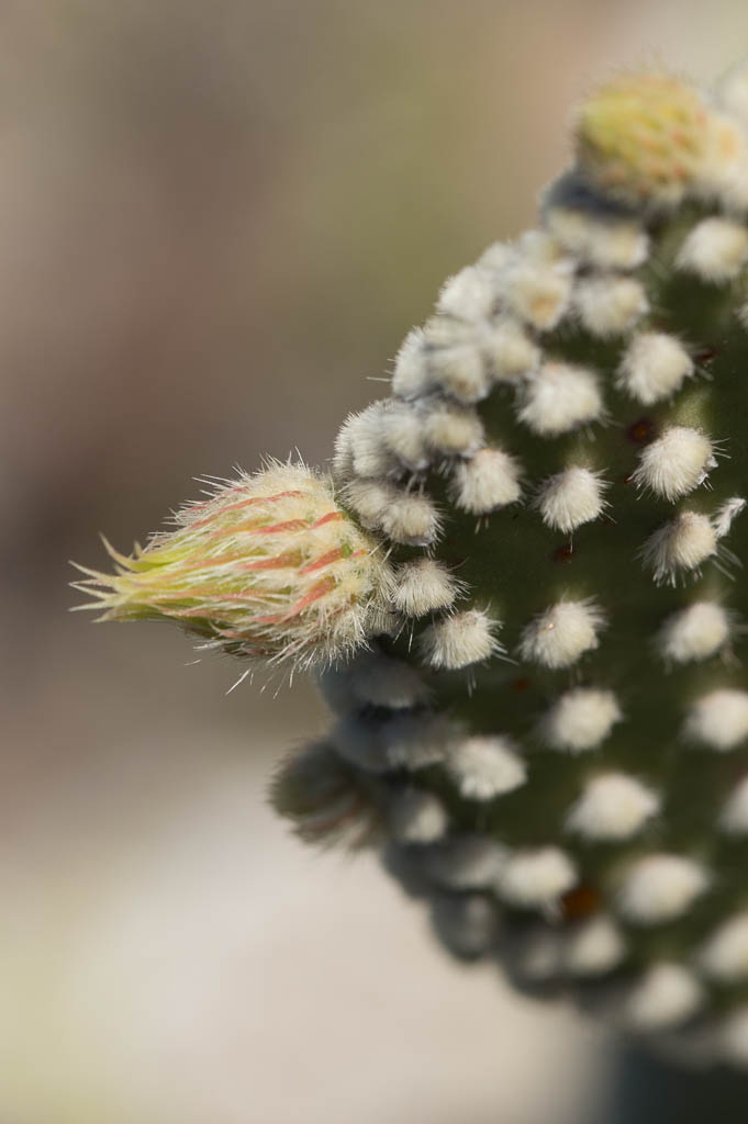
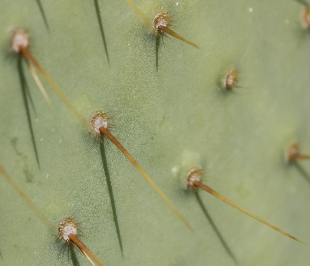
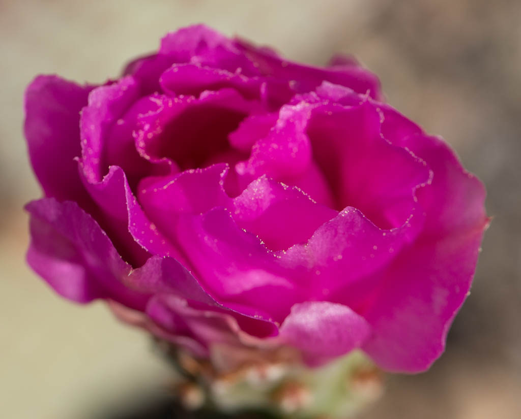
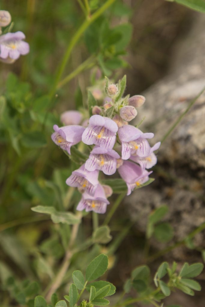
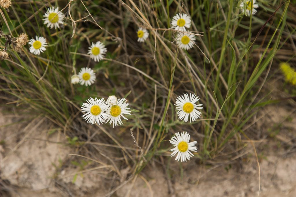
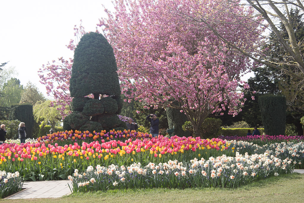
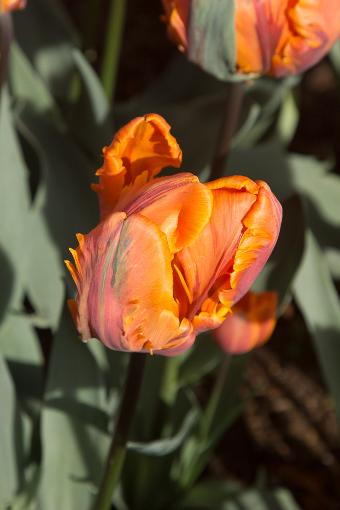
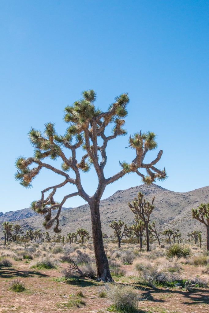
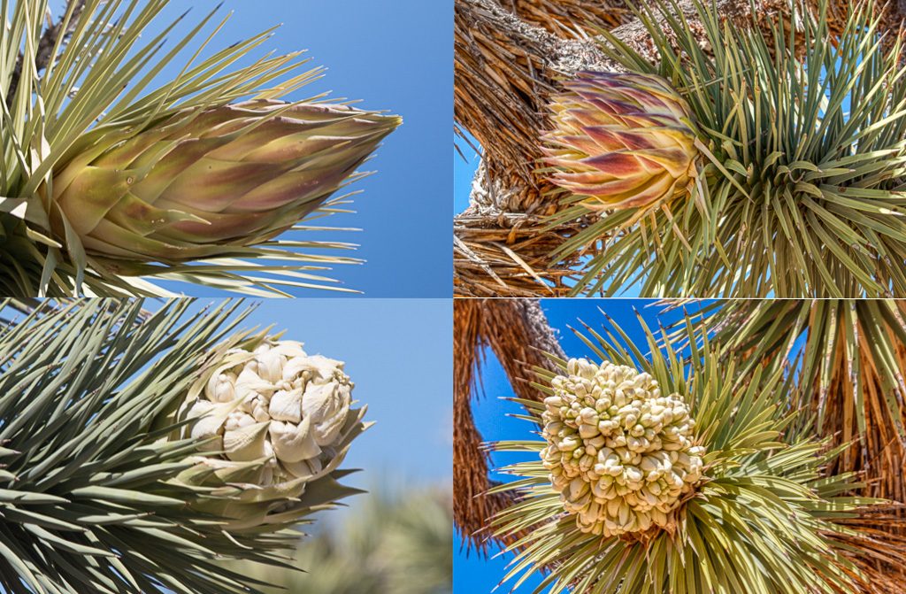
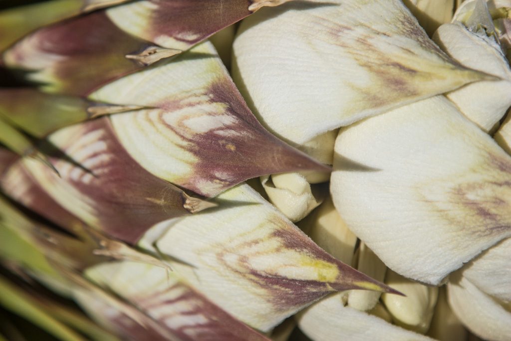
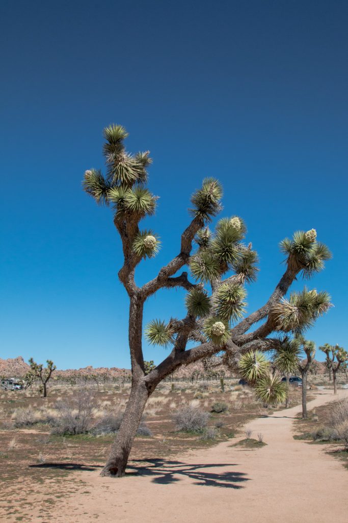
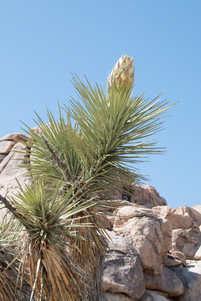
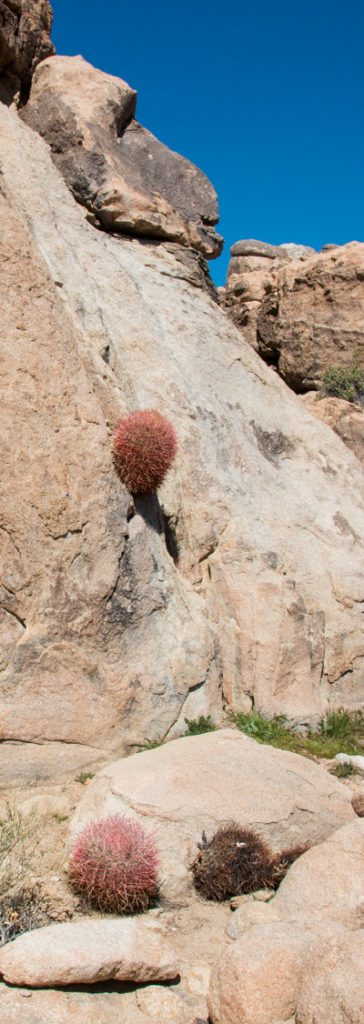
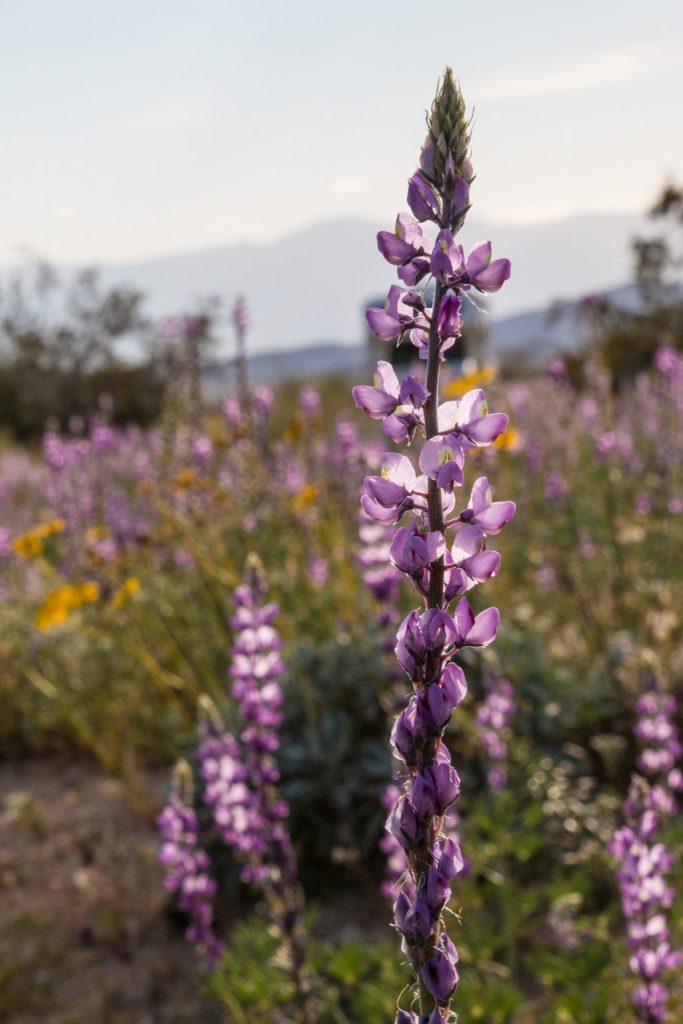
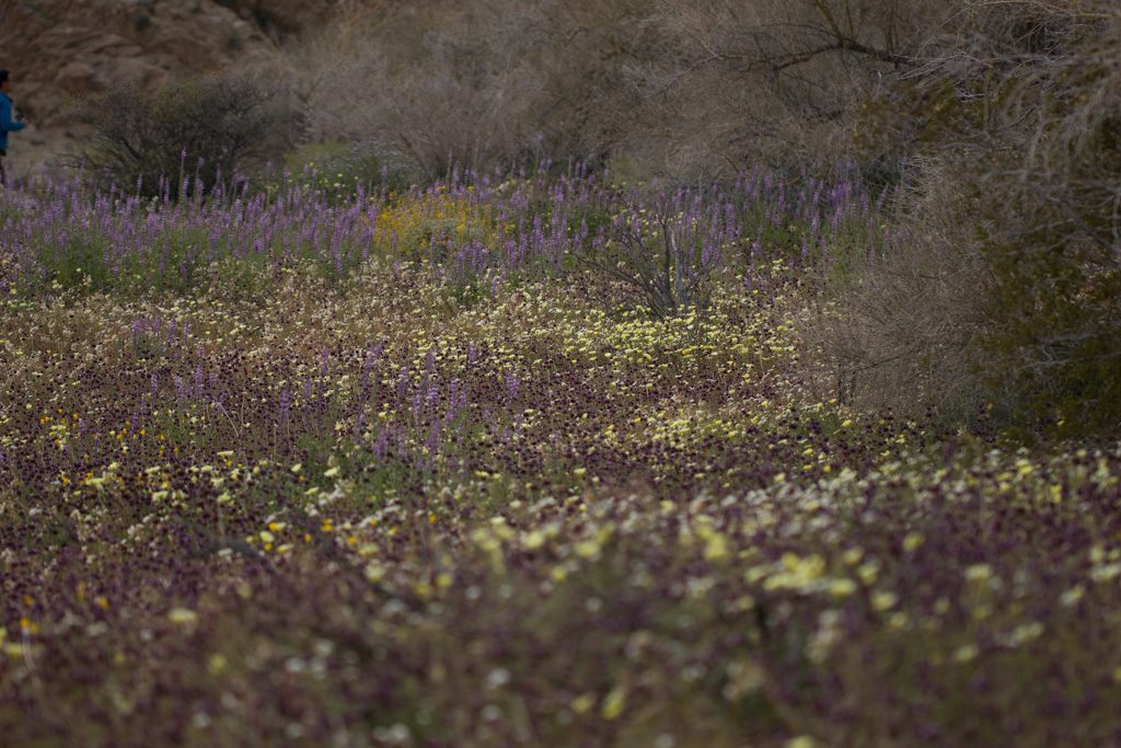
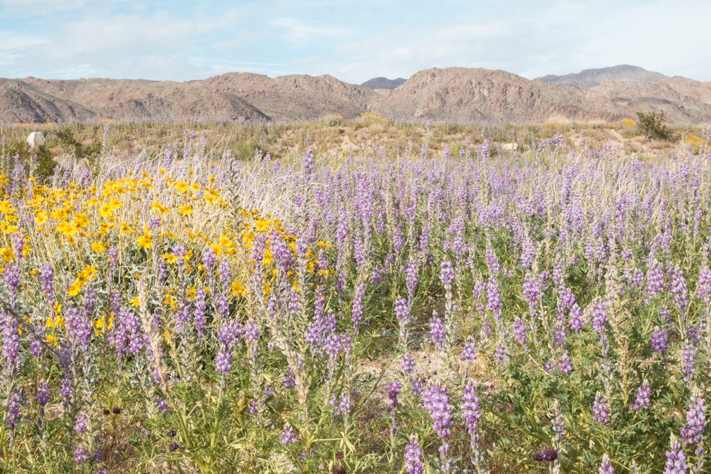
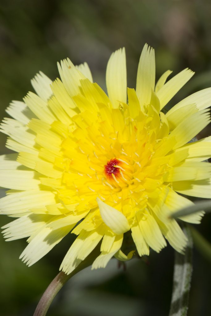
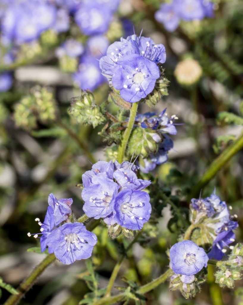
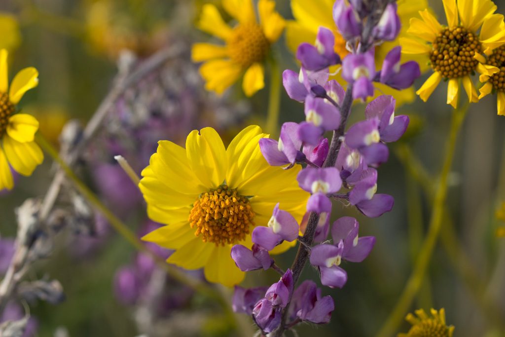
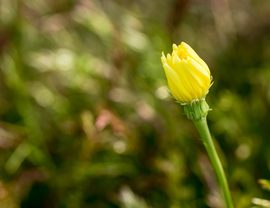
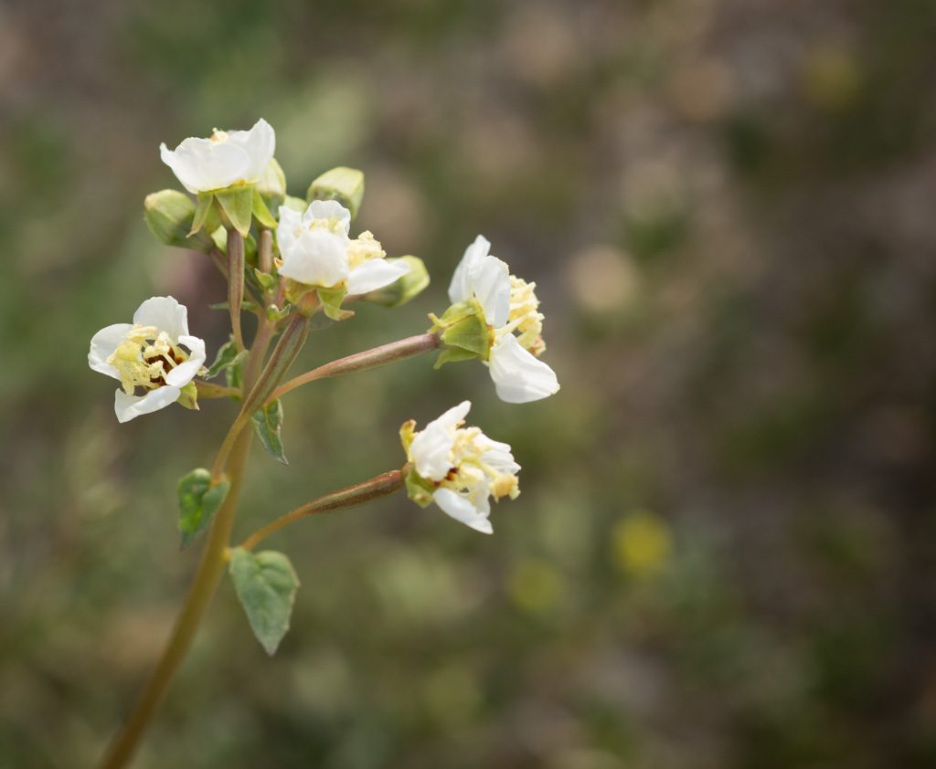
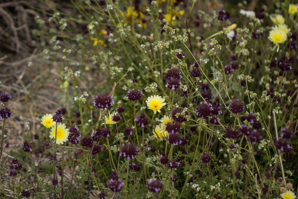
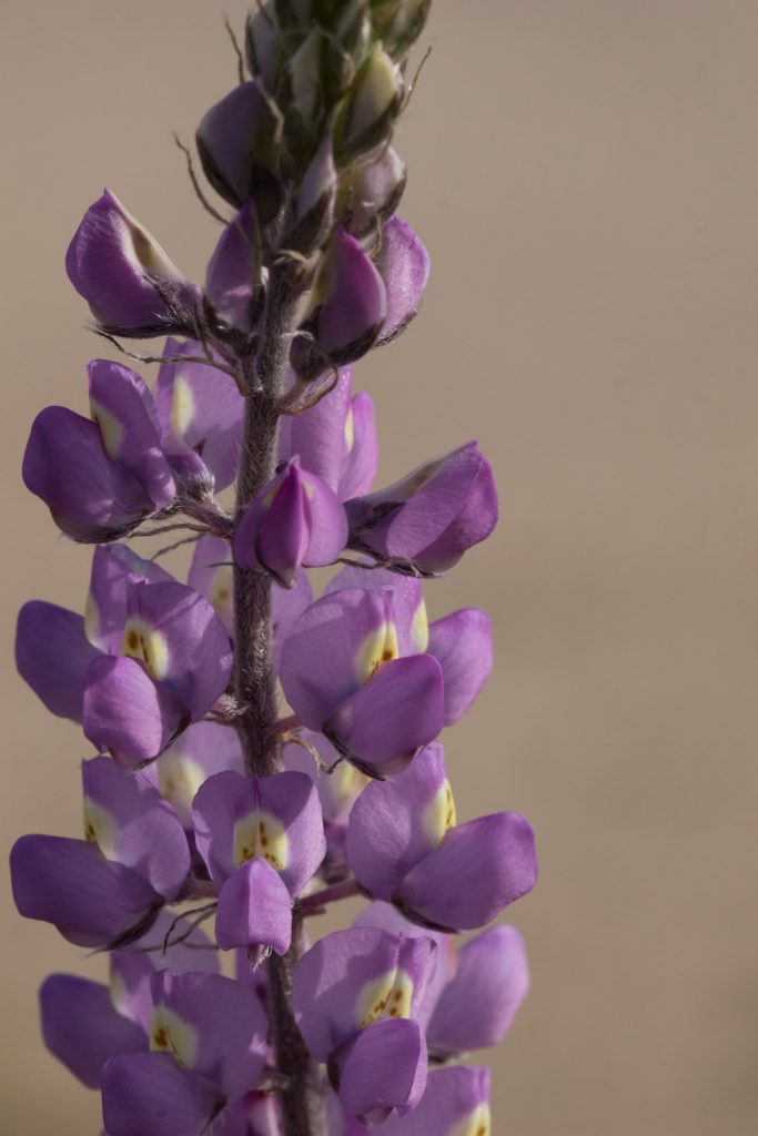
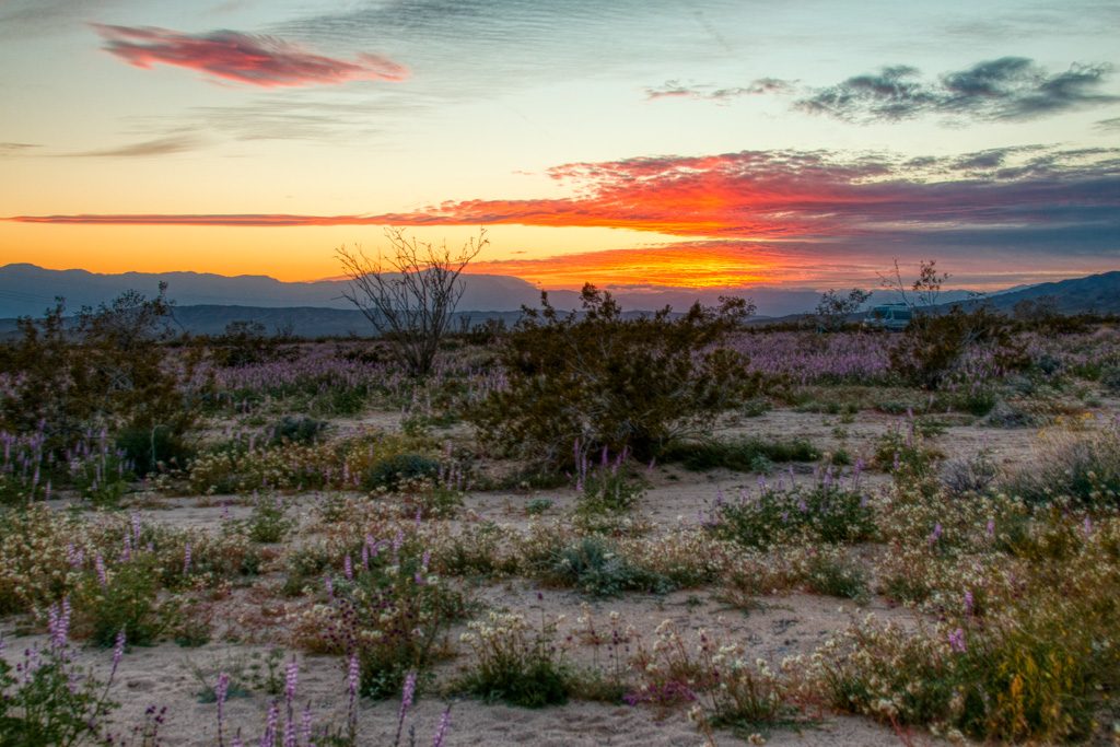
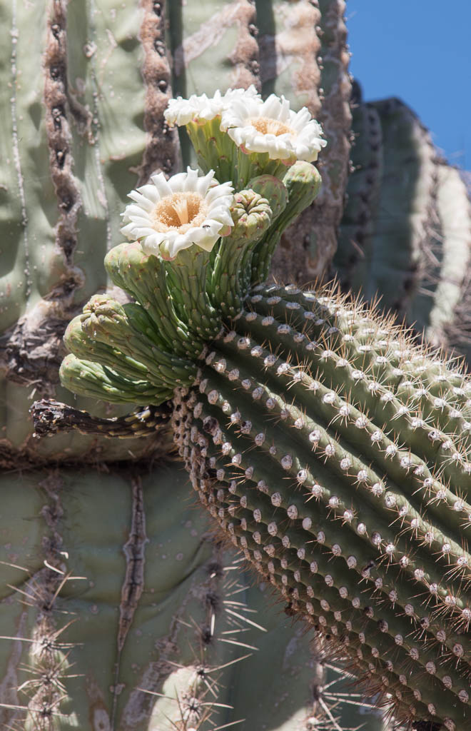
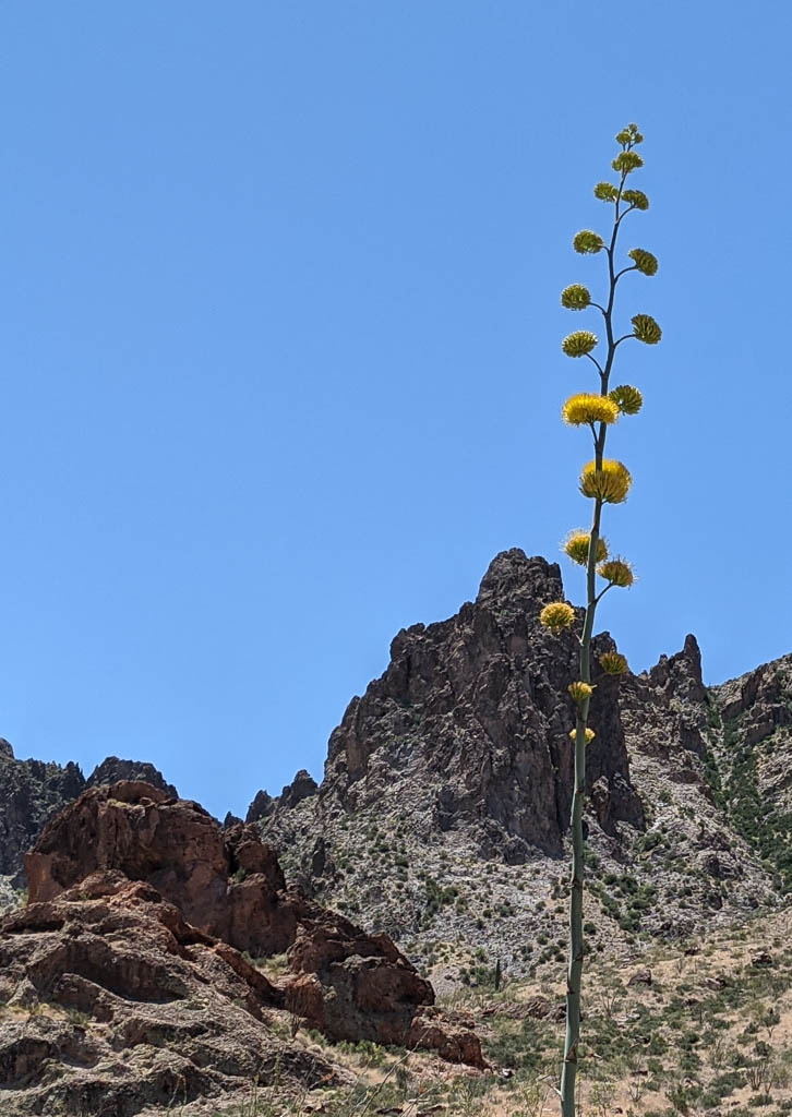
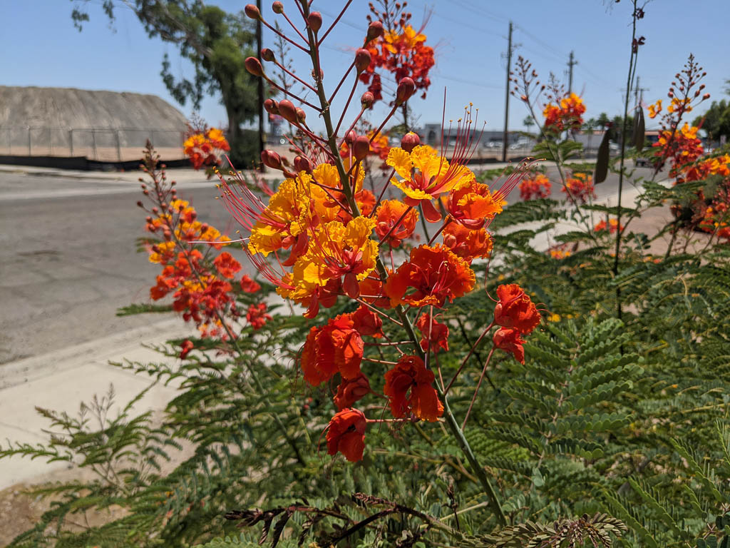
Fantastic invention! Available on Amazon and from many other places.

Still blooming!

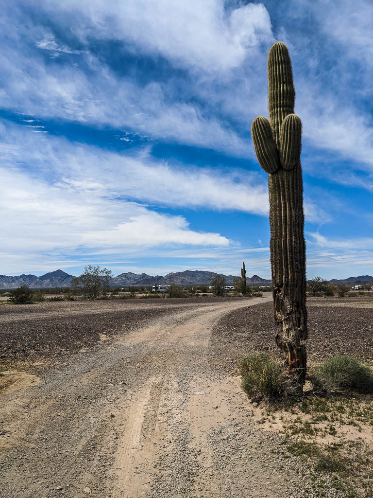
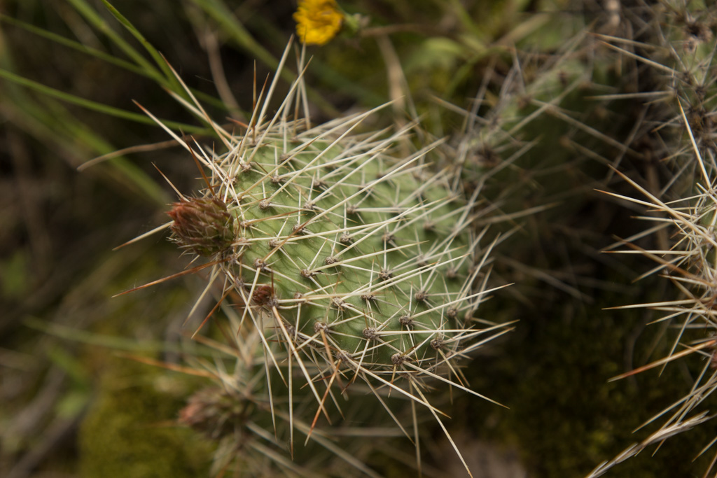
We are still seeing flowering plants in the area, although the saguaros are pretty much done by now.

I find saguaro blooms so pretty.
A RED saguaro bloom: Christmas cactus?
We hadn’t seen this before. Kathe identified it as a “Century plant!” Phew! Glad we didn’t miss the bloom.
I found this down in Yuma, while getting the truck fixed.

Miscellany

[Quick: what periodical had a “Miscellany” page on the last page of every issue?]

Yes, it gets hot here. This was in May, when the northeast was having frost warnings! Brrrr….

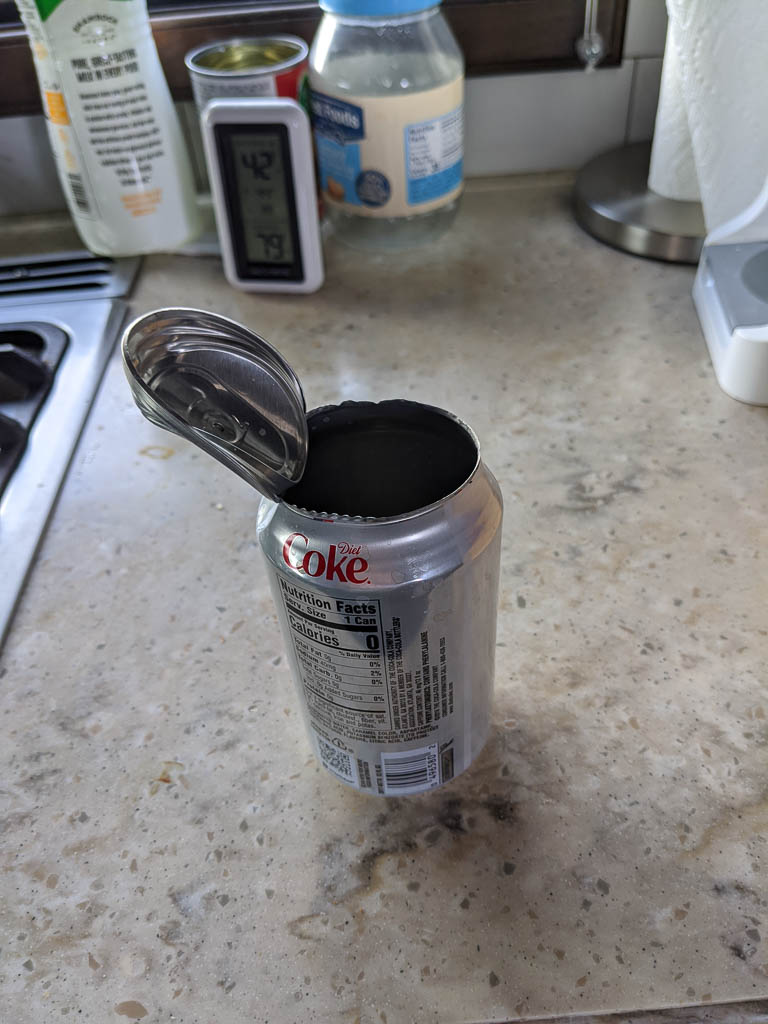
One afternoon I went out to the truck and found this waiting for me, in the console cup holder. The can was half empty, but I could find no trace whatsoever of the half of the contents that weren’t there. No spray on the ceiling, no drips in the cup holder or on the floor. I count myself very lucky! You can see in the pic that the pop top is still sealed. Guess that isn’t the weakest part of the can!

Don’t let this happen to you!

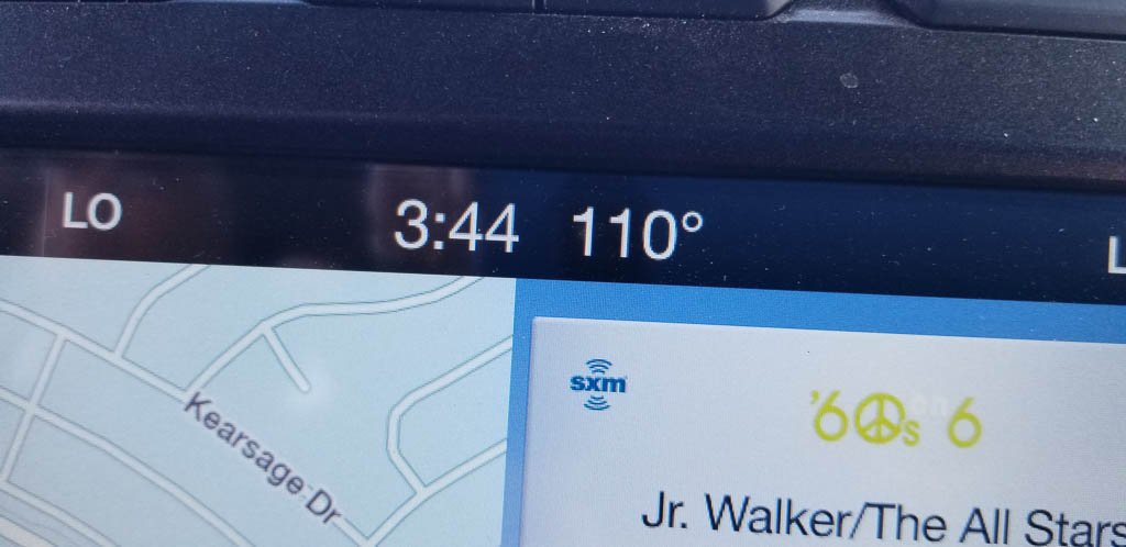
The truck thermometer said 127, but it had been sitting in the sun. I’d guess the air temp at about 115 outside. Who knows how hot inside the closed up truck! (Not the same day as the 110° picture above.)

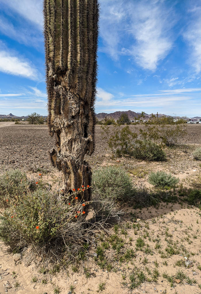
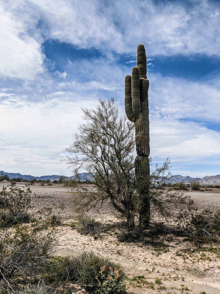
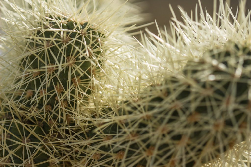
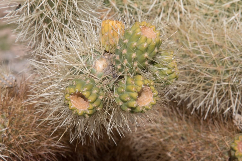
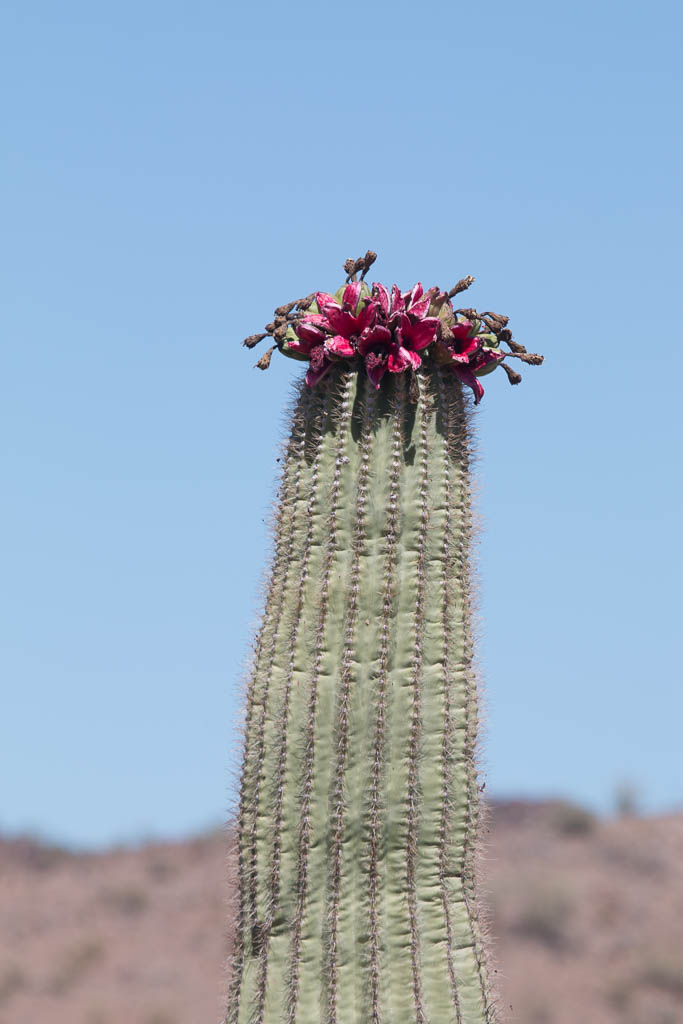
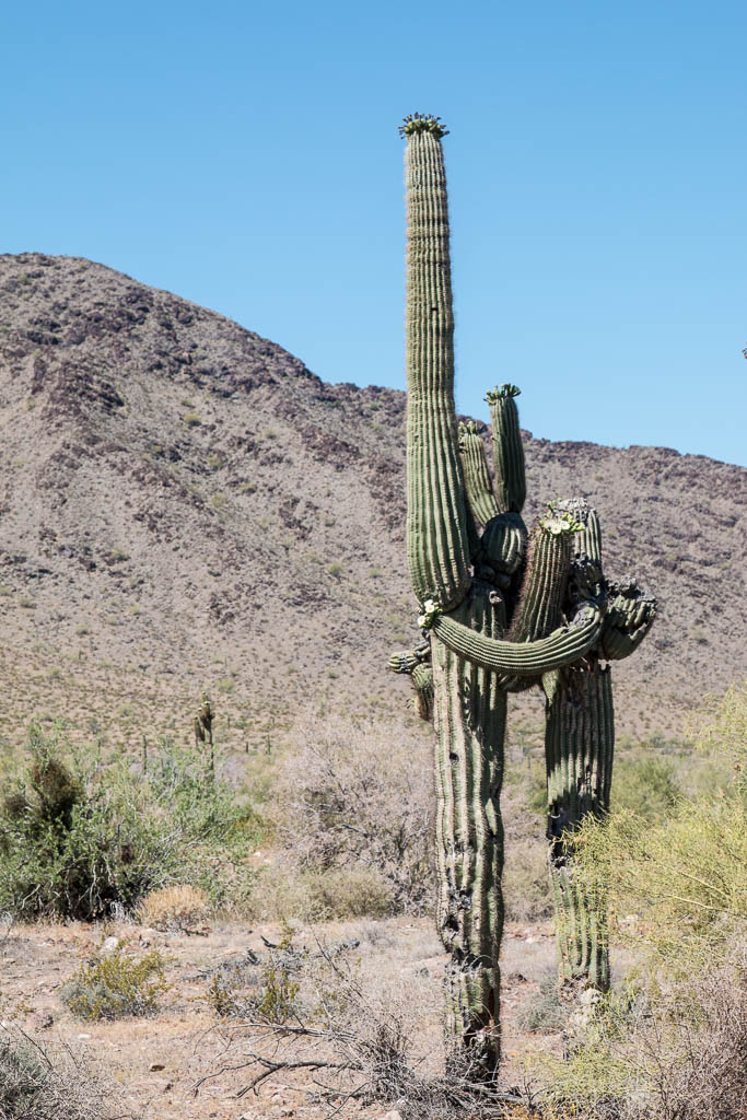
We were amused by these saguaros:

Everybody / everything needs a hug now and then!

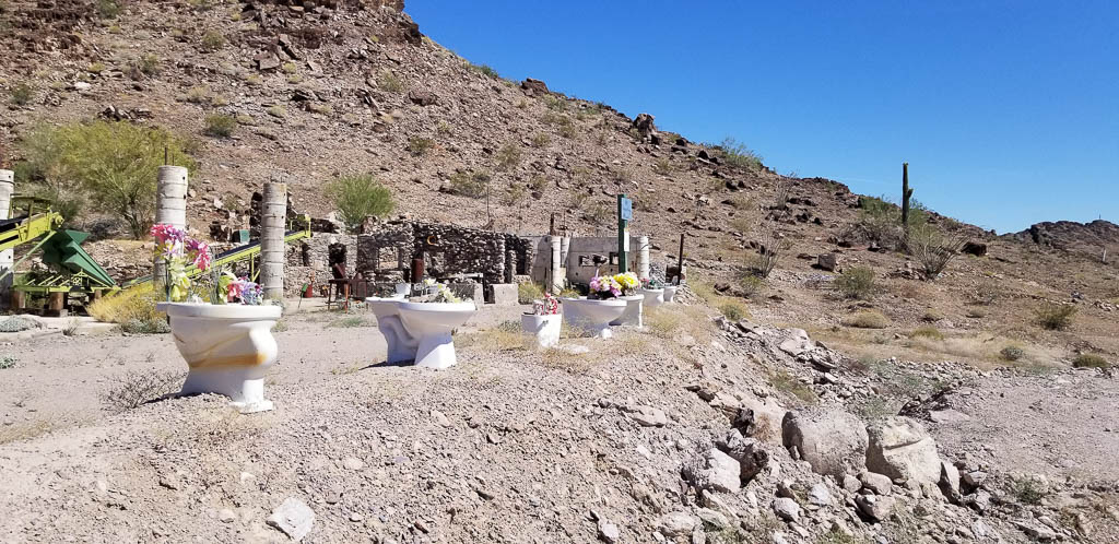
Several posts back we talked about the public art that was scattered around town. When we saw “Potty Garden” as a point of interest on the map of desert trails, we had to check it out! Of course!

Wouldn’t you?

The potty garden

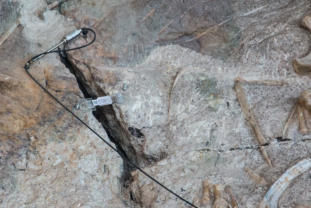
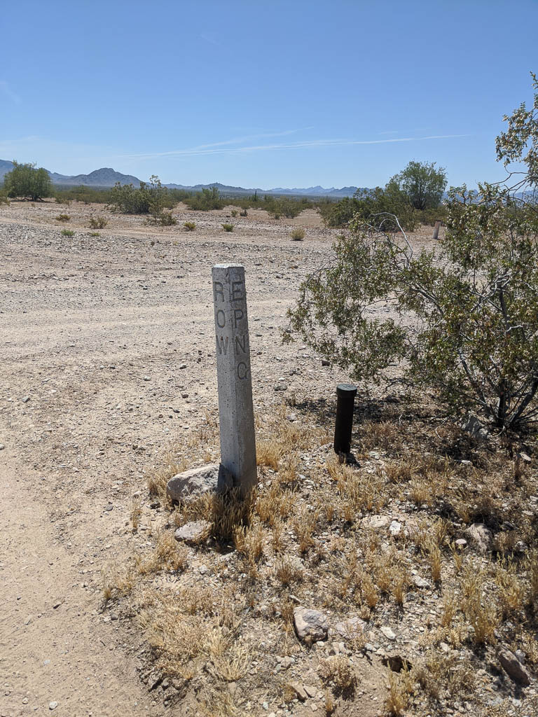
As I noted above, in amongst the mountains it is easy to convince yourself that you’re all alone. But every once in a while our path meets signs of the outside world.

Did the off-road trail influence the route of this, or did the trail result from laying the cable? After all, the desert is already disturbed!

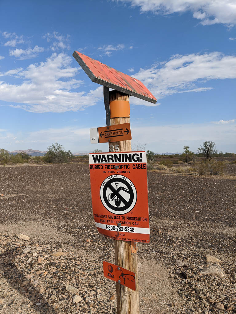
The slanted orange thing at the top is an identification number, for checking the route from a helicopter. All the infrastructure around here, cable as above, gas pipelines, and towers for the electrical grid have this setup. It is not at all unusual to see a low, slow helo going by as it is checking something.

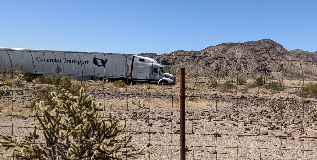
A few of the trails parallel Interstate 10, to take advantage of the grading. (But isn’t “unusual” grading the point of riding these machines?)

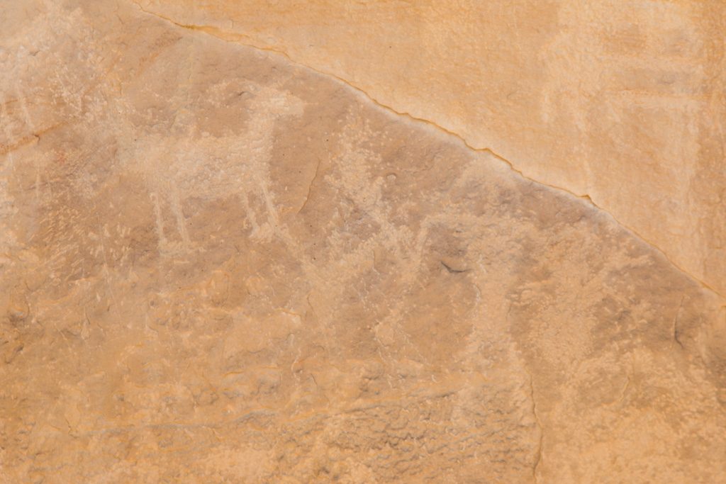
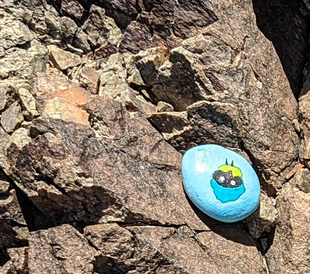
And occasionally someone leaves a sign of their former presence. Geocache? Easter egg?

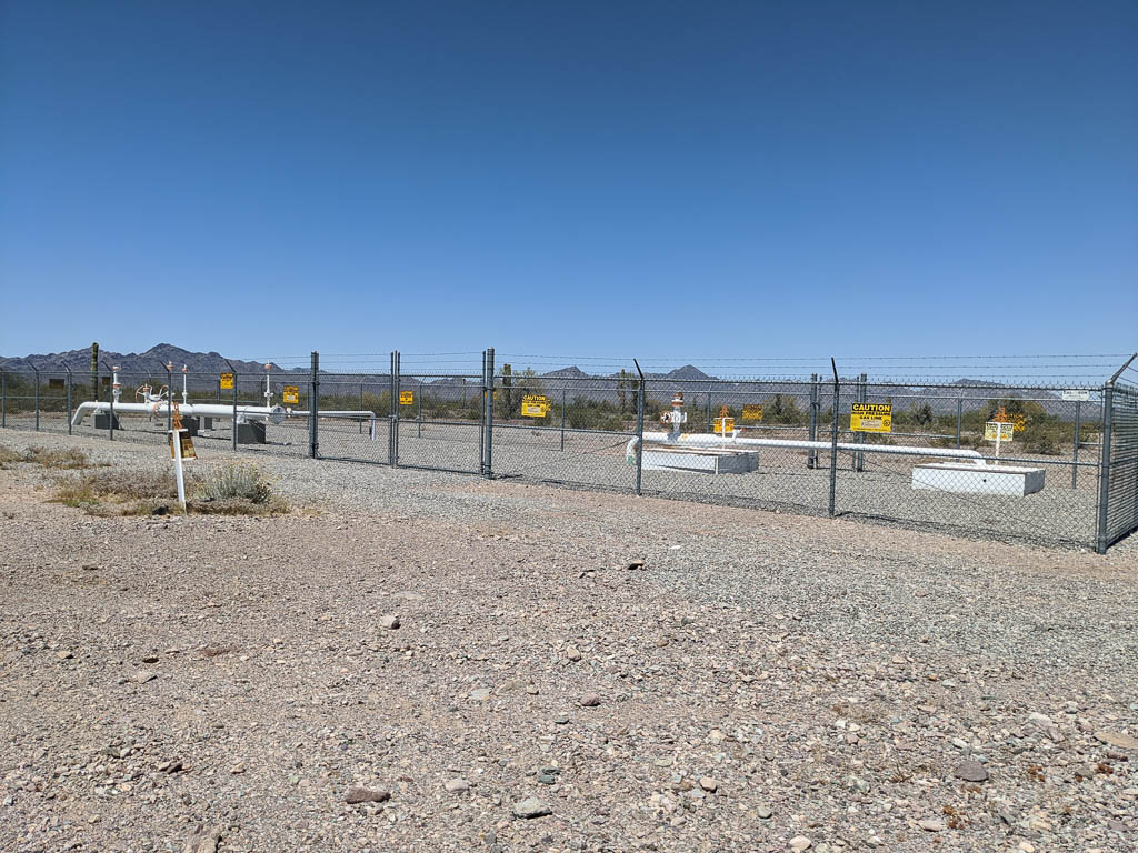
The El Paso (TX) Natural Gas Company holds several rights of way through the area to get their product to the cities on the coast.

Took up a minute or two to figure out the engraving: “EPNG ROW.”

One of the pipelines provides what could be considered an “off road highway,” named “Pipeline Road.” Really; it is on the maps. In addition to being a nice wide well graded path (they run pickups on it), you occasionally come across installations like this. I’ve found two in the area.

Part of the pipeline infrastructure, away from anywhere.

The promised video

I’ve heard that cartography is the art of omitting information. If maps included all the detail available, they would be unusable. Consider city subway maps. They show almost nothing, but present the important (for that use) information clearly.

I think making videos is similar. I have incredible respect for people who produce videos; editing hours of “film” into minutes or even seconds and still coming out with an interesting, cohesive story. I don’t consider myself to be in that group of people, but I have pulled together a few snippets of trail rides to try to show you what we’ve been seeing these past few weeks. I hope you enjoy it! It is just over 1 minute long. The first part is the mule deer running across our path on KOFA Queen Canyon Road, then starting at about 15 seconds, Kathe’s climb of the hill (at 2X speed). It was way steeper than it looks…

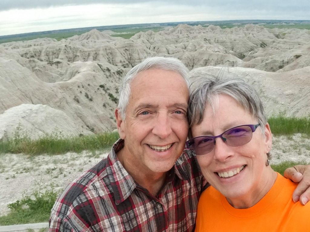
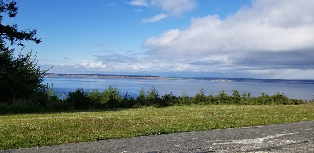
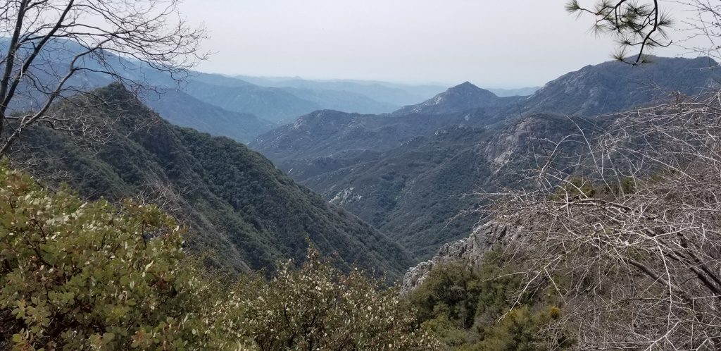
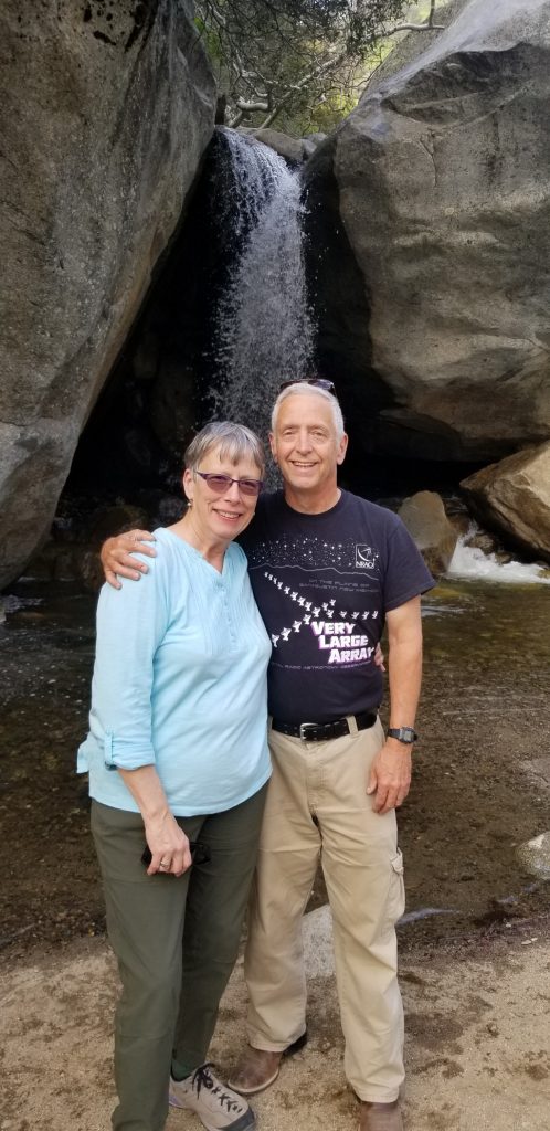
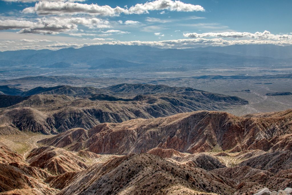
The view from the top was worth the climb! We’re looking west; the very farthest mountain range is probably California.

That’s about it for now. We hope you stay safe as society starts to open up. We have no plans to change how we’ve been isolating: riding in the desert with no others nearby or staying in the RV, unless going somewhere is absolutely necessary. Arizona is becoming a hot spot (get it?); things are not under control here.

See you next time!

-Al & Kathe aka The Lobsters

Quartz + Sight = Change of Plans

A change of plans.

Indeed.

I have held back from posting through the winter (but I guess you already knew that!) because I’ve been rather focused on the health of my siblings and my vision challenges.

I have REALLY felt the distance from my siblings since the fall. We were able to travel to CT for my brother-in-law’s funeral in October. I extended my stay to help my sister through the first days of her grief and sadly, she is now fighting cancer herself. At the same time, my younger sister had some serious health concerns that necessitated her move to a long-term rehab facility. Daily visits to see her were important for both of us as she tried to adjust to her new situation. Believe it or not, also in October, my brother ended up in ICU for 6 days due to a bad combination of prescriptions (that his doc had missed and which the pharmacy had missed too—I learned that MD does NOT require pharmacies to run the safeguard program to catch and red-flag such errors!). He pulled through—thank God!

I returned to AZ early in November fully expecting to make a trip back to spend more time with my sisters in Feb or Mar. My eyes had a different plan for me. Not to bore anyone with any details (and if you follow me on FB, you’ve seen some of this already), but I’ve had 3 surgeries this winter — and finally, the most recent procedure (shunt implant) on my right eye is showing early positive results. I am beyond excited and will now be followed weekly by my glaucoma specialist to be sure the pressure doesn’t go dangerously low.

In the meantime, my left eye is gearing up for ITS same surgery in the not-too-distant future as the pressure is already in the danger zone. This particular surgery can take up to 3 months for full recovery. Back to back surgeries mean I’ll be followed very carefully by my GS right through the summer and beyond.

And then, of course, there is the coronavirus and COVID-19. Ugh. I have decided that the very most difficult challenge is being away from family members who are ill. Providing comfort from a distance through cards, texting, phone calls, and video-chats will have to do. I am so grateful to SO many who are keeping my extended family in their prayers.

We have had to cancel all of our 2020 summer plans to visit more National Parks with our grandsons, Graham and Dean. Hopefully next year…

These changes seem rather minimal as we watch and read about the many sacrifices made by the COVID-19 first responders: health care providers and supporters, police and fire departments, grocery store clerks, pharmacists, and thousands more.

And how are we managing?

Except for 2 grocery runs and one trip to the eye doc in Phoenix, we’ve been self-isolating. That’s not actually very hard to do while we continue to boondock on the desert where we’ve been since early October 2019. With more than 11,000 acres on this BLM Long Term Visitor Area, there is PLENTY of room to keep to yourself.

Another beautiful sunset over a mostly empty desert. You can see some rigs in the distance. You can see the source of the line, “…the purple mountains’ majesty.”
Looking the other way, with the setting sun just touching the tops of the mountains. Again, the rigs are few and far between.

We have been taking walks each day and have been enjoying the colorful flowers that are now making an appearance in the desert. A fair amount of rain this winter has made for a lovely bloom. We do wonder how the desert bloom is in other parts of the southwest where it was rather spectacular a year ago. Anyone know?

We’re filling our time with reading, walking, bingeing on Netflix, etc. (check out our new favorite – The Great British Baking Show), LOTS of quilting (I’m taking several terrific online classes), and too much time on the computer.

We are visiting with our kids and grandkids nearly daily between Facetime and Zoom. Zoom is particularly fun because we can see everyone at once and the connection is excellent. I’ve also been able to visit with my P.E.O. sisters (16 of us) on Zoom–what fun!

We’ve been heartened and absolutely amazed at how our nation’s educators, school districts, and local municipalities have risen to the occasion to keep their students fed, safe, engaged, and supported. Check out this amazing video created by educators in the Corning-Painted Post (NY) School District where our son and daughter-in-law teach.

The church we still belong to in Maine continues to do amazing work and is keeping our church family together through live streaming prayer services, Bible study, and Sunday worship. It’s been so important for us to maintain those connections. Bible study on Zoom with my pastor and other dear friends continues to be a real lifeline for me.

“Home is where the heart is.” For us, home is also where we park it. On March 13th, the sale of our “sticks and bricks” house on Mount Desert Island finally closed, so these 36 feet of trailer are “all we have.” It is a relief to not have the house, but also feels a bit strange.

Did you know that there are ONE MILLION full-time RV’ers in the US? We have received several questions from friends wondering whether we will be able to find a place to stay once the BLM closes the LTVA we’re in, in April, because there are many reports in the news of campgrounds closing . Yes. We have decided to stay put in Quartzsite for the foreseeable future. We too have been keeping abreast of closures of state parks, some national park campgrounds and facilities, as well as an increasing number of private campgrounds. We are glad that we’ve been able to secure a spot in a local private campground here in Quartzsite for April 15-at least Sept 15. We can come back to the BLM land (desert) as of Sept 15 but if it’s still very, very hot, we may just stay put in the private campground where we can run our AC’s! (Solar just doesn’t provide enough power to run AC’s.)

Life feels alien right now, and hard. But we’re uplifted by the resilience of life demonstrated here on the desert by these saguaro and other plants and animals.

A seemingly healthy saguaro cactus, despite significant damage near the bottom.
It is hard to believe they can survive this much damage! Is this from animals looking for water, or insects, or???
If a tree were girdled like this, it would be long dead!

Since our last post (March 6), so much has changed. For all of us.

We hope that this post finds you self-isolated, safe, and healthy!

Millions of Years!

The RVing “Rule of Twos:”

  • About 200 miles per day,
  • Arrive by 2:00 (or at least early enough to set up by late afternoon),
  • Stay at least two nights.

We’re retired, no need to push for long driving days. So when we plan our travels, one of the tasks is “Where to stop?” When we have a longish drive between two major stops, we have to break up the drive across multiple days. So we look on the map at “around” 200 miles, and see what looks promising.

When you notice the name, “Flaming Gorge,” the decision is pretty much made! We’re really glad that we saw that. And also that we decided on three nights!

Flaming Gorge

Flaming Gorge was named by John Wesley Powell in 1869 during his exploration of the west. The name stuck. When you see the reds of the surrounding cliffs, you can see why. Flaming Gorge is one of five distinct gorges/canyons in this stretch of the Green River. This pic is actually just before Flaming Gorge, in Red Canyon.

The Green River in Red Canyon, just above Flaming Gorge. Yes, the river really is green.

The gorge area is only about 30 miles from our campground, but it is thirty miles of twisting mountain road. I didn’t realize how strong my fear of edges was until I tried to drive on these. Fortunately, Kathe’s shoulder has now healed enough that she was able to resume her driving duties! Phew…

Geology is big here; there are signs along the roadside giving the current rock formation / era, and sayings like, “Dinosaurs roamed here,” or “Ancient seabed, shells and sand dunes.” Because of the erosion over the millennia, we travel backward and forward through the history of the earth as we drive up and down (or actually, down and up) the hillsides.

Sheep Creek Bay Overlook, at the south end of Flaming Gorge. The sun conditions make huge differences in the color of the water. The next day, the water here was gray. Notice the prominent evidence of tectonic activity with the upthrust formations tilting once horizontal sediment beds.

Parts of these gorges have been flooded to create the ninety-one mile long Flaming Gorge Reservoir by damming the Green River, the Colorado’s biggest tributary. We were able to take a tour of the 502′ high Flaming Gorge Dam, going down into the turbine room, and out at the downstream base. Thank goodness for elevators!

Flaming Gorge Dam
One of three turbine-driven generators. Together, the three turbines use 4,000 cubic feet of water per second. The dam can release more water if needed, through bypasses.
One of the turbine wheels that was removed during a retrofit.
I thought we used a lot of climbing rope on the MDI-SAR team! They do inspections by rappelling down the face of the dam. Oh! May I? May I, please? Please?

The dam has of course changed the ecology of the river. Some fish previously in the river are gone. But the Green River downstream of the dam is now apparently a world-class trout fishery. There were lots of very large trout swimming in the eddies of the generating plant outlets, but fishing is not allowed in the immediate downstream area.

Are you hungry yet?

As is frequently the case, the top of the dam is a roadway, usually a two direction road except when something like this is trying to cross!

Yes, it IS an oversize load…
At times, the road over the dam is definitely one way!

Dinosaur National Monument

About an hour and a half away from our campground (again over the mountains) lay Dinosaur National Monument. What kid (of any age) can resist dinosaurs? Sure! Let’s go.

Dinosaur NM is quite large, but its gem is just inside the western (nearest to us!) entrance. The “Quarry Exhibit Hall” is an enclosed cliff face of what was originally the river bed of an ancient river. Approximately 1,500 bones are visible here, from ten different species of dinosaurs. The site is estimated to have been formed about 149 million years ago. It was discovered in 1909 by Earl Douglass of the Carnegie Museum when he found eight tail vertebrae of an Apatosaurus (how can they tell???). Many of the fossils discovered here were shipped to museums around the world, but many remain.

One side of the Quarry Exhibit Hall, showing how it is built right into the cliff face. This is the third such building. It appears robust; time will tell if this is the one that will last!

Naturally enough, the cliff face and the fossilized bones are pretty uniform in color. This makes discerning the bones somewhat difficult, especially in pictures.

As taken.

To make it easier to see the bones, I have enhanced the contrast and used edge sharpening in the remainder of these pictures. I should note that the National Park Service does the same thing on its website. (To a greater degree, in my opinion!)

With boosted contrast and sharpening.

One of the things that makes this site so different is not just the density of preserved bones (which of course are now fossilized, i.e., they are rock, not bone), but also the number of bones that are still articulated—attached to the bones next to them. It is very rare to find skulls still articulated to the cervical vertebrae.

Skull still attached.

Many species died here. In this picture are large bones from two different species. Across the top is an Apatosaurus scapula. Below it, going from lower left toward the upper right is a Diplodocus scapula. And from lower right toward upper left is an Apatosaurus femur.

Scapula, scapula, femur.

Apparently, mostly complete skeletons are exceedingly rare. The NPS publication describing this part of the wall says, “Articulated Skeleton: Paleontologist’s Dream.” This picture is of a nearly complete Camarasaurus. I couldn’t see all of what they were describing, but then, I’m not a paleontologist!

“Nearly complete.” If you say so!

And if I could be permitted a slight aside here, whatever happened to the dinosaur names that I learned as a kid? My grandkids (and this exhibit) and I speak a completely different “language” of dino names! I want my T-Rex back!

Aside to the aside: I really put that in for a bit of humor, but decided to do a little web searching and came across this. Apparently, Apatosaurus and Brontosaurus (Thunder Lizard) were initially thought to be different species, but soon thereafter they were “determined” to be the same, with the animal identified as Apatosaurus being simply a juvenile Brontosaurus. Since the name Apotosaurus was published first, the name Brontosaurus was dropped from the formal nomenclature in the early 20th century, but not from many museum exhibits, nor from popular use. But wait! There’s more! In 2015, a new study “determined” that they are indeed separate species, and that there may be a third closely related species. So I guess I get my Brontosaurus back.

Whatever their names, some of the beasts were BIG! This is a Camarasaurus femur.

Don’t meet this one on a dark night…

Notice that parts of that femur are dark and shiny. That is from the oil on many people’s hands. Most of the gallery is under a “don’t touch” policy, but in some places the kids (again, of all ages!) are invited to touch.

Please touch me!

As part of the preservation efforts here, the wall is being monitored for seismic activity. There are strain gauges across many of the cracks, and there are other detectors at several places. I was not able to find a ranger who could identify what those were for.

Monitoring the rock. Notice that one of the bones is broken at a crack.

Dinosaur National Monument is big; we only dipped our toes into the water, so to speak. We did go another mile or so in to “Swelter Shelter,” to see some 1,000 year-old pictographs and petroglyphs, created by the Fremont people. I learned the difference here; the terms are not synonyms. A pictograph is created by staining the surface of the stone, usually with red ocher (ochre if you’re a Brit). A petroglyph is formed by chipping or etching the stone. Both are present at this site, but most are petroglyphs.

Combining both forms here. Notice that there is some evidence of ocher staining that remains.
Do these remind you of 1950’s depictions of aliens? Wavy, sinuous arms, tentacles from their heads? Hmmm.

Unfortunately, there were also etchings that were less than 1,000 years old. Why do people feel the need to carve their initials into irreplaceable sites like this?

For an “in between” stop in our adventure, this one had some pretty great stuff! Our countries are so full of fascinating nature, history, and people. We keep marveling!

We are about to join with our two oldest grandkids for several weeks, so get ready for some guest bloggers!

We’ll see you again down the road.

geysers, grizzlies, and guardrails

“All animals in Yellowstone National Park are wild and dangerous!”

“All wildlife is dangerous! Remain at least 25 yards from any animal.  Remain at least 100 yards away from bison and bear.”

“Yellowstone is a Dangerous Place”

These and similar signs are all over Yellowstone.  We need to be wary of all the animals!

Beware dangerous chipmunks! Or is it some kind of western squirrel? He was greatly enjoying a gourmet mushroom he’d found nearby.

We did see quite an array of wildlife in the park, in addition to the chipmunk.  We saw bison, including some close enough to get good pictures of (but far enough to still be safe). We also saw deer, elk, and an osprey.  No bear (of which I’m very glad), and no moose (of which there are very few remaining in the park).

Practicing for rutting season, I guess.
An after dinner drink!
An osprey on the prowl for dinner,
Gotcha! How would you like your trout?

There are many dangerous things in the park, as in most of the National Parks.  Their wildness is what calls many of us to go to them; it is what makes these places special.  Being attacked by wild animals, driving off the edge of a narrow mountain road, or falling into a pool of boiling water are some of the things that can befall a careless or inattentive visitor.

We got a late start on our first day in the park, so we decided to just do the north part of the park (we were staying outside the north entrance). We’d go down the western side through Mammoth Hot Springs, to Norris, across to Canyon, up through Tower, and then back to Mammoth. Here’s a picture of the Yellowstone river near Tower.

Yellowstone River

We had visited Yellowstone eleven years ago after a service trip to Pine Ridge Reservation in South Dakota with our church.  We were in a small rental car and enjoyed driving in the park. The roads on the east side of the park are quite mountainous, twisty and narrow—a challenge! Fun! 

Driving them in a crew cab long bed dually pickup truck (basically, the biggest F350 that Ford makes) is an entirely different experience from driving them in a compact!  White knuckle time. Through a good portion of the park, there were no guardrails. And it was hundreds and hundreds of feet to the ground below. We decided to not go to the Grand Canyon of the Yellowstone and the Lamar Valley because they would have required retracing some of that route.  But those were the only places we had wanted to visit that we missed. If we go back in the future, we may rent a compact car to make touring the park less terrifying!

The geysers and geothermal pools are, of course, Yellowstone’s calling card. The density of these features is unique in the world. They are unquestionably beautiful and awe inspiring, but you need to be careful.  There are boardwalks in many of the dense areas of springs, pools, and geysers, and there are frequent signs warning people to stay on the boardwalks.  The “ground” they traverse is often simply a thin coating over a hot spring, most of which will be fatal if a person becomes immersed.

Travertine and hot pools in the Norris Basin area.

On our previous visit, I watched two men ahead of me on a boardwalk.  They came to one of the “Danger! Hot water. Stay on the boardwalk” signs, and one handed the other his camera, stepped off the boardwalk (right next to the sign), and had his friend take a picture of him and the sign.  As a former boss of mine was fond of saying, “You can’t fix stupid.”  But Darwin clearly missed an opportunity here.

This time, we saw many unattended small children on the boardwalks, some standing on the edge of the boardwalks (there are often no railings), or kneeling at the edge leaning over—presumably, “to get a better view.” As parents, it was very tough to see these situations.

But… these pools and springs are unquestionably beautiful!

Grand Prismatic Spring

The colors of the pools are caused by thermophyllic bacteria, also referred to as “extremophiles.” Different types of bacteria have different colors and live in different water temperature ranges: blue indicates the hottest temperatures, then yellow, then red.

I didn’t get a good picture of it, but the steam drifting above the Grand Prismatic Spring was tinged with the reds and blues of the water.

Quick: what was the Roman Coliseum built out of?  Travertine. Didn’t know that myself until a few hours ago. Travertine is a type of rock made by the evaporation of mineral laden water.  And it is all over Yellowstone, particularly in the Mammoth Hot Springs and Norris Basin areas.

Travertine terraces.
I wish I knew what causes it to form terraces instead of just smooth slopes.

Over time, the travertine will envelop anything it encounters.

Such as this tree…
Or this walkway.

The pools and springs sometimes warn of their danger by continuously steaming. 

Caution: blue indicates the hottest springs and pools.

Others are quiet and appear inviting!

Quiet, but deadly. Notice how thin the crust is!

Geysers are the other thermal features most people associate with Yellowstone. Some are grand, but erupt unpredictably; others are small and erupt frequently. A few are large and predictable. Eruptions can last for a short time, releasing all their pressure quickly, or they can last for hours. We saw quite a few of the small geysers,

Even small geysers can build up a significant cone over time from the dissolved minerals.
Not sure whether this is a small geyser or just a bubbling spring.

And what visit to Yellowstone National Park is complete without watching Old Faithful erupt?

It really is impressive seeing this eruption. Not the biggest in the park, but the biggest we were to see on this trip.

We had the great pleasure of meeting a member of the Mount Desert Island Search and Rescue team who is now a law enforcement ranger at the Old Faithful District. We hadn’t seen each other since last July, and it was very good to see him again!

We finished our trip by hiking to the Morning Glory Pool. When we visited eleven years ago, it was about six weeks earlier in the year than we were here this time. On our previous visit, the Morning Glory area was closed due to grizzly bear activity in the area, feeding on several bison which had not survived the winter.

Morning Glory has a reputation of being one of the prettiest pools in the park and I was really looking forward to finally getting to see it this time. It was pretty, but I was somewhat disappointed.

It is widely reported that Morning Glory has been damaged by visitors throwing coins and trash into it, and the colors are reportedly not as striking as before; some articles refer to the name “Faded Glory,” The park is making efforts to try to repair the damage, but it is unknown whether it will ever be completely restored.

Morning Glory Pool

It was a real treat to be able to explore and enjoy Yellowstone again—it’s a real gem and should be on everyone’s bucket list.

South Dakotans!

Once we decided (months ago now) to give up our ‘sticks and bricks’ home in Maine and continue our nomadic life as full-time RVers, we needed to choose a state to ‘hang our hat.’

Well, we’ve done it. We’re South Dakotans. In March, we registered our truck and trailer in South Dakota; the registration fees there are much lower than in Maine. All that South Dakota requires for registration is a South Dakota mailing address, and since it is quite possible that the trailer and truck will never be in Maine again, there was no point in leaving them registered there. We were able to do the registrations entirely through the mail, which resulted in the following conversation being held several times with campground “neighbors.”

“Where are you from in South Dakota?”

“Never been there!” (OK, Not quite true… but it is a good line. We had been there for a week eleven years ago, on Pine Ridge Reservation.)

But now we have. In order to establish our domicile in South Dakota, we have now obtained our SD drivers’ licenses, and registered to vote.

South Dakota has laws that are written specifically to attract full-time RVers, as do Florida and Texas. To gain resident status—to be able to get a driver’s license and register to vote—you merely have to have proof of spending one night in the state every five years. The reason we chose to cease having Maine as our domicile is because SD has no state income tax, and as noted above, much lower vehicle registration costs. Now we just have to make sure that we don’t stay in any one state for six months or more in any year, or that state could claim us.

“Honey, why did we plan so much time in South Dakota? There isn’t much to do here…”

Yeah. Right…

Mount Rushmore National Monument

Everyone has seen Mount Rushmore, if not in person, then in pictures. So is there anything new to say about it?

It is BIG. Pictures can’t capture the scope of the sculpture. No, not even the ones that we’re including here. The entryway into the park is aligned closely to the direction of Washington’s gaze. But I didn’t realize until we wandered a bit that there are other viewing sites that let you look directly at the other presidents as well. We didn’t find the one to look directly at Lincoln, but we did for Jefferson and Teddy Roosevelt.

There is a “sculptor’s studio,” where they have maintained one of Gutzon Borglum’s scaled down sculptures created in preparation for the real one on the mountain. This study is at a scale of one inch to one foot. The studio allowed us our favorite picture of this visit.

The study and the mountain, from the sculptor’s studio.

Side note: In the early 20th century, Borglum maintained a home and studio in north Stamford, CT, not far from where Kathe grew up!

Crazy Horse Memorial

As we continued to explore the Black Hills of South Dakota, we knew we wanted to stop here. The amazing thing about the Crazy Horse memorial is that it is a work in progress—indeed, it was 1948 when artist Korczak Ziolkowski began to carve this incredibly huge work. The sculpture depicts the Oglala Lakota warrior, Chief Crazy Horse astride his horse and pointing into the distance.

It is HUGE! Larger than Mount Rushmore, the carving, when finished, will be 563 feet tall and 641 feet long. Look carefully.

Chief Crazy Horse Memorial. At the right you can see the etched outline of where the horse’s head will be.

You can actually spot some heavy equipment up at the top (on top of the arm)–we can’t imagine doing that kind of work, can you?

Close(r) up of the arm with equipment

Ziolkowski’s wife and and seven of their children continue to direct the project since his death in the early 80’s. Technology has changed a bit; the use of laser measuring tools and explosives is now in place.

What is particularly impressive about this project is that a lot more is happening at the site than just the sculpture — a new on-site university, an incredible museum, speakers, special programs, and conferences. Everything is supported by private donation and run by a non-profit group. In fact, the US federal government offered to donate 10 million dollars and it was declined. There was concern that the federal government would take over control of (and change) the project.

Wind Cave National Park

Al first learned about this park from a friend on the MDI Search and Rescue team who used to be a ranger there. Wind Cave was designated as a NP in 1903 and was actually the first cave anywhere in the world to be so protected. It is the sixth largest and most dense cave system in the world. To date, 149 miles of passageways have been explored and surveyed—all within ONE square mile. However, they only represent 5% of the total cave system. YIKES!

Wind Cave: only one square mile in area (so far).

There are three major levels. We took a tour in middle level.

No stalagtites or stalagmites here. The rock over the cave isn’t porous.

Frostwork, popcorn (which reminded us of our ceilings in our old home in NH), and boxwork are the three formations found here. In fact, Wind Cave is thought to be the home for 95% of the world’s boxwork.

To form boxwork, the limestone from which the cave is carved fractures twice. The first fractures are filled with water bearing the mineral calcite, which forms a latticework of stone much more erosion resistant than limestone. Later (much later), the limestone is fractured again, this time admitting flowing water. Over millions of years, limestone is eroded away to create the cave, but the stronger calcite remains to create the striking boxwork.

Boxwork in Wind Cave. Although it is resistant to erosion, it is VERY fragile!

Wind Cave is a sacred place for the Lakota People. Their emergence story originates here; they believe the cave is where they left the subterranean world to live on the surface. The NPS has a writeup on their website.

The only known natural entrance to the cave is a small opening (maybe a five year old could squeeze through). The ranger explained that when there is a difference in barometric pressure inside and outside the cave, a wind will blow; sometimes the air is rushing into the cave, sometimes out. She demonstrated with a ribbon.

On this day, the air pressure outside the cave is higher than that within; therefore the wind is blowing into the cave.

Badlands National Park

The native peoples had names for it. The early European trappers and explorers had names for it in their languages. Nobody wanted to travel through it. Today, we call it “the Badlands.”

Who would want to travel across this terrain?

We also call it beautiful! The rawness of nature here is inspiring.

Even in this hostile environment, mother nature surprises us.

Big Horn sheep

We chose to take a trail that was partly on the floor, and partly on a ridge. There was a log and wire ladder to get to the ridge that took some doing—mental and physical.

Can you find Kathe?

Unfortunately, we think that this ladder is what injured Kathe’s shoulder, requiring her to be seen by a doc, and wear a sling for about a week.

We also saw some careless parenting up on the ridge.

Unsupervised. Parents are way back off the left hand side of the picture.

We are about 50 feet off the floor. The wall below the path is sheer. The boy in the white shirt is off the path, standing on a sloping surface covered with loose material. A few seconds after this picture was taken he fell; fortunately he only only slid part way toward the edge. It was absolutely terrifying to watch; we felt completely helpless. A disaster was very narrowly averted. I was getting ready to rush back down to the floor to see whether there would be anything I could do for him.

A few miles northwest from where most of the pictures above were taken, the terrain is quite different, with smoother features and a fascinating coloring.

A different era, different sediment reaching the ocean floor. Different colors.

There was so much to see in the Badlands. As always, click on any Badlands picture in the gallery below to see them all as a slideshow.

As we noted above, pictures cannot truly represent what we’re seeing. We wish you could be with us to share the real experience, but for now these pics will have to do. We really enjoyed taking this first exploration of our new state. We’ll be back!

Olympic Peninsula

We had the good fortune to spend a week on Washington’s Olympic Peninsula. We visited four major areas on the peninsula, each one very different.

Sol Duc

We started out by camping in Sol Duc (Sole Duck), deep in Olympic National Park. The campground was run by the concessionaire, and was part of the Sol Duc Resort. We sort of lucked into this one via Sir Google; there are actually two campgrounds in Sol Duc that take RVs. The other one was heavily wooded and we would probably not have been successful getting Scarlet and Rhett in there. The one we had was small (about 15 sites), but wide open. The site was nestled in a grove of birch trees.

Beautiful in the morning

It was also a short walk to one of Sol Duc’s main attractions: thermal springs! We spent quite a bit of time soaking… The spring water is 150°, and is mixed with the river water to the desired temp for each of three pools. The hot one was hot enough that even I couldn’t stay in it for more than about 10 minutes—and I love hot baths! Just like in the Three Bears, the middle one (temperature) was just right.

Ummm. Sorry. No pictures; we were too busy relaxing!

You may have heard that the Pacific Northwest (PNW) gets a LOT of rain. There are several rainforests within the park. We were not in one, but looking around at the trees it sure looked like it. The older trees were covered in moss!

There are several trails leading out of the Sol Duc campgrounds; we encountered some deer browsing just off one of the trails.

Only about 15 feet off the trail.

We followed one of the trails out to the Sol Duc waterfall.

It is hard to comprehend the amount of water that cascades through these falls every day.

On the way back home (yes, the trailer really is “home”) we found another waterfall, albeit not quite as large.

A pretty, small stream, part way up a hill from the trail.

Sol Duc is completely surrounded by mountains. Nice scenery! Lousy connectivity! For the first time ever, we had to send a text message out through the Garmin Inreach satellite communicator that we carry for back country emergencies. (It wasn’t an emergency…)

Crescent Beach

Sol Duc is southwest of Port Angeles, which seems to be the major town on the Strait of Juan de Fuca, the northern boundary of the Olympic Peninsula. Crescent Beach is a little west of Port Angeles, but is on the shore of the Strait.

Being here made us appreciate Oregon’s beach access law. Directly across the road from the campground was “their” beach, but “don’t go past the rainbow pole! That’s not our beach and you’ll be trespassing.”

In the distance (right side) is Vancouver Island, Canada!

About 1/2 way toward the trees in the distance, the beach belongs to someone else, and campers can’t go there. Sigh.

A state park, at the other end of the beach… and people in the park can’t go onto the campground’s beach, either.

Nevertheless, it was a beautiful setting and we enjoyed strolling on the sand.

Can you find Kathe? What’s she looking for?

Kathe normally beachcombs for sea glass, but we haven’t been successful finding any in the PNW. Here she was looking for…

Sand dollars!

We had a visitor.

But what are all those dark spots on the beach? Something is living in the sand (clams?). It leaves two kinds of markings.

Tracks from the creature from the deep!
They can be quite complex.
Piles of sand, expelled from below. These are all over the beach, and are those dark markings in the previous picture.

Please leave a comment if you know what animal is creating these tracks and the… what shall I call them?

Sometimes I wonder about the people who lay out campgrounds. Who would think that putting the sewer connection at the highest point in the site would be a good idea? Remember: it flows downhill!

Hurricane Ridge

Crescent Beach isn’t part of Olympic National Park, but we went back into the park to visit Hurricane Ridge on the recommendation of a friend who is a former park ranger there. So, so, so glad!

Also we were so glad that we didn’t have our trailer hooked up to our truck for this one! The road up the ridge is steep and twisty. But the views are worth it. Down at sea level the skies were gray and cloudy, so we almost didn’t go. (Note to self as a future reminder… Always go!) Up top? Take a look!

Kathe getting pix of the horizon.
Yes, it was worth …
… the drive up the ridge.

Despite the name, the weather was quite mild with calm winds. We enjoyed our hike to the end of the currently open trail. The remaining trail to the peak of Hurricane Hill was still closed due to snow.

And there was still lots of snow on the ridge. Some people like to fight with Darwin’s attempts to clean the gene pool. The pictures below are at the top of a very steep slope down into the valley.

Stating the obvious: “Caution. The contents of this coffee cup may be hot.”
Close up of the signs.

They are doing a lot of work on the trail up to Hurricane Mountain. It seems like they are widening it, and are using a lot of large rocks along the up-slope edge of the trail. I was quite surprised to see what appear to be ferns on this rock. I don’t know whether they are fossilized in the rocks, or somehow imprinted on the rock after it was split. I suspect the latter, but…

Images of fern leaves on the rock.

Fort Worden State Park

Unexpectedly, Fort Worden turned out to be the highlight of our time on the peninsula. Located on the northeast corner of the peninsula, with the Strait of Juan de Fuca to the north and west, and Puget Sound to the east and south, it was the main one of three forts that guarded Puget Sound Naval Shipyard in Bremerton, and Seattle. The driving force for the creation of the fort was the shipyard, not the city! Fort Worden was built between 1898 and 1917 in the second wave of the Endicott Board forts; the first wave (of which Fort Stevens was part) was built before the establishment of the shipyard when defense of the Sound was not deemed critical. The fort was activated with the arrival of the first troops in 1902, and served in both World Wars I and II. The gun emplacements were never used; the guns were removed in WWI, for use in Europe. The primary use for the fort after that was training.

Reduce, reuse, recycle! Fort Worden is a poster child for reuse. Decommissioned by the Army in 1953, it was purchased by the State of Washington in 1957 to become “Fort Worden Juvenile Diagnostic and Treatment Center,” for troubled youth. This center closed in 1971, and in 1973, Washington re-created it as the current state park. For a more detailed history of this fascinating fort, read Fort Worden: Rebirth Through Decay, by Peter St. George.

What makes Fort Worden special, compared, for instance, to Fort Stevens, is that a large number of its original buildings are intact. Most other forts of this era have had their (mostly wooden) structures torn down leaving only the foundations.

A Public Development Authority (PDA) was created by the city of PortTownsend, WA, to

“help renovate and fill the 70-plus historic buildings on Fort Worden’s campus, expand the number and types of partners and programming at the fort, and create an outstanding hospitality experience for guests.”

The state still owns the property; the PDA has a 99 year lease on the buildings. The PDA is renovating the existing buildings to enable other uses. The base hospital is now a remote campus for Goddard College. Local businesses at the fort include two publishing / printing companies, a yoga studio, a massage therapist, the Port Townsend School of the Arts, and Centrum Arts Foundation. There are concert series, with some of the larger concerts held in the WWI-era balloon hangar!

The officers’ and NCOs’ residences and a dormitory are being refurbished and furnished with antique period furniture. These are available for rental, from 30 beds down to three or four. Apparently many family reunions and some weddings book there. We were taken on a tour by one of the PDA board members! We were so gobsmacked by what we were walking through that we forgot to take any pictures. (Us? Forget pictures???) But you can see some of the refurbished officer’s houses and other residences on the PDA’s website. (You can also reserve time in them on those pages, if you will be in the PNW.)

Finally, not all of the buildings remain. There are foundations here too, all that is left of some of the quarters. The PDA is in the process of building new structures there, within the original building footprints.

The state park also includes the remains of the gun emplacements, in pretty much the same state as those we found in Fort Stevens. However, we found some types that we didn’t see in Oregon.

Mounting for a five inch gun. Much lighter construction than for the ten inch rifles used in both forts.
Mount for a three inch anti-aircraft gun.

The fort was constructed by the Army Corps of Engineers. Being engineers, they were very detailed. Being the Army, meticulous records were kept. Here are some pictures of the plan for the three inch anti-aircraft gun mounts pictured above.

Diagram of this battery of anti-aircraft guns. (Can you find Kathe?)
Closeup showing measurements.

North 317.39 feet, East 231.25 feet. But from where? The entire fort was laid out from a single benchmark, which still exists.

The benchmark is the brass point on the side of this block. Note the engraved, “B.M.”

The trees have grown in the many years since the fort was active, but in some places you can still see what the soldiers would have seen.

Looking east across Puget Sound, to Whidbey Island. Taken from the roof of one of the ten inch batteries.

In other areas, you can’t.

Looking out from an observation bunker.

We’re now over 20,000 miles into our adventure, and are still having a great time.

Loving our new life—and each other!

SERENDIPITOUS SPRING and salmon

I love to photograph flowers.

In a workshop we took with the amazing photographer/writer Colleen Miniuk, I learned that before I capture the image, I should title it. Yup. Before I even push the button.

That has stuck with me.

We camped recently in Mount Vernon, Washington. When we made our reservation, the campground owner made mention of the fact that since we’d be there “after the big crowds,” he had space for us.

Imagine our thrill when we learned upon checking in, that the Skagit Valley Tulip Festival was ongoing! The busiest time was the weekend just before we arrived but there were still fields and fields of tulips to enjoy (and far smaller crowds).

After we settled in, we grabbed our cameras and took off in the truck to take in tons of terrific tulips. It was totally astonishing!

Roozengaarde features a five acre display garden planted with over a half million bulbs, a 25 acre tulip field and 20 acre daffodil field. Tulip Town has another half million bulbs planted. The entire event goes on for the entire month of April (but sometimes the tulips are a bit early or late). The festival includes dozens and dozens of coordinated events in the region, everything from parades to fun runs, art shows to salmon barbecue dinners, and classes of all kinds.

We enjoyed a scrumptious salmon dinner sponsored by the local Kiwanis Club; it’s their biggest fundraiser of the year. It was a great way to meet and support the locals.

Back to the tulips. Here are a few of my favorites.

Whisper

Shadow Play
Lean on Me
A River Runs Through It
Parrot Song

Roozengaarde was founded when William Roozen emigrated from Holland in 1947. The family began raising tulips in Holland in the mid-1700’s and has continued through at least six generations. It is now the largest tulip-bulb grower in the country and farms 2000 acres!

Fancy Fence

Here is a gallery of the rest of my favorites — hope you enjoy them! Click on any picture to view them all as a slide show.

Oregon Coast

From Sequoia National Park, we boogied pretty quickly up to the Oregon coast. We wanted to encapsulate this part of the adventure into one post rather than sending several with only a day or two apart, so it is a bit long. Go get a cup of tea or other beverage of your choice.

Here’s what I really wanted the title of this post to be, but it is (way) too long!

The Oregon Coast: Waves, Windy, Winding Roads, Weed…

Let’s get the “Weed” out of the way. Oregon was the first state to decriminalize marijuana possession in 1973, although it didn’t legalize recreational marijuana until 2014—two years after Colorado and California. There are “Cannabis Dispensaries,” “Bud Barns,” and “Pot Shops” everywhere you look. It seems every small town has one or two. No, we didn’t partake.

The Oregon coast is amazingly beautiful. We went up US 101, which runs near the coast—at times, right along it. There are many sea stacks (very large rocks out in the water), which together with frequent cliffs on the shoreline make excellent targets for the waves to crash against. It is frequently very foggy!

Sea stack through the fog
Waves crashing… minute after minute, hour after hour, year after year.

In the sections below, you can paste the latitude and longitude into Google maps to see where we camped…

Gold Beach: 42.536509 -124.396648

We had been advised to check out the area around Gold Beach by many people. We found Honey Bear RV Resort and Campgrounds a little north of there. As we drove in the campgrounds’s driveway, I noticed two small elk in a field. Cool! We decided to have dinner in the campground’s restaurant (is that what makes it qualify as a “resort?” I still don’t understand the distinctions…), and I was carrying my camera with me as I often do in new places. A man came up to us, and asked if we’d like to get some pictures of elk. Of course! Our order had just gone into the kitchen so we had some time.

We followed the man out of the restaurant, down the road a bit, and then he turned and said, “I normally don’t let campers in here, but this is the best place to get elk pictures.” He was the campground owner!

Part of the campground’s herd… wild elk that happen to graze here.

Kathe and I walked down to the beach just before sunset. Our first night on the coast…

Sunset over the ocean. A Pacific Ocean treat.

Gold Beach is just past the north end of the Samuel H. Boardman State Scenic Corridor. Coming north from California, we had decided that we would drive past the sights to get to the campground, and then return south without the trailer on our first day at Honey Bear to see all (OK, “some of”) the scenic pull outs the state has marked. We had divided the coast roughly into fourths, with the idea that we’d day trip up and down the coast from our campsites in order to see the sights. Rocks and water! The same draw that made us love Acadia so much.

Aside… Oregon has a crazy number of State Parks—255, to be exact. Incredibly, 93 of those state parks are along the coast! Granted, many of are very small with some being little more than a parking lot for beach or view access. But fifty seven of them have campgrounds, and we made use of two of them.

The Oregon Beach Bill was signed into law in 1967 and
established a permanent public easement for access and recreation along the ocean shore seaward of the existing line of vegetation, regardless of ownership. A policy soon followed that provided for public access to the 362 miles of beach at regular intervals.

The next day we headed north on the coast for another day of sea-gazing… This brought us past three of the nine lighthouses on the coast, and many more spectacular shore vistas!

Coquille River Light
Arago Light
Cape Blanco Lighthouse

Florence: 43.922106 -124.113042

Dunes… The only sand dunes I had experienced were on the Outer Banks of North Carolina’s shore. They were big! Ummm… Not as big as Oregon’s dunes.

The Oregon Dunes National Recreational Area stretches for over 40 miles, and encompasses 31,500 acres. For part of its stretch near Florence, it is bordered by the Honeyman State Park, our next stop. The dunes near Florence are not the tallest in this huge dune field, so where we saw them they weren’t as tall as in NC. Our particular campsite was backed by a steep, thickly vegetated hillside. I’ll guess it was 50 to 60 feet high. I found a nearby trail and went up. When I got to the top, the other side was sand dunes! We were right on the edge of the recreational area.

Kathe and I hiked into the dunes in another spot a few miles away. There, the dunes were heavily grassed, and the dunes went right down to the beach.

The grasses are now considered an invasive species.

Depoe Bay: 44.860257 -124.04309

They advertise the Sea and Sand RV Park as “Camping on the beautiful Oregon Coast.” They aren’t kidding! Driving to our campsite we thought we were going to drive right into the ocean.

Come ride with us, and remember that we have over seven tons of trailer pushing us down the hill.


We had possibly the best space in the campground (94, if you want to book it). There were no more sites on our door side, so no neighbors there, and we were on the third of three tiers, about 60 feet above the ocean with a completely unobstructed view! Simply amazing. Apparently this site is usually booked a year ahead of time; we had called about a week and a half before, so someone must have just cancelled! Hooray for us! (As we were getting ready to leave, another camper stopped by to tell us that they had just booked the site for this same week, next year…)

Hard not to love this campsite!
This is the life…

There is a downside to camping this near the ocean. The waves make a lot of noise all night. I know… poor me.

Someone turn the waves off! I can’t sleep!

Tillamook: 45.428327 -123.937862

This was the least picturesque stop on our trip up the Oregon coast. There is a large dairy processing plant which produces mostly cheese but also ice cream and yogurt, known locally as “The Cheese Factory.”

“Are you going to the Cheese Factory??” “Have you been to the Cheese Factory?” Everyone in the area wants to know… Apparently it is The Big Thing in the area.

They have an interesting self-guided tour via a glass-walled walkway above the factory floor. I was surprised to learn that it takes less than 24 hours for the milk arriving in the tanker truck to be turned into a block of cheese ready for aging. According to a Tillamook website, the warehouse next door where they age the cheese accounts for about ten percent of the nation’s cheese supply. I guess it is a Big Thing!

Coastal scenery wise, there is a “three capes drive,” which held promise. But most of the time the road was behind trees, and the access to the capes was via hikes of a mile or more. It was cold and raw, and we decided to not hike it.

We did get to one part where we could drive to the shore. We almost got stuck one more time in deep loose sand! Fortunately, we didn’t have the trailer with us this time…

There at the beach we saw these folks having fun on the winds from the ocean hitting the dunes to give them lift.

I’m wishing that it were me up in the parachute! It looks like so much fun…

Wildlife

In addition to the elk, above, we saw sea lions at several locations, as well as large colonies of birds.

Soaking up those rays…
Incoming! Common murres, a relative of the penguin but in the northern hemisphere. Unlike penguins, they can fly!
… and outbound.

Astoria / Fort Stevens:
46.181835 -123.965693

Fort Stevens is the farthest north state park in Oregon, and also the largest. We were in a very nice campground of over 500 sites, which actually had full hookups for RVs: 50 amps, water, and sewer. Sewer hookups are very rare in state parks! We saw another Solitude (our type of trailer) with a different floor plan and much more storage capacity. That—or something like it—might be a next camper… but certainly not this year. We’re just getting this one the way we like it!

The address of the park is on Peter Iredale Rd., which got me wondering… “Who was Peter Iredale?”

Peter Iredale

That was the wrong question. Not who, but what.

The Peter Iredale was a four-masted, steel hulled sailing ship around the turn of the 20th century that carried grain from this area to Australia. (Peter Iredale was one of the owners of the company that owned the ship, so there is also a who—but he’s not the reason that “Peter Iredale” is a common place name in the area.)

The Peter Iredale

The ship was wrecked here during a storm in 1908. Much of her hull was cut up and sold for scrap, but the forward part was left on the beach. Nature will eventually reclaim her, but for now she is an interesting subject for photography.

The steel plating of the hull is gone to scrap, but a small amount of the iron framing remains.

South Jetty

The land currently occupied by Fort Stevens forms the southern portion of the mouth of the Columbia River, a vital, but very dangerous shipping lane.

The geography was constantly changing as storms moved the land, and deposited much of it on the bottom of the channel, increasing the navigational challenges. The area needed to be stabilized.

There were three jettys built by the US Army Corps of Engineers at the mouth of the river, of which the south jetty is one. It was started in 1885, and the whole project of controlling the mouth of the Columbia took 50 years.

The jetty is four and a half miles long and projected into the ocean one mile; at the time of its completion it was the longest in the world. To build it, they had to first build a railroad track on trestles out into the ocean to transport the rocks.

The South Jetty of the Columbia River. It still extends far into the ocean.
Some of the pilings remaining from the many miles long trestle built to create the south jetty.

The Fort

So why is this “Fort Stevens” State Park?

Fort Stevens was the primary installation of three forts guarding the mouth of the Columbia River. The fort saw duty in the Civil War, Spanish-American war, and World Wars I and II. It started as an earthen construction in the Civil War and was enhanced with large concrete installations for several batteries of ten inch rifles by the First World War. Improvements in ship construction (thicker hulls and steel decks) made those guns largely obsolete by WWII, at which point the river was primarily guarded by a mine field comprising up to 148 mines that were electrically controlled from Fort Stevens. (I had assumed that they were contact mines, but not so.)

Fort Stevens holds the distinction of being one of only two places in the continental US to be fired upon by a foreign power. On June 22, 1942, a Japanese submarine fired nine five inch projectiles at the fort. They landed without harm, and the fire was not returned from the fort. Later, the captain of the sub was quoted as saying that if he had known how many large rifles were at the fort, he would not have been anywhere in the area!

The guns are long gone and the emplacements are deteriorating, but some are still open to be wandered in and on.

A gun emplacement; the circular structure allowed aiming the gun through an arc of about 200 degrees.
Fixtures like this one allowed pulling the gun mount to aim it.
The back side of one of the batteries.
A magazine for storing projectiles and powder, immediately below the gun deck.

What’s next?

We have one more stop before we cross into Canada, to visit with Beth, Jon, and the kids. Can’t wait to get there!

We’re starting to plan our travel after we visit with Beth’s family, and are starting to run into problems finding a campground with available space. We had heard about this, but hadn’t experienced it up until now. We’ve plotted our travels up through the second week of June, and now have to slot in the remaining two weeks until our grandsons Graham and Dean join us to visit National Parks in Utah! Lots of possibilities…

Big Mountains, Giant Trees

We’ve left our winter home of Quartzsite, AZ, and are headed north—initially to Vancouver, BC, to visit our daughter Beth’s family. Can’t wait! As much as we enjoyed being in the desert in Quartzsite (thank you BLM!), it is good to be on the road again and seeing new things.

Our second stop was in Three Rivers, CA, just outside the southern entrance to Sequoia National Park, the second National Park (what was the first???). Nestled in the western flank of the Sierra Nevada mountains, the scenery was gorgeous!

There is a downside to being surrounded by mountains… No cell signal. Nada. Zilch. Zip. It made us long for the very slow connectivity in Quartzsite! However, the campsite had a poor WiFi signal—I think through a satellite—so we could occasionally check our mail / Facebook messages. Sigh. We’re addicted to the net.

The restaurant we went to for breakfast was using dial-up to tie into their credit card system. When was the last time you heard the dulcet (!?) tones of a dial-up modem?

The reason for being here was to go into Sequoia NP, so let’s get to it!

The major attraction here is the trees, of course. In terms of volume (mass), the giant sequoias are the largest living trees. Coastal redwoods can grow taller, but they have a smaller diameter, and don’t retain that diameter at higher heights as much as sequoias do. The sequoias are limited in height due to limits on the capillary action which brings water and nutrients up from the root system. The redwoods can take in moisture through their leaves more efficiently, and thus grow higher than capillary action by itself would allow. (The ranger giving the talk accused the redwoods of “cheating!”—he must be a sequoia fan)

Note the building for scale!

We went up into the mountains to see the tree named “General Sherman,” the largest known living tree in the world, in terms of volume. The diameter at the base is greater than 36 feet! And the volume of its trunk is more than 52,000 CUBIC FEET. It is up at around 6,900 feet elevation; getting there was fun. Vehicles over 22 feet long are prohibited from making the drive. Our truck is exactly 22 feet; we can see why longer vehicles are excluded!

Unfortunately, I forgot to dump the dashcam that evening, and the video of the drive got overwritten. However, here are a few pics showing the road.

I don’t want to think about the effort it took to create the road! The designers did an excellent job of siting it; with very few exceptions the road above you is invisible. Looking down (way down), you can occasionally see the path ahead of you.

Yes. That’s road WAAAY down there!
All those sections of road that you can see are one road, back and forth and back and …
A portrait of the artist.

We were particularly taken with this roadside wall construction; it is so different from what we were used to at Acadia!

Smooth, flat walls, with a precise 90° corner to the smooth, flat top.

What were we talking about? Oh, yes. The trees!

General Sherman. World’s largest living tree
Can you find Kathe?

There are 75 known groves of giant sequoias in the world. The adjacent Sequoia and Kings Canyon National Parks protect “over 30” (NPS statistic) of those groves. (Three more groves are protected in nearby Yosemite NP.) General Sherman is in the grove named Giant Forest, an apt name if ever there was one. It contains 2,161 sequoias with a base diameter of over ten feet.

The sequoias live for a very long time. The ages of General Sherman and “The Sentinel” (near the museum in Giant Forest) are both estimated to be 2,200 years (“plus or minus 600 years,” according to one research article, we were told by a ranger). A page in the Yosemite NP site refers to a sequoia 3,266 years old, but is written in the past tense, so it may not still be living. Yes, you can buy giant sequoia seeds in the gift shop, but you’d better will them to your great-great-great-great-great-great-great-grandchildren!

The Sentinel—at least, a part of it!
The base of The Sentinel, showing fire damage.

Giant sequoias require fire to reproduce! The fire does two things. It causes the seed cones (should these be called “sequoia cones,” like “pine cones?”) to open and release their seeds, and it removes the debris covering the forest floor so that the seeds can reach the soil and take root. A decades-long policy of complete fire suppression resulted in unhealthy groves with dense underbrush of other trees. That policy has been reversed, allowing some fires to take their natural course; the groves are regaining their health and there are now immature giant sequoias of different ages growing in the forest. There are few trees in the Giant Forest that do not bear signs of fire. Fortunately, they are able to withstand the fires, in part due to a bark that is up to two feet thick.

With a person for scale.
Amazingly, still alive!

A good portion of the park is still closed due to snow. It is hard to believe that only a few days ago we were in the desert, with the temps in the high 80’s. When we drove through the park gate, the ranger told us, “You can’t go through to King’s Canyon. The road is closed due to last night’s avalanche.” Never been told that before!

Speed limit…. BLANK? Let’s go fast!

In addition to the trees, the park has high mountains, deep valleys, and fast flowing streams.

Do they really need to say this?
We’re really both still traveling together!

Before Europeans discovered this area, indigenous people were here. There is at least one site with pictographs; quite possibly more that they don’t tell visitors about.

Pictographs at Hospital Rock

And we found this “community kitchen” fascinating.

Grinding holes worn into the rock in the kitchen
Can you get acorn flower at Whole Foods?

We enjoy visiting parks “out of season;” not only are the crowds thinner (sometimes non-existent), but it also forces you to come back again to see the parts that are currently closed! Lots more to see here.

Our next post will probably be from the Oregon coast… See you there!

“Paging Dr. Seuss!”

Joshua Tree National Park is a great playground with varied terrain; large portions are covered with myriad granite structures. Some are weathered and rounded, with large smooth (-ish) boulders in the area. Some are jagged with rubble scree at their base instead of the boulders. The geology of the area is complex. From what I’m reading, some of that difference depends on the depth of the magma that was the source. The crystalline structure of much of the granite is quite large and rough; this draws rock climbers from all around the world. We saw many there.

We traveled to Joshua Tree NP with friends James and Gloria, whom we met first at the Grand Design RV Owners’ rally back in January. James is a ham radio operator, so we also went to the Quartzfest gathering together.

The park has two very different ecosystems, the Mojave desert and the Colorado desert; they are distinguished by elevation with the Mojave much higher than the Colorado. Vegetation and animals are different between the two, with the higher Mojave being both wetter and more vegetated, and the Colorado more arid. We spent our first two days in the Mojave desert on the north side of the park, which contains the majority of the Joshua Trees.

The northern part, Mojave desert

The scale of some of the rock formations is hard to get across in pictures, until you see some with people in them. Can you find the four climbers in the picture below? Hint: one of them is the climber in the picture above.

Climbers’ playground! And a nice place for us to pause for lunch and to watch.
No people in this one (to the best of my knowledge!) But trust me; it is big. Larger than the surfaces the climbers were using.
Can you find Kathe?
With rocks like these, who needs a gym???

Joshua trees

Have you ever looked at the trees in Dr. Seuss’ books, such as the cover of The Lorax? It is said that the Joshua trees are the inspiration for his Truffula trees; he lived and worked in the southern California area.

They are oddly shaped! Twisty and gnarly. But oh, so cool to look at.

Kathe and James, both looking for the best picture of this tree.

Technically, Joshua Trees aren’t trees, but related to the agave. They are long lived, typically living several hundred years. The visitor center was selling Joshua Tree seeds and a little, itty-bitty pot to plant them in. Might work, if the person buying them can wait a few hundred years!

We were very lucky to be there while the Joshua Trees were blooming. There are several fairly distinct stages to the bloom cycle.

The lower right picture is a fully formed bloom. Not a usual “flower” structure!
Art in nature!
Joshua tree blooms
Another tree in bloom. It seems to be a young tree, but that’s a guess.

A part of the Mojave desert portion of the park holds a Joshua tree forest. It isn’t a dense forest, but there sure are a lot of Joshua trees!

A view of the forest; the tree in the foreground is blooming.

A few more pictures of scenes from the Mojave part of the park that I just found visually magnetic.

Yes, there is vegetation other than Joshua trees//

Life in the desert is hard. Even for the cholla (CHOY-ah) cacti. The lace-like skeleton of the cholla is interesting.

Do you know the purpose of this mesh-like construction? I don’t. Another year’s free subscription to our blog to whoever dreams up the funniest answer.

But life tries hard to find a foothold! (“roothold”?)

The transition zone

Where the two deserts meet is called the “transition zone.” Overlooking the transition zone is the highest point in the park reachable by vehicle, Keys View.

Looking southwest, toward the Colorado desert. The Coachella Valley in the midground is nearly a mile below us. The dark stripe on the right a little above the midpoint is a section of the San Andreas fault which runs through the valley. Just to the left of the picture is the Salton Sea, at 230 feet below sea level.

Although the transition zone contains animals from both sections, we saw very little wildlife in the park at all, just a few lizards. We’re just as glad that we didn’t see any of the rattlesnakes which are starting to come out as the days grow warmer. (People camping near us in Quartzsite have seen them!)

The Colorado desert

It is possible to drive from the northern part of the park to the southern part through the park but it is an approximately two hour drive due to the speed limit in the park. We opted to pick up our stakes and bring our rigs to the southern entrance, going around the west side of the park. Part of the reason for moving instead of just doing the southern part as a day trip from the north is that this brought us that much closer to “home,” i.e., Quartzsite.

Going around the park that way on I-8 (or, “the 8,” out here) one comes across this.

Think this is a windy stretch of road?

If you’re hauling an RV as we were, you better hope it isn’t a windy day! But we’re really glad to see large wind and solar farms. This one went on for miles; it is the largest we had seen since Texas.

There is a BLM dry camping area immediately outside the park at the southern entrance (the area abuts the park). This turned out to be one of the prettiest places we have ever camped, with desert flowers blooming right alongside our camper and all around us, and mountains in the background. We would go back there in a heartbeat!

Desert lupine, smaller than the kind we have in Maine. Nice campsite!

The southern part of the park has few Joshua Trees. Being more arid, the main vegetation here is various types of cacti. The main draw there, especially this time of year, is the desert bloom—at least it was for us.

This has been an exceptional year for the bloom.  We didn’t go to two highly reported areas, one near Tucson and one in Southern California where the authorities had to close a town of 60,000 people when 100,000 people tried to come photograph the flowers one Sunday.

But Joshua Tree was really pretty!

Fields of flowers in the desert.

The Cholla Garden

“Be careful! They’ll jump out at you and attack you!” Gloria warned us as we were getting out of the car at the Cholla (CHOY-ah) Garden section of the park.

The Cholla Garden

“Yeah. Ha ha ha ha.” That’s me, of course. (You’d think I would have learned by now…)

Cholla are well guarded, but those needles are for transportation, not protection!

Cholla cacti spread by dropping small sections to the ground which then take root. The dropped sections are transported by passing animals, including those of the homo sapiens variety. See all those needles? Barbed!

I was walking through the garden being careful to not brush against cacti. Then the wind blew a small dropped section against my boot. Instantly about twenty needles were stuck in the leather (thank goodness that I wasn’t wearing sandals or even regular low shoes)! Did I mention that the needles are barbed? Trying to pull the needles out of my boot’s heavy leather simply resulted in them breaking off.

The cholla bloom isn’t a typical flower.

We really enjoyed our three days in JTNP. There is much more to do there, including several hikes we’d like to take. We’ll be back.

So closes another portion of our adventure. We wish you the best on your own adventure through life, whatever it may be!

Camping is tough when you have to put up with scenes like this every evening! The view from our BLM campsite south of Joshua Tree NP.