Millions of Years!

The RVing “Rule of Twos:”

  • About 200 miles per day,
  • Arrive by 2:00 (or at least early enough to set up by late afternoon),
  • Stay at least two nights.

We’re retired, no need to push for long driving days. So when we plan our travels, one of the tasks is “Where to stop?” When we have a longish drive between two major stops, we have to break up the drive across multiple days. So we look on the map at “around” 200 miles, and see what looks promising.

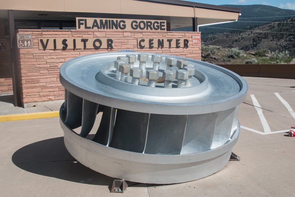
When you notice the name, “Flaming Gorge,” the decision is pretty much made! We’re really glad that we saw that. And also that we decided on three nights!
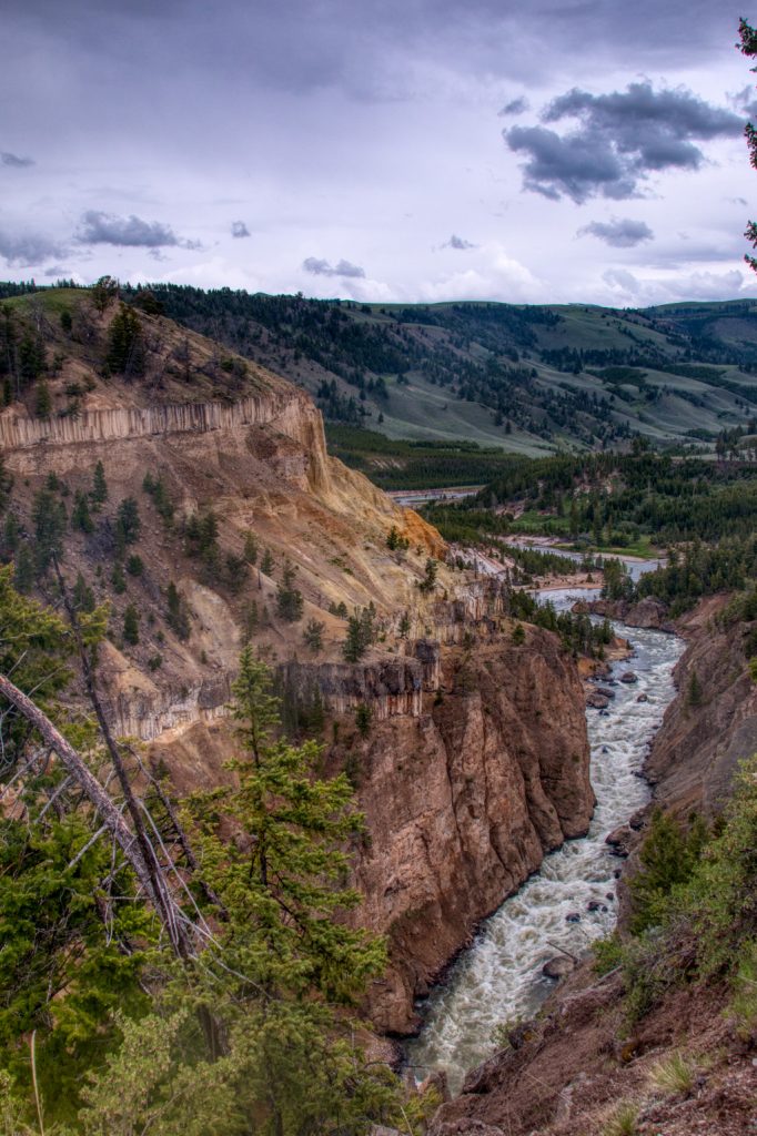
Flaming Gorge

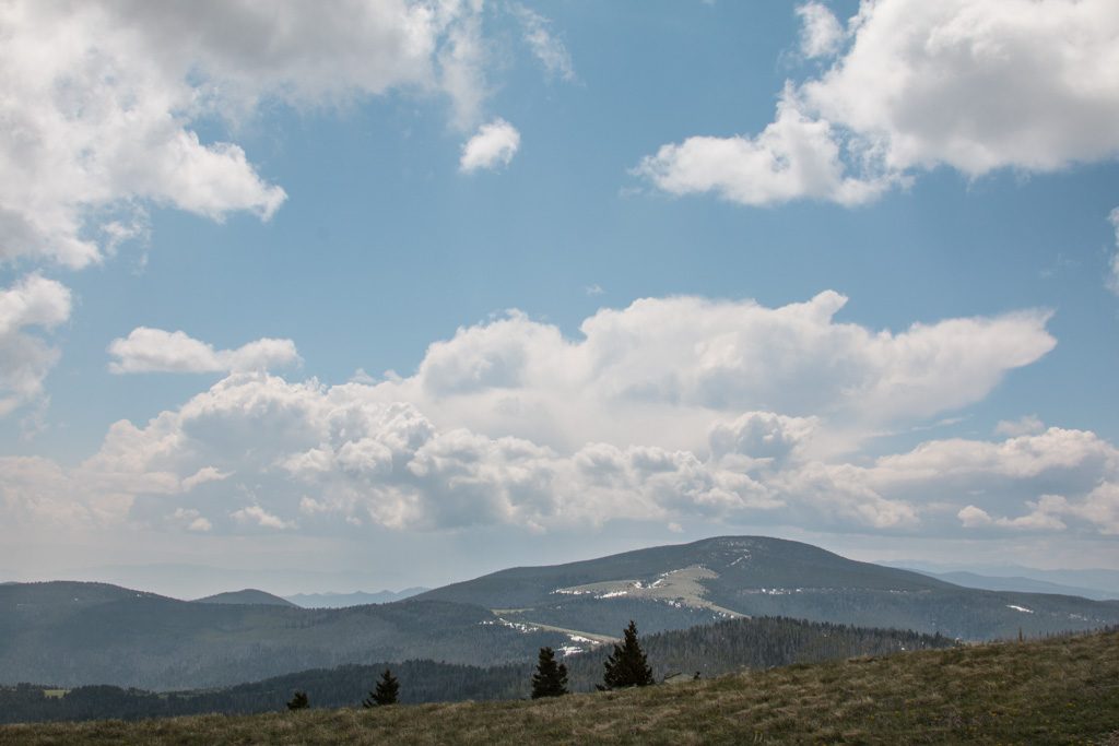
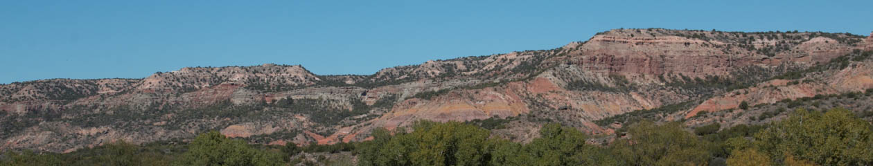
Flaming Gorge was named by John Wesley Powell in 1869 during his exploration of the west. The name stuck. When you see the reds of the surrounding cliffs, you can see why. Flaming Gorge is one of five distinct gorges/canyons in this stretch of the Green River. This pic is actually just before Flaming Gorge, in Red Canyon.

The Green River in Red Canyon, just above Flaming Gorge. Yes, the river really is green.

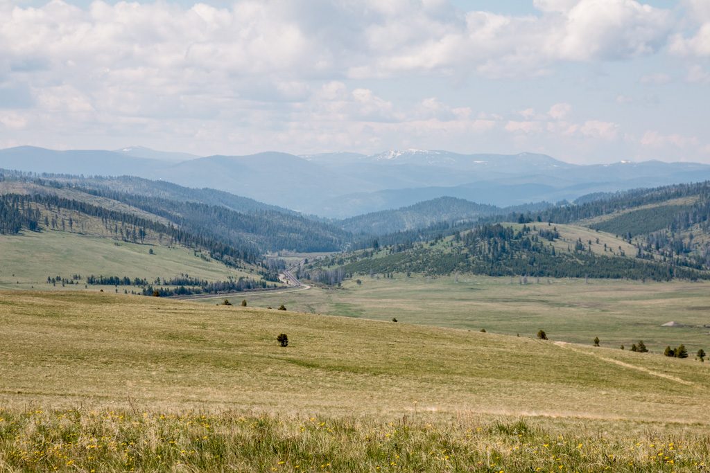
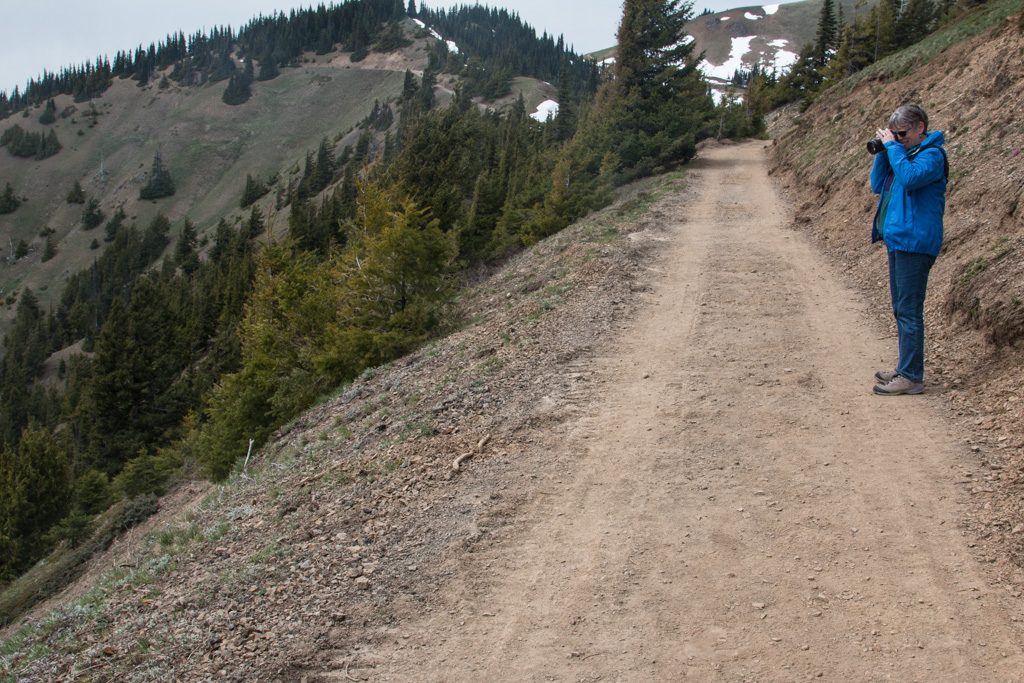
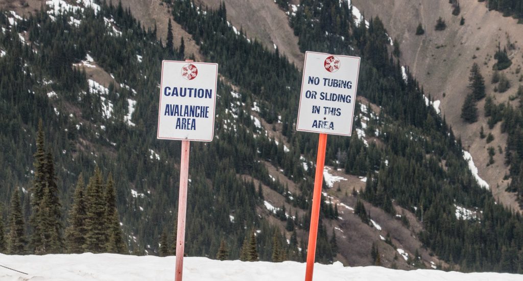
The gorge area is only about 30 miles from our campground, but it is thirty miles of twisting mountain road. I didn’t realize how strong my fear of edges was until I tried to drive on these. Fortunately, Kathe’s shoulder has now healed enough that she was able to resume her driving duties! Phew…

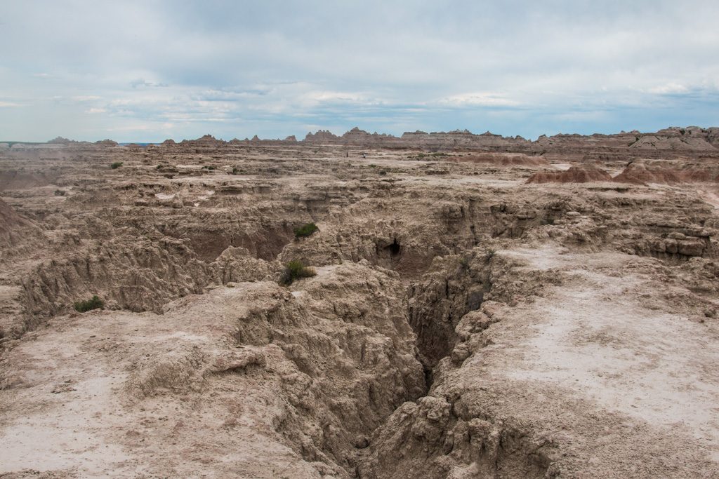
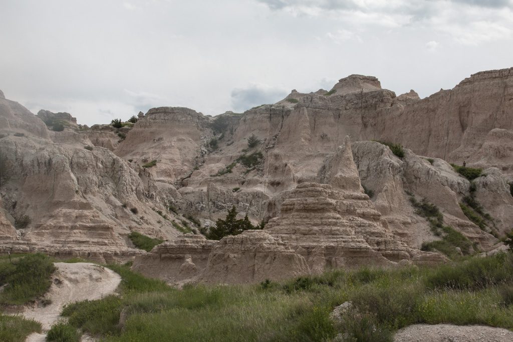
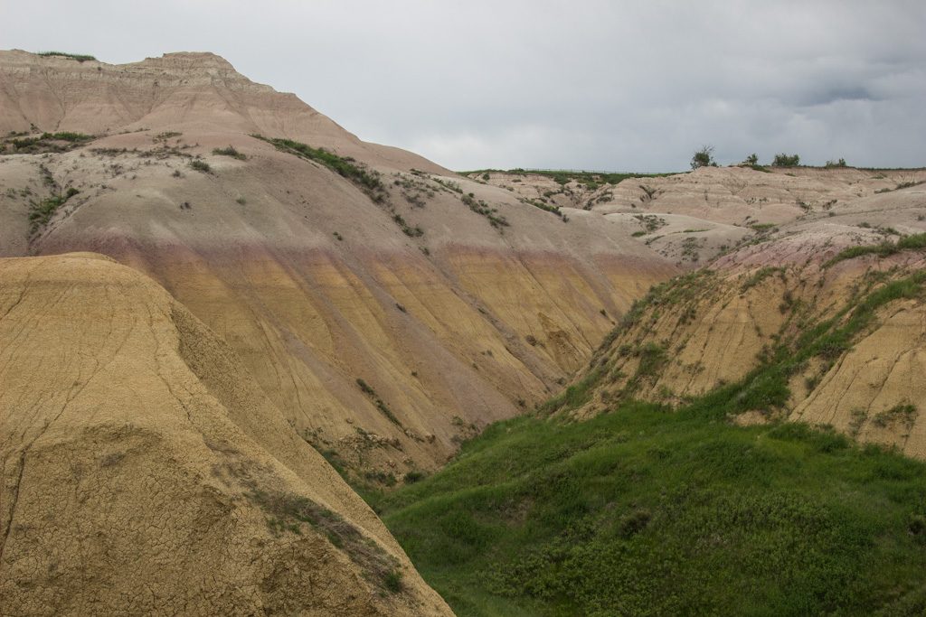
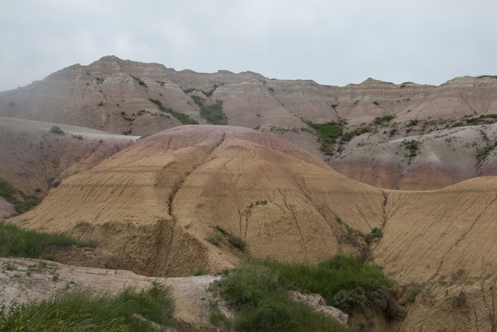
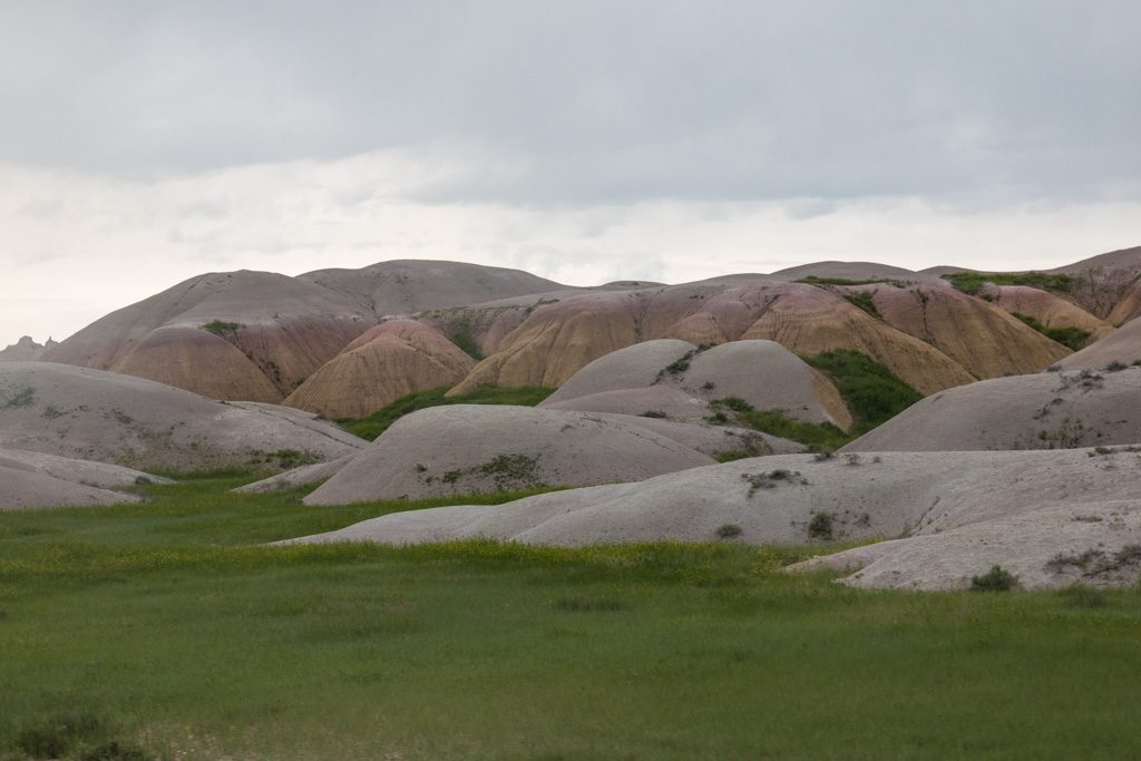
Geology is big here; there are signs along the roadside giving the current rock formation / era, and sayings like, “Dinosaurs roamed here,” or “Ancient seabed, shells and sand dunes.” Because of the erosion over the millennia, we travel backward and forward through the history of the earth as we drive up and down (or actually, down and up) the hillsides.

Sheep Creek Bay Overlook, at the south end of Flaming Gorge. The sun conditions make huge differences in the color of the water. The next day, the water here was gray. Notice the prominent evidence of tectonic activity with the upthrust formations tilting once horizontal sediment beds.

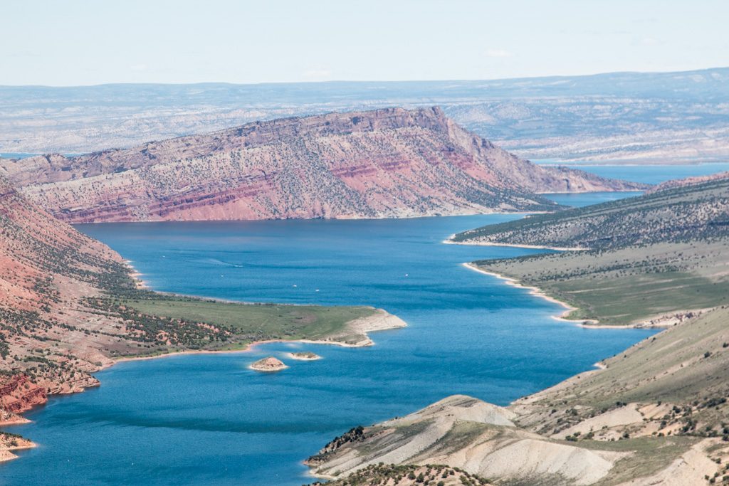
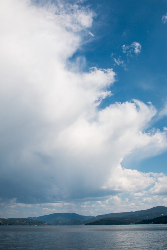
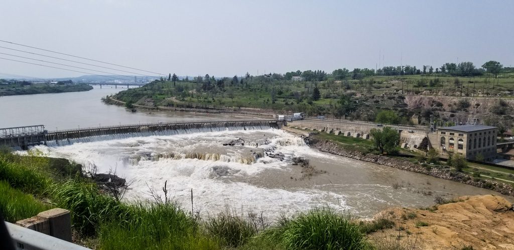
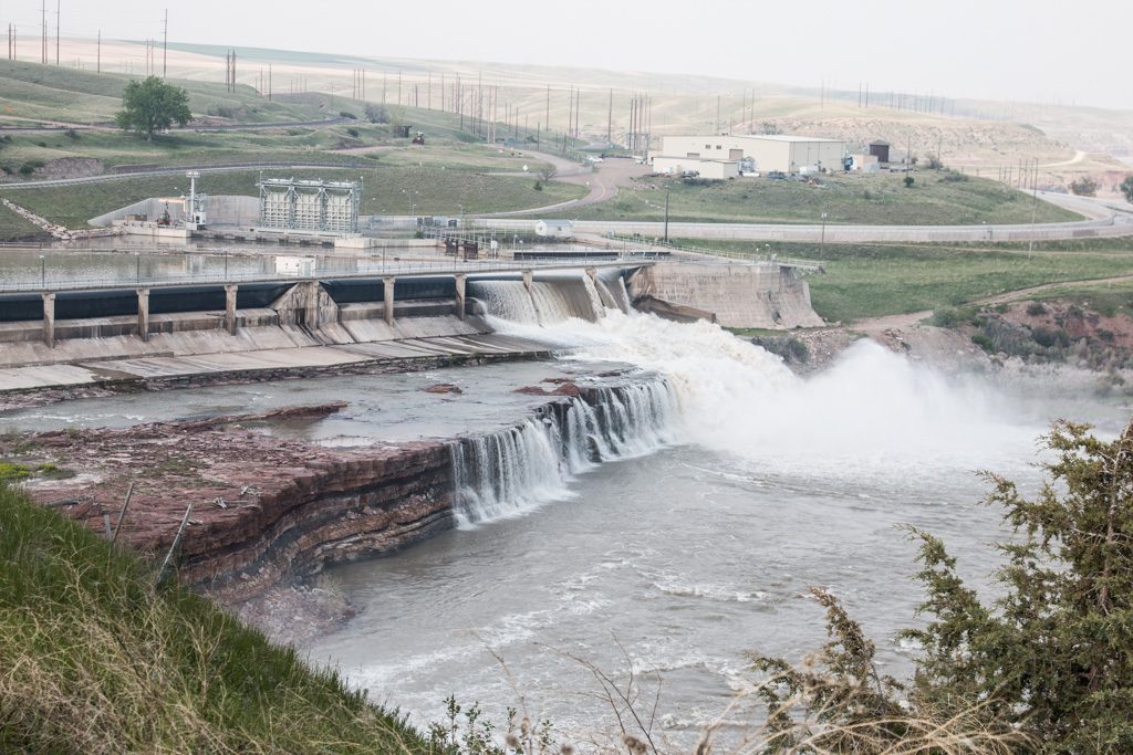
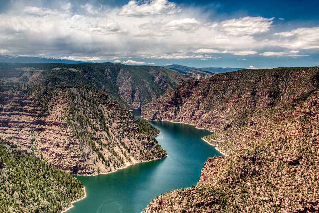
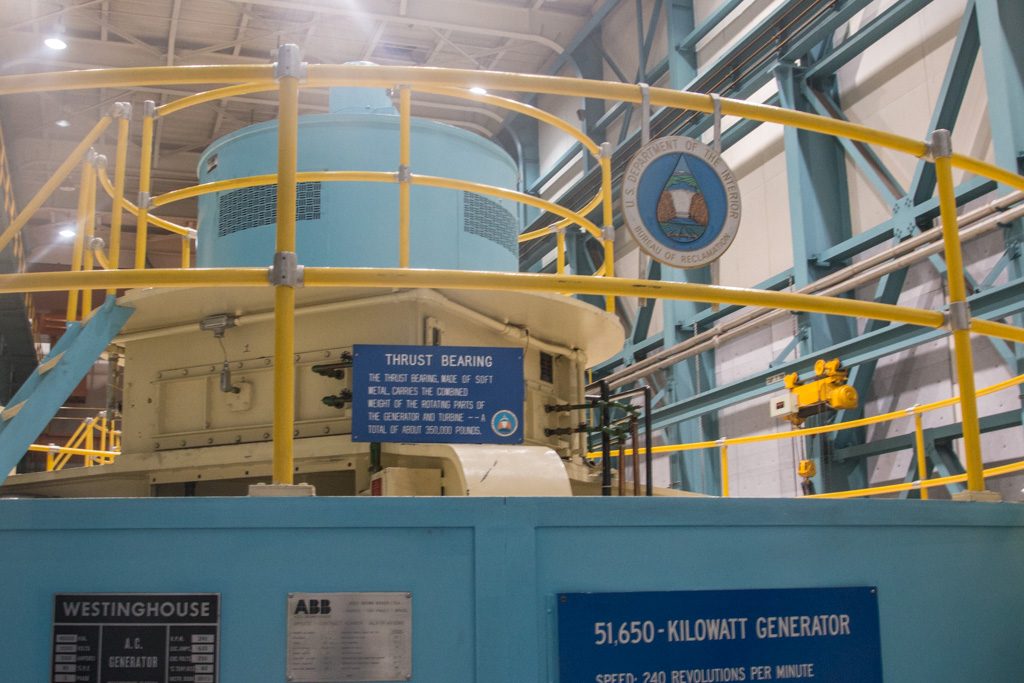
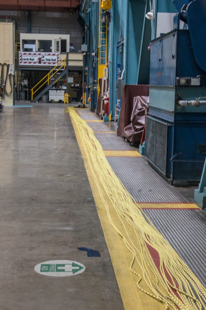
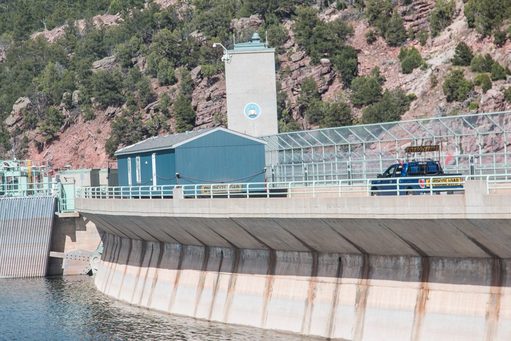
Parts of these gorges have been flooded to create the ninety-one mile long Flaming Gorge Reservoir by damming the Green River, the Colorado’s biggest tributary. We were able to take a tour of the 502′ high Flaming Gorge Dam, going down into the turbine room, and out at the downstream base. Thank goodness for elevators!

Flaming Gorge Dam
One of three turbine-driven generators. Together, the three turbines use 4,000 cubic feet of water per second. The dam can release more water if needed, through bypasses.
One of the turbine wheels that was removed during a retrofit.
I thought we used a lot of climbing rope on the MDI-SAR team! They do inspections by rappelling down the face of the dam. Oh! May I? May I, please? Please?

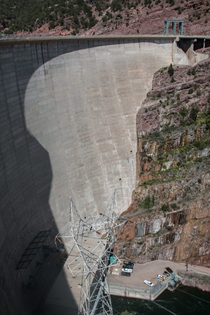
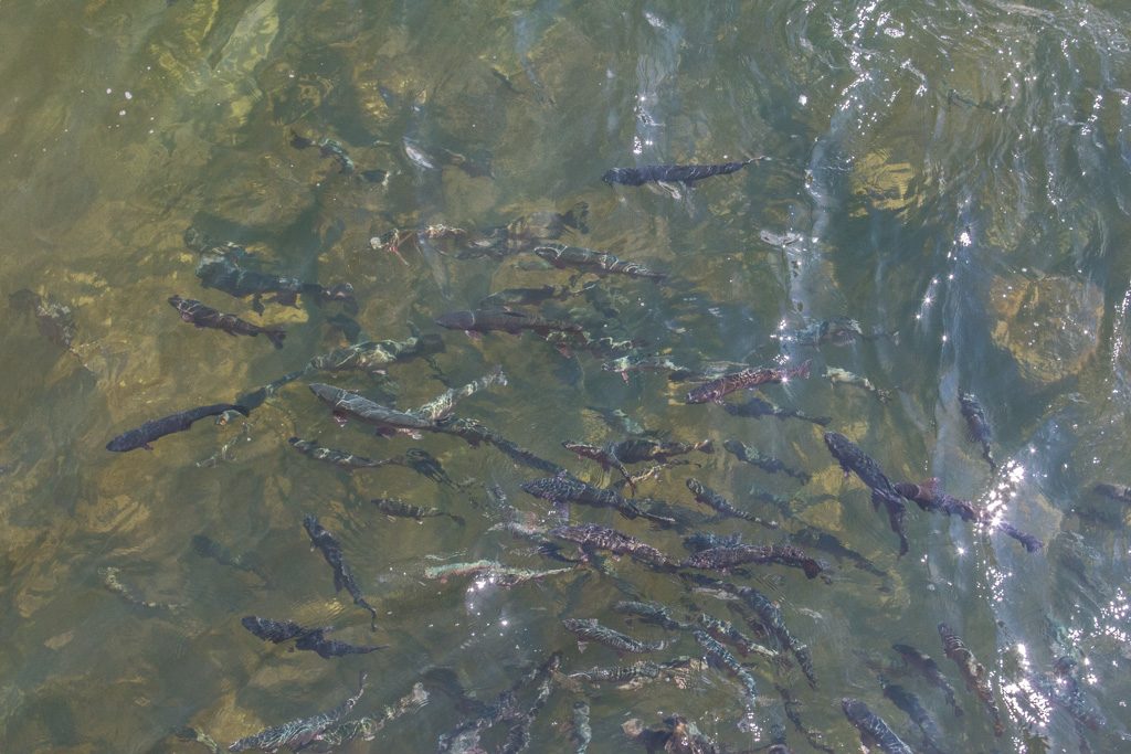
The dam has of course changed the ecology of the river. Some fish previously in the river are gone. But the Green River downstream of the dam is now apparently a world-class trout fishery. There were lots of very large trout swimming in the eddies of the generating plant outlets, but fishing is not allowed in the immediate downstream area.

Are you hungry yet?

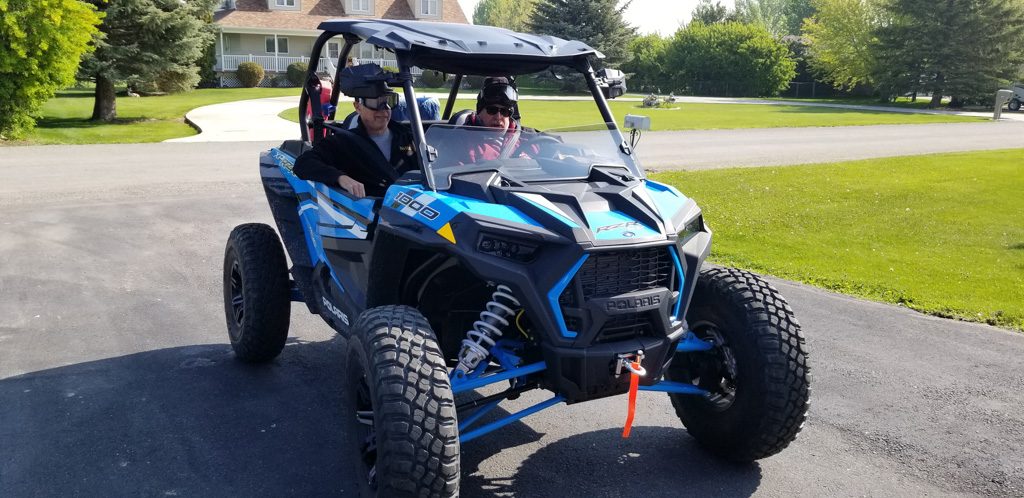
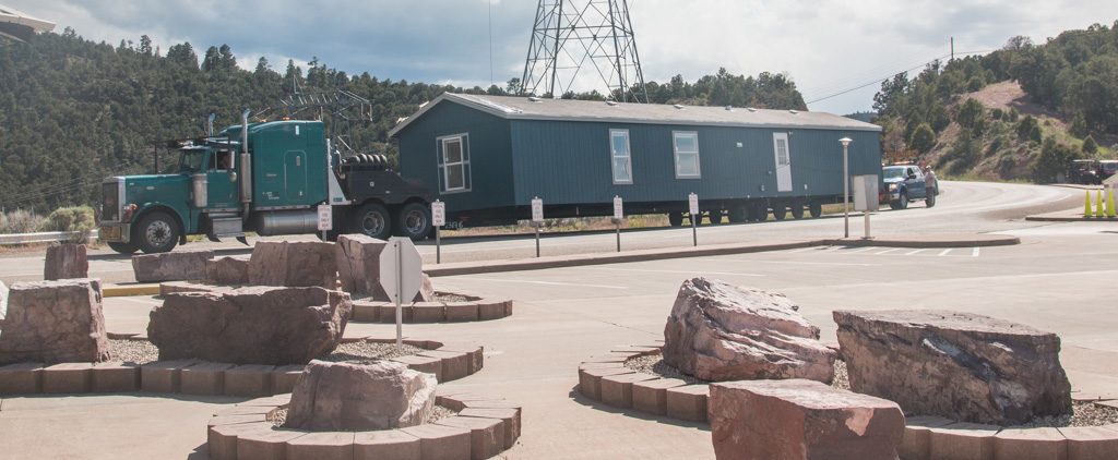
As is frequently the case, the top of the dam is a roadway, usually a two direction road except when something like this is trying to cross!

Yes, it IS an oversize load…
At times, the road over the dam is definitely one way!

Dinosaur National Monument

About an hour and a half away from our campground (again over the mountains) lay Dinosaur National Monument. What kid (of any age) can resist dinosaurs? Sure! Let’s go.

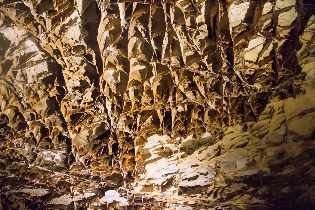
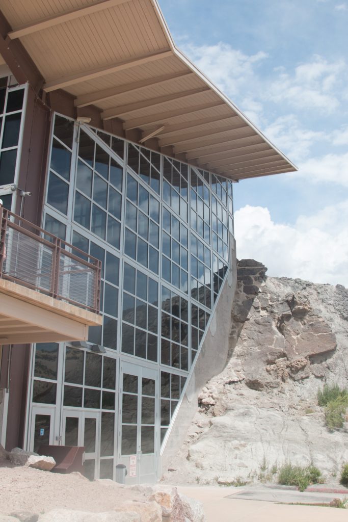
Dinosaur NM is quite large, but its gem is just inside the western (nearest to us!) entrance. The “Quarry Exhibit Hall” is an enclosed cliff face of what was originally the river bed of an ancient river. Approximately 1,500 bones are visible here, from ten different species of dinosaurs. The site is estimated to have been formed about 149 million years ago. It was discovered in 1909 by Earl Douglass of the Carnegie Museum when he found eight tail vertebrae of an Apatosaurus (how can they tell???). Many of the fossils discovered here were shipped to museums around the world, but many remain.

One side of the Quarry Exhibit Hall, showing how it is built right into the cliff face. This is the third such building. It appears robust; time will tell if this is the one that will last!

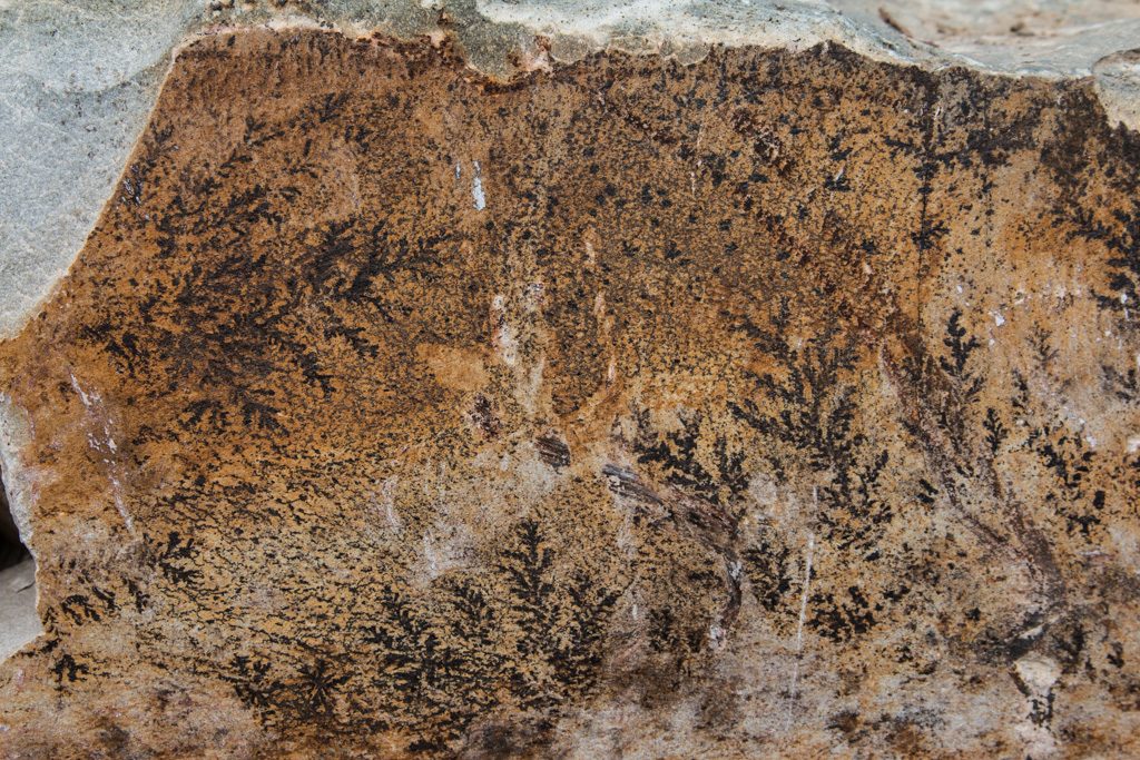
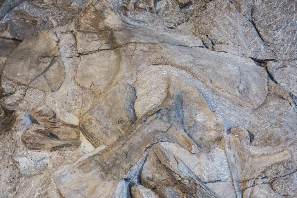
Naturally enough, the cliff face and the fossilized bones are pretty uniform in color. This makes discerning the bones somewhat difficult, especially in pictures.

As taken.

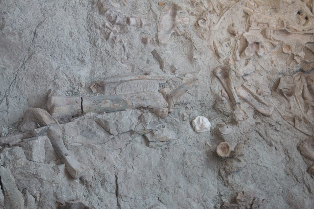
To make it easier to see the bones, I have enhanced the contrast and used edge sharpening in the remainder of these pictures. I should note that the National Park Service does the same thing on its website. (To a greater degree, in my opinion!)

With boosted contrast and sharpening.

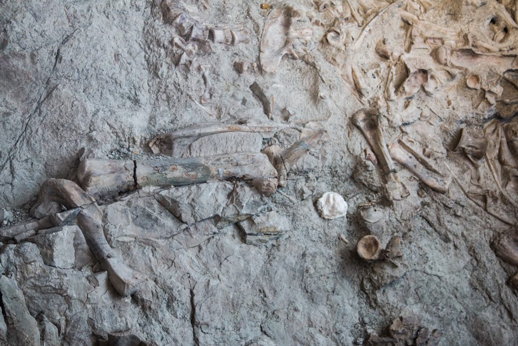
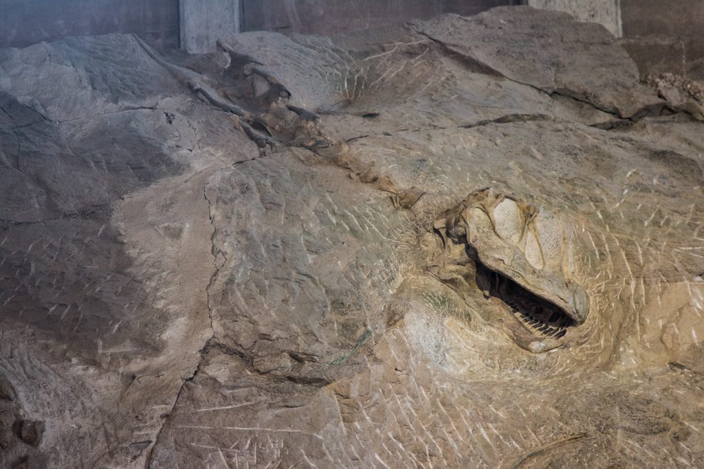
One of the things that makes this site so different is not just the density of preserved bones (which of course are now fossilized, i.e., they are rock, not bone), but also the number of bones that are still articulated—attached to the bones next to them. It is very rare to find skulls still articulated to the cervical vertebrae.

Skull still attached.

Many species died here. In this picture are large bones from two different species. Across the top is an Apatosaurus scapula. Below it, going from lower left toward the upper right is a Diplodocus scapula. And from lower right toward upper left is an Apatosaurus femur.

Scapula, scapula, femur.

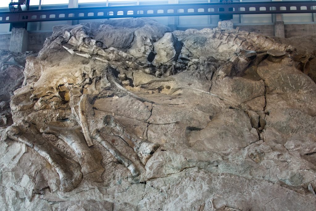
Apparently, mostly complete skeletons are exceedingly rare. The NPS publication describing this part of the wall says, “Articulated Skeleton: Paleontologist’s Dream.” This picture is of a nearly complete Camarasaurus. I couldn’t see all of what they were describing, but then, I’m not a paleontologist!

“Nearly complete.” If you say so!

And if I could be permitted a slight aside here, whatever happened to the dinosaur names that I learned as a kid? My grandkids (and this exhibit) and I speak a completely different “language” of dino names! I want my T-Rex back!

Aside to the aside: I really put that in for a bit of humor, but decided to do a little web searching and came across this. Apparently, Apatosaurus and Brontosaurus (Thunder Lizard) were initially thought to be different species, but soon thereafter they were “determined” to be the same, with the animal identified as Apatosaurus being simply a juvenile Brontosaurus. Since the name Apotosaurus was published first, the name Brontosaurus was dropped from the formal nomenclature in the early 20th century, but not from many museum exhibits, nor from popular use. But wait! There’s more! In 2015, a new study “determined” that they are indeed separate species, and that there may be a third closely related species. So I guess I get my Brontosaurus back.

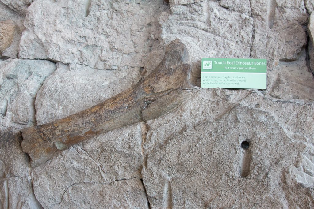
Whatever their names, some of the beasts were BIG! This is a Camarasaurus femur.

Don’t meet this one on a dark night…

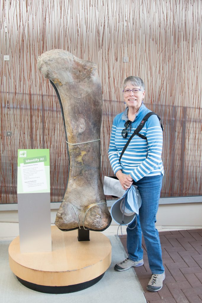
Notice that parts of that femur are dark and shiny. That is from the oil on many people’s hands. Most of the gallery is under a “don’t touch” policy, but in some places the kids (again, of all ages!) are invited to touch.

Please touch me!

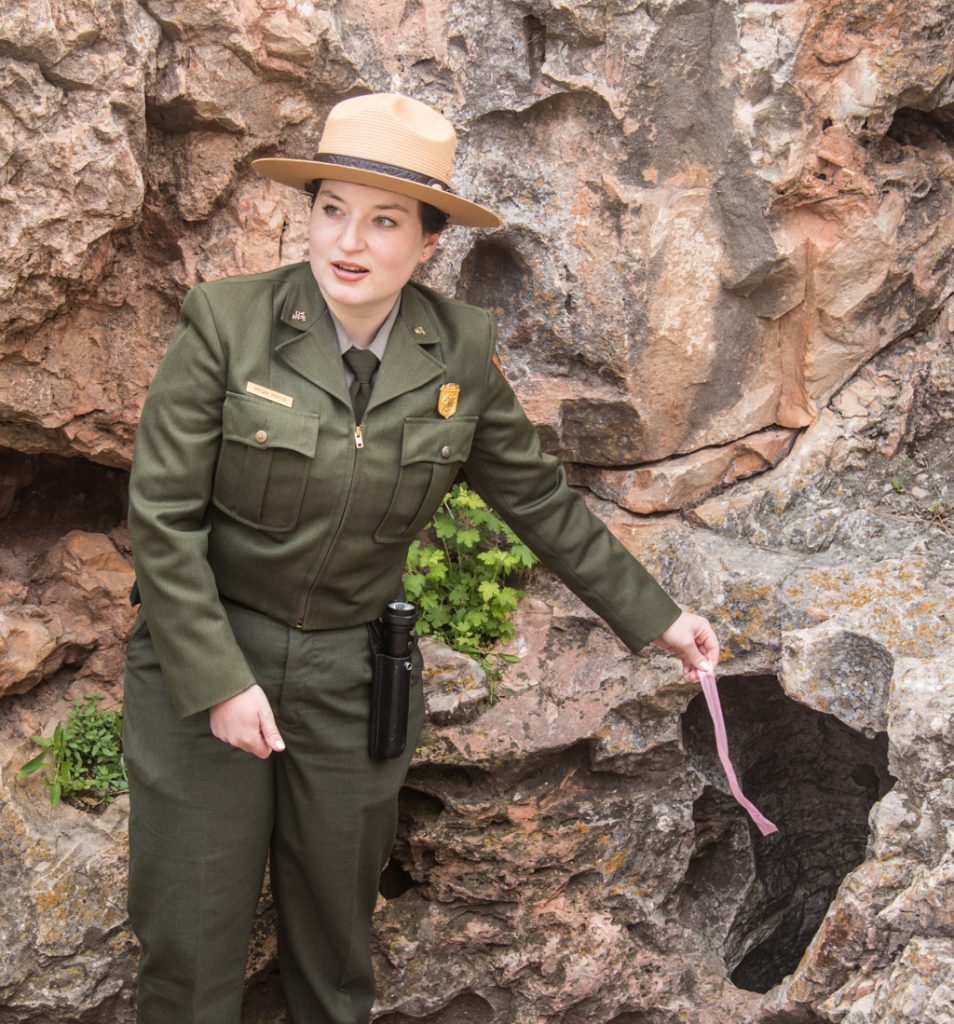
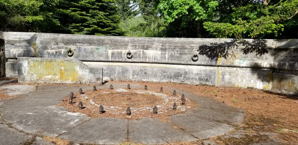
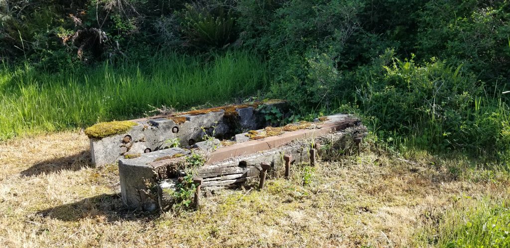
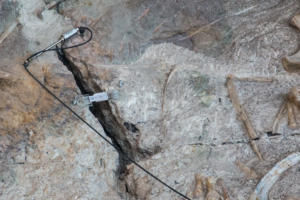
As part of the preservation efforts here, the wall is being monitored for seismic activity. There are strain gauges across many of the cracks, and there are other detectors at several places. I was not able to find a ranger who could identify what those were for.

Monitoring the rock. Notice that one of the bones is broken at a crack.

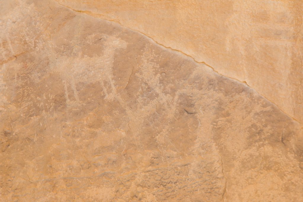
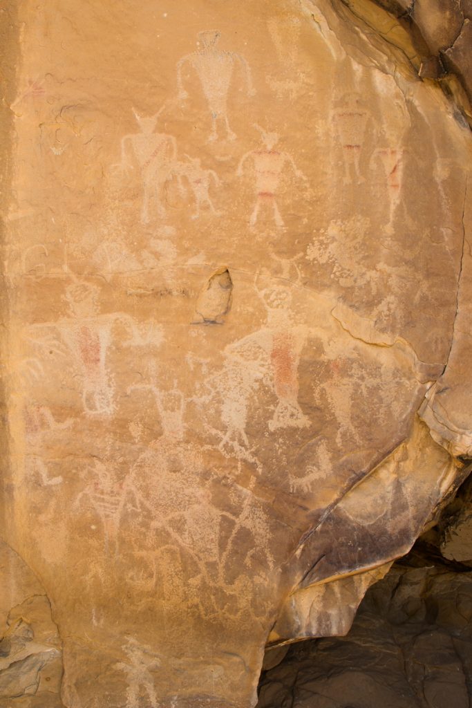
Dinosaur National Monument is big; we only dipped our toes into the water, so to speak. We did go another mile or so in to “Swelter Shelter,” to see some 1,000 year-old pictographs and petroglyphs, created by the Fremont people. I learned the difference here; the terms are not synonyms. A pictograph is created by staining the surface of the stone, usually with red ocher (ochre if you’re a Brit). A petroglyph is formed by chipping or etching the stone. Both are present at this site, but most are petroglyphs.

Combining both forms here. Notice that there is some evidence of ocher staining that remains.
Do these remind you of 1950’s depictions of aliens? Wavy, sinuous arms, tentacles from their heads? Hmmm.

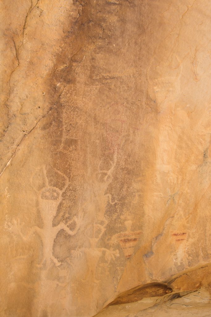
Unfortunately, there were also etchings that were less than 1,000 years old. Why do people feel the need to carve their initials into irreplaceable sites like this?

For an “in between” stop in our adventure, this one had some pretty great stuff! Our countries are so full of fascinating nature, history, and people. We keep marveling!

We are about to join with our two oldest grandkids for several weeks, so get ready for some guest bloggers!

We’ll see you again down the road.

geysers, grizzlies, and guardrails

“All animals in Yellowstone National Park are wild and dangerous!”

“All wildlife is dangerous! Remain at least 25 yards from any animal.  Remain at least 100 yards away from bison and bear.”

“Yellowstone is a Dangerous Place”

These and similar signs are all over Yellowstone.  We need to be wary of all the animals!

Beware dangerous chipmunks! Or is it some kind of western squirrel? He was greatly enjoying a gourmet mushroom he’d found nearby.

We did see quite an array of wildlife in the park, in addition to the chipmunk.  We saw bison, including some close enough to get good pictures of (but far enough to still be safe). We also saw deer, elk, and an osprey.  No bear (of which I’m very glad), and no moose (of which there are very few remaining in the park).

Practicing for rutting season, I guess.
An after dinner drink!
An osprey on the prowl for dinner,
Gotcha! How would you like your trout?

There are many dangerous things in the park, as in most of the National Parks.  Their wildness is what calls many of us to go to them; it is what makes these places special.  Being attacked by wild animals, driving off the edge of a narrow mountain road, or falling into a pool of boiling water are some of the things that can befall a careless or inattentive visitor.

We got a late start on our first day in the park, so we decided to just do the north part of the park (we were staying outside the north entrance). We’d go down the western side through Mammoth Hot Springs, to Norris, across to Canyon, up through Tower, and then back to Mammoth. Here’s a picture of the Yellowstone river near Tower.

Yellowstone River

We had visited Yellowstone eleven years ago after a service trip to Pine Ridge Reservation in South Dakota with our church.  We were in a small rental car and enjoyed driving in the park. The roads on the east side of the park are quite mountainous, twisty and narrow—a challenge! Fun! 

Driving them in a crew cab long bed dually pickup truck (basically, the biggest F350 that Ford makes) is an entirely different experience from driving them in a compact!  White knuckle time. Through a good portion of the park, there were no guardrails. And it was hundreds and hundreds of feet to the ground below. We decided to not go to the Grand Canyon of the Yellowstone and the Lamar Valley because they would have required retracing some of that route.  But those were the only places we had wanted to visit that we missed. If we go back in the future, we may rent a compact car to make touring the park less terrifying!

The geysers and geothermal pools are, of course, Yellowstone’s calling card. The density of these features is unique in the world. They are unquestionably beautiful and awe inspiring, but you need to be careful.  There are boardwalks in many of the dense areas of springs, pools, and geysers, and there are frequent signs warning people to stay on the boardwalks.  The “ground” they traverse is often simply a thin coating over a hot spring, most of which will be fatal if a person becomes immersed.

Travertine and hot pools in the Norris Basin area.

On our previous visit, I watched two men ahead of me on a boardwalk.  They came to one of the “Danger! Hot water. Stay on the boardwalk” signs, and one handed the other his camera, stepped off the boardwalk (right next to the sign), and had his friend take a picture of him and the sign.  As a former boss of mine was fond of saying, “You can’t fix stupid.”  But Darwin clearly missed an opportunity here.

This time, we saw many unattended small children on the boardwalks, some standing on the edge of the boardwalks (there are often no railings), or kneeling at the edge leaning over—presumably, “to get a better view.” As parents, it was very tough to see these situations.

But… these pools and springs are unquestionably beautiful!

Grand Prismatic Spring

The colors of the pools are caused by thermophyllic bacteria, also referred to as “extremophiles.” Different types of bacteria have different colors and live in different water temperature ranges: blue indicates the hottest temperatures, then yellow, then red.

I didn’t get a good picture of it, but the steam drifting above the Grand Prismatic Spring was tinged with the reds and blues of the water.

Quick: what was the Roman Coliseum built out of?  Travertine. Didn’t know that myself until a few hours ago. Travertine is a type of rock made by the evaporation of mineral laden water.  And it is all over Yellowstone, particularly in the Mammoth Hot Springs and Norris Basin areas.

Travertine terraces.
I wish I knew what causes it to form terraces instead of just smooth slopes.

Over time, the travertine will envelop anything it encounters.

Such as this tree…
Or this walkway.

The pools and springs sometimes warn of their danger by continuously steaming. 

Caution: blue indicates the hottest springs and pools.

Others are quiet and appear inviting!

Quiet, but deadly. Notice how thin the crust is!

Geysers are the other thermal features most people associate with Yellowstone. Some are grand, but erupt unpredictably; others are small and erupt frequently. A few are large and predictable. Eruptions can last for a short time, releasing all their pressure quickly, or they can last for hours. We saw quite a few of the small geysers,

Even small geysers can build up a significant cone over time from the dissolved minerals.
Not sure whether this is a small geyser or just a bubbling spring.

And what visit to Yellowstone National Park is complete without watching Old Faithful erupt?

It really is impressive seeing this eruption. Not the biggest in the park, but the biggest we were to see on this trip.

We had the great pleasure of meeting a member of the Mount Desert Island Search and Rescue team who is now a law enforcement ranger at the Old Faithful District. We hadn’t seen each other since last July, and it was very good to see him again!

We finished our trip by hiking to the Morning Glory Pool. When we visited eleven years ago, it was about six weeks earlier in the year than we were here this time. On our previous visit, the Morning Glory area was closed due to grizzly bear activity in the area, feeding on several bison which had not survived the winter.

Morning Glory has a reputation of being one of the prettiest pools in the park and I was really looking forward to finally getting to see it this time. It was pretty, but I was somewhat disappointed.

It is widely reported that Morning Glory has been damaged by visitors throwing coins and trash into it, and the colors are reportedly not as striking as before; some articles refer to the name “Faded Glory,” The park is making efforts to try to repair the damage, but it is unknown whether it will ever be completely restored.

Morning Glory Pool

It was a real treat to be able to explore and enjoy Yellowstone again—it’s a real gem and should be on everyone’s bucket list.

South Dakotans!

Once we decided (months ago now) to give up our ‘sticks and bricks’ home in Maine and continue our nomadic life as full-time RVers, we needed to choose a state to ‘hang our hat.’

Well, we’ve done it. We’re South Dakotans. In March, we registered our truck and trailer in South Dakota; the registration fees there are much lower than in Maine. All that South Dakota requires for registration is a South Dakota mailing address, and since it is quite possible that the trailer and truck will never be in Maine again, there was no point in leaving them registered there. We were able to do the registrations entirely through the mail, which resulted in the following conversation being held several times with campground “neighbors.”

“Where are you from in South Dakota?”

“Never been there!” (OK, Not quite true… but it is a good line. We had been there for a week eleven years ago, on Pine Ridge Reservation.)

But now we have. In order to establish our domicile in South Dakota, we have now obtained our SD drivers’ licenses, and registered to vote.

South Dakota has laws that are written specifically to attract full-time RVers, as do Florida and Texas. To gain resident status—to be able to get a driver’s license and register to vote—you merely have to have proof of spending one night in the state every five years. The reason we chose to cease having Maine as our domicile is because SD has no state income tax, and as noted above, much lower vehicle registration costs. Now we just have to make sure that we don’t stay in any one state for six months or more in any year, or that state could claim us.

“Honey, why did we plan so much time in South Dakota? There isn’t much to do here…”

Yeah. Right…

Mount Rushmore National Monument

Everyone has seen Mount Rushmore, if not in person, then in pictures. So is there anything new to say about it?

It is BIG. Pictures can’t capture the scope of the sculpture. No, not even the ones that we’re including here. The entryway into the park is aligned closely to the direction of Washington’s gaze. But I didn’t realize until we wandered a bit that there are other viewing sites that let you look directly at the other presidents as well. We didn’t find the one to look directly at Lincoln, but we did for Jefferson and Teddy Roosevelt.

There is a “sculptor’s studio,” where they have maintained one of Gutzon Borglum’s scaled down sculptures created in preparation for the real one on the mountain. This study is at a scale of one inch to one foot. The studio allowed us our favorite picture of this visit.

The study and the mountain, from the sculptor’s studio.

Side note: In the early 20th century, Borglum maintained a home and studio in north Stamford, CT, not far from where Kathe grew up!

Crazy Horse Memorial

As we continued to explore the Black Hills of South Dakota, we knew we wanted to stop here. The amazing thing about the Crazy Horse memorial is that it is a work in progress—indeed, it was 1948 when artist Korczak Ziolkowski began to carve this incredibly huge work. The sculpture depicts the Oglala Lakota warrior, Chief Crazy Horse astride his horse and pointing into the distance.

It is HUGE! Larger than Mount Rushmore, the carving, when finished, will be 563 feet tall and 641 feet long. Look carefully.

Chief Crazy Horse Memorial. At the right you can see the etched outline of where the horse’s head will be.

You can actually spot some heavy equipment up at the top (on top of the arm)–we can’t imagine doing that kind of work, can you?

Close(r) up of the arm with equipment

Ziolkowski’s wife and and seven of their children continue to direct the project since his death in the early 80’s. Technology has changed a bit; the use of laser measuring tools and explosives is now in place.

What is particularly impressive about this project is that a lot more is happening at the site than just the sculpture — a new on-site university, an incredible museum, speakers, special programs, and conferences. Everything is supported by private donation and run by a non-profit group. In fact, the US federal government offered to donate 10 million dollars and it was declined. There was concern that the federal government would take over control of (and change) the project.

Wind Cave National Park

Al first learned about this park from a friend on the MDI Search and Rescue team who used to be a ranger there. Wind Cave was designated as a NP in 1903 and was actually the first cave anywhere in the world to be so protected. It is the sixth largest and most dense cave system in the world. To date, 149 miles of passageways have been explored and surveyed—all within ONE square mile. However, they only represent 5% of the total cave system. YIKES!

Wind Cave: only one square mile in area (so far).

There are three major levels. We took a tour in middle level.

No stalagtites or stalagmites here. The rock over the cave isn’t porous.

Frostwork, popcorn (which reminded us of our ceilings in our old home in NH), and boxwork are the three formations found here. In fact, Wind Cave is thought to be the home for 95% of the world’s boxwork.

To form boxwork, the limestone from which the cave is carved fractures twice. The first fractures are filled with water bearing the mineral calcite, which forms a latticework of stone much more erosion resistant than limestone. Later (much later), the limestone is fractured again, this time admitting flowing water. Over millions of years, limestone is eroded away to create the cave, but the stronger calcite remains to create the striking boxwork.

Boxwork in Wind Cave. Although it is resistant to erosion, it is VERY fragile!

Wind Cave is a sacred place for the Lakota People. Their emergence story originates here; they believe the cave is where they left the subterranean world to live on the surface. The NPS has a writeup on their website.

The only known natural entrance to the cave is a small opening (maybe a five year old could squeeze through). The ranger explained that when there is a difference in barometric pressure inside and outside the cave, a wind will blow; sometimes the air is rushing into the cave, sometimes out. She demonstrated with a ribbon.

On this day, the air pressure outside the cave is higher than that within; therefore the wind is blowing into the cave.

Badlands National Park

The native peoples had names for it. The early European trappers and explorers had names for it in their languages. Nobody wanted to travel through it. Today, we call it “the Badlands.”

Who would want to travel across this terrain?

We also call it beautiful! The rawness of nature here is inspiring.

Even in this hostile environment, mother nature surprises us.

Big Horn sheep

We chose to take a trail that was partly on the floor, and partly on a ridge. There was a log and wire ladder to get to the ridge that took some doing—mental and physical.

Can you find Kathe?

Unfortunately, we think that this ladder is what injured Kathe’s shoulder, requiring her to be seen by a doc, and wear a sling for about a week.

We also saw some careless parenting up on the ridge.

Unsupervised. Parents are way back off the left hand side of the picture.

We are about 50 feet off the floor. The wall below the path is sheer. The boy in the white shirt is off the path, standing on a sloping surface covered with loose material. A few seconds after this picture was taken he fell; fortunately he only only slid part way toward the edge. It was absolutely terrifying to watch; we felt completely helpless. A disaster was very narrowly averted. I was getting ready to rush back down to the floor to see whether there would be anything I could do for him.

A few miles northwest from where most of the pictures above were taken, the terrain is quite different, with smoother features and a fascinating coloring.

A different era, different sediment reaching the ocean floor. Different colors.

There was so much to see in the Badlands. As always, click on any Badlands picture in the gallery below to see them all as a slideshow.

As we noted above, pictures cannot truly represent what we’re seeing. We wish you could be with us to share the real experience, but for now these pics will have to do. We really enjoyed taking this first exploration of our new state. We’ll be back!

Big Country, Great friends

Traveling full-time in an RV can make it challenging to keep in touch with friends. Thank goodness for the internet — email, Facetime, Facebook, Messenger, and this blog have helped to bridge the gap.

Traveling in an RV can also make it possible to reacquaint ourselves with friends from 50 years ago (Barbie and Jeff in D.C.!), to visit with Maine snowbirds in their away-from-Maine homes, and to make and foster NEW friendships along the way.

A dear friend who splits her time between Maine and Idaho caught up with me on Facebook and asked if we could get together when we came through her area. Jean suggested that we meet in the beautiful city of Couer d’Alene to have lunch and then take a boat ride on the lake. She brought along her daughter, one of her sons, and her granddaughter (all of whom I’d heard so much about). We had a ball! This part of the country is simply magnificent — we managed a short hike before lunch and even biked 10 miles on the famed Couer d’Alene Bike Trail after dinner. So good to see you, Jean! See you in Maine this summer. 🙂

Coeur d’Alene has lots of public art around the downtown area.
Can anyone name this mouse and moose from a children’s book? There are five of these in the area, forming a trail for kids to explore!
Just like on MDI, there are “small” vacation homes on Lake Coeur d’Alene.

While on the Arizona desert, we made friends with several couples. Lydia (a fellow Quartzsite Quilter) and Tom spend their non-desert time in their home in Helena, Montana. They were kind enough to invite to “mooch-camp” in their yard (we hooked up to their water but used our solar power) and it was terrific! We got to know them so much better—they were amazingly generous and couldn’t wait to share their beautiful part of the Big Sky world with us!

Montana lives up to its nickname, “Big Sky Country.”

Tom took Al on an 80+ mile ride up into the mountains on his flashy new Razr (4-wheeler). What a ball they had! Even though it was early May, there was still plenty of snow up in them thar hills and that determined the length of their ride. I’m quite sure that Al and Tom will find plenty of places to explore this winter when Lydia and I are at quilting club.

Al and Tom ready to go. In Montana (and Arizona), vehicles like this can be street legal, so we just rode from Tom’s driveway!

(Al) We rode up to the continental divide. Beside the amazing views, it is quite something to realize that all the rain falling on one side goes to the Pacific, and on the other side it flows to the Caribbean and Atlantic.

Onward to the Pacific.
End of the ride, at least for today. We didn’t want to get stuck in the snow!

Lydia and I had quite an adventure ourselves! Lydia couldn’t wait to show me several of her favorite quilt shops. Even though Helena is the state capital, it’s not a terribly large city. It supports a number of successful quilt shops which I found amazing.

As we drive/ride outside of the Northeast, we are struck by the speed limits. 80 mph is the posted limit in so many places! It’s not at all unusual to be able to see 40 or 50 miles ahead—little dots in front of the huge mountains turn out to be farms. Traveling 80+ miles to go out for dinner isn’t a big deal to those in Big Sky territory. Think about it: in the same time it would take us to drive back and forth between Bass Harbor and Bar Harbor, we could be nearly 80 miles away. But we don’t. When we’re pulling Rhett, we don’t go faster than 60.

I can see for miles and miles and miles and …. (The Doors)

We learned that the Missouri River headwaters are in Montana! The river actually begins at the confluence of the Madison, Jefferson, and Gallatin Rivers near Three Forks, Montana. We followed miles and miles of the Missouri and it was breathtaking: huge, still a bit brown with snowmelt and erosion, and marked with a number of beautiful falls where water flow is managed and electric power is generated.

Just past Great Falls, we stopped at the very impressive Lewis and Clark Interpretive Center. We spent a thorough two hours learning so much more about the incredible adventurers who answered President Jefferson’s charge to check out what the U.S. had just “purchased” or was it “acquired”? This was one of many, many times on this trip where we were reminded of the very complicated relationship between the Native Americans and the white man. It took us right back to our church’s mission trip to the Pine Ridge Reservation in South Dakota some twelve years ago. It still hurts.

Tom and Lydia showed us a terrific time and we’re already talking about the next time. They say we’ve barely scratched the surface!

Our friends and hosts: Lydia and Tom.

We are LOVING the West—South Dakota and Yellowstone NP blog entries will come in short succession here. We’re trying to catch up at a time when the driving distances can be long and we’re spending most of our time away from our computers enjoying all that’s here to see and explore.

Olympic Peninsula

We had the good fortune to spend a week on Washington’s Olympic Peninsula. We visited four major areas on the peninsula, each one very different.

Sol Duc

We started out by camping in Sol Duc (Sole Duck), deep in Olympic National Park. The campground was run by the concessionaire, and was part of the Sol Duc Resort. We sort of lucked into this one via Sir Google; there are actually two campgrounds in Sol Duc that take RVs. The other one was heavily wooded and we would probably not have been successful getting Scarlet and Rhett in there. The one we had was small (about 15 sites), but wide open. The site was nestled in a grove of birch trees.

Beautiful in the morning

It was also a short walk to one of Sol Duc’s main attractions: thermal springs! We spent quite a bit of time soaking… The spring water is 150°, and is mixed with the river water to the desired temp for each of three pools. The hot one was hot enough that even I couldn’t stay in it for more than about 10 minutes—and I love hot baths! Just like in the Three Bears, the middle one (temperature) was just right.

Ummm. Sorry. No pictures; we were too busy relaxing!

You may have heard that the Pacific Northwest (PNW) gets a LOT of rain. There are several rainforests within the park. We were not in one, but looking around at the trees it sure looked like it. The older trees were covered in moss!

There are several trails leading out of the Sol Duc campgrounds; we encountered some deer browsing just off one of the trails.

Only about 15 feet off the trail.

We followed one of the trails out to the Sol Duc waterfall.

It is hard to comprehend the amount of water that cascades through these falls every day.

On the way back home (yes, the trailer really is “home”) we found another waterfall, albeit not quite as large.

A pretty, small stream, part way up a hill from the trail.

Sol Duc is completely surrounded by mountains. Nice scenery! Lousy connectivity! For the first time ever, we had to send a text message out through the Garmin Inreach satellite communicator that we carry for back country emergencies. (It wasn’t an emergency…)

Crescent Beach

Sol Duc is southwest of Port Angeles, which seems to be the major town on the Strait of Juan de Fuca, the northern boundary of the Olympic Peninsula. Crescent Beach is a little west of Port Angeles, but is on the shore of the Strait.

Being here made us appreciate Oregon’s beach access law. Directly across the road from the campground was “their” beach, but “don’t go past the rainbow pole! That’s not our beach and you’ll be trespassing.”

In the distance (right side) is Vancouver Island, Canada!

About 1/2 way toward the trees in the distance, the beach belongs to someone else, and campers can’t go there. Sigh.

A state park, at the other end of the beach… and people in the park can’t go onto the campground’s beach, either.

Nevertheless, it was a beautiful setting and we enjoyed strolling on the sand.

Can you find Kathe? What’s she looking for?

Kathe normally beachcombs for sea glass, but we haven’t been successful finding any in the PNW. Here she was looking for…

Sand dollars!

We had a visitor.

But what are all those dark spots on the beach? Something is living in the sand (clams?). It leaves two kinds of markings.

Tracks from the creature from the deep!
They can be quite complex.
Piles of sand, expelled from below. These are all over the beach, and are those dark markings in the previous picture.

Please leave a comment if you know what animal is creating these tracks and the… what shall I call them?

Sometimes I wonder about the people who lay out campgrounds. Who would think that putting the sewer connection at the highest point in the site would be a good idea? Remember: it flows downhill!

Hurricane Ridge

Crescent Beach isn’t part of Olympic National Park, but we went back into the park to visit Hurricane Ridge on the recommendation of a friend who is a former park ranger there. So, so, so glad!

Also we were so glad that we didn’t have our trailer hooked up to our truck for this one! The road up the ridge is steep and twisty. But the views are worth it. Down at sea level the skies were gray and cloudy, so we almost didn’t go. (Note to self as a future reminder… Always go!) Up top? Take a look!

Kathe getting pix of the horizon.
Yes, it was worth …
… the drive up the ridge.

Despite the name, the weather was quite mild with calm winds. We enjoyed our hike to the end of the currently open trail. The remaining trail to the peak of Hurricane Hill was still closed due to snow.

And there was still lots of snow on the ridge. Some people like to fight with Darwin’s attempts to clean the gene pool. The pictures below are at the top of a very steep slope down into the valley.

Stating the obvious: “Caution. The contents of this coffee cup may be hot.”
Close up of the signs.

They are doing a lot of work on the trail up to Hurricane Mountain. It seems like they are widening it, and are using a lot of large rocks along the up-slope edge of the trail. I was quite surprised to see what appear to be ferns on this rock. I don’t know whether they are fossilized in the rocks, or somehow imprinted on the rock after it was split. I suspect the latter, but…

Images of fern leaves on the rock.

Fort Worden State Park

Unexpectedly, Fort Worden turned out to be the highlight of our time on the peninsula. Located on the northeast corner of the peninsula, with the Strait of Juan de Fuca to the north and west, and Puget Sound to the east and south, it was the main one of three forts that guarded Puget Sound Naval Shipyard in Bremerton, and Seattle. The driving force for the creation of the fort was the shipyard, not the city! Fort Worden was built between 1898 and 1917 in the second wave of the Endicott Board forts; the first wave (of which Fort Stevens was part) was built before the establishment of the shipyard when defense of the Sound was not deemed critical. The fort was activated with the arrival of the first troops in 1902, and served in both World Wars I and II. The gun emplacements were never used; the guns were removed in WWI, for use in Europe. The primary use for the fort after that was training.

Reduce, reuse, recycle! Fort Worden is a poster child for reuse. Decommissioned by the Army in 1953, it was purchased by the State of Washington in 1957 to become “Fort Worden Juvenile Diagnostic and Treatment Center,” for troubled youth. This center closed in 1971, and in 1973, Washington re-created it as the current state park. For a more detailed history of this fascinating fort, read Fort Worden: Rebirth Through Decay, by Peter St. George.

What makes Fort Worden special, compared, for instance, to Fort Stevens, is that a large number of its original buildings are intact. Most other forts of this era have had their (mostly wooden) structures torn down leaving only the foundations.

A Public Development Authority (PDA) was created by the city of PortTownsend, WA, to

“help renovate and fill the 70-plus historic buildings on Fort Worden’s campus, expand the number and types of partners and programming at the fort, and create an outstanding hospitality experience for guests.”

The state still owns the property; the PDA has a 99 year lease on the buildings. The PDA is renovating the existing buildings to enable other uses. The base hospital is now a remote campus for Goddard College. Local businesses at the fort include two publishing / printing companies, a yoga studio, a massage therapist, the Port Townsend School of the Arts, and Centrum Arts Foundation. There are concert series, with some of the larger concerts held in the WWI-era balloon hangar!

The officers’ and NCOs’ residences and a dormitory are being refurbished and furnished with antique period furniture. These are available for rental, from 30 beds down to three or four. Apparently many family reunions and some weddings book there. We were taken on a tour by one of the PDA board members! We were so gobsmacked by what we were walking through that we forgot to take any pictures. (Us? Forget pictures???) But you can see some of the refurbished officer’s houses and other residences on the PDA’s website. (You can also reserve time in them on those pages, if you will be in the PNW.)

Finally, not all of the buildings remain. There are foundations here too, all that is left of some of the quarters. The PDA is in the process of building new structures there, within the original building footprints.

The state park also includes the remains of the gun emplacements, in pretty much the same state as those we found in Fort Stevens. However, we found some types that we didn’t see in Oregon.

Mounting for a five inch gun. Much lighter construction than for the ten inch rifles used in both forts.
Mount for a three inch anti-aircraft gun.

The fort was constructed by the Army Corps of Engineers. Being engineers, they were very detailed. Being the Army, meticulous records were kept. Here are some pictures of the plan for the three inch anti-aircraft gun mounts pictured above.

Diagram of this battery of anti-aircraft guns. (Can you find Kathe?)
Closeup showing measurements.

North 317.39 feet, East 231.25 feet. But from where? The entire fort was laid out from a single benchmark, which still exists.

The benchmark is the brass point on the side of this block. Note the engraved, “B.M.”

The trees have grown in the many years since the fort was active, but in some places you can still see what the soldiers would have seen.

Looking east across Puget Sound, to Whidbey Island. Taken from the roof of one of the ten inch batteries.

In other areas, you can’t.

Looking out from an observation bunker.

We’re now over 20,000 miles into our adventure, and are still having a great time.

Loving our new life—and each other!