Oregon Coast

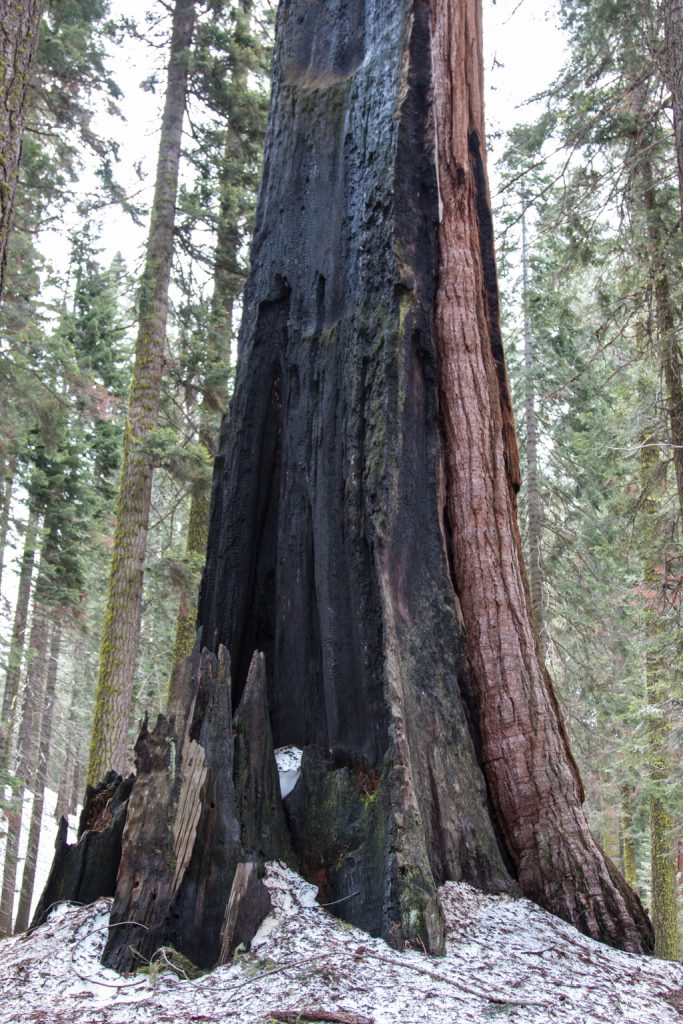
From Sequoia National Park, we boogied pretty quickly up to the Oregon coast. We wanted to encapsulate this part of the adventure into one post rather than sending several with only a day or two apart, so it is a bit long. Go get a cup of tea or other beverage of your choice.

Here’s what I really wanted the title of this post to be, but it is (way) too long!

The Oregon Coast: Waves, Windy, Winding Roads, Weed…

Let’s get the “Weed” out of the way. Oregon was the first state to decriminalize marijuana possession in 1973, although it didn’t legalize recreational marijuana until 2014—two years after Colorado and California. There are “Cannabis Dispensaries,” “Bud Barns,” and “Pot Shops” everywhere you look. It seems every small town has one or two. No, we didn’t partake.

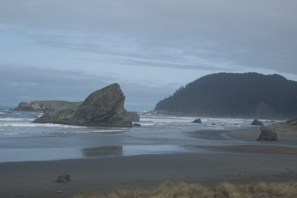
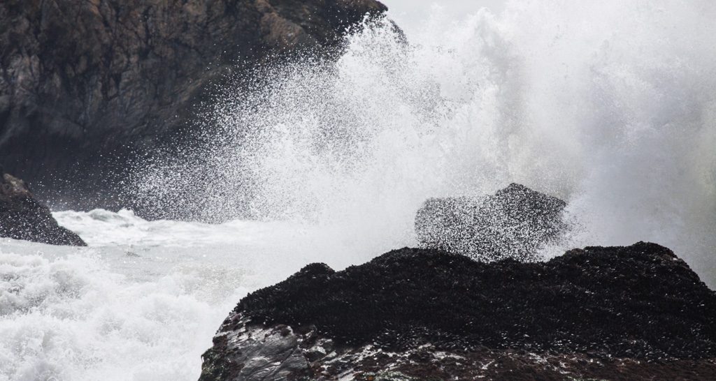
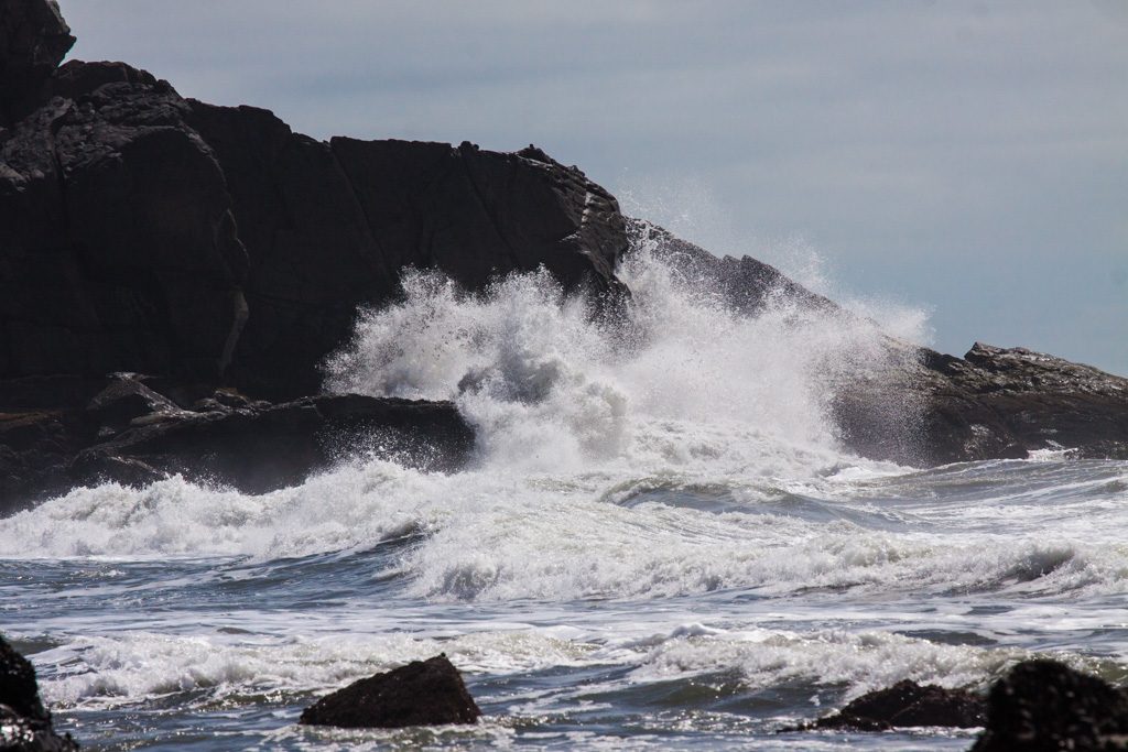
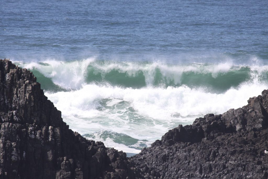
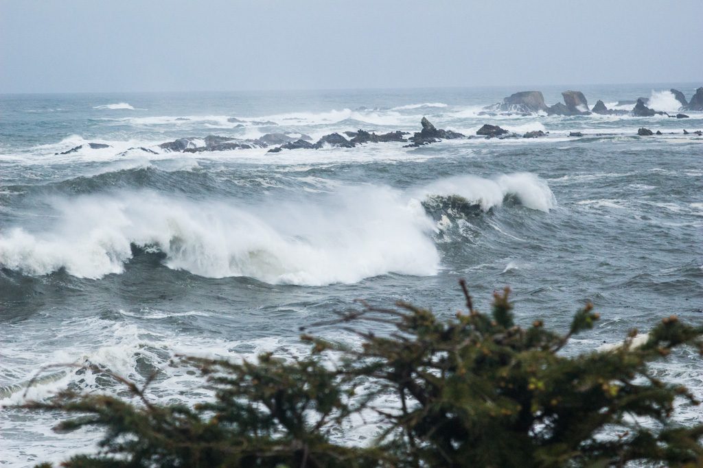
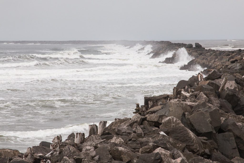
The Oregon coast is amazingly beautiful. We went up US 101, which runs near the coast—at times, right along it. There are many sea stacks (very large rocks out in the water), which together with frequent cliffs on the shoreline make excellent targets for the waves to crash against. It is frequently very foggy!

Sea stack through the fog
Waves crashing… minute after minute, hour after hour, year after year.

In the sections below, you can paste the latitude and longitude into Google maps to see where we camped…

Gold Beach: 42.536509 -124.396648

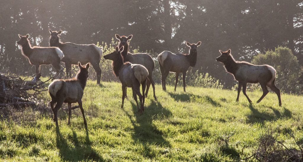
We had been advised to check out the area around Gold Beach by many people. We found Honey Bear RV Resort and Campgrounds a little north of there. As we drove in the campgrounds’s driveway, I noticed two small elk in a field. Cool! We decided to have dinner in the campground’s restaurant (is that what makes it qualify as a “resort?” I still don’t understand the distinctions…), and I was carrying my camera with me as I often do in new places. A man came up to us, and asked if we’d like to get some pictures of elk. Of course! Our order had just gone into the kitchen so we had some time.

We followed the man out of the restaurant, down the road a bit, and then he turned and said, “I normally don’t let campers in here, but this is the best place to get elk pictures.” He was the campground owner!

Part of the campground’s herd… wild elk that happen to graze here.

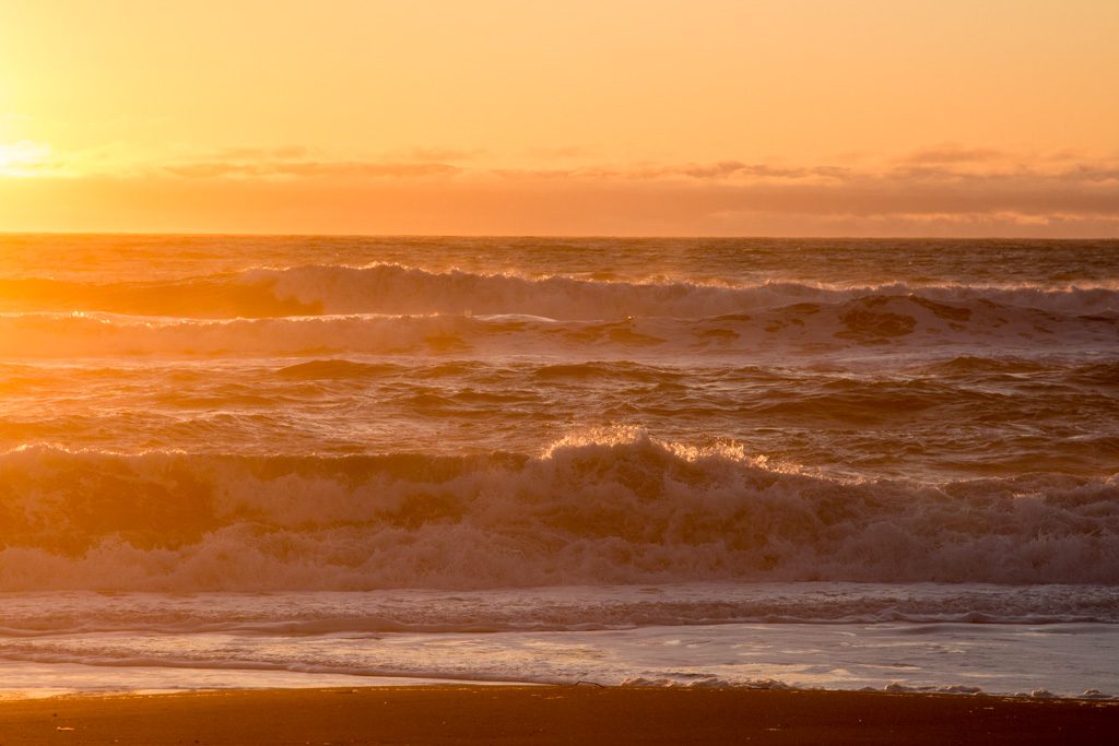
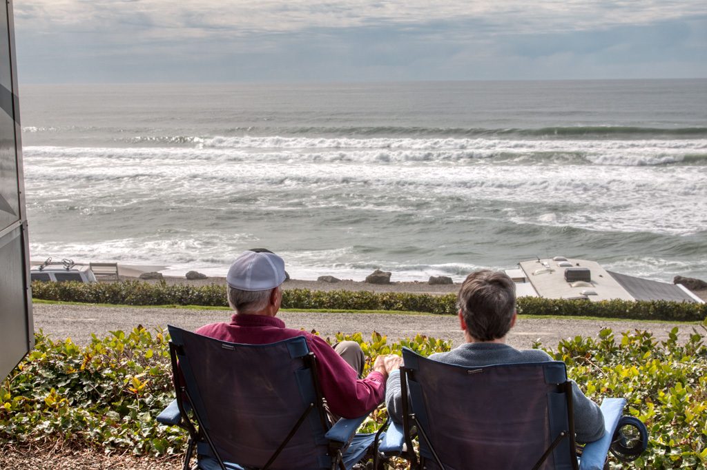
Kathe and I walked down to the beach just before sunset. Our first night on the coast…

Sunset over the ocean. A Pacific Ocean treat.

Gold Beach is just past the north end of the Samuel H. Boardman State Scenic Corridor. Coming north from California, we had decided that we would drive past the sights to get to the campground, and then return south without the trailer on our first day at Honey Bear to see all (OK, “some of”) the scenic pull outs the state has marked. We had divided the coast roughly into fourths, with the idea that we’d day trip up and down the coast from our campsites in order to see the sights. Rocks and water! The same draw that made us love Acadia so much.

Aside… Oregon has a crazy number of State Parks—255, to be exact. Incredibly, 93 of those state parks are along the coast! Granted, many of are very small with some being little more than a parking lot for beach or view access. But fifty seven of them have campgrounds, and we made use of two of them.

The Oregon Beach Bill was signed into law in 1967 and
established a permanent public easement for access and recreation along the ocean shore seaward of the existing line of vegetation, regardless of ownership. A policy soon followed that provided for public access to the 362 miles of beach at regular intervals.

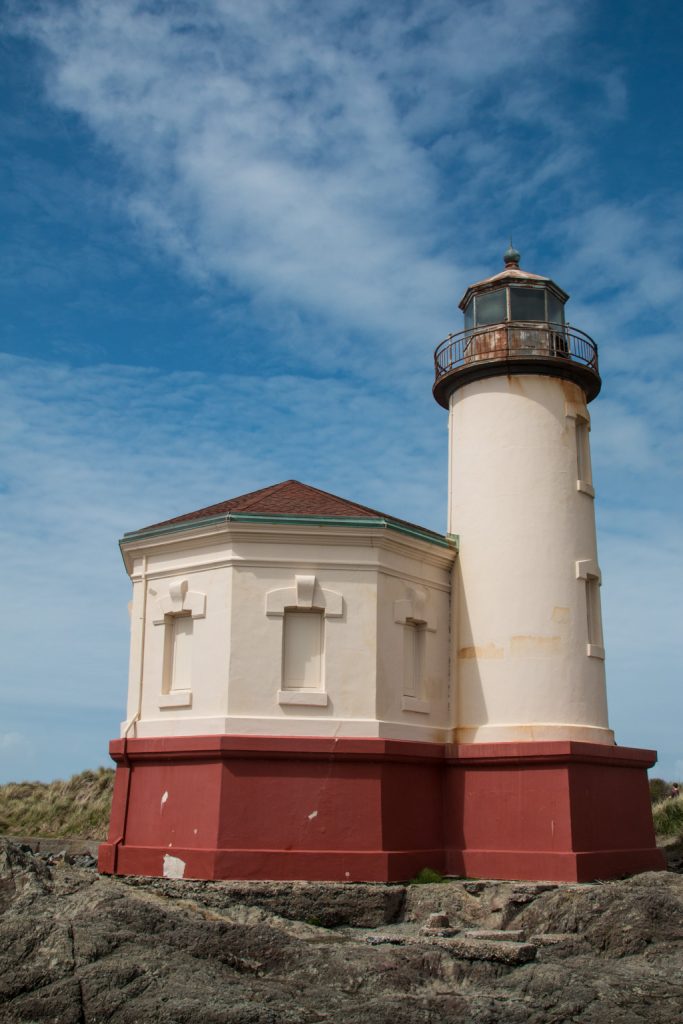
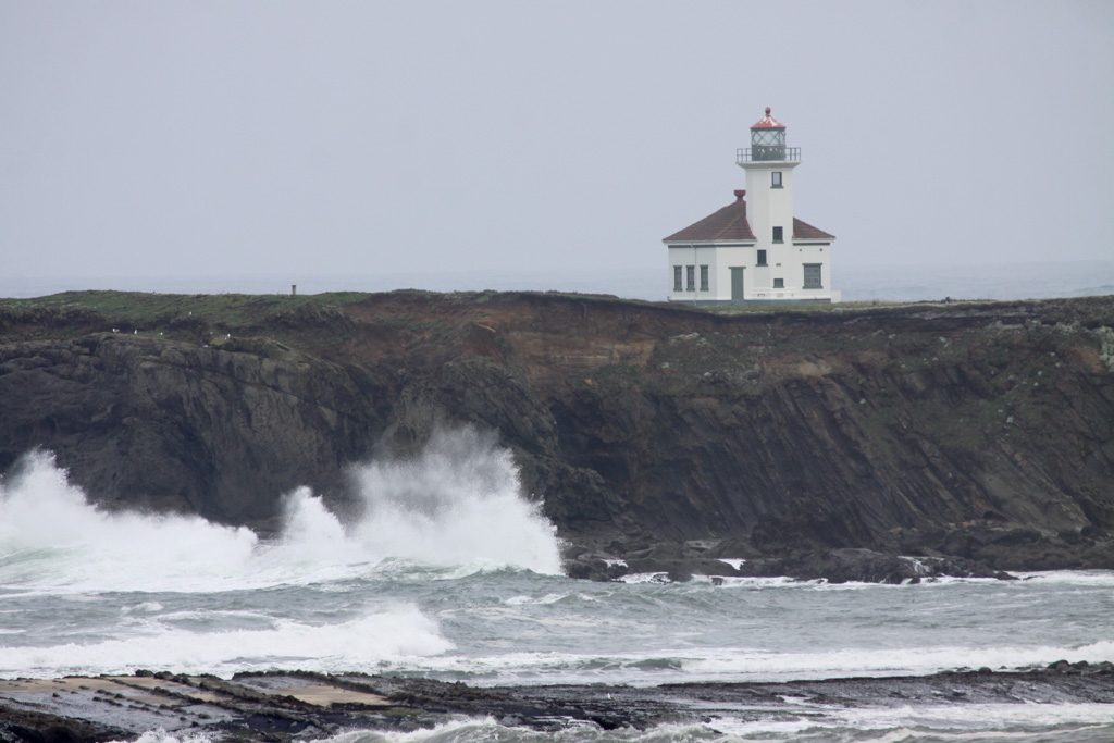
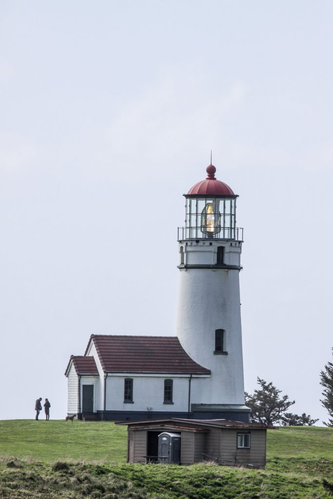
The next day we headed north on the coast for another day of sea-gazing… This brought us past three of the nine lighthouses on the coast, and many more spectacular shore vistas!

Coquille River Light
Arago Light
Cape Blanco Lighthouse

Florence: 43.922106 -124.113042

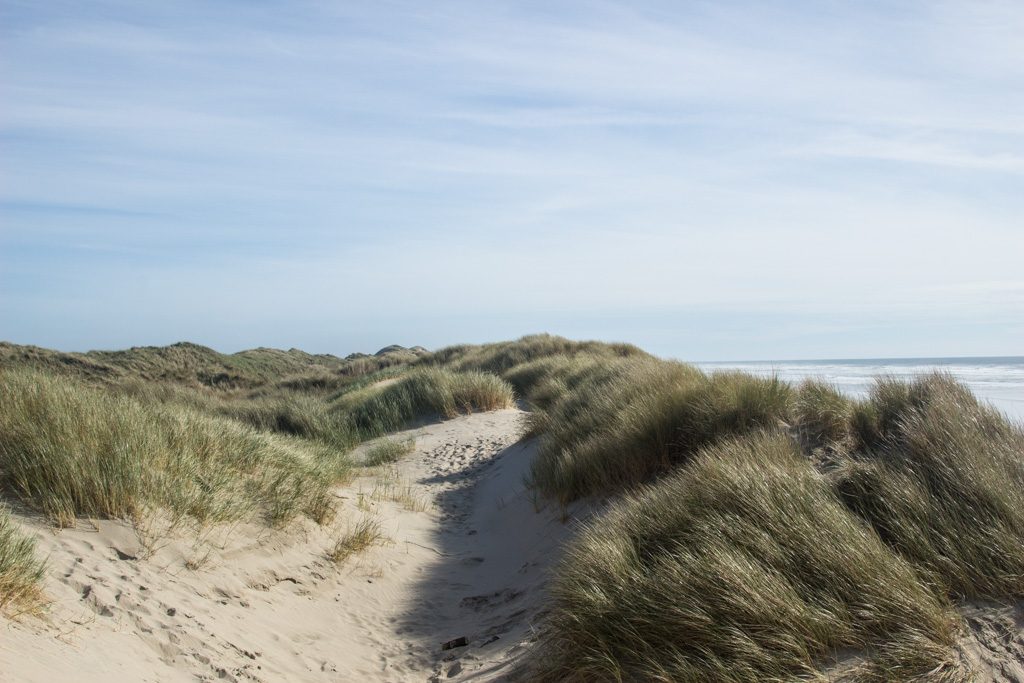
Dunes… The only sand dunes I had experienced were on the Outer Banks of North Carolina’s shore. They were big! Ummm… Not as big as Oregon’s dunes.

The Oregon Dunes National Recreational Area stretches for over 40 miles, and encompasses 31,500 acres. For part of its stretch near Florence, it is bordered by the Honeyman State Park, our next stop. The dunes near Florence are not the tallest in this huge dune field, so where we saw them they weren’t as tall as in NC. Our particular campsite was backed by a steep, thickly vegetated hillside. I’ll guess it was 50 to 60 feet high. I found a nearby trail and went up. When I got to the top, the other side was sand dunes! We were right on the edge of the recreational area.

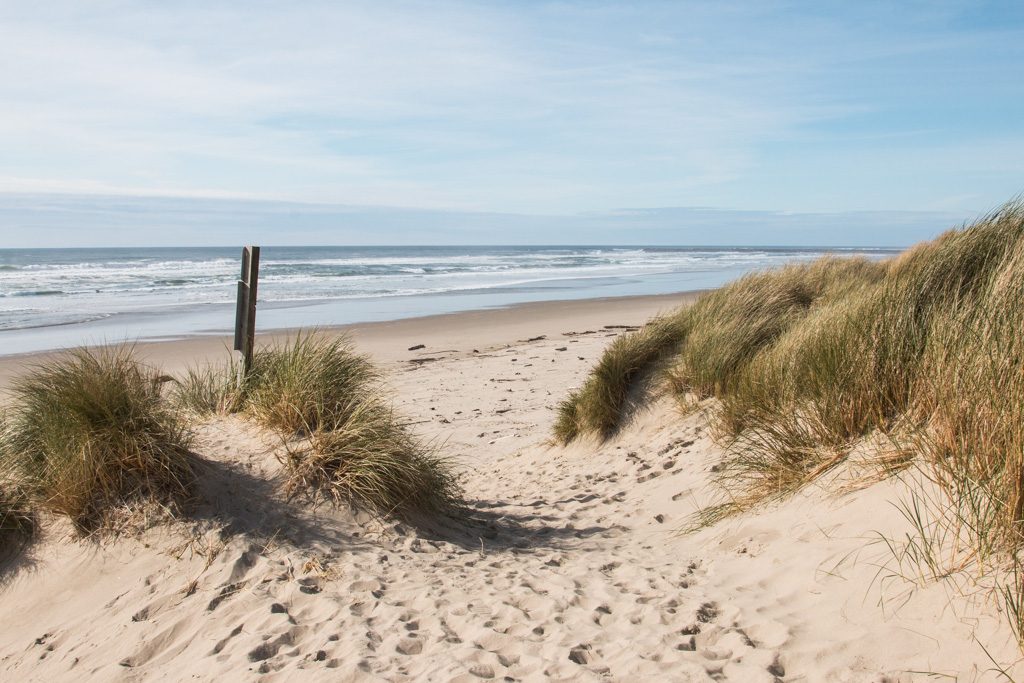
Kathe and I hiked into the dunes in another spot a few miles away. There, the dunes were heavily grassed, and the dunes went right down to the beach.

The grasses are now considered an invasive species.

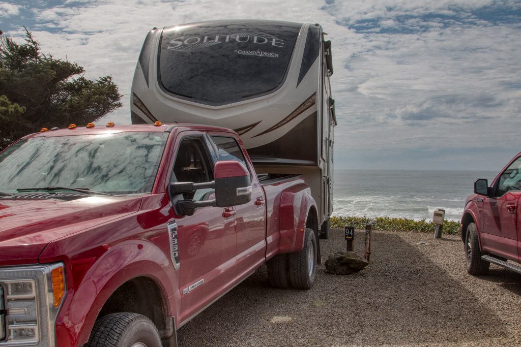
Depoe Bay: 44.860257 -124.04309

They advertise the Sea and Sand RV Park as “Camping on the beautiful Oregon Coast.” They aren’t kidding! Driving to our campsite we thought we were going to drive right into the ocean.

Come ride with us, and remember that we have over seven tons of trailer pushing us down the hill.


We had possibly the best space in the campground (94, if you want to book it). There were no more sites on our door side, so no neighbors there, and we were on the third of three tiers, about 60 feet above the ocean with a completely unobstructed view! Simply amazing. Apparently this site is usually booked a year ahead of time; we had called about a week and a half before, so someone must have just cancelled! Hooray for us! (As we were getting ready to leave, another camper stopped by to tell us that they had just booked the site for this same week, next year…)

Hard not to love this campsite!
This is the life…

There is a downside to camping this near the ocean. The waves make a lot of noise all night. I know… poor me.

Someone turn the waves off! I can’t sleep!

Tillamook: 45.428327 -123.937862

This was the least picturesque stop on our trip up the Oregon coast. There is a large dairy processing plant which produces mostly cheese but also ice cream and yogurt, known locally as “The Cheese Factory.”

“Are you going to the Cheese Factory??” “Have you been to the Cheese Factory?” Everyone in the area wants to know… Apparently it is The Big Thing in the area.

They have an interesting self-guided tour via a glass-walled walkway above the factory floor. I was surprised to learn that it takes less than 24 hours for the milk arriving in the tanker truck to be turned into a block of cheese ready for aging. According to a Tillamook website, the warehouse next door where they age the cheese accounts for about ten percent of the nation’s cheese supply. I guess it is a Big Thing!

Coastal scenery wise, there is a “three capes drive,” which held promise. But most of the time the road was behind trees, and the access to the capes was via hikes of a mile or more. It was cold and raw, and we decided to not hike it.

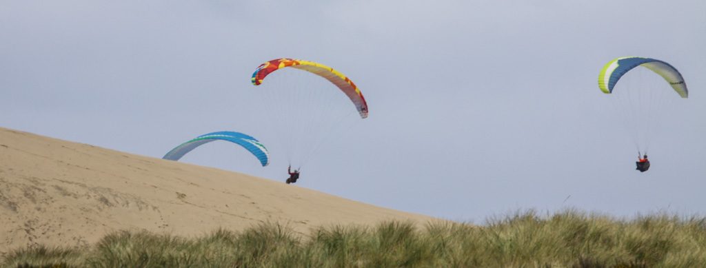
We did get to one part where we could drive to the shore. We almost got stuck one more time in deep loose sand! Fortunately, we didn’t have the trailer with us this time…

There at the beach we saw these folks having fun on the winds from the ocean hitting the dunes to give them lift.
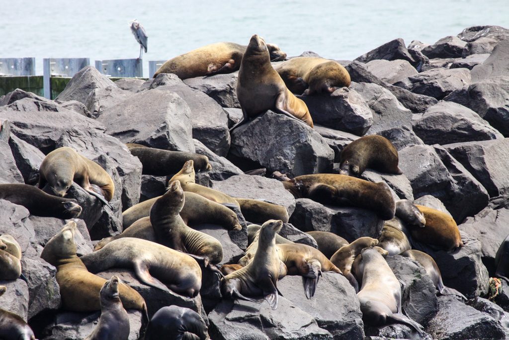
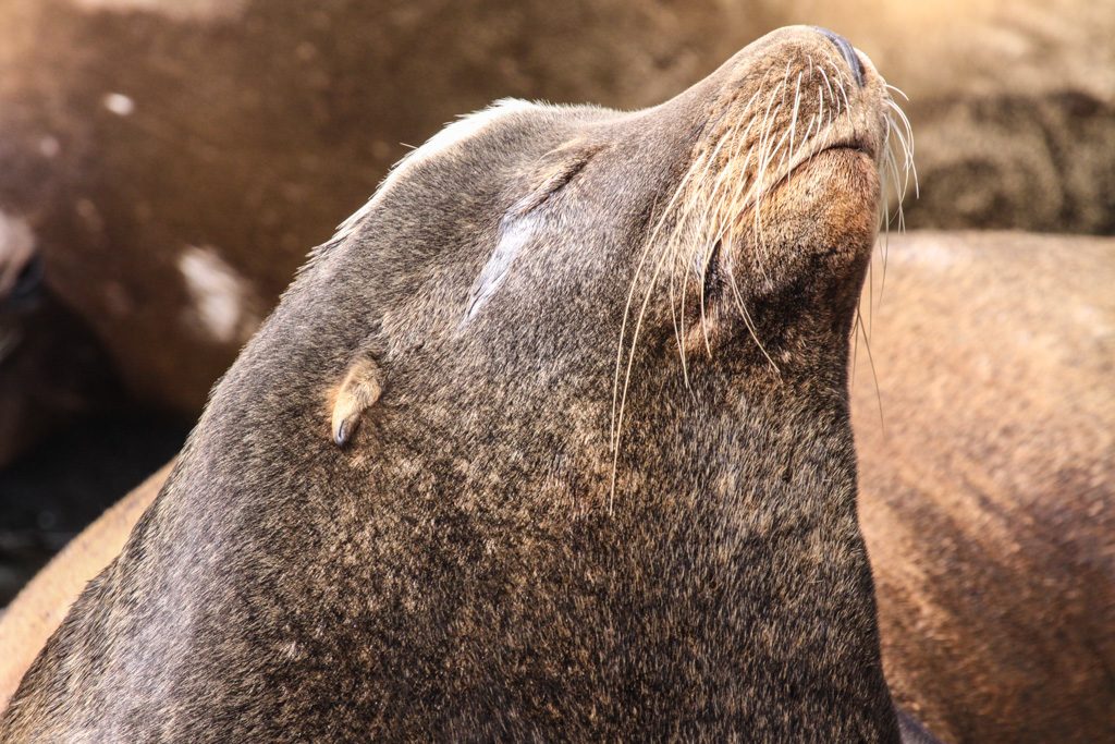
I’m wishing that it were me up in the parachute! It looks like so much fun…

Wildlife

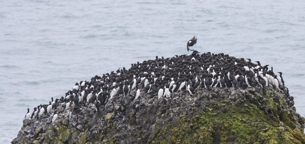
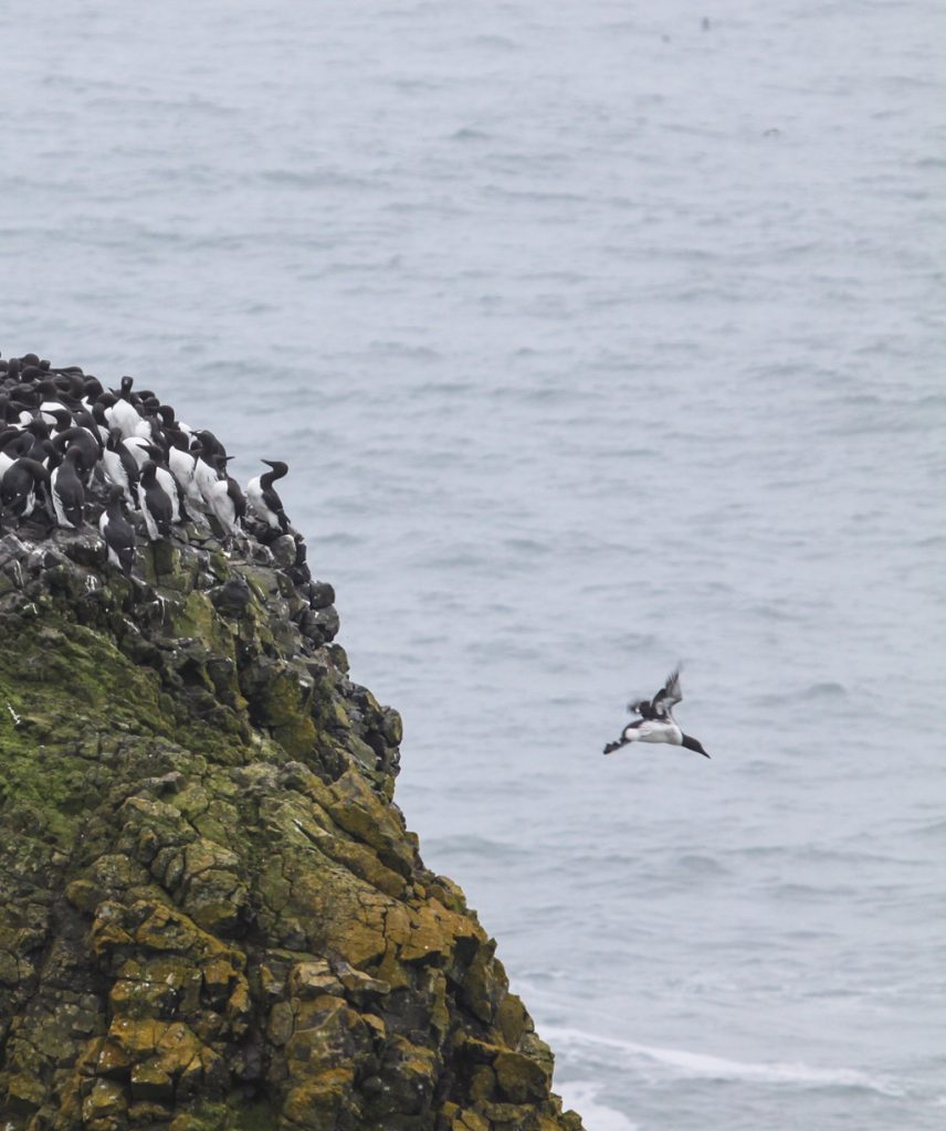
In addition to the elk, above, we saw sea lions at several locations, as well as large colonies of birds.

Soaking up those rays…
Incoming! Common murres, a relative of the penguin but in the northern hemisphere. Unlike penguins, they can fly!
… and outbound.

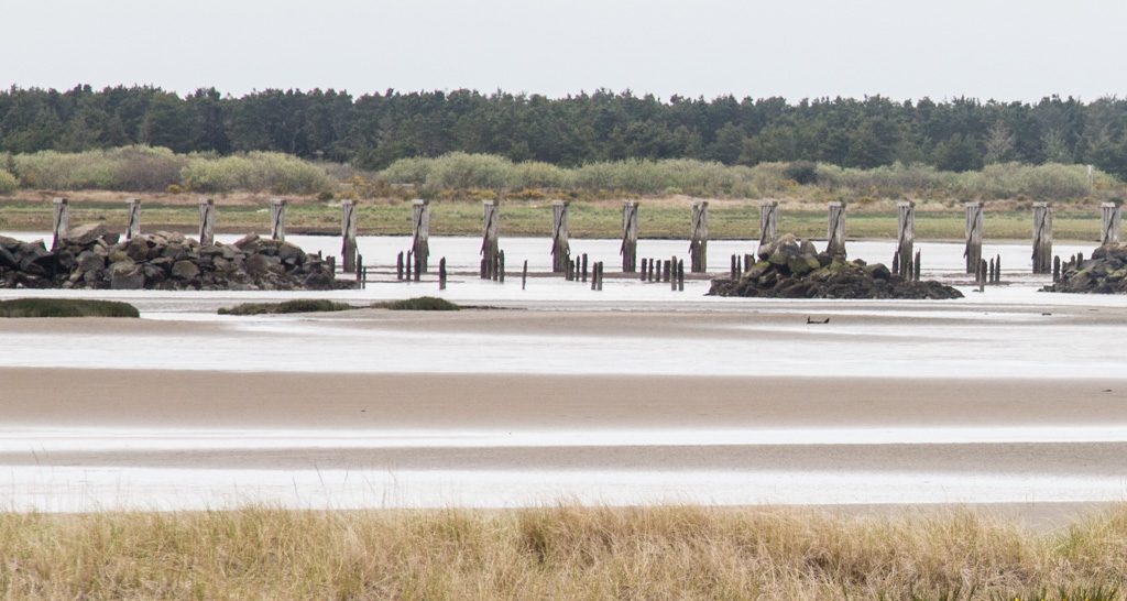
Astoria / Fort Stevens:
46.181835 -123.965693

Fort Stevens is the farthest north state park in Oregon, and also the largest. We were in a very nice campground of over 500 sites, which actually had full hookups for RVs: 50 amps, water, and sewer. Sewer hookups are very rare in state parks! We saw another Solitude (our type of trailer) with a different floor plan and much more storage capacity. That—or something like it—might be a next camper… but certainly not this year. We’re just getting this one the way we like it!

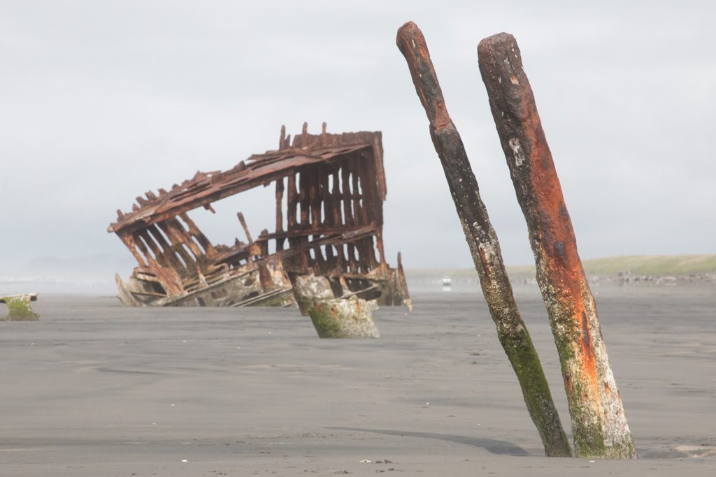
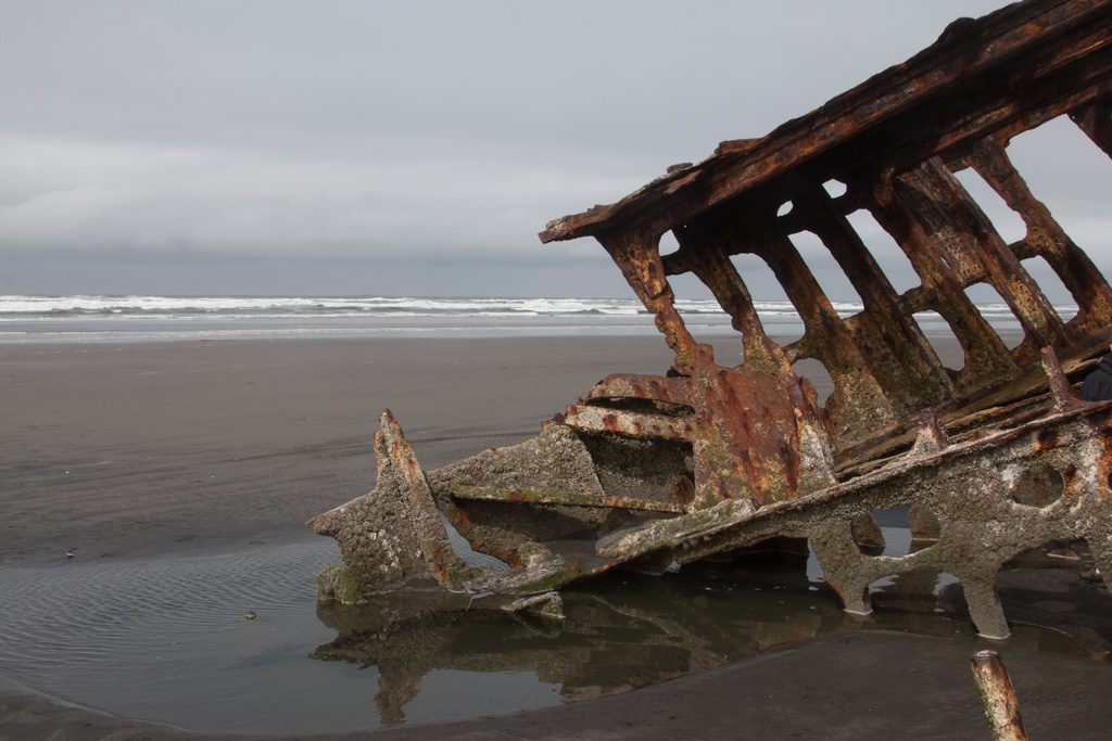
The address of the park is on Peter Iredale Rd., which got me wondering… “Who was Peter Iredale?”

Peter Iredale

That was the wrong question. Not who, but what.

The Peter Iredale was a four-masted, steel hulled sailing ship around the turn of the 20th century that carried grain from this area to Australia. (Peter Iredale was one of the owners of the company that owned the ship, so there is also a who—but he’s not the reason that “Peter Iredale” is a common place name in the area.)

The Peter Iredale

The ship was wrecked here during a storm in 1908. Much of her hull was cut up and sold for scrap, but the forward part was left on the beach. Nature will eventually reclaim her, but for now she is an interesting subject for photography.

The steel plating of the hull is gone to scrap, but a small amount of the iron framing remains.

South Jetty

The land currently occupied by Fort Stevens forms the southern portion of the mouth of the Columbia River, a vital, but very dangerous shipping lane.

The geography was constantly changing as storms moved the land, and deposited much of it on the bottom of the channel, increasing the navigational challenges. The area needed to be stabilized.

There were three jettys built by the US Army Corps of Engineers at the mouth of the river, of which the south jetty is one. It was started in 1885, and the whole project of controlling the mouth of the Columbia took 50 years.

The jetty is four and a half miles long and projected into the ocean one mile; at the time of its completion it was the longest in the world. To build it, they had to first build a railroad track on trestles out into the ocean to transport the rocks.
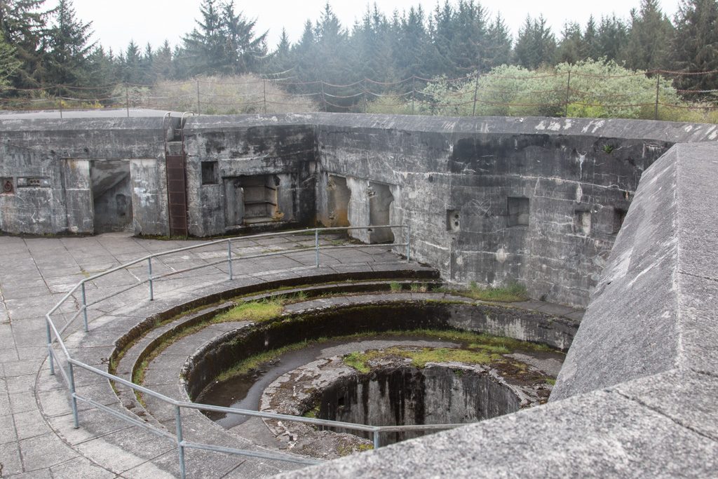
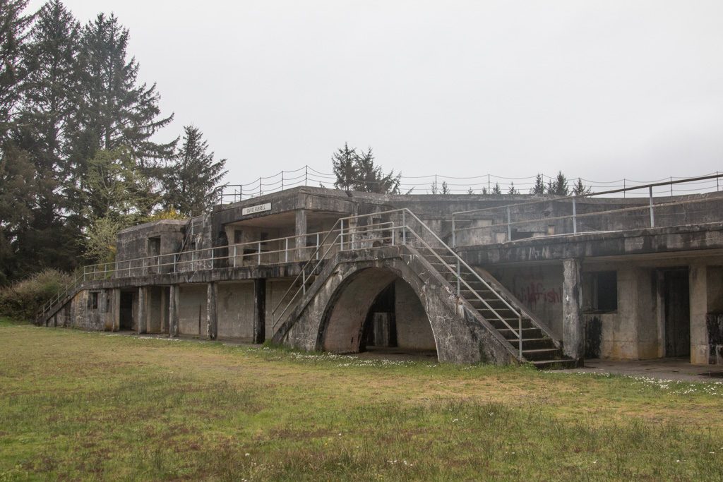
The South Jetty of the Columbia River. It still extends far into the ocean.
Some of the pilings remaining from the many miles long trestle built to create the south jetty.

The Fort

So why is this “Fort Stevens” State Park?

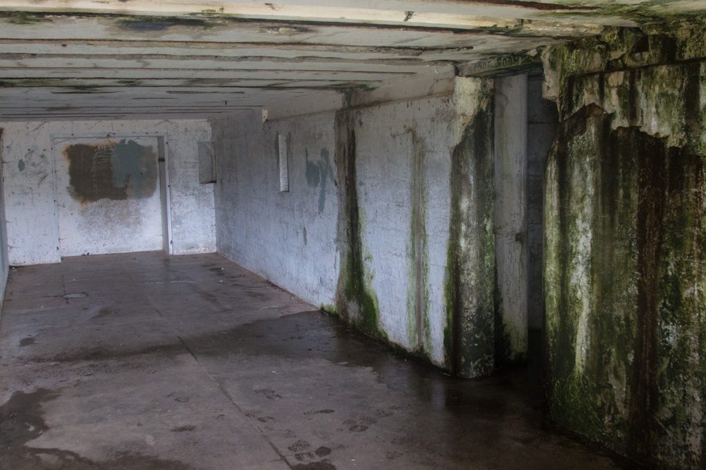
Fort Stevens was the primary installation of three forts guarding the mouth of the Columbia River. The fort saw duty in the Civil War, Spanish-American war, and World Wars I and II. It started as an earthen construction in the Civil War and was enhanced with large concrete installations for several batteries of ten inch rifles by the First World War. Improvements in ship construction (thicker hulls and steel decks) made those guns largely obsolete by WWII, at which point the river was primarily guarded by a mine field comprising up to 148 mines that were electrically controlled from Fort Stevens. (I had assumed that they were contact mines, but not so.)

Fort Stevens holds the distinction of being one of only two places in the continental US to be fired upon by a foreign power. On June 22, 1942, a Japanese submarine fired nine five inch projectiles at the fort. They landed without harm, and the fire was not returned from the fort. Later, the captain of the sub was quoted as saying that if he had known how many large rifles were at the fort, he would not have been anywhere in the area!

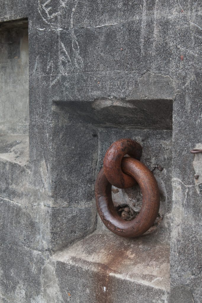
The guns are long gone and the emplacements are deteriorating, but some are still open to be wandered in and on.

A gun emplacement; the circular structure allowed aiming the gun through an arc of about 200 degrees.
Fixtures like this one allowed pulling the gun mount to aim it.
The back side of one of the batteries.
A magazine for storing projectiles and powder, immediately below the gun deck.

What’s next?

We have one more stop before we cross into Canada, to visit with Beth, Jon, and the kids. Can’t wait to get there!

We’re starting to plan our travel after we visit with Beth’s family, and are starting to run into problems finding a campground with available space. We had heard about this, but hadn’t experienced it up until now. We’ve plotted our travels up through the second week of June, and now have to slot in the remaining two weeks until our grandsons Graham and Dean join us to visit National Parks in Utah! Lots of possibilities…

Dry camping — it’s a boon (dock)!

When we first starting considering getting an RV, Al was quite excited about the possibility of dry camping, i.e., living ‘off the grid.’

I wasn’t so sure. All I could picture was Little House on the Prairie: brushing my teeth with a twig, beating my dirty clothes on a rock (while it’s raining, of course), combing baby powder through my hair every week or so, and dragging myself across the dry desert in search of an oasis.

You get the idea.

Will Al REALLY make me do this?

“It’ll be fun!”
“It’ll save us money!” and
“We can DO it!”
just didn’t cut it for me.

Last year, after we’d made our purchase, but before we had taken ownership of our RV, we flew out to Arizona for one last time sans RV. Al had read extensively about a wide variety of dry camping locations, most of it land owned/managed by the US government: Bureau of Land Management (BLM), US Forest Service, Army Corps of Engineers (COE), and lots more. We wanted to explore our options.

Think of it as ‘shopping for land’ if you were building a house. Kind of.

It was late winter/early spring. We drove through some US Forest Service mud sludge wetlands logging roads woods. We spotted a couple of campers set some distance off the road beaten path. I couldn’t see a soul. I was convinced that those RVs were set there as a come-on for would-be camping enthusiasts.

Too isolated for me.

We couldn’t find any COE areas near us. We did drive along a stretch of the Colorado River where we saw quite a few campgrounds. RVs were literally inches apart from each other. So close that you could borrow a cup of milk from your neighbor by leaning out the window — never having to leave your rig!

Too crowded for me.

We had read about Quartzsite. An RV mecca in the winter. Snowbird country. Home of a HUGE RV show (the BIG TENT) each year. Rock Capital of the World.

And desert. LOTS and LOTS of desert.

Lots and lots of empty desert!

Not that Lawrence of Arabia kind of desert with blowing white dunes. No oases either. And actually a bit more vegetation than I expected.

We had read about the BLM land in Quartzsite where many snowbirds park their rigs and boondock (dry camp) for most of the winter. We stopped at the small brick building at the entrance to LaPosa West; there we found a very friendly host couple volunteering their time to answer questions and register newly-arrived campers. They couldn’t say enough about what a fabulous time they’d had in Q during this, their second winter onsite.

I remember peering out the small window. There were RVs but they were spaced at quite a distance from each other. And I saw people! In a few spots, I could see a group of 3 or 4 campers near each other—a neighborhood!

The hosts encouraged us to hop back into our rental car and drive through the area to check it out. It turns out that this Long-Term Visitor Area (LTVA) is one of a network of seven winter LTVAs across southwestern Arizona and southern California. They pointed out that the BLM area in Q comprises four large areas (LaPosa West, North, South, and Tyson Wash). AND…(drum roll please!) that there are actually a dump station, waterfills, and trash dumpsters at LaPosa South!

Maybe my teeth and hair could possibly be very happy here.

We drove into “town” and it seemed fairly peaceful quiet deserted. Turns out that it was late in the season and many of the snowbirds had left for points north. Knowing all too well about the craziness of ‘tourist season’ (summertime in Acadia National Park), we had a hunch that Q might be just the right spot for us. And all that desert!

Fast forward seven months. We get our eight solar panels installed on the RV (details in this earlier post) along with all of the thingamabobs that will sustain us electrically while on the desert.

Fast forward another six months. We recently left LaPosa South where we spent just over four months. And…WE LOVED IT!

How did we fare? Just great! We learned that:

  • Having nearly four acres of desert all to ourselves is AMAZING! There are literally miles of land available for camping. Having stayed at so many campgrounds with TIGHT spaces as we came across the US, camping on the desert was a dream.
Desert twilight
  • Paying $180 for an entire SEASON of camping is a sweet deal. You can park on an LTVA — and move from one LTVA to another within the system in SW AZ and SO CA — from Sept 15 thru Apr 15 for just $180.
  • Navy showers aren’t so bad. Short and sweet.
  • If you are careful, you can easily go a week before needing to refill your water tank and dump your black/grey tanks.
  • Wiping off dishes with a paper towel just after eating greatly reduces the amount of water you’ll need for dishwashing.
  • Pouring your dirty dishpan water down the toilet helps to maintain the black tank.
  • Eight solar panels can sustain you every day! We only ran our generators 2 or 3 times across the four months we were there (and that was when we’d had two cloudy/rainy days in a row.
  • You can NEVER get tired of desert sunrises and sunsets.
  • People are very trustworthy. You can LEAVE your camper on the desert (while you fly to see your kids and grandkids over Christmas) and not a thing is disturbed.
Not our site; this one was like this for well over a month. Their gear was never touched!
  • The desert can be VERY windy and dusty; I became quite proficient at wiping down counters and windowsills frequently.
  • It’s easy to meet new people on the desert.
  • The rattlesnakes don’t reappear until very late in March.
  • Many, many people who spend the winter on the desert own and ride their side-by-sides, jeeps, or ATVs all over the desert.
  • Bicycling on the desert works best if you add an extra-thick gel seat to your bike. It’s also a good idea to wear a stretchy nylon cowl or bandanna over your mouth and nose in case a side-by-side passes by and kicks up dust.
  • Following the desert bloom is thrilling!
  • Rockhounding in the Q area is a nearly full-time hobby for many snowbirds. The Q Gem and Mineral Club has so many resources available for novice and experienced rockhounds and lapidarists including classes, use of equipment, rock/gem shows, and lots of rockhounding field trips.
Quartzsite quartz!
  • Quartzsite is a hub for so many fabulous things: an incredible public library (large supported by snowbirds); a very active quilting club (my peeps!); welcoming churches; one of the best game stores we’ve ever seen; an amazing number of fairs, festivals, rallies, concerts, hobby clubs, gatherings; and best of all, some fabulous new friends who are certain to be traveling companions.

It was just right. And we’re going back next fall.

Big Mountains, Giant Trees

We’ve left our winter home of Quartzsite, AZ, and are headed north—initially to Vancouver, BC, to visit our daughter Beth’s family. Can’t wait! As much as we enjoyed being in the desert in Quartzsite (thank you BLM!), it is good to be on the road again and seeing new things.

Our second stop was in Three Rivers, CA, just outside the southern entrance to Sequoia National Park, the second National Park (what was the first???). Nestled in the western flank of the Sierra Nevada mountains, the scenery was gorgeous!

There is a downside to being surrounded by mountains… No cell signal. Nada. Zilch. Zip. It made us long for the very slow connectivity in Quartzsite! However, the campsite had a poor WiFi signal—I think through a satellite—so we could occasionally check our mail / Facebook messages. Sigh. We’re addicted to the net.

The restaurant we went to for breakfast was using dial-up to tie into their credit card system. When was the last time you heard the dulcet (!?) tones of a dial-up modem?

The reason for being here was to go into Sequoia NP, so let’s get to it!

The major attraction here is the trees, of course. In terms of volume (mass), the giant sequoias are the largest living trees. Coastal redwoods can grow taller, but they have a smaller diameter, and don’t retain that diameter at higher heights as much as sequoias do. The sequoias are limited in height due to limits on the capillary action which brings water and nutrients up from the root system. The redwoods can take in moisture through their leaves more efficiently, and thus grow higher than capillary action by itself would allow. (The ranger giving the talk accused the redwoods of “cheating!”—he must be a sequoia fan)

Note the building for scale!

We went up into the mountains to see the tree named “General Sherman,” the largest known living tree in the world, in terms of volume. The diameter at the base is greater than 36 feet! And the volume of its trunk is more than 52,000 CUBIC FEET. It is up at around 6,900 feet elevation; getting there was fun. Vehicles over 22 feet long are prohibited from making the drive. Our truck is exactly 22 feet; we can see why longer vehicles are excluded!

Unfortunately, I forgot to dump the dashcam that evening, and the video of the drive got overwritten. However, here are a few pics showing the road.

I don’t want to think about the effort it took to create the road! The designers did an excellent job of siting it; with very few exceptions the road above you is invisible. Looking down (way down), you can occasionally see the path ahead of you.

Yes. That’s road WAAAY down there!
All those sections of road that you can see are one road, back and forth and back and …
A portrait of the artist.

We were particularly taken with this roadside wall construction; it is so different from what we were used to at Acadia!

Smooth, flat walls, with a precise 90° corner to the smooth, flat top.

What were we talking about? Oh, yes. The trees!

General Sherman. World’s largest living tree
Can you find Kathe?

There are 75 known groves of giant sequoias in the world. The adjacent Sequoia and Kings Canyon National Parks protect “over 30” (NPS statistic) of those groves. (Three more groves are protected in nearby Yosemite NP.) General Sherman is in the grove named Giant Forest, an apt name if ever there was one. It contains 2,161 sequoias with a base diameter of over ten feet.

The sequoias live for a very long time. The ages of General Sherman and “The Sentinel” (near the museum in Giant Forest) are both estimated to be 2,200 years (“plus or minus 600 years,” according to one research article, we were told by a ranger). A page in the Yosemite NP site refers to a sequoia 3,266 years old, but is written in the past tense, so it may not still be living. Yes, you can buy giant sequoia seeds in the gift shop, but you’d better will them to your great-great-great-great-great-great-great-grandchildren!

The Sentinel—at least, a part of it!
The base of The Sentinel, showing fire damage.

Giant sequoias require fire to reproduce! The fire does two things. It causes the seed cones (should these be called “sequoia cones,” like “pine cones?”) to open and release their seeds, and it removes the debris covering the forest floor so that the seeds can reach the soil and take root. A decades-long policy of complete fire suppression resulted in unhealthy groves with dense underbrush of other trees. That policy has been reversed, allowing some fires to take their natural course; the groves are regaining their health and there are now immature giant sequoias of different ages growing in the forest. There are few trees in the Giant Forest that do not bear signs of fire. Fortunately, they are able to withstand the fires, in part due to a bark that is up to two feet thick.

With a person for scale.
Amazingly, still alive!

A good portion of the park is still closed due to snow. It is hard to believe that only a few days ago we were in the desert, with the temps in the high 80’s. When we drove through the park gate, the ranger told us, “You can’t go through to King’s Canyon. The road is closed due to last night’s avalanche.” Never been told that before!

Speed limit…. BLANK? Let’s go fast!

In addition to the trees, the park has high mountains, deep valleys, and fast flowing streams.

Do they really need to say this?
We’re really both still traveling together!

Before Europeans discovered this area, indigenous people were here. There is at least one site with pictographs; quite possibly more that they don’t tell visitors about.

Pictographs at Hospital Rock

And we found this “community kitchen” fascinating.

Grinding holes worn into the rock in the kitchen
Can you get acorn flower at Whole Foods?

We enjoy visiting parks “out of season;” not only are the crowds thinner (sometimes non-existent), but it also forces you to come back again to see the parts that are currently closed! Lots more to see here.

Our next post will probably be from the Oregon coast… See you there!