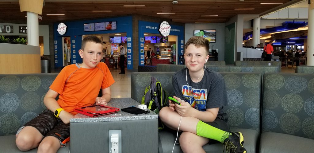
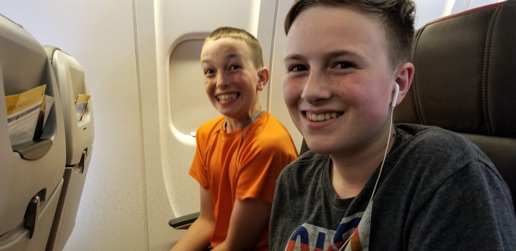
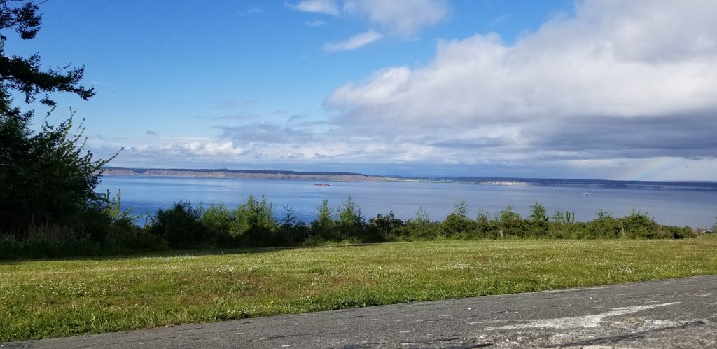
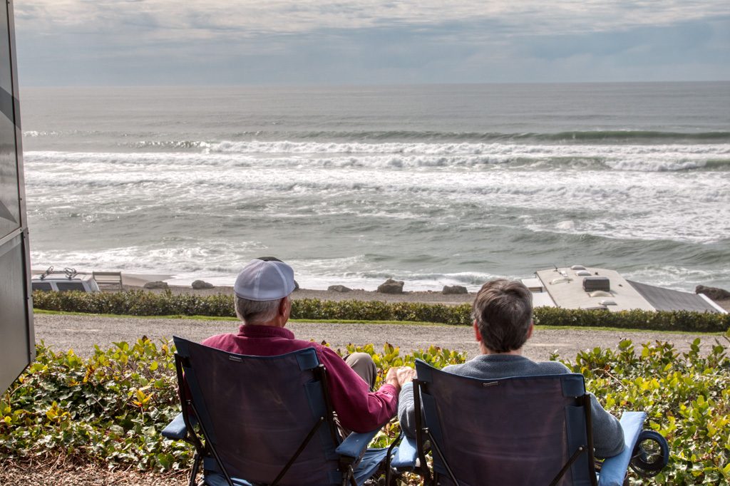
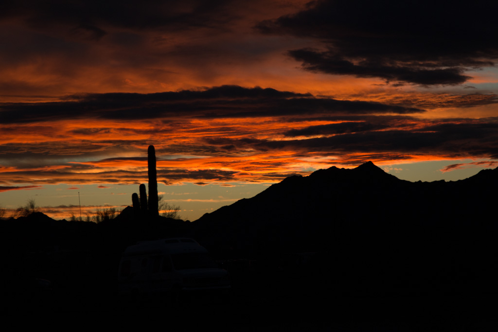
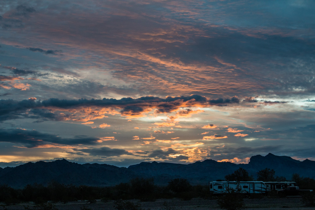
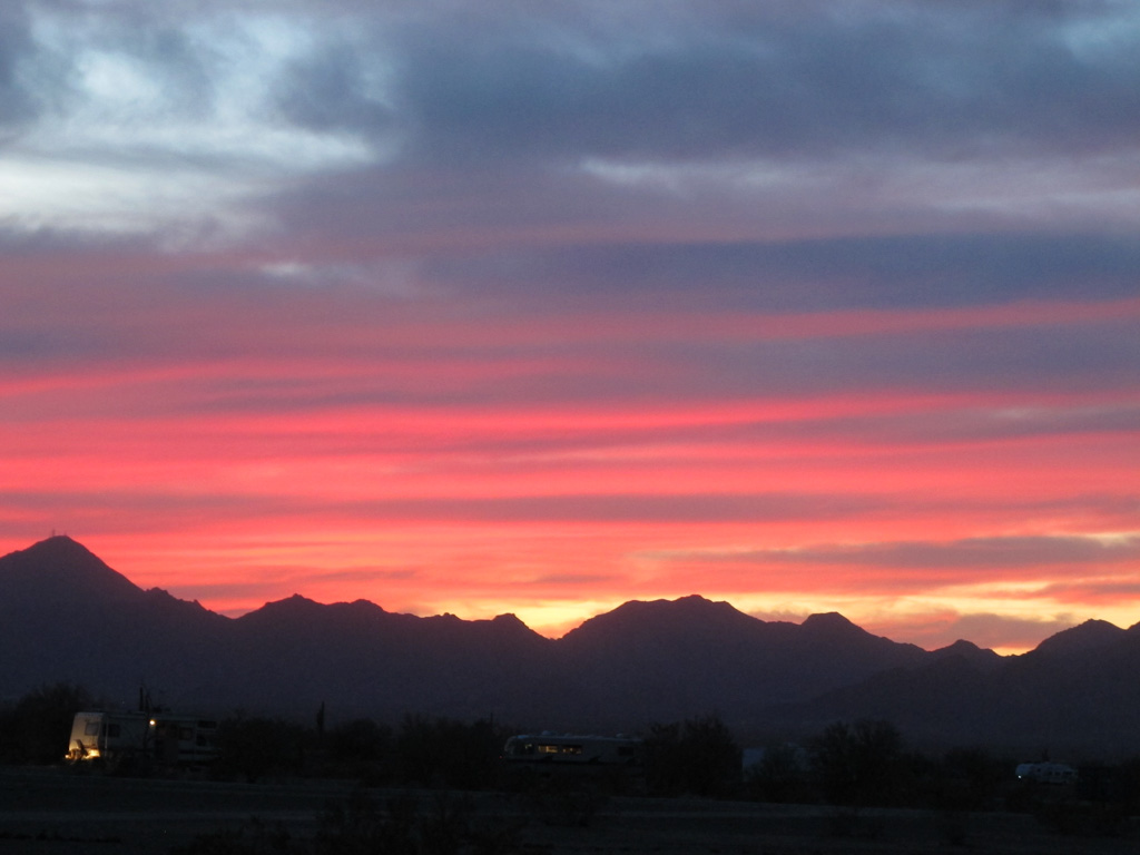
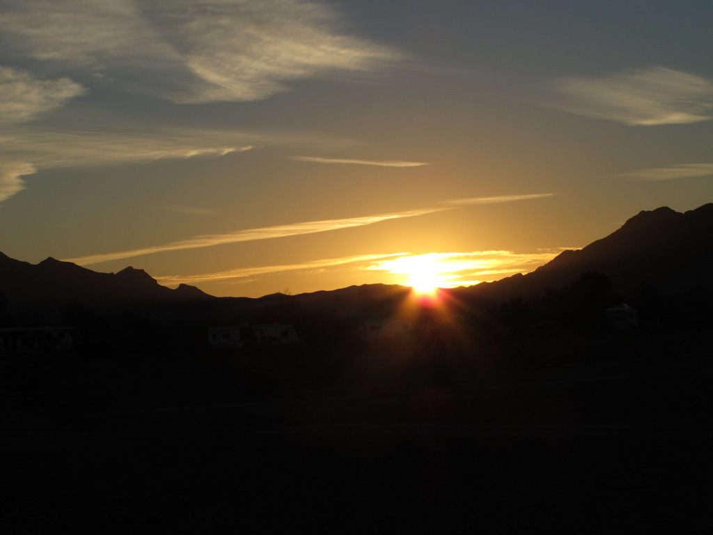
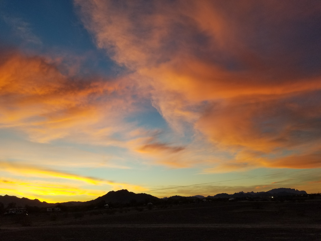
Hello! My name is Graham and my brother and I recently flew into Salt Lake City from Rochester via Chicago to start our adventure in Utah. After our flight from Chicago to SLC was delayed two hours, we finally arrived back at the camper with our grandparents.
Waiting for a plane…We found a plane!Finally here!
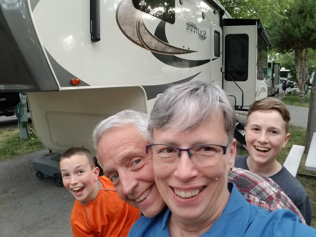
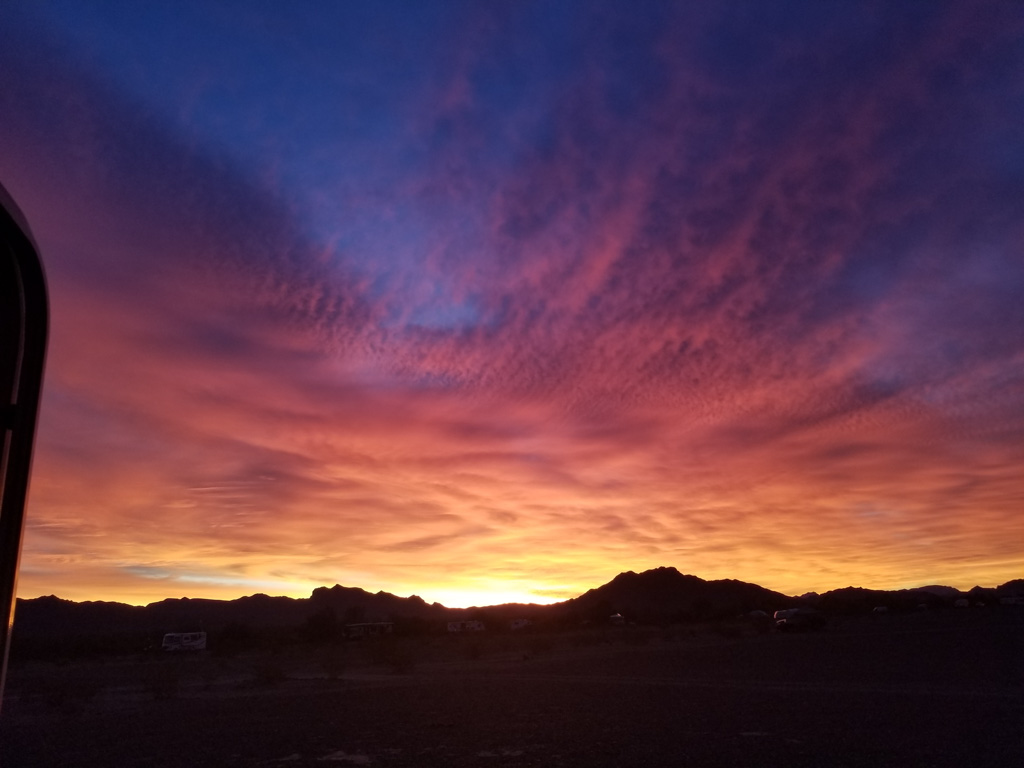
One of the necessities of the camper was that there was room for grandkids to accompany on trips. As the backseat riders in Scarlet, the truck, Dean and I have only been here since Thursday the 27th. We started planning this trip over a year ago, and it is finally happening.
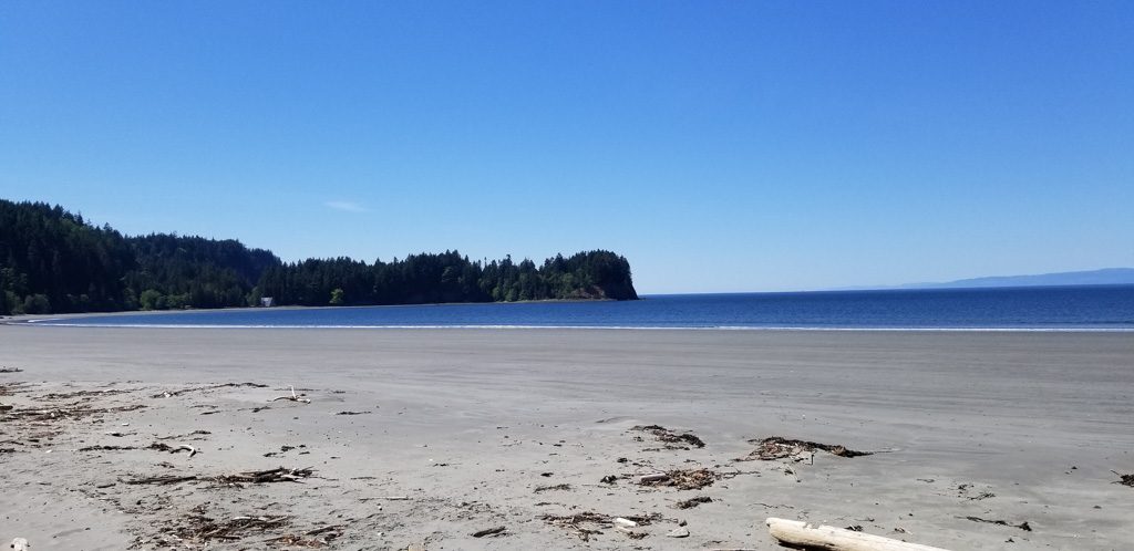
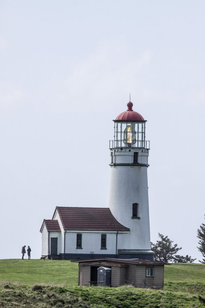
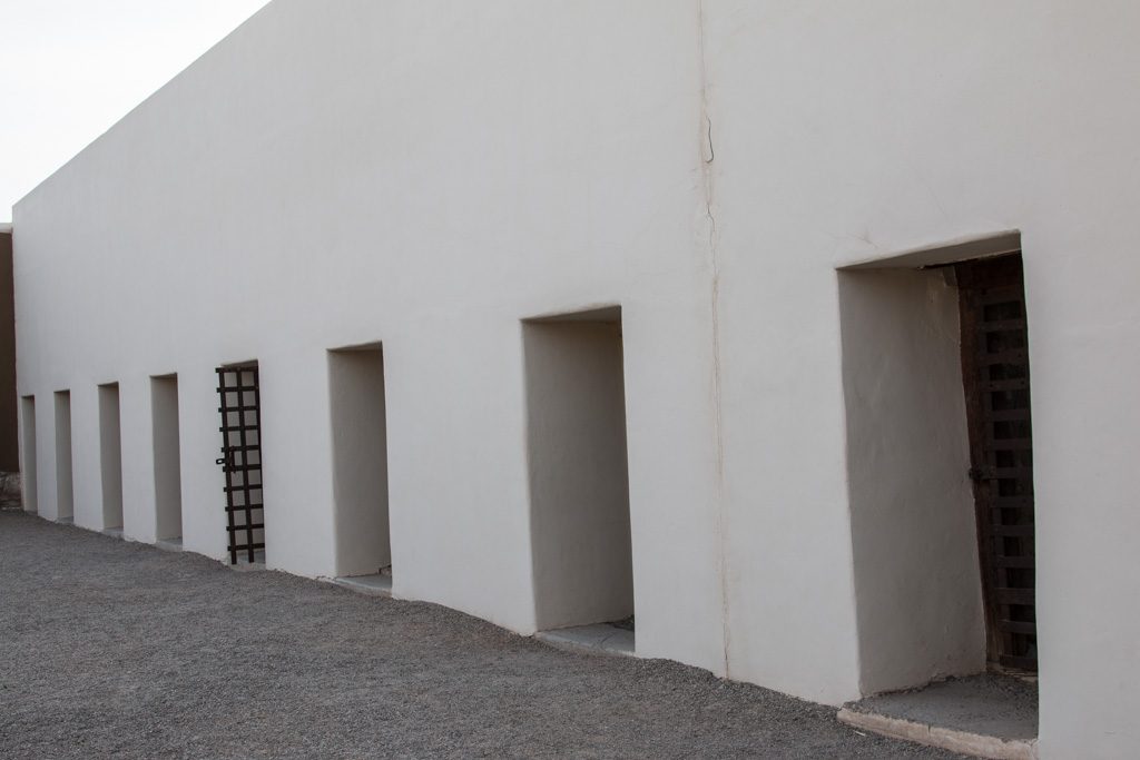
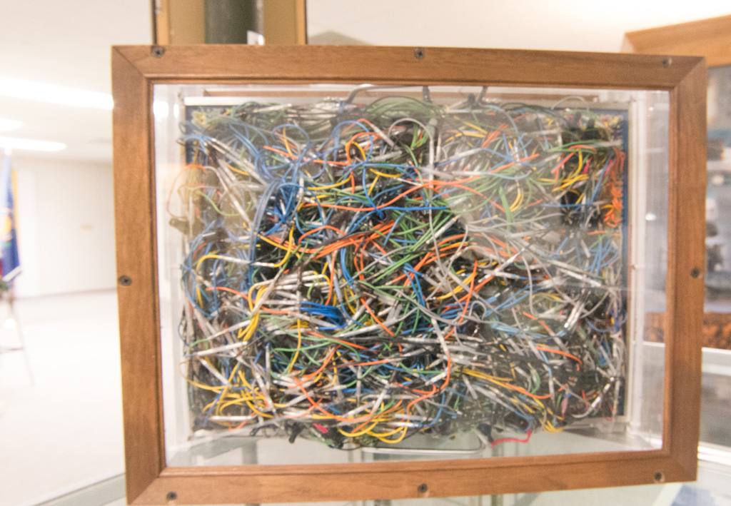
On our first day here we stayed in a KOA in Salt Lake City, only 10 minutes from the airport. We departed the next morning, heading for Price. In Price we discovered that there was more than we had expected there. Price had only been a short stop on the way to Moab. There we found a cool mining museum, where we met a woman who had just come back from our home, Corning! We found a lot of cool artifacts there, and an old caboose and tie-layer.
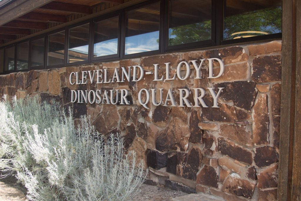
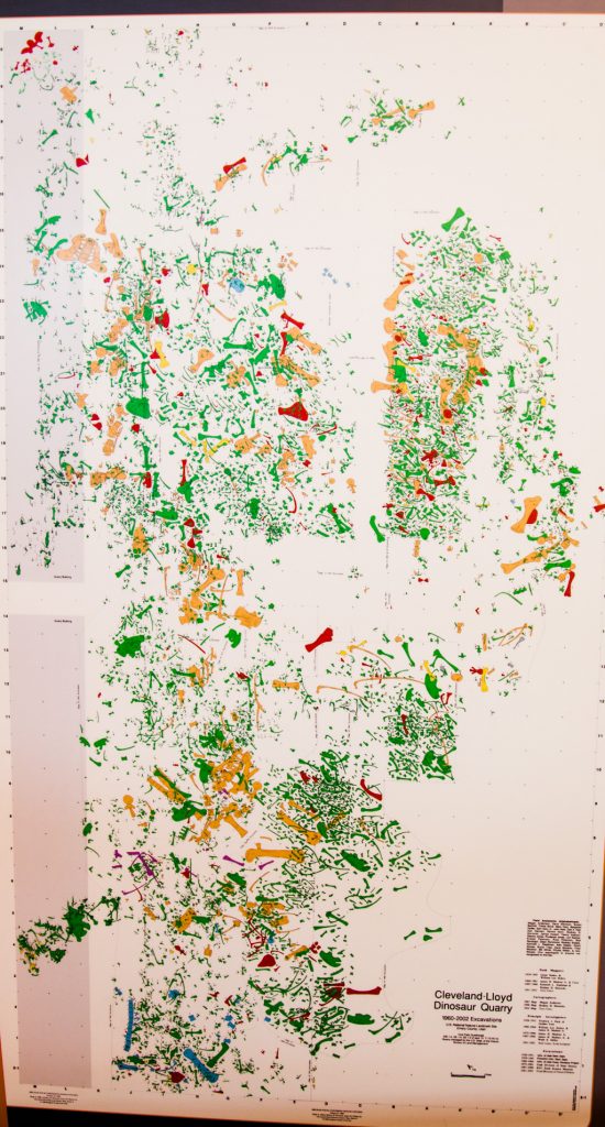
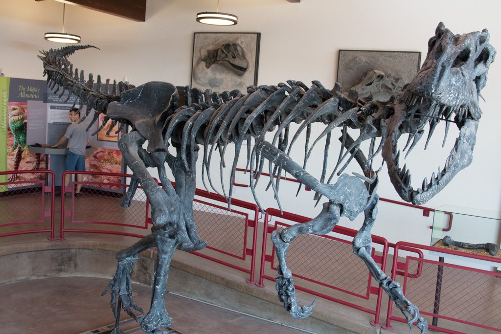
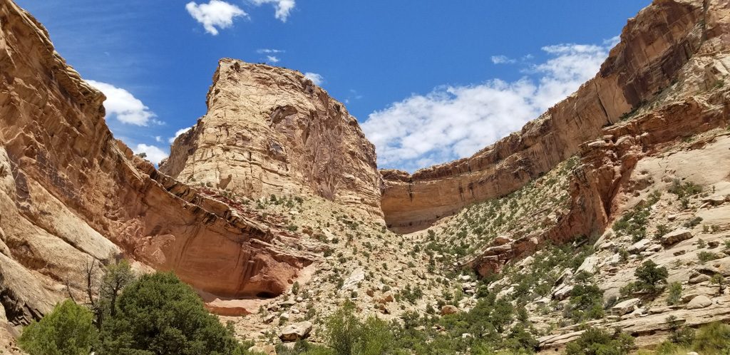
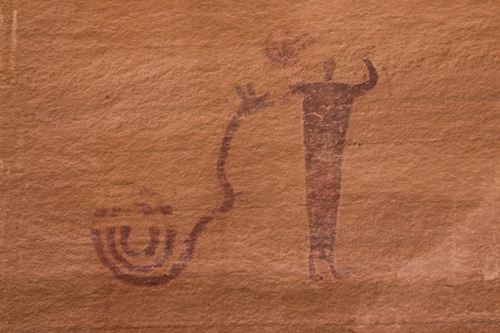
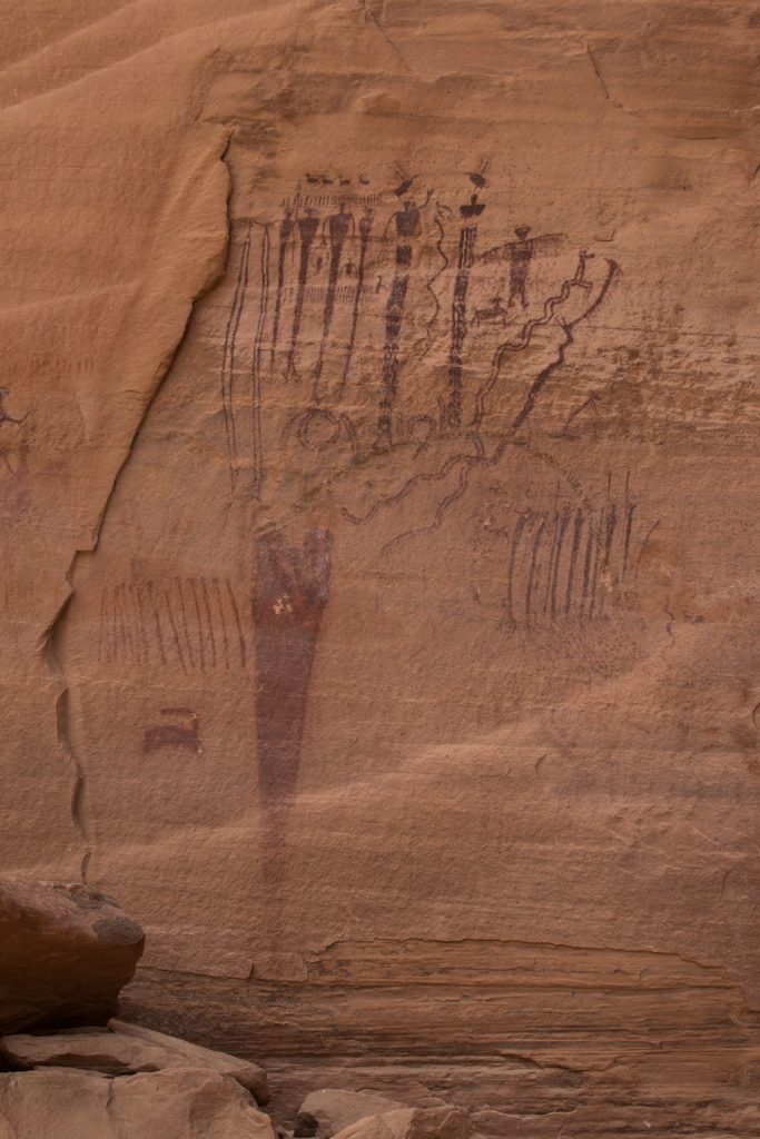
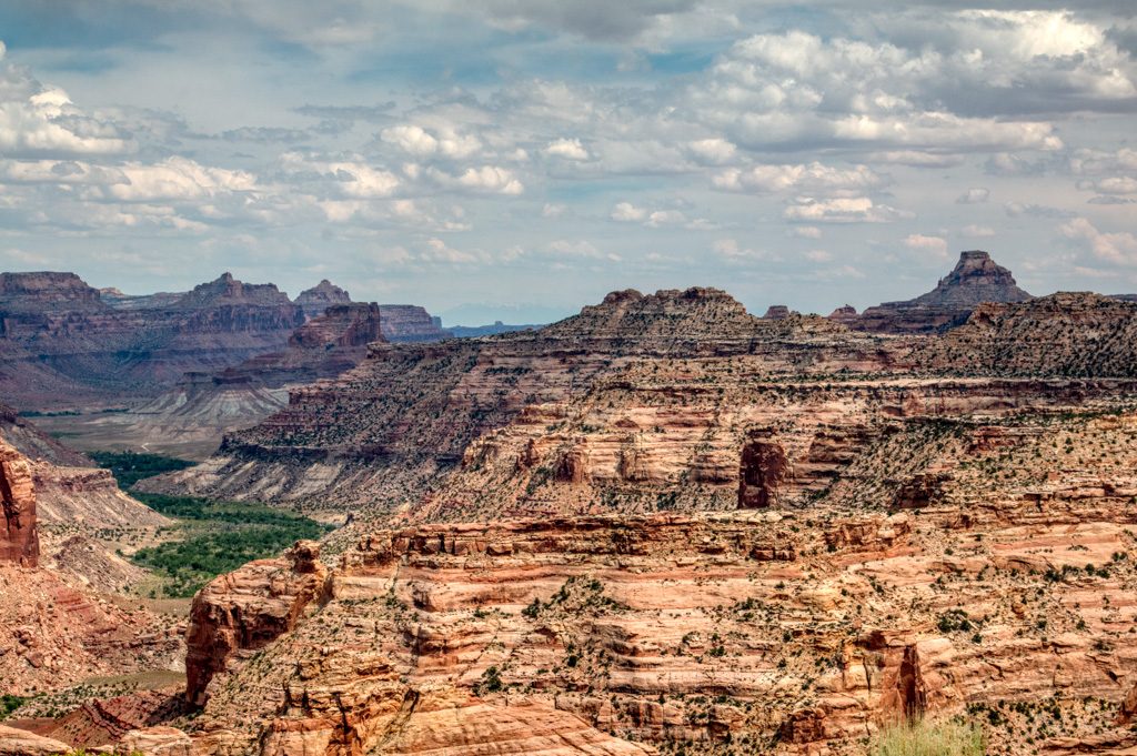
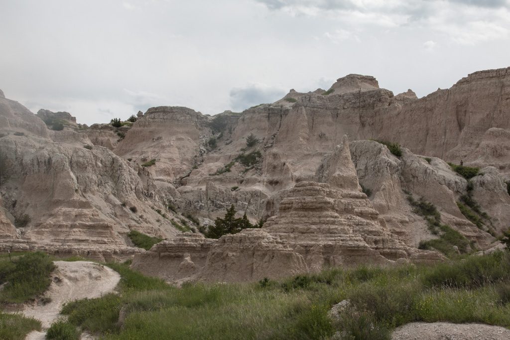
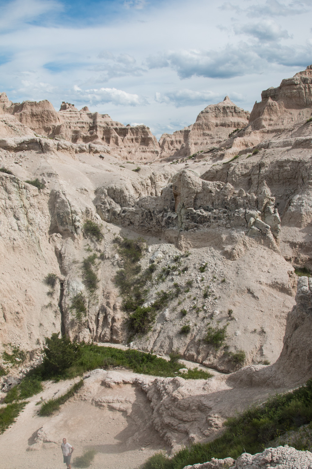
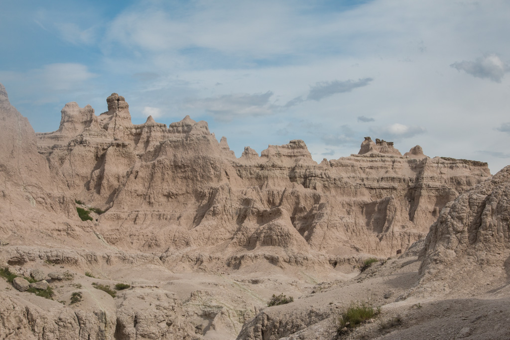
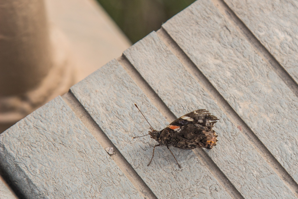
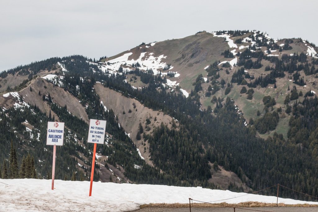
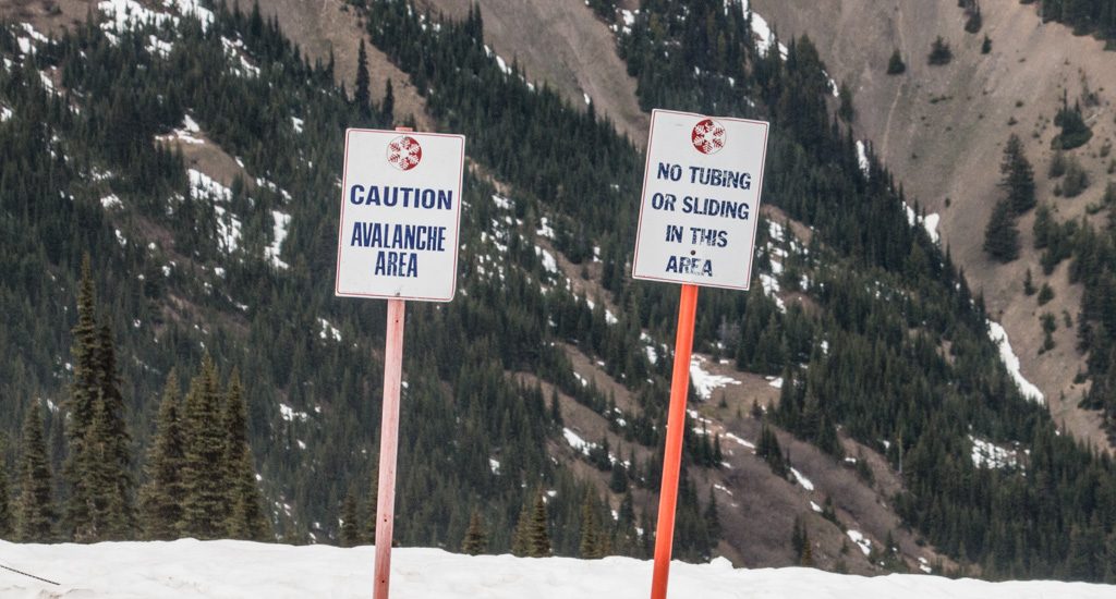
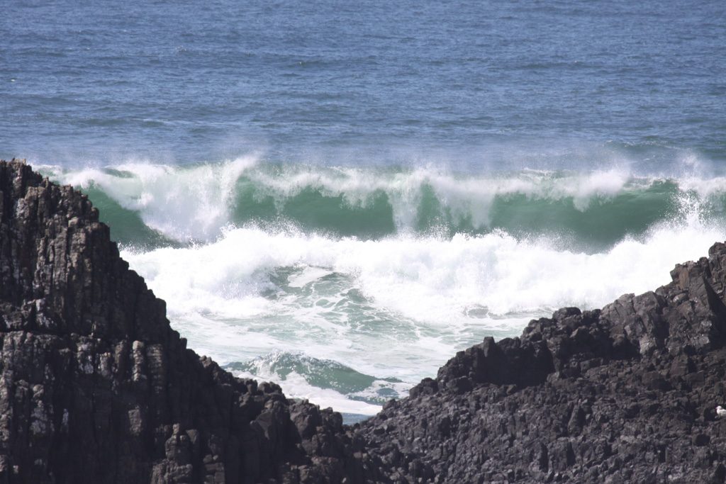
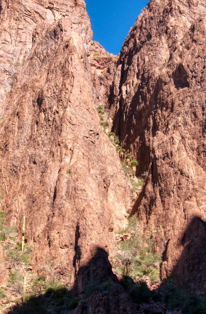
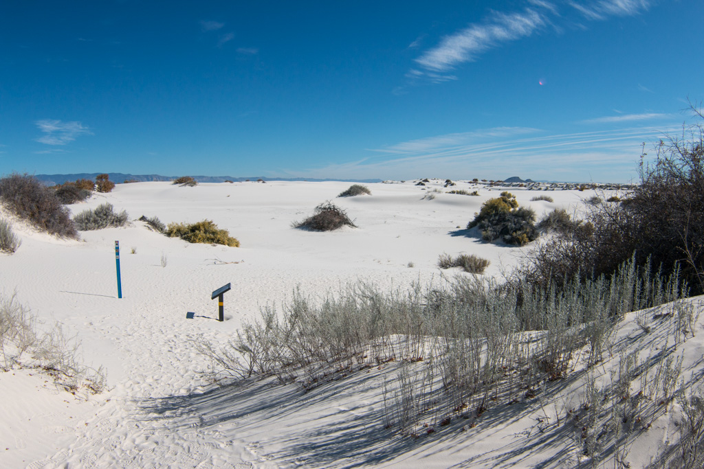
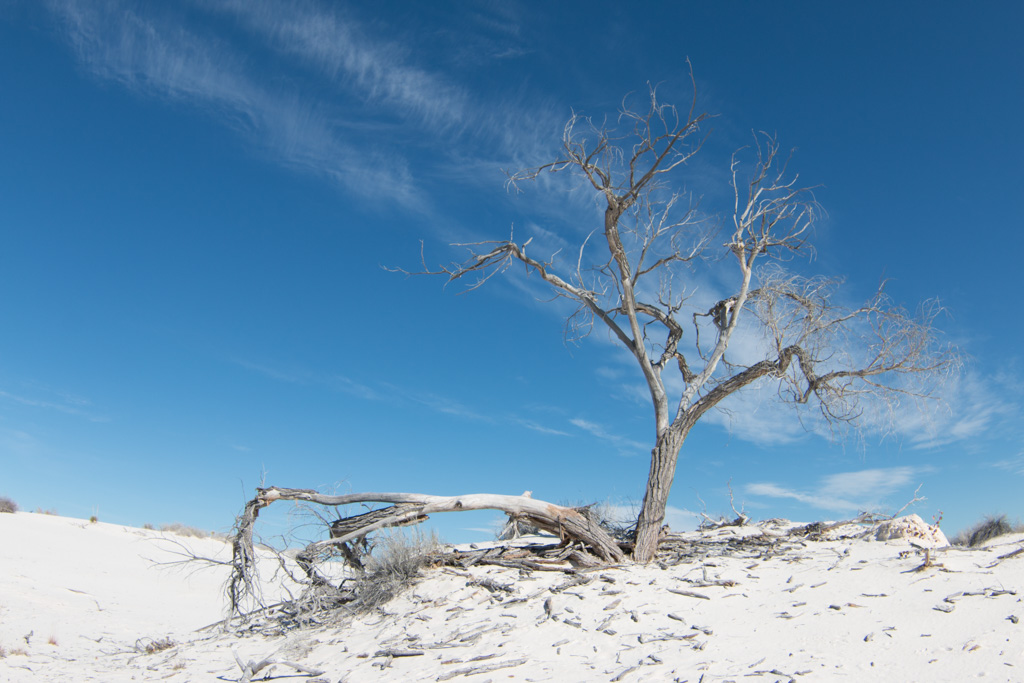
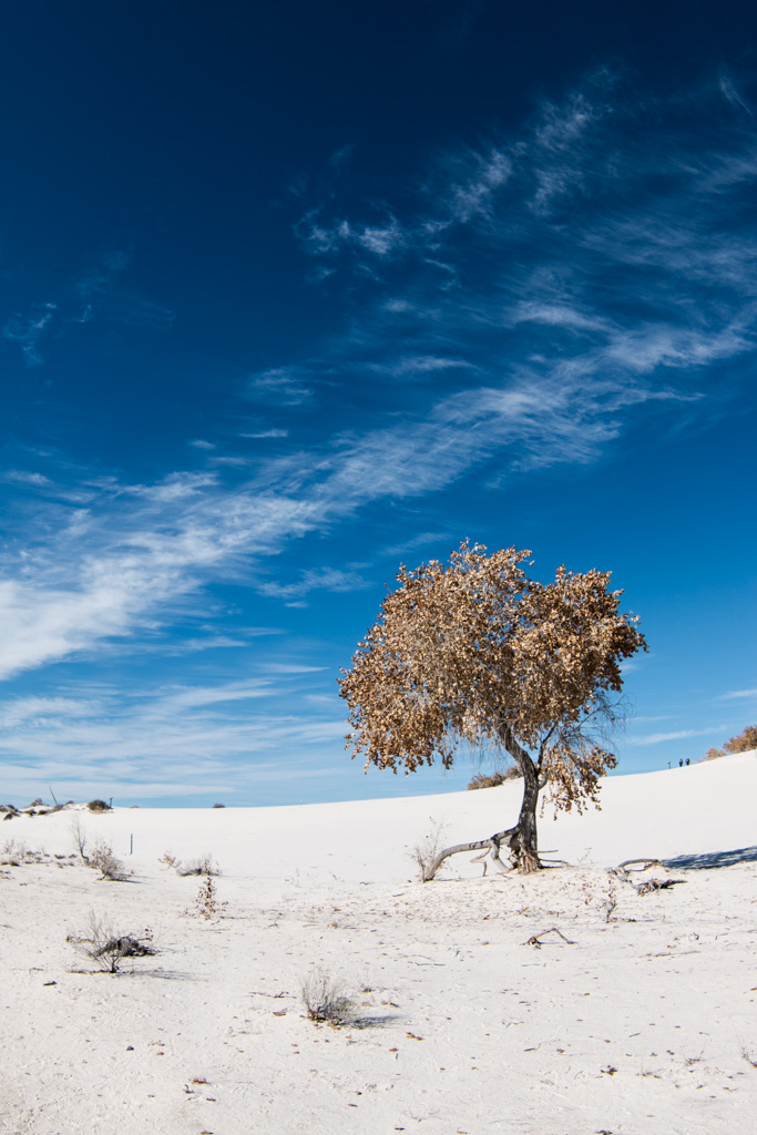
The next day we went to the Cleveland-Lloyd Dinosaur Quarry, where over 15,000 bones have been found. The majority of the bones were found in a 60×40 foot area. 70% of the bones were Allosaurus. We then went to Buckhorn Wash, a really nice drive through a long canyon. We stopped at two pictograph and petroglyph panels along the way. Pictographs are painted, petroglyphs are carved or chipped into the stone. We then went to the Wedge Overlook, fittingly deemed the ‘Mini Grand Canyon’.
Dino quarry!15000 bones! The green is Allosaurus.Rawwwr!Inside the canyon!Snake!What do you think this one is?Sheep?Cheese!‘Mini Grand Canyon’
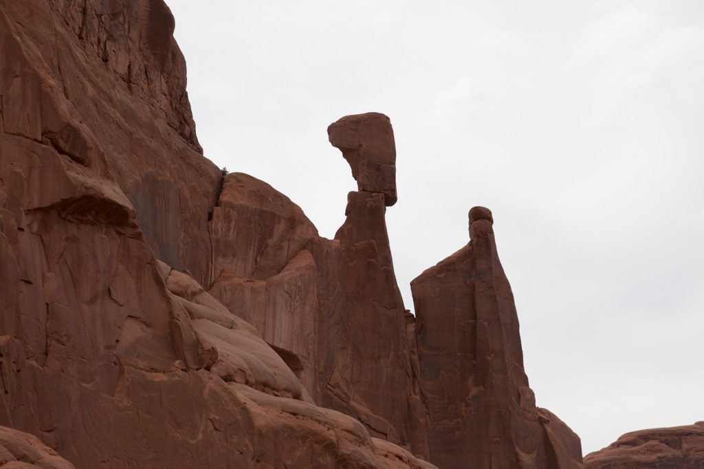
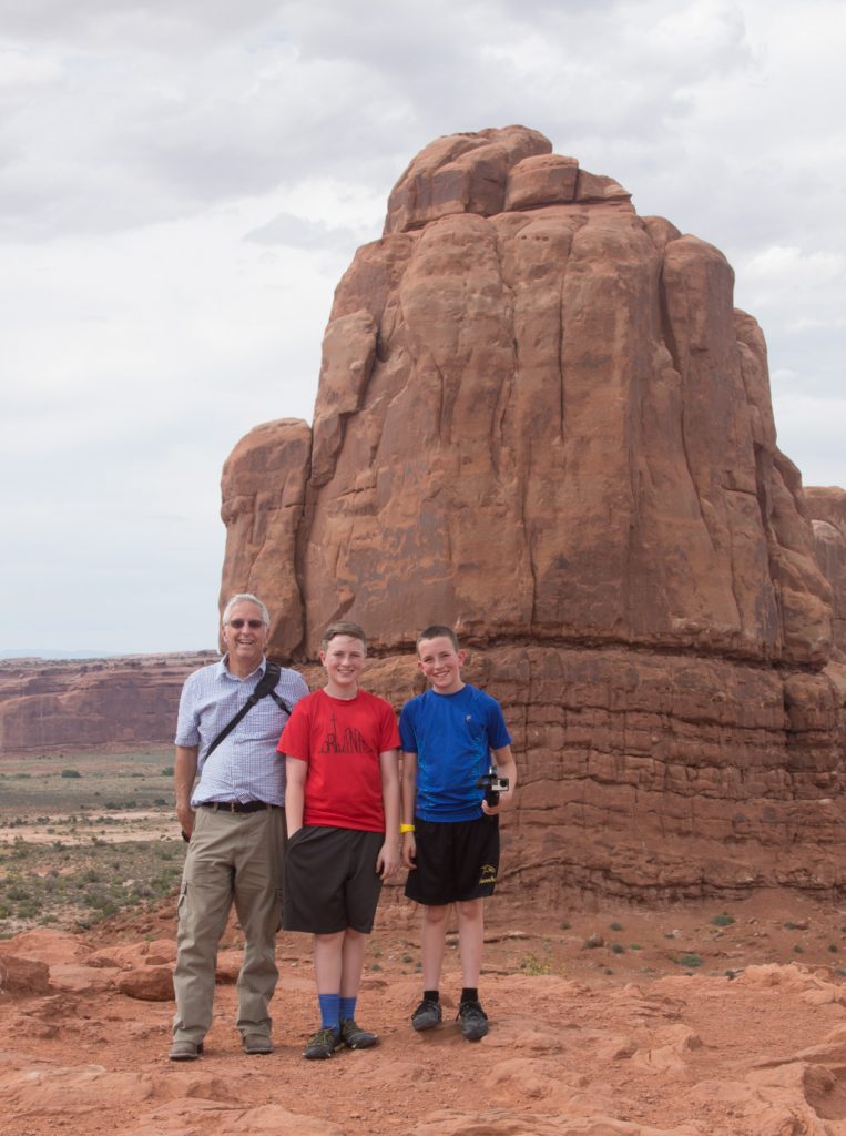
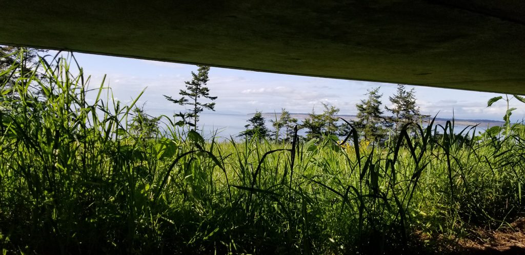
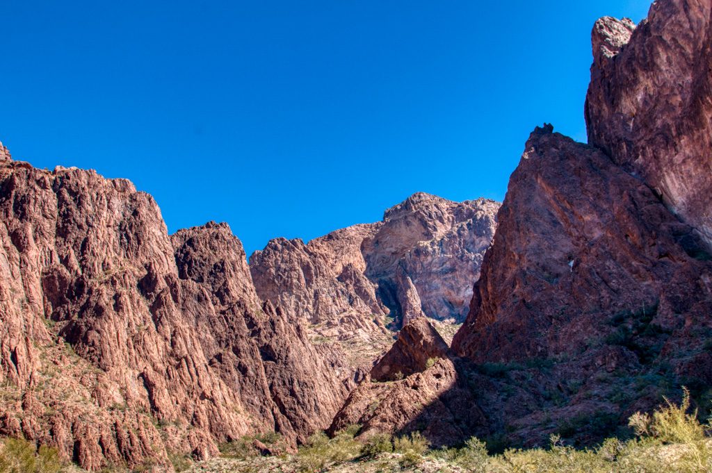
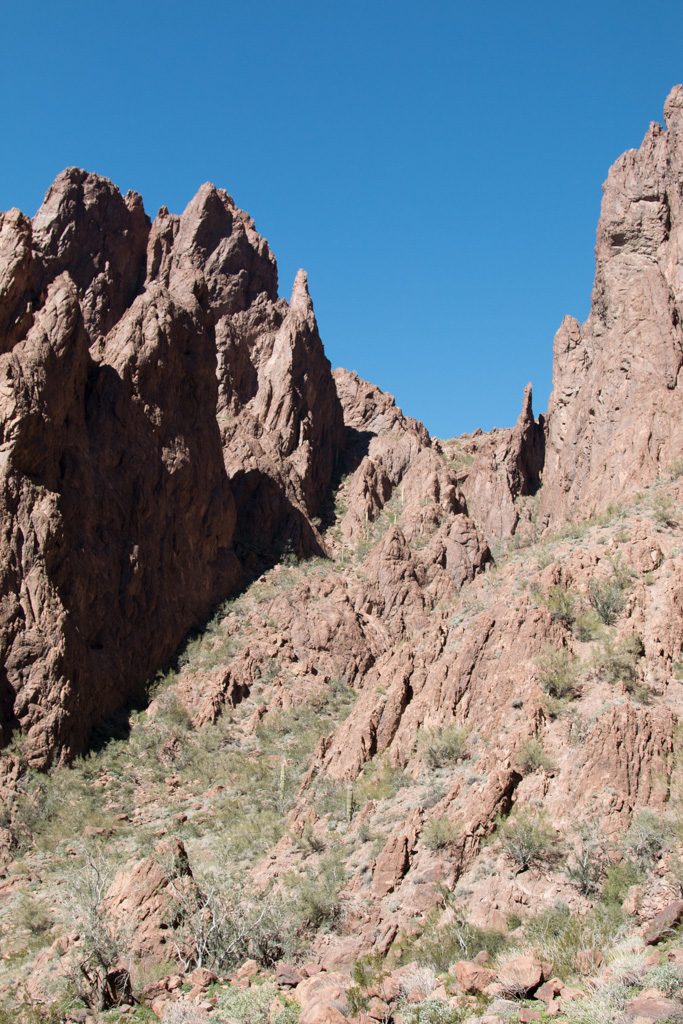
We departed Price and went to Moab, home of two National Parks, Arches and Canyonlands. We headed to Susie’s Branding Iron for lunch, had delicious food, and headed off to our first day at Arches. We stopped about every two minutes to take pictures, which got old towards the end. At the end, as the boys went to investigate the Windows, Grandma went to find parking. She went to the lower loop and discovered an amazing double arch! I went climbing up under the arch and found a gap under a big rock and found a cool thing to crawl through. We went back to the camper and played a fun game, The Mind.
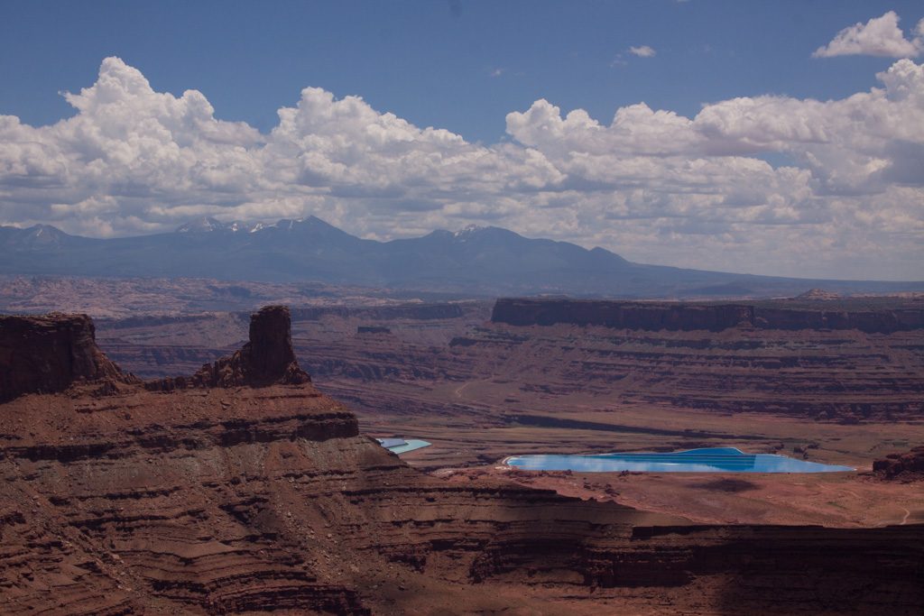
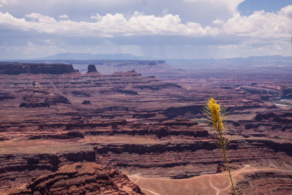
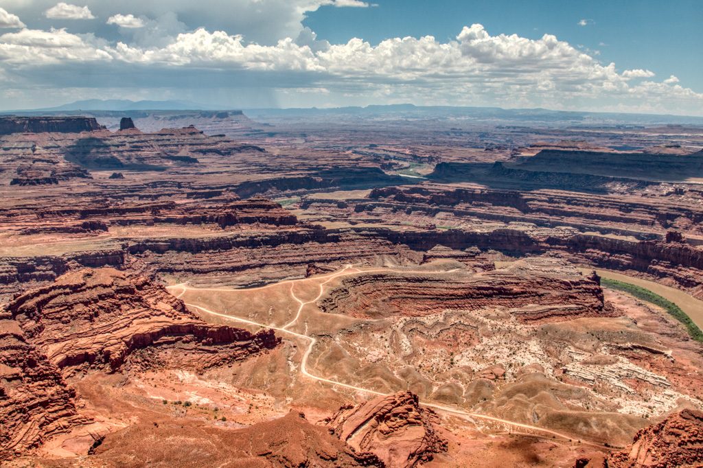
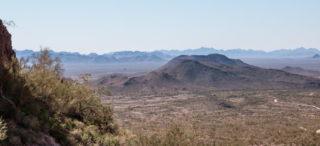
The next day, we started off to Dead Horse Point State Park, a park near the top of Canyonlands. The reason it has such an odd name is because the cowboys corralled the horses to the point of the park where they picked the best ones to sell and left the rest trapped at the end. The horses died of thirst, while looking out 2000 feet above the Colorado River. The view there is spectacular and we got some great photos. We also saw a potash evaporation facility and a nice guy told us what it was for. The way to get potash is to drill down to it and put water in the hole, then take the potash water and put it in these large pools to evaporate, leaving only the potash. Potash is mainly used for fertilizer.
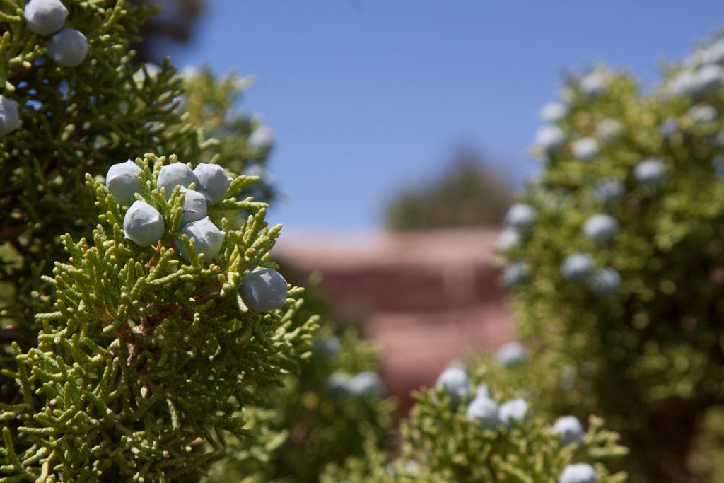
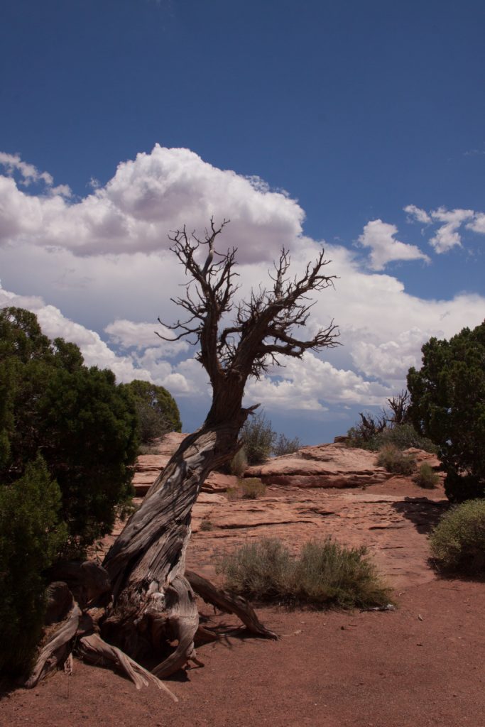
Potash pools Photo credit: Graham SimonsUtah Juniper Photo credit: Graham SimonsView from Dead Horse Point Photo credit: Graham SimonsCool Tree! Photo credit: Graham Simons
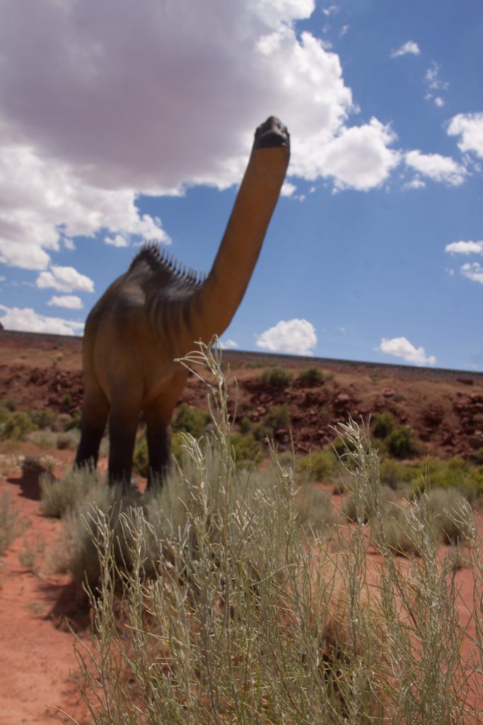
We then went for “fro yo” and went to a dinosaur amusement park , where there are giant dinosaurs that I had fun photographing. There was also a series of rooms that had a 3D aquarium. The 8th room was a shark attack, and the floor moved when the shark hit the ‘window’ or screen. We then went to get my FAVORITE food, sushi! We ordered a ‘Boat 2’ not knowing it was served on an actual boat! I also tried Octopus for the first time, and I liked it! We went back to the camper and played some of The Mind.
Watch Out! Photo credit: Graham SimonsDon’t worry, this one is a herbivore. Photo credit: Graham SimonsNo one was expecting this!
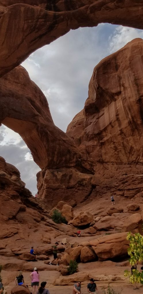
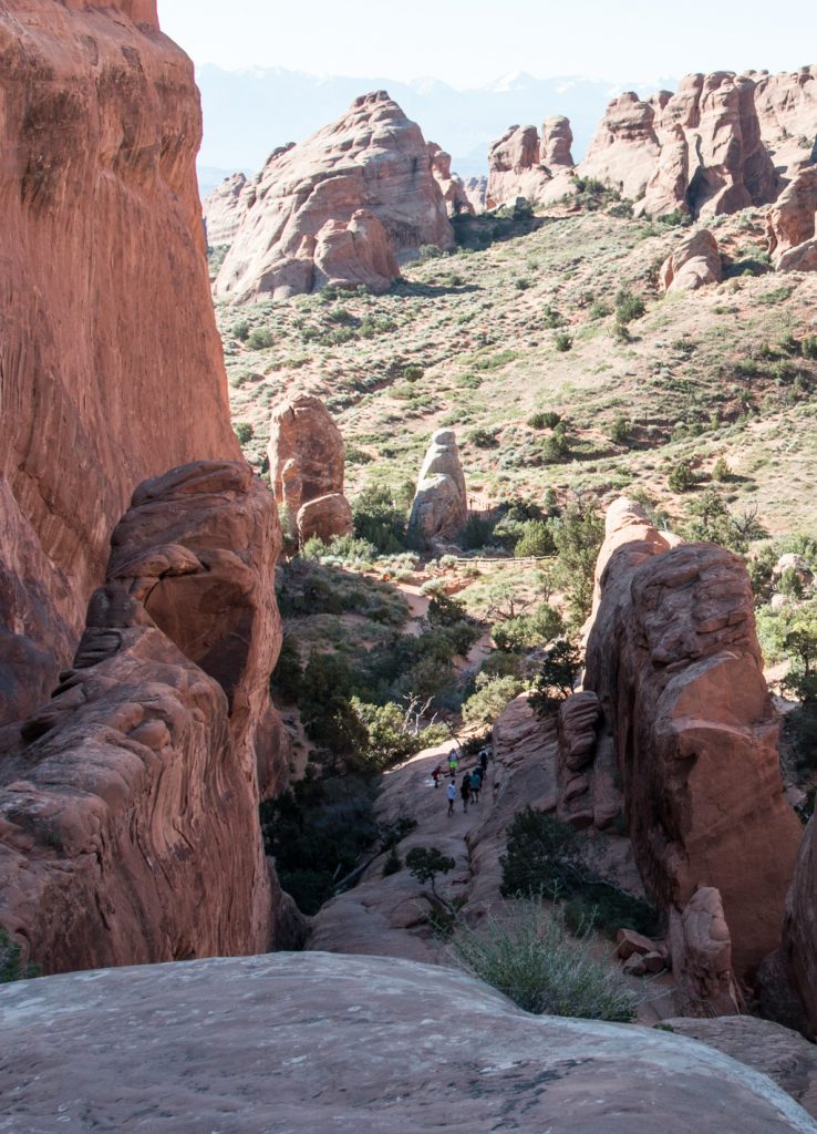
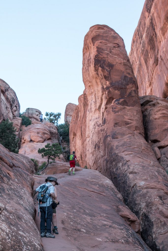
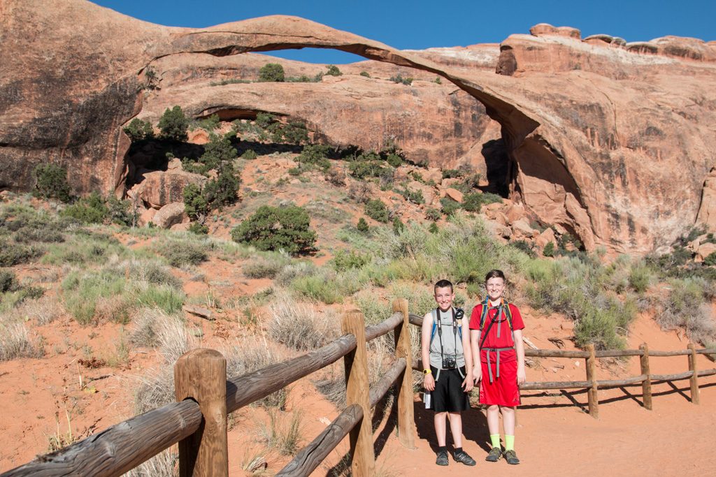
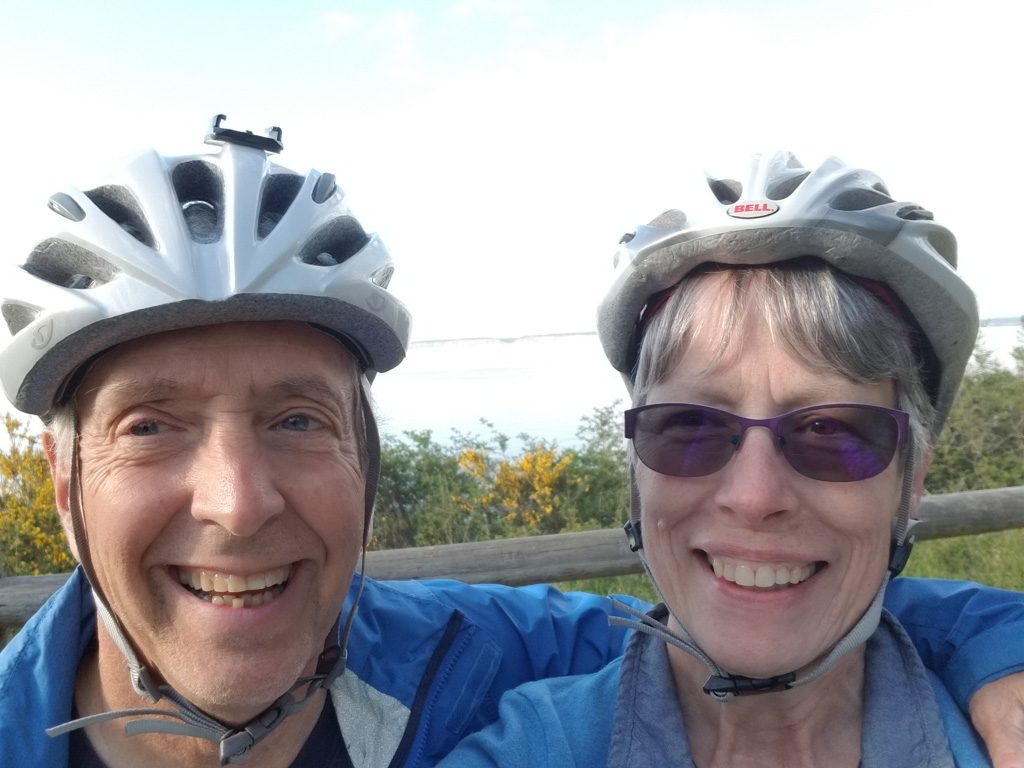
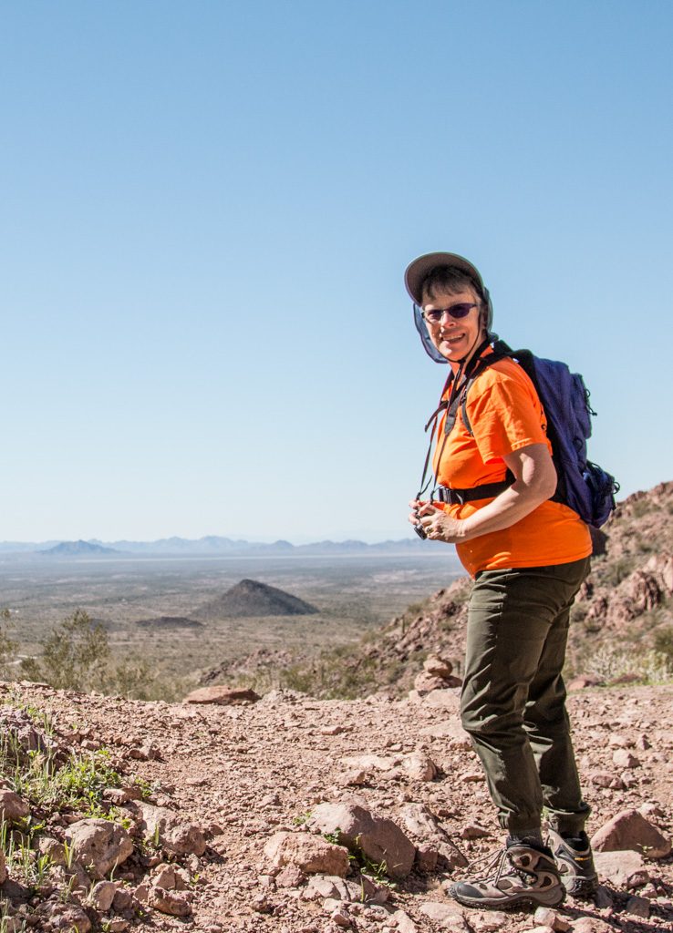
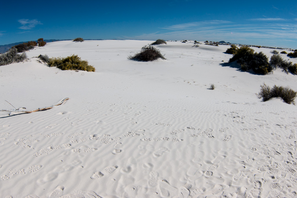
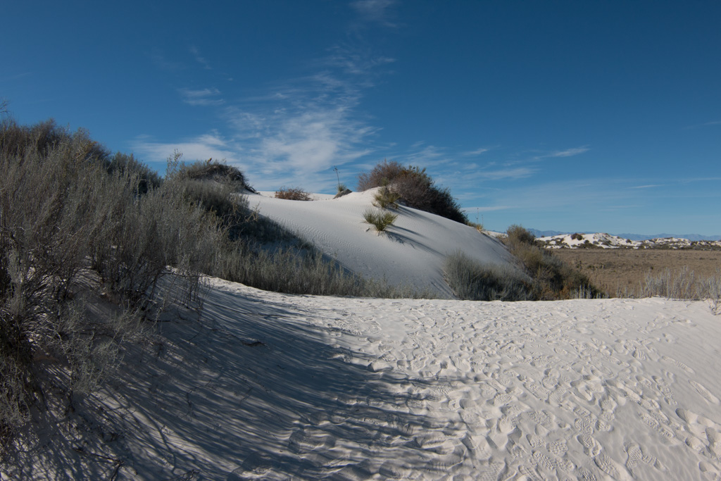
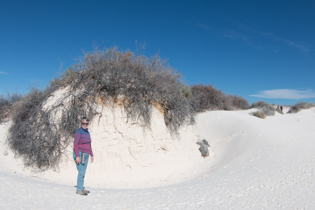
The next day, we woke up super early and left for Arches, so we could do a hike while it was still relatively cool. We set out with the goal to see Landscape Arch, the widest arch in the world, 305 feet. We also saw two smaller arches, Tunnel and Pinetree. We got to the big arch, and me being me, I wanted to climb up the thin, steep, and possibly dangerous next part of the trail. I made it up pretty quickly, and went back down.
Long way downThe green backpack is me!Only 11 feet thick at its smallest point.
We came back to Rhett having agreed to do some Ham Radio work. We have been working to get our licenses for a few months. Grandpa and Dean walked down the road a ways while Grandma and I stayed in the camper and Dean and I used their call signs to communicate. It was pretty fun and we learned a lot doing it. We finished off our day by watching Captain Marvel, and Grandma made some delicious bread pudding.
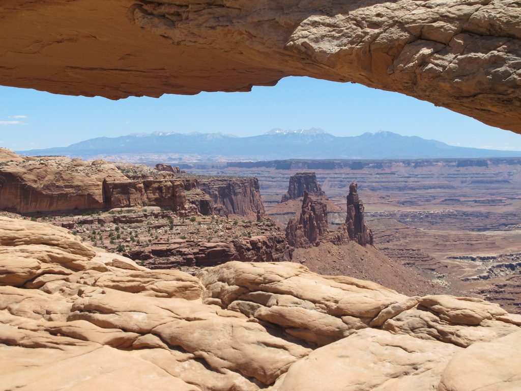
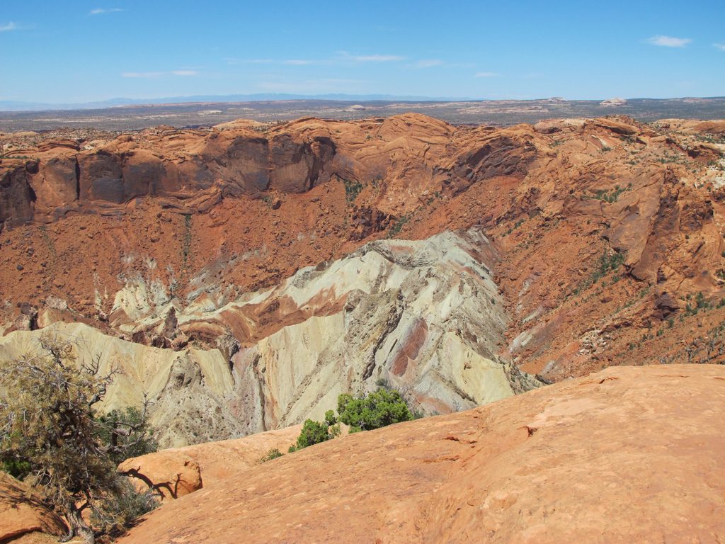
The next day, we left to our first day at Canyonlands’ Island in the Sky district. We drove out to some cool viewpoints went on two short hikes, the first of which was a short and easy hike to Mesa Arch. The second hike was a bit more uphill, but was a nice hike to the first overlook for Upheaval Dome. Our personal opinion is that it was formed by a meteorite strike, while the other possibility of its formation is a salt dome. We hiked back down and returned to the RV to plan for the next few days.
That is a road!But I thought this park was Canyonlands, not Arches… Photo credit: Dean SimonsMeteorite or salt dome? Photo credit: Dean Simons
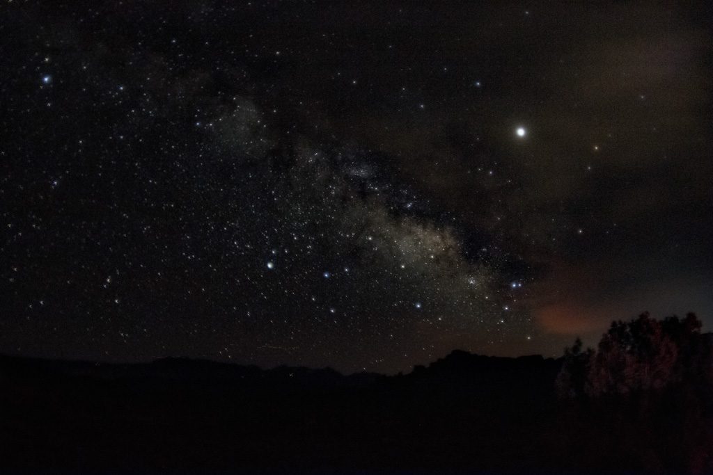
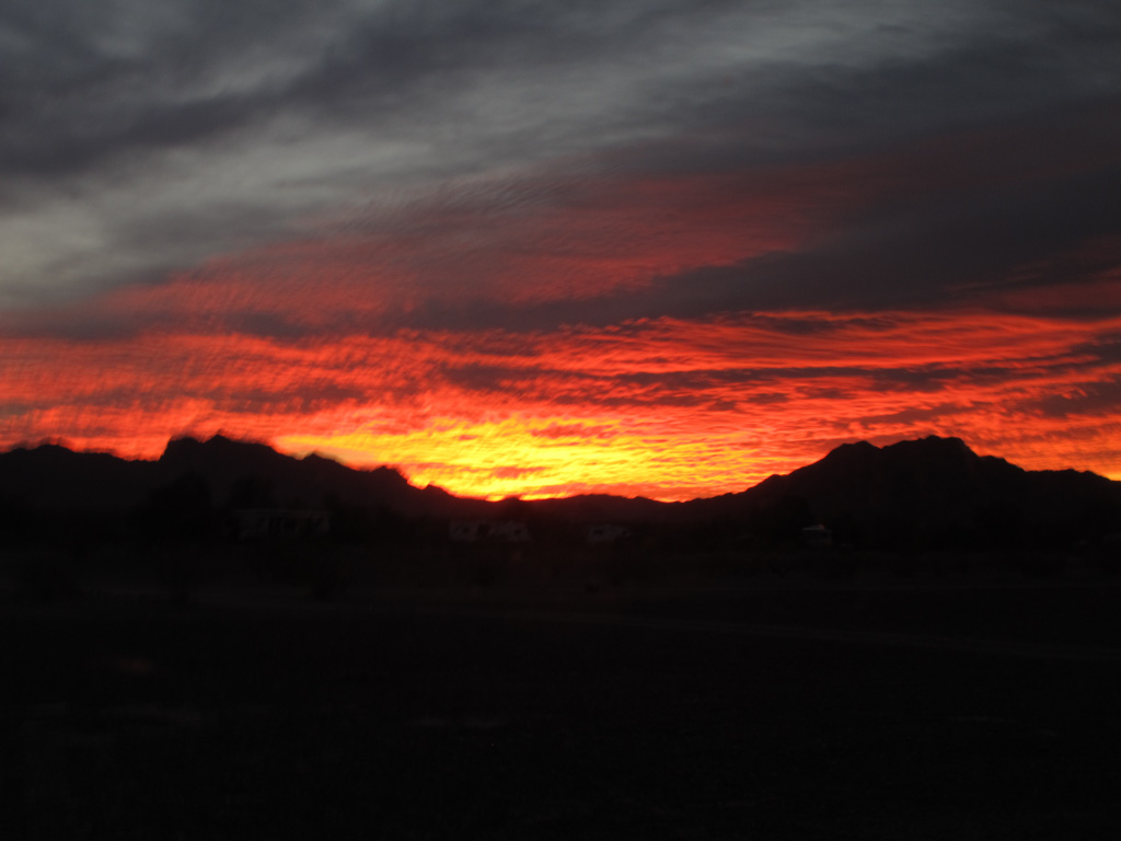
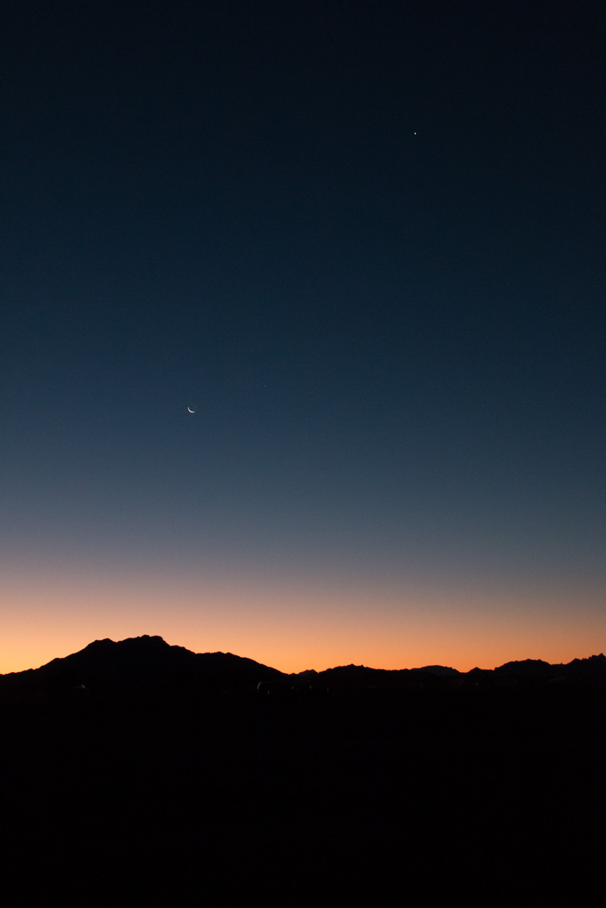
Finally, we left the camper at about 9:00 to do some star photography at Panorama Point in Arches. We got some cool photos, and towards the end we got the whole viewpoint to ourselves! The people that were already there were mostly there for sunset. We headed back to the camper at about 11 pm.
Milky Way from Panorama Point
The first week was really fun, and I look forward to seeing the other state and national parks in Utah.
Once we decided (months ago now) to give up our ‘sticks and bricks’ home in Maine and continue our nomadic life as full-time RVers, we needed to choose a state to ‘hang our hat.’
Well, we’ve done it. We’re South Dakotans. In March, we registered our truck and trailer in South Dakota; the registration fees there are much lower than in Maine. All that South Dakota requires for registration is a South Dakota mailing address, and since it is quite possible that the trailer and truck will never be in Maine again, there was no point in leaving them registered there. We were able to do the registrations entirely through the mail, which resulted in the following conversation being held several times with campground “neighbors.”
“Where are you from in South Dakota?”
“Never been there!” (OK, Not quite true… but it is a good line. We had been there for a week eleven years ago, on Pine Ridge Reservation.)
But now we have. In order to establish our domicile in South Dakota, we have now obtained our SD drivers’ licenses, and registered to vote.
South Dakota has laws that are written specifically to attract full-time RVers, as do Florida and Texas. To gain resident status—to be able to get a driver’s license and register to vote—you merely have to have proof of spending one night in the state every five years. The reason we chose to cease having Maine as our domicile is because SD has no state income tax, and as noted above, much lower vehicle registration costs. Now we just have to make sure that we don’t stay in any one state for six months or more in any year, or that state could claim us.
“Honey, why did we plan so much time in South Dakota? There isn’t much to do here…”
Everyone has seen Mount Rushmore, if not in person, then in pictures. So is there anything new to say about it?
It is BIG. Pictures can’t capture the scope of the sculpture. No, not even the ones that we’re including here. The entryway into the park is aligned closely to the direction of Washington’s gaze. But I didn’t realize until we wandered a bit that there are other viewing sites that let you look directly at the other presidents as well. We didn’t find the one to look directly at Lincoln, but we did for Jefferson and Teddy Roosevelt.
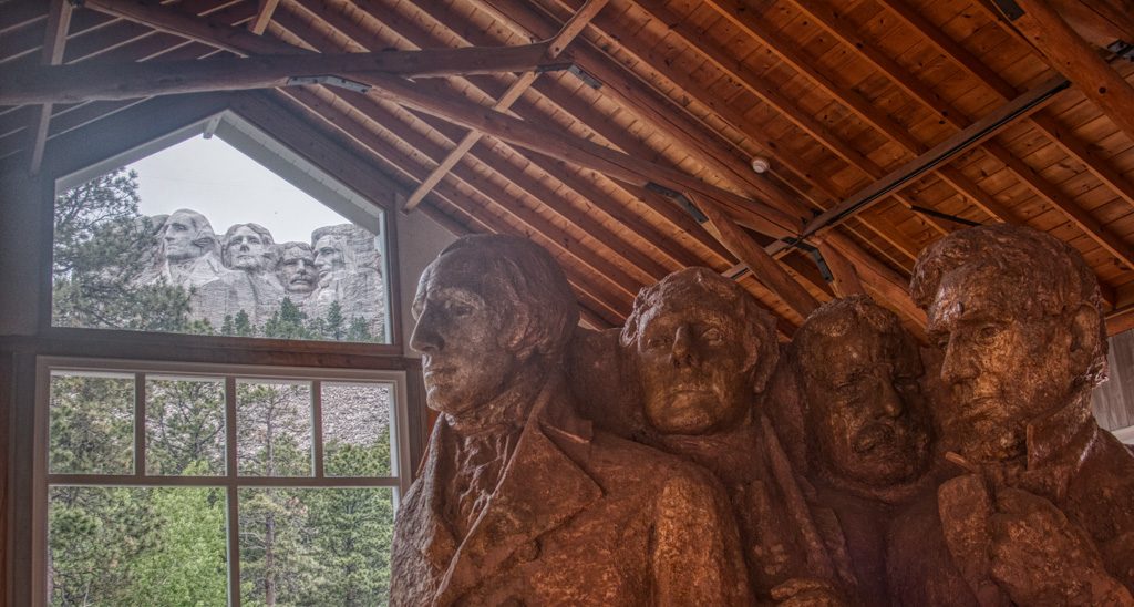
There is a “sculptor’s studio,” where they have maintained one of Gutzon Borglum’s scaled down sculptures created in preparation for the real one on the mountain. This study is at a scale of one inch to one foot. The studio allowed us our favorite picture of this visit.
The study and the mountain, from the sculptor’s studio.
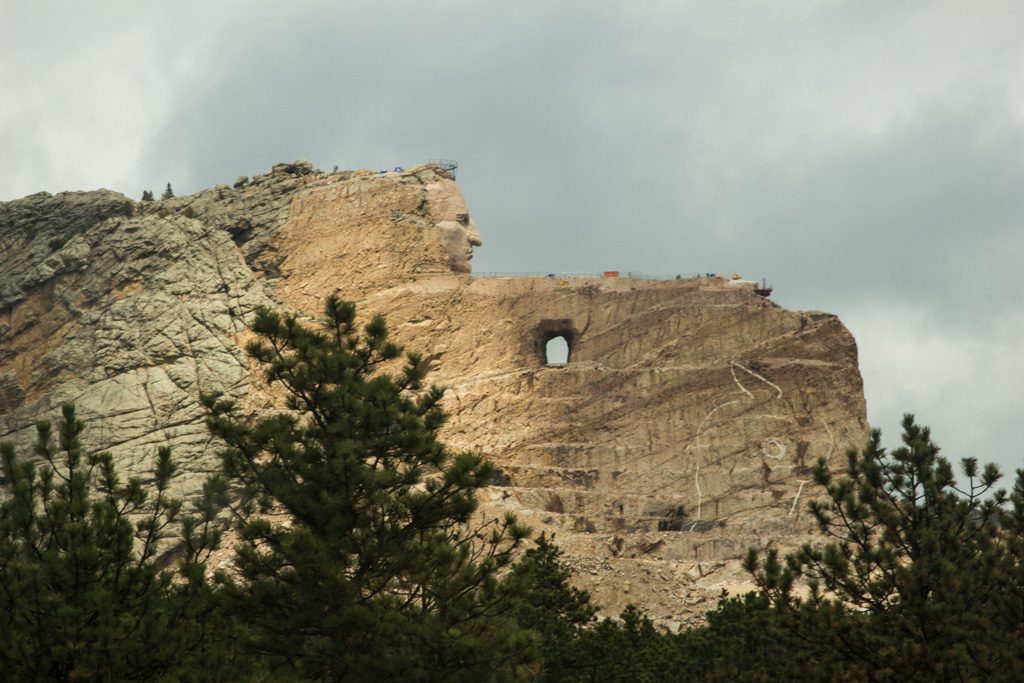
As we continued to explore the Black Hills of South Dakota, we knew we wanted to stop here. The amazing thing about the Crazy Horse memorial is that it is a work in progress—indeed, it was 1948 when artist Korczak Ziolkowski began to carve this incredibly huge work. The sculpture depicts the Oglala Lakota warrior, Chief Crazy Horse astride his horse and pointing into the distance.
It is HUGE! Larger than Mount Rushmore, the carving, when finished, will be 563 feet tall and 641 feet long. Look carefully.
Chief Crazy Horse Memorial. At the right you can see the etched outline of where the horse’s head will be.
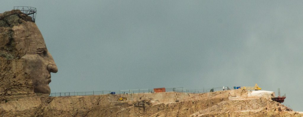
You can actually spot some heavy equipment up at the top (on top of the arm)–we can’t imagine doing that kind of work, can you?
Close(r) up of the arm with equipment
Ziolkowski’s wife and and seven of their children continue to direct the project since his death in the early 80’s. Technology has changed a bit; the use of laser measuring tools and explosives is now in place.
What is particularly impressive about this project is that a lot more is happening at the site than just the sculpture — a new on-site university, an incredible museum, speakers, special programs, and conferences. Everything is supported by private donation and run by a non-profit group. In fact, the US federal government offered to donate 10 million dollars and it was declined. There was concern that the federal government would take over control of (and change) the project.
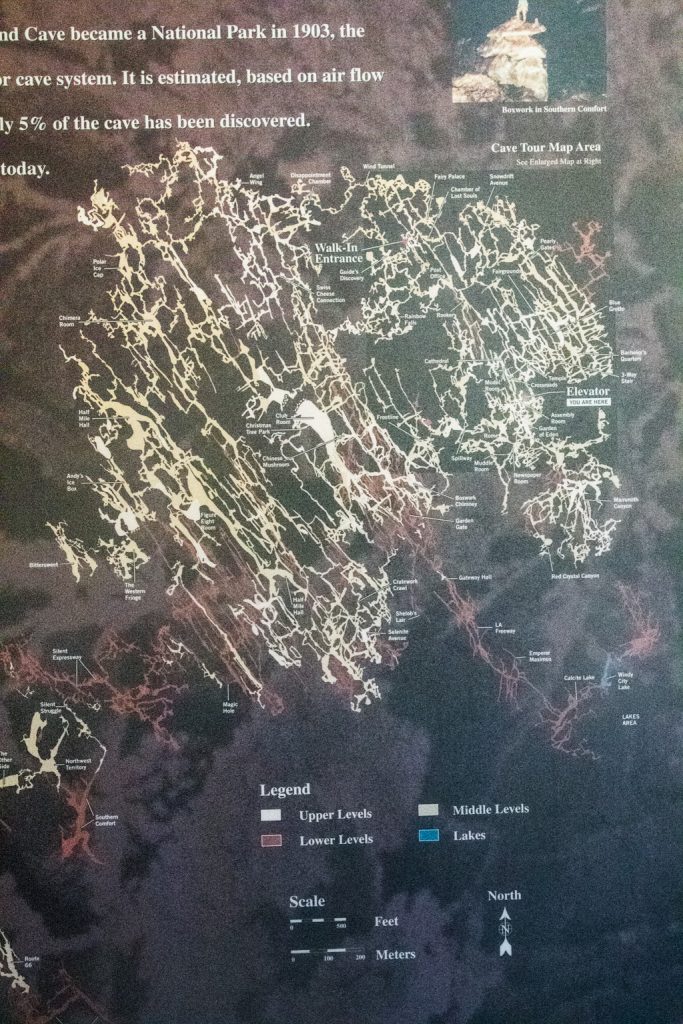
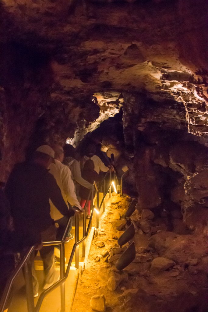
Al first learned about this park from a friend on the MDI Search and Rescue team who used to be a ranger there. Wind Cave was designated as a NP in 1903 and was actually the first cave anywhere in the world to be so protected. It is the sixth largest and most dense cave system in the world. To date, 149 miles of passageways have been explored and surveyed—all within ONE square mile. However, they only represent 5% of the total cave system. YIKES!
Wind Cave: only one square mile in area (so far).
There are three major levels. We took a tour in middle level.
No stalagtites or stalagmites here. The rock over the cave isn’t porous.
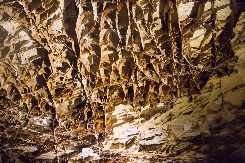
Frostwork, popcorn (which reminded us of our ceilings in our old home in NH), and boxwork are the three formations found here. In fact, Wind Cave is thought to be the home for 95% of the world’s boxwork.
To form boxwork, the limestone from which the cave is carved fractures twice. The first fractures are filled with water bearing the mineral calcite, which forms a latticework of stone much more erosion resistant than limestone. Later (much later), the limestone is fractured again, this time admitting flowing water. Over millions of years, limestone is eroded away to create the cave, but the stronger calcite remains to create the striking boxwork.
Boxwork in Wind Cave. Although it is resistant to erosion, it is VERY fragile!
Wind Cave is a sacred place for the Lakota People. Their emergence story originates here; they believe the cave is where they left the subterranean world to live on the surface. The NPS has a writeup on their website.
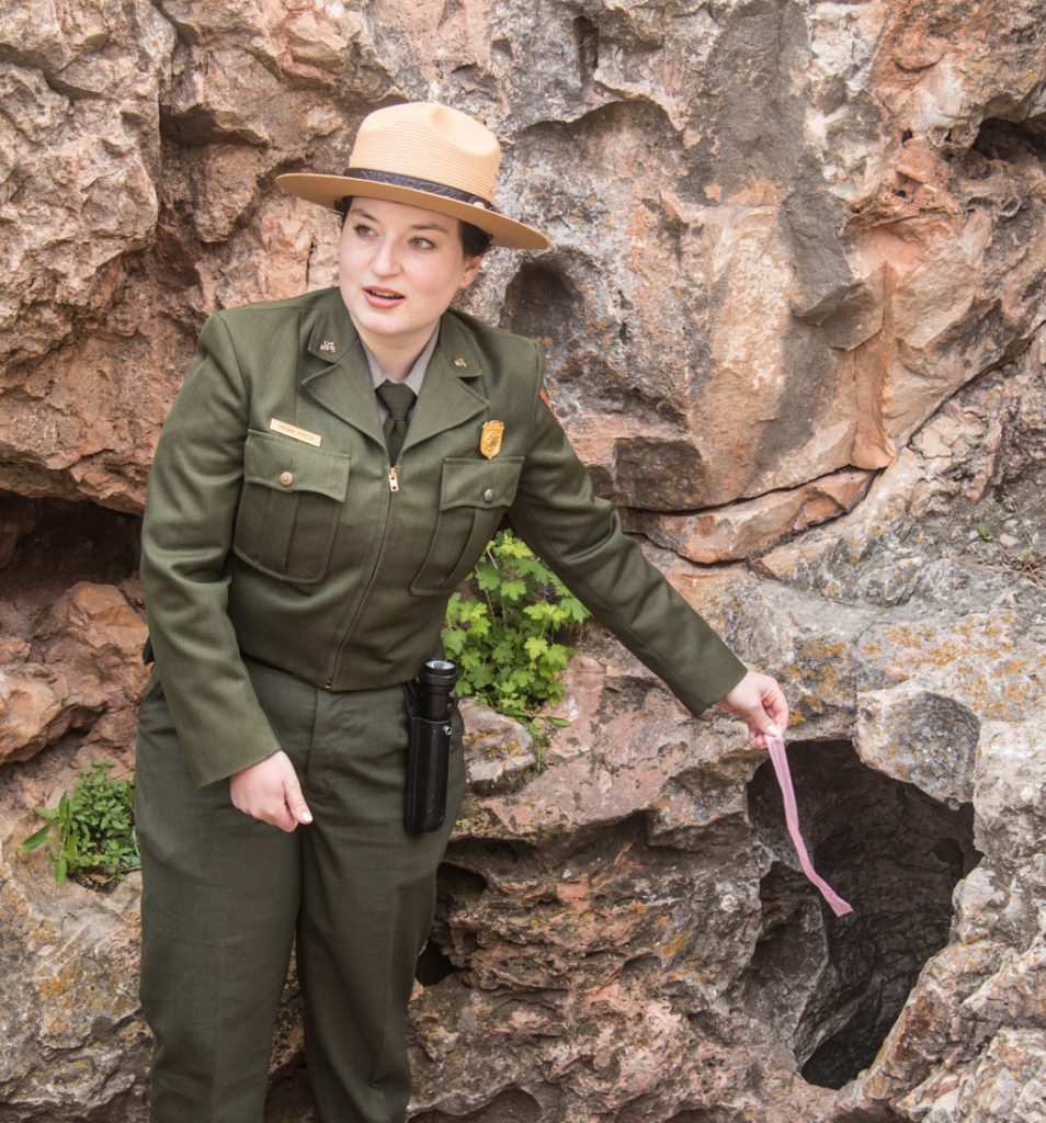
The only known natural entrance to the cave is a small opening (maybe a five year old could squeeze through). The ranger explained that when there is a difference in barometric pressure inside and outside the cave, a wind will blow; sometimes the air is rushing into the cave, sometimes out. She demonstrated with a ribbon.
On this day, the air pressure outside the cave is higher than that within; therefore the wind is blowing into the cave.
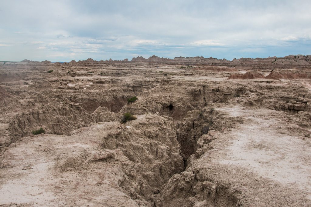
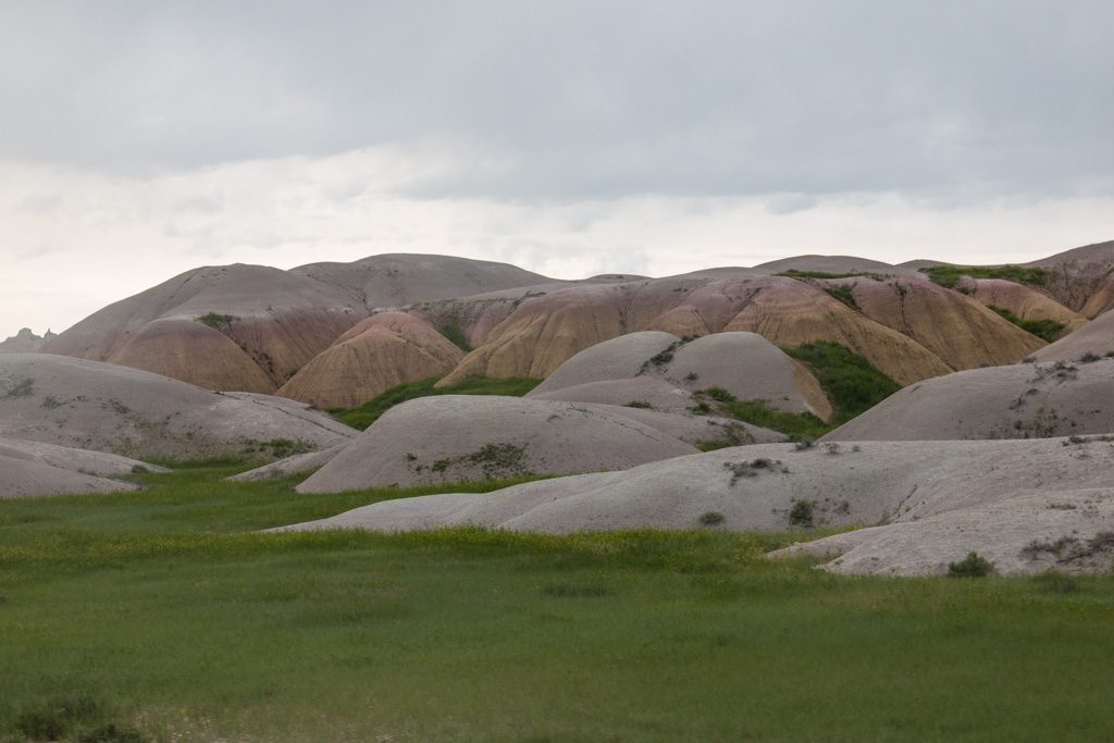
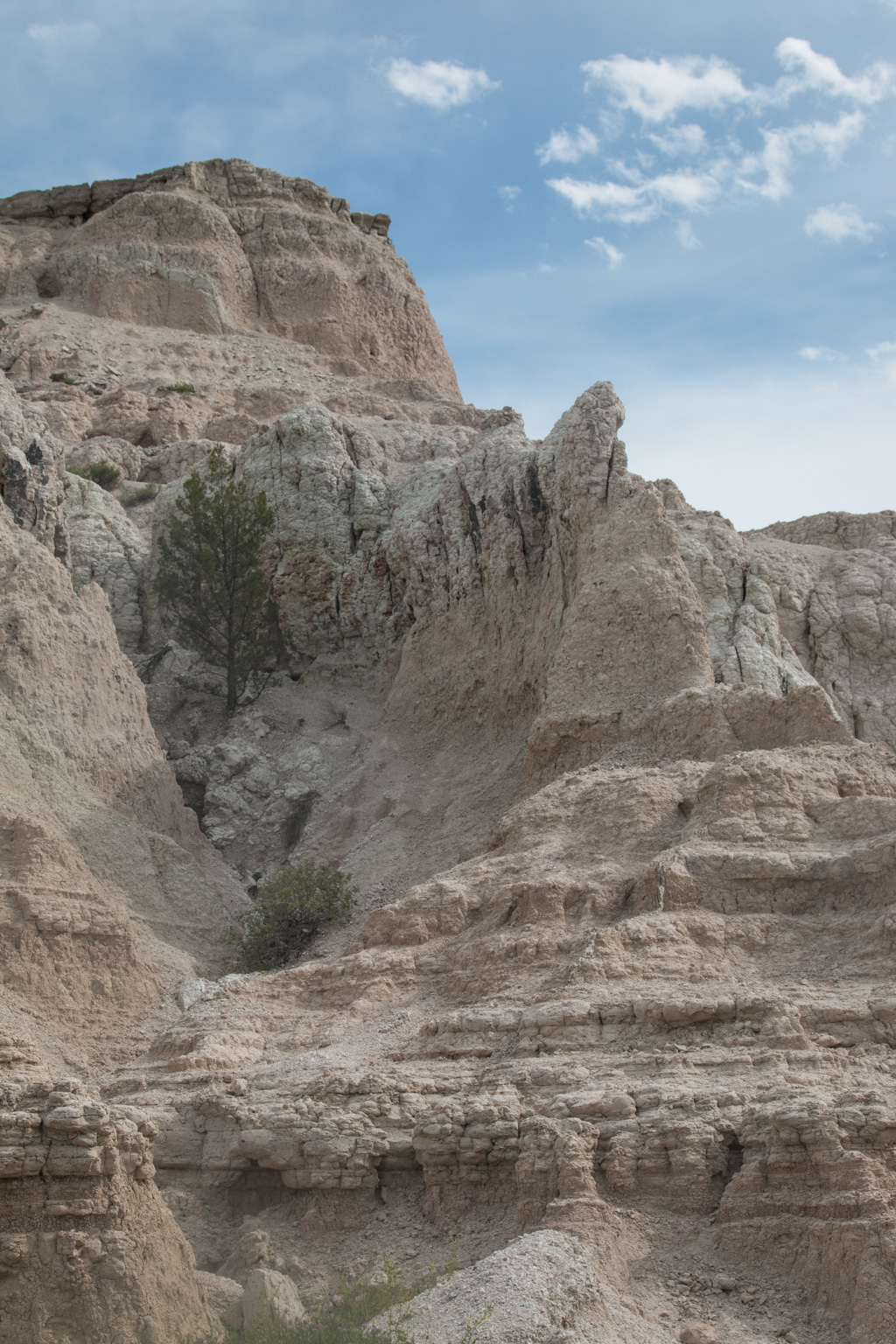
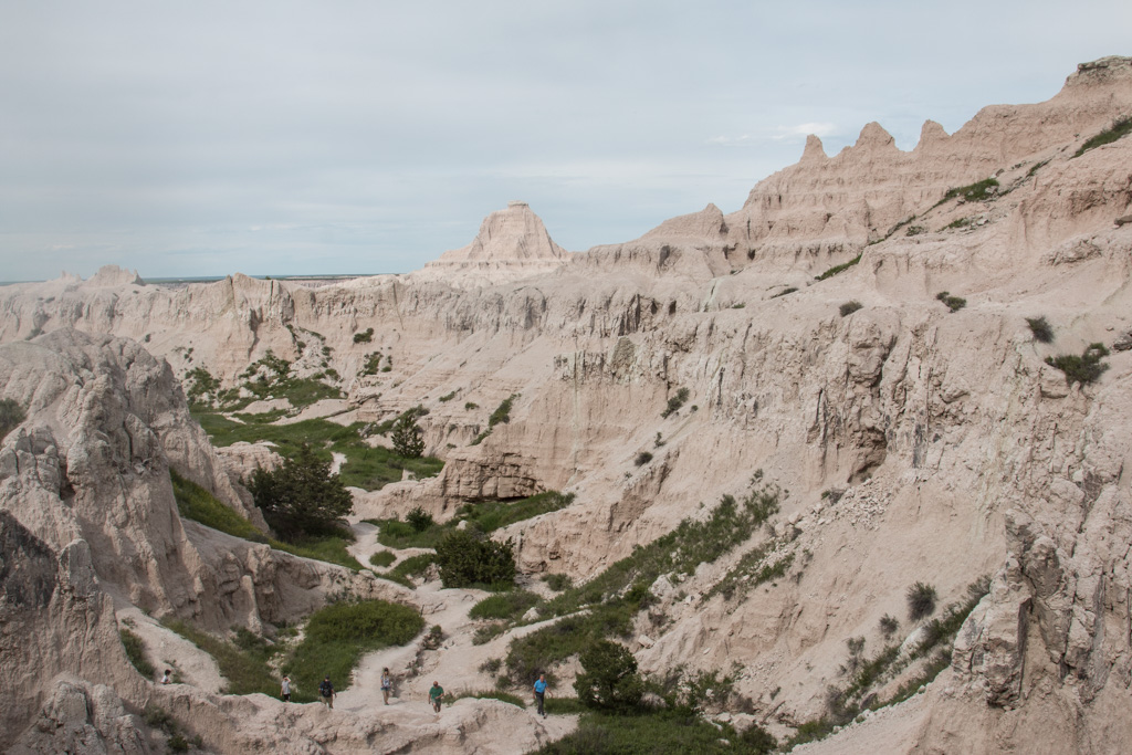
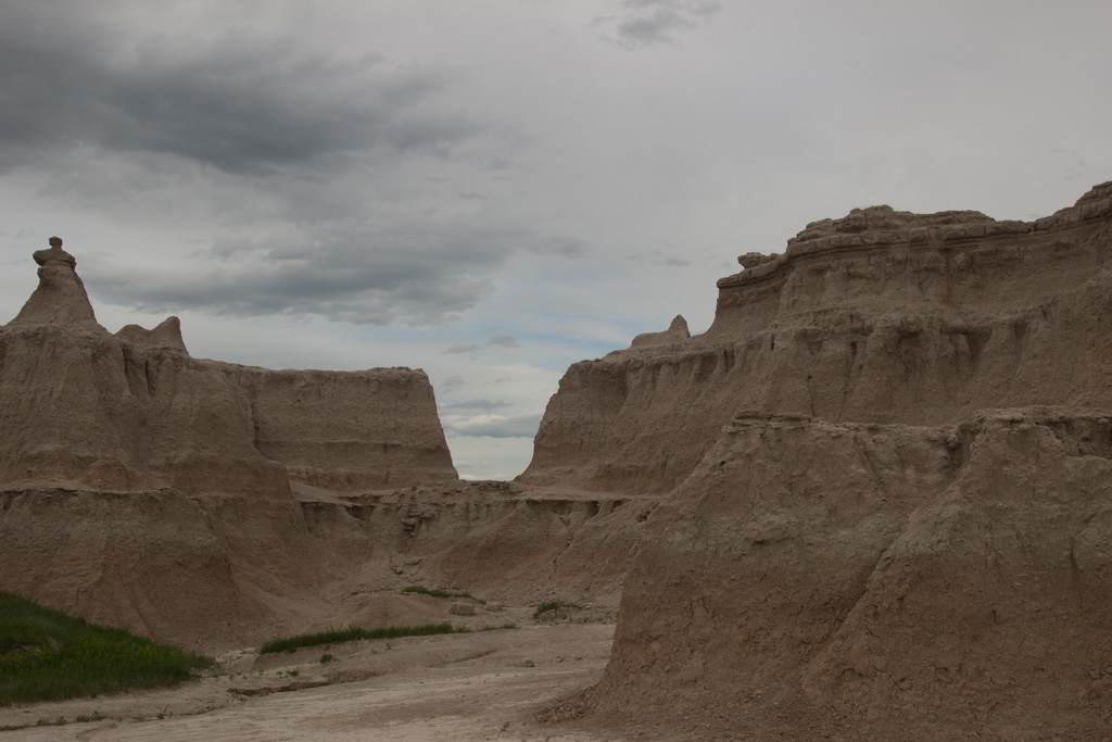
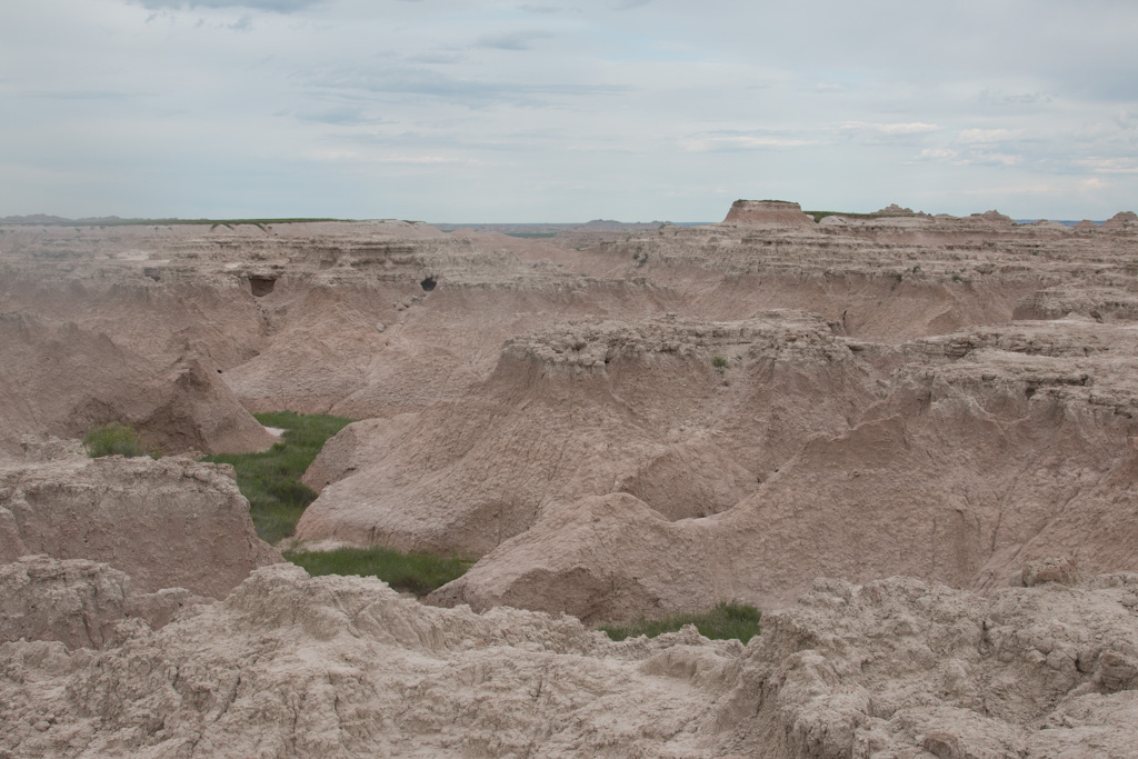
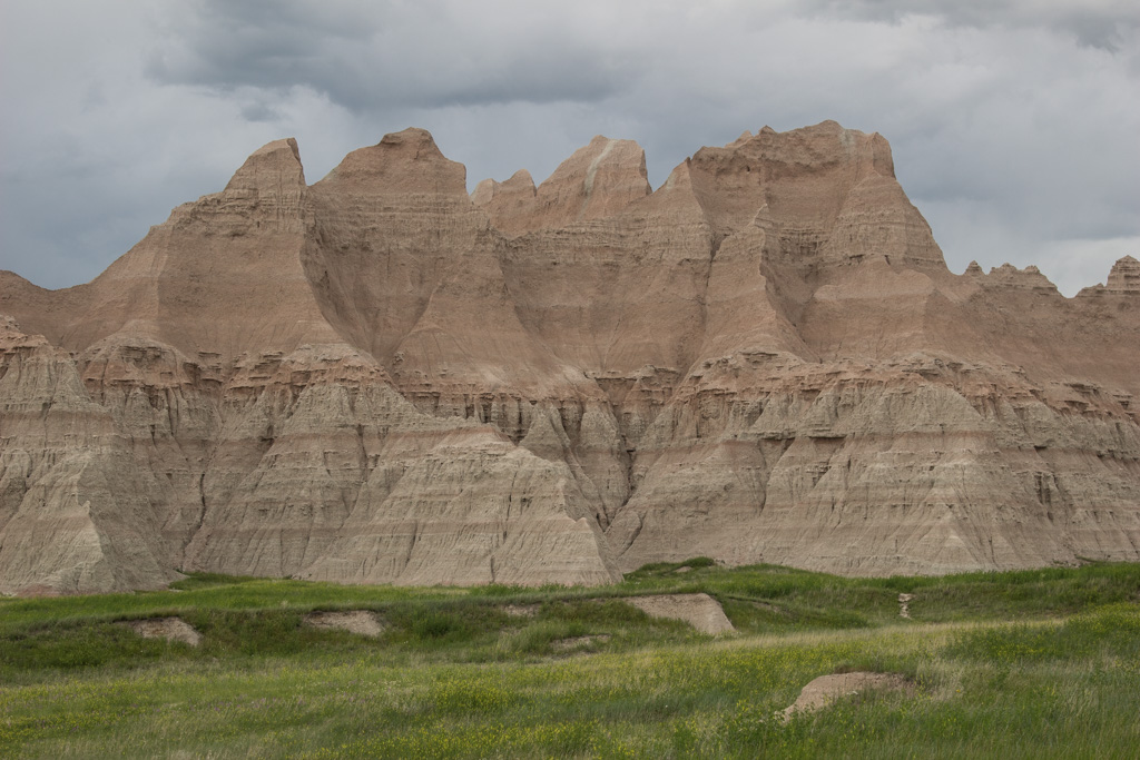
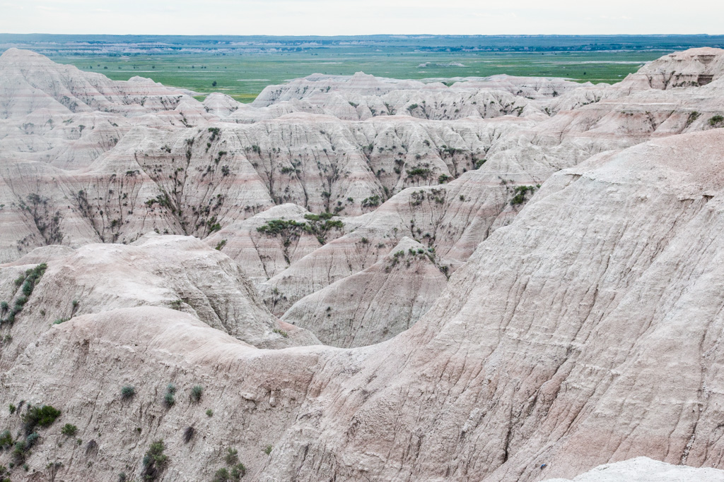
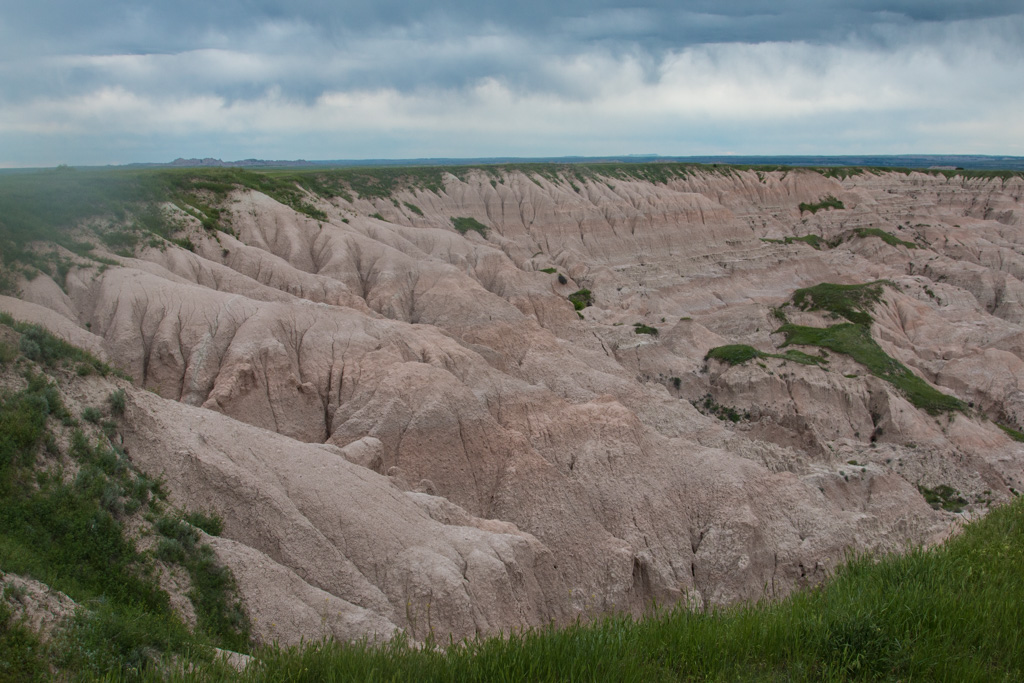
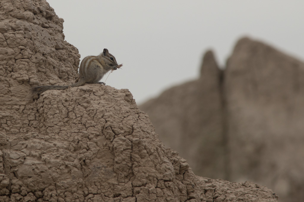
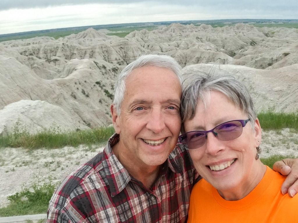
The native peoples had names for it. The early European trappers and explorers had names for it in their languages. Nobody wanted to travel through it. Today, we call it “the Badlands.”
Who would want to travel across this terrain?
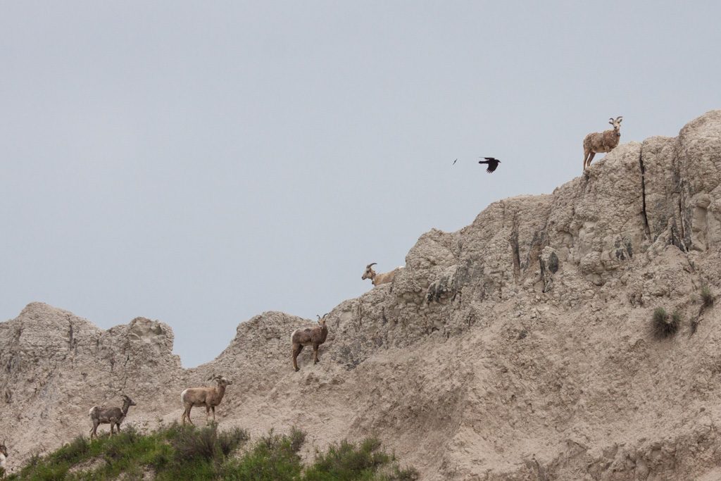
We also call it beautiful! The rawness of nature here is inspiring.
Even in this hostile environment, mother nature surprises us.
Big Horn sheep
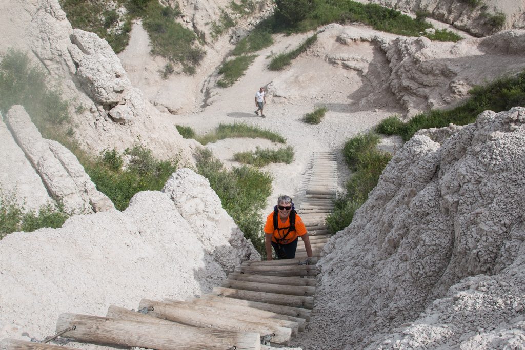
We chose to take a trail that was partly on the floor, and partly on a ridge. There was a log and wire ladder to get to the ridge that took some doing—mental and physical.
Can you find Kathe?
Unfortunately, we think that this ladder is what injured Kathe’s shoulder, requiring her to be seen by a doc, and wear a sling for about a week.
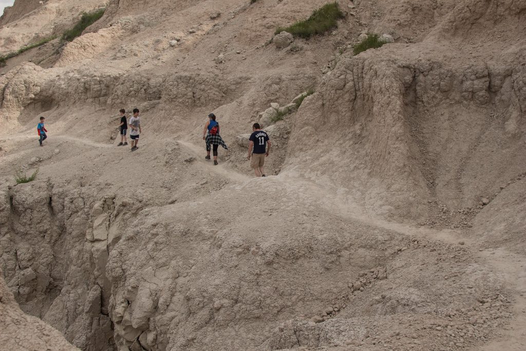
We also saw some careless parenting up on the ridge.
Unsupervised. Parents are way back off the left hand side of the picture.
We are about 50 feet off the floor. The wall below the path is sheer. The boy in the white shirt is off the path, standing on a sloping surface covered with loose material. A few seconds after this picture was taken he fell; fortunately he only only slid part way toward the edge. It was absolutely terrifying to watch; we felt completely helpless. A disaster was very narrowly averted. I was getting ready to rush back down to the floor to see whether there would be anything I could do for him.
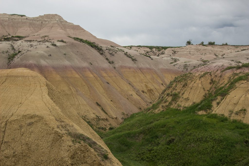
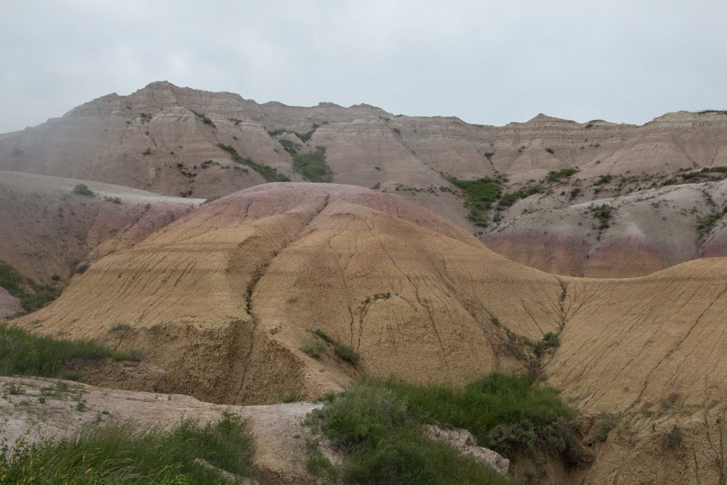
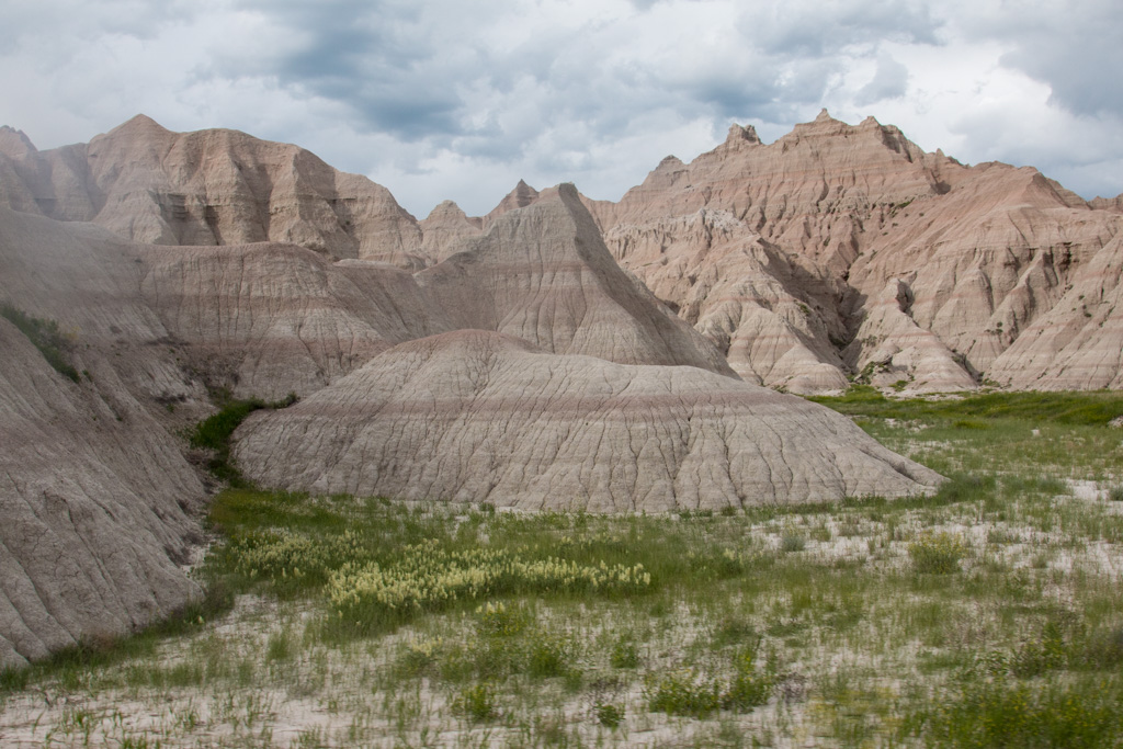
A few miles northwest from where most of the pictures above were taken, the terrain is quite different, with smoother features and a fascinating coloring.
A different era, different sediment reaching the ocean floor. Different colors.
There was so much to see in the Badlands. As always, click on any Badlands picture in the gallery below to see them all as a slideshow.
As we noted above, pictures cannot truly represent what we’re seeing. We wish you could be with us to share the real experience, but for now these pics will have to do. We really enjoyed taking this first exploration of our new state. We’ll be back!
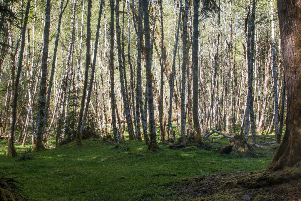
We started out by camping in Sol Duc (Sole Duck), deep in Olympic National Park. The campground was run by the concessionaire, and was part of the Sol Duc Resort. We sort of lucked into this one via Sir Google; there are actually two campgrounds in Sol Duc that take RVs. The other one was heavily wooded and we would probably not have been successful getting Scarlet and Rhett in there. The one we had was small (about 15 sites), but wide open. The site was nestled in a grove of birch trees.
Beautiful in the morning
It was also a short walk to one of Sol Duc’s main attractions: thermal springs! We spent quite a bit of time soaking… The spring water is 150°, and is mixed with the river water to the desired temp for each of three pools. The hot one was hot enough that even I couldn’t stay in it for more than about 10 minutes—and I love hot baths! Just like in the Three Bears, the middle one (temperature) was just right.
Ummm. Sorry. No pictures; we were too busy relaxing!
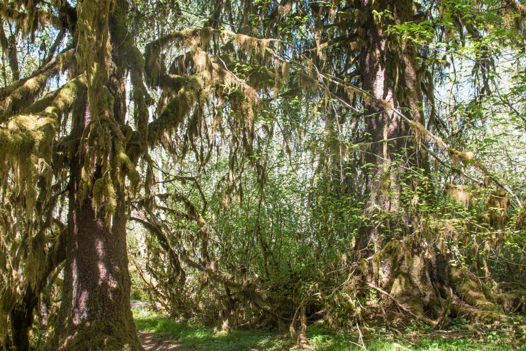
You may have heard that the Pacific Northwest (PNW) gets a LOT of rain. There are several rainforests within the park. We were not in one, but looking around at the trees it sure looked like it. The older trees were covered in moss!
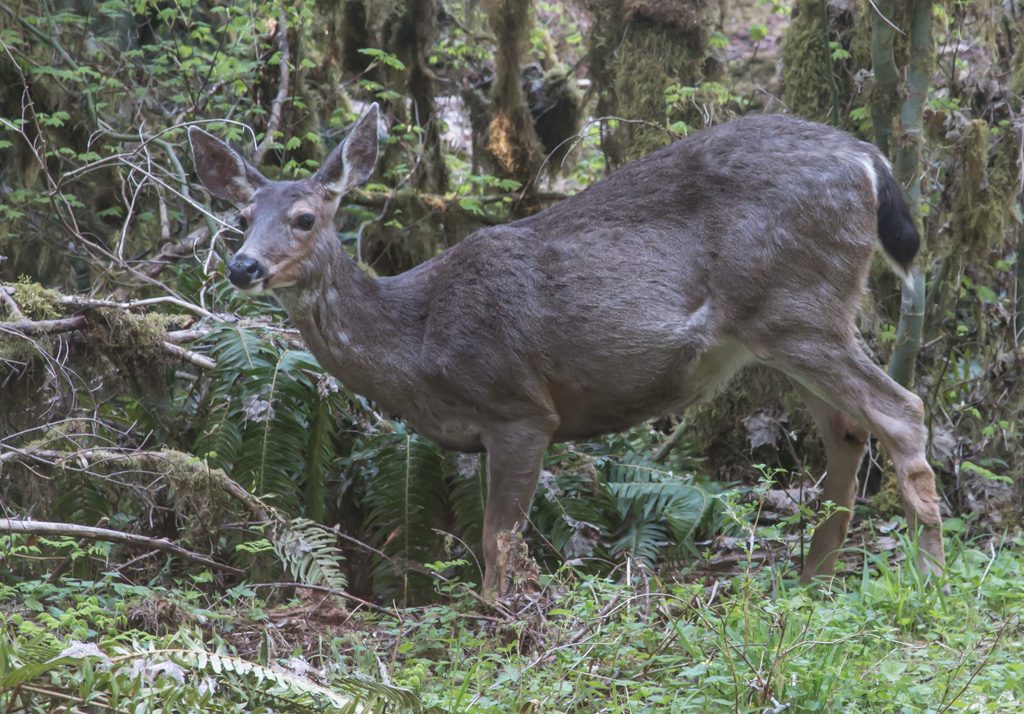
There are several trails leading out of the Sol Duc campgrounds; we encountered some deer browsing just off one of the trails.
Only about 15 feet off the trail.
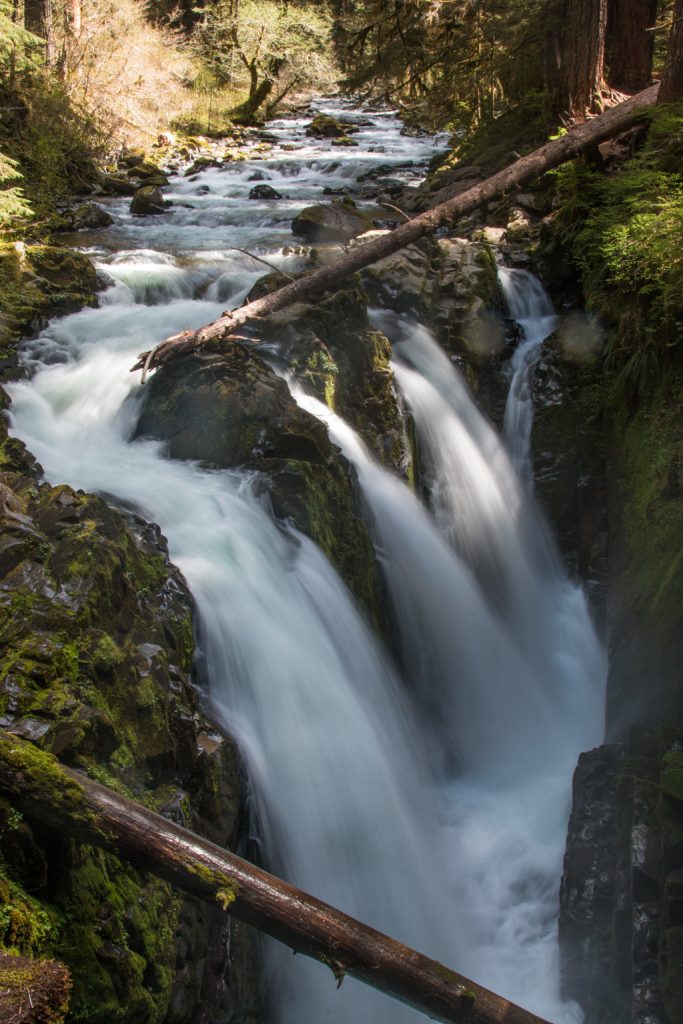
We followed one of the trails out to the Sol Duc waterfall.
It is hard to comprehend the amount of water that cascades through these falls every day.
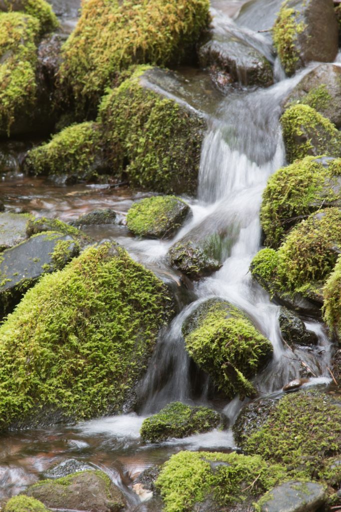
On the way back home (yes, the trailer really is “home”) we found another waterfall, albeit not quite as large.
A pretty, small stream, part way up a hill from the trail.
Sol Duc is completely surrounded by mountains. Nice scenery! Lousy connectivity! For the first time ever, we had to send a text message out through the Garmin Inreach satellite communicator that we carry for back country emergencies. (It wasn’t an emergency…)
Crescent Beach
Sol Duc is southwest of Port Angeles, which seems to be the major town on the Strait of Juan de Fuca, the northern boundary of the Olympic Peninsula. Crescent Beach is a little west of Port Angeles, but is on the shore of the Strait.
Being here made us appreciate Oregon’s beach access law. Directly across the road from the campground was “their” beach, but “don’t go past the rainbow pole! That’s not our beach and you’ll be trespassing.”
In the distance (right side) is Vancouver Island, Canada!
About 1/2 way toward the trees in the distance, the beach belongs to someone else, and campers can’t go there. Sigh.
A state park, at the other end of the beach… and people in the park can’t go onto the campground’s beach, either.
Nevertheless, it was a beautiful setting and we enjoyed strolling on the sand.
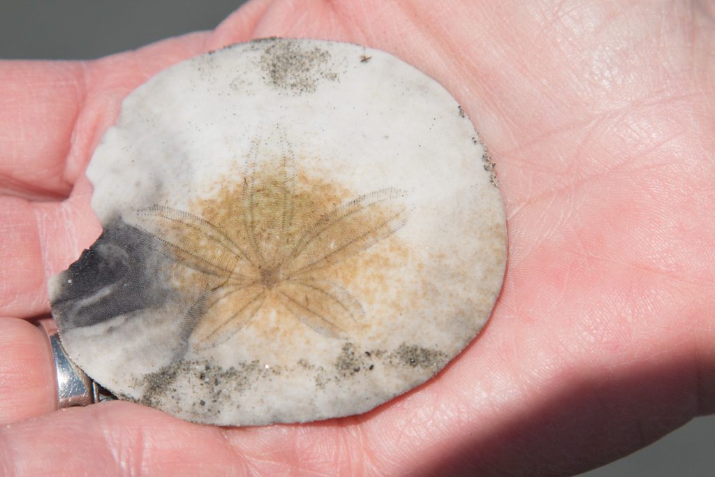
Can you find Kathe? What’s she looking for?
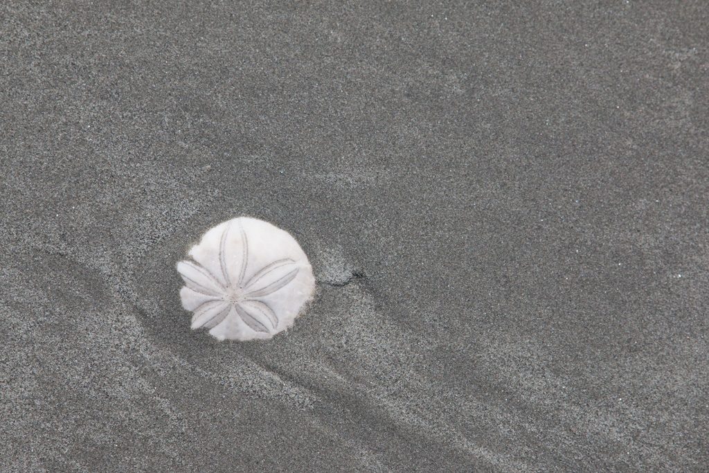
Kathe normally beachcombs for sea glass, but we haven’t been successful finding any in the PNW. Here she was looking for…
Sand dollars!
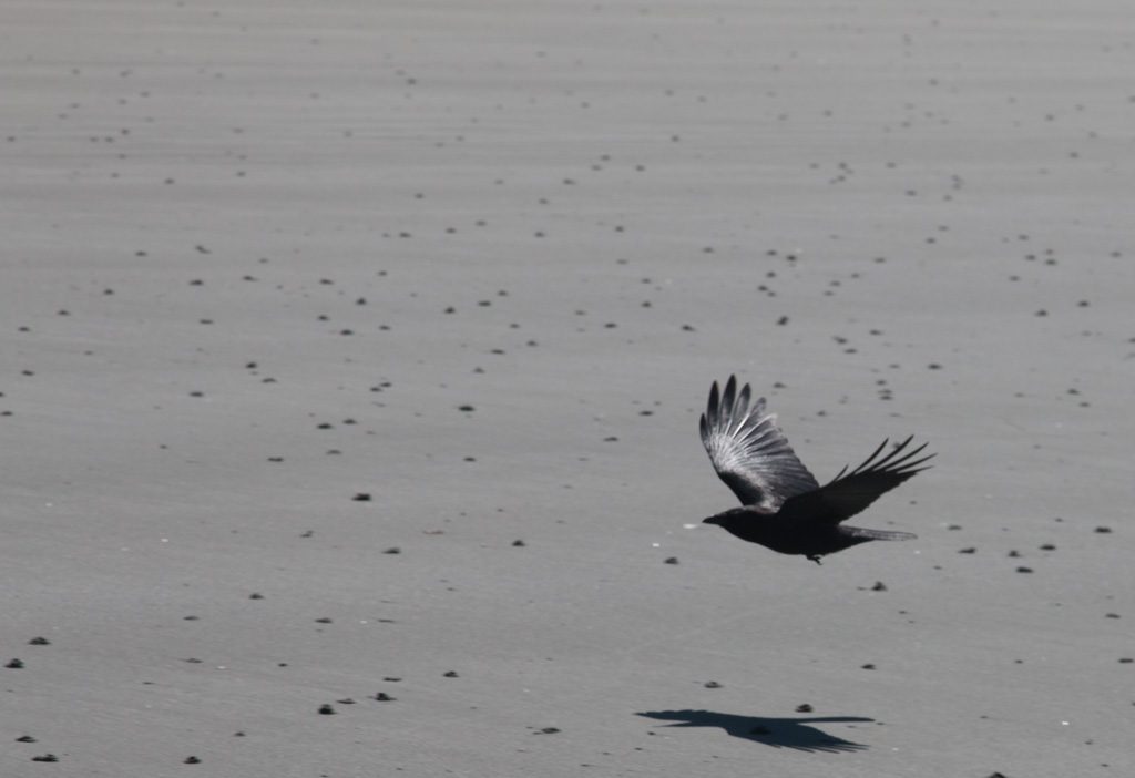
We had a visitor.
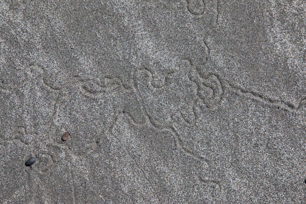
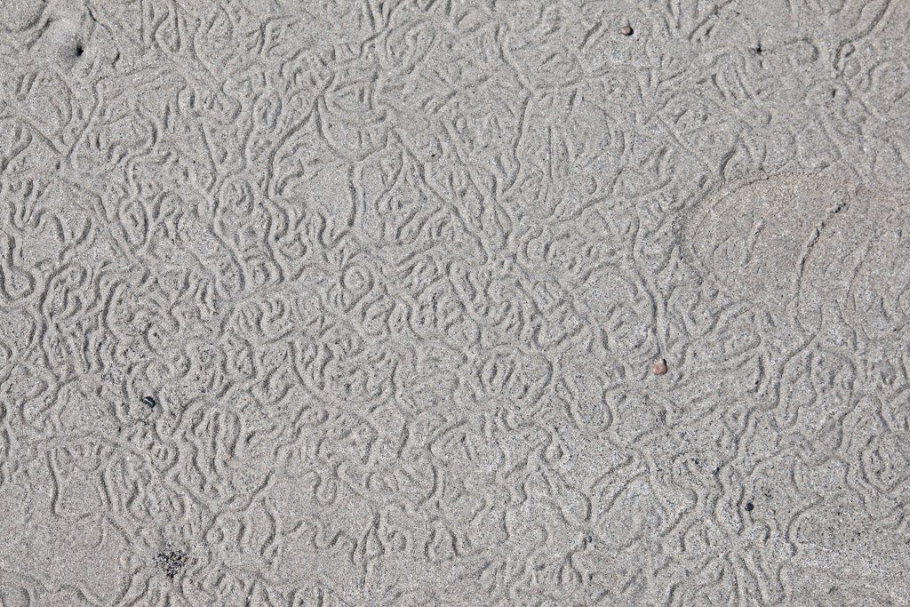
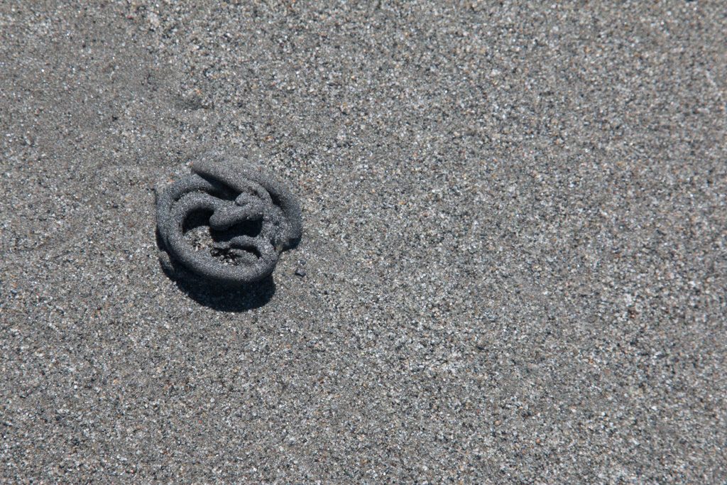
But what are all those dark spots on the beach? Something is living in the sand (clams?). It leaves two kinds of markings.
Tracks from the creature from the deep!They can be quite complex.Piles of sand, expelled from below. These are all over the beach, and are those dark markings in the previous picture.
Please leave a comment if you know what animal is creating these tracks and the… what shall I call them?
Sometimes I wonder about the people who lay out campgrounds. Who would think that putting the sewer connection at the highest point in the site would be a good idea? Remember: it flows downhill!
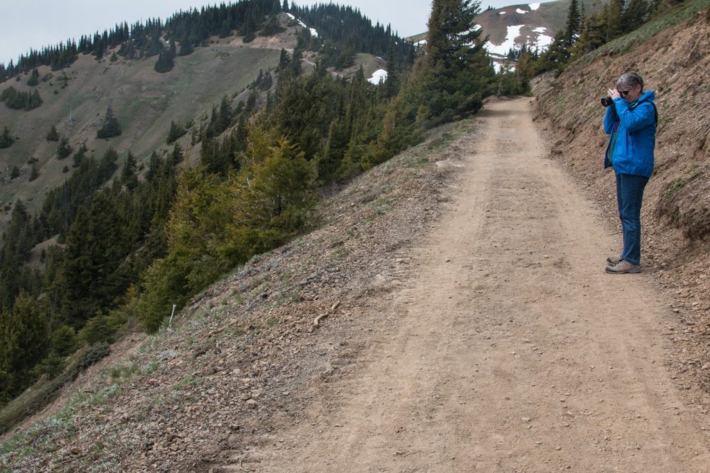
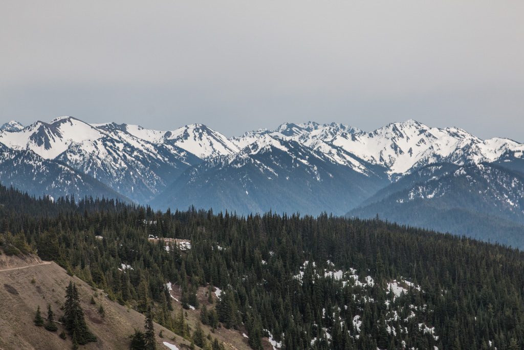
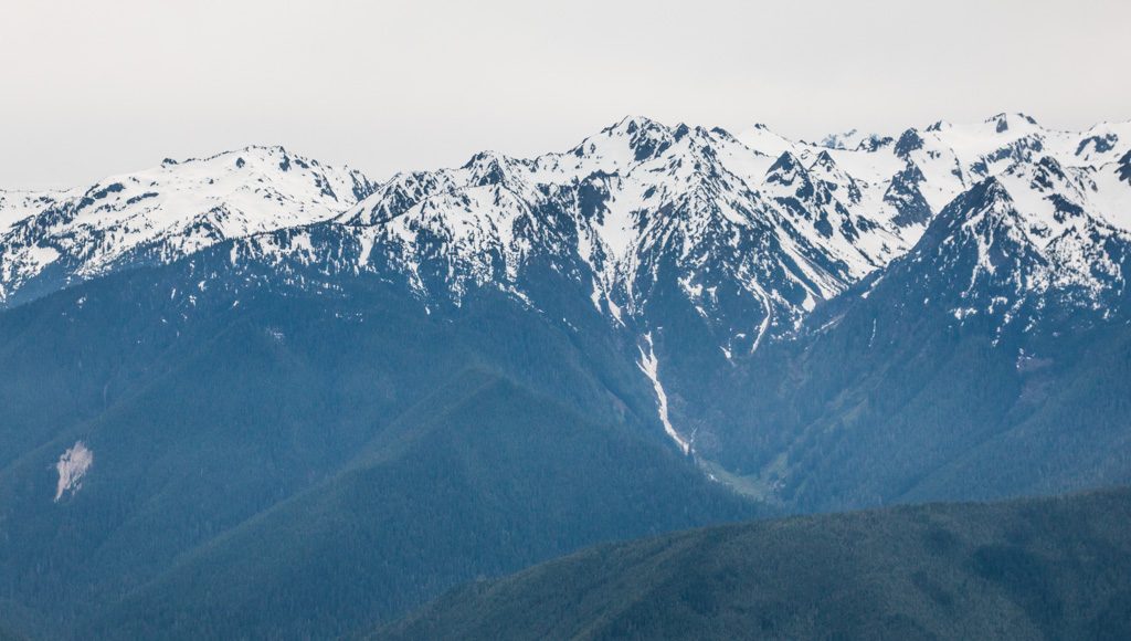
Hurricane Ridge
Crescent Beach isn’t part of Olympic National Park, but we went back into the park to visit Hurricane Ridge on the recommendation of a friend who is a former park ranger there. So, so, so glad!
Also we were so glad that we didn’t have our trailer hooked up to our truck for this one! The road up the ridge is steep and twisty. But the views are worth it. Down at sea level the skies were gray and cloudy, so we almost didn’t go. (Note to self as a future reminder… Always go!) Up top? Take a look!
Kathe getting pix of the horizon.Yes, it was worth …… the drive up the ridge.
Despite the name, the weather was quite mild with calm winds. We enjoyed our hike to the end of the currently open trail. The remaining trail to the peak of Hurricane Hill was still closed due to snow.
And there was still lots of snow on the ridge. Some people like to fight with Darwin’s attempts to clean the gene pool. The pictures below are at the top of a very steep slope down into the valley.
Stating the obvious: “Caution. The contents of this coffee cup may be hot.”Close up of the signs.
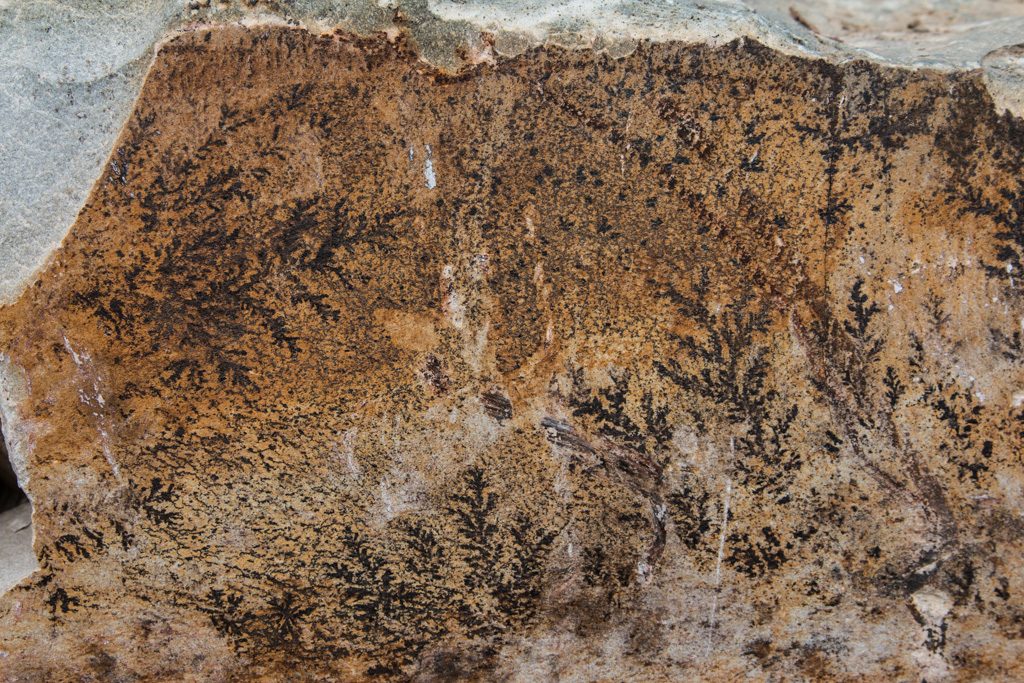
They are doing a lot of work on the trail up to Hurricane Mountain. It seems like they are widening it, and are using a lot of large rocks along the up-slope edge of the trail. I was quite surprised to see what appear to be ferns on this rock. I don’t know whether they are fossilized in the rocks, or somehow imprinted on the rock after it was split. I suspect the latter, but…
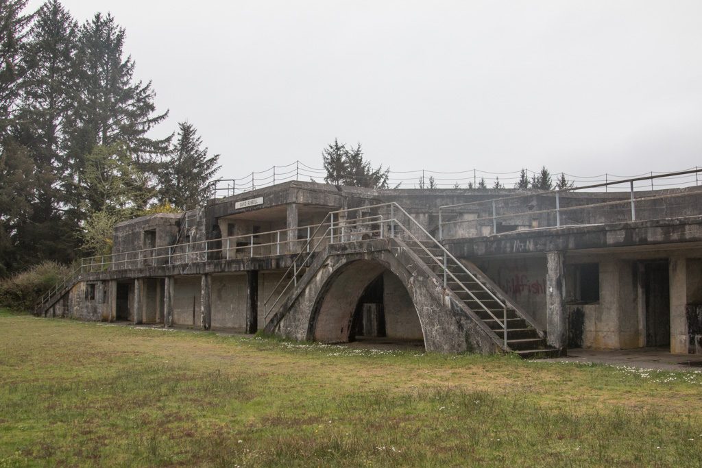
Unexpectedly, Fort Worden turned out to be the highlight of our time on the peninsula. Located on the northeast corner of the peninsula, with the Strait of Juan de Fuca to the north and west, and Puget Sound to the east and south, it was the main one of three forts that guarded Puget Sound Naval Shipyard in Bremerton, and Seattle. The driving force for the creation of the fort was the shipyard, not the city! Fort Worden was built between 1898 and 1917 in the second wave of the Endicott Board forts; the first wave (of which Fort Stevens was part) was built before the establishment of the shipyard when defense of the Sound was not deemed critical. The fort was activated with the arrival of the first troops in 1902, and served in both World Wars I and II. The gun emplacements were never used; the guns were removed in WWI, for use in Europe. The primary use for the fort after that was training.
Reduce, reuse, recycle! Fort Worden is a poster child for reuse. Decommissioned by the Army in 1953, it was purchased by the State of Washington in 1957 to become “Fort Worden Juvenile Diagnostic and Treatment Center,” for troubled youth. This center closed in 1971, and in 1973, Washington re-created it as the current state park. For a more detailed history of this fascinating fort, read Fort Worden: Rebirth Through Decay, by Peter St. George.
What makes Fort Worden special, compared, for instance, to Fort Stevens, is that a large number of its original buildings are intact. Most other forts of this era have had their (mostly wooden) structures torn down leaving only the foundations.
A Public Development Authority (PDA) was created by the city of PortTownsend, WA, to
The state still owns the property; the PDA has a 99 year lease on the buildings. The PDA is renovating the existing buildings to enable other uses. The base hospital is now a remote campus for Goddard College. Local businesses at the fort include two publishing / printing companies, a yoga studio, a massage therapist, the Port Townsend School of the Arts, and Centrum Arts Foundation. There are concert series, with some of the larger concerts held in the WWI-era balloon hangar!
The officers’ and NCOs’ residences and a dormitory are being refurbished and furnished with antique period furniture. These are available for rental, from 30 beds down to three or four. Apparently many family reunions and some weddings book there. We were taken on a tour by one of the PDA board members! We were so gobsmacked by what we were walking through that we forgot to take any pictures. (Us? Forget pictures???) But you can see some of the refurbished officer’s houses and other residences on the PDA’s website. (You can also reserve time in them on those pages, if you will be in the PNW.)
Finally, not all of the buildings remain. There are foundations here too, all that is left of some of the quarters. The PDA is in the process of building new structures there, within the original building footprints.
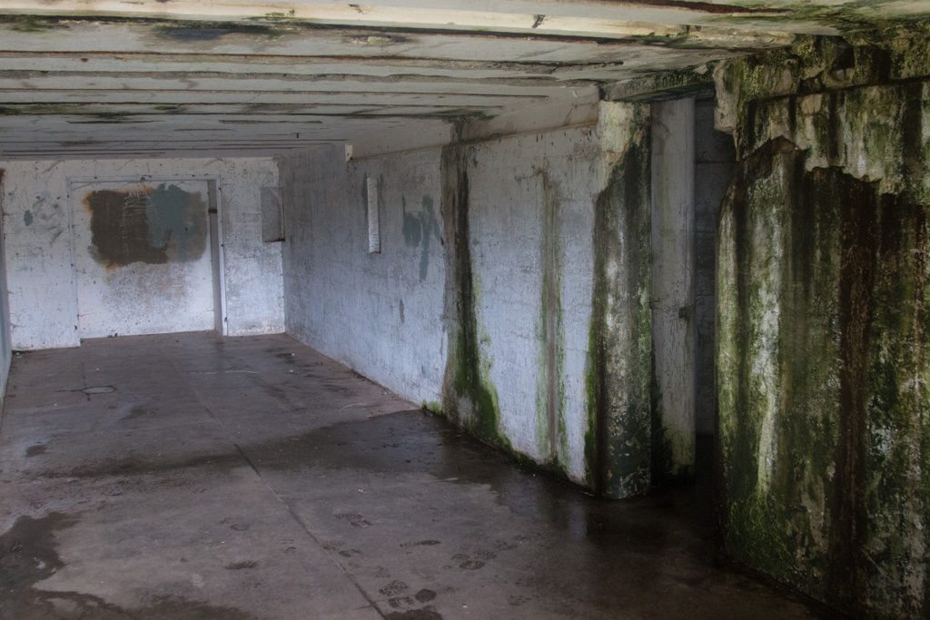
The state park also includes the remains of the gun emplacements, in pretty much the same state as those we found in Fort Stevens. However, we found some types that we didn’t see in Oregon.
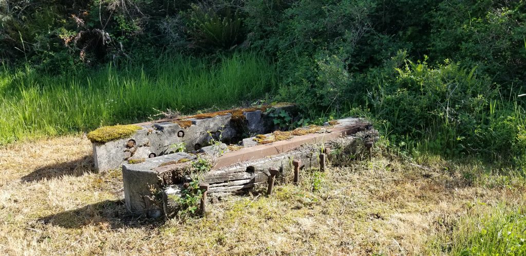
Mounting for a five inch gun. Much lighter construction than for the ten inch rifles used in both forts.Mount for a three inch anti-aircraft gun.
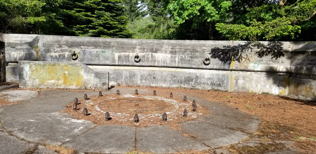
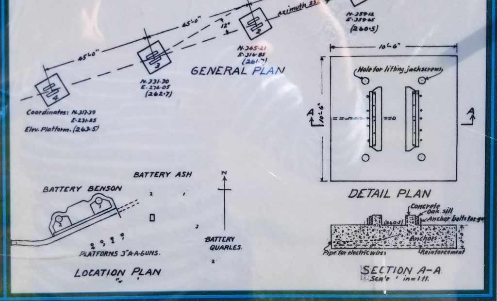
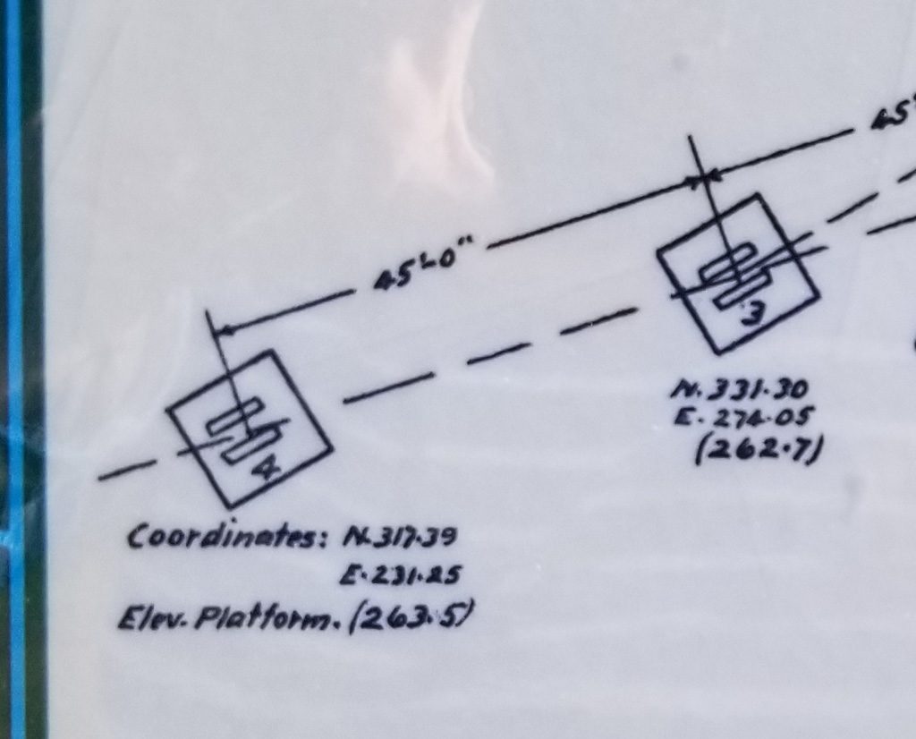
The fort was constructed by the Army Corps of Engineers. Being engineers, they were very detailed. Being the Army, meticulous records were kept. Here are some pictures of the plan for the three inch anti-aircraft gun mounts pictured above.
Diagram of this battery of anti-aircraft guns. (Can you find Kathe?) Closeup showing measurements.
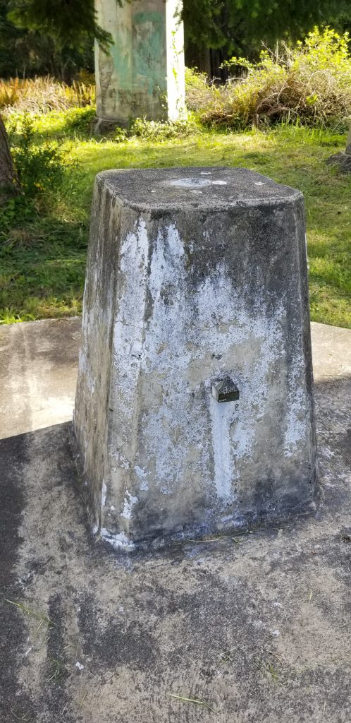
North 317.39 feet, East 231.25 feet. But from where? The entire fort was laid out from a single benchmark, which still exists.
The benchmark is the brass point on the side of this block. Note the engraved, “B.M.”
The trees have grown in the many years since the fort was active, but in some places you can still see what the soldiers would have seen.
Looking east across Puget Sound, to Whidbey Island. Taken from the roof of one of the ten inch batteries.
In other areas, you can’t.
Looking out from an observation bunker.
We’re now over 20,000 miles into our adventure, and are still having a great time.
From Sequoia National Park, we boogied pretty quickly up to the Oregon coast. We wanted to encapsulate this part of the adventure into one post rather than sending several with only a day or two apart, so it is a bit long. Go get a cup of tea or other beverage of your choice.
Here’s what I really wanted the title of this post to be, but it is (way) too long!
The Oregon Coast: Waves, Windy, Winding Roads, Weed…
Let’s get the “Weed” out of the way. Oregon was the first state to decriminalize marijuana possession in 1973, although it didn’t legalize recreational marijuana until 2014—two years after Colorado and California. There are “Cannabis Dispensaries,” “Bud Barns,” and “Pot Shops” everywhere you look. It seems every small town has one or two. No, we didn’t partake.
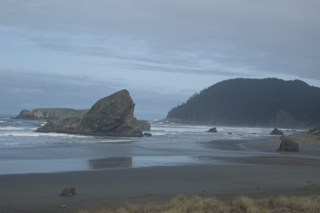
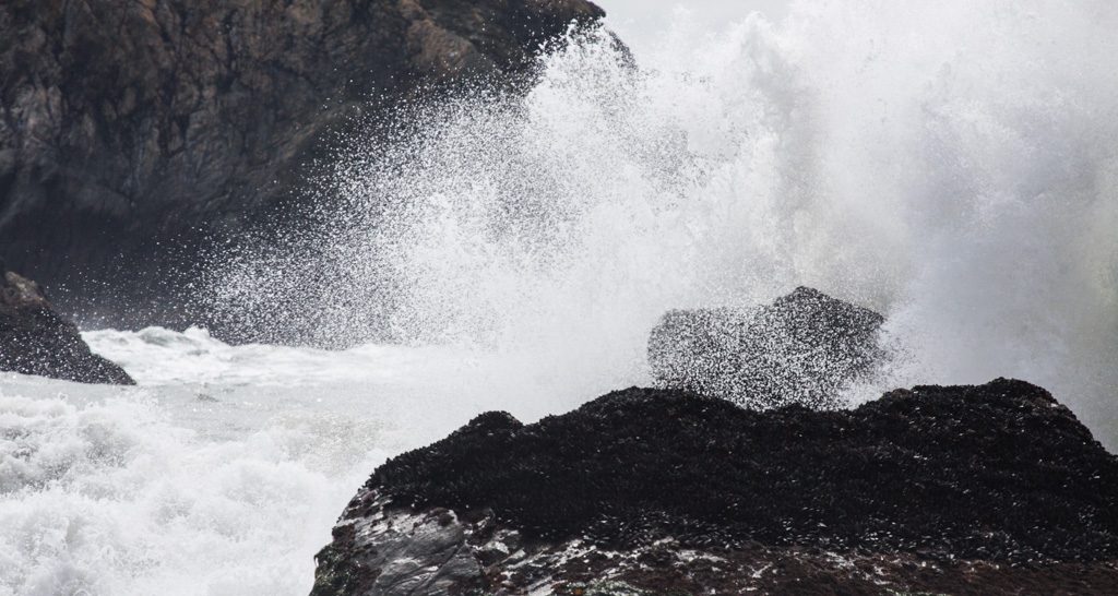
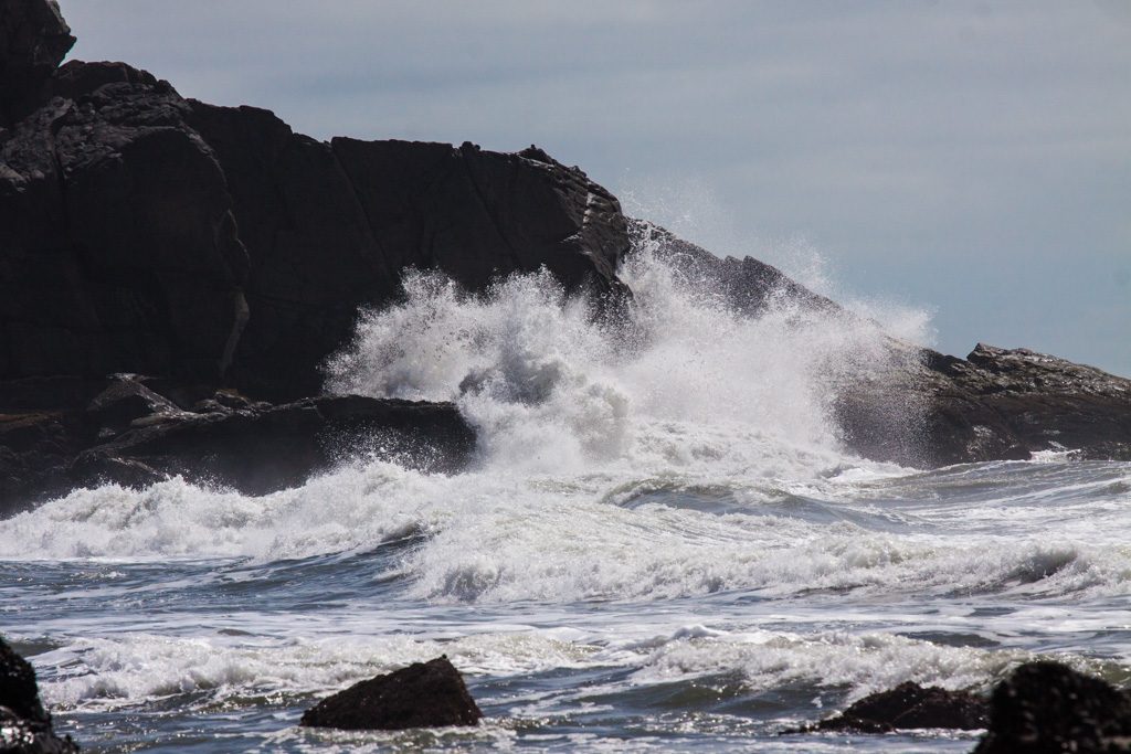
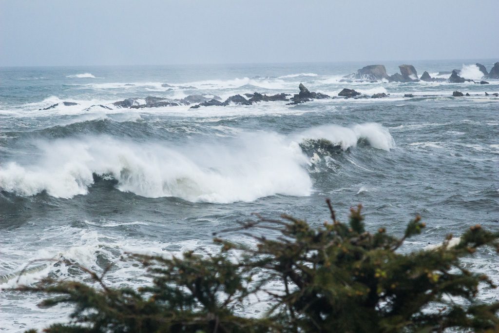
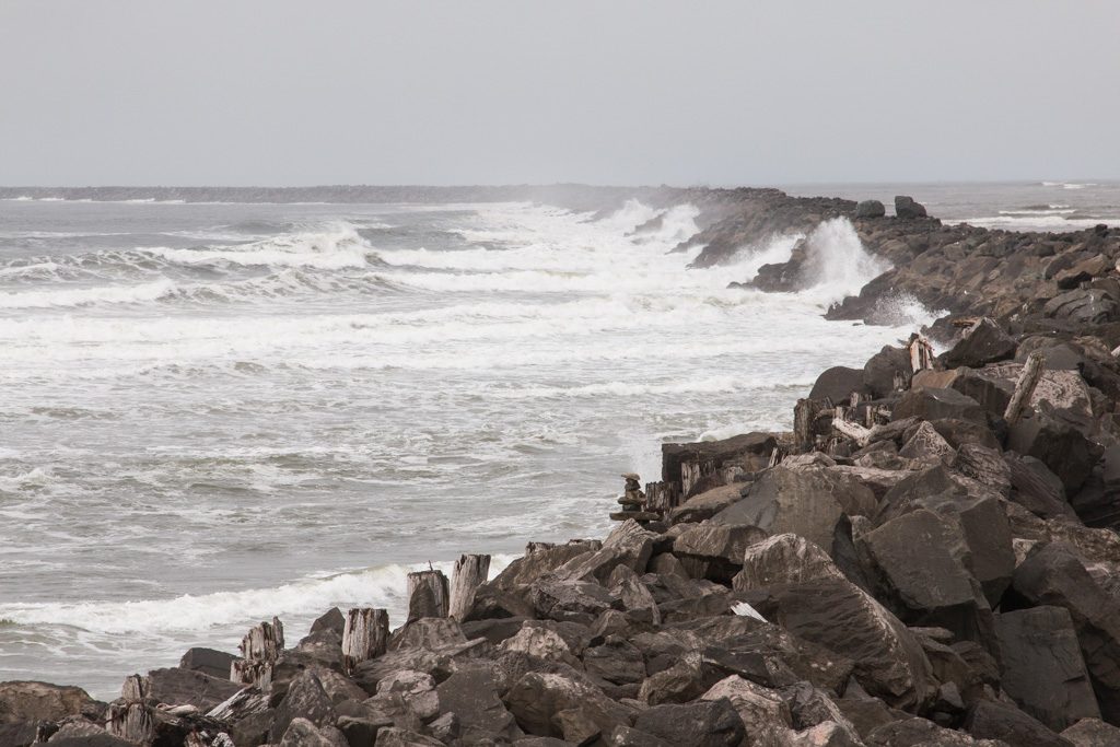
The Oregon coast is amazingly beautiful. We went up US 101, which runs near the coast—at times, right along it. There are many sea stacks (very large rocks out in the water), which together with frequent cliffs on the shoreline make excellent targets for the waves to crash against. It is frequently very foggy!
Sea stack through the fogWaves crashing… minute after minute, hour after hour, year after year.
In the sections below, you can paste the latitude and longitude into Google maps to see where we camped…
Gold Beach: 42.536509 -124.396648
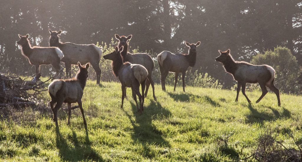
We had been advised to check out the area around Gold Beach by many people. We found Honey Bear RV Resort and Campgrounds a little north of there. As we drove in the campgrounds’s driveway, I noticed two small elk in a field. Cool! We decided to have dinner in the campground’s restaurant (is that what makes it qualify as a “resort?” I still don’t understand the distinctions…), and I was carrying my camera with me as I often do in new places. A man came up to us, and asked if we’d like to get some pictures of elk. Of course! Our order had just gone into the kitchen so we had some time.
We followed the man out of the restaurant, down the road a bit, and then he turned and said, “I normally don’t let campers in here, but this is the best place to get elk pictures.” He was the campground owner!
Part of the campground’s herd… wild elk that happen to graze here.
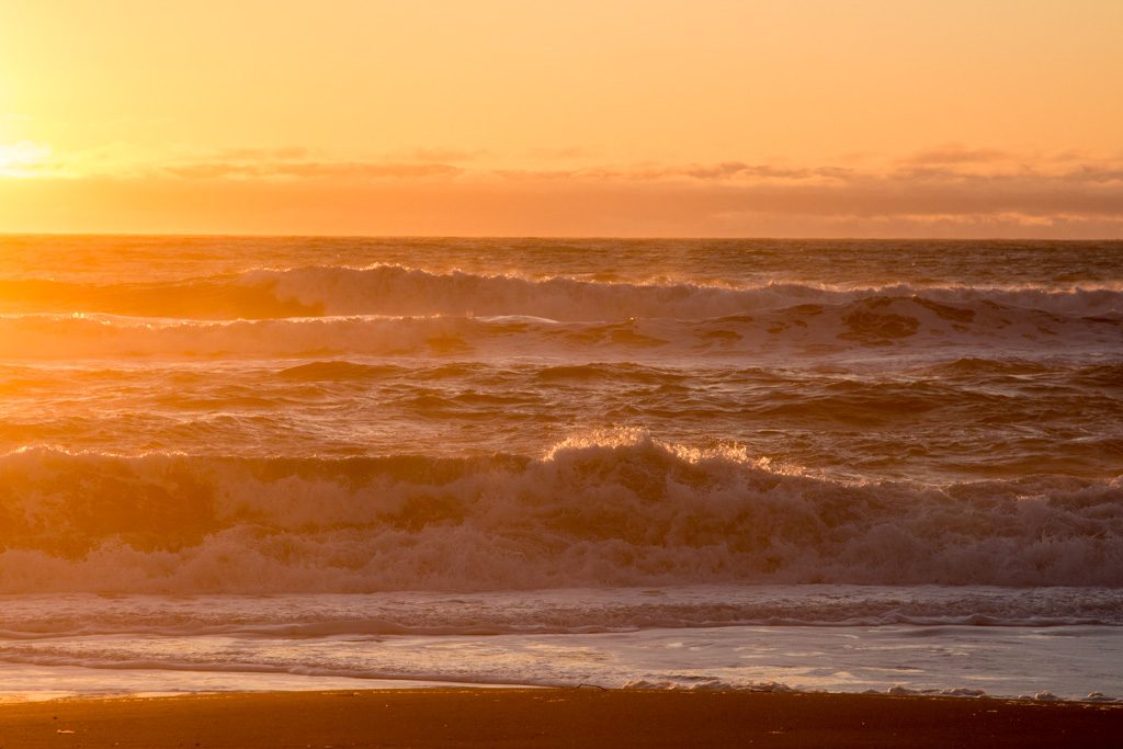
Kathe and I walked down to the beach just before sunset. Our first night on the coast…
Sunset over the ocean. A Pacific Ocean treat.
Gold Beach is just past the north end of the Samuel H. Boardman State Scenic Corridor. Coming north from California, we had decided that we would drive past the sights to get to the campground, and then return south without the trailer on our first day at Honey Bear to see all (OK, “some of”) the scenic pull outs the state has marked. We had divided the coast roughly into fourths, with the idea that we’d day trip up and down the coast from our campsites in order to see the sights. Rocks and water! The same draw that made us love Acadia so much.
Aside… Oregon has a crazy number of State Parks—255, to be exact. Incredibly, 93 of those state parks are along the coast! Granted, many of are very small with some being little more than a parking lot for beach or view access. But fifty seven of them have campgrounds, and we made use of two of them.
The Oregon Beach Bill was signed into law in 1967 and established a permanent public easement for access and recreation along the ocean shore seaward of the existing line of vegetation, regardless of ownership. A policy soon followed that provided for public access to the 362 miles of beach at regular intervals.
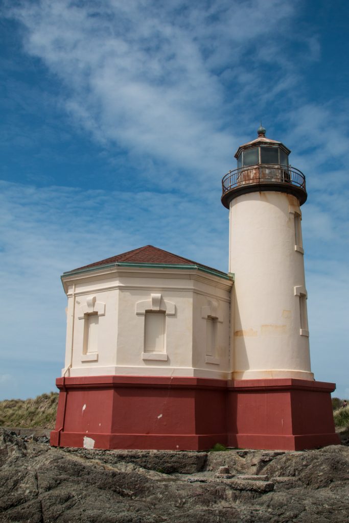
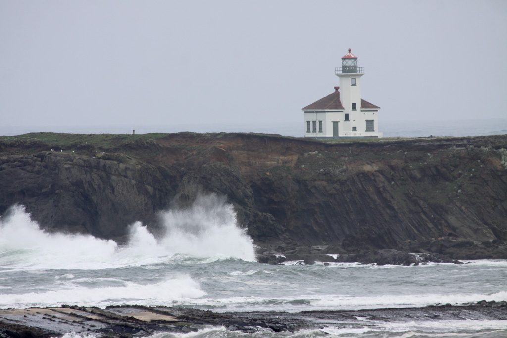
The next day we headed north on the coast for another day of sea-gazing… This brought us past three of the nine lighthouses on the coast, and many more spectacular shore vistas!
Coquille River LightArago LightCape Blanco Lighthouse
Florence: 43.922106 -124.113042
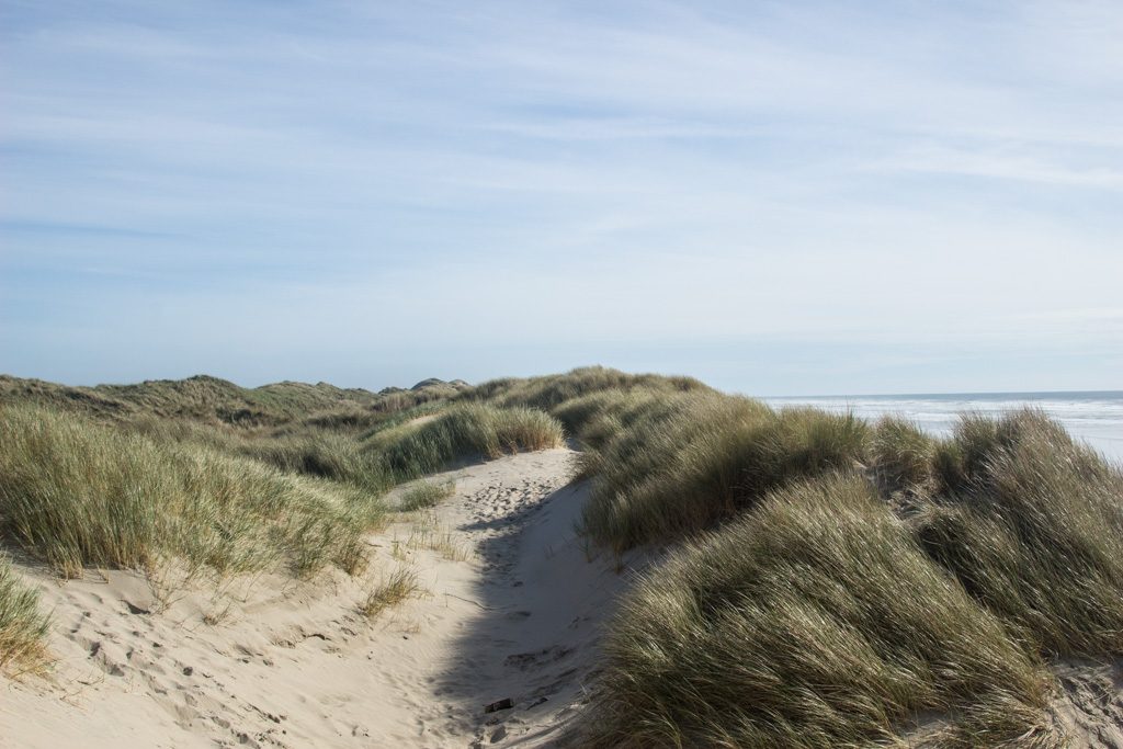
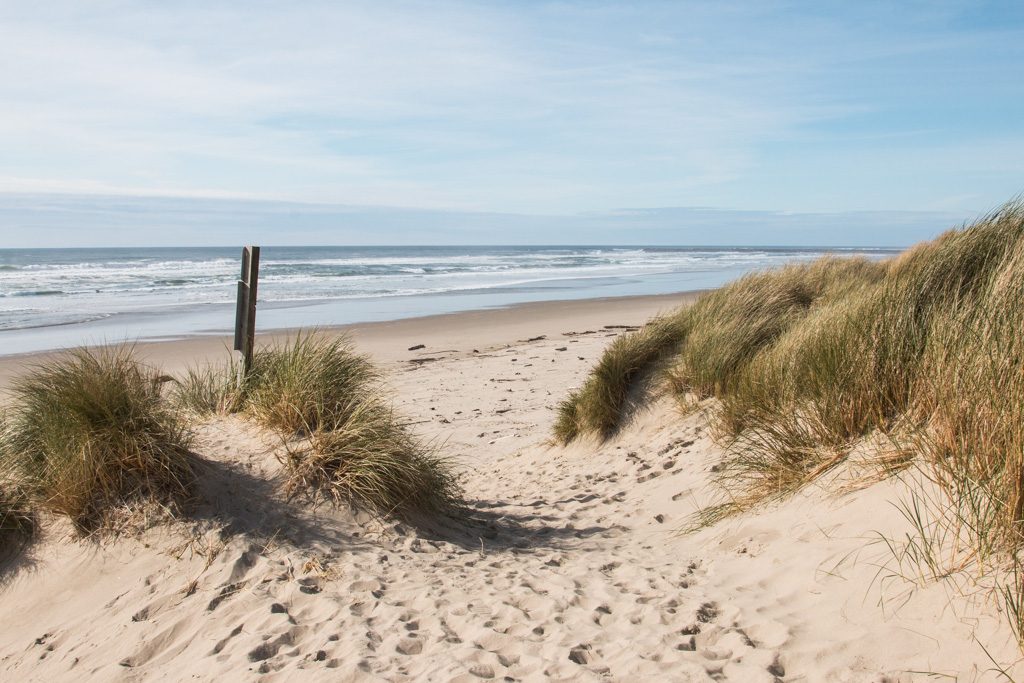
Dunes… The only sand dunes I had experienced were on the Outer Banks of North Carolina’s shore. They were big! Ummm… Not as big as Oregon’s dunes.
The Oregon Dunes National Recreational Area stretches for over 40 miles, and encompasses 31,500 acres. For part of its stretch near Florence, it is bordered by the Honeyman State Park, our next stop. The dunes near Florence are not the tallest in this huge dune field, so where we saw them they weren’t as tall as in NC. Our particular campsite was backed by a steep, thickly vegetated hillside. I’ll guess it was 50 to 60 feet high. I found a nearby trail and went up. When I got to the top, the other side was sand dunes! We were right on the edge of the recreational area.
Kathe and I hiked into the dunes in another spot a few miles away. There, the dunes were heavily grassed, and the dunes went right down to the beach.
The grasses are now considered an invasive species.
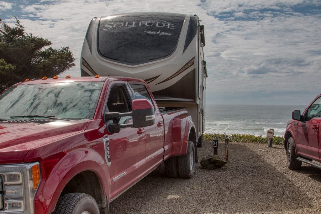
Depoe Bay: 44.860257 -124.04309
They advertise the Sea and Sand RV Park as “Camping on the beautiful Oregon Coast.” They aren’t kidding! Driving to our campsite we thought we were going to drive right into the ocean.
Come ride with us, and remember that we have over seven tons of trailer pushing us down the hill.
We had possibly the best space in the campground (94, if you want to book it). There were no more sites on our door side, so no neighbors there, and we were on the third of three tiers, about 60 feet above the ocean with a completely unobstructed view! Simply amazing. Apparently this site is usually booked a year ahead of time; we had called about a week and a half before, so someone must have just cancelled! Hooray for us! (As we were getting ready to leave, another camper stopped by to tell us that they had just booked the site for this same week, next year…)
Hard not to love this campsite!This is the life…
There is a downside to camping this near the ocean. The waves make a lot of noise all night. I know… poor me.
Someone turn the waves off! I can’t sleep!
Tillamook: 45.428327 -123.937862
This was the least picturesque stop on our trip up the Oregon coast. There is a large dairy processing plant which produces mostly cheese but also ice cream and yogurt, known locally as “The Cheese Factory.”
“Are you going to the Cheese Factory??” “Have you been to the Cheese Factory?” Everyone in the area wants to know… Apparently it is The Big Thing in the area.
They have an interesting self-guided tour via a glass-walled walkway above the factory floor. I was surprised to learn that it takes less than 24 hours for the milk arriving in the tanker truck to be turned into a block of cheese ready for aging. According to a Tillamook website, the warehouse next door where they age the cheese accounts for about ten percent of the nation’s cheese supply. I guess it is a Big Thing!
Coastal scenery wise, there is a “three capes drive,” which held promise. But most of the time the road was behind trees, and the access to the capes was via hikes of a mile or more. It was cold and raw, and we decided to not hike it.
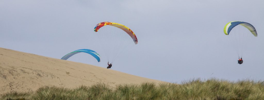
We did get to one part where we could drive to the shore. We almost got stuck one more time in deep loose sand! Fortunately, we didn’t have the trailer with us this time…
There at the beach we saw these folks having fun on the winds from the ocean hitting the dunes to give them lift.
I’m wishing that it were me up in the parachute! It looks like so much fun…
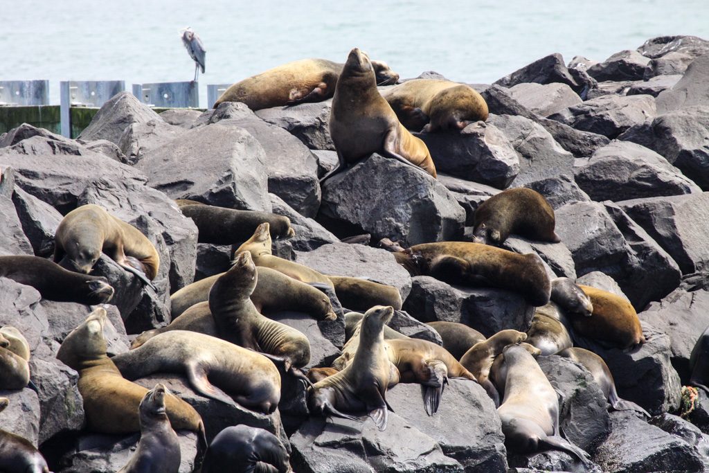
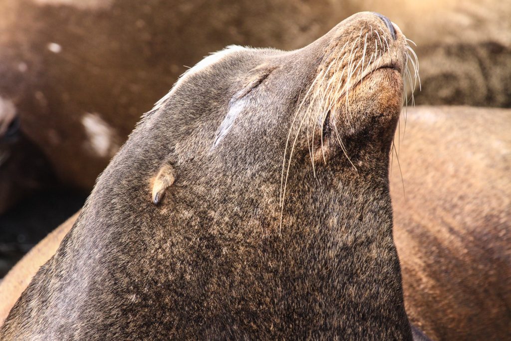
Wildlife
In addition to the elk, above, we saw sea lions at several locations, as well as large colonies of birds.
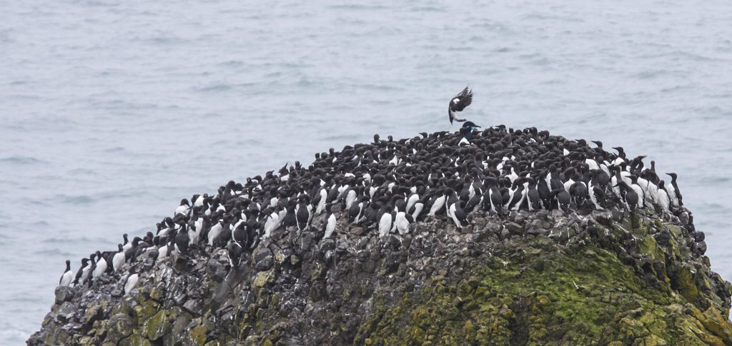
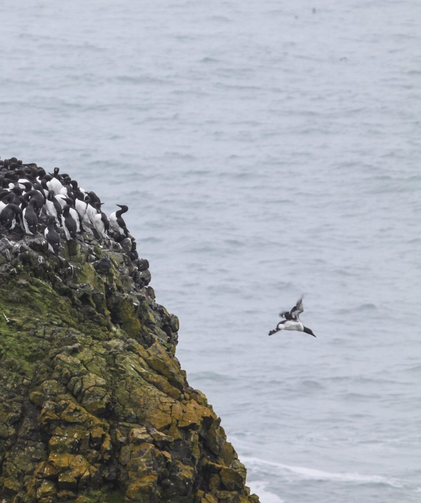
Soaking up those rays…Incoming! Common murres, a relative of the penguin but in the northern hemisphere. Unlike penguins, they can fly!… and outbound.
Astoria / Fort Stevens: 46.181835 -123.965693
Fort Stevens is the farthest north state park in Oregon, and also the largest. We were in a very nice campground of over 500 sites, which actually had full hookups for RVs: 50 amps, water, and sewer. Sewer hookups are very rare in state parks! We saw another Solitude (our type of trailer) with a different floor plan and much more storage capacity. That—or something like it—might be a next camper… but certainly not this year. We’re just getting this one the way we like it!
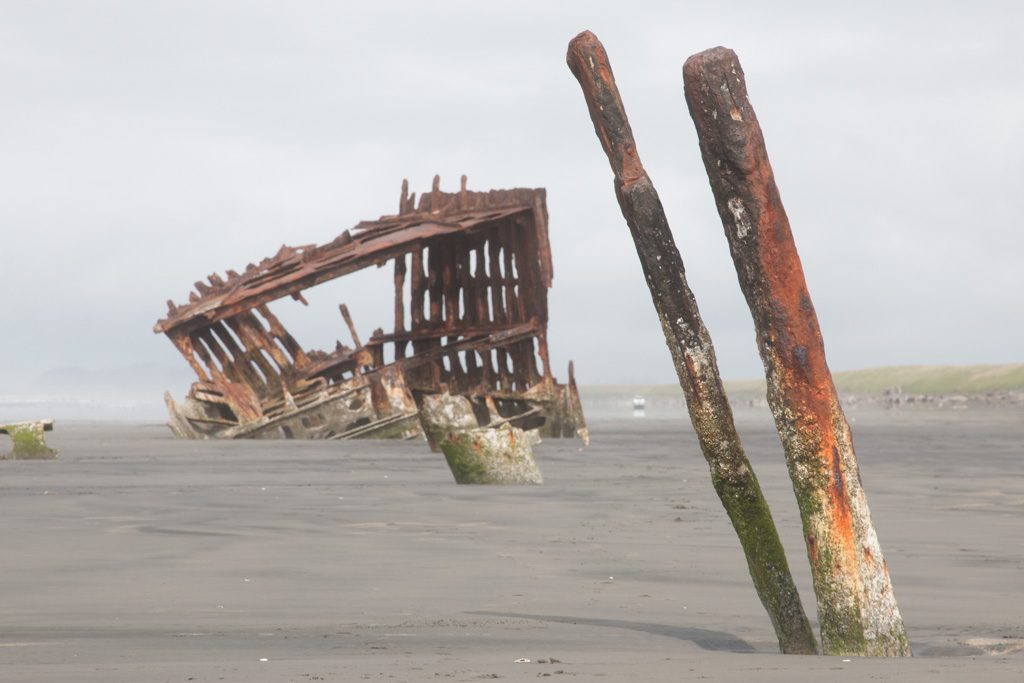
The address of the park is on Peter Iredale Rd., which got me wondering… “Who was Peter Iredale?”
Peter Iredale
That was the wrong question. Not who, but what.
The Peter Iredale was a four-masted, steel hulled sailing ship around the turn of the 20th century that carried grain from this area to Australia. (Peter Iredale was one of the owners of the company that owned the ship, so there is also a who—but he’s not the reason that “Peter Iredale” is a common place name in the area.)
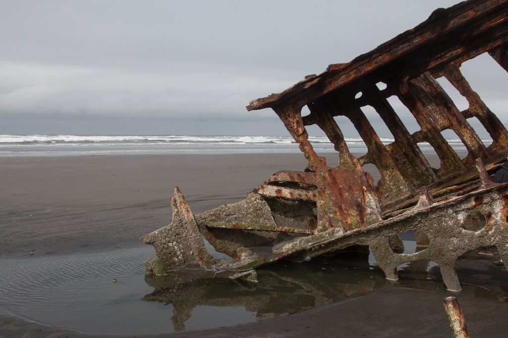
The Peter Iredale
The ship was wrecked here during a storm in 1908. Much of her hull was cut up and sold for scrap, but the forward part was left on the beach. Nature will eventually reclaim her, but for now she is an interesting subject for photography.
The steel plating of the hull is gone to scrap, but a small amount of the iron framing remains.
South Jetty
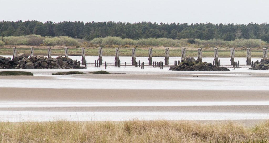
The land currently occupied by Fort Stevens forms the southern portion of the mouth of the Columbia River, a vital, but very dangerous shipping lane.
The geography was constantly changing as storms moved the land, and deposited much of it on the bottom of the channel, increasing the navigational challenges. The area needed to be stabilized.
There were three jettys built by the US Army Corps of Engineers at the mouth of the river, of which the south jetty is one. It was started in 1885, and the whole project of controlling the mouth of the Columbia took 50 years.
The jetty is four and a half miles long and projected into the ocean one mile; at the time of its completion it was the longest in the world. To build it, they had to first build a railroad track on trestles out into the ocean to transport the rocks.
The South Jetty of the Columbia River. It still extends far into the ocean.Some of the pilings remaining from the many miles long trestle built to create the south jetty.
The Fort
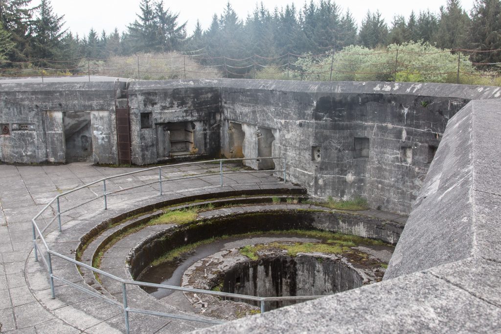
So why is this “Fort Stevens” State Park?
Fort Stevens was the primary installation of three forts guarding the mouth of the Columbia River. The fort saw duty in the Civil War, Spanish-American war, and World Wars I and II. It started as an earthen construction in the Civil War and was enhanced with large concrete installations for several batteries of ten inch rifles by the First World War. Improvements in ship construction (thicker hulls and steel decks) made those guns largely obsolete by WWII, at which point the river was primarily guarded by a mine field comprising up to 148 mines that were electrically controlled from Fort Stevens. (I had assumed that they were contact mines, but not so.)
Fort Stevens holds the distinction of being one of only two places in the continental US to be fired upon by a foreign power. On June 22, 1942, a Japanese submarine fired nine five inch projectiles at the fort. They landed without harm, and the fire was not returned from the fort. Later, the captain of the sub was quoted as saying that if he had known how many large rifles were at the fort, he would not have been anywhere in the area!
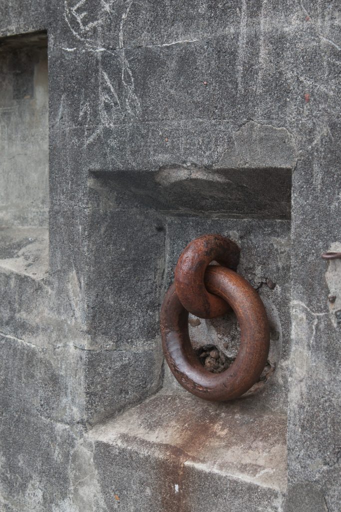
The guns are long gone and the emplacements are deteriorating, but some are still open to be wandered in and on.
A gun emplacement; the circular structure allowed aiming the gun through an arc of about 200 degrees.Fixtures like this one allowed pulling the gun mount to aim it.The back side of one of the batteries.A magazine for storing projectiles and powder, immediately below the gun deck.
What’s next?
We have one more stop before we cross into Canada, to visit with Beth, Jon, and the kids. Can’t wait to get there!
We’re starting to plan our travel after we visit with Beth’s family, and are starting to run into problems finding a campground with available space. We had heard about this, but hadn’t experienced it up until now. We’ve plotted our travels up through the second week of June, and now have to slot in the remaining two weeks until our grandsons Graham and Dean join us to visit National Parks in Utah! Lots of possibilities…
Each sunset marks another day of our adventure together.
Al: “I retired seven months ago today.”
Kathe: “That’s not possible!”
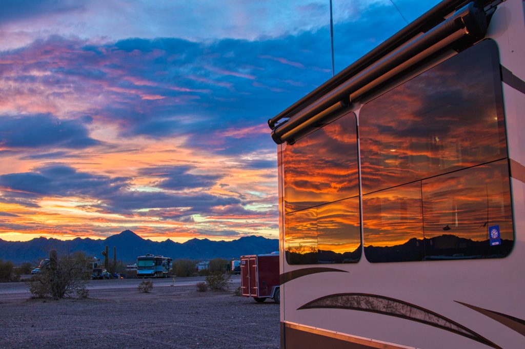
We’ve been living here on the desert for over three months. The time has gone by so quickly. We are now starting to plan our spring and summer travel; it is almost time to leave.
We’ve come to love it here on the desert. At our own choosing, we can be quiet or busy—with friends or on our own. And, with apologies to all our family and friends still in the colder climes, the weather hasn’t been too bad, either!
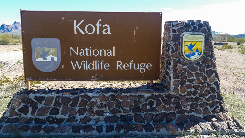
Palm Canyon
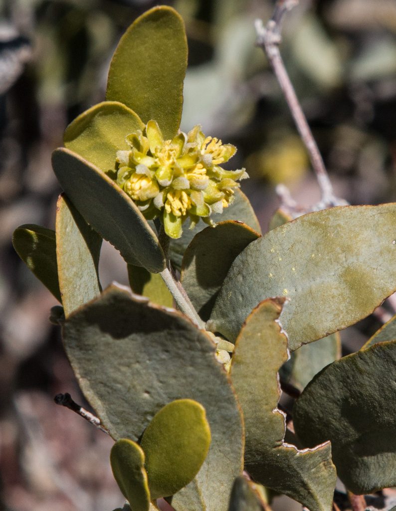
Last week, we went with some friends to Palm Canyon, in the Kofa National Wildlife Refuge. According to this, it is the last place in Arizona that California palm trees grow in their native environment. A nice one-mile in-and-out walk, it was our first time up actually near the mountains that surround us.
Entrance to the NWR: Several miles down a dirt road.We’re walking back in there! The start of the Palm Canyon trail, yet several more miles down the dirt road. Kathe, on the trail!Surrounded by the remains of volcanos
A comment I had read on the net said that the viewing point was a half mile up the trail, but that the palms themselves could be reached in an additional third of a mile “up a fairly steep trail.”
Yeah. Got rope?
At the viewing point.“Up a fairly steep trail.” Yeah.A closer view. Longer lens; we didn’t go toward the palms past the viewing point!
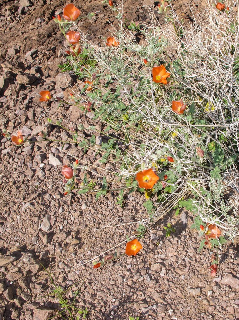
The desert is greening up. We’ve apparently had an unusually large amount of rain this winter. A person we met on the trail said that in a normal year, this scenery would be brown.
Not lush like in non-desert areas, but there is green there!
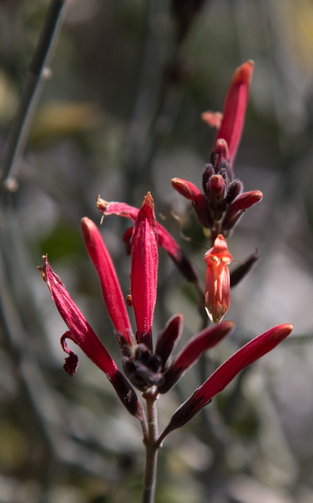
And we’re starting to see some flowers blooming. We hope to see more of the “desert bloom” when we go to Joshua Tree National Park in California for a few days this week.
The “ghost flower” (Mohavia Confertiflora). The petals are translucent!
We had been warned that for a few weeks in January Quartzsite is an overcrowded madhouse with long lines, terrible traffic in town and so on due to multiple rock and gem shows, and a big RV show. Additionally, the population on the LTVA (BLM’s Long Term Visitors Area), where we are living, swells. We wanted to avoid all that humanity if we could.
Fortunately in addition to the LTVA, the BLM has six “fourteen day” camping locations in the Quartzsite area. These sites have no services whatsoever, but are free to camp in for 14 days. After that you have to leave for at least fourteen days. If you want to continue to use free BLM land in that time period, you must move at least 25 miles away.
We were fortunate that we had two back-to-back events at a fourteen day area three miles farther out of town than we normally reside: a (yes, another) Grand Design RV owners’ rally, and a ham radio gathering, “Quartzfest.” These allowed us to avoid the worst of the Q-crush. Just to experience the big RV show in town we did ride our bikes there one afternoon; no way we were going to try to drive in and find a parking space. For all the hype surrounding the “big tent” show, we were unimpressed.
Quilt Show!
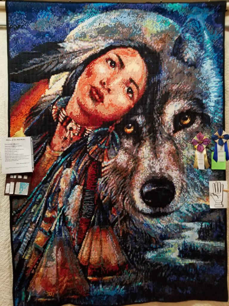
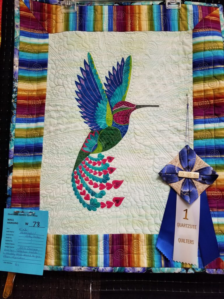
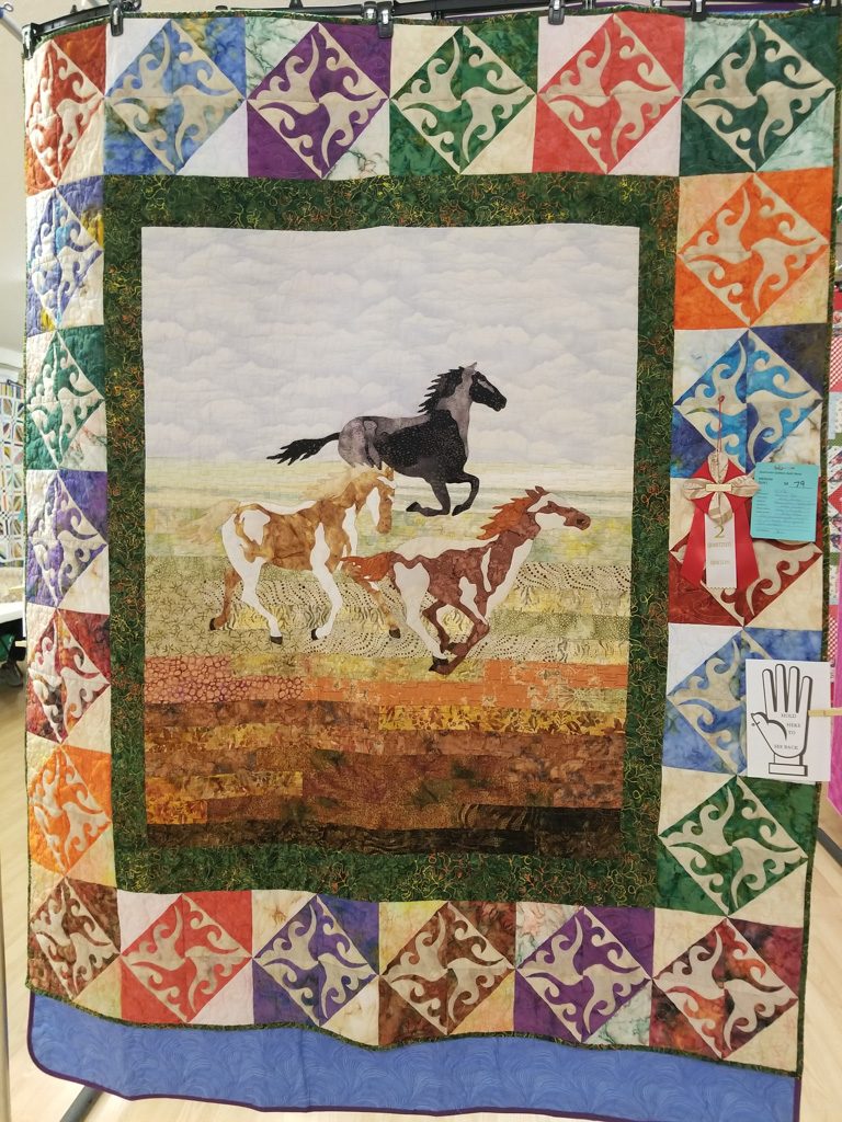
We had fun helping with the Quartzsite Quilt Show put on by the local quilting group Kathe is part of! I helped set up (and tear down) the exhibit space, and Kathe was busy before, during, and after the show. The quilts were quite impressive.
“Wolf Maiden” by Janet Nieuwenhoff. More than 68,000 1/4-inch squares. “Hummingbird” by Kathy Chesher“Running Free” by Kathy Chesher and granddaughter Kaylee Wilcox“Storm at Sea” by Cara Osmin
Road Trip: Yuma
We spent a week in the Yuma area, staying at BLM’s Imperial Dam LTVA in California with “blast from the past” friends, Henk and Mary.
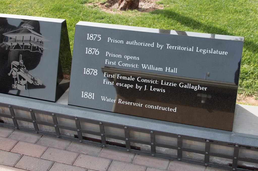
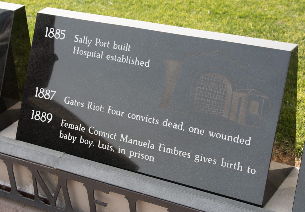
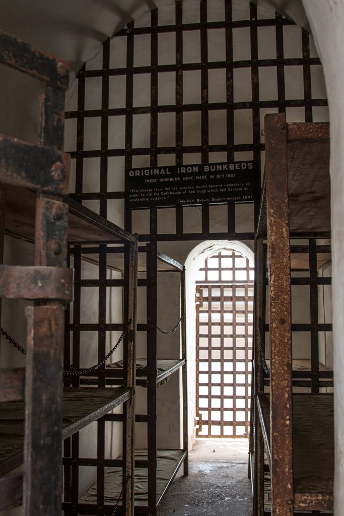
Arizona didn’t become a state until 1912; Yuma had Arizona’s first prison, in use from 1876 to 1909. A portion of the prison, now called the “Territorial Prison,” is preserved as a state park (part was long ago demolished to make way for a railroad line). There is a museum with many displays about prison life. One showed interesting information about the prisoner demographics; some that stuck out to me were that most of the prisoners were considered to be literate, and virtually all used tobacco of one form or another.
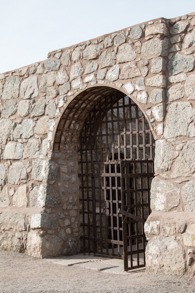
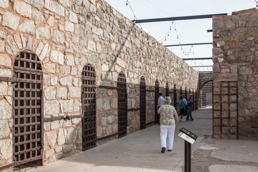
Entrance sally port into the prison.Some of the timeline stones…The original cell block. The doors had a second identical grate about 18″ inside; the two were interlocked so that it was impossible to open both at the same time. Only a few of the cells still have this mechanism intact.The “new” cell block. The interlocked double-gate mechanism seen in the old cell block did not seem to be used here. (Remember, the prison was shut down in 1909.)
The territorial prison had enlightened leadership. From one of the museum displays:
The Prison had more modern amenities than most homes in Yuma, and Yumans resented that.
Electricity
Forced Ventilation
Sanitation, including two bathtubs and three showers
A library with 2,000 books, the most in the Territory at the time
Enlightened, progressive administration
Even a Prison Band!
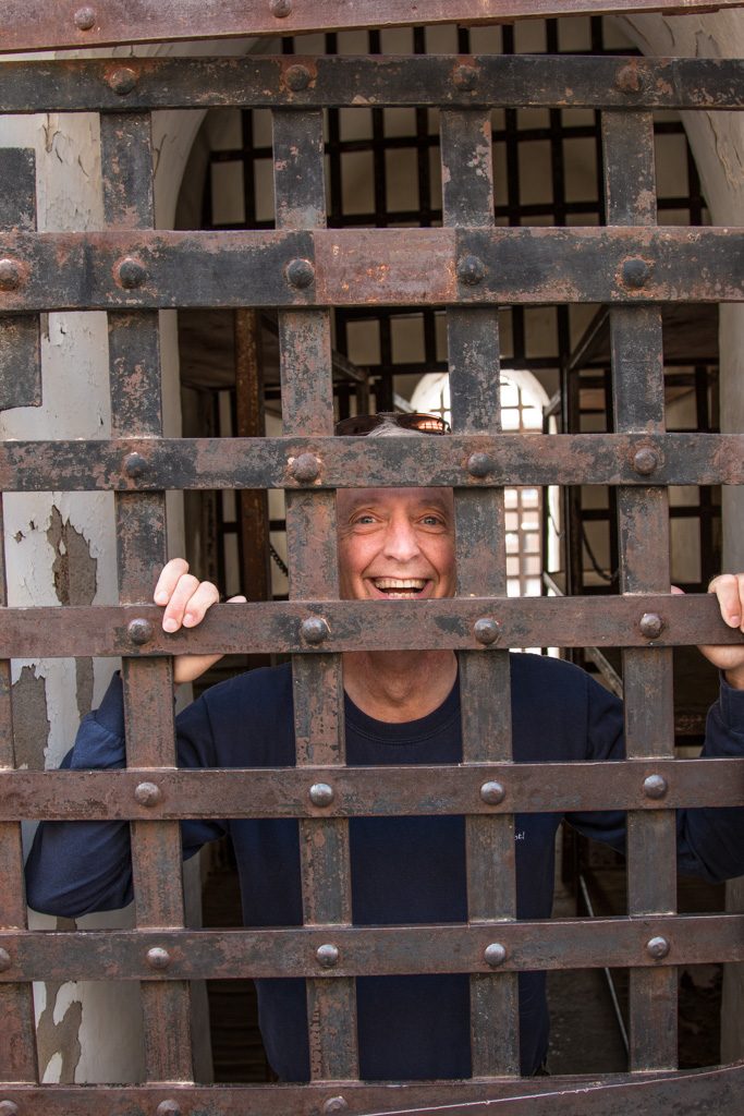
Some of the cells are open to enter, and, of course, pretend to lock your friend in!
Each cell housed twelve inmates, and was exposed to the weather. Note the steel bunks. Ouch!Prisoner Al!
From Yuma, Kathe went to Corning to play Grandma Lobster, giving Mike and Laurelyn the opportunity to travel during school vacation week. While Kathe was gone, I went to another ham radio gathering in Yuma.
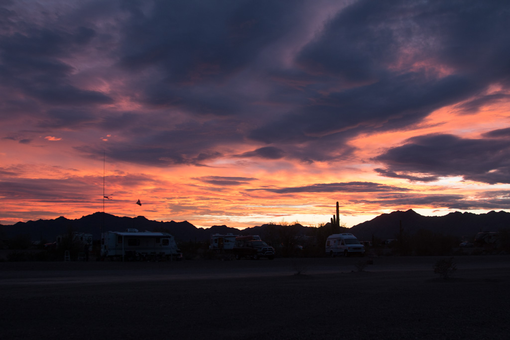
By the time we got back to Quartzsite it was obvious that the exodus had begun. The desert is emptier again; so is the town. People have started heading north preparing the way for us.
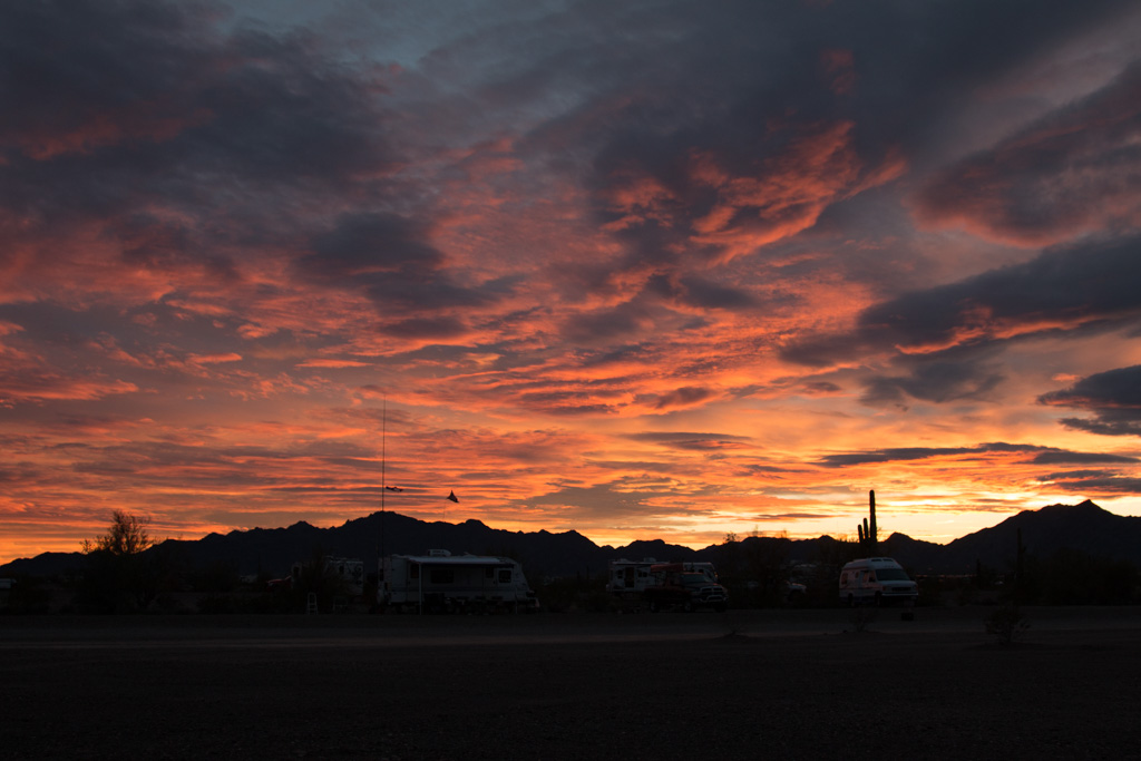
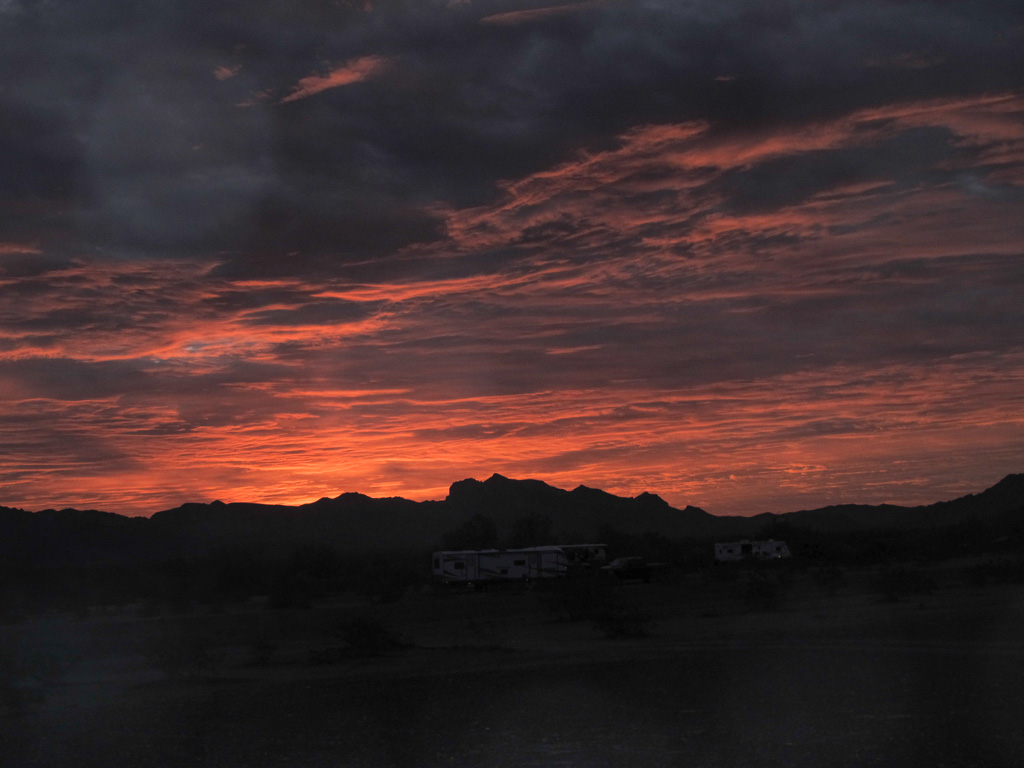
Sunrises and Sunsets
One of the advantages of living on the desert is the essentially unrestricted view of the horizon, especially compared to New England. We have been (usually!) waking up before sunrise, and have gotten in the habit of looking for the sunrise, and again for the sunset every day.
Click on any of the pictures below to see them all as a slideshow of larger versions, and remember you can always right click on any picture in our blog and choose “open image in new tab” or similar, to see the largest resolution that we uploaded..
One other thing…
Drum roll please! When we set out on our adventure, we told ourselves that we would try RV “full-timing” for a year before deciding whether to sell our house on Mount Desert Island.
Well, it hasn’t been a year, but we’ve made the decision! We want to continue this adventure for the foreseeable future, so we will be putting the house on the market this summer. We’ll fly back to MDI to take care of all that has to be done to get a house ready for new occupants.
That’s about it for now. Life has been fairly quiet so we haven’t been posting frequently. Rest assured that as we start to travel again we’ll be keeping you up to date with the activities of your favorite lobsters!
Now that we’re pretty much settled, we have time to play with toys (repeat after me: “Toys are good!”) and take day trips.
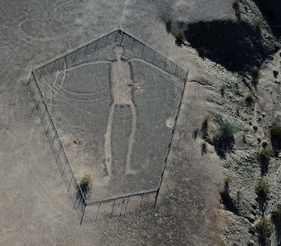
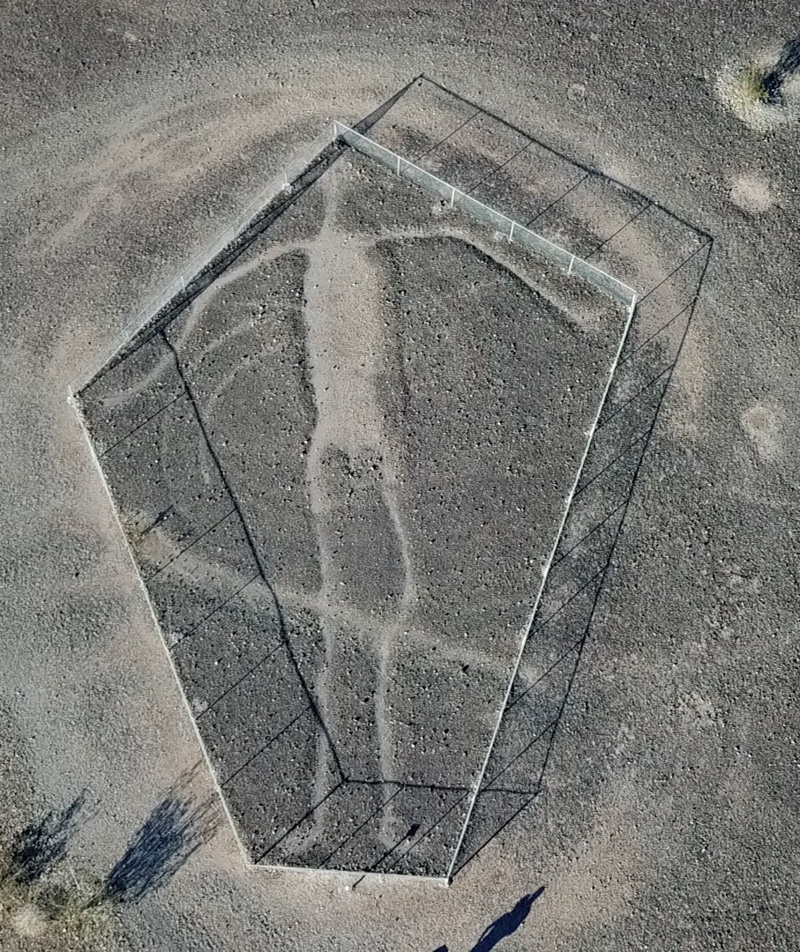
Not too far from here are the Blythe Intaglios. If you don’t want to click the link, briefly these large desert drawings were created by early indigenous people by scraping aside the dark stone layer at the top of the desert floor, exposing the lighter colored earth below. Also called geoglyphs, these are very hard to date. However scientists believe they appear to be between 2000 and 500 years old.
They’re very hard to see from ground level, so our drone whispered in my ear…
#1. Considered the best preserved of the intaglios, this human figure is 105′ from head to feet.
#2. Depiction of a man, 102′ from head to feet. The line across the knees is part of what was originally a circle; only the part inside the fence is still easily visible. If the figures were sacred, is it possible the circle is the remnant of a dance ritual?
The intaglios were first “discovered” by modern man in 1932 by a pilot flying from Las Vegas to Blythe (CA). The intaglios were fenced in in 1974, after it became clear that off-road vehicles would destroy them. There are visible tire tracks in both pictures above. There are several theories about their original purpose and of course what set of theories wouldn’t be complete without one or more about aliens!
We are constantly in awe of the scenery here. I know that the desert landscapes don’t appeal to everyone, but they really strike a chord in me. See if you can spot the Colorado River.
We’ll go back in the new year (we’ll be camping in another location closer to them), to try to find the remainder of the intaglios.
Back at the ranch (OK, camper), I’m enjoying getting familiar with the drone, and with video editing at which I am a COMPLETE newcomer. Here is a quick view of our current location. We are in the camper near the bottom, just to the left of center.
At some point I’ll post a video with audio, or with multiple scenes composited. I’m not good enough at that yet!
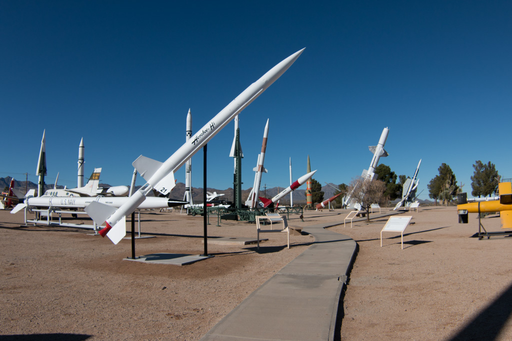
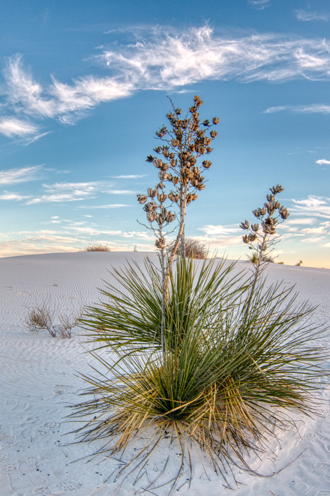
Early on in our trip planning, White Sands National Monument was on our list. But then we decided that we’d like to see some of Utah “before it got too cold,” so we planned to go west on I-40 all the way into Flagstaff and then north. We decided that we’d do White Sands, NM some other time.
Well, “too cold” seemed to be following us all the way across the country (local temperatures were often 15° to 20° below normal—we started to think that it was our fault!). We decided that we would drop down to a more southerly, i.e., warmer, route—I-10—after Bosque del Apache. Yea! White Sands was back on the route!
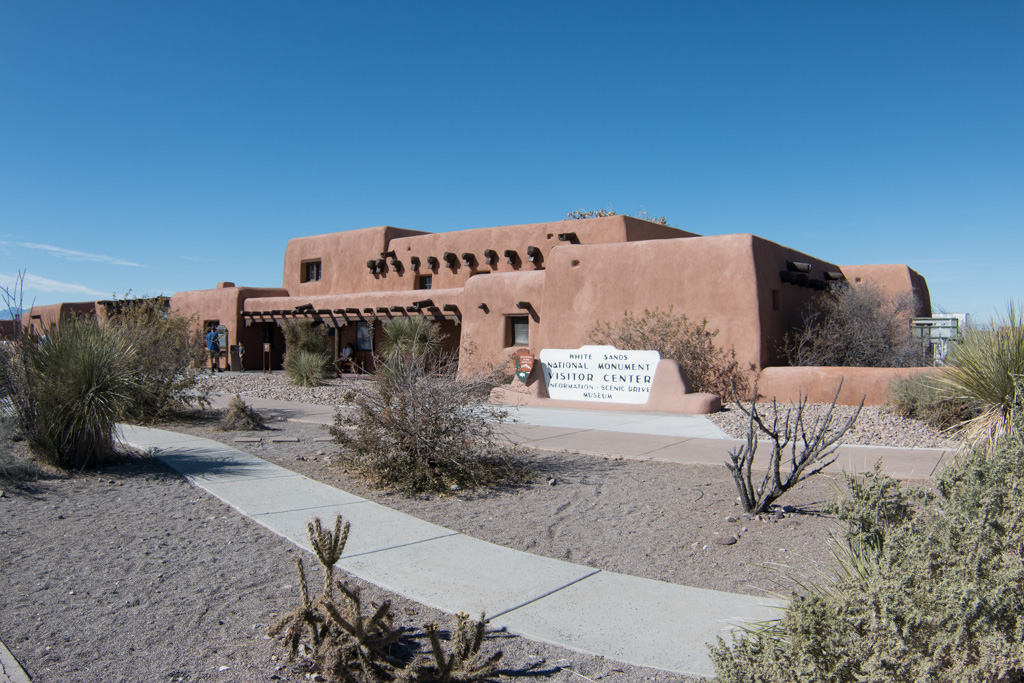
White Sands National Monument visitors’ center, built in the 1930s.
We knew that there are basically two “White Sands” things. There is White Sands National Monument, and also White Sands Missile Range, the largest military base in the country in terms of area. The Missile Range is closed to the public (of course), so we focused our imaginations on the Monument, which we thought was completely separate.
It turns out, it isn’t so separate. The Monument is completely inside the missile range; it closes to public access any time the military launches a missile. Phew!
The other thing we didn’t know was that the missile range has a museum open to the public! Did I mention in a previous post that I like space-oriented things?
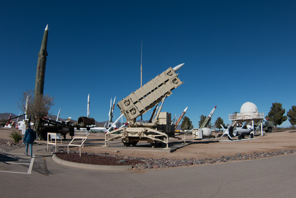
White Sands Missile Range Museum
The first day, we went to the museum. Since you’re entering a military base (by all of about 100 yards), you must present ID, and they run a quick check with the FBI to see if you’re a baddie. (Sorry, no pics of the entrance station where we had to register. That is apparently a serious no-no.)
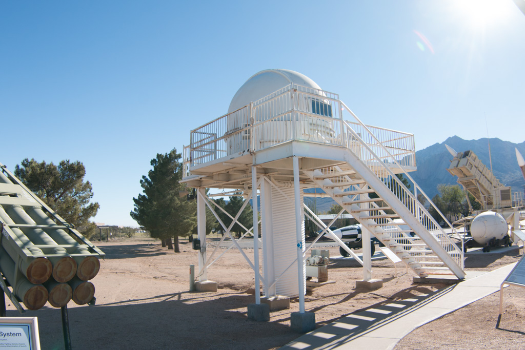
Outdoors display
We spent most of the time at the museum outside at the rocket display. It was neat to actually see some of the rockets whose names I knew from the ’60s.
The Patriot, launched from a truck
Some of the missiles in the outdoor portion of the museum
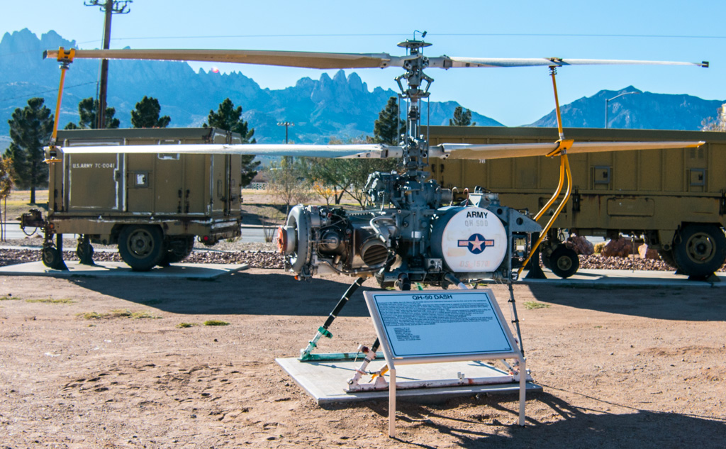
The OH-50, an unmanned helicopter developed in the 1950s for anti-submarine warfare. Drones aren’t new! Although it is no longer in use in combat, it is still the only unmanned helo to be combat certified. The OH-50 is still used at the Missile Range to tow targets.
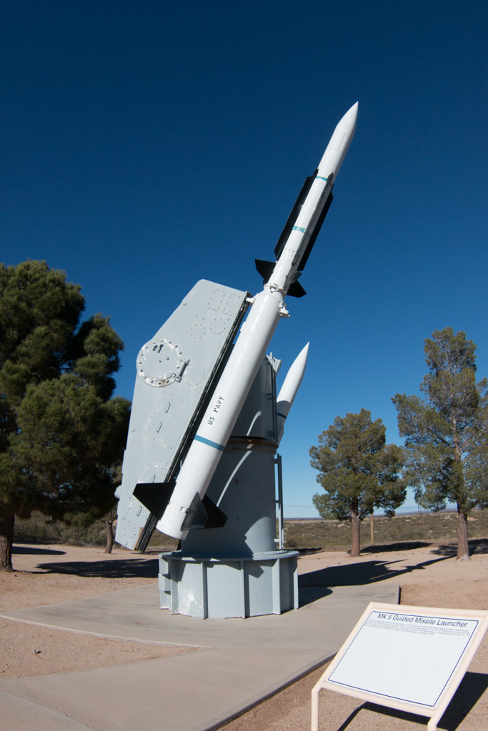
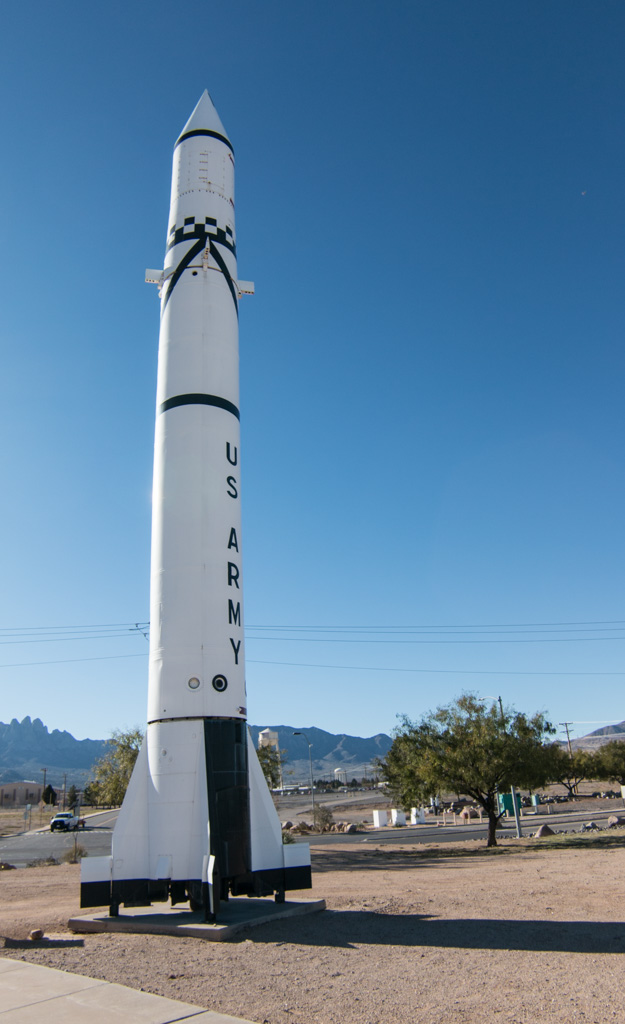
WSMR is an Army base, but used by all branches of the military. This is a Navy guided missile launcher tested here.
The rockets on display here were almost all developed for the military, but they also enabled our manned space program. Until the Apollo program’s use of the Saturn V booster, all of the rockets used for our manned space flights were repurposed military rockets—Redstone, Atlas, and Titan. The Redstone held a special place in my memory because it was used for Alan Shepard’s and Gus Grissom’s sub-orbital flights at the start of Project Mercury, the beginning of the US manned space program.
I didn’t know that the Redstone was designed to be “transportable.” From the information sign in front of the rocket:
As a field-artillery missile, Redstone was mobile and transportable by plane, truck, or train. However, when on the move, it needed a convoy eighteen miles long, with 200 vehicles carrying approximately 10,000 individual pieces of equipment and more than 600 men. The Redstone itself was carried on three trucks—its nose section (warhead), midsection (power plant and fuel tanks), and tail section—to be assembled in the field.
Transportable? Maybe. Stealthy? No way!
Indoors
There was also a nice indoor portion of the museum. Part of it covered the computing resources used in the early days of the missile age. Here is a “patch panel” used to program a computer in the days before software. This is from a computer used into the ’70s!
A quote on the information card: “You had to be a bit crazy to work on the patch panels!”
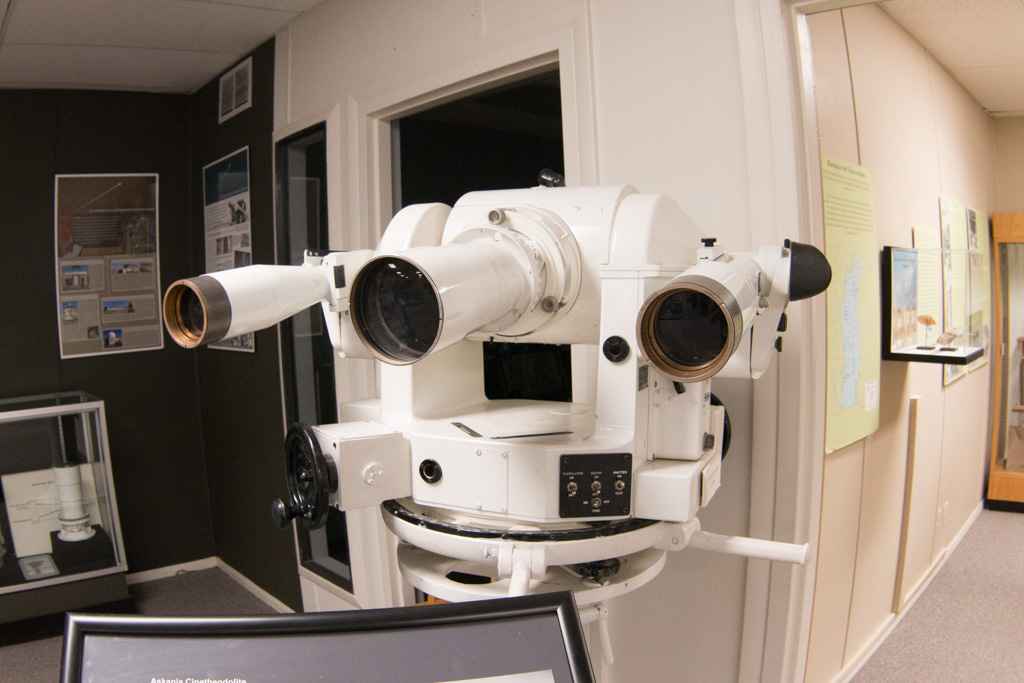
One way of gathering data about test flights is to track the rockets visually, with “cinetheodolites.” Each of these required two operators, and many were used around the range.
A cinetheodolite ($75,900 on eBay! Get yours today!)
Housing for a cinetheodolite
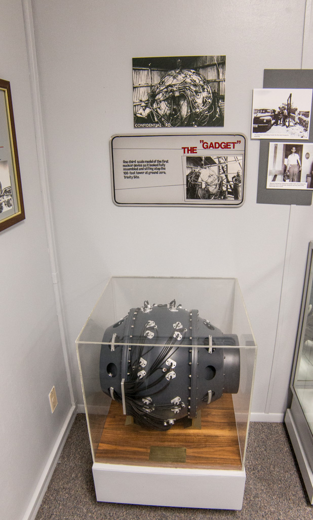
Trinity
There are moments that change the course of history forever; one happened here. On June 16, 1945, the world’s first atomic explosion happened on White Sands Missile Range, at the Trinity Site. The Trinity Site is only open to visitors twice a year so we weren’t able to see it first hand, but a good portion of the museum’s indoors display space is devoted to it.
A one-third scale model of the bomb that was detonated at the Trinity Site.
The Trinity bomb was the same design as the second bomb, dropped on Nagasaki, Japan, to end World War II.
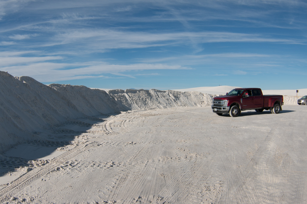
White Sands National Monument
On the second day, we went to the National Monument. Mile after mile of white “sand,” actually gypsum. After having seen the delicate gypsum florets in Mammoth Cave, it was amazing to see this much gypsum, literally piled up. Kathe thought it looked like we were on the moon!
This plant’s root system causes these hills to remain even after the dune has moved on.
The leaves of this tree are thick and very waxy
It was interesting to walk on the dunes. I have lived near the water all my life except for our time in New Hampshire, and am used to walking on sand—including the sand dunes on North Carolina’s Outer Banks. The gypsum packs much more tightly than sand, and is very easy to walk on in comparison.
We went sledding down the dunes on a plastic saucer (like would be used on snow). Despite waxing the bottom of the saucer, other than the color of the dune’s surface, it wasn’t anything like sledding on snow! It was quite sticky, but once you got going, it was fun riding down the dune. Kathe got some good rides, but I fell out of the saucer each time! Unfortunately, I didn’t get any good video of me tumbling down the dune. (Sand-sky-sand-sky-sand-sky…)
The dunes are always moving, driven by the wind. Keeping the tourist area road open is a constant problem.
Harder than plowing snow? I don’t know…
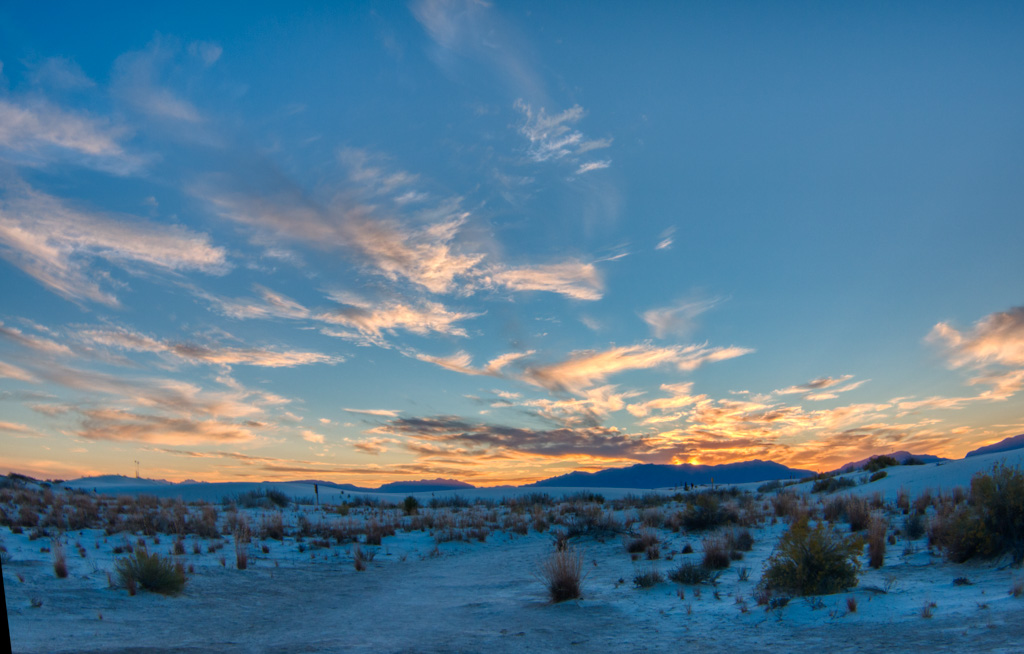
We had a really good day there, walking some trails and seeing the scenery. Al finished with a ranger-led walk just before sunset. The guide is an astronomer by training, working as a paleo-geologist. He described some of the research going on at the whole White Sands site, much of it outside the bounds of the Monument.
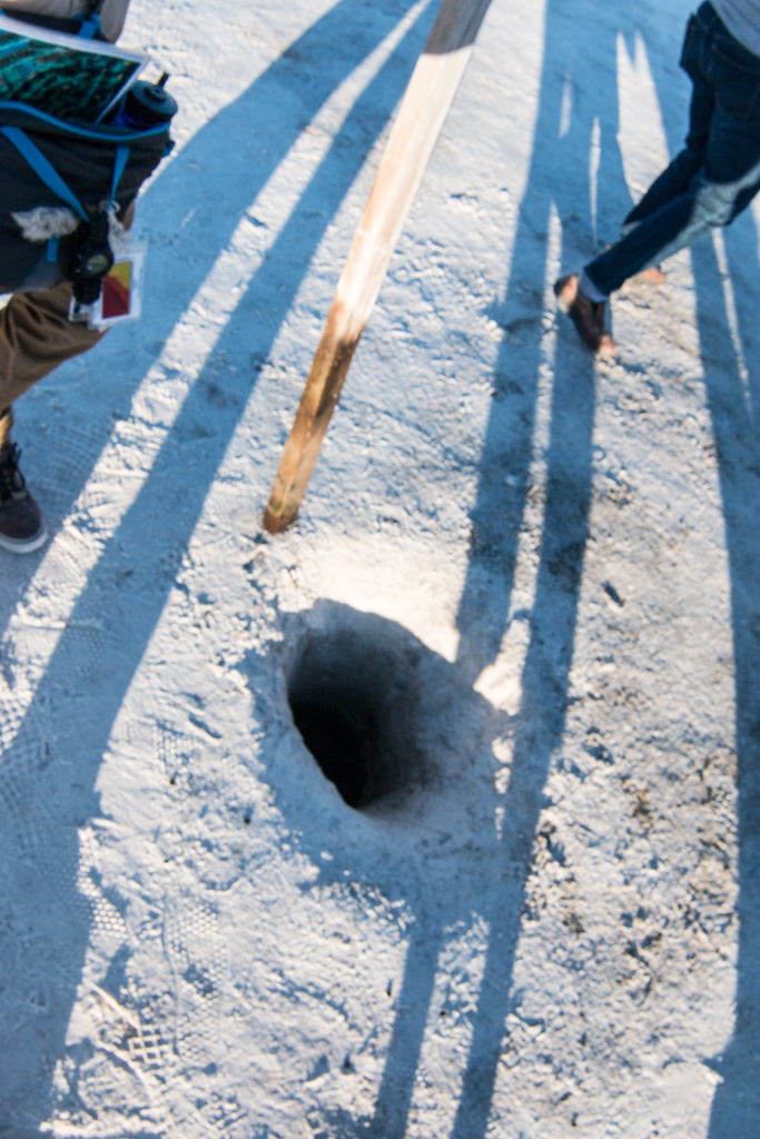
On the desert floor (where there isn’t currently a dune), the water table is only a foot or two below the surface. The geology of the area depends on this.
A wet stick shows that there is water about 18 inches down this hole. The water table (the level of the water below the ground) is closely monitored.
The yucca plant below may be 30 or more feet tall. It is rooted on the desert floor, and as a dune comes along it grows to keep its leaves and flowers above the level of the dune. Unfortunately, when the dune passes, the yucca can’t support its long stem. It collapses and dies.
You didn’t think I’d leave without a sunset shot, did you?
Blue sands at sunset
If you get a chance, do plan to go. White Sands National Monument is other-worldly. (Lunar?)
I admit it. I’ve been thinking about this post for several weeks and needed time to let it percolate.
Truthfully, I’ve been procrastinating. I’m not sure I can do this experience the justice it deserves but I’ll try.
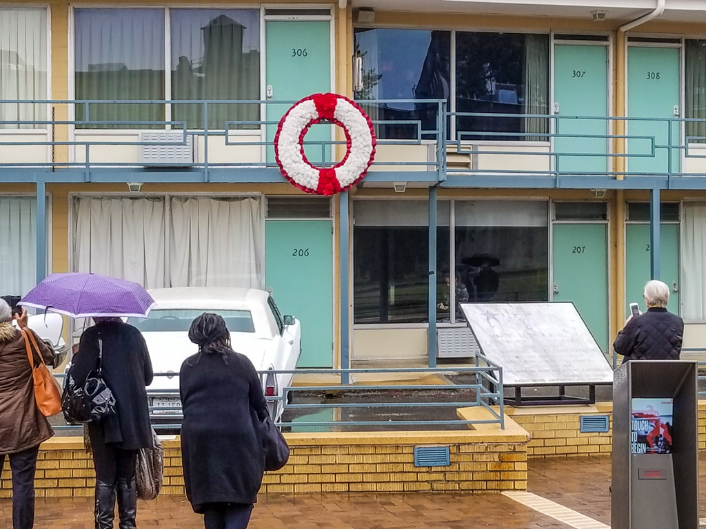
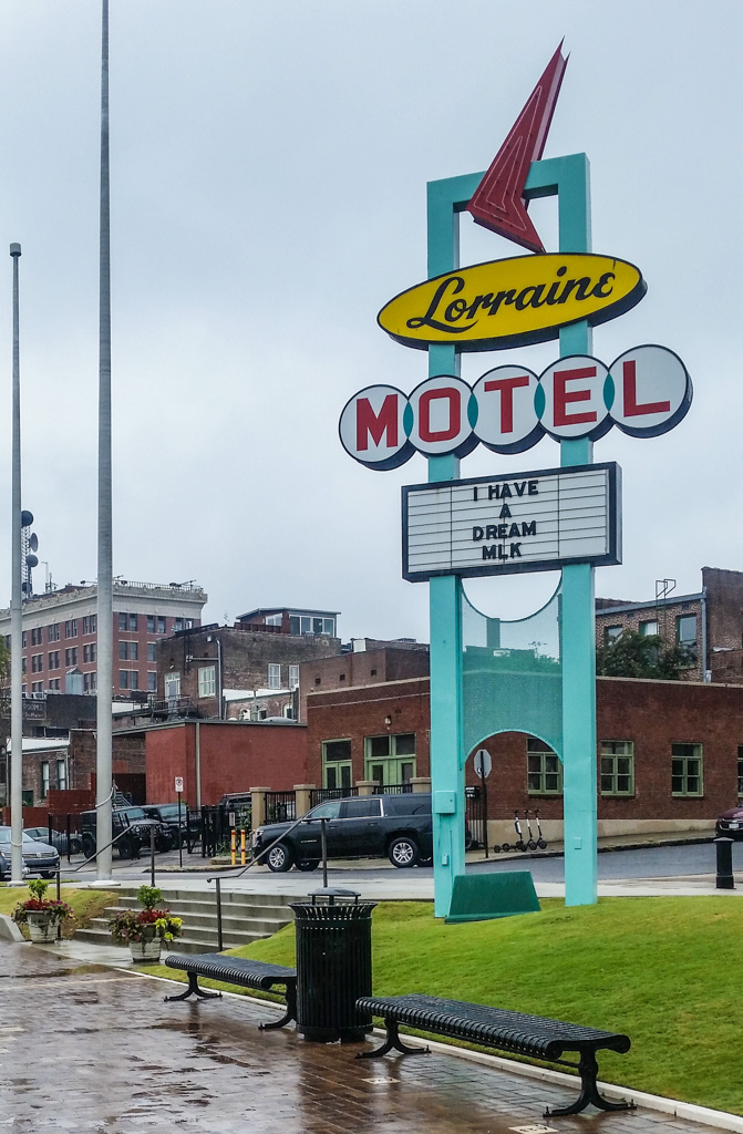
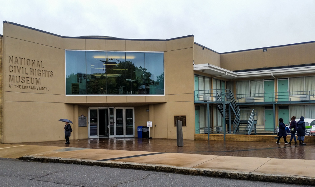
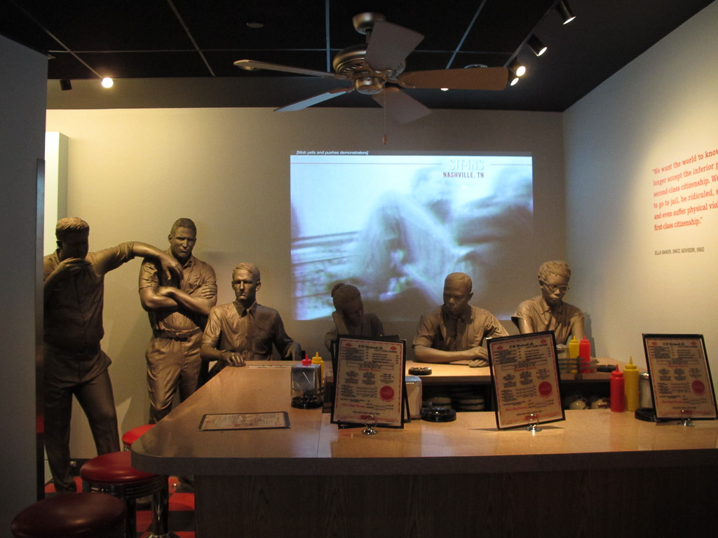
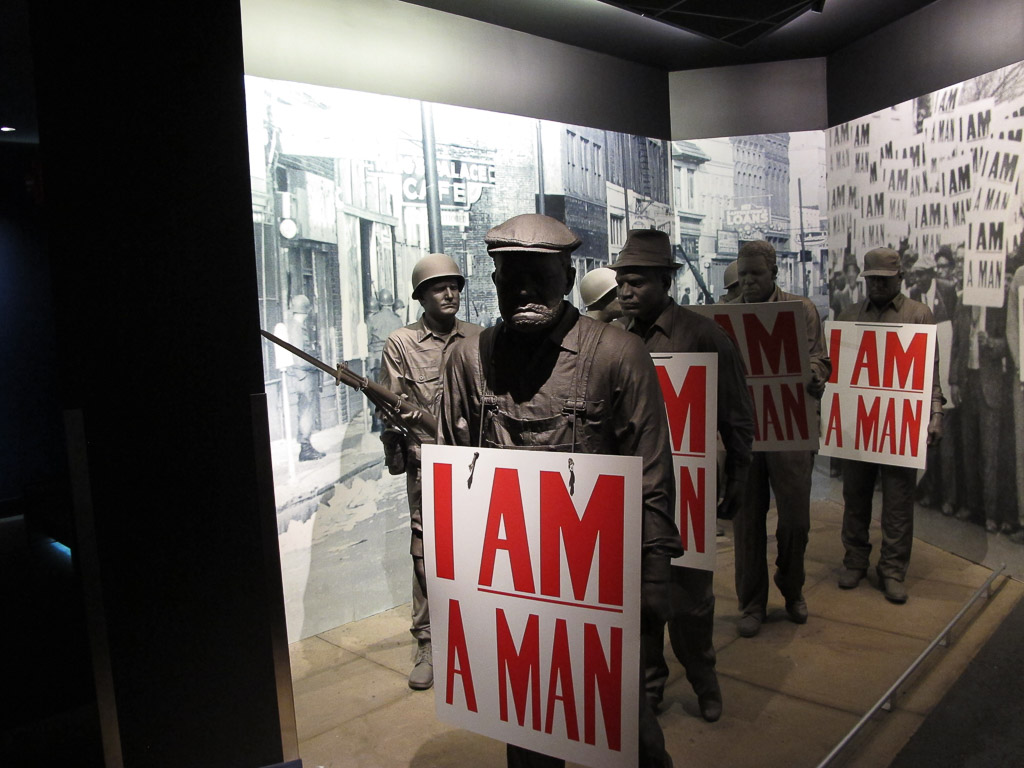
While exploring what to see in Memphis, we learned that it is the home of the National Civil Rights Museum. The museum is actually on the site of the the Lorraine Motel, where Martin Luther King, Jr. was assassinated. This destination jumped to the top of our list for our Memphis stay.
We had no idea.
The balcony where MLK was murdered. Notice the small kiosk on the right; there were a half dozen of these spread out on the plaza — you could lean into one and learn important details about the time and place. The shape of the kiosk kept the sound enclosed so as not to disturb others’ experience while taking it all in.
The NCRM has two large buildings— the Lorraine Building (the motel) and the Legacy Building across the street, which was the boarding house from where the assassin James Early Ray took aim. The path of the bullet is depicted in the pavement that runs between the two buildings.
Notice the path of the bullet, the dark stripe in the sidewalk.
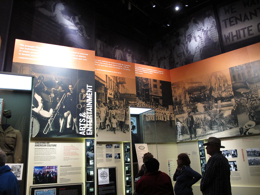
From the moment we stepped inside the museum, it was very clear that it had been designed with incredible precision and purpose.
The museum was incredibly text rich—it took us several hours to read our way through the museum and I’m sure we didn’t read all that was posted. (It did make me wonder how someone who isn’t able to read English well would experience the museum.)
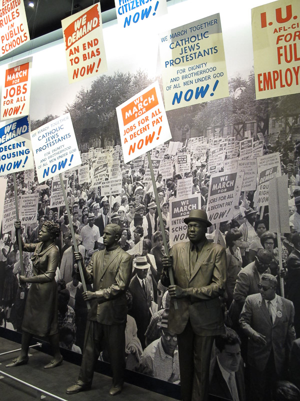
The expanse of coverage was overwhelming both in size and scope—the museum’s floor-to-high-ceiling exhibits span the Civil Rights Movement in the United States beginning in the 1700s with resistance to slavery and continuing into the current day with worldwide events that not only conjure inequality but also call us to work for equality—for all.
We were overwhelmed by the impact the exhibits had on us. I felt a combination of breathlessness, anxiety, regret, and anger. There was so much to take in. So much to learn.
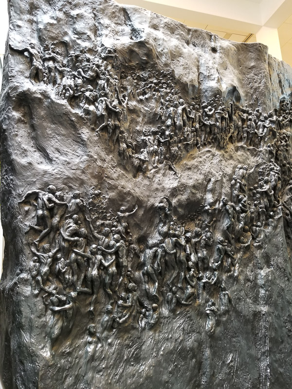
This stunning two-sided bronze sculpture, Movement to Overcome (Michael Pavlovsky, sculptor), stands 14 ft high, 21 ft wide, and 6 ft deep. It depicts the slow, uphill struggle for Civil Rights.
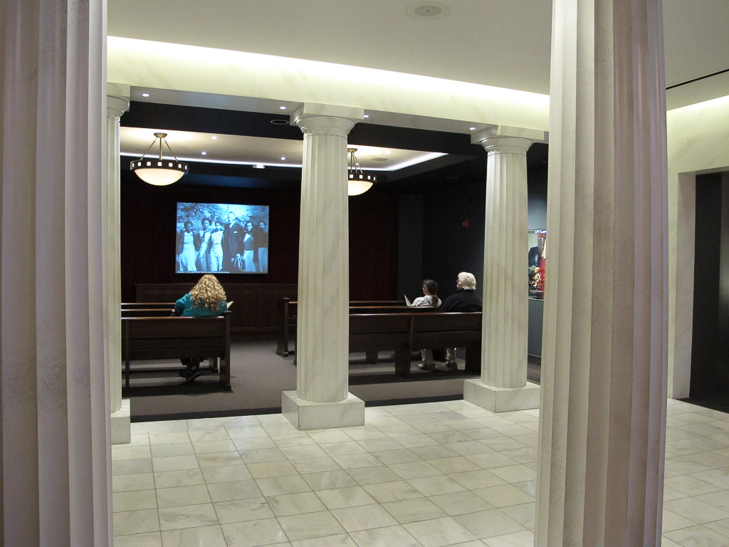
The powerful introductory movie concluded with shadows of people marching across the screen. As the theater was dimly relighted, we were asked to exit by climbing a few stairs onto the stage and exiting behind the screen. We became part of the march. Chills.
It was difficult to witness some of the bone-chilling exhibits. In a large room focused on slavery, an alcove depicted the innards of a slave ship where life-sized bronze statues wrapped in chains were crowded together on the floor. Their agonizing screams and groans played on a continuous loop. It felt disrespectful to even consider taking a photograph. We were there to learn. And we were humbled.
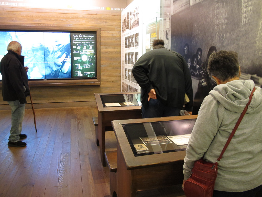
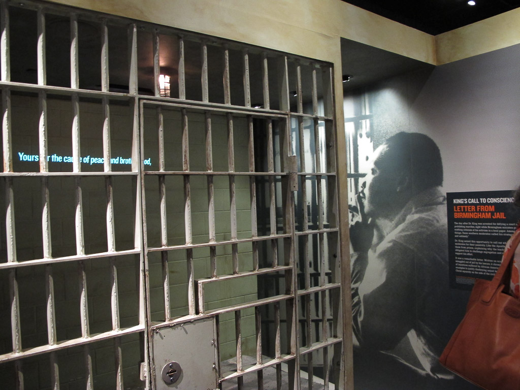
As we tried to take it all in, the displays continued to draw us into each scene as if we were present. The story of school desegregation was displayed in a courtroom and a classroom. Martin Luther King Jr.’s experience in the Birmingham Jail was told in a jail cell.
We agreed that our own public education had been tremendously lacking in U.S. history past the Civil War. The school curriculum in Stamford, CT in the 1960’s did not include anything past the beginning of the Reconstruction era. Current events were glossed over and never put into an historical context.
I felt ashamed as I realized how little I knew. We should all know this history. Why weren’t we taught this?
I won’t presume to be the one to teach others this history that is so new to me; hopefully you already know much of it yourself.
The Rise of Jim Crow began in the late 1800’s and continued well into the 20th century. The 15th amendment and legislation were passed to guarantee rights to African Americans and were then destroyed by a series of new laws and Supreme Court decisions that made “Separate but Equal” the law of the land. Segregated schools. Separate water fountains. Separate. Separate. But never Equal.
The Jim Crow era led to. . .
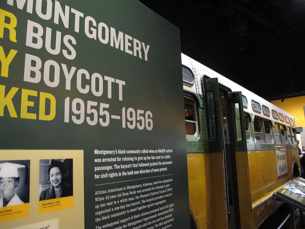
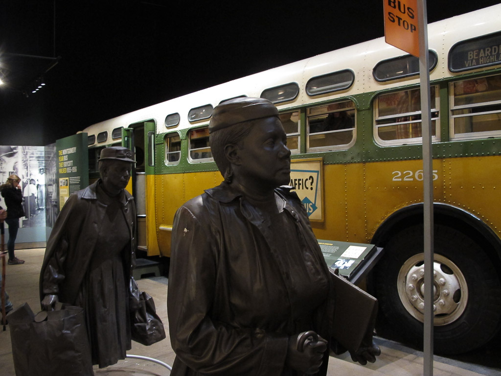
The Montgomery Bus Boycott
The Student Sit-ins
A lunch counter sit-in.
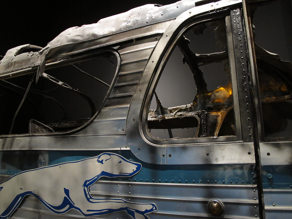
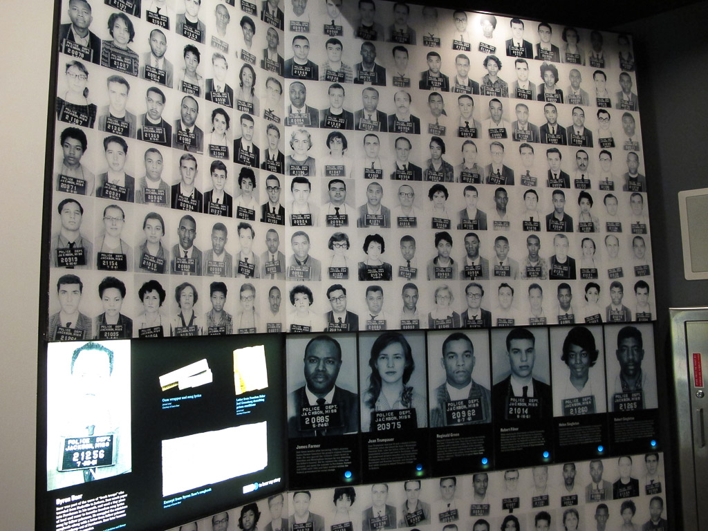
The Freedom Riders of 1961
A burned out bus used by the Freedom Riders
Incarcerated Freedom Riders in the early ’60s.
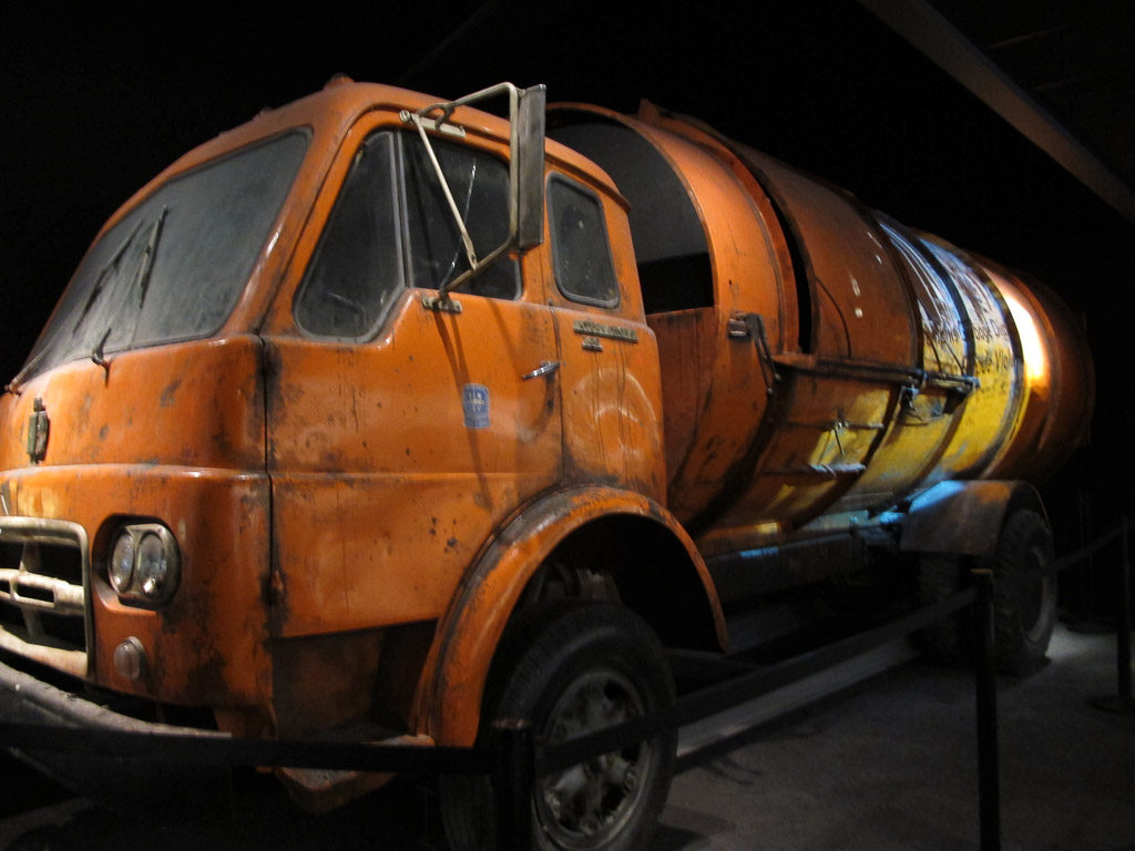
The Sanitation Workers’ Strike in Memphis
Civil Rights Marches
In the afternoon we visited the three-story Legacy Building across the street. On the 3rd floor, a timeline tells the story of the American Civil Right Movement up to the time of MLK’s assassination. The entire second floor is dedicated to the investigation of the crime: the conspiracy theories, extensive evidence , and the actual spot where James Earl Ray took aim.
I felt unsettled. Is this where the museum leaves us? I was glad when the tour ended on the first floor. Here we learned more about how the Civil Rights Movement here in the US has impacted human rights and civil rights throughout the world. We were left with the voices of many who have been called into action and who are making huge impacts globally to work toward equality for all. In the dimly lit room, a mural of silhouetted men, women, and children led us out; again, we became part of the story.
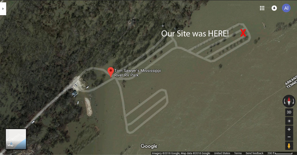
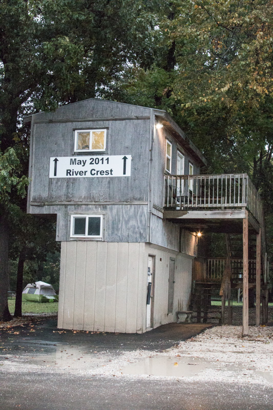
When we were looking for a campground near Memphis, several folks suggested the Tom Sawyer RV Park (actually in W. Memphis, Arkansas). We learned that it is RIGHT on the banks of the Mississippi and this totally intrigued us. The park’s website includes information about the importance of monitoring the Mississippi Riveras your camping time approaches; they’re closed when the river overflows its banks. Yikes! We checked and it looked like we’d be just fine; it takes a couple of weeks for rain far north to really affect the height of the river. We knew we didn’t want to approach when THIS was happening!
Here’s our site where it would be during a flood!
High water! Camping on the flood plain.
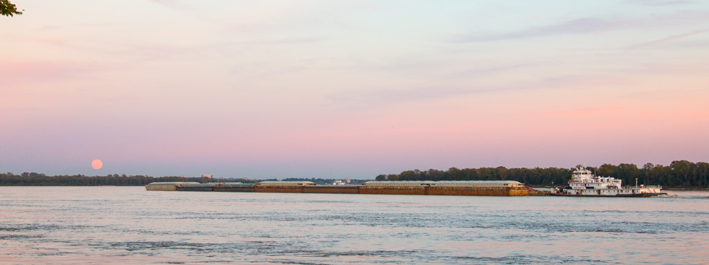
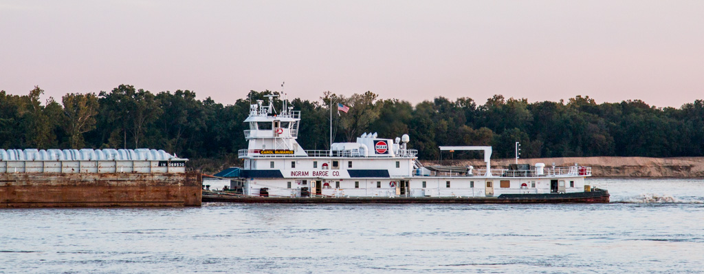
During our first hour at the campground, we were drawn to the river (actually only about 50 yards from our site) as a huge collection of barges (all attached, 7 barges long, and 3 across) was pushed along by ONE boat (that looked quite a bit like an oversized tugboat).
Can you count all the barges? Most of the loads were three barges across and anywhere from three to ten barges long!
One of the best parts of moving around the country is how much we love being so close to different forms of transportation. In Indiana, we camped very close to a very active train track — it ran all day and night (never kept us awake) and reminded us of how much our nation’s commerce depends on different modes of transport. Then, of course, there are the thousands and thousands of tractor trailers (some pulling two or even THREE trailers!) that we share the road with as we move along the nation’s interstates. And while on the Mississippi for several days, a low rumble accompanied us much of the time — we could look out the bedroom window and watch the barges moving through as we fell asleep—and then again, when we woke up the next morning. Sometimes we could tell what they were hauling, and other times, hmmm… They were mesmerizing. It’s fun to watch our nation’s commerce on the go!
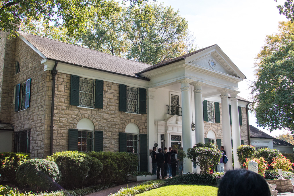
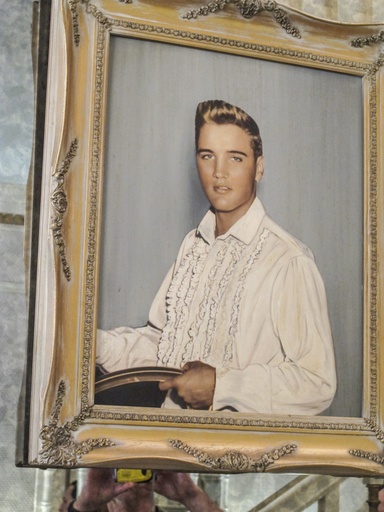
So, why Memphis? Graceland, of course! We’ve learned to take others’ recommendations, whether positive or negative, with a grain of salt. We like to experience what we can and draw our own conclusions—sometimes a place that someone else told us to not waste our time with, is a favorite of ours!
So we drove to Graceland our first morning there—and spent hours poring over building after building of memorabilia not just about Elvis but also about many other musicians. We started with a tour of the mansion—and were quite impressed by all that we were able to see. I’ll let the pictures tell the story:
The Presley’s home — treasured and beautifully maintained.
The living room and music room beyond — the 12 foot couch was specially ordered
The dining room
The heart of the home
Elvis’ jungle room–his favorite
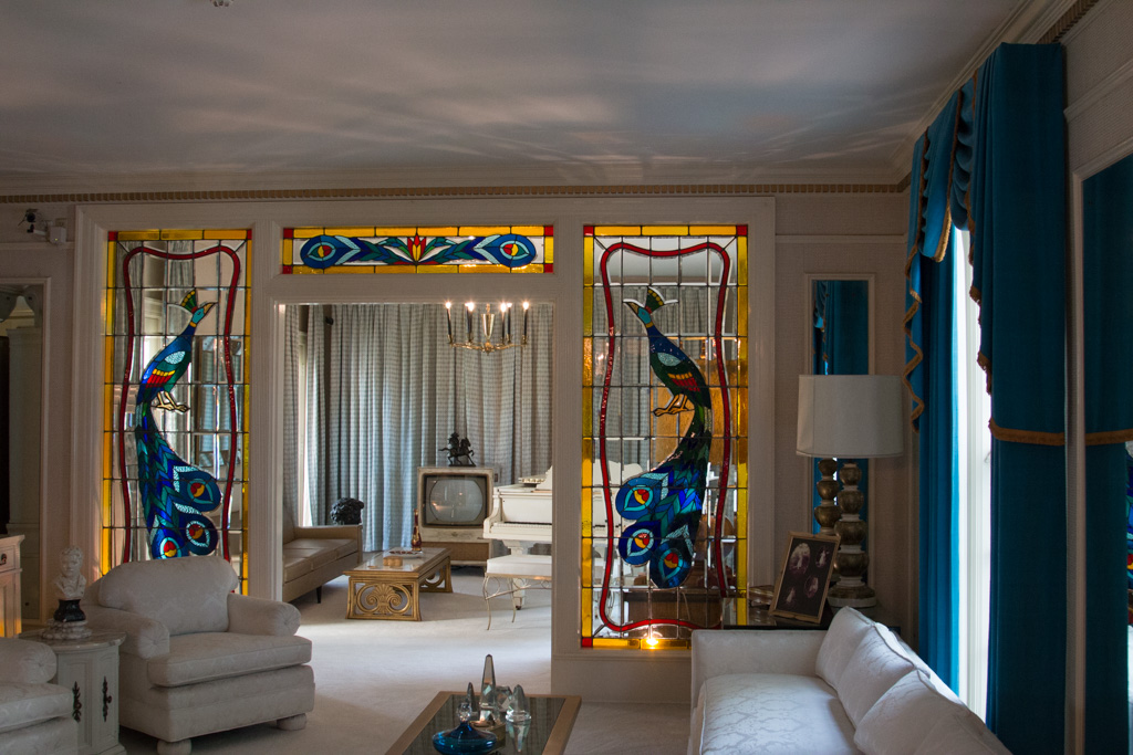
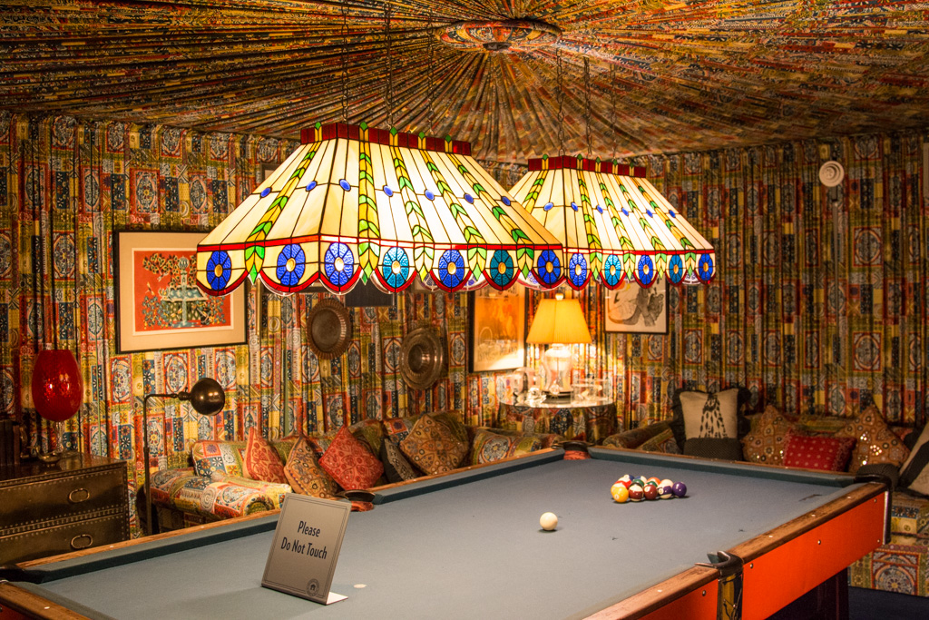
Elvis designed this pool room himself — nearly EVERY surface was covered with fabric — the walls (pleated), much of the furniture, and yup–the ceiling!
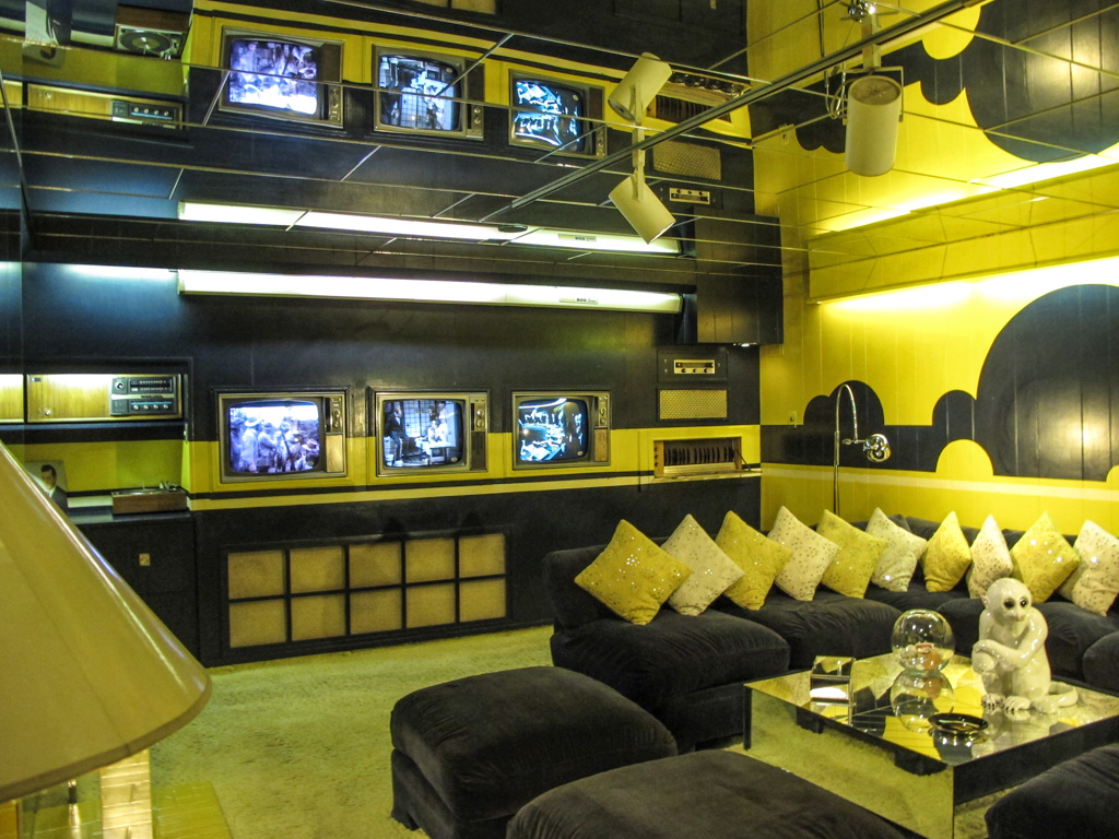
Elvis’ media room hurt our eyes!
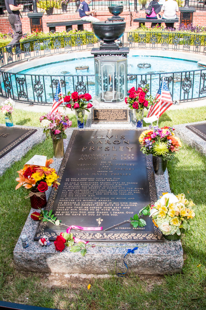
Family graves in the memorial garden on the grounds of the mansion
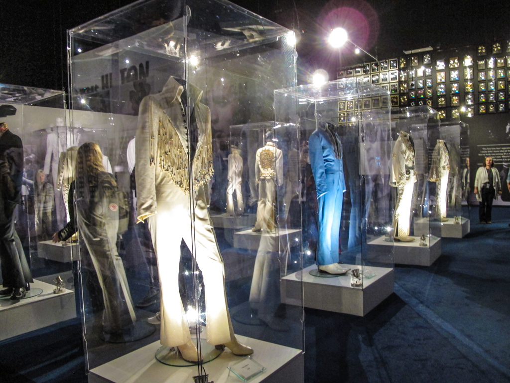
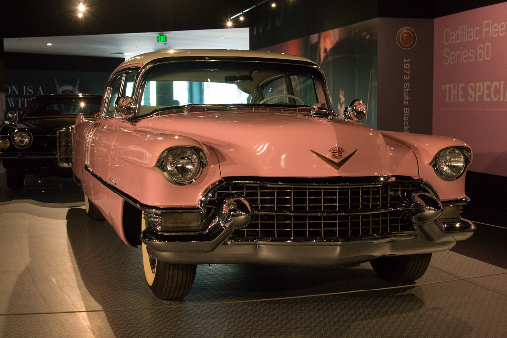
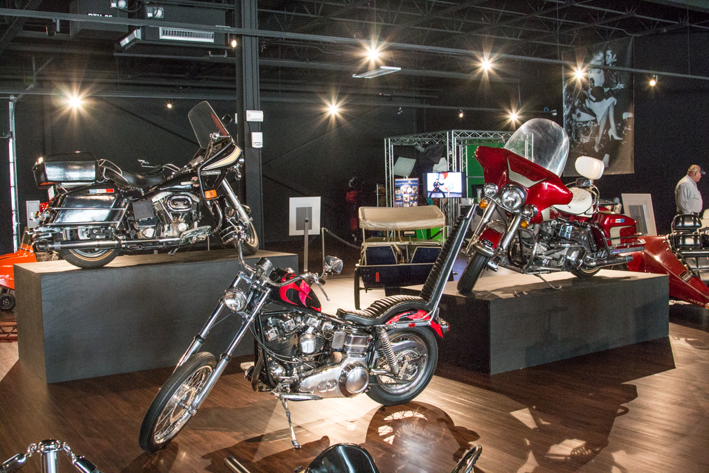
But Graceland comprises much more than the house! There were a number of buildings that featured everything from Elvis’ car and motorcycle collections, gold records, a gallery featuring dozens of musicians who were/are influenced by Elvis, a huge archive of all things Elvis including items related to his military service, and, oh yes, an incredible array of bedazzled jumpsuits!
It took us at least a couple of hours to get through all of the extra buildings. We were pretty impressed and Elvis’ music serenaded us throughout the entire complex. Not having ever been huge Elvis fans, we had a lot of fun and found ourselves humming Elvis tunes for several days!
We were giddy when we realized we could spend the better part of a week in Washington, D.C. We’d only ever been with kids or as kids ourselves. We were long overdue for an opportunity to experience our nation’s capital as adults with no real responsibilities for anyone else!
We camped at the Cherry Hill Park Campground, in College Park MD. If you’re coming this way in an RV, we highly recommend it. It’s the nicest place we’ve stayed so far, and by no means the most expensive. The Metro bus comes right to the campground and it’s a quick ride to the train station. And then just a 20-25 minute ride into the heart of D.C. It was SO easy to navigate.
And… the campground has single-stream recycling!
Each day at 4 PM, the campground offers a great orientation to the D.C. transportation system and an intro to two tours—we signed up for both. Terrific.
A week in Washington Is not nearly enough! We didn’t have even that much time, but we had a wonderful time. We went into the city four times; twice on our own and twice as part of the tours organized by the campground.
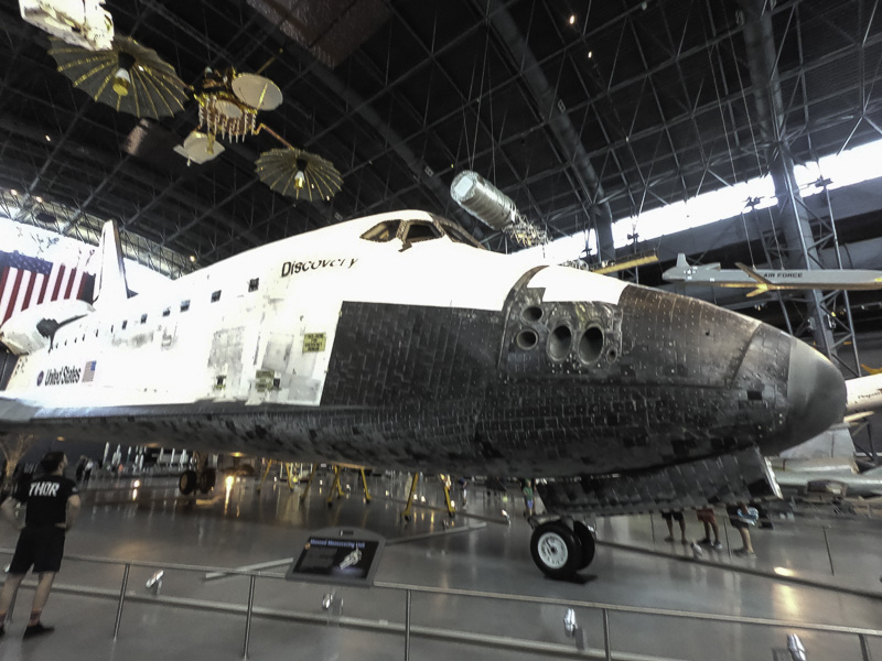
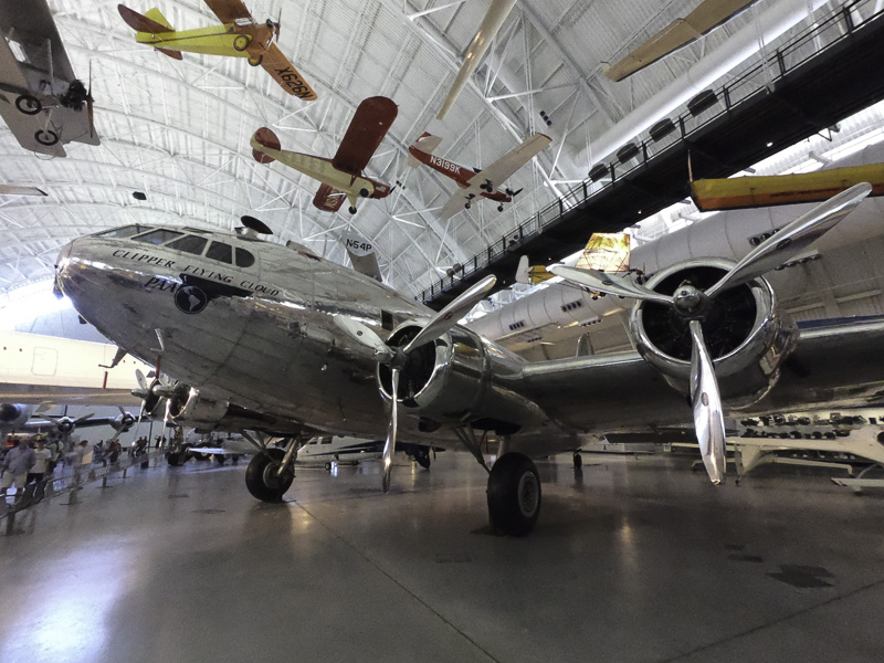
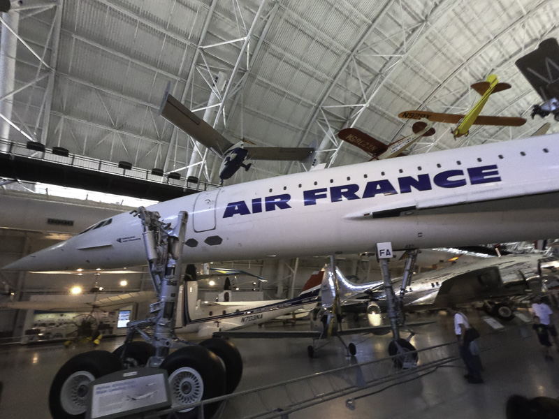
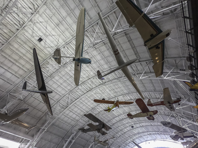
The first day we were there, we went into the city on our own and split up. I (Al) went to the Steven F. Udvar-Hazy Center of the Smithsonian’s Air and Space museum near Dulles Airport. If you are into the history of aviation and space exploration at all, this is a must see.
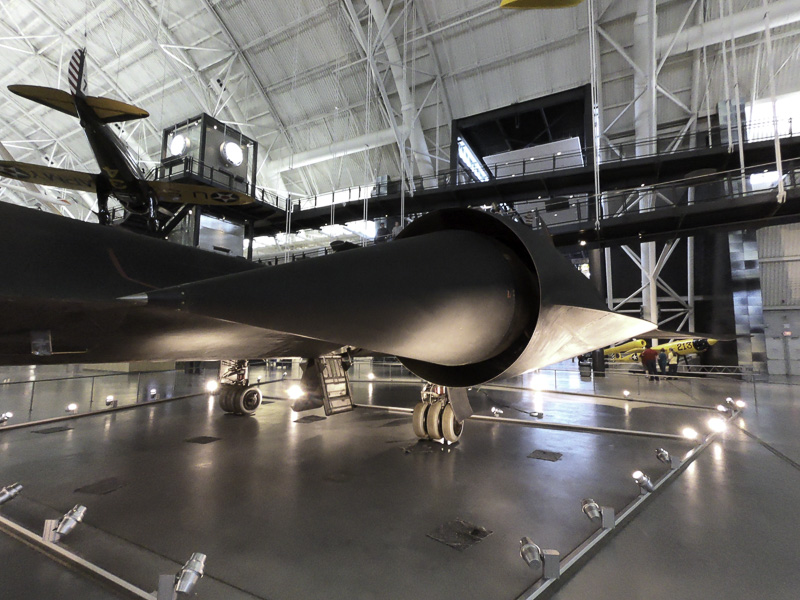
The museum is in a huge hangar, and has a wide range of planes and space craft from very early days to recent history. Main displays include a Concorde SST, an SR-71 (the fastest—2000 MPH—and highest flying—80,000 ft—jet ever built — 32 were built in all), the space shuttle Discovery, and the Enola Gay. Beside those four, there are aircraft and space craft densely packed in the hanger, in three layers: one on the hangar floor and two layers creatively suspended in the air from the ceiling. I spent over three hours there and only scratched the surface. The density actually is a problem in trying to get good pictures of the craft because of the visual clutter in the background.
The SR-71 is very difficult to photograph in its entirety in this setting. It is huge. It is jet black (get it?). It is crowded by other craft. Here is the port engine, a marvel of slide rule engineering—it was designed in the late 50’s—early 60’s— with NO computers!
SR-71’s engine and “spike”
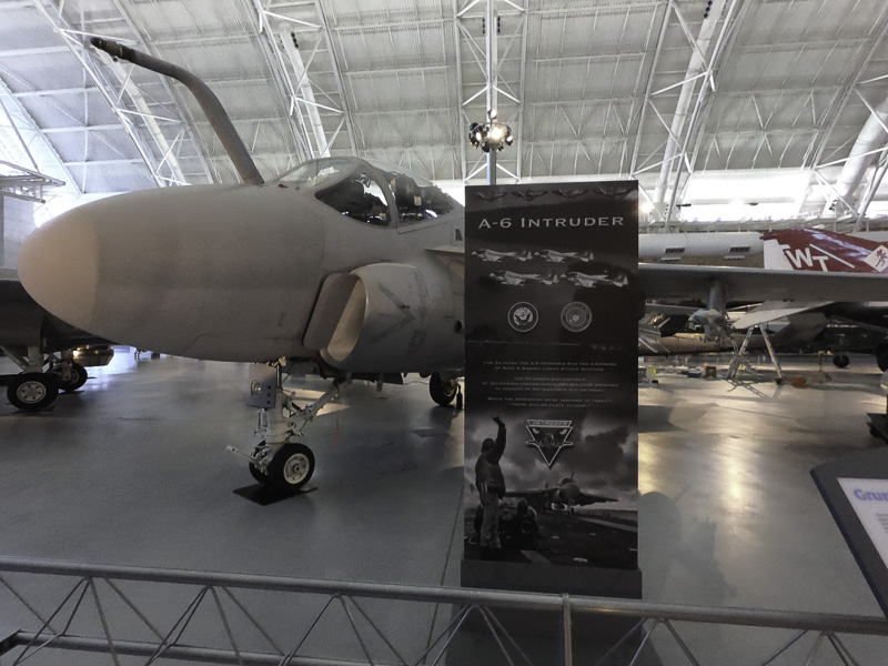
The A-6 was one of the key bombers of the Vietnam era.
A-6
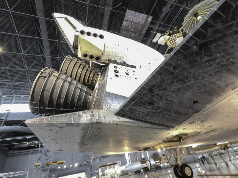
The Discovery has a prime place on the display floor.
Discovery. Thank you for living up to your name…
The engine nozzles. This thing is BIG!
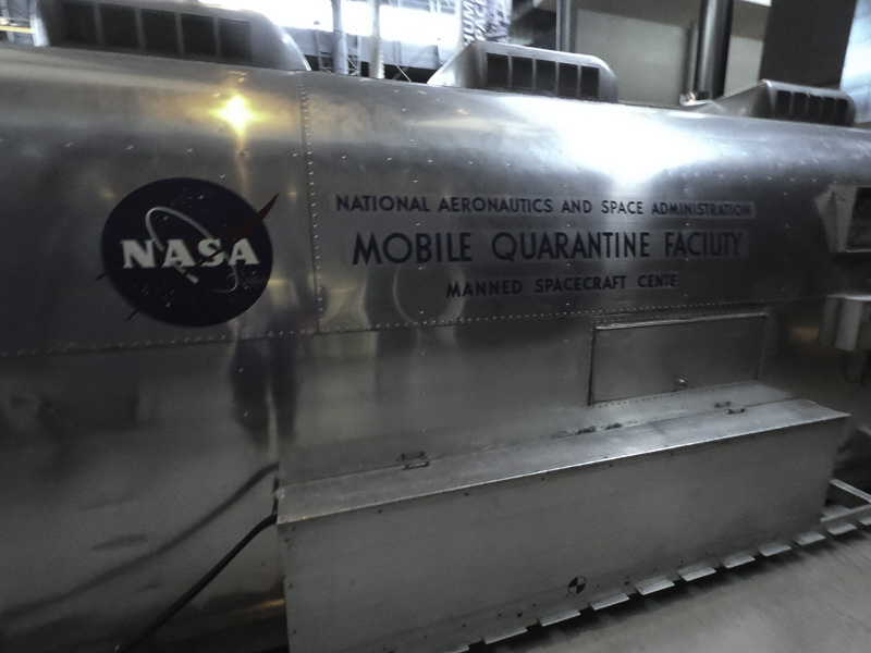
If I had to have an Airstream instead of our current trailer, this is the one I would want!
The NASA “RV”
(Actually, it wasn’t made by Airstream. Sure looks like one, though!)
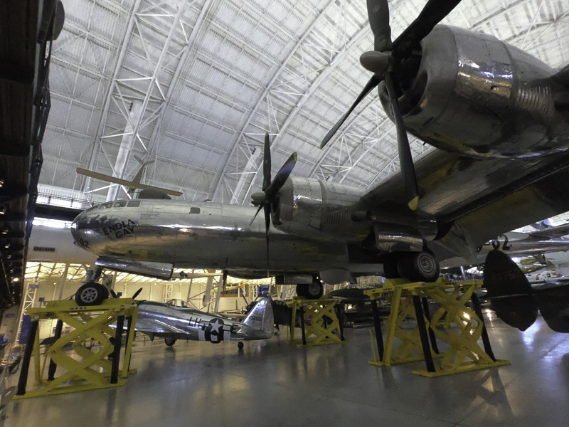
One of the most famous airplanes in history:
Enola Gay–it dropped the first atomic bomb , on Hiroshima.
The Boeing 307 was one of the, if not the, first commercial airliners. It was based on the B-17C bomber from World War II.
Boeing 307
I wonder whether or when we’ll have another supersonic passenger plane.
The Concorde
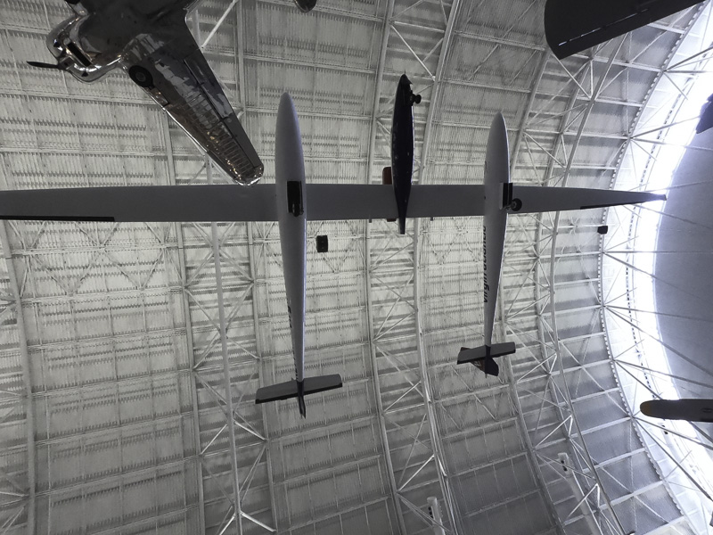
The Global Flyer accomplished the first solo, non-stop circumnavigation of the world. Sixty seven hours and one minute.
Global Flyer . The wingspan is HUGE!
A sampling of the planes suspended from the ceiling.
Too many planes to keep straight!
The museum is quite a distance from downtown area, but is well worth the trip!
Kathe: While Al was at the museum, I visited several museums on and near the National Mall. Within just a couple of blocks of wandering, I came upon a very long queue of folks waiting to get into the Newseum. As it turned out, it was FREE MUSEUM day in D.C. I hopped into line and immediately started chatting with a couple of women. Before long I realized that even though it was a free entry day (usually $25), I still needed a ticket. One of the women I was in line with graciously offered me a second free ticket that she had. Score!
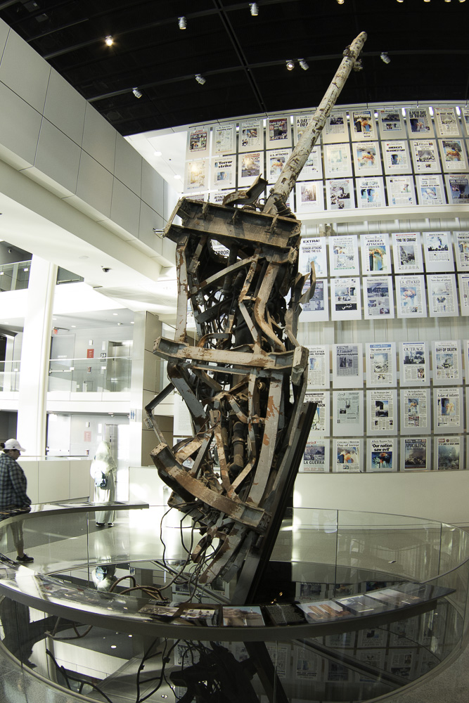
I stayed at the Newseum for two solid hours and thought my head would explode! This museum focuses on the world of journalism and promotes first amendment rights through exhibits that include (among many others): 9/11, the Berlin Wall, a special FBI exhibit, a daily display of 80 first pages of newspapers from around the US and the world, a wide range of films documenting important world events, and an extraordinary gallery of decades of Pulitzer Prize winning photos.
The remains of the antenna tower from the top of the World Trade Center. Front pages of international newspapers reporting on 9/11.
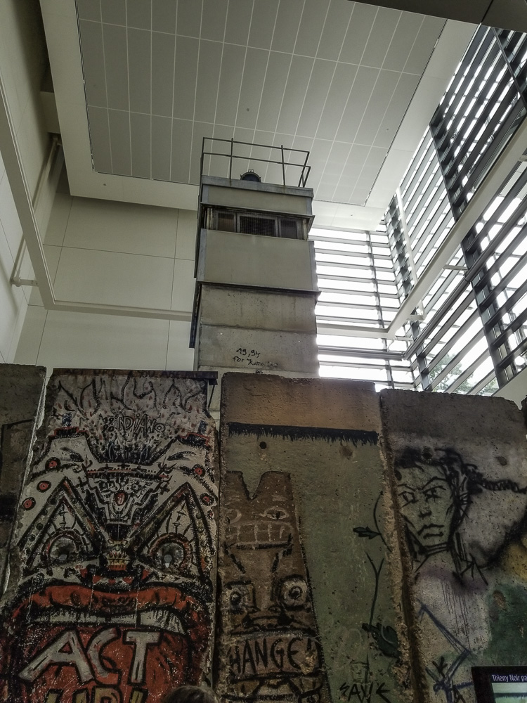
This display includes eight panels from the Berlin Wall and the guard tower from Checkpoint Charlie – extraordinary!
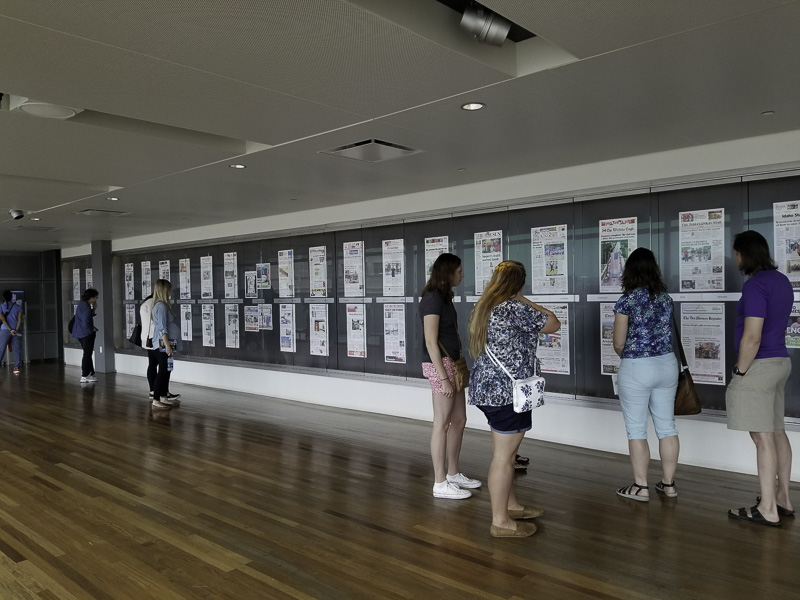
During the overnight hours, the Newseum receives copies of the front page of more than 80 newspapers. They are printed oversized and displayed – fascinating to see how the same story can be reported from so many perspectives. An important display!
What is striking is that each of the exhibits includes a range of short videos by journalists who covered the story. It is without a doubt the most current, dynamic, compelling, and thought-provoking museum I’ve visited; I considered suggesting that they hand out Kleenex as you come through the main door — and yes, I took Al back to it later in the week! I can’t recommend this one highly enough.
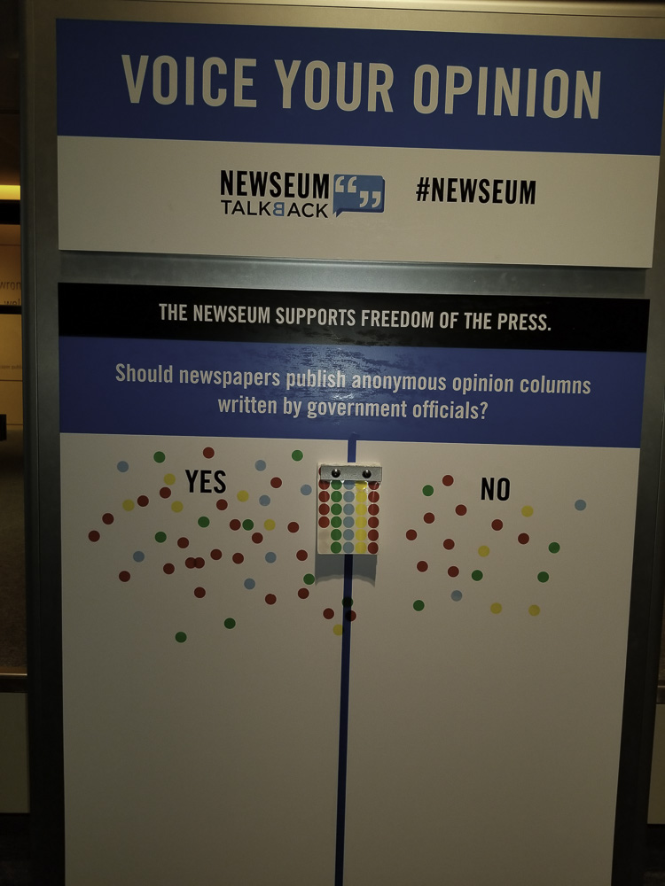
You can also make YOUR opinions known at the Newseum. The opinion poll question is always related to the current day’s news.
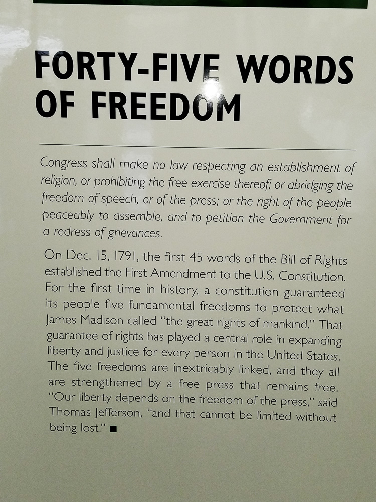
It was refreshing to reread the First Amendment. Do you know what the five rights are?
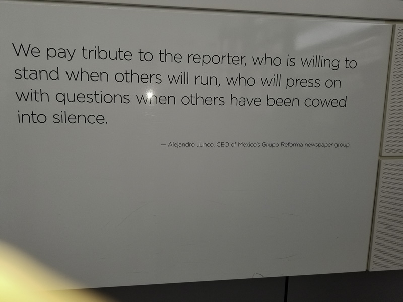
A sobering memorial (at least two stories high) of journalists who have given their lives in their pursuit of the truth.
Just in! The Newseum set its all-time single-day visitor record on Saturday, Sept. 22, 2018, with 11,815 people visiting the one-of-a-kind institution. (Guess it helped that I was there!)
I also visited (somewhat briefly) the National Gallery of Art, the National Museum of Natural History, and the Hirshhorn Sculpture Garden. It was a whirlwind and honestly, I could have spent days upon days visiting so many more museums — alas, I needed to meet Al and we needed to figure out where we would eat dinner.
Never underestimate the power of Google! We searched “Restaurants near Me” and found an Indian restaurant nearby — what a find! It turns out that Rasika is a restaurant which has won a James Beard award and we can see why. It was amazing!
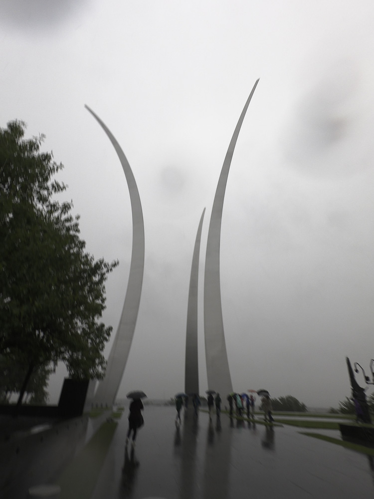
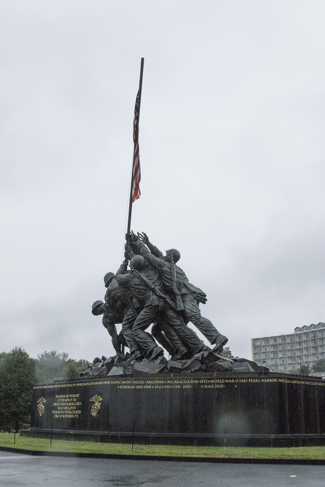
On the second day we took a day-long guided tour of the city with a very knowledgeable guide. We visited the Air Force Memorial and the Marine War Memorial (also called the Iwo Jima memorial). Then we took a water taxi ride from the wharf near the Lincoln Memorial to Georgetown.
“Bomb burst” maneuver, missing man formation
The Marine War Memorial, “Iwo Jima”
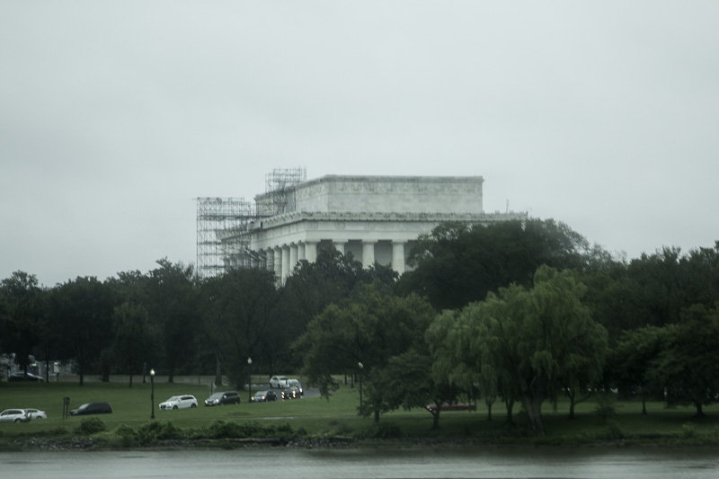
Lincoln Memorial from the Potomac River
We stopped at the Pentagon City Mall for lunch, and found a stand offering a wide variety of baklava squares that were imported directly from Lebanon. They were incredibly delicious and oh, so sweet. We got several and were able to make them last for several days, but it was tough. It would have been so easy to eat all of them before the end of the tour!
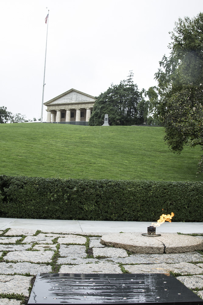
After lunch we went to Arlington National Cemetery, and took their tram tour. We hadn’t known that Arlington was originally the estate of Robert E. Lee, which was confiscated after the Civil War. The very first graves (Union soldiers) had been interred in Mrs. Lee’s garden (making a clear statement to Lee). We stopped at the grave of President Kennedy, where Jackie Kennedy Onassis and two of their children are also buried. The site is directly below Lee’s house, and was actually selected by the president when he visited the cemetery. Admiring the view, he was heard to say, “I could stay here forever.”
JFK’s grave and RE Lee’s house
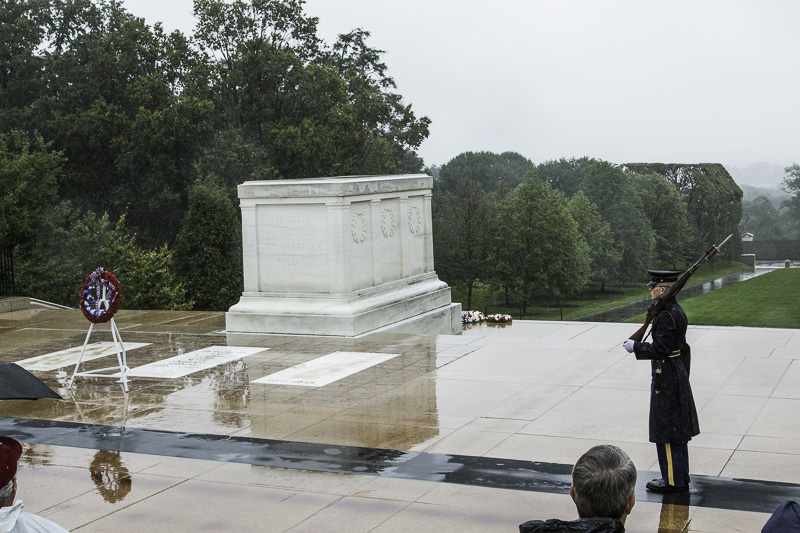
Next we went to the Tomb of the Unknown Soldier, a very sobering place. We had both been to this site before but it was good to revisit it. We were present for the changing of the guard ceremony. The guard has been present 24/7/365 since it was initiated on April 6, 1948. The markings of so many years of the sentries’ precise steps were visible in the dark orange on the granite platform. It is an incredible honor to be chosen for this highly competitive post.
The Tomb of the Unknown Soldier
There are graves for one soldier each from World War I, World War II, the Korean War, and the Vietnam War. The crypt for the Vietnam War unknown soldier is now empty, as the entombed soldier was identified in 1998 as Air Force 1st Lt. Michael Joseph Blassie through mitochondrial DNA.
Here is Kathe’s video of the Changing of the Guard ceremony.
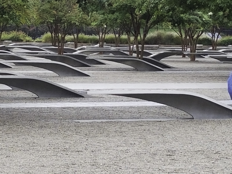
Since the rain had picked up and no one really wanted to get off the trolley, the tour of Arlington was a bit shorter than usual. Our tour guide asked if we would like to visit the Pentagon Memorial. Yes! Several others on the tour had already seen the NYC 9/11 Memorial and the Flight 93 National Memorial in Shanksville, PA and were eager to see this 9/11 memorial as well.
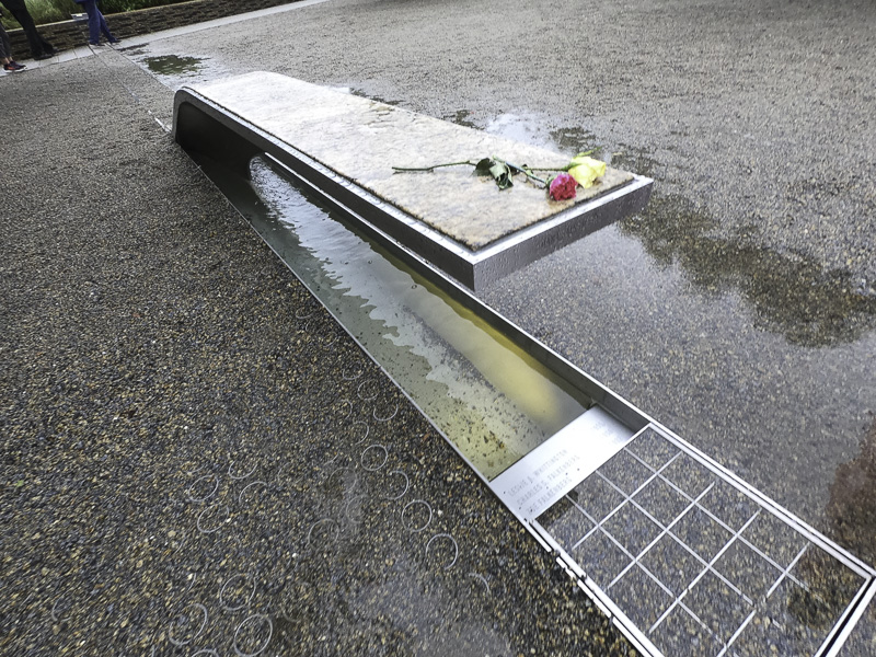
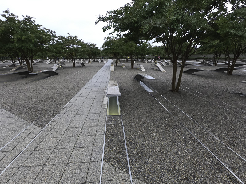
The Pentagon Memorial is breathtaking — and a feat of imagination. There is a stainless steel cantilevered bench inlaid with granite for each of the 184 victims with their name engraved on it. The bench has a lighted pool of water underneath which reflects light onto the gravel field at night. Each bench resembles an airplane wing and points one of two ways depending on if the victim worked at the Pentagon or was on the ill-fated plane that crashed into the building. All of the benches for people born in the same year are arranged in a line going diagonally across the large area.
If the base points toward the Pentagon, it commemorates an employee. If the base points in the opposite direction, the victim was on the plane.
The victim’s name is engraved on the edge of the bench. However, in this case, three other names and birth years are engraved below; this represents four members of the same family who were all victims aboard the hijacked plane.
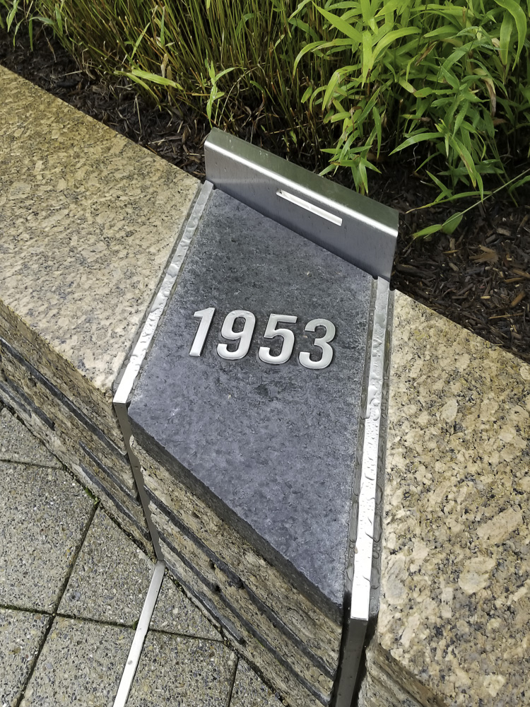
Commemorative benches in line with this marker represented those born in 1953.
You can follow the stainless steel tracks across the memorial to count how many victims were born in a particular year. It was harrowing.
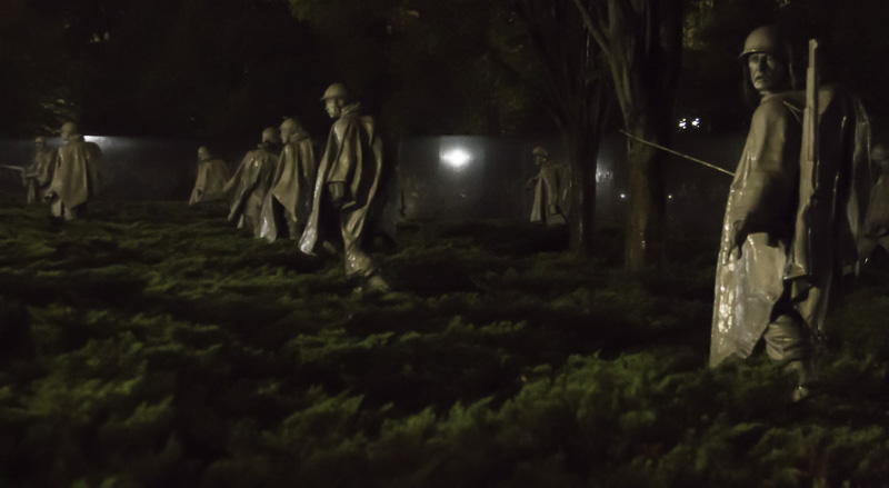
The third day we took a night tour to several memorials including the Jefferson, Lincoln, FDR, MLK, World War II, the Korean War, and the Vietnam War memorials. While we had been to several of those before, those visits had not been at night nor in the rain. Washington looks different at night!
Two of the memorials that really struck us were the Korean War Memorial and the FDR Memorial. The nineteen statues of soldiers in the Korean War Memorial were all facing in different directions, on guard, each wearing a rain poncho, and some in full combat gear. It was fitting that we visited the memorial at night and in the rain. The statues were surrounded by low shrubs that gave the sense that they were standing in rice patties. It was striking.
The bronze statues seemed to come to life.
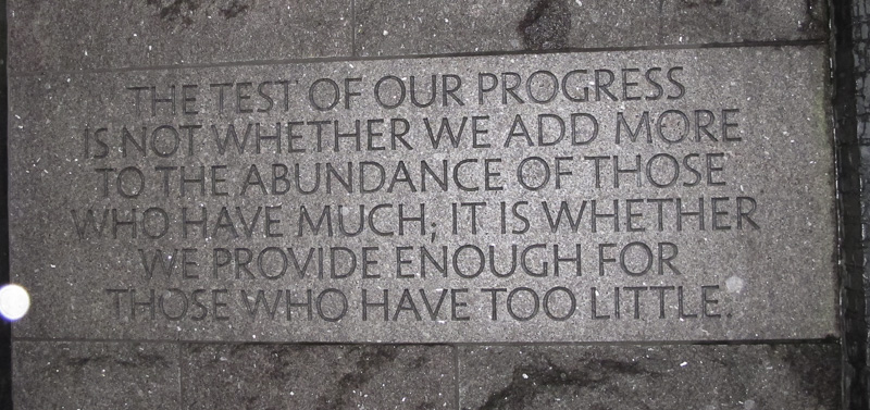
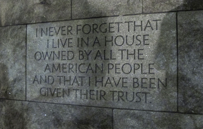
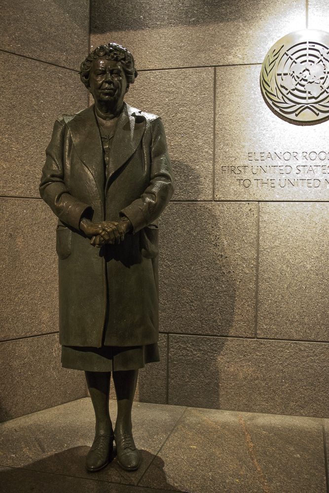
The FDR Memorial was huge—it’s the largest memorial on the National Mall. There was a large open air room that depicted each of FDR’s four terms as President. The pathway through the memorial was meandering and featured bronze statues, water installations, stirring wall art, and FDR quotes. Near the end of the walkway was a beautiful statue of First Lady Eleanor Roosevelt. It was hard to take it all in; we’ll certainly visit it again. You can learn more about this monument here.
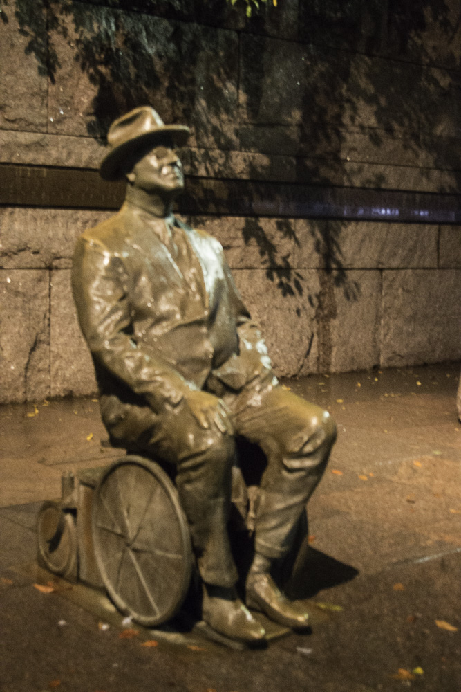
The first statue in the memorial depicts FDR in his wheelchair.
FDR was in office during the Great Depression.
FDR was a man who took his role as President seriously and with great humility.
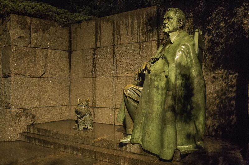
One can see how tired FDR looks during his third term in office. His beloved dog, Fala, was always at his side.
Eleanor Roosevelt, the only First Lady depicted in a presidential memorial in D.C. She was a steadfast adviser to her husband and also served as our first ambassador to the United Nations.
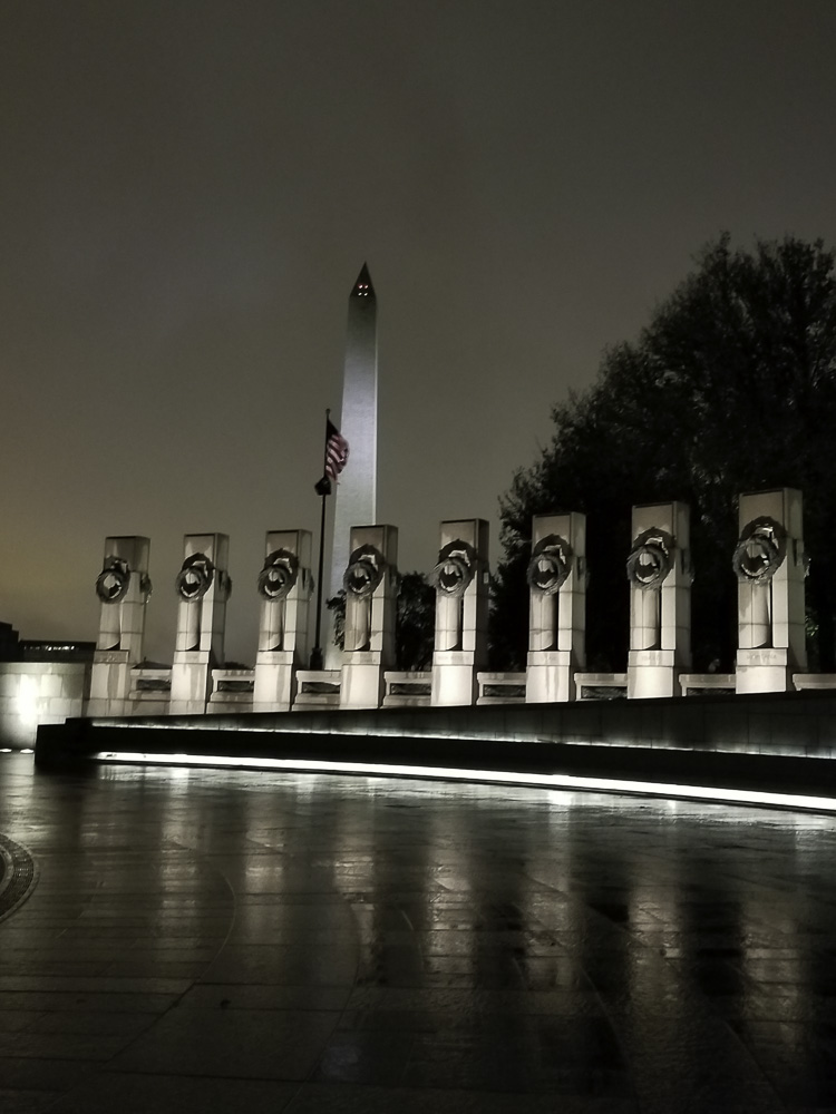
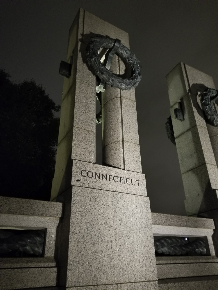
The World War II Memorial was impressive and particularly beautiful lit up at night.
The World War II Memorial.
At the WW2 Memorial
Our last day in the city we visited two keystones in the federal government, and then re-visited the Newseum so that Al could see several of the exhibits that wowed Kathe on the first day.
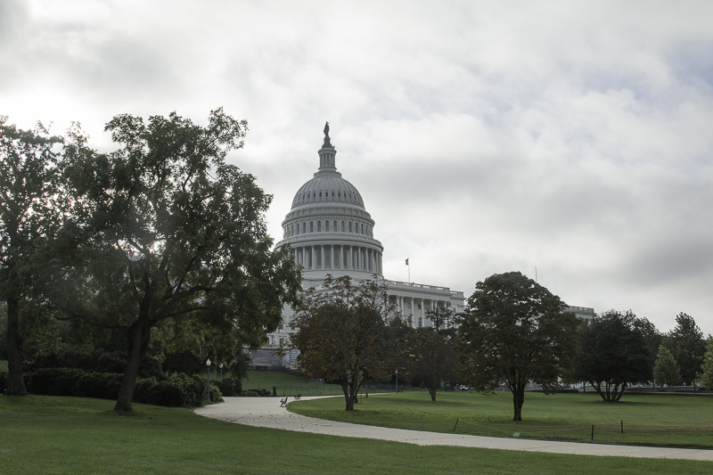
We first visited the Capitol, which requires a guided tour unless you contact your Representative or Senator. The guided tour was slightly disappointing to Al. It covers just the crypt below the Rotunda, the Rotunda itself, and the Statuary Hall. All of these were very crowded and we were not allowed to separate at all from the tour group, so that good photography was not possible.
Walking from the mall to the Capitol, you have to go to the far side to reach the visitors’ center. When you get to approximately the front side of the Capitol, the sign says “Average walking time: 8 minutes.”
Walking past the building you get several views of the Capitol.
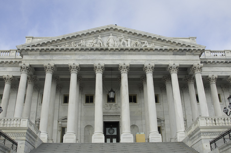
On the side away from the mall, you pass the main (ceremonial?) entrance to the Senate building, which is a wing added to the original Capitol building.
Here is the original Capitol building. Until Reagan, presidents were inaugurated on these stairs. Starting with Reagan, the inaugurations switched to the other side because the crowds could overflow onto the National Mall.
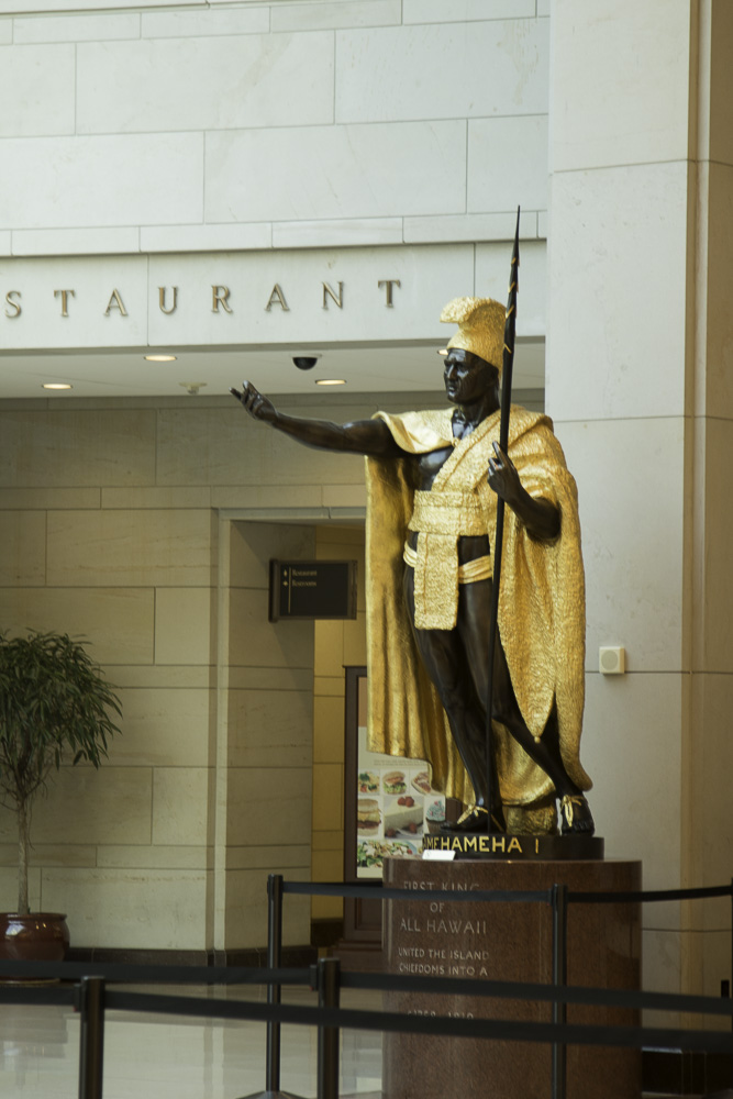
Every state can send two statues depicting important (dead) people from the state. Most are in Statuary Hall, but some are in the main hall of the visitors’ center. Here is King Kamehameha I from Hawaii, the largest of the 100 state statues.
After an introductory film, we began the tour in the crypt, just below the Rotunda. The crypt is so named because it was intended to be the burial place for George Washington. Washington’s express wishes in his will were to be buried in his Mount Vernon estate, which eventually were acceded to. In the center of the crypt is a marker which is the geographic center of the original extents of the District of Columbia. If it were not roped off, here you could stand simultaneously in Northeast, Northwest, Southwest, and Southeast DC!.
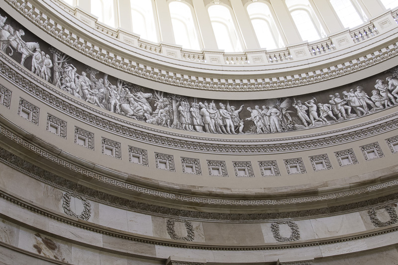
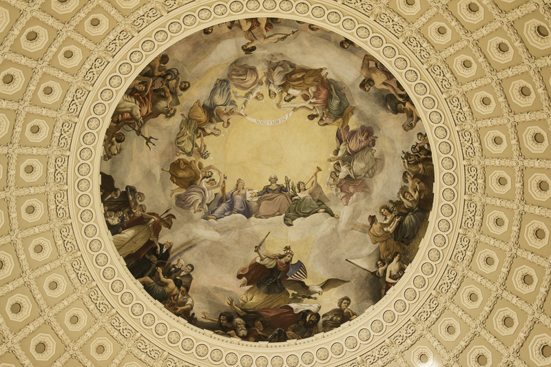
The Rotunda has eight murals depicting historic moments. It also has a circular mural around the dome opening showing 400 years of American history.
The ceiling of the Rotunda has a painting named “The Apotheosis of Washington.” Apotheosis means to elevate someone to the status of a god. Washington, who twice voluntarily relinquished power, would have hated it.
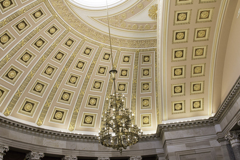
The Statuary Hall was originally the House Chamber until the members could no longer fit, at which point the separate House building was added.
The ornate ceiling of the National Statuary Hall, formerly the House chamber
The spherical shape of the ceiling caused the room to have terrible acoustics, making it very difficult to conduct business. The solution? Build a new House chamber!
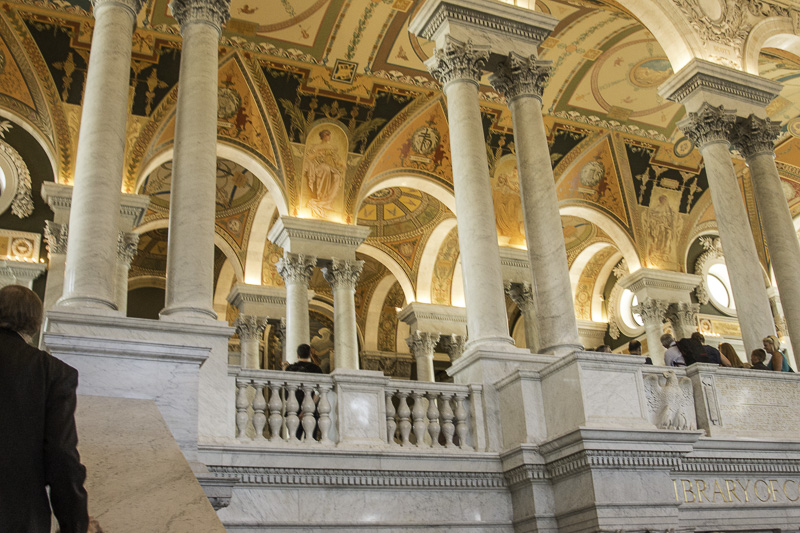
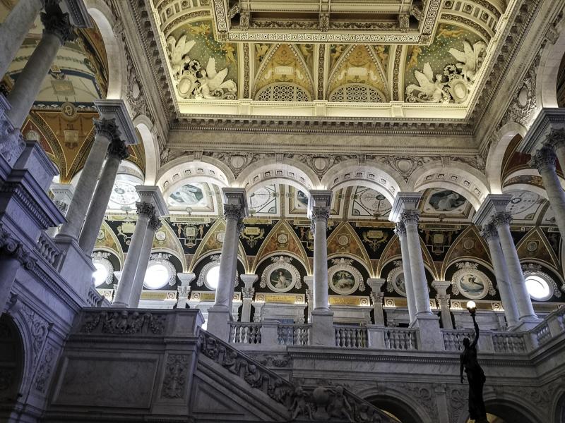
We then walked through the tunnel from the Capitol to the Library of Congress, specifically the original Jefferson building. The Library currently comprises four buildings: three adjacent ones in the Capitol district, Jefferson, Adams, and Madison, and one at Fort Meade.
The Jefferson building’s interior is overwhelmingly beautiful. Whereas the Capitol required one to take a guided tour, here we opted for one which was leaving as we emerged from the tunnel. We’re glad that we did.
Our tour guide was an older gentleman who was so engaging and knowledgeable. He was overwhelmingly proud to be able to share the LOC with us. His main message to us was that there is no happenstance about ANYTHING in the LOC — every ceiling, wall, mural, stairway, statue, inscription, etc. tells a story about the pursuit of knowledge and the importance of reading and learning.
It is an inspirational place and yet one more place in D.C. that you couldn’t possible take in in just one visit.
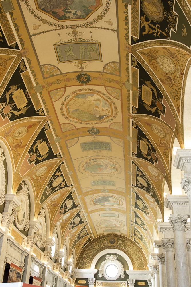
One of many inscriptions throughout the Library of Congress.
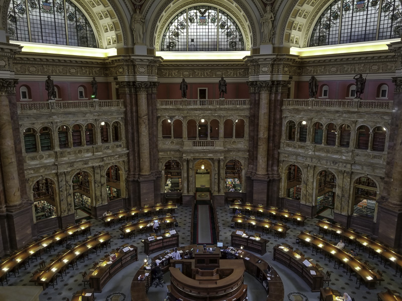
The main reading room seen from the balcony above.
The Library of Congress is the largest library in the world (in terms of its collection), the official research arm of Congress, and also home of the U.S. Copyright Office. It comprises more than 167 million items, and adds 12,000 items to its collection each working day. It is considered our national library. It has more than 838 miles of bookshelves!
We left our nation’s capital with such a sense of awe and deep reverence and appreciation, especially for those who have served our country in the military and in service to our country. Perhaps it’s being a bit “older” that helped us to appreciate this beautiful city in a humbling way. We will certainly visit again!