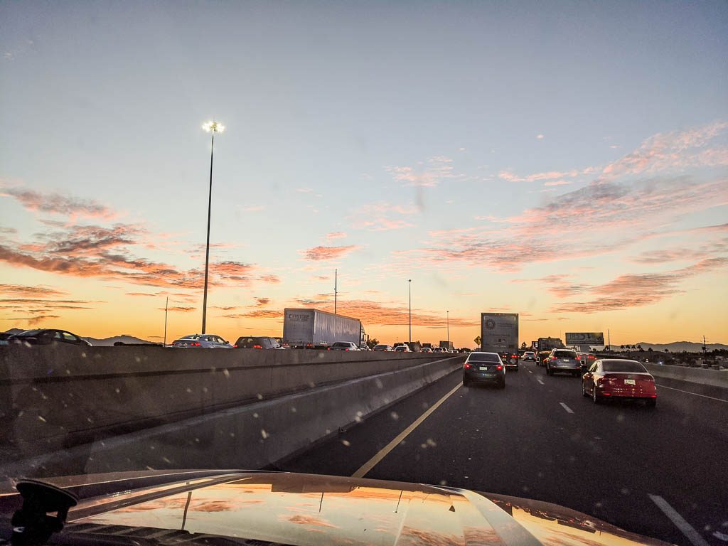
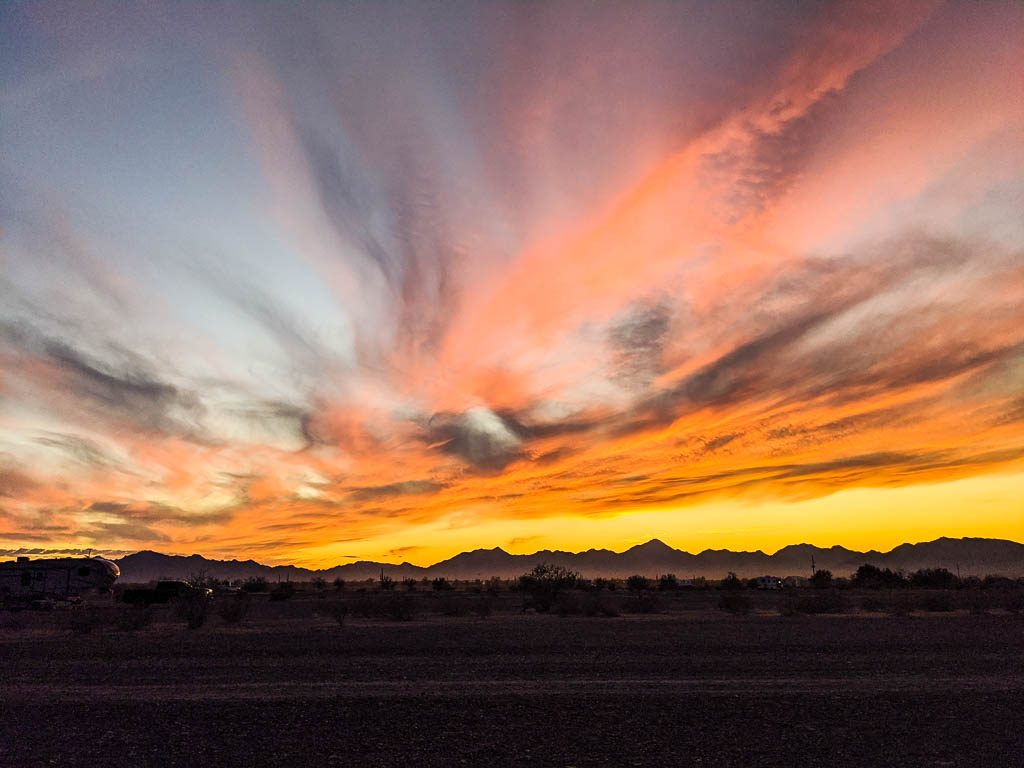
We weren’t going to restart the blog for another week, but today’s events make it seem worthwhile.
You’re getting this email because you were subscribed to the Lobsters’ email list when we were traveling between 2018 and 2020. If you are no longer interested, please just send an email to lobsters@lobstersontheloose.com, and we’ll unsubscribe you.
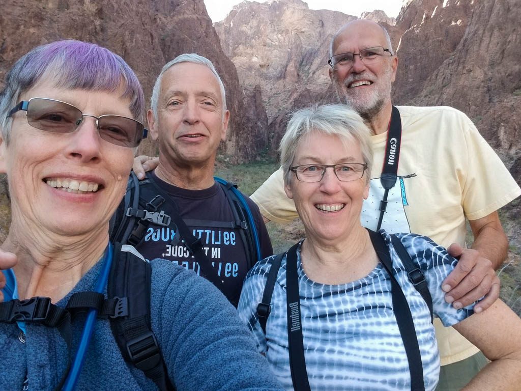
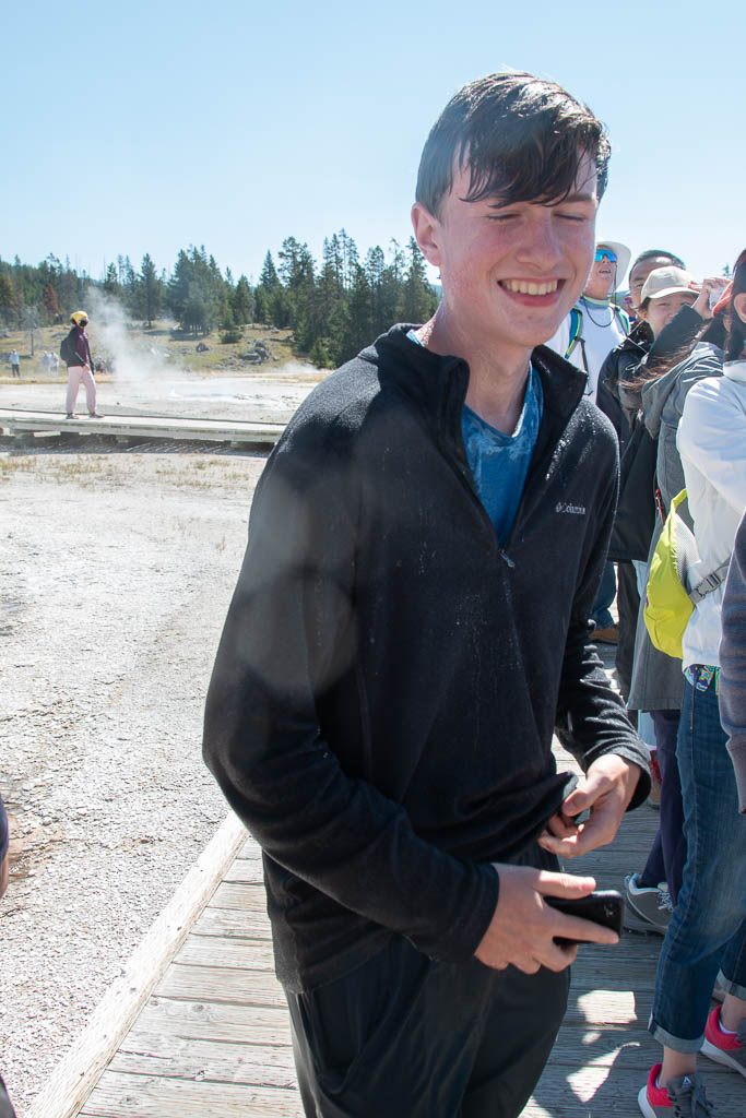
We’re on the road again to take two more grandchildren (Mira and Brynn) through National and State Parks in Utah and Arizona, like the trip we took with Graham and Dean (their older brothers) five years ago. Kathe and I may create some new blog entries during this trip, but we’re especially looking forward to our two granddaughters recording their impressions of the trip and sharing their pictures. That part of the trip will start in just over a week, but… about today!
We’re on our way from Helena, Montana, to Flagstaff, Arizona, where we will start the trip with our granddaughters. Closing up the camper this morning in Fillmore, UT, Kathe commented that we really should have pressure washed the camper before we left home. About 50 miles south of Fillmore, Kathe noticed a sign for a truck and RV wash at the next exit. “Turn left, one half mile,” it said. At the bottom of the exit, signs for the wash pointed right… We went right, into a big Flying J truck plaza; we didn’t see the wash, so I walked over to a large garage area to ask directions of two men heading out in a golf cart. Yes, we should have gone left. We started to pull ahead but had to wait for a few semi rigs to pass by, As we started again, the guys in the cart pulled up fast on Kathe’s side, flagging us down.
“You have a broken leaf spring! Your tires are rubbing against each other.”
Oh, no. We’re in the middle of, basically, nowhere. “Is there a spring shop anywhere in the area?”
“Yes, we are, and we stock the parts you need. We fix a lot of these trailers. Just pull in over there.”
As we looked at the suspension in general, everything but the axles and brakes needed replacement. I agreed with their evaluation of parts that needed replacing; they weren’t trying to upsell.
One leaf spring was broken. Two others were recurved, from being loaded (overloaded?) for too long. Leaf springs are supposed to bow down, with the axle at the lowest point. When recurved (probably the wrong term), they bow upward. So we replaced all four springs with heavier ones (eight instead of six leaves).
What a leaf spring should look like, bowing down and with a curl on each end for attachment. This is one of our new ones, being installed.Here’s what ours looked like! Oops!
Why did the leaf spring break? A trailer suspension has devices called “equalizers” to accommodate independent motion when the axles need to go up or down at different times. The equalizers on both sides had broken welds which caused them to bend and bind, putting extra stresses on the springs. Two new, stronger equalizers went on the list.
Our broken equalizer. Bad equalizer! Bad!
One of the reasons the equalizers had broken is that the stock suspension of the trailer had poor stabilization for them causing them to flex to the side while going around corners. So we added a stabilizer bar to protect them.
The two tires that were rubbing against each other were trashed. (No blowout, thank goodness!) (Also, no pictures; I forgot. Drat!) All the tires were six years old, so time to replace them all, anyway. Four new tires.
Fortunately, there were no other repair jobs in the shop; all four men at the shop went to work on our rig right away. In under two hours, we were back on the road!
Our heroes!
If we hadn’t talked about cleaning the trailer while closing up at the campground,
If Kathe hadn’t seen the sign for the truck wash going down the highway,
If the sign at the bottom of the exit ramp hadn’t been incorrect,
If the two guys coming out of their garage on the cart hadn’t noticed our rubbing tires…
Our day would have been very different! We’re very thankful that everything happened the way it did. The camper is now safer than it has ever been.
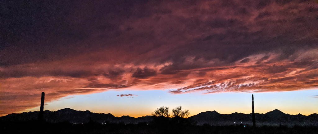
Then we went to the RV wash! Right where the billboard on the highway said we would find it. All is good.
And it is good to be back on the road in the Southwest. This will be a short trip, about five weeks, three weeks with the girls. We can’t wait for them to join us!
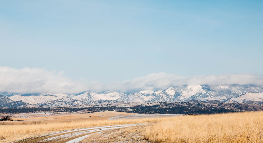
I just love this scenery; one of the things I really miss living in Montana.
The saying is, “You can pick your friends, but you can’t pick your family.”
We’re lucky, though. Our family members are our friends!
It is hard to believe that it has been over eight months since we last wrote. When I started writing, my intention was to cover both what has been going on in our lives since January, and also our great visit with our son Mike’s and Laurelyn’s family from New York. It quickly became apparent that would be WAY too long, so herewith: our visit with the NY clan. It’s way more interesting!
It had been over two years since Kathe had seen them, and almost three years since I had seen the whole family. The high point of our visit was three days in Yellowstone National Park.
Kathe and I had been to Yellowstone twice, but Laurelyn was the only one of her family who had ever been—and that had been when she was about six! So new experiences all around.
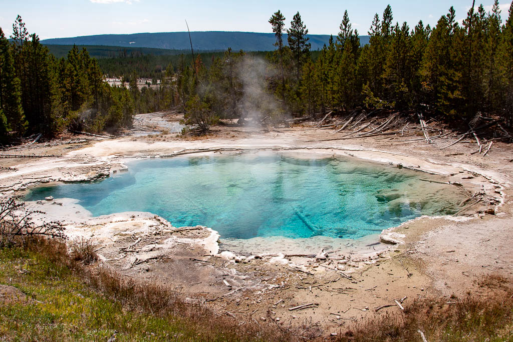
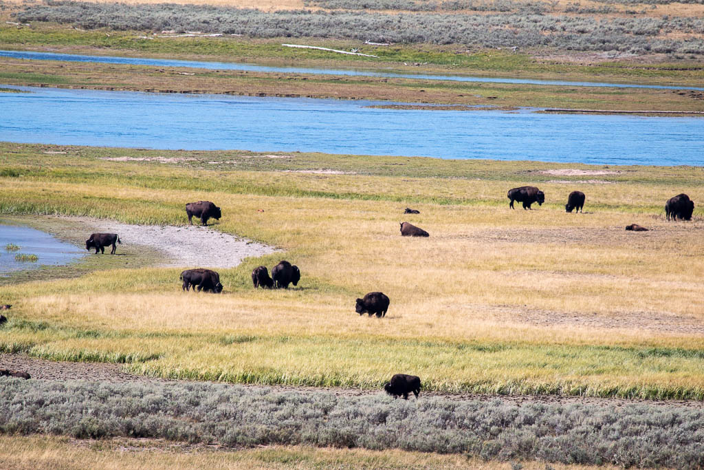
Of the four large animals in Yellowstone, we saw two: elk and bison. (The other two are moose and brown / grizzly bears.) And we saw many geothermal features, including, of course, the geysers for which Yellowstone is famous.
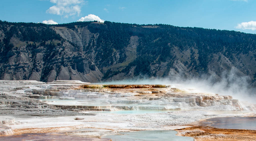
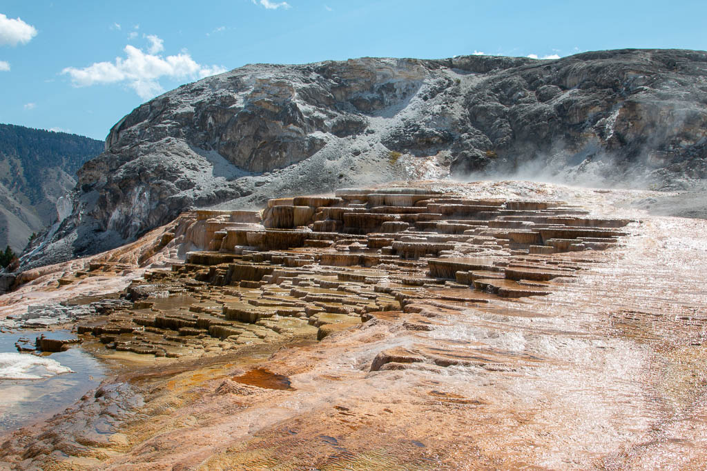
Mammoth Hot Springs and Norris Geyser Basin
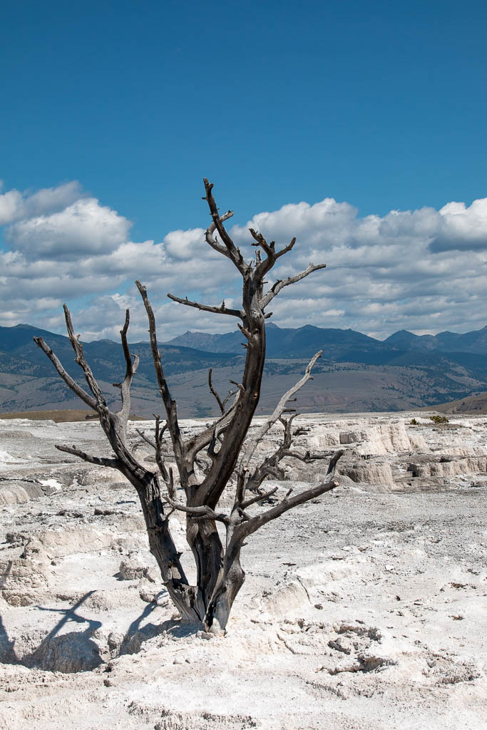
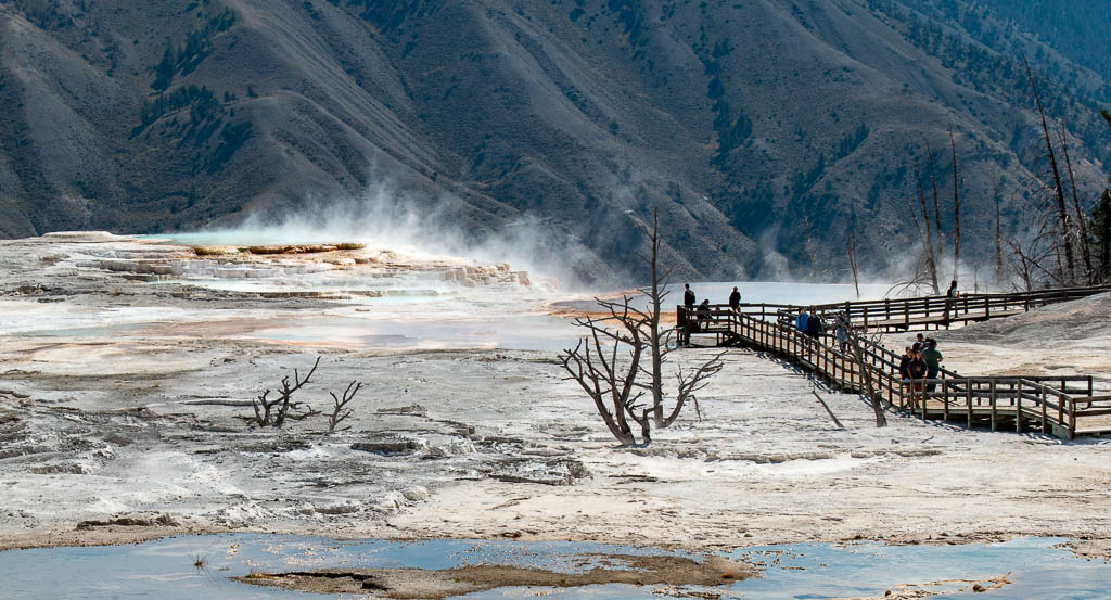
Coming into Yellowstone from the north, the first thing we hit was the Mammoth Hot Springs area. The most visually striking things here (aside from the number of cars trying to find a parking place!) are the travertine (a form of limestone) flows. There are few if any geysers in this area.
I’ve seen a report that the springs deposit about two tons of travertine daily (https://www.yellowstonepark.com/things-to-do/geysers-hot-springs/yellowstone-geyser-basins-map/), but have been unable to confirm that from an NPS source.
Travertine terraces in Mammoth Hot Springs
The deposits form beautiful structures, and will consume anything that gets in their way.
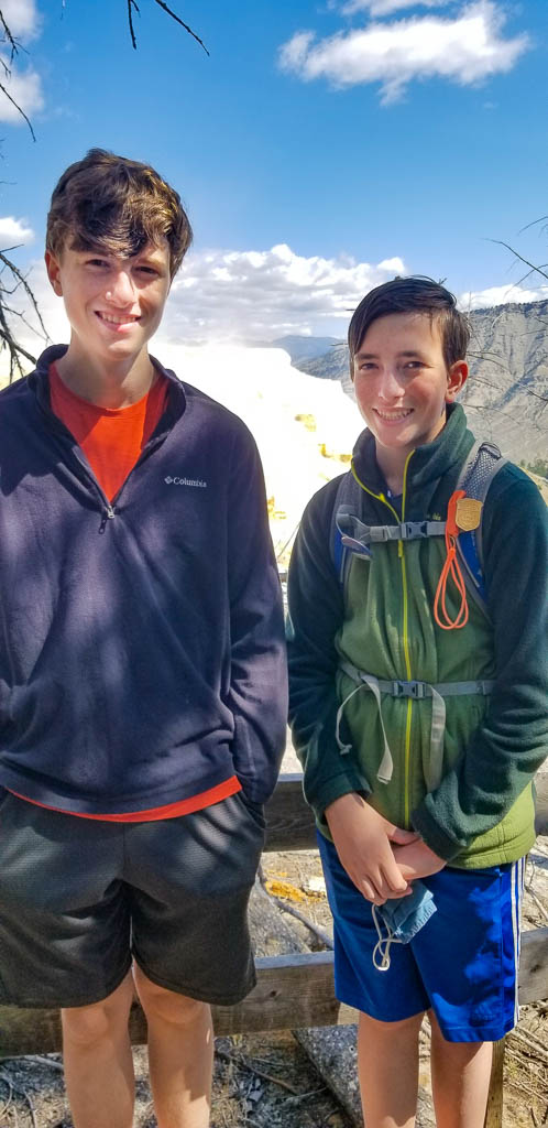
Graham and Dean enjoying Hot SpringsNotice how the travertine has almost reached the level of the boardwalk in some places!
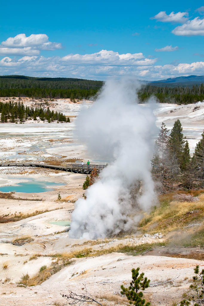
Norris Geyser Basin
We proceeded down to Norris Geyser Basin, parking on the road with a moderate walk in. Norris has geysers, as well as travertine flows, and many pools: pretty to look at, but don’t touch!
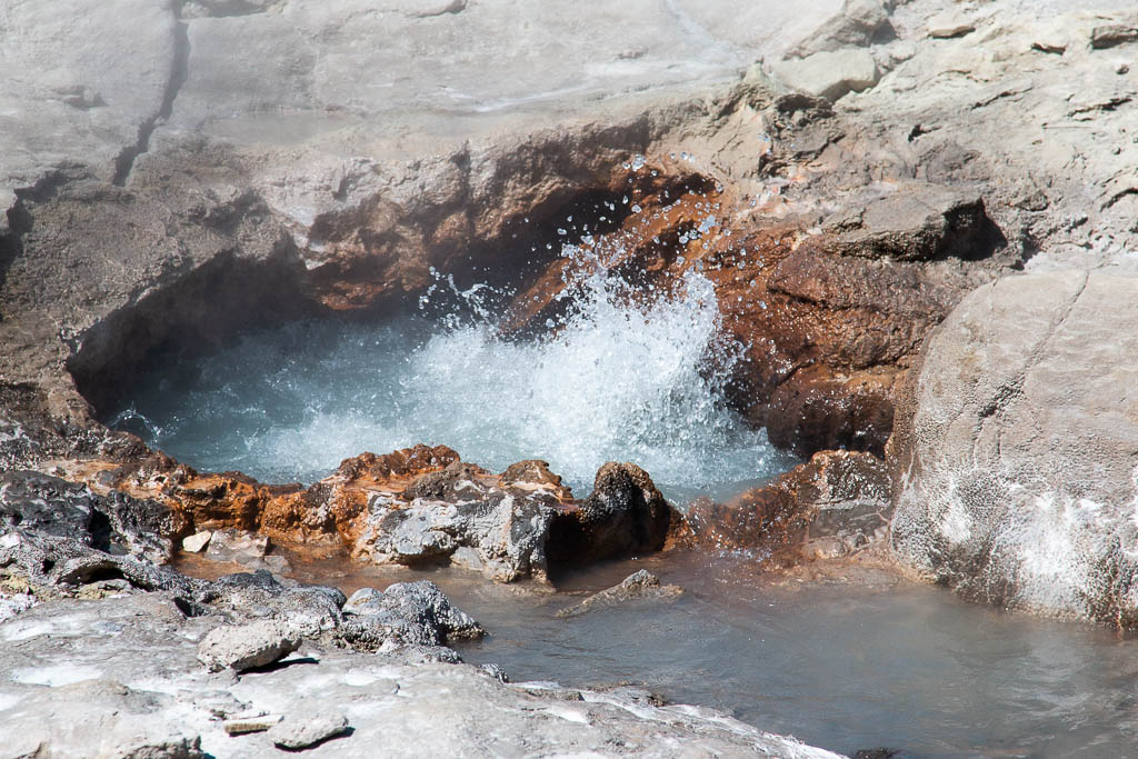
The first feature we came to was a fumarole, a continuous, loud, jet of steam. The amount of energy being released each second is hard to grasp.
Fumarole at Norris
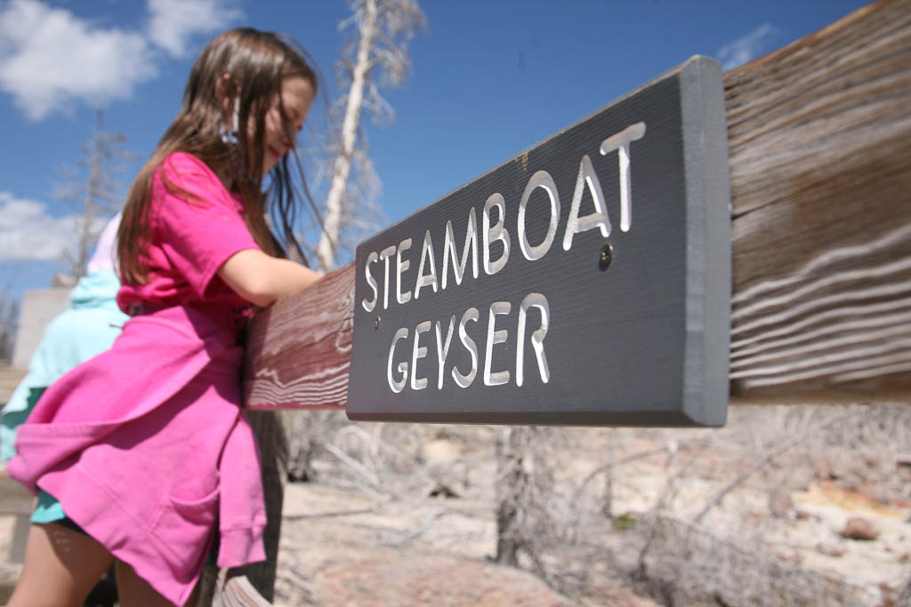
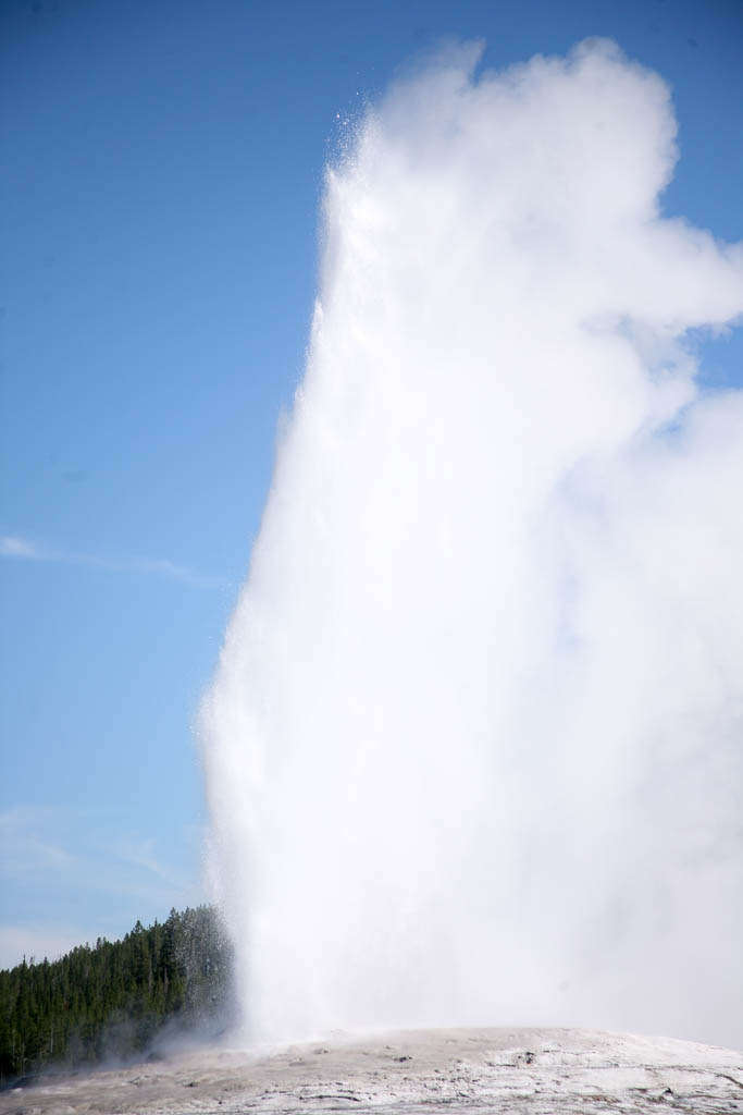
Norris is home to Steamboat geyser, the world’s tallest active geyser with eruptions in the 300 to 400 foot range. Unfortunately, its eruptions are relatively rare, with intervals varying between several days to almost a month. When we were there, it had erupted 32 days previously. While it would have been nice to wait around for it, we were not able to.
Brynn is ever hopeful! (Photo credit: Mira Simons)
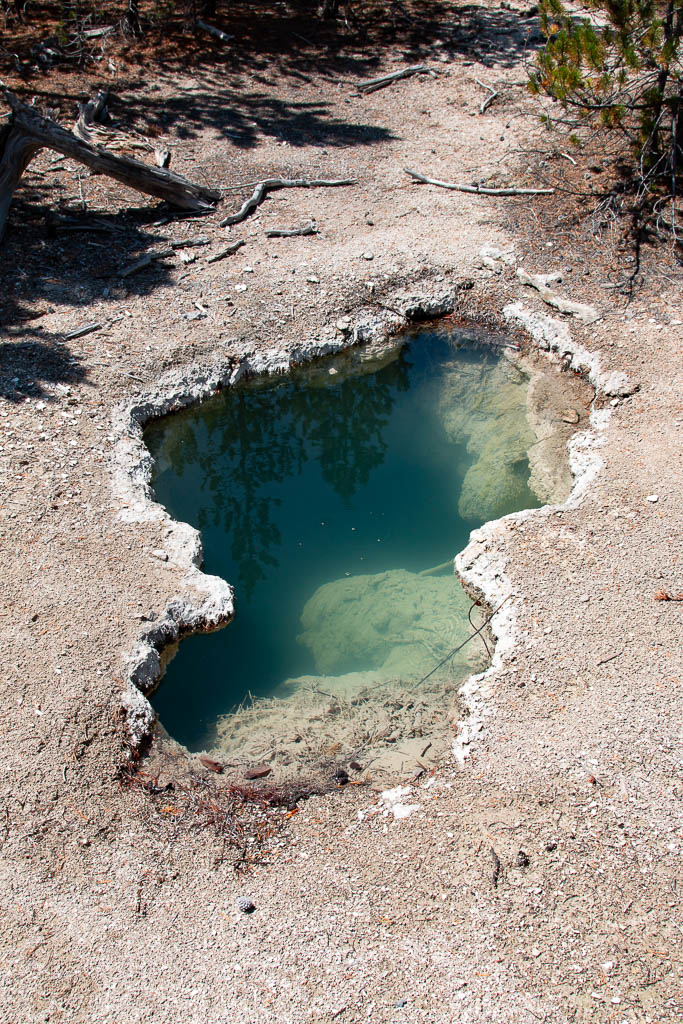
Signs everywhere warn visitors to stay on the boardwalks. The surface is frequently thin and a person could fall through. We did see places where bison had walked on the surface (they didn’t read the signs). The problem is we can’t tell where the surface is solid and where not. Not worth the risk.
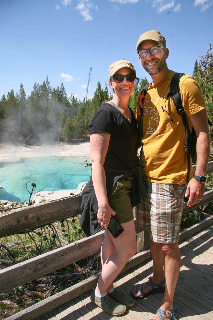
The surface is deceptively thin, with extremely hot water beneathMike and Laurelyn enjoying the Norris scenery and each other. (Photo credit: Mira Simons)Frequently we walked by little boiling pots like this.
Note to self: stay UPWIND! Always upwind…
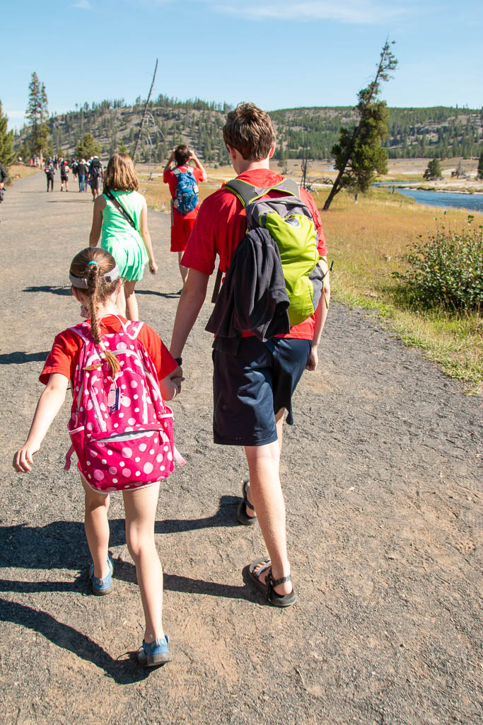
The next day we drove farther south, to the Old Faithful geyser field.
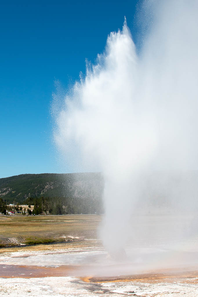
It is not often that Old Faithful is upstaged.
The Beehive geyser is taller than Old Faithful. It erupts somewhat irregularly, but about twice a day. Sometimes you get lucky! As we were walking the path through the Old Faithful geyser field, a ranger told us that the Beehive was about to erupt so we picked up our pace and went over to it. Mike was in the lead with Mira and Brynn, Graham was somewhere in the middle, and Laurelyn, Dean and we trailed. The geyser was beautiful when it erupted!
Beehive geyser in its initial moments. Before… the later moments!
Shortly after it started, we spotted Graham coming toward us, soaked! He had been in the spray area.
As we were enjoying his misfortune (nicely, of course!), the wind shifted. And we were… soaked! Karma, you know… We moved away, but it was a while before we were out of range; all the while I was trying to protect my camera from the acidic water. (I seem to have succeeded—it still works fine!) Mike, Mira, and Brynn had been on the upwind side. I’m sure that they are still chuckling about the rest of us getting drenched. Fortunately, it was a warm day and we were all soon comfortable again, if not quite dry yet.
We were actually able to catch Old Faithful three times! It is always fun to watch even if you’ve seen it before. While it is not the highest geyser in the park, it is the most regular in its schedule with eruptions that can be predicted to within a few minutes—so it is the most famous and the one most people see.
Old Faithful (Photo credit: Mira Simons)
Some of the geysers had prediction windows that spanned six hours or more (and we saw people waiting for them). Others, like Steamboat are simply considered not predictable. Some (former? inactive?) geysers noted that their last eruption was in the 1800s. (When) will they erupt again? Who knows!
Perspective! (i.e., Talk to the Rangers)
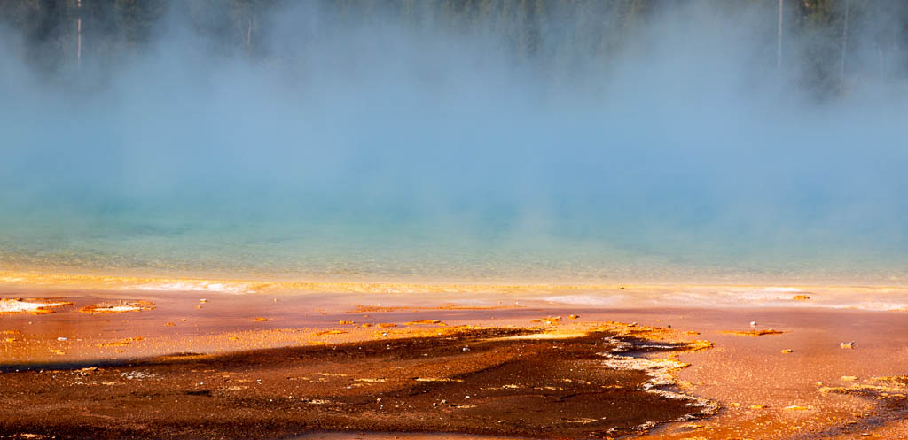
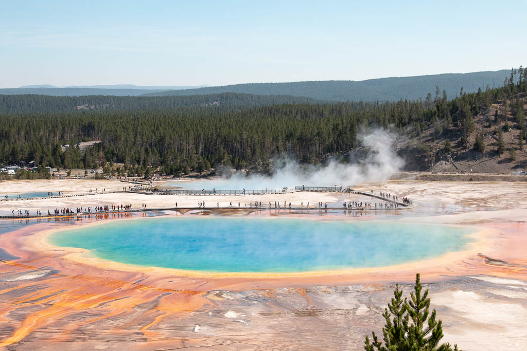
I’ve always been a bit disappointed with Grand Prismatic Spring. The pictures in the brochures are beautiful, and taken from above (drone shots?). But from the walkway by the spring (always stay on the walkways!), it has always been shrouded in mist. Also, being at the level of the surface, you are looking across the spring not down on it.
Grand Prismatic Spring from the surface. Yes, there are varied colors there, but…
I think Mike has never met a person he didn’t want to chat with. True to form he started talking with a ranger: “See that group of people across the way up on the mountain? That’s where you want to be!” Mike got the directions and off we went.
On the way up to the better view of Grand Prismatic! Foreground: Brynn and Graham. Background, leading the way, Mira and Dean.
NOW I know why people like the Grand Prismatic Spring so much.
From up on the hillside—no drone needed!
Like so many things in life, it is all a matter of perspective.
Yellowstone is a wonderful place to teach and learn photography. Mike is teaching Mira, and using full manual for all the settings! Way to go, Mira!
Several of the pictures in this blog post were taken by Mira. (Check for the “Photo credit” attributions.)
Animals
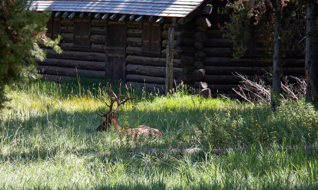
When we first drove into the park through the North entrance and got to Mammoth, there were several elk browsing and resting in the open areas, quite used to people and cars in the area. We all enjoyed them being just tens of feet away, especially Brynn and Mira. I thought their excitement would fade as we saw them more and more times through our visit, but I was wrong!
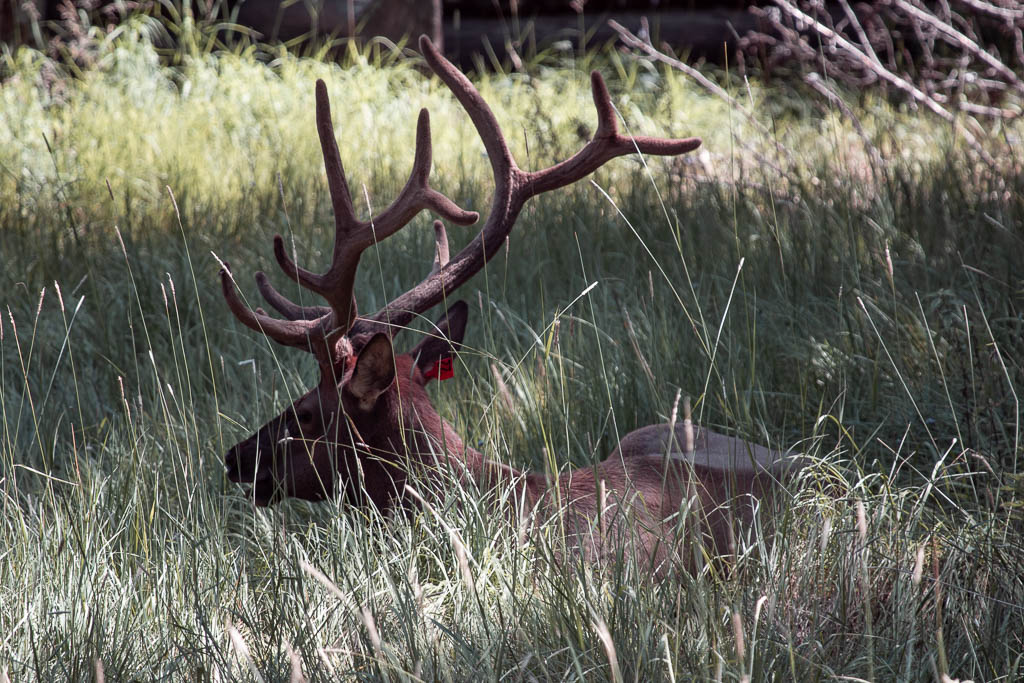
When you see a lot of cars parked alongside of the road, you know that you should stop too, and see whatever the attraction is. One time we did this, we were rewarded with this elk stag resting in the shade.
A nice elk stag resting in the shade
Sometimes I have to laugh at myself. I was thinking, “Sometimes, a 100mm lens just isn’t long enough.” Then, “Wait! I have a 400mm lens in the car!” Run back to the car…
With a 400mm lens!
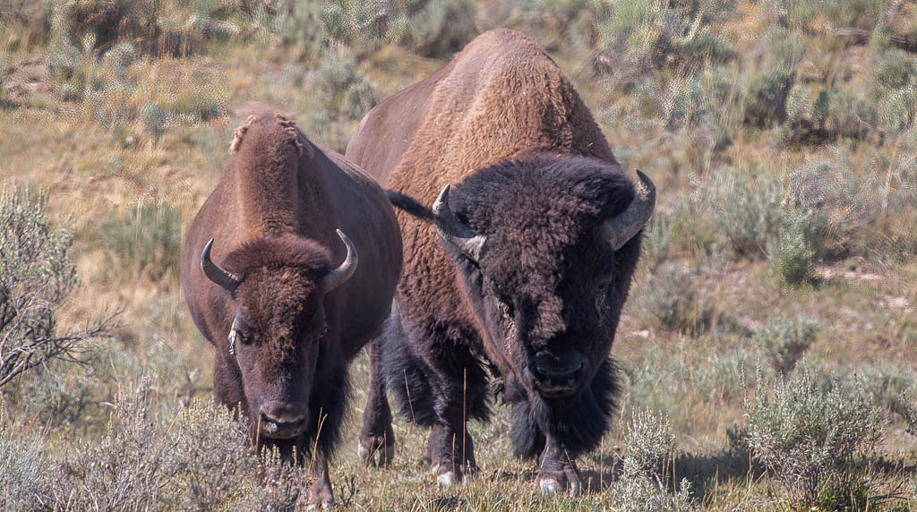
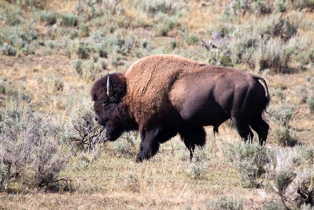
We were winding down our last day in the park, a little disappointed that we had not seen any bison up close (we had seen one the better part of a mile away in a huge field). Once again, cars parked alongside of the road…
I’m only a little bit nervous! (This is with a long lens).
It was a great way to close out our visit to Yellowstone!
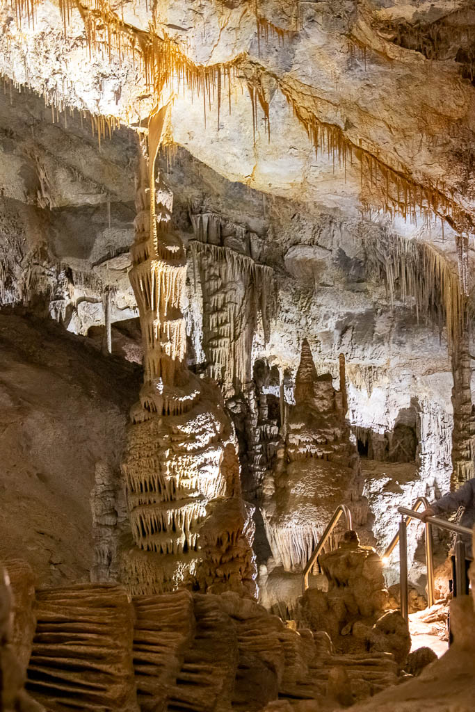
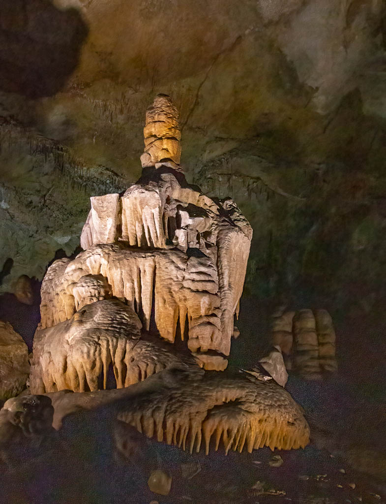
Western Montana has a strong affinity with the Lewis and Clark expedition, the Corps of Discovery. (We live in Lewis and Clark County.) We went to Lewis & Clark Caverns State Park, and took a two mile tour of the cavern (one mile underground). While not as big as other caverns we have been in (Mammoth Cave, Wind Cave, and Luray Caverns), it was, nonetheless beautiful and fun. It makes you appreciate the power of water over time, both to destroy, eroding the rock to form the cave, and to build, creating the stalagmites, stalactites, and other formations.
Note: all the light for these photos is artificial; we’re far underground. At one point the guide turned off all the lights. The darkest night above ground does not compare with this absolute lack of light.
Delicate and massive. In the foreground, is part of a stalagmite that fell thousands of years ago.A new stalagmite growing on the base of the fallen stalagmite, above.Delicate, translucent ribbon-like formations
Lewis and Clark were presumably unaware of the cavern (they kept detailed journals, and there is no mention of it), but they did go up the Jefferson River, which passes the base of the mountain containing the cavern. Close enough to use the name!
In fairness, I have to say that Montana isn’t the only state with an affinity for Lewis and Clark. There are also Lewis and Clark state parks or recreation areas in Washington, Oregon, North Dakota, South Dakota, Nebraska, Iowa, and Missouri, and I probably missed a few.
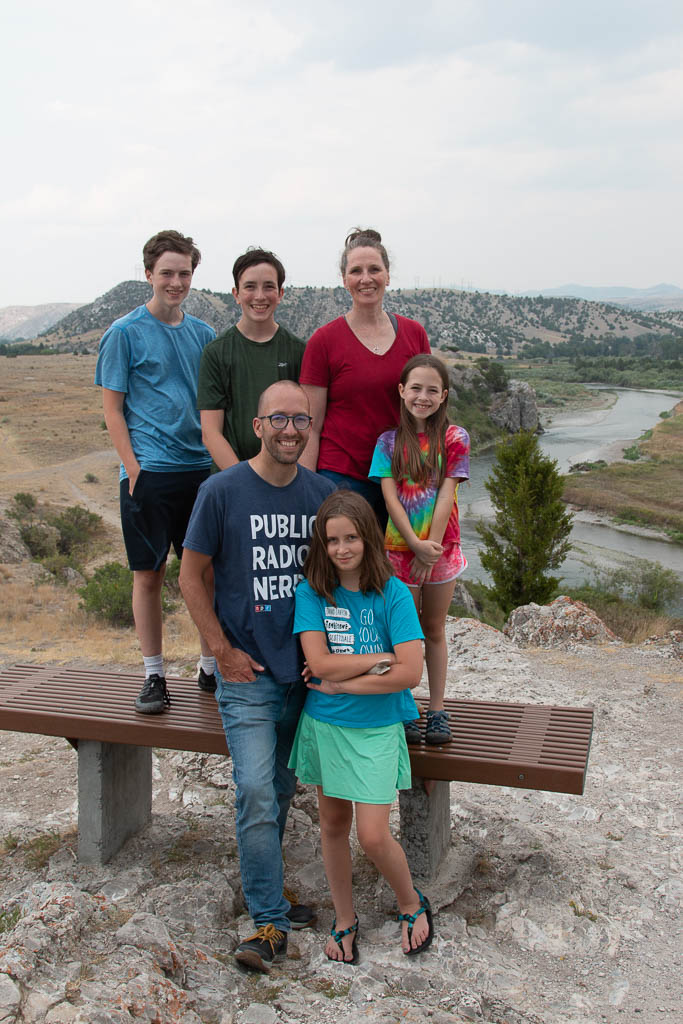
Coming back home from the Cavern, we stopped at Three Forks (marvelous pies!), and the Missouri Headwaters State Park. This is where the Jefferson, Madison, and Gallatin rivers join to form the Missouri.
The gang atop Fort Rock, at the Missouri Headwaters State Park, The very beginning of the Missouri (I think) is in the background. (Or the Jefferson, the Madison, or the Gallatin. But I think it is the Missouri!)
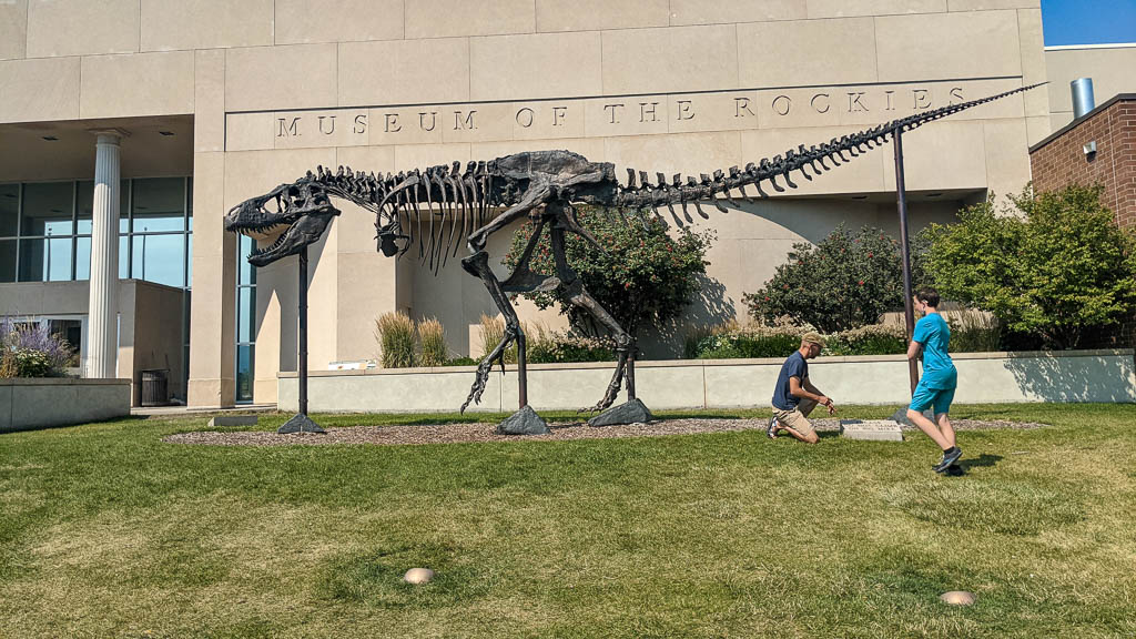
We also went to the Museum of the Rockies, which we all enjoyed. It has some major dinosaur skeletons, as indicated by this brass casting of a Tyrannosaurus Rex named “Big Mike.”
“Big Mike,” A bronze casting of a Tyrannosaurus Rex
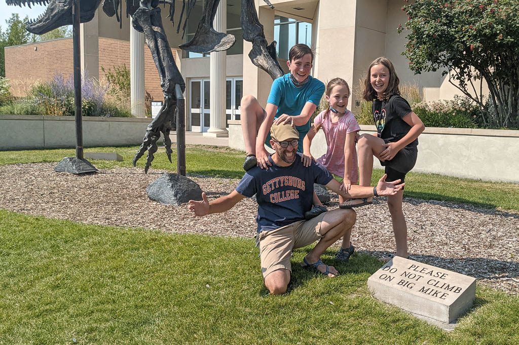
Of course, there is a sign asking people to not climb on Big Mike… so what are kids to do?
Couldn’t resist! (For those who don’t know, that’s Mike!)
Of course.
Climbing!
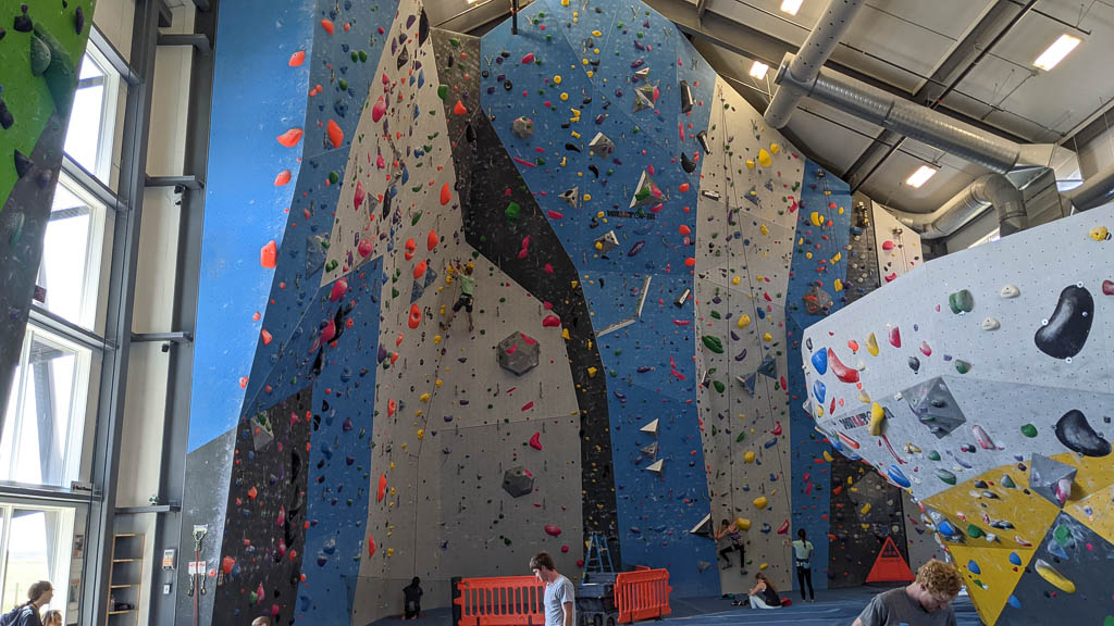
Speaking of climbing, Mike found a climbing gym that looked nice down in Bozeman: Spire Climbing Center. So we went to check it out. Oh, yeah…
It’s massive.
One of several rooms. Note the climbers on the wall for scale.
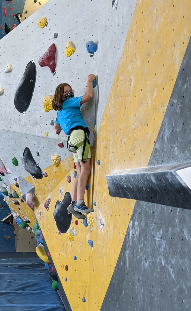
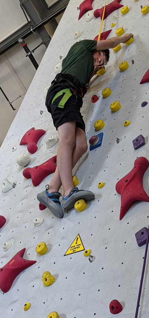
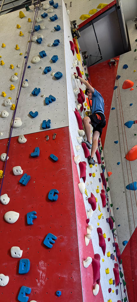
Grandma chose to stay home, but everyone else got some elevation.
Mira boulderingGraham looking for his next foot positionDean deep in concentrationAnd Brynn, just hanging around!
The top of every route had a big red Staples “That was easy!” button. Yeah. Right.
There were several other activities that we considered such as a rodeo but chose to not do because of Covid—the youngest two are currently too young to be vaccinated. So we spent the rest of the visit hanging with good friends, cooking (mostly Mike on the grill, and Mira making great cookies), building a jigsaw puzzle, and… Oh, yes! And watching fire fighting planes and helicopters.
As you undoubtedly know, much of the west is on fire now. We are about 5 miles from Helena Airport which is a base for fire aircraft. There were a wide variety of aircraft in and out of the airport continually: DC-10s, Chinooks, Blackhawks, and a Sikorsky Sky Crane, among others. The sky crane had a large hose dangling down so it could refill its water by hovering over a nearby lake; we called it Snuffleupagus. Graham, particularly, watched their comings and goings on the Flight Aware app, and spotted several new fires based on the aircrafts’ flight paths and a satellite-based fire spotting site before the fires were announced in the daily briefings or posted on the several fire mapping websites.
DC-10 firefighting tanker approaching Helena Airport (taken from our back yard)
Speaking of the fires, we are lucky to have had none in the immediate area, but we have had dense smoke on a fairly regular basis since early July, with occasional clear days. We are surrounded by mountains, and frequently we couldn’t see them at all. This was a disappointment for Mike and Laurelyn, but one of the great things was that in Yellowstone we had no smoke problems at all.
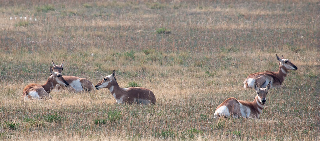
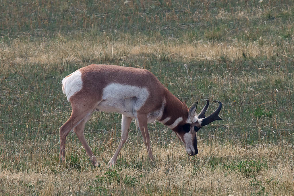
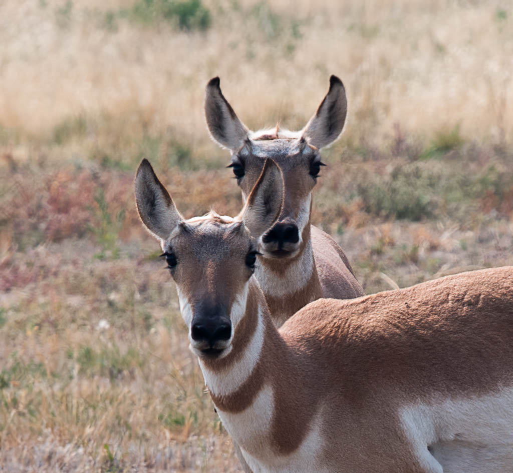
Pronghorn
A small (11) herd of pronghorn is in the area again, as some were last fall when we moved in. Because of size differences, we think that there are yearlings in the group. Their timing just overlapped with the visit, so everyone was able to see them! Another animal you can’t see in New York State.
We think that there was one adult buck because it had horns, but pronghorn horns are odd. The difference is between antlers and horns is that antlers are shed each year and horns are not. Except for pronghorn horns which are??? And female pronghorn also have horns but they are much smaller. These are in the size range for males from what we’ve read.
“Here’s looking at you, kid!”
Unfortunately all good things come to an end, and our visit ended far too soon. We hope that they will find their way back west again in the not-distant future! We miss them all already.
Looks like everyone enjoyed themselves! (Photo credit: Mike Simons)
More friends and family!
We’re still enjoying the glow from Mike & Laurelyn’s family’s visit, but we’re also excited about finally getting a chance to visit Beth & Jon’s family at their new home in Canada! The border is open again! Yea!
It has been quite a while since we’ve written. We hope that you and those close to you continue to be well. We’re thankful that 2020 is over; the vaccines are starting to rollout, and we’re hopeful that 2021 will be a better year all around.
We are approaching our four month anniversary in our new house in East Helena, Montana. It seems unbelievable that it has been that long since we were living in Rhett, our 36 foot fifth wheel RV. And yet at the same time, our two-year adventure exploring America and Canada is starting to seem almost like a dream. Did we really do that? Yes! We’re really glad that we created the Lobsters on the Loose blog, so that we can go back and remind ourselves of all that we have done.
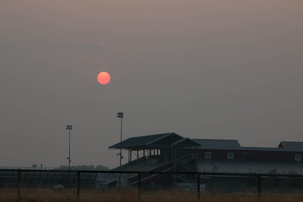
We arrived in Helena a few days before our house closing, and stayed at the county fairgrounds. This was right at the height of the western wildfires, and the air was very smoky.
September 18, 7:34 in the morning. Very dim light, with a red fireball sun!
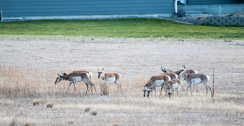
The first few days we were in our new house, there was a group of “antelope” (or so we were told) in our back yard. Antelope only live in Africa; these are actually pronghorn sheep… known locally as antelope. I was surprised to learn that their closest living relative is the giraffe. Sure! I can see that resemblance! Uh-huh.
Pronghorn, a.k.a., “antelope” in our back yard.
After a few days, they moved on. We saw them a few weeks ago in a field about 5 miles away, and we hope they return next year.
We are settling into our new life here in East Helena Montana. We’re making our home “ours” with furnishings, decorations, and projects like upgrading the lighting to suit our aging eyes.
We have to learn the symbolism in the state seal!
We’re learning the layout of nearby Helena, the state capital, where we do most of our errands when we have to go out. We’re still isolating as much as possible and we remain healthy although dealing with some of the vicissitudes of aging. We’re establishing relationships with some doctors and we’re becoming Montanans by getting our drivers’ licenses and registering to vote.
Several of our specialists are located in Missoula which is two hours away. Luckily, it’s a beautiful ride through a pass in the Rockies; our car knows the way well. I’ve (Kathe) had more glaucoma surgery and am forever grateful that I’ve found a glaucoma specialist who is really terrific. And it looks like, finally, after ten months, my back pain is largely under control thanks to a pain specialist in Missoula. Getting old is NOT for sissies!
I’m thoroughly enjoying plenty of quilting time in my sewing room. Al set me up with some very bright track lighting and it’s a joy to work on the projects I have going. The views out the sewing room windows are gorgeous! I especially love hearing the train go by — even though it’s several miles away, we can see it in the distance. Trains here are different than we’re used to from the east coast. Many (most?) are well over a mile long!
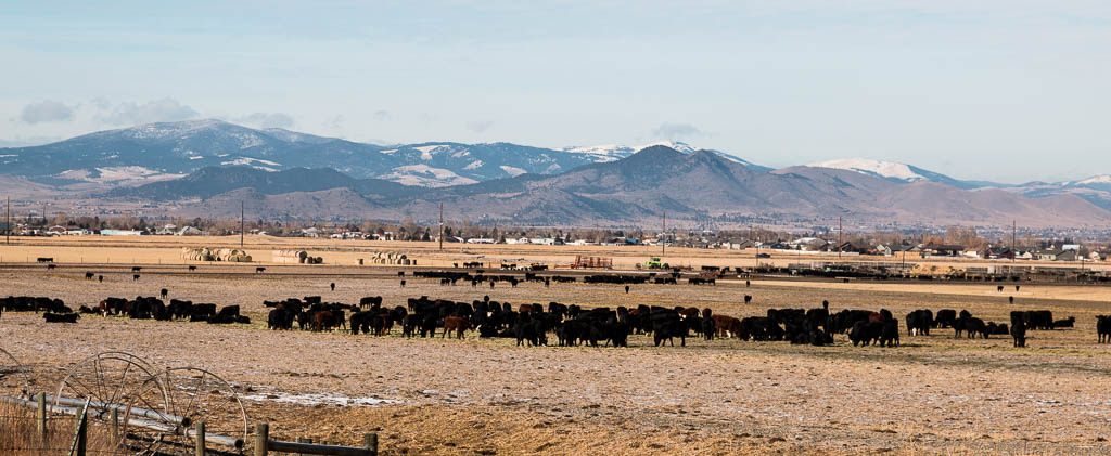
Most of the land around us is agricultural; there are lots of cattle in Montana! Cowboy boots? Check. Cowboy hat? Have to get them. Chaps and spurs? Hmmm… We’ll have to think about those.
Some of our neighbors!
Since it is January and we’re writing about living in Montana, you can correctly assume that we decided to not return to the Arizona desert this winter. It was not a difficult decision to make. While we still have to isolate ourselves, it is easier in a house than in an RV. It still feels a little strange to us that sometimes we have to search for each other in the house, after both being in the same room for two years. We joke about now having to use our ham radio walkie-talkies to find each other.
Covid-19 has changed the RVing world. For us, it made the RV life less desirable. One of the things we enjoyed most about RVing was being able to meet other people and learn about their backgrounds and experiences. Covid ruled that out, so part of the impetus was gone. While we were in Quartzsite, Kathe most enjoyed her Quartzsite Quilters group and the activities at the Gem and Mineral club. While both of those continue to meet (why?), due to virus concerns Kathe would not have attended either this winter had we gone down.
For others, Covid has made RVing more attractive, offering the ability to vacation and travel while maintaining distance and isolation. No hotels, no airplanes, no restaurants needed. RV sales are booming, with many dealers’ lots empty and manufacturing backlogged by parts shortages. It was difficult before to find campground or RV park sites, especially near popular attractions such as National Parks; reservations had to be made well in advance. It will be interesting to see how much this boom in RV sales will make that problem worse, and whether the effect will be long lasting—or will many of those new RVs quickly become rarely-used lawn ornaments?
It looks like many others are also deciding to not go to Quartzsite this winter. A friend who did go to Q this winter said recently that there were about one-quarter of the rigs there, compared to what he remembers from last year at this time. The big influx into Quartzsite is usually the first two weeks of January, so it will be interesting to see whether the large crowds materialize.
So we’re staying in Montana. We have prepared for winter: heavy coats, a snow blower, and a Subaru Outback. Just as in Maine, it seems that Subaru is the state car of Montana—if you exclude the pickup trucks! The mileage that Scarlet, our F350 dually truck got (14 – 15 mpg), and the difficulty of finding parking in town for such a large (24′ long) vehicle made us decide to get other transportation. But so far Montana’s winter has been milder than usual, with less snow. We had one 10″ snowfall in mid October, but only flurries since; the ground is currently bare, and until this week the high temps have been in the high 30s / low 40s.
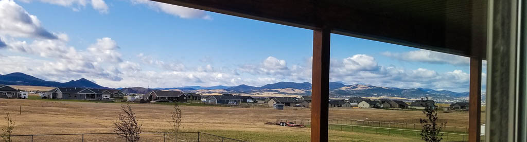
Helena is surrounded by mountain ranges; it is in the “eastern front” of the Rockies (we’re about 20 miles east of the Continental Divide “as the crow flies”). We can see mountains in all directions and those mountains do have snow. We are at about 3900′ elevation; according to the weather service, most of the snow has been above 5000′.
Our back yard toward the southwest, taken before the arrival of snow in the mountains. Much of the open area is common land for our development.Another view, this time looking north.
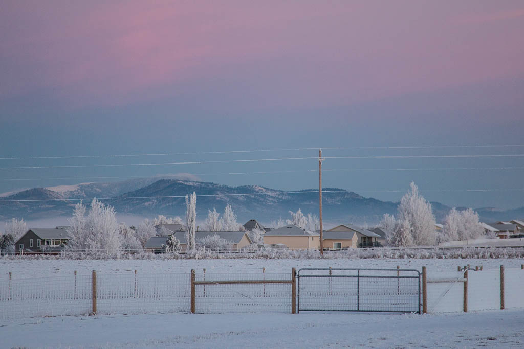
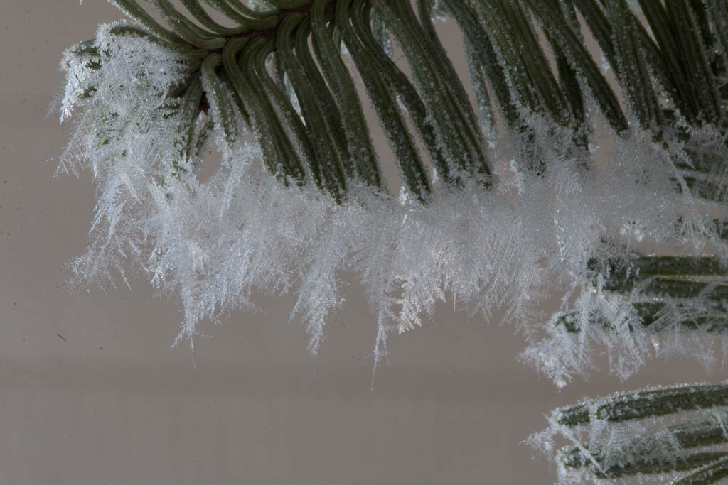
A few mornings ago we were finally greeted by real winter; it was two degrees and 90% humidity. Perfect conditions for the formation of hoar frost on neighboring trees and even our door’s Christmas wreath.
Early morning Montana looking north out our front door. Oh, yes. The morning brought about an inch of snow as well…Up close and personal, such delicate formations.
The next day was in the 40s, and we have bare ground once again. Of course!
So what does the future hold? While we plan to continue traveling in Rhett, it is unlikely that we will be full-timers again—but one thing this year has taught us is that you can’t predict the future, so maybe. During the spring, summer, and fall, we hope to do more exploring but probably in trips measured in multiple weeks, not multiple months. And hopefully, we will be able to return to wintering in the Quartzsite area or elsewhere warm! As we do have more adventures, we will continue this blog, but it may be quiet for a while until the spring.
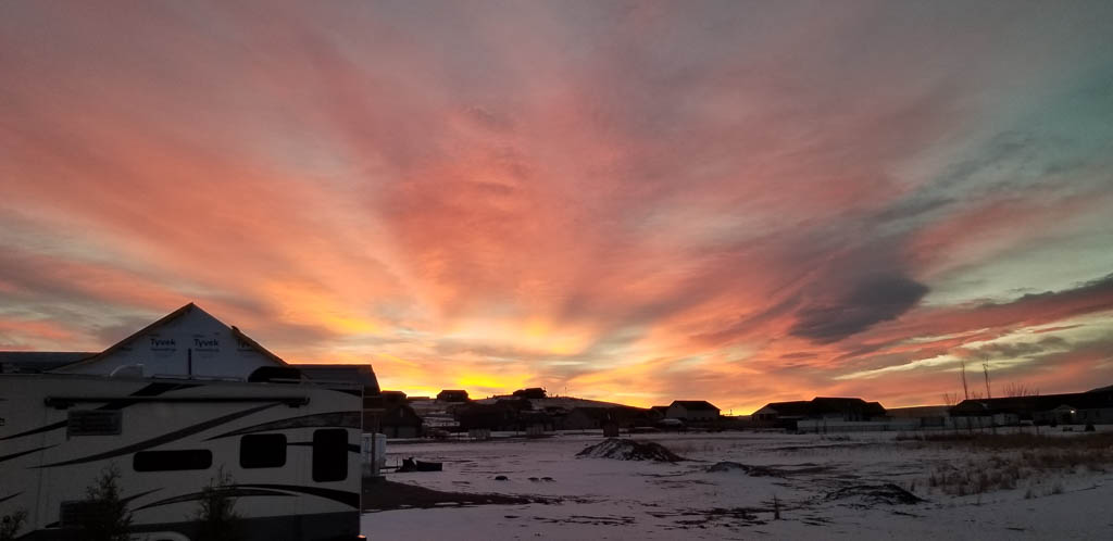
By the way, we can still end blog posts with pictures of beautiful sunsets (or in this case, a sunrise), now from here in Montana…
The snow was from a flurry, and gone within a day… That’s Rhett, parked in our side yard.
We hope that you and your loved ones stay safe, healthy, and warm this winter.
For those who haven’t been in the RVing world, there are two basic types of refrigerators. “RV” (also called “absorption”) refrigerators, and “residential” refrigerators. The RV refrigerators work by heating ammonia to turn it into a gas, and can be powered by 120V household electricity or propane. Residential refrigerators work by compressing a gas, and only run on 120V electricity.
When we were starting out, we knew that we’d be boondocking a lot, so we chose an RV unit so we could use propane instead of our precious solar electricity.
RV refrigerators are notoriously finicky, and have very little extra cooling capacity to bring new “occupants” down to temperature. Also when they are run on electricity, they are MUCH less efficient than a residential refrigerator. Hey, we were new to the RV world. We didn’t know.
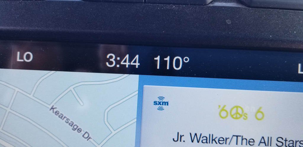
So… is it a refrigerator when the temperature on some days doesn’t stay below 42 degrees? Is it a freezer if the ice cubes can take more than a day to freeze (but they eventually do) and the ice cream is more like a gelled soup? Granted: some (many) of the days were over 110°, but still.
We finally decided to scrap the RV refrigerator and replace it with a residential unit. Remember: what you buy from a dealer is an “RV kit,” which you then modify and tinker with until you get the RV you want. It is a never ending process.
So, herewith the tale of the Great Refrigerator Swap of 2020.
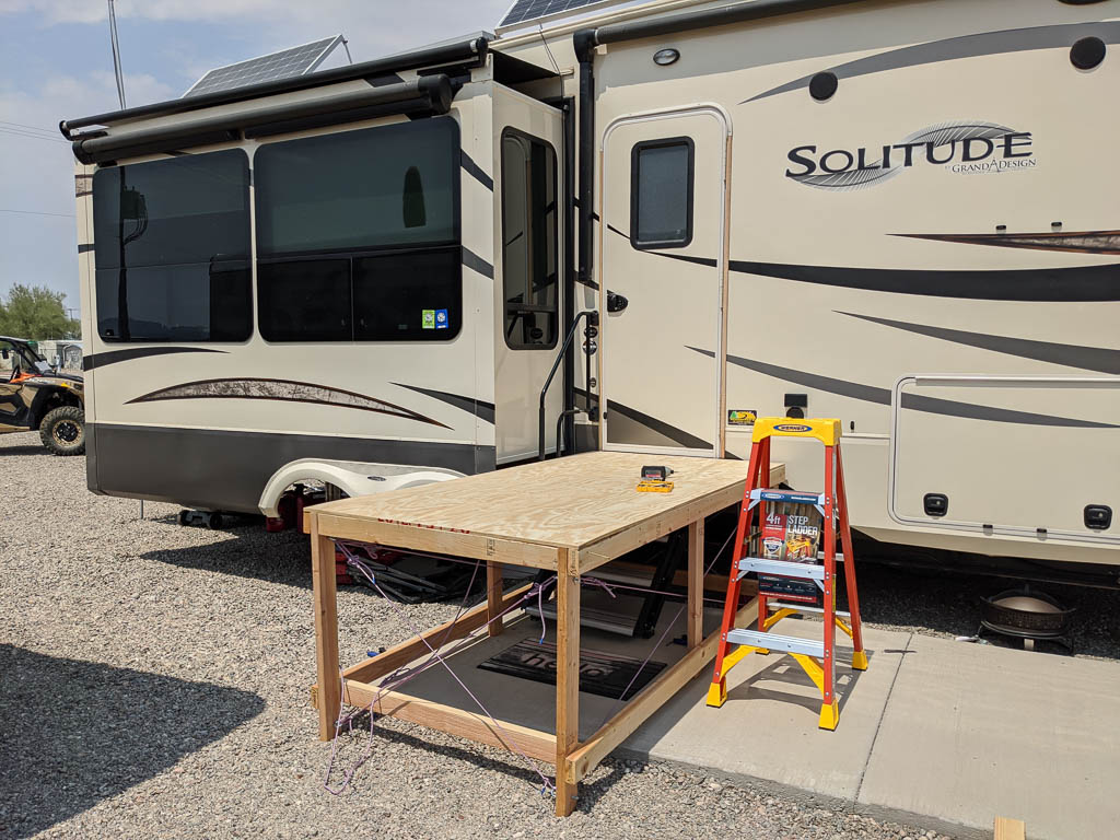
Perhaps the greatest constraint on the selection of a new fridge was its size, especially its depth with the doors and hinges off. Some people change refrigerators by removing a window from the side of the RV and passing it through. This requires many people, and violates the integrity of the RV’s exterior seal—will you really get it reinstalled so that it is weather tight? In these days of COVID-19, gathering a bunch of friends to help with a project is much more difficult than before, and besides, all our friends were smarter than we were and had left Arizona for the summer! So we needed to bring it through the door. Just inside the door is a cabinet and counter, that we would need to angle around. By using a template, we figured we needed a unit that was no more than 23″ deep, and about 34″ wide.
After identifying a couple of possible candidates on the web, we read through their on-line reviews. It turned out that none of the possibilities had stellar reviews. Oh, well. We went to the Home Depot in Yuma, looked at two, and settled on the Samsung Model# RF18HFENBSG-2.
Not in stock. (ALL of the candidate units were made of unobtanium.) But we could get it delivered by August 26th. GREAT!
An RV’s floor is a little over three feet off the ground. I’m doing this by myself; Kathe’s back will let her help a small amount, but NO LIFTING! How am I going to get this in the rig?
Plywood. Two by fours.
I built a 4′ by 8′ deck outside the camper about 3/4″ below floor height. The height was limited by the lower edge of the door which opens outward.
Our delivery platform. For rigidity, I used rope x-bracing.
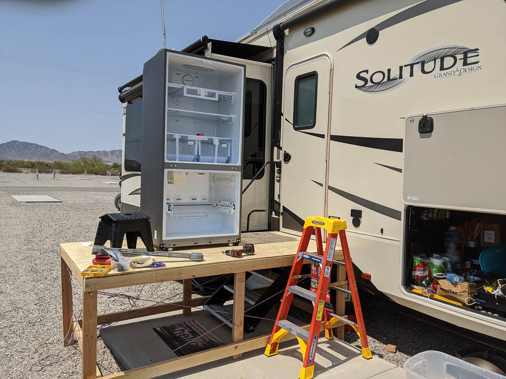
The Home Depot delivery truck had a lift gate on it, normally used to lower appliances to the ground. I had them back up to the deck and lower the fridge onto that, where I could remove the doors and hinges to make it narrow enough to slide in. We had somewhere between 1/8″ and 1/4″ extra space going through the door. Made in the shade!
As thin as possible.
More plywood. I put 1/4″ sheathing (the cheapest plywood I could find) down on the floor in the camper, to protect the plastic flooring in our main living area.
We’re in! Past the critical point. Notice the plywood on the rig’s floor.
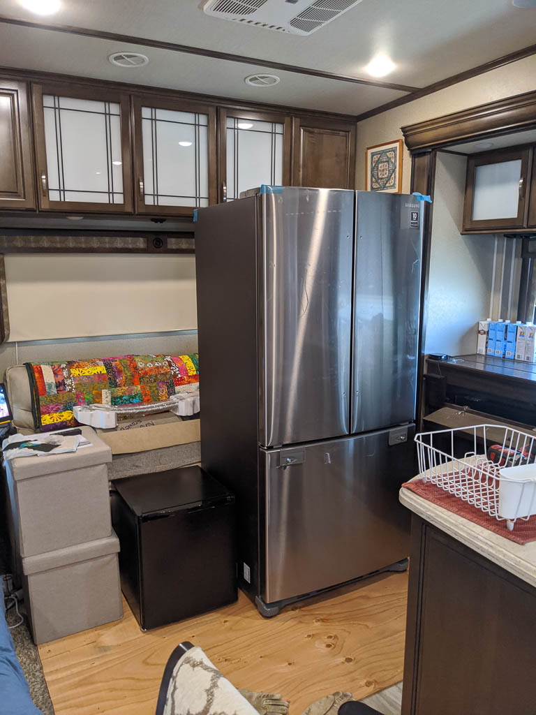
Once we had the unit in the back of our rig (our “living room”), the doors went back on and we brought it down to temp. It was SO FAST in comparison!
In our “living room.”
The small black cube in the picture is a tiny refrigerator we picked up to keep our critical items (leftovers, cold cuts, dairy, etc.) when we couldn’t rely on our large RV refrigerator.
Time to get the old refrigerator out of its home to make room for the new resident. Transfer all the food. Take the doors and hinges off. (Sense a theme here?) Re-plumb the propane: behind the fridge is a propane distribution splitting the feed to the refrigerator, the stovetop, and the oven. One-in, three-out had to change to one-in, two out. Fortunately a large RV parts store in Quartzsite remains open during the summer, so I could get the needed part locally.
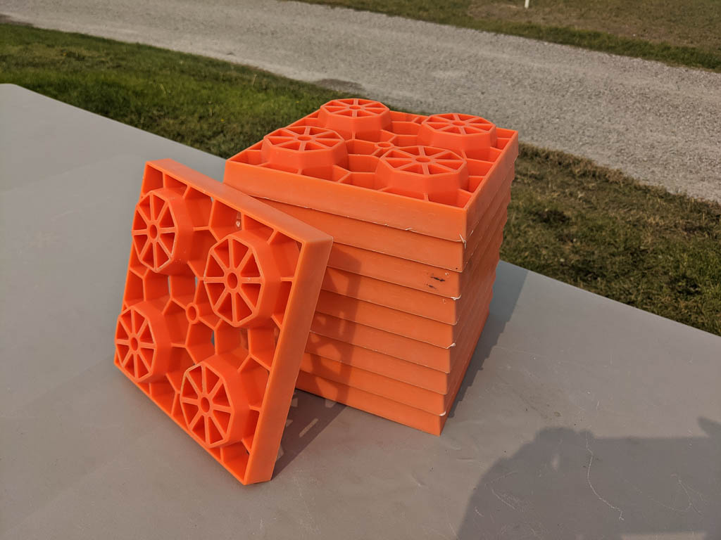
The floor in the refrigerator bay is about 6″ above the main floor in the rig, so we used the blocks RVers use to level their rigs when the site isn’t particularly level. They look like huge Legos!
We slid the fridge out onto two stacks of blocks, and then by tipping the fridge back and forth we were able to remove the blocks one or two at a time, alternating sides.
The old fridge up on the leveling blocks, coming out.
Out with the old. Again we had a small fraction of an inch to spare when navigating it out the doorway. Slid it into the back of our pickup and thence to the Quartzsite transfer station.
You can see the plumbing involved in an absorption refrigerator.
You may have noticed in a previous post that we decided to buy a house in Montana. This happened after we had ordered the fridge, and the scheduled closing wouldn’t let me do what I wanted to do for a final installation of the new fridge before we had to leave Quartzsite. So I did a temporary one.
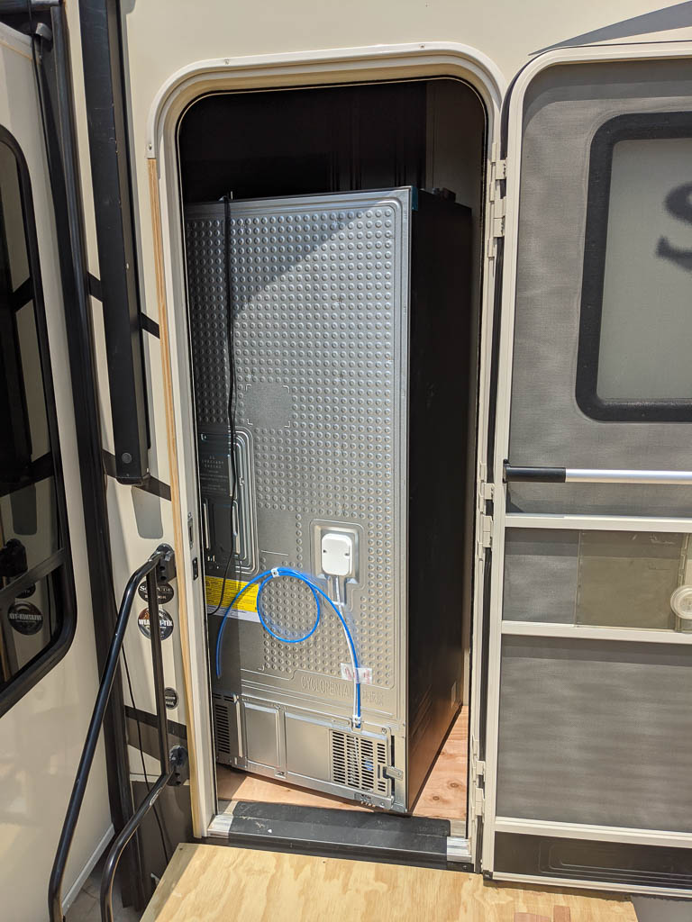
The new refrigerator was slightly taller than the old one, and I wanted to leave a space above it for ventilation. So before we could put the new unit in, I had to trim the top of the opening about two inches higher. There were 4″ reinforcing blocks behind where I needed to cut, and behind those were pocket screws. Once those were removed, the trim was easy.
The reinforcing block stapled and glued into place.And the pocket screws hidden behind
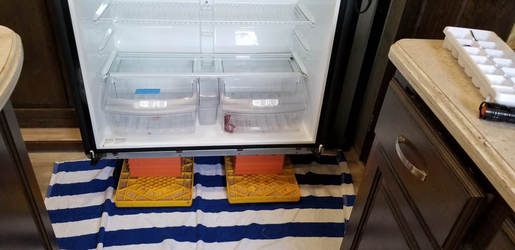
To move the new unit from the back of the rig, past the counter to the final location, we had to once again (say it with me) take the doors and hinges off. We used the same leveling blocks to raise the new refrigerator up to height, and slid it in place.
When originally measuring, I neglected to account for the propane distribution point, which prevents me from placing the refrigerator all the way back to the wall, and left the front feet hanging in the air. It works out well, though, as the refrigerator needs to have air flow behind it to dissipate the heat it has removed from the inside.
To keep the fridge off the back wall and propane hoses, I placed shims on the back wall. To level the unit without the front feet being supported, I shimmed the front with two two-by-four blocks, which happened to be exactly the right height. To keep the unit from tipping while we are traveling, I simply used a ratchet strap. It’s quick’n’dirty, but effective.
So we’re on our way to Montana with a new residential refrigerator! There are lots of things to fix and improve in a permanent installation, but I’ll tell you about those in another post.
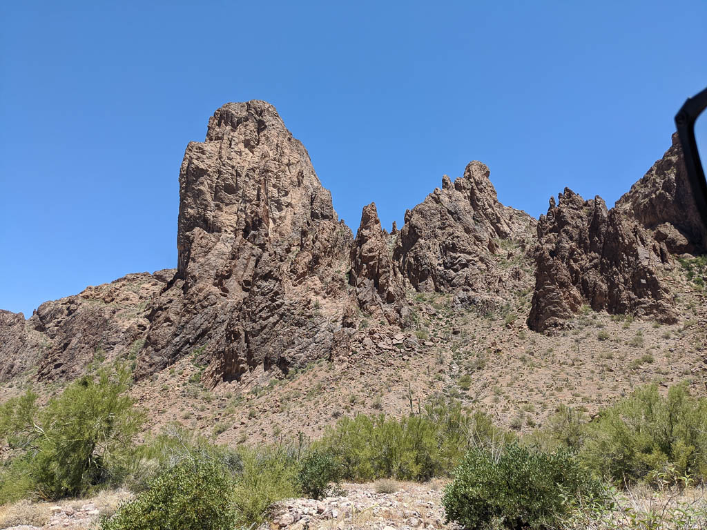
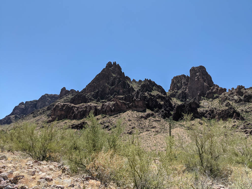
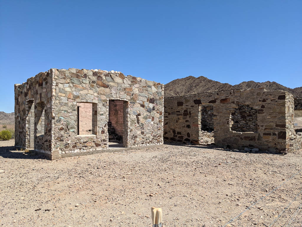
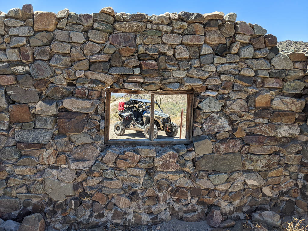
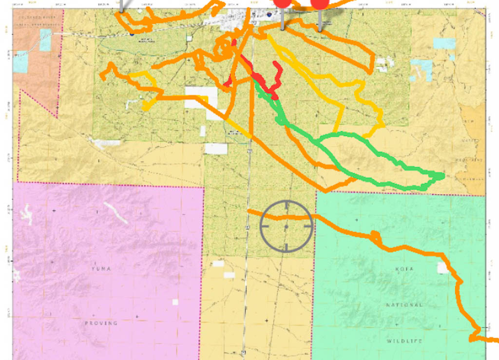
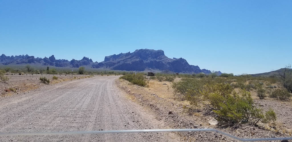
Near us is the KOFA National Wildlife Refuge. KOFA stands for King of Arizona, the name of one of the abandoned mines within the Refuge. We’ve written about KOFA NWR before, here and here. But now we can explore it more with Clark. And it is unbelievably pretty.
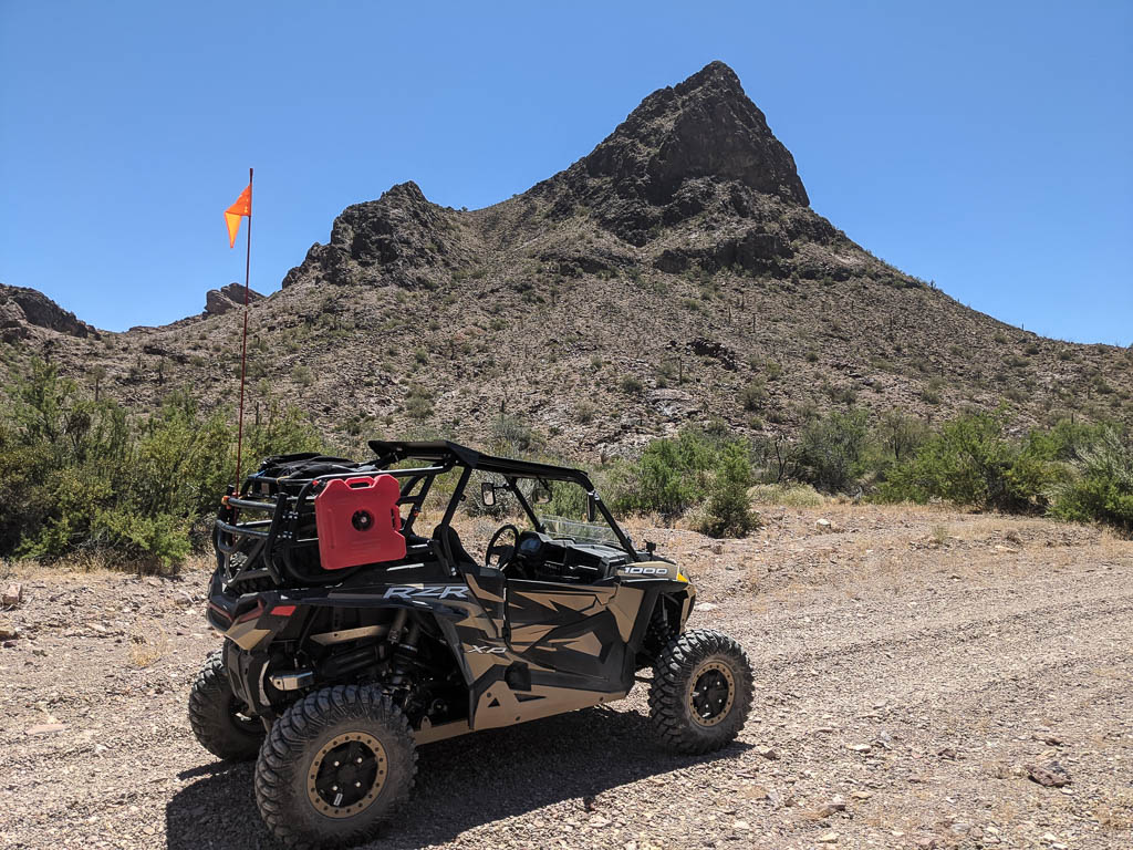
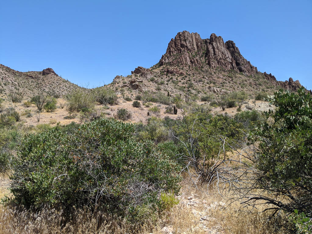
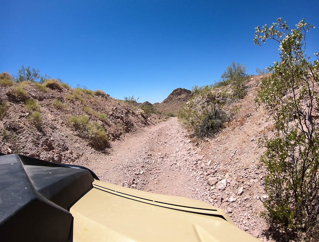
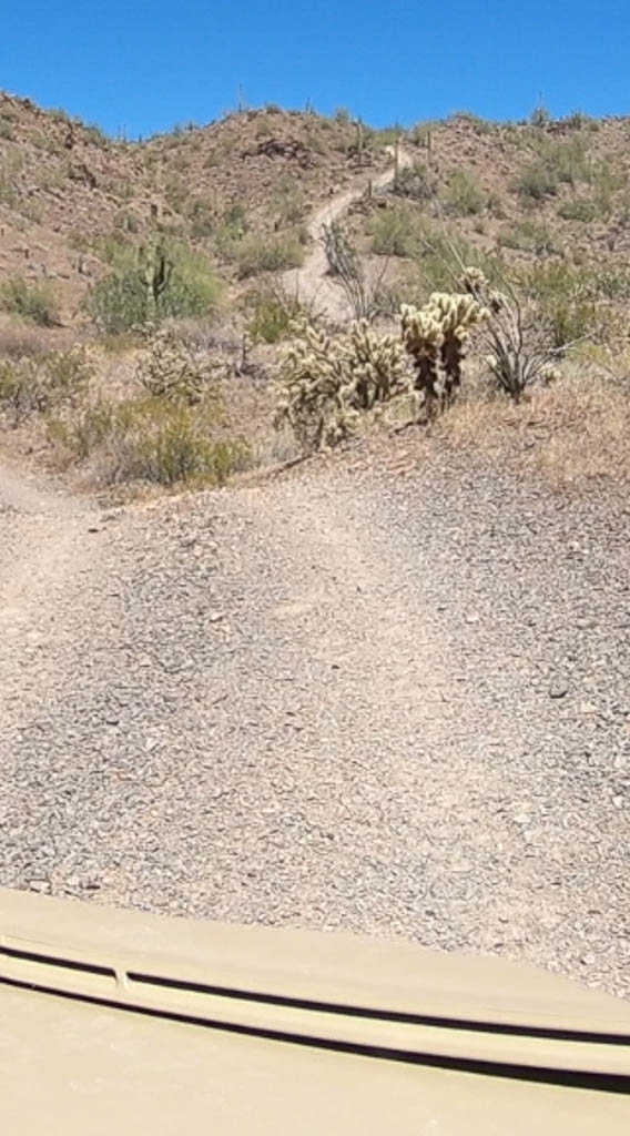
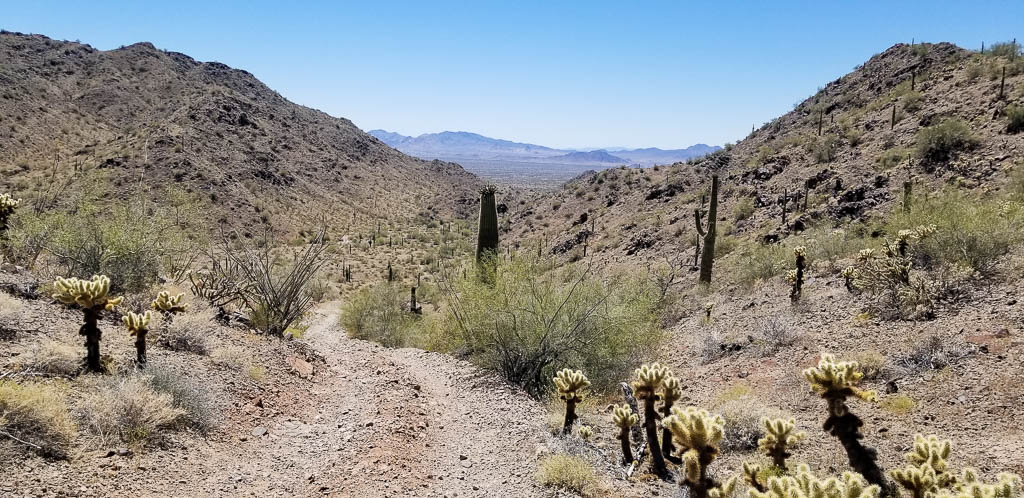
Recently we went to the KOFA Queen Canyon Road, which starts a little down the Palm Canyon Road. Palm Canyon road is accessible to normal vehicles. The Queen Canyon road most definitely is not, with narrow tracks, and steep descents and rises, sometimes without a level section in between. To traverse the Queen Canyon Road, you need something like our chariot, Clark.
Clark in its element!
Slightly to the north of Palm Canyon, Queen Canyon goes farther back, behind the mountains you can see from the road. These are much different than those in and near Quartzsite, just thirty miles to the north. Quartzsite’s are fairly gentle; the mountains in KOFA are more jagged. We’ll again apologize to our friends in the Rocky Mountain states. We know that these aren’t real mountains; one of the taller ones in the area, Cunningham Mountain, tops out around 3,280 feet ASL, or about 2,400 feet above town. But that’s the local terminology, so we’ll use it.
On KOFA Queen Canyon Road
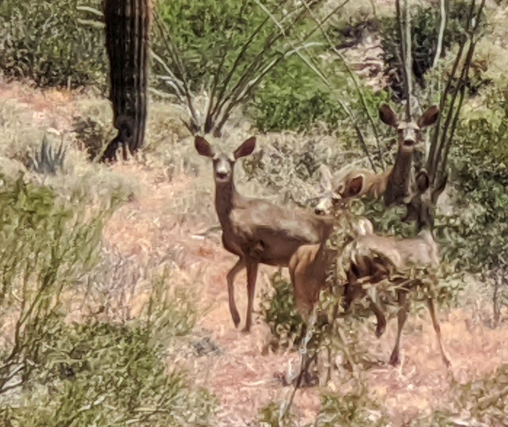
Kathe mused, “How long would we need to stop and wait in order to see some wildlife?” We didn’t stop and wait, but shortly thereafter six mule deer ran across the trail a short distance ahead of us. They climbed the bank on the opposite side and four of them stopped part way up and turned back to look at us. After several minutes they turned and ran up the rest of the hill to join their friends. They were the only large wildlife we have seen in the Reserve so far.
Four of the mule deer that crossed our path
Please excuse the lack of focus. That’s cropped way down from my phone camera. It is a good camera, but has problems when the interesting subject is not in the foreground. I have to figure a way to keep my real camera handy without killing it with the fine dust that gets everywhere.
Fortunately, the GoPro was on, so we captured their dash across the trail. It is in the video at the end of the post.
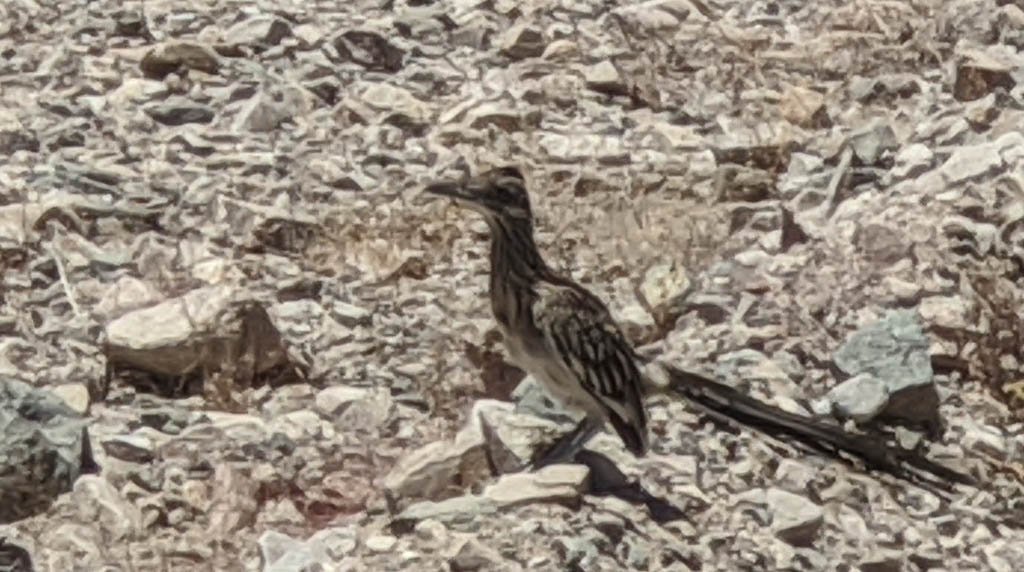
We see quail everywhere, including family groups of mama and up to twenty chicks. We’ve seen some as small as about an inch and a half tall—doing well at keeping up with mama as she hurries across the trail. We see road runners less often; again, apologies for the focus problem here. Same excuse.
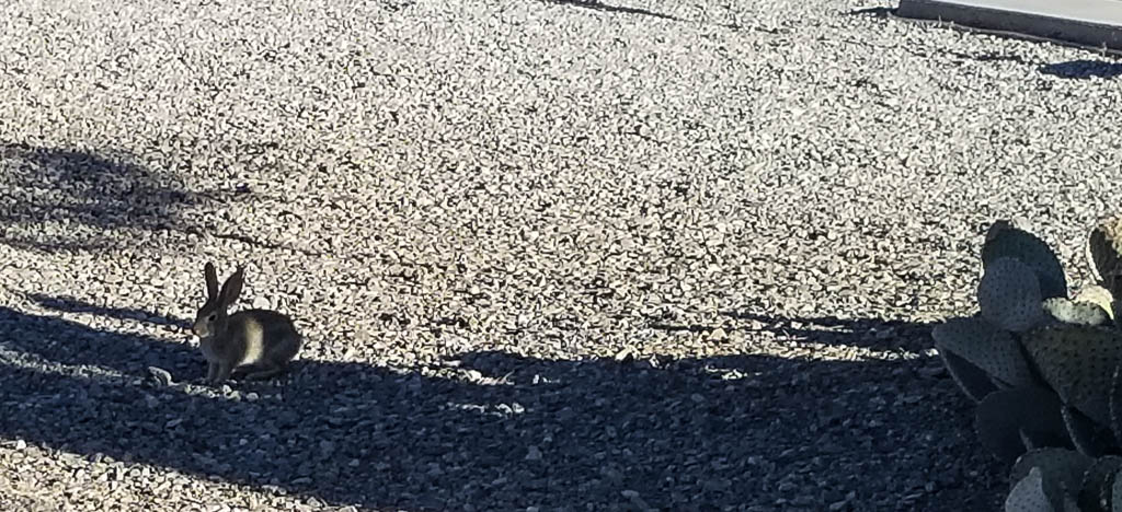
And we have “wild” life in the campground as well!
Peter cottontail in the campground
The prospector
When traveling the trails into and behind the mountains near here, it is easy to convince yourself that you are the only person.
Anywhere.
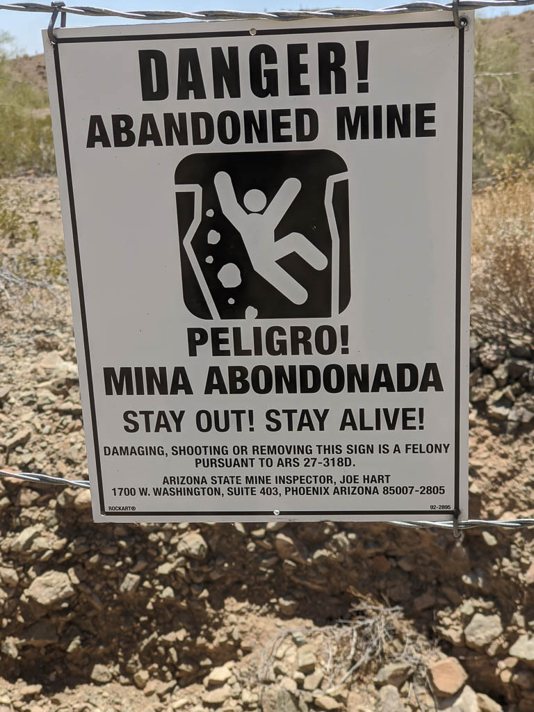
I stopped on a trail to take a picture of an “Abandoned Mine” sign to show you, when from behind me I heard a booming voice, “Good afternoon, friend!”
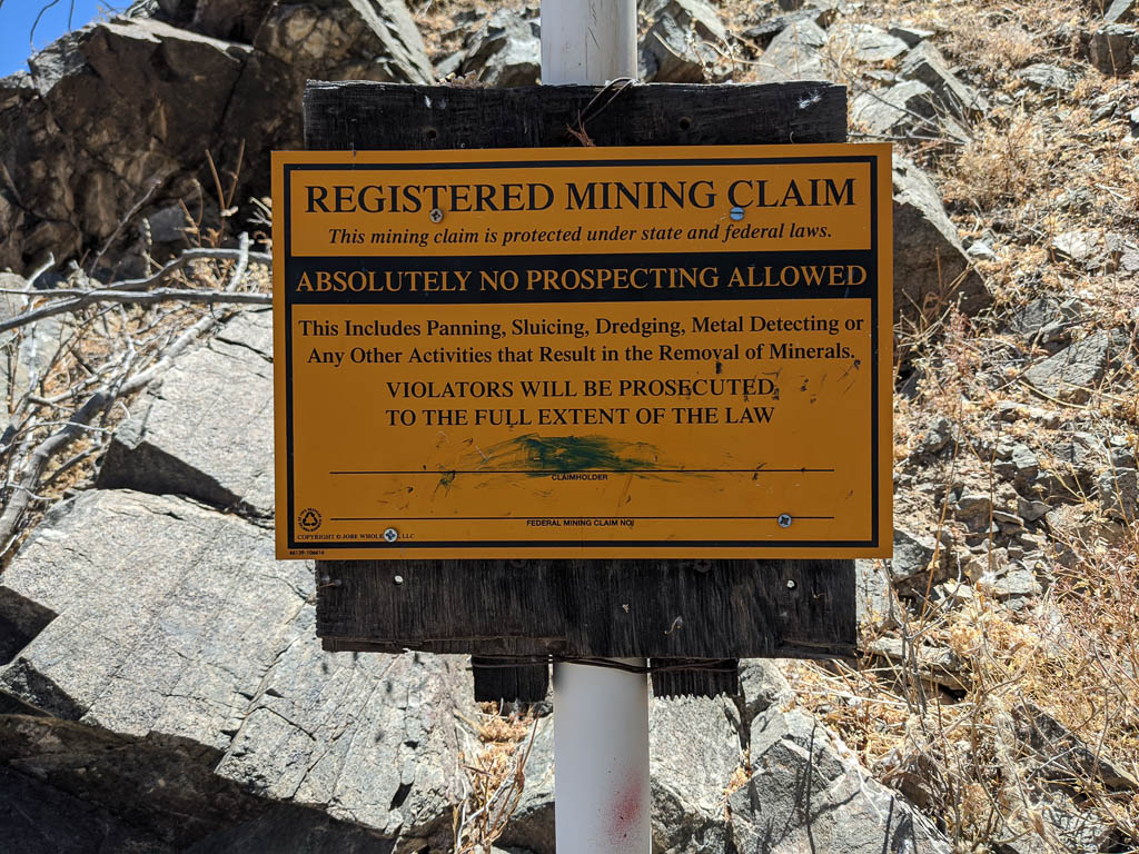
Definitely not what I expected there! He came over and explained that I was on his mining claim; he had heard me ride in (Clark is loud) and wanted to know what I was doing. It was obvious to him that I was just riding the trails and the conversation was entirely amiable. He is prospecting for gold; he said that he has been successful so far on this claim. According to him gold is the reason for most, if not all, of the claims in this part of Arizona. I asked him about the process of staking a claim. He said that he really doesn’t know. Apparently virtually all the land in the area is claimed by someone (many someones); he had to buy his claim from another person. “I got it used.”
Mining claim signs are everywhere!
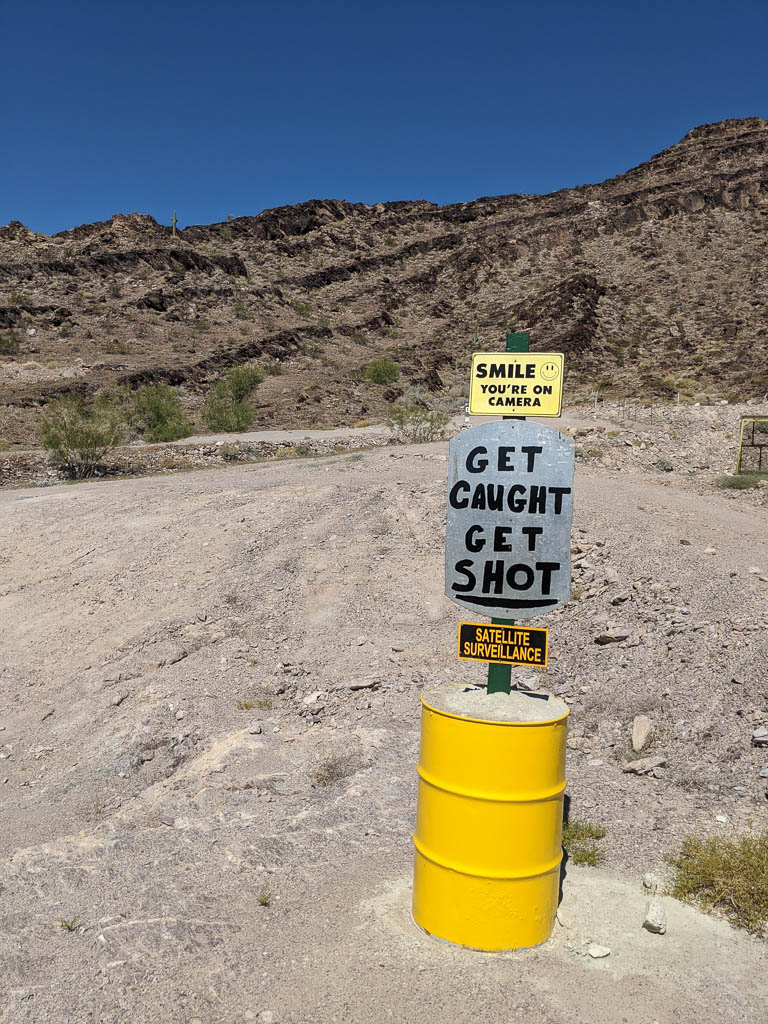
Some people post their claim in a little stronger manner…
Satellite? Nah. Don’t think so!
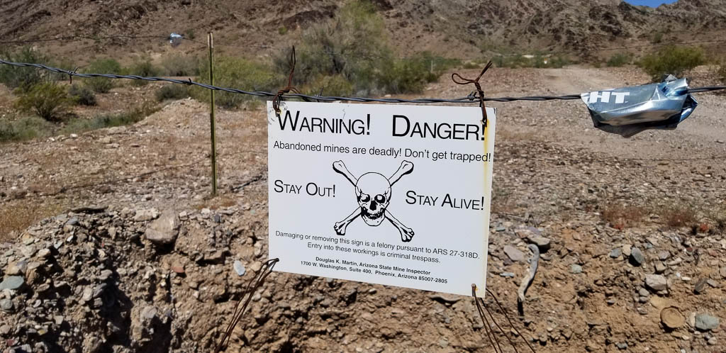
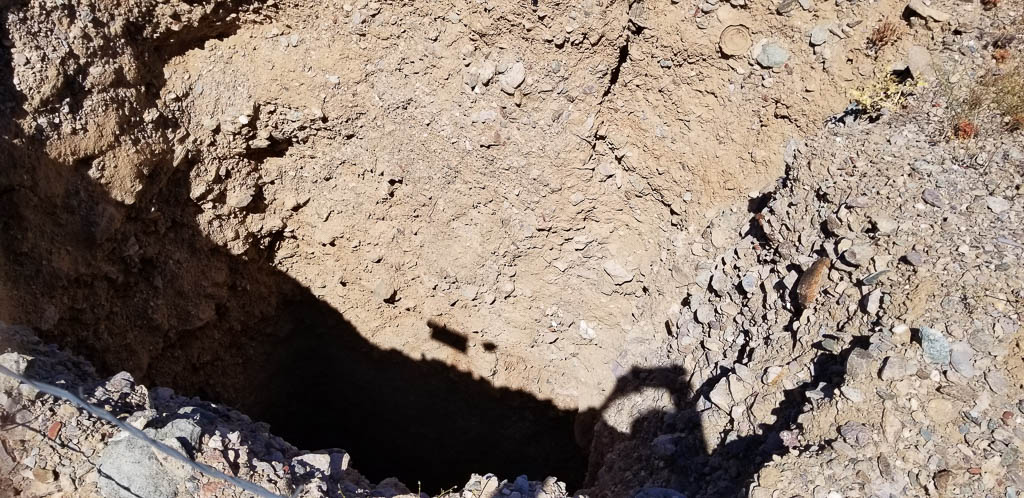
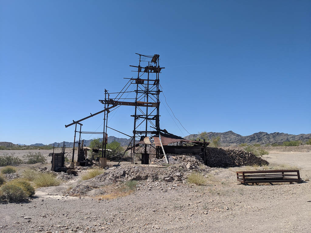
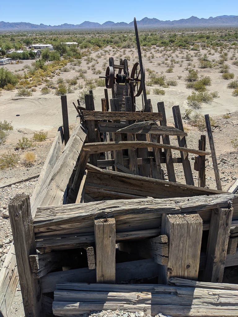
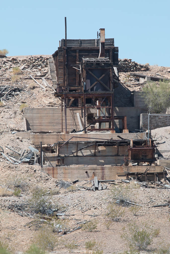
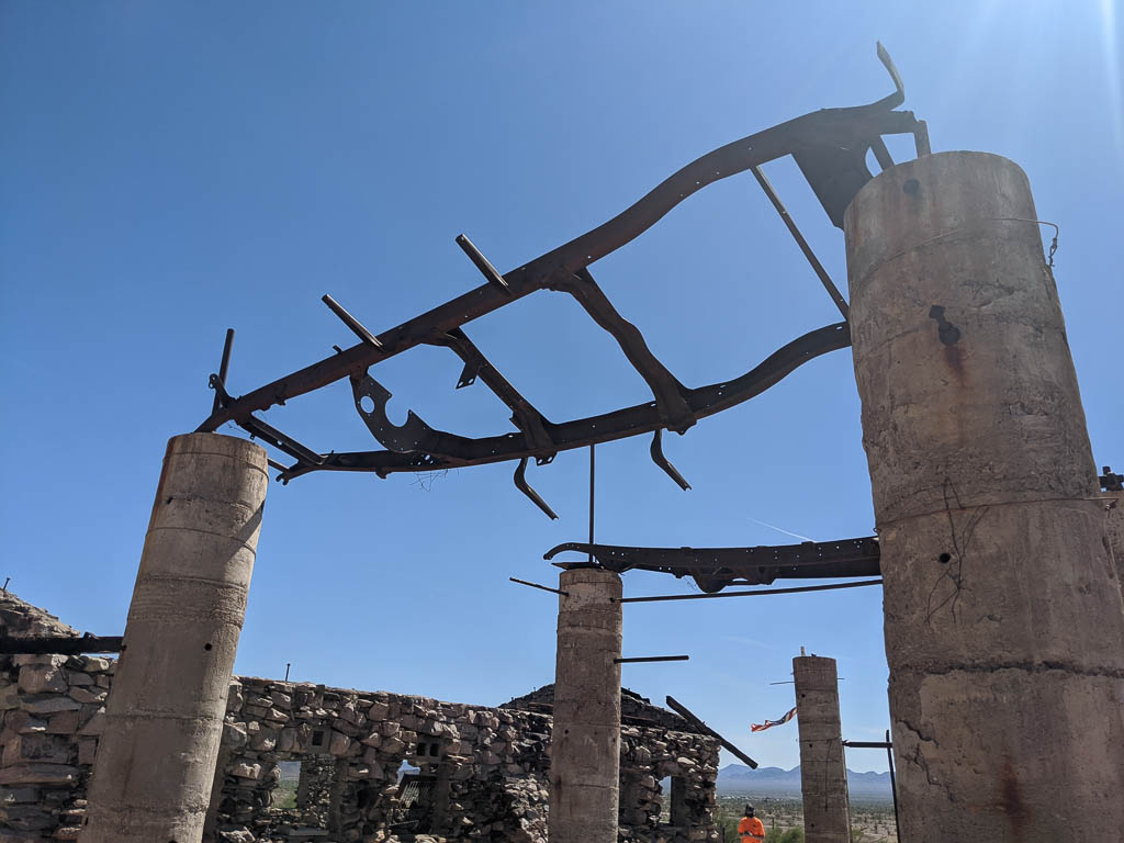
Abandoned mines are all over the place—open holes in the ground from ten feet deep to…many. Some still have structures that survive…sort of.
One of several designs of warning signs.Another; this one has more modern design, but who knows—they may both be in use.
Most of the abandoned mines that are just holes in the ground are fenced off with warning signs, but not all. Just another danger to be aware of, along with the scorpions, rattle snakes, and roadrunners (beware of falling anvils). No, we haven’t seen any scorpions or rattle snakes. Yet. Be sure that we’ll let you know here if we do!
Just an open hole in the ground—at least as far as I can see from here.Surviving abandoned mine structureAbandoned “stamp mill.” Look it up; we had to! Stamp mill from the top. A nearby mine. Not sure whether it was associated with the stamp mill.
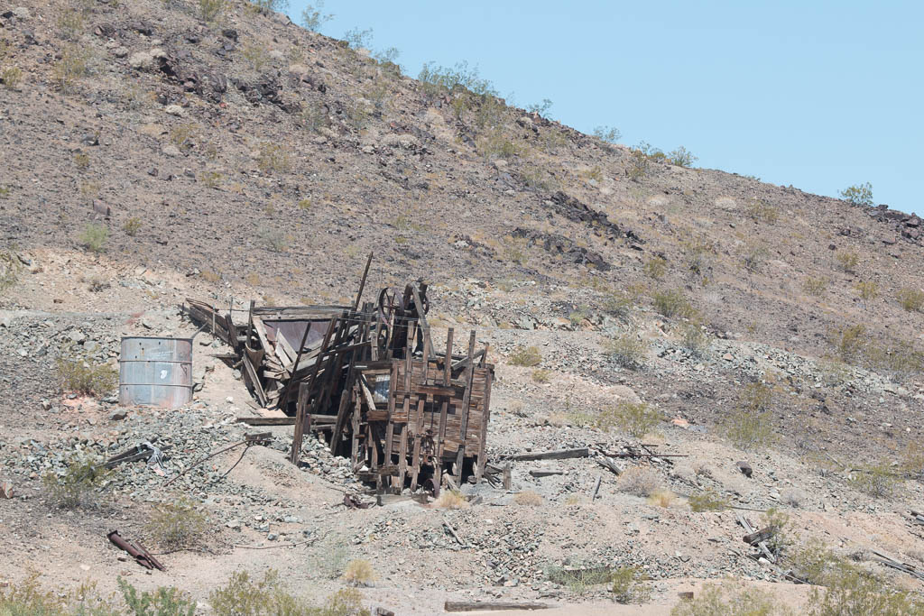
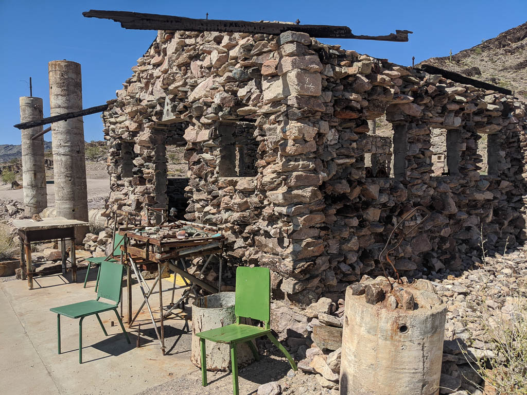
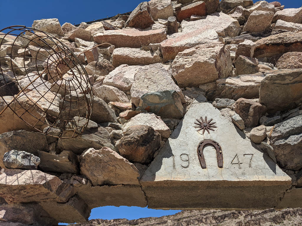
There isn’t much timber out here for building shelters. One thing miners had lots of, is rock. So quite a few stone cabins remain; some in better condition than others. It seems that very little mortar was used; we’ve seen a few with no sign of mortar at all.
Rough exterior,smooth(er) interior.The cabin above is seventy three years oldSmooth exterior, rough interior.With a framed picture of Clark! Most of the wood in these cabins is long gone, but some remains.
Reduce, reuse, recycle. When the old truck dies, it becomes a hardware store, providing parts and equipment for other mining camp needs. Here, some roof rafters.
Steel roof rafters!
Driving the trails
We’ve been out on Clark nearly every day; usually both of us go (and Kathe drives), sometimes Al goes out alone. We’re becoming more comfortable with Clark’s mountain-goat-like abilities. So far we have clocked almost 600 miles of fun in the immediate area. The dealer we bought Clark from offers a discounted service that we picked up. They call it a “two year” plan, but it is based on hours of use: X services at Y hour intervals. We’ll probably use it up by early fall at this rate!
Back in the dark days of computing before GUIs, there was a command-line game called “Adventure.” It had two key phrases: “You are in a maze of twisty passages, all alike,” and “You are in a maze of twisty passages, all different.” If you went into a twisty passage going north, you might come out in a different room going south. Or east. (It is still available on github!)
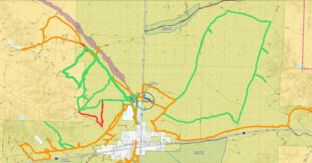
The trails here are like that. There are hundreds of them; only a small subset are marked. They twist and turn and intersect and head who knows where! We use a GPS-enabled tablet running the Avenza mapping program to navigate, so we feel secure about not getting lost, but I wouldn’t want to go too far here without it. (We also run Avenza on our phones as backup.) Here are some of of our tracks.
Some of our tracks north of town; the map is 17.4 miles across (BLM map)And some of our tracks south of town; the map is 21 miles across (BLM map)
Some friends have asked how we try to stay safe when riding on the desert.
We carry another backup GPS in the form of a Garmin inReach satellite communicator, with which we can send and receive text messages while out of cell phone range. It also has an SOS function to contact a 24/7/365 rescue dispatch center should the need arise. Needless to say we hope we never need that! But it is nice to be able to send texts to let someone know, for instance, that we’re OK, but taking longer than expected so they don’t worry.
We also carry a fairly capable trauma first aid kit, some spare parts, a tool kit to take apart / repair much of the machine, and ropes, pulleys, etc., to extract ourselves by using Clark’s winch if we get stuck.
And water. Lots and lots of water.
And when one of us goes out alone, we always let the other know roughly where we will be.
A recent conversation:
Al: The only way you can find out what Clark can do is to try more and more challenging things.
Kathe: And what happens when what you try is outside its capabilities and you’re stuck (or rolled, or…)?
She’s so practical.
But we haven’t been stuck yet. (And haven’t rolled it!) For the most part, we stay on well traveled trails. Yes, that rise may look very steep, but from looking at the tracks, many, many people have traveled it successfully. Onward!
Sometimes, the trails are wide, flat, and smooth:
You occasionally see regular cars on roads like this.
Sometimes, narrow:
Narrow track. Don’t meet someone coming the other way! It is one vehicle wide.
Sometimes hilly and steep (and sometimes much steeper than they appear from the bottom).
Yes, we’re going up that. MUCH steeper than it looked from here!
To really appreciate that hill, please watch the video at the end of this post which tries to give an example of what we’ve been enjoying from Clark.
And, sometimes, they just aren’t. Visible, that is. There are some BLM-designated trails that look like just bare unmolested desert surface stretching into the distance, or that appear to simply be a tangle of desert shrubbery. Our GPS-enabled mapping tablet has let us traverse some of these “non-trails” (my term). Others, we just couldn’t figure out at all.
Some trails proceed in washes instead of across them. We are fortunate: a wash that is part of the local trail system is right behind our RV Park, so we can access the trails by going through a gate at the rear of the property.
Driving in a wash with a deep, loose, gravel bed reminds me of sailing with a strong following sea. The rudder is more like a hint to the boat of where you’d like it to point, instead of a strong command. When driving in the deep gravel, even in four wheel drive, pointing the front tires is merely a hint to Clark. Which it usually (eventually) obeys.
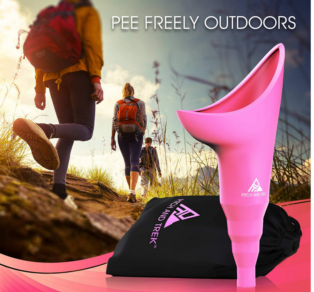
Caution: This might make you blush
Kathe here. When we first started riding out onto the desert, I prided myself in the fact that I can go for hours without peeing. Women, you know what I mean! Right?
But soon I realized some of our trips might get long. And hydrating while we’re out on the desert is ESSENTIAL. However, peeing behind a bush (cactus!) just wouldn’t cut it. Ouch! But what could I do? I didn’t want to be the cause of foreshortening a planned excursion.
Enter FUD — the feminine urinary director. Yup. It’s a thing. A REAL thing. And it works GREAT! I can stand up and pee away from me. Now we can be out for a number of hours and I can be comfortable. Why didn’t I know about these years ago? Here’s what it looks like.
Fantastic invention! Available on Amazon and from many other places.
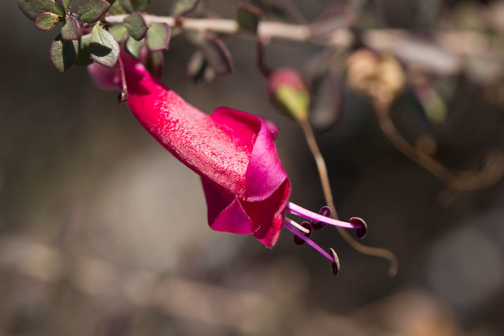
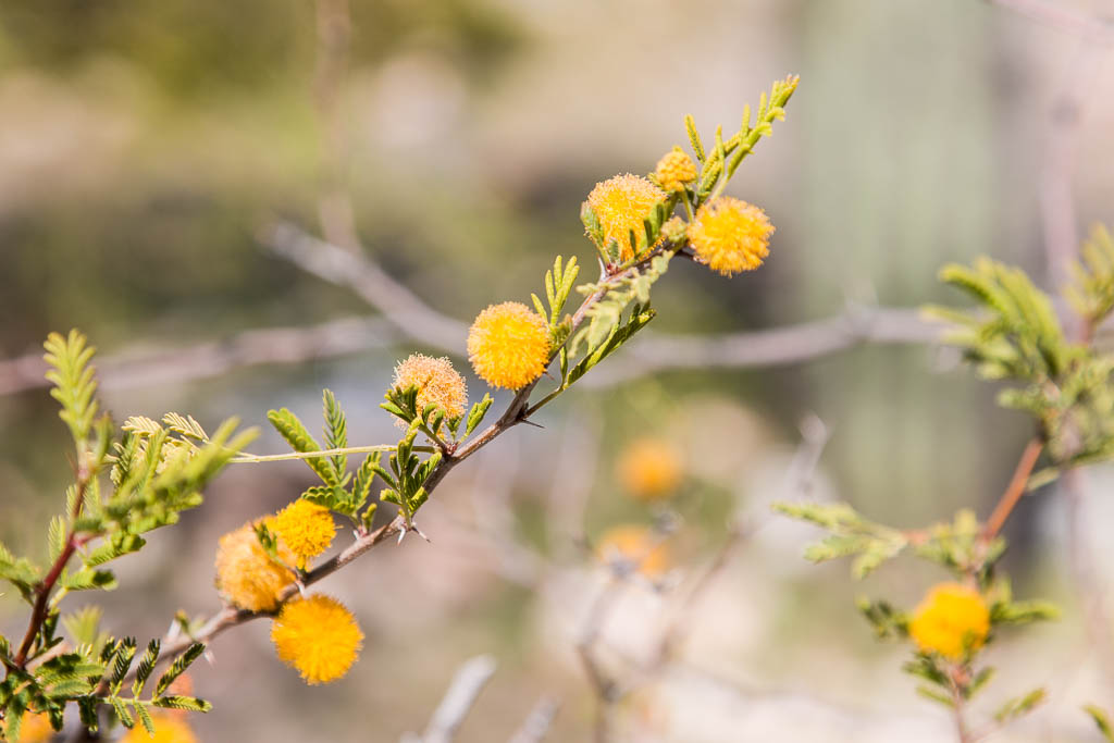
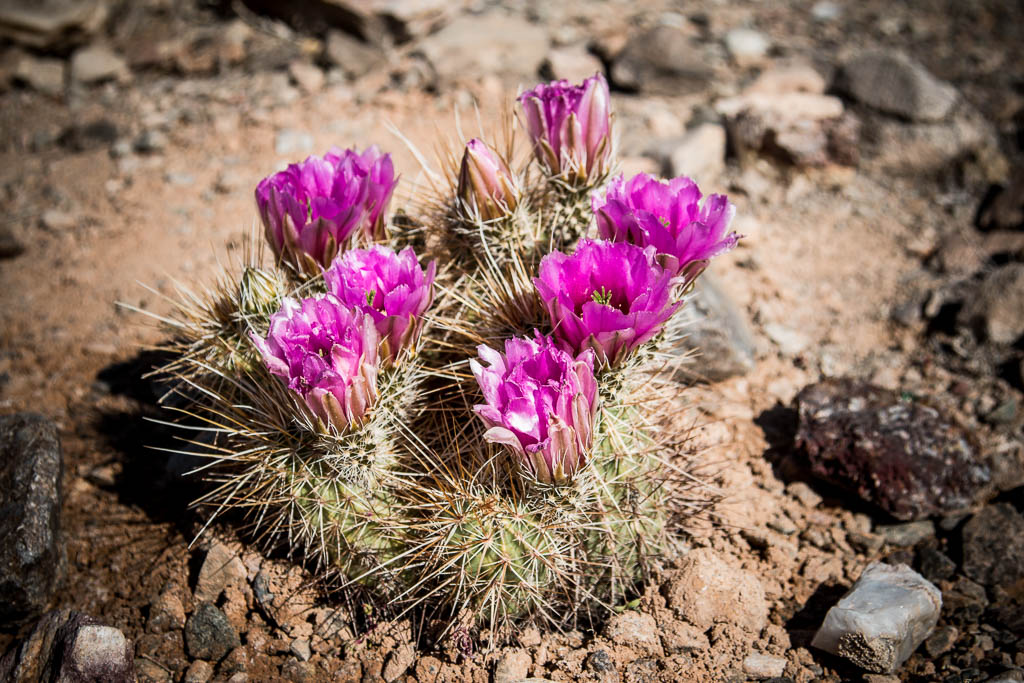
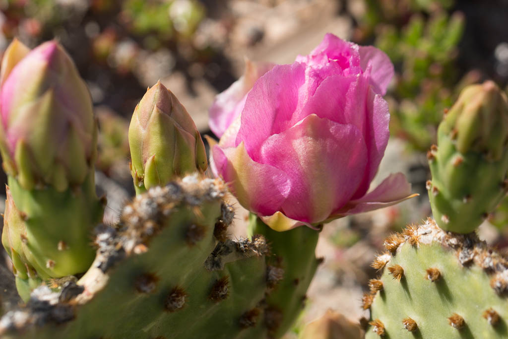
Still blooming!
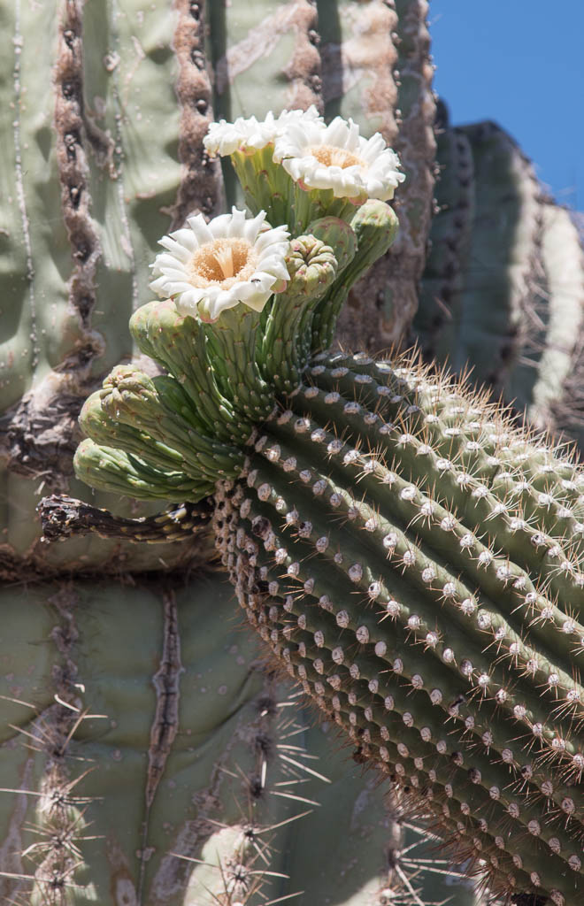
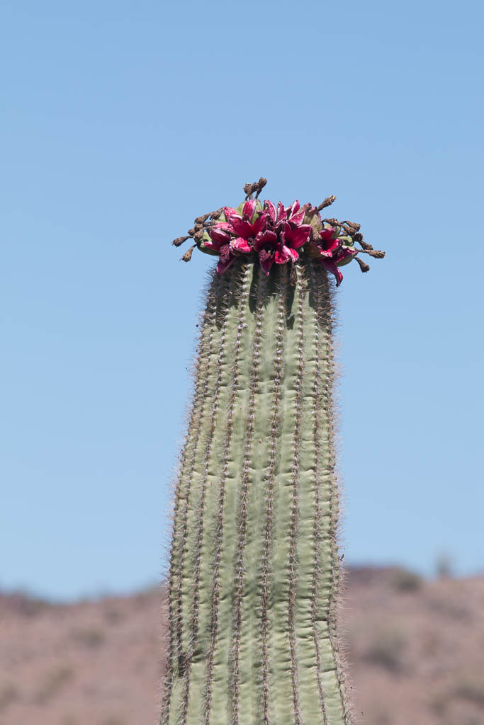
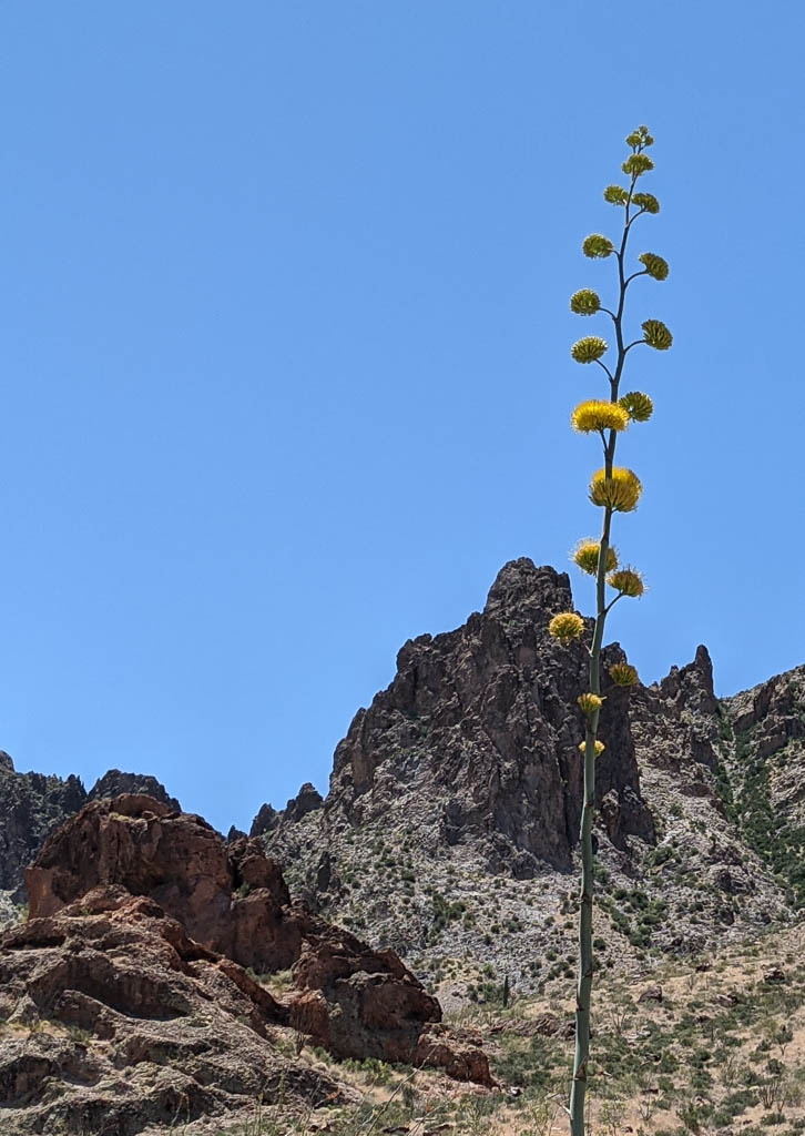
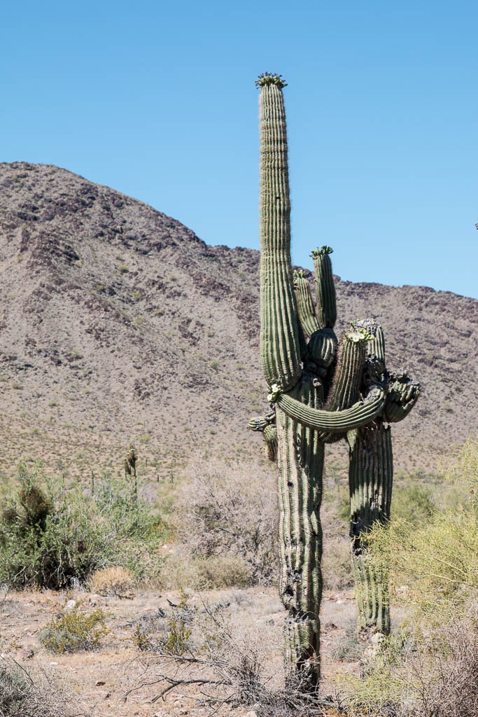
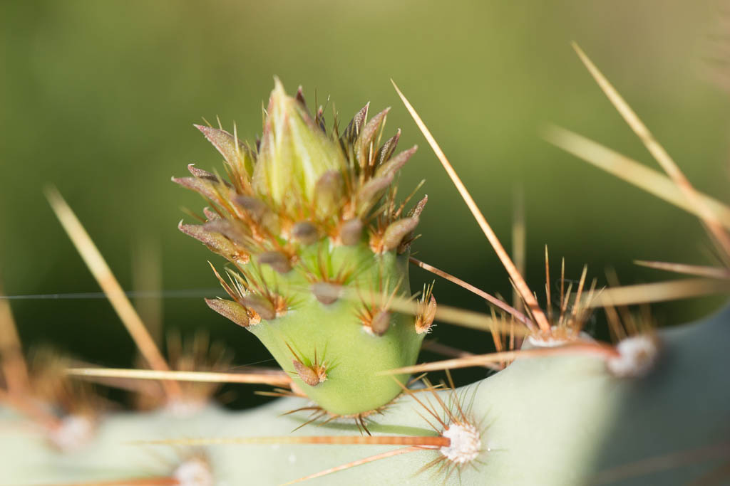
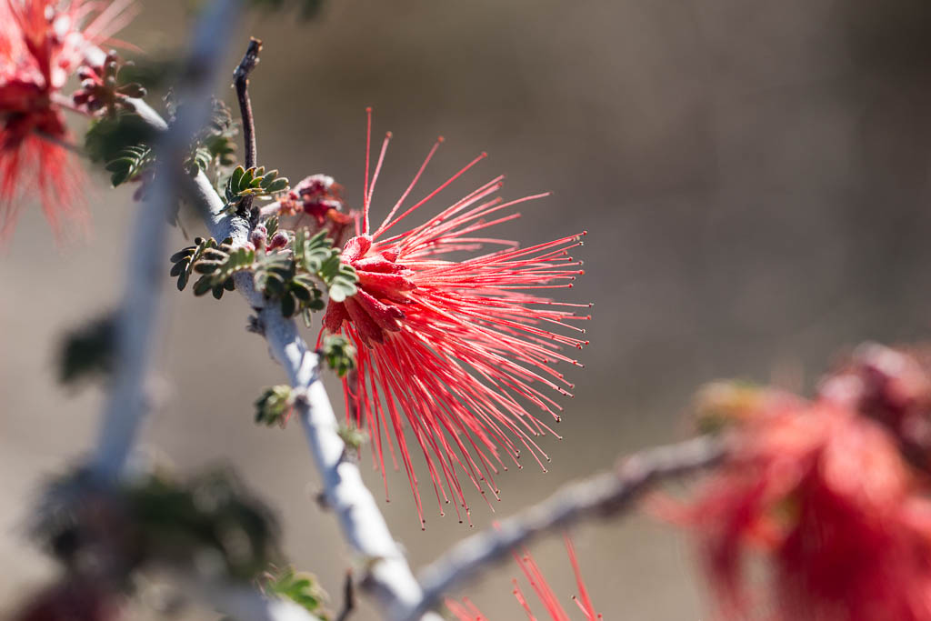
We are still seeing flowering plants in the area, although the saguaros are pretty much done by now.
I find saguaro blooms so pretty.A RED saguaro bloom: Christmas cactus?We hadn’t seen this before. Kathe identified it as a “Century plant!” Phew! Glad we didn’t miss the bloom.I found this down in Yuma, while getting the truck fixed.
Miscellany
[Quick: what periodical had a “Miscellany” page on the last page of every issue?]
Yes, it gets hot here. This was in May, when the northeast was having frost warnings! Brrrr….
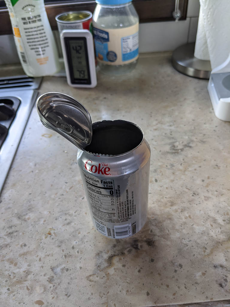
One afternoon I went out to the truck and found this waiting for me, in the console cup holder. The can was half empty, but I could find no trace whatsoever of the half of the contents that weren’t there. No spray on the ceiling, no drips in the cup holder or on the floor. I count myself very lucky! You can see in the pic that the pop top is still sealed. Guess that isn’t the weakest part of the can!
Don’t let this happen to you!
The truck thermometer said 127, but it had been sitting in the sun. I’d guess the air temp at about 115 outside. Who knows how hot inside the closed up truck! (Not the same day as the 110° picture above.)
We were amused by these saguaros:
Everybody / everything needs a hug now and then!
Several posts back we talked about the public art that was scattered around town. When we saw “Potty Garden” as a point of interest on the map of desert trails, we had to check it out! Of course!
Wouldn’t you?
The potty garden
As I noted above, in amongst the mountains it is easy to convince yourself that you’re all alone. But every once in a while our path meets signs of the outside world.
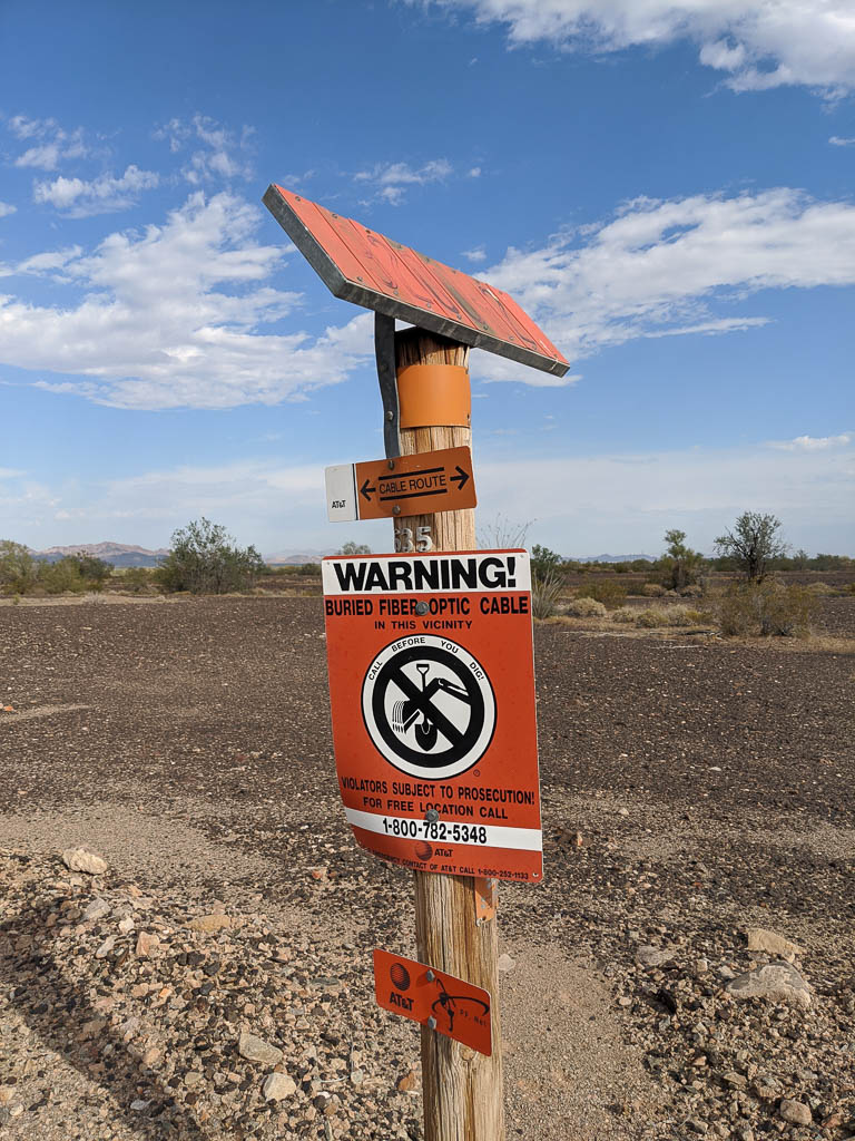
Did the off-road trail influence the route of this, or did the trail result from laying the cable? After all, the desert is already disturbed!
The slanted orange thing at the top is an identification number, for checking the route from a helicopter. All the infrastructure around here, cable as above, gas pipelines, and towers for the electrical grid have this setup. It is not at all unusual to see a low, slow helo going by as it is checking something.
A few of the trails parallel Interstate 10, to take advantage of the grading. (But isn’t “unusual” grading the point of riding these machines?)
And occasionally someone leaves a sign of their former presence. Geocache? Easter egg?
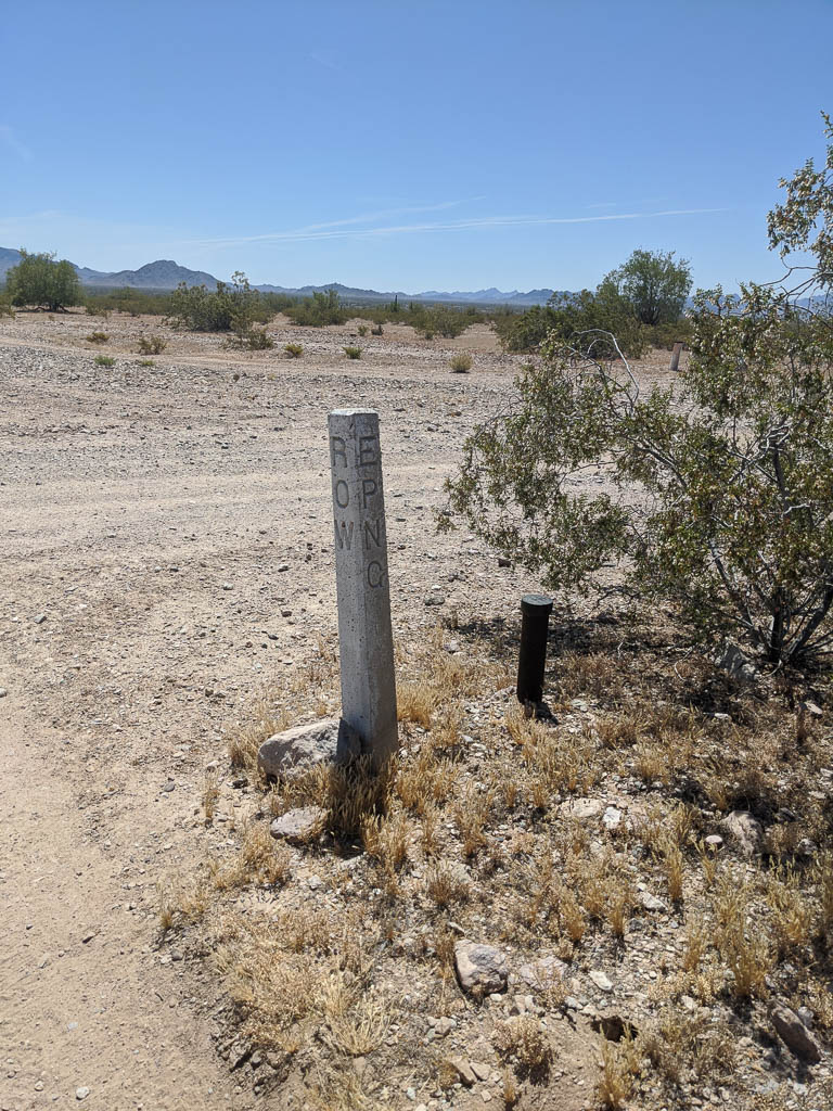
The El Paso (TX) Natural Gas Company holds several rights of way through the area to get their product to the cities on the coast.
Took up a minute or two to figure out the engraving: “EPNG ROW.”
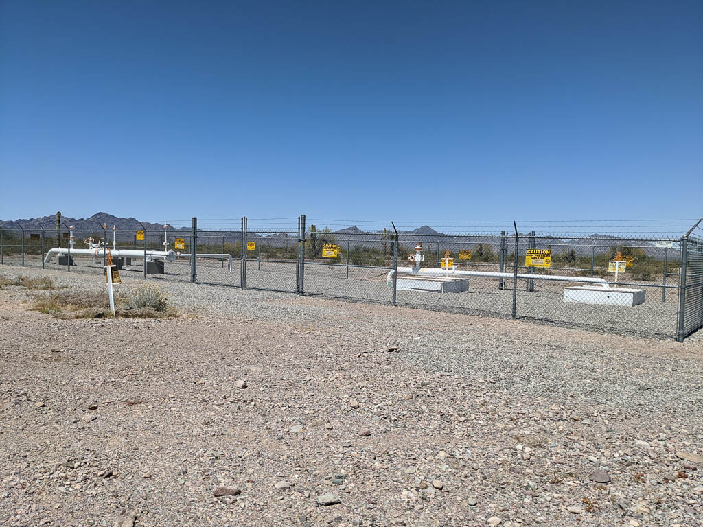
One of the pipelines provides what could be considered an “off road highway,” named “Pipeline Road.” Really; it is on the maps. In addition to being a nice wide well graded path (they run pickups on it), you occasionally come across installations like this. I’ve found two in the area.
Part of the pipeline infrastructure, away from anywhere.
The promised video
I’ve heard that cartography is the art of omitting information. If maps included all the detail available, they would be unusable. Consider city subway maps. They show almost nothing, but present the important (for that use) information clearly.
I think making videos is similar. I have incredible respect for people who produce videos; editing hours of “film” into minutes or even seconds and still coming out with an interesting, cohesive story. I don’t consider myself to be in that group of people, but I have pulled together a few snippets of trail rides to try to show you what we’ve been seeing these past few weeks. I hope you enjoy it! It is just over 1 minute long. The first part is the mule deer running across our path on KOFA Queen Canyon Road, then starting at about 15 seconds, Kathe’s climb of the hill (at 2X speed). It was way steeper than it looks…
The view from the top was worth the climb! We’re looking west; the very farthest mountain range is probably California.
That’s about it for now. We hope you stay safe as society starts to open up. We have no plans to change how we’ve been isolating: riding in the desert with no others nearby or staying in the RV, unless going somewhere is absolutely necessary. Arizona is becoming a hot spot (get it?); things are not under control here.
We hope that all of you and those you love are staying healthy during the COVID-19 pandemic. But we know it is likely not true for some of you. Our thoughts are with you.
We are fortunate that the known case count here in LaPaz county is still only 7. However, that may be because the county has only tested a handful of people. We are sure there are more infected people around, so we are taking as many precautions as we can when we go out, particularly when we have to go to Phoenix, which is the primary virus hot spot for Arizona.
We have moved from our winter home on the desert to the commercial campground in Quartzsite that Kathe mentioned in the last post. It is already quite hot (105 today, and even hotter tomorrow), so we may need to reconsider our plans to stay in Quartzsite for the summer. Time will tell—stay tuned. Thank goodness for “shore power,” so we can run the ACs; it still stays comfortable in the RV.
Cacti are blooming!
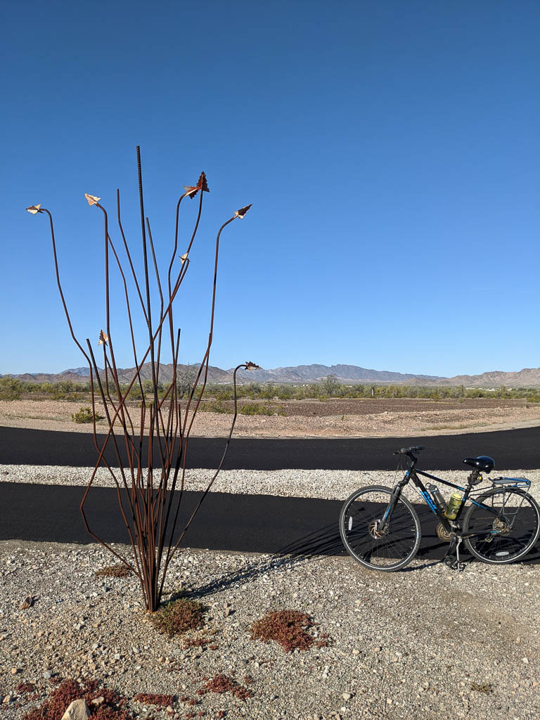
So… what to do? What to do? We’re riding our bikes around town, which is now constrained to the (very) early morning. We hope to build up our endurance, but for now with the shape we’re in and the heat, we’re limiting our rides to about 7 or 8 miles. I know…we’re pikers! Trying to get out most days.
Quartzsite has several miles of bike paths alongside the town streets . We use the paths where we can, and ride the quiet side streets when necessary. We’ve been able to do lots of exploring and enjoy the lizards and quail that often dart in front of us.
All of the street names in town are designated with a compass direction: North, South, East, or West. Part of this is probably to be able to visualize where a street is without checking a map, but c’mon. The town is just not that big. (We’re not in Washington, DC!)
But there is another reason. Being in the desert, the town is riven with washes, those paths that drain heavy rains out of the nearby mountains.
One of the larger washes through town.
The very first piece of advice we got about camping on the desert here back in 2018 was, “Don’t camp in a wash!” Ya think???
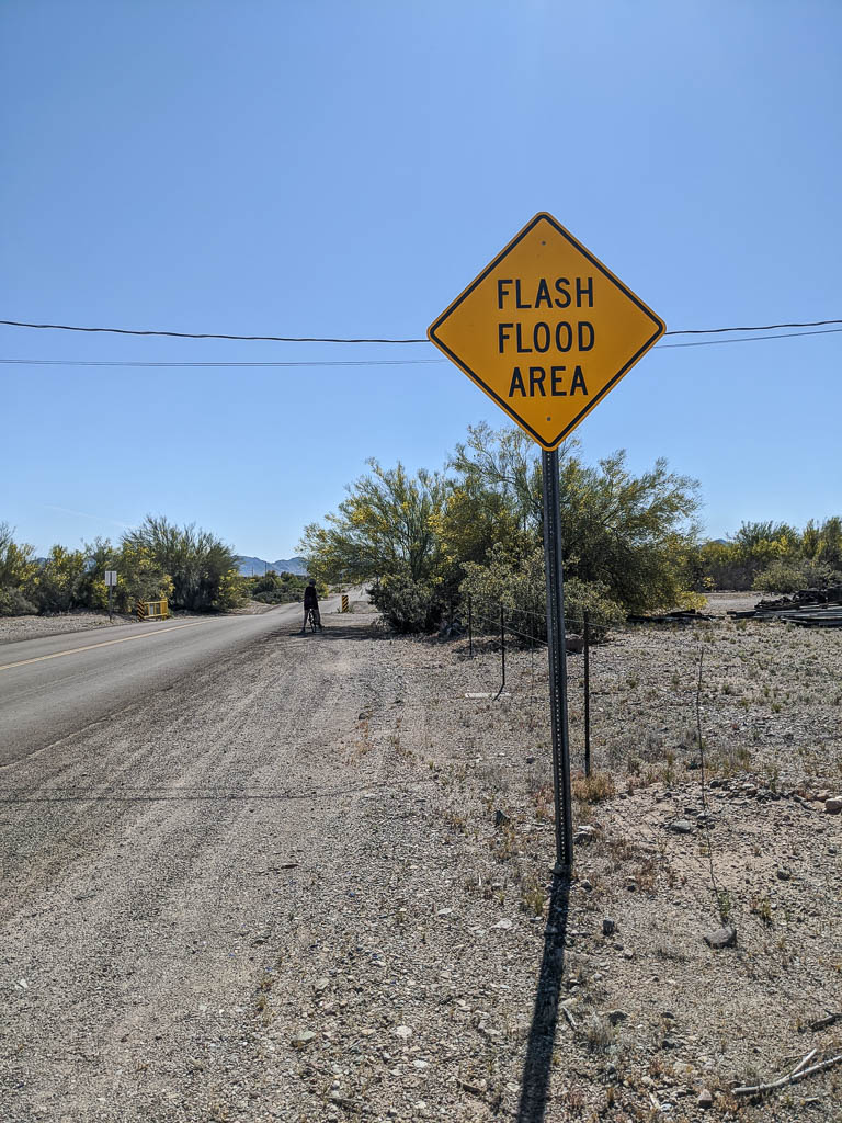
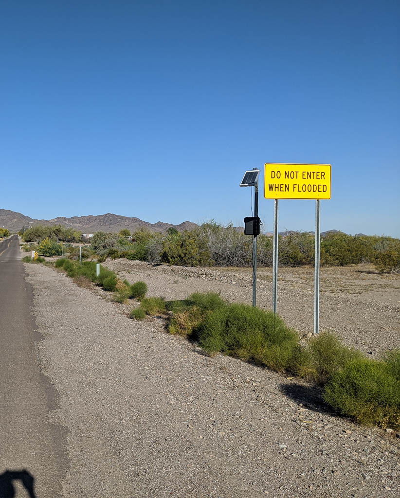
Some roads cross the washes on bridges. Some roads just follow the terrain down into the wash and back up. “Do not enter when flooded” signs are a common sight in town.
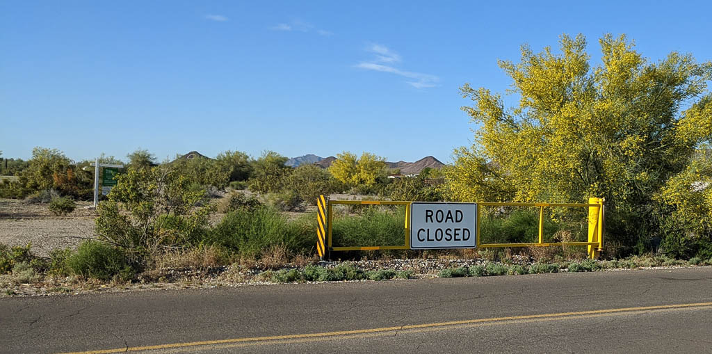
But some roads… ummm… don’t. Some roads simply stop on one side of the wash and then pick up again on the other side. For instance, West Cowell isn’t connected to East Cowell at all. Pro tip: Not all in-car navigation systems are aware of this!
Here, the road just drops down into the wash and back out again.Good advice!In Montana, this would be for snow. Not here!
While we’re out and around biking the side streets we notice that lots of the plants are flowering. As we go past the same places with each day’s rides, we notice that bud to blossom to past is sometimes the matter of only two or three days. As always, click on a picture below to see a larger version.
We’ve also noticed that cottontail bunny rabbits are almost as abundant as squirrels are back east. They seem to be a lot more skittish, though. We haven’t been able to get a picture of one for the blog yet.
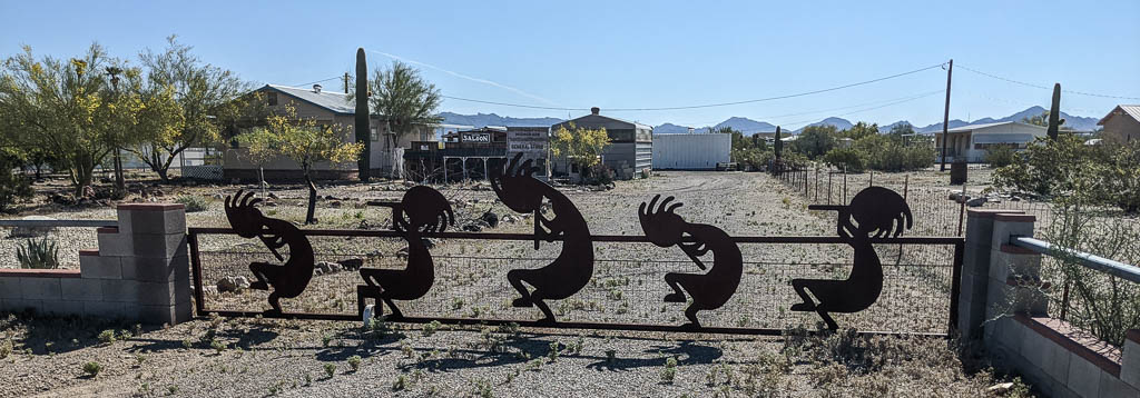
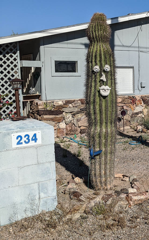
There is also a fair amount of “public art” around town. This is not commissioned art in parks, downtown squares (of which there aren’t any), etc., but art of various types put up by property owners.
Kokopelli dancingA saguaro cactus from welding tanks and caps.A decorated (real) saguaro
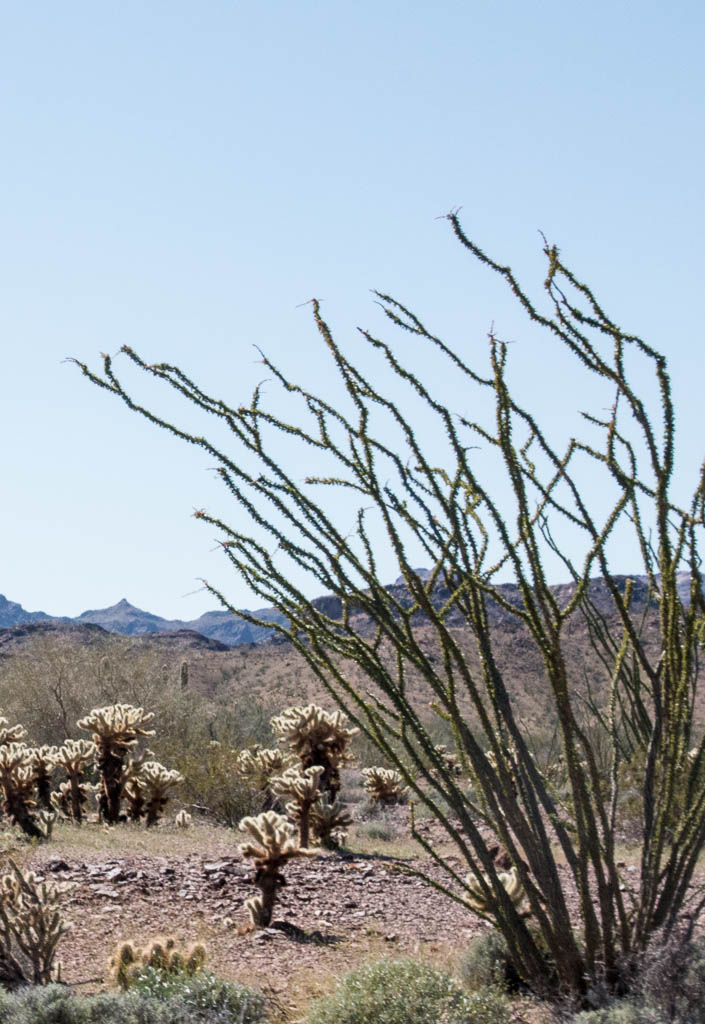
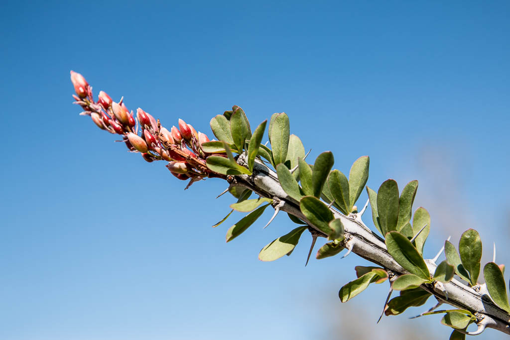
There is a spindly cactus out here called an ocotillo; it has tiny leaves, which limits moisture loss through transpiration. Out at the edge of town on one of the bike paths there is an ocotillo made of rebar. (It loses even less moisture through transpiration!)
Ocotillo out in the desert
Ocotillo blossoms
Rebar ocotillo!
Kathe’s major activity for the past several weeks is helping to produce our Bar Harbor church’s streamed worship service. Each week’s process is getting more and more efficient as she becomes more familiar with the tools she’s using, primarily the Audacity audio editor and the OpenShot video editor.
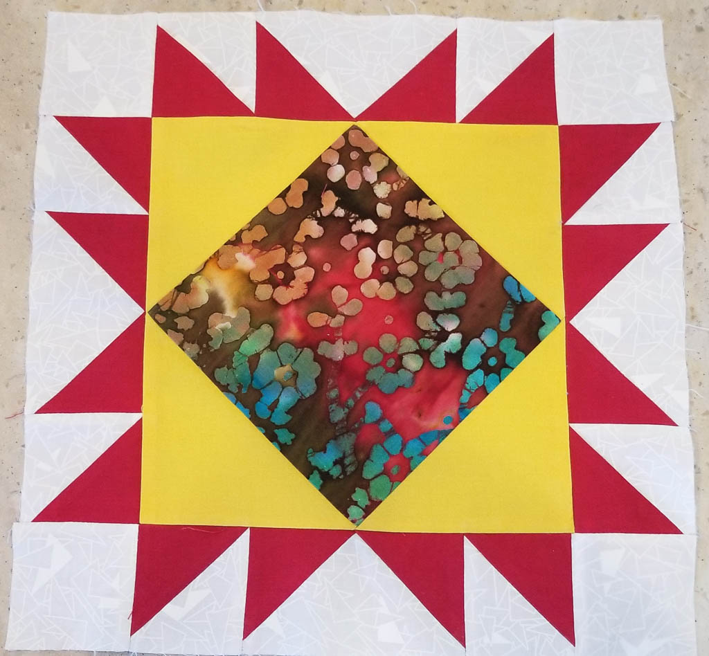
Kathe is also quilting up a storm, taking several online courses enjoying learning about free motion quilting something she had never tried before.
Project from Kathe’s Precision Piecing class with Philippa Naylor
I’m puttering at the computer (is that “’putering“?) to learn some new programming tools and some new photography techniques. Two of my hobby projects are writing a program to plot historical Covid data, and rationalizing about 15 years of backups. (How many copies of the Quicken database from 2008 do I really need?) I’m also reading a lot, generally alternating a new book with one I’ve enjoyed before, sort of brain “comfort food.”
We continue to watch a lot of streamed TV. Some of our new favorites are The Great British Baking Show and Schitt’s Creek on Netflix, and Blue Murder, Line of Duty, and Silent Witness on Amazon Prime.
If you’ve found (or rediscovered) one or more favorites to stream, please drop recommendations in the comments! We only have enough queued up to last us through 2022.
We know that we are very fortunate, since we are both healthy, continue to have an income, and have a place in which to shelter away from others. There are so many who don’t have those things right now. I’m probably even more fortunate since I’m an introvert. Social distancing—let’s make that physical distancing—is easier for me than it is for extroverts like Kathe.
So…what are YOU doing? And HOW are you? A wise person recently told me, “It is OK to not be OK.”
We’ll write again soon, even if just to say “same ol’, same ol’.” Keeping in touch is important, especially now.
Long time, no type. In some aspects it has been a quiet winter (you’ll be able to read about the not-so-quiet part in an upcoming post), so not much to write home about. We haven’t done any real traveling since we arrived in Quartzsite in October.
Recently Kathe had a “free motion quilting” class in Phoenix. I decided that I’d go with her to Phoenix, and find something to do. There have to be some nice trails there on the outskirts that I could wander on.
But it turned out to be a rainy day (yes, Arizona has them). So what to do? Hmmm… I’ll look at the web… Multiple “things to do in Phoenix on a rainy day” lists had the Musical Instrument Museum at, or very near, the top of the list. OK, let’s give it a try. Then I’ll grab some lunch somewhere and see something else in the afternoon.
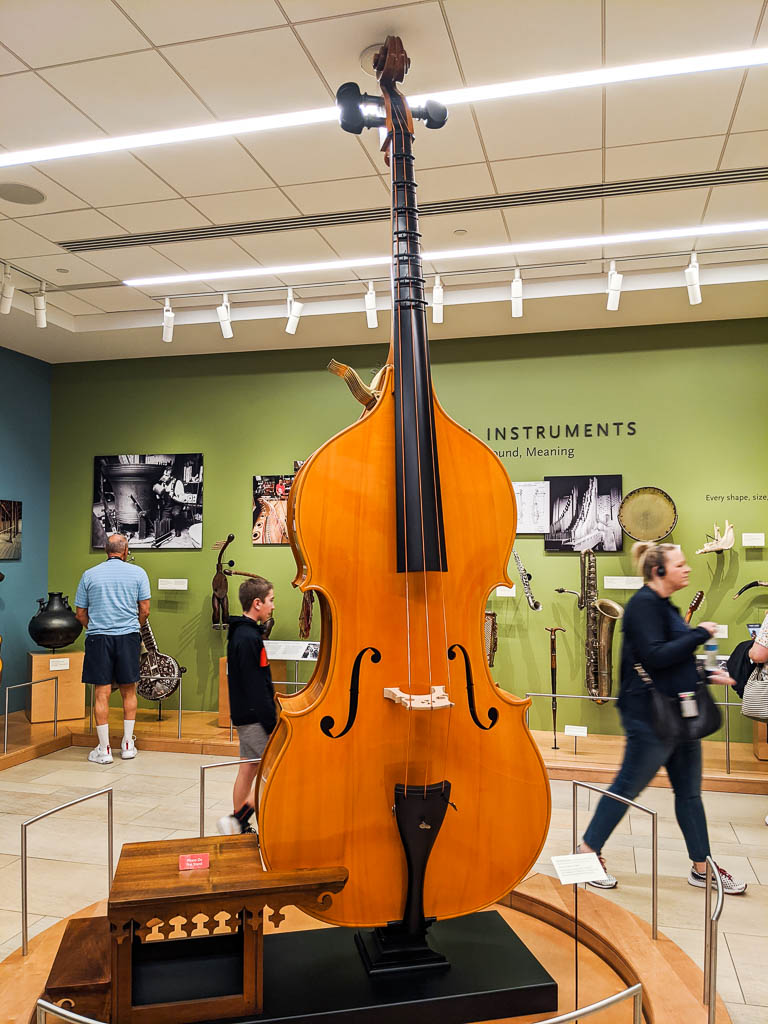
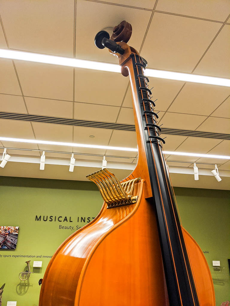
When I told some of my grandkids that I had gone to the museum, Dean immediately asked, “Did you see the Octobass?”
Oh, yeah.
The Octobass.
The apparent size is accurate, not an artifact of perspective caused by having the instrument in the very close foreground. Note the platform to the left for the musician to stand on, and the fact that the top of the octobass is only an inch or two from the ceiling.
Remote controls for stopping the strings above where a musician could reach.
Dean had obviously read about the museum!
Spoiler alert: I never did go anywhere else. I hadn’t seen everything by the time I had to go pick up Kathe at 4:00. Phew! (And the lunch in the museum cafe was surprisingly good!)
The museum is organized in a few different ways; one is by geography. There are rooms dedicated to the instruments from these areas: Africa and Middle East, Asia and Oceania, Europe, Latin America, and America and Canada. Within each room, the instruments from different cultures and regions are grouped for display.
Each display in the museum has a video screen showing related music making. Everyone gets a wearable receiver / headset that picks up the audio for the screen if you are within about five feet. This made it much more interesting than if there were simply static displays. Several of the pictures below show these video screens.
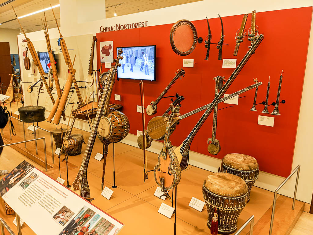
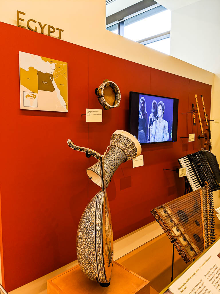
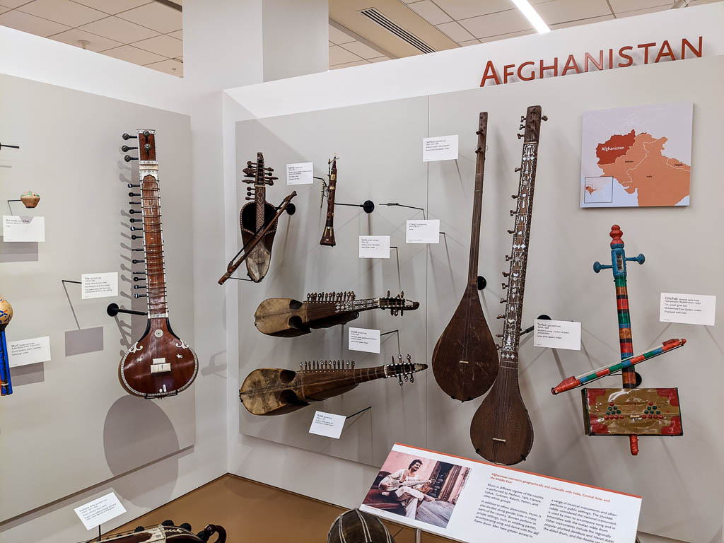
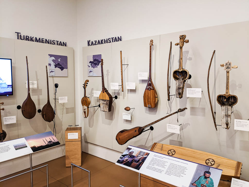
Here are a few examples of the regional displays.
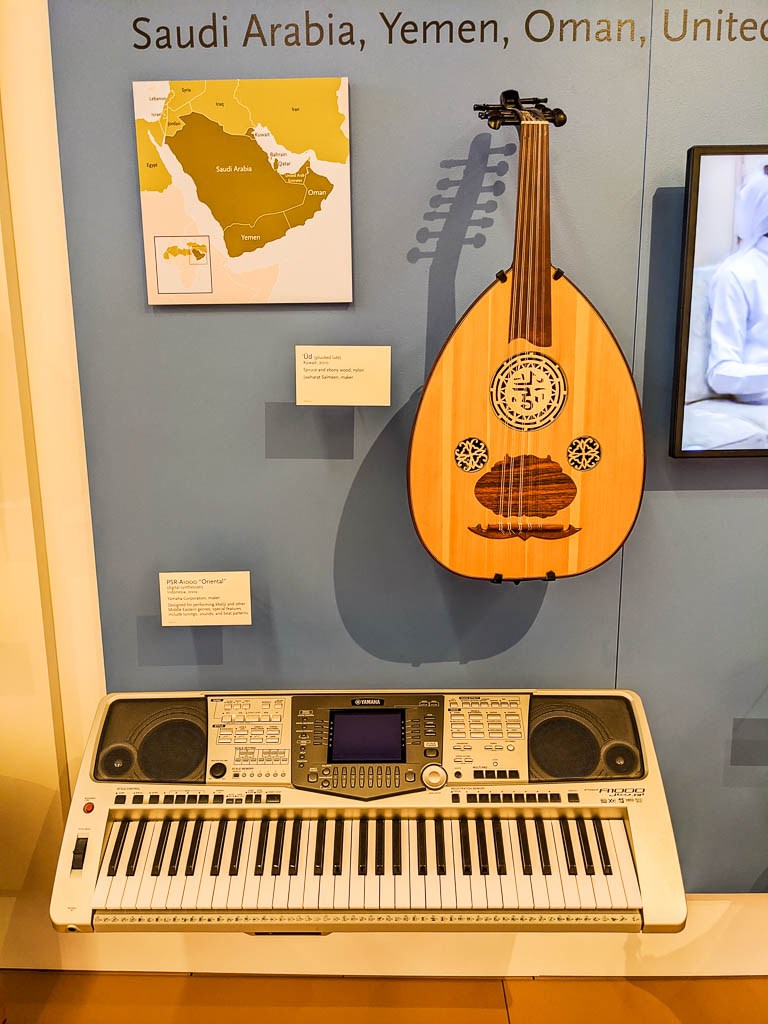
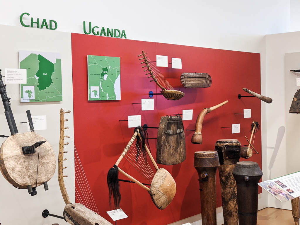
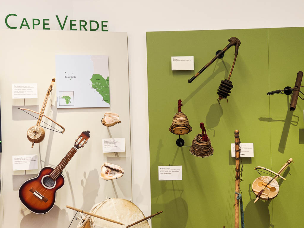
Northwest ChinaHighly decorated instruments from EgyptFrom AfghanistanTurkmenistan and KazakhstanSaudi Arabia: Yamaha made keyboards with different tunings, sounds, and rhythms for Middle East musical genresUgandaCape VerdeA wooden “slit drum” from the Central African Republic
Some of the displays contained traditional dress and ceremonial costumes.
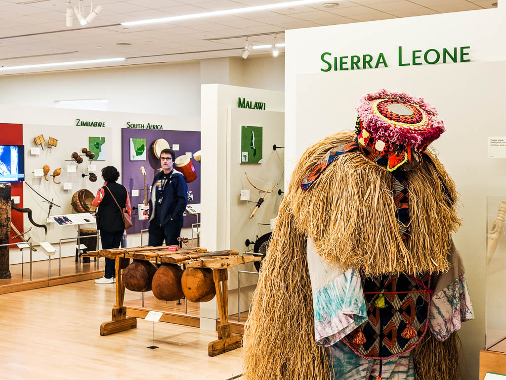
Ceremonial dress from Sierra Leone
Something that hit me quite strongly was the similarity of instrument designs used around the world, and the diversity of the music they produce when used in different cultures.
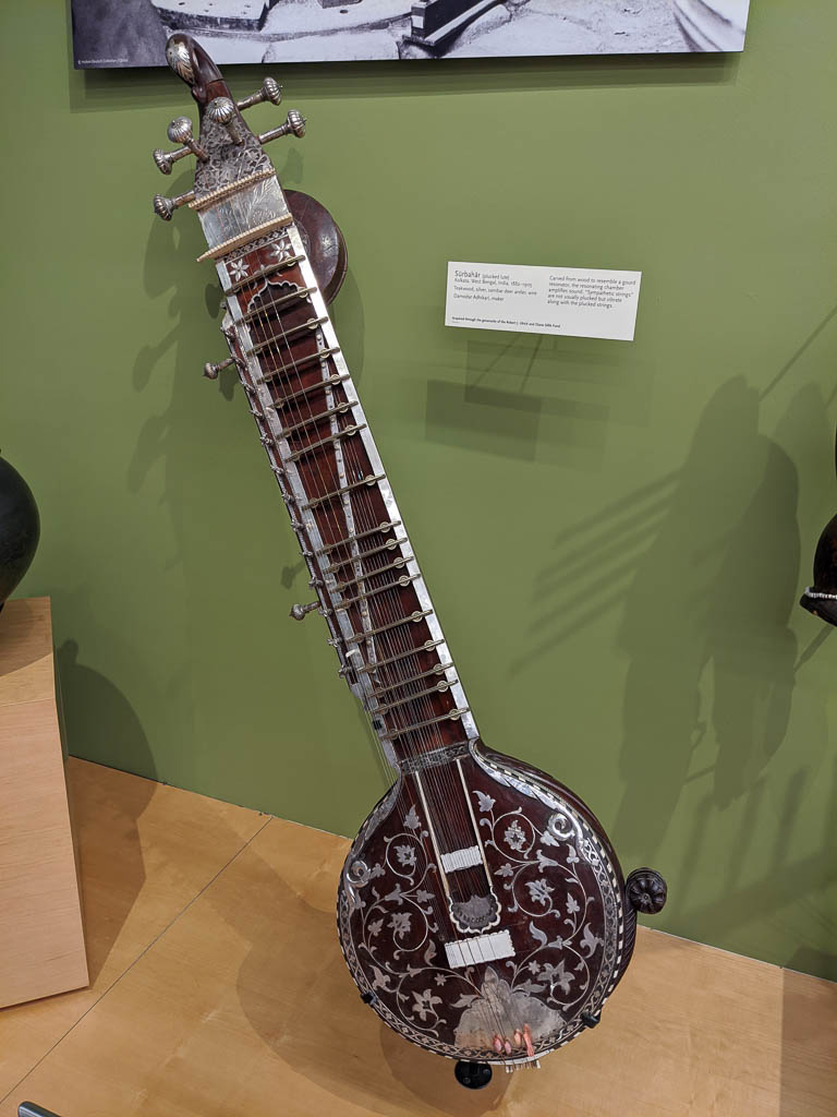
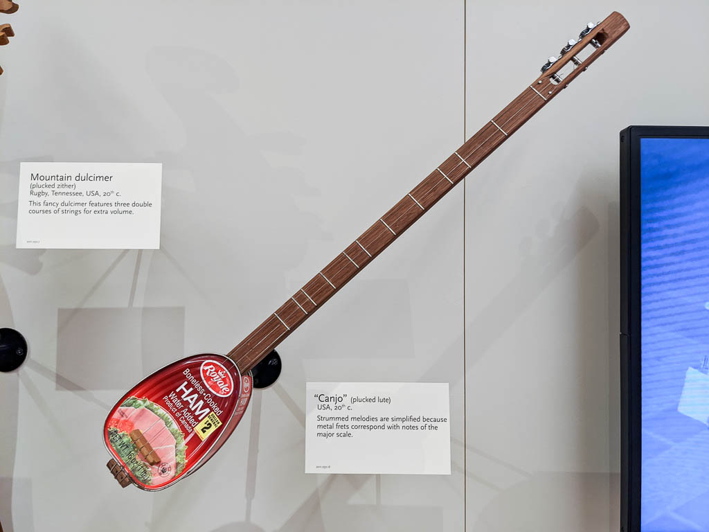
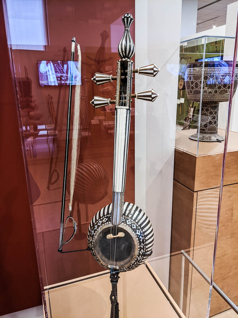
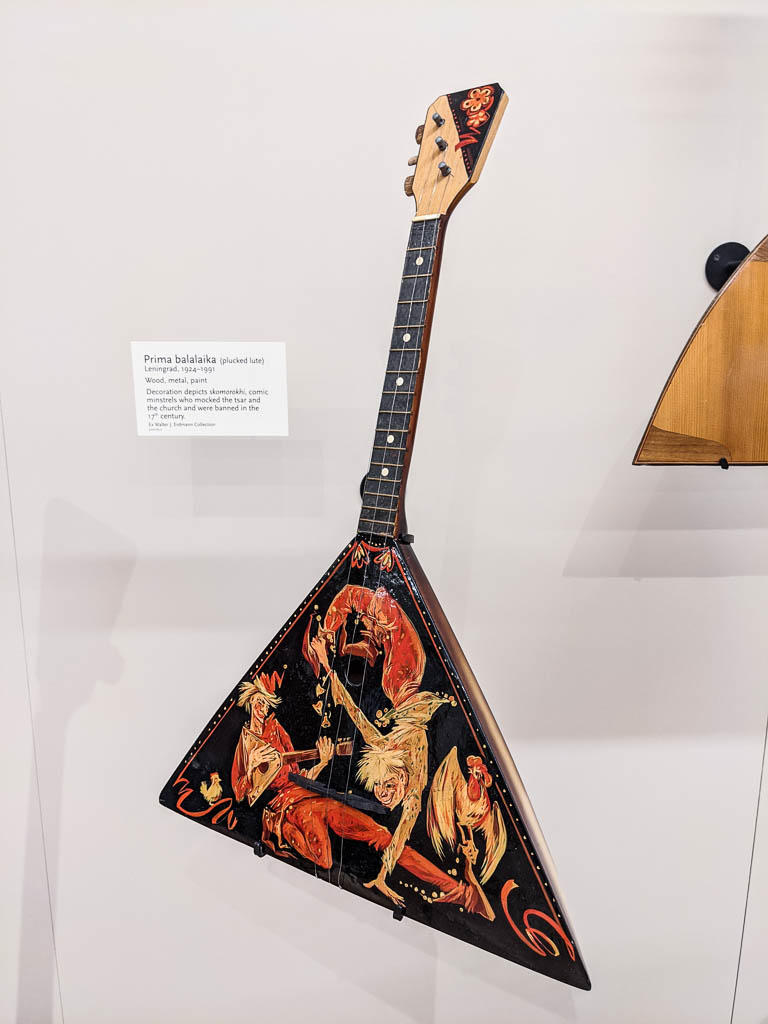
It seems that almost all the string instruments fall into the categories of “zither” and “lute,” which are then modified by how the string is caused to vibrate, for example, “strummed,” “plucked,” or “struck.” You’ll see some examples below.
There is also a room highlighting various famous artists—or should I say, the instruments used by various famous artists! Also a room for guitars, for mechanical instruments such as player pianos, music boxes, etc., and a room for playing (with?) a variety of instruments.
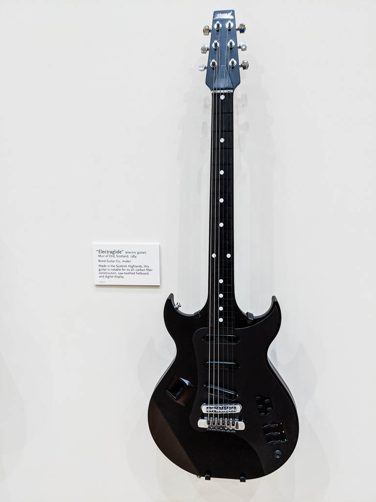
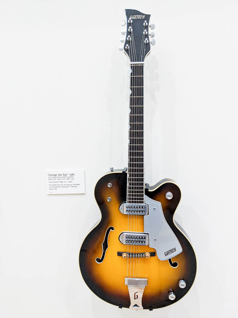
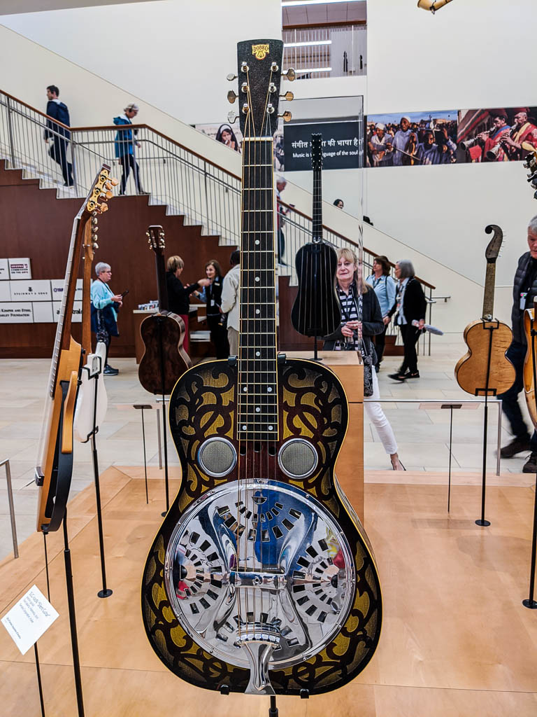
Guitars: plucked lutes
Guitars are one of the most widespread instruments; they are manufactured on every continent except Antarctica. Now there is an opportunity for the over-winterers! Be the first!
Here are a (very) few of the guitars in the guitar room. Click on an image to see a bigger version with some brief descriptive text.
Other Lutes
Beside guitars, the lute family includes mandolins, ukuleles, and… ummm… lutes. But wait! There’s more!
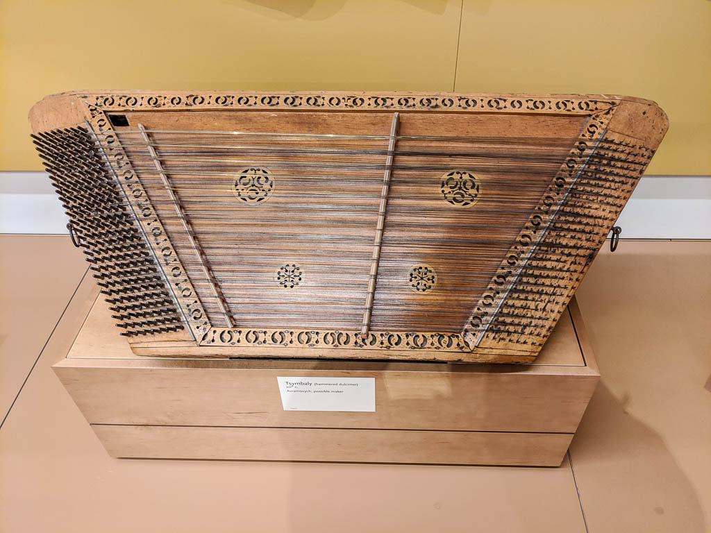
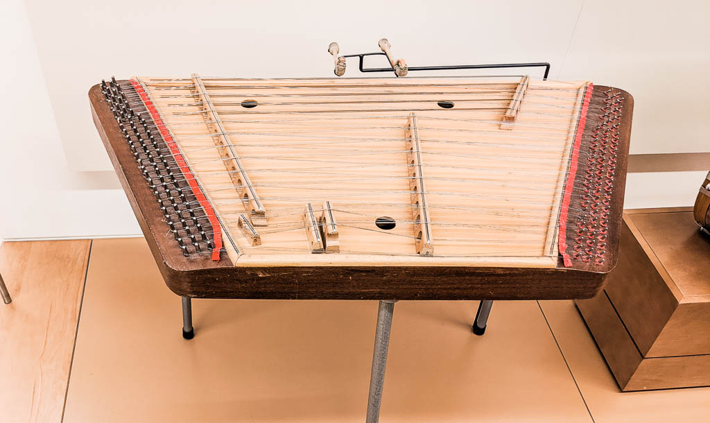
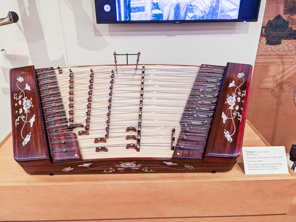
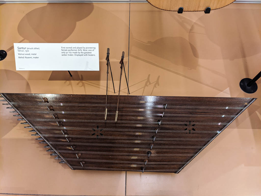
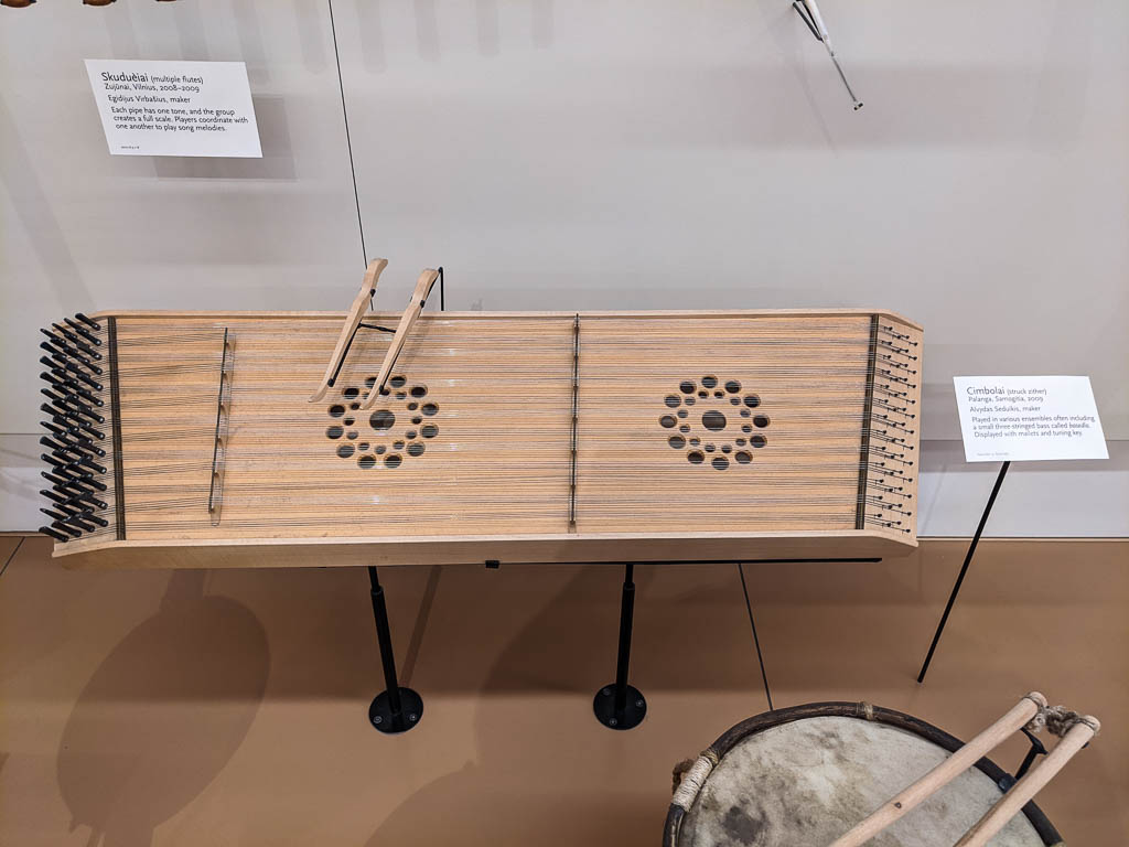
Zithers
Many cultures have what we would call a hammer dulcimer; the museum uses the more generic name “struck zither.” Here are a few examples from around the world. Again, click on a picture to see the instrument’s name and country of origin.
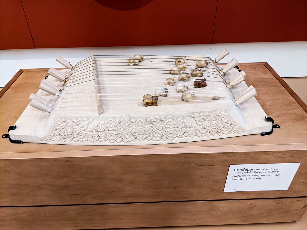
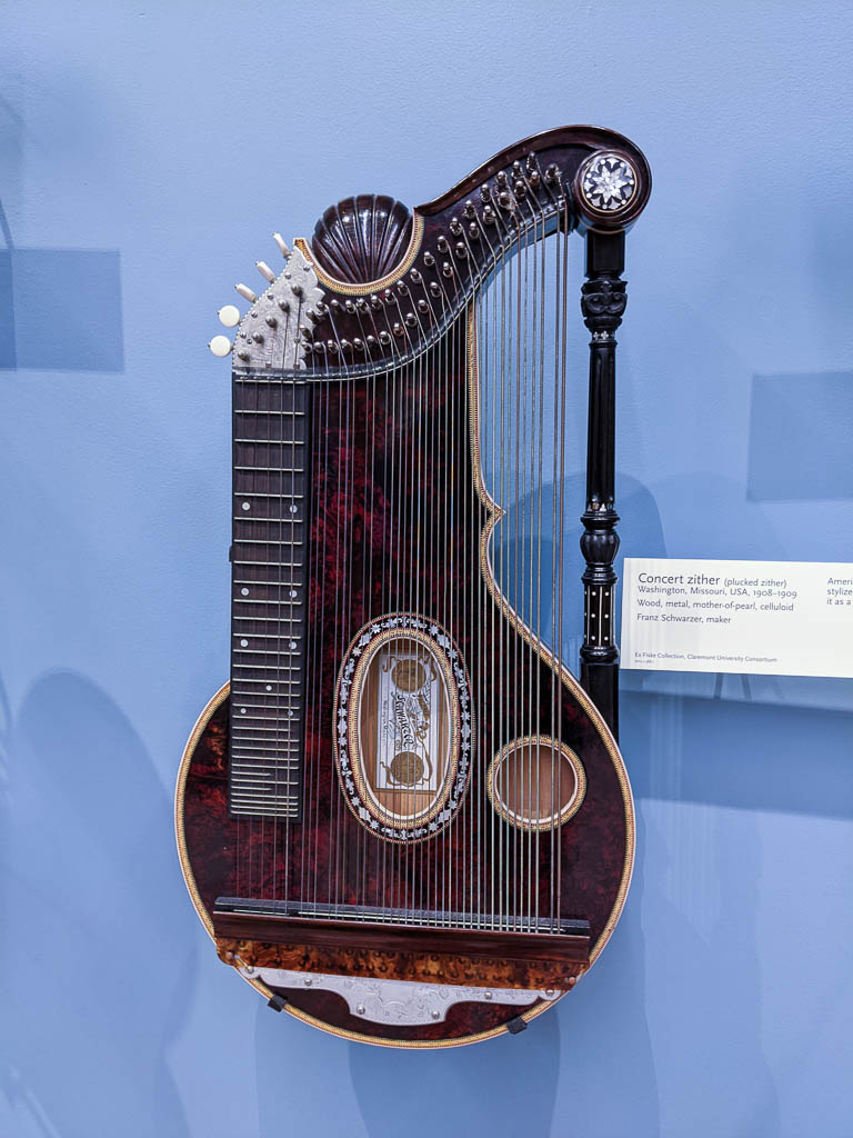
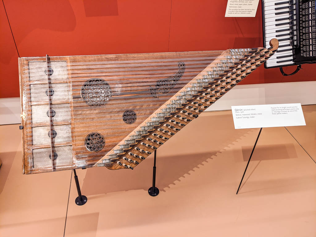
Other zithers were on display as well, both strummed and plucked. This family includes harps, and autoharps. Here are a few of the many on display.
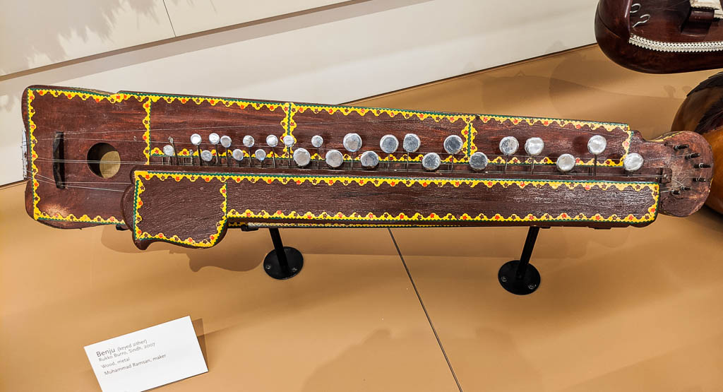
A plucked concert zither, from MissouriA qānūn, a plucked zither, from EgyptA benju, a keyed zither, from Pakistan
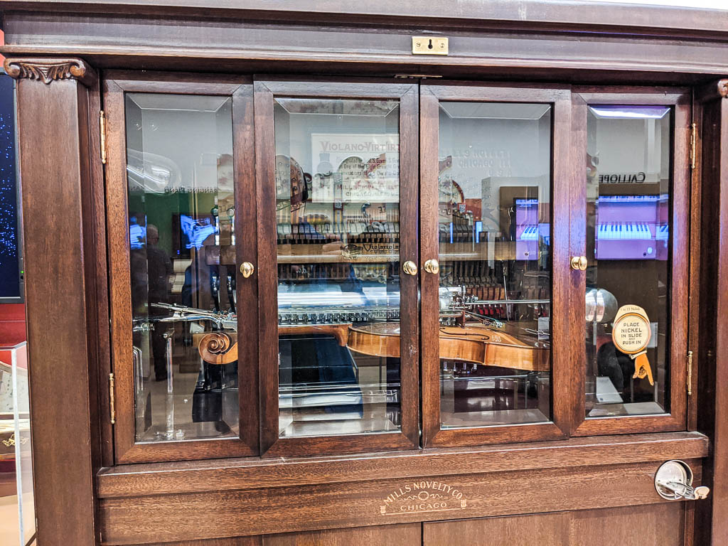
Mechanical players
The mechanical instruments room doesn’t include record players, tape recorders (am I dating myself?), or other similar machines. That is probably because they are music reproduction machines, not music creating machines. But there is certainly a wide range of the latter represented!
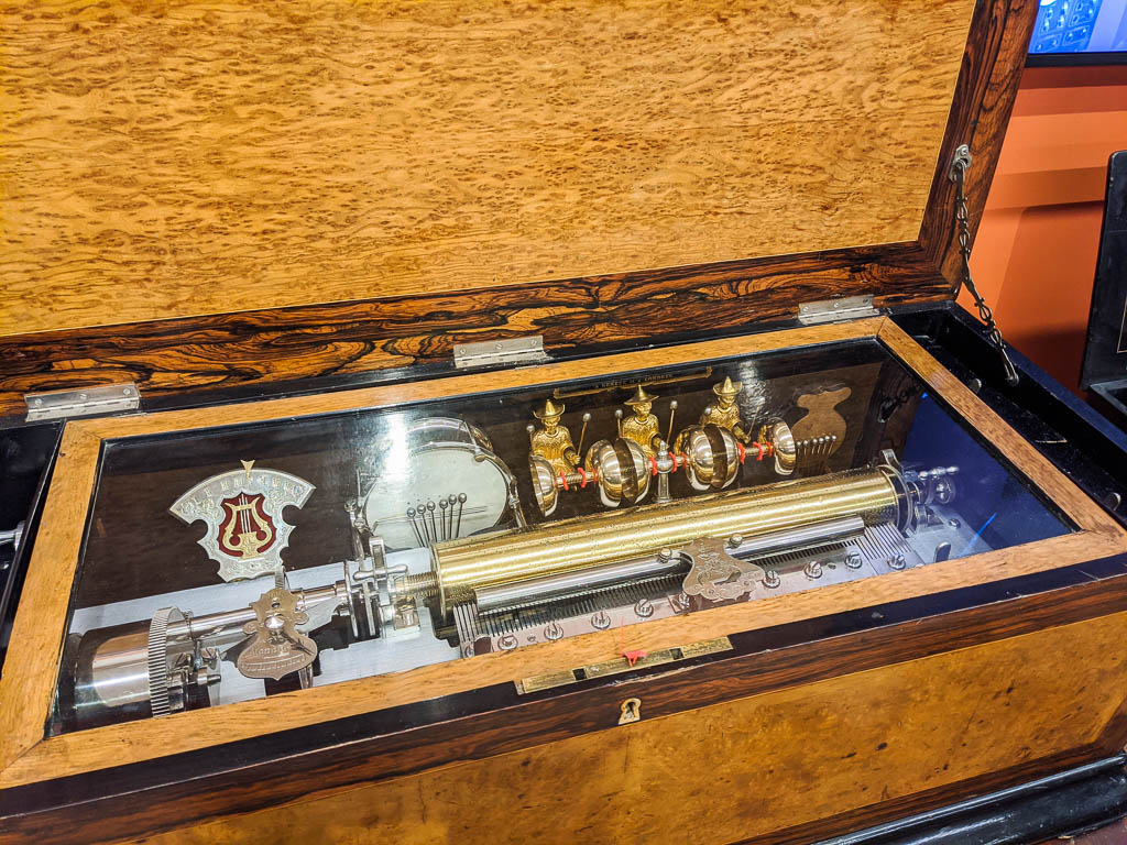
Player piano AND violin!
One of the interesting things about the combination piano and violin (above) is that it uses electric instead of pneumatic controls.
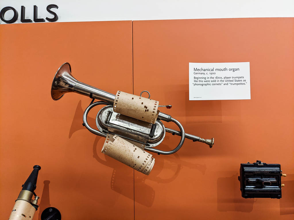
A player…. trumpet???
Despite the card calling this a “mouth organ” in the title, the fine print in the description calls it a “player trumpet.” Who knew?
“Just” a music box?
Boy, that music box looks just like the one I had as a kid!
Yeah. Right.
A player organ with flute (wide) and “string” (narrow) pipes.
One item in the mechanical room that I couldn’t get a picture of (too big) was a “portable” many-instrument item. It was about 15 feet tall and 30 feet wide. It was designed to be moved, but had to be disassembled to do so.
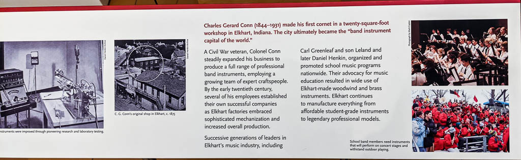
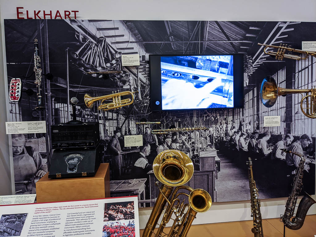
Elkhart, Indiana
Every RVer knows that Elkhart is the world capital of RVs, with more manufactured there than anywhere else by a large margin.
I was very surprised to learn that it also claims the title of the world capital of band instruments, manufactured by the Conn company and other Elkhart-based companies, many of which were started by former Conn employees.
The Elkhart story
Finally, a few special instruments
For various reasons, a few of the instruments I saw were special to me.
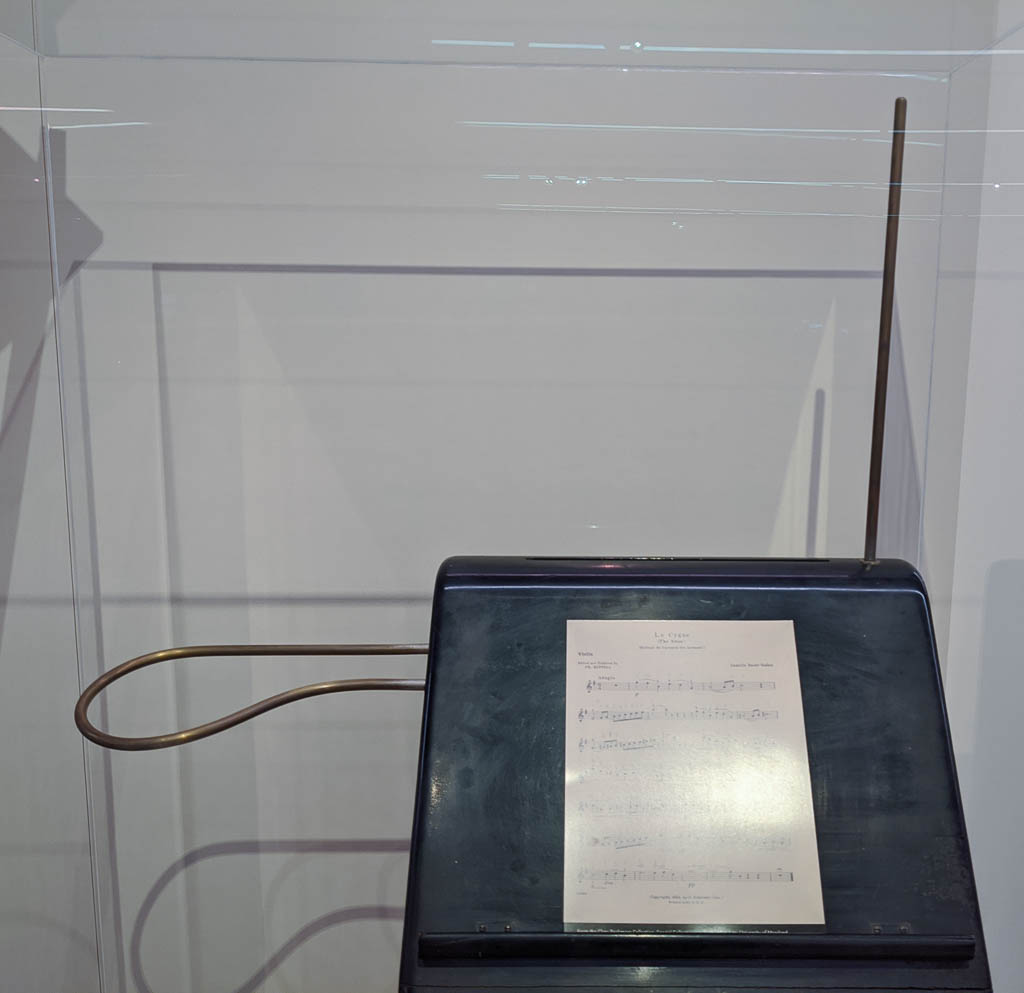
Back in the early ’60’s, my brother and our father built a Theremin from plans in Popular Electronics magazine. You may not know the name, but you have almost certainly heard a Theremin or derivative instrument. Think of the eerie varying pitched tones in grade B sci-fi movies. I never knew it was a legitimate instrument, used in concerts by Clara Rockwood. Here is one actually built by Lev Sergeyevich Teremin (a.k.a. Léon Theremin), and given to Clara.
The loop on the left and the stick on the right are antennas. One controls pitch, the other, volume. You control the instrument by moving your hands closer to or farther away from the antennas, without ever touching them.
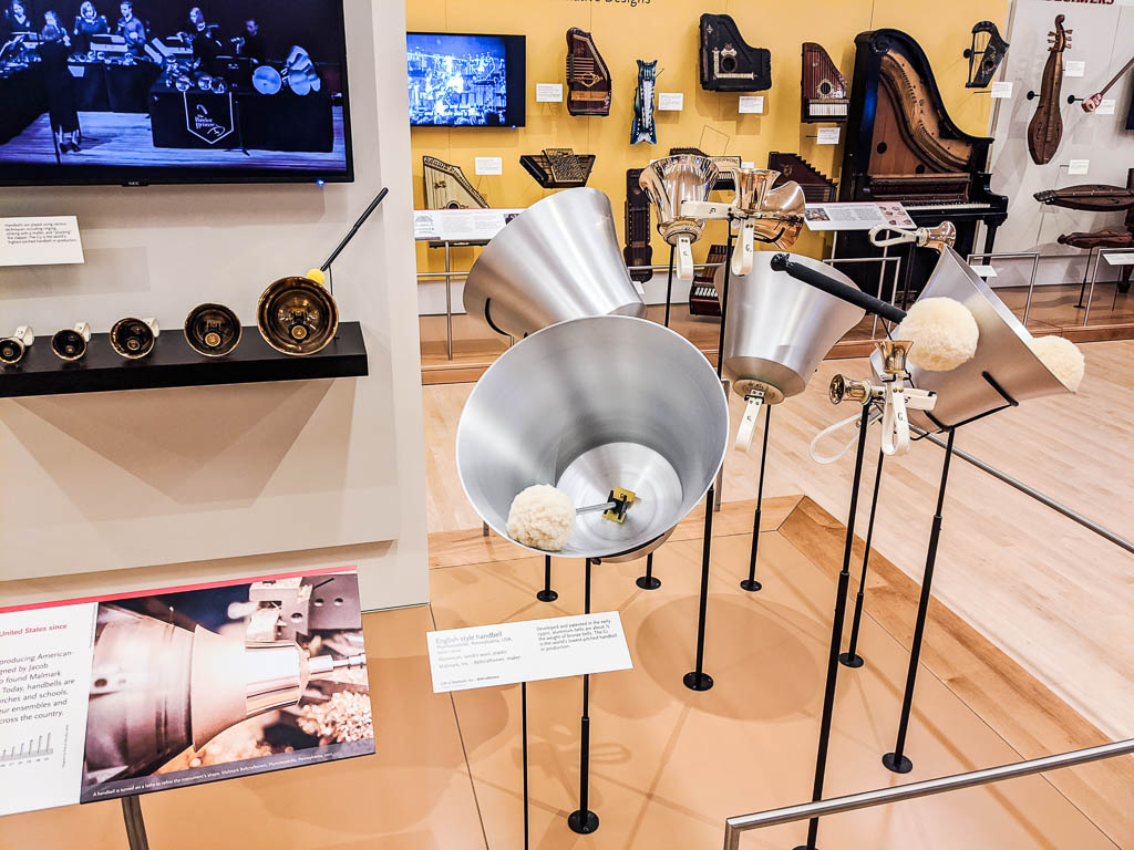
Nashua First Church bell choir, you need these! This G1 is the lowest-pitched handbell currently in production. Using aluminum instead of brass for the larger bells cuts the weight by half.
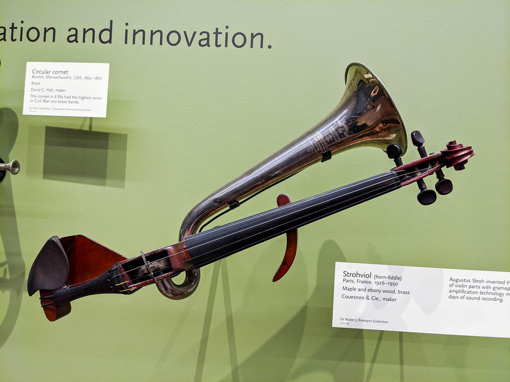
Is this a cross between a violin and a trumpet? No, it is a cross between a violin and an old-style phonograph. The horn is for amplification.
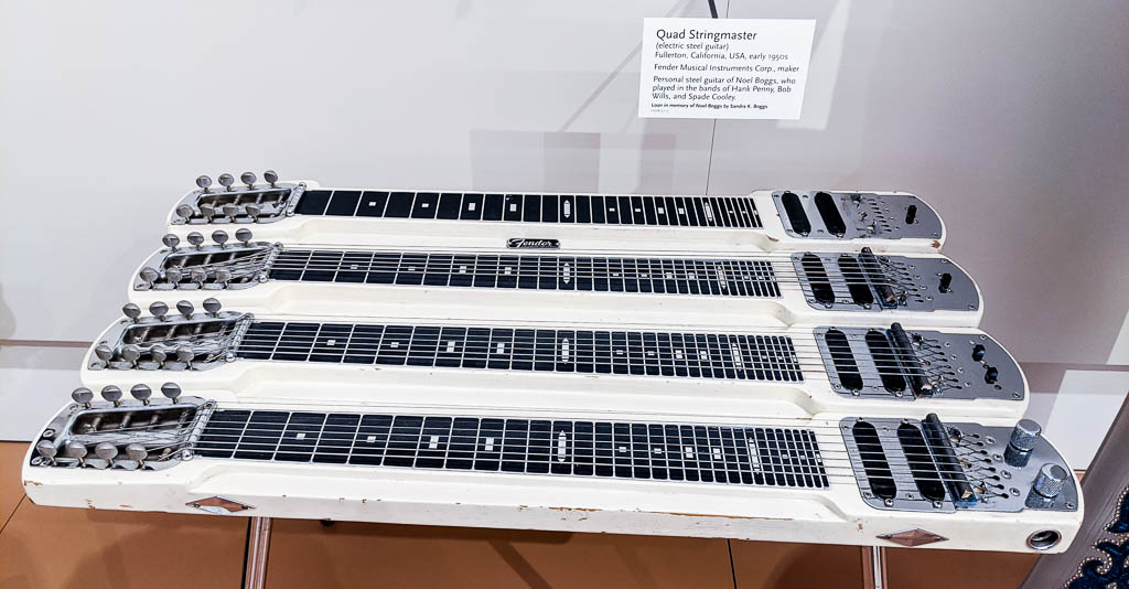
This next one caught my attention because of the WHY??? factor. It is an electric steel guitar with FOUR fingerboards… OK, you musicians out there. WHY? Is there a human 2.0 option for a few extra pairs of arms?
The Quad Stringmaster, by Fender
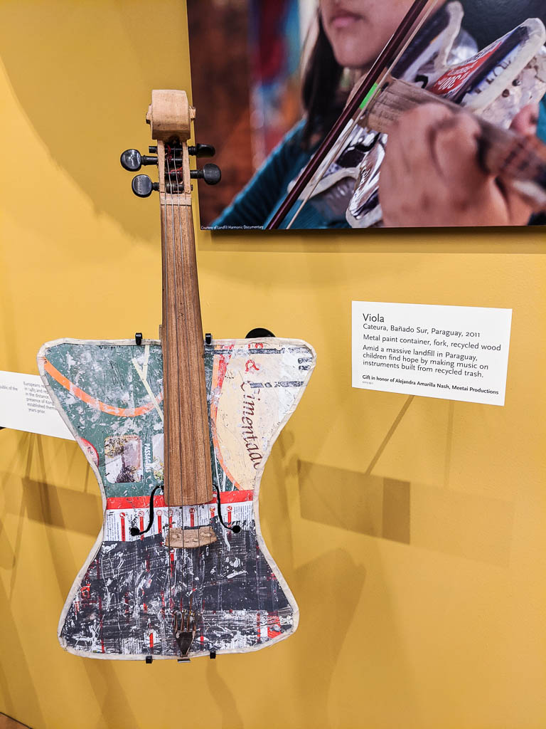
And finally, one that had me close to tears. Children in Paraguay scavenge refuse dumps, to make instruments from the waste they find. Here a viola (bowed lute) from an old paint can, using a discarded fork for the tailpiece. The urge to create music is strong!
Only now do we realize how much we were in “vacation, ” or “tourist” mode for all of last fall. Go here, see that.
It was a wonderful trip down to the Arizona desert in 2018, taking about 9,000 miles. Hope you enjoyed traveling with us via our posts. But we’ve not made many posts this year (OK, this is only the second one). We have entered fully into “living” mode in the RV.
Having left the northeastern corner of the country for the indeterminate future, we had to decide what to do with doctors. We could keep our current ones, but that would mean returning to Maine and MDI moderately frequently–not the easiest place in the world to travel to. So we decided to create a new locus for our health care needs.
Our current expectation is that the longest period of time that we will spend in any one place for the foreseeable future is here in southwestern Arizona. So we decided to use the Phoenix area as our new medical “home.”
Being the fifth largest city in the US, and being a mecca for retirees, Phoenix has a plethora of doctors: doctors with expertise in the vicissitudes of aging (ageing for those of you outside the US and Canada).
Also, being the 5th largest city comes with first world problems!
So, much of the last several weeks has been spent starting relationships with various doctors in the Phoenix area. One of the advantages of trips to Phoenix is that it has a great ham radio store (and restaurants, well-stocked supermarkets, other stores, and…)!
Kathe had an unresolved issue while being treated in Maine when it came time to leave, so her doctor put us in touch with an appropriate specialist in Phoenix and suggested that we get there sooner than later. Kathe was able to get an appointment in the near future, so this trip south was very different from last year’s. We basically plotted a straight line from Indiana to Quartzsite, and boogied on down with mostly one night stops and a few two nighters. Not the way we normally enjoy traveling, but possible. That’s why there haven’t been pics taking you along as we explored new places.
So beside saying “Aaaahhhhh,” and following the instructions to “Look straight ahead at the white light,” what else are we doing?
Mostly it has to do with people. We are enriching friendships with people we met last year and those we met 30 years or so ago. And making new friends.
Henk and Mary, renewing friendships from long ago. We’re in Palm Canyon, in Kofa NWR.
Kathe is getting back into quilting, and I’m starting (finally) to do some hobby programming. (I didn’t do ANY programming the first year of retirement, which stunned me.) We’ve gotten our bikes tuned up ready for some riding this winter. Kathe will be taking her first classes at the local Gem and Mineral Club in the next few weeks: silverwork, lapidary, and faceting.
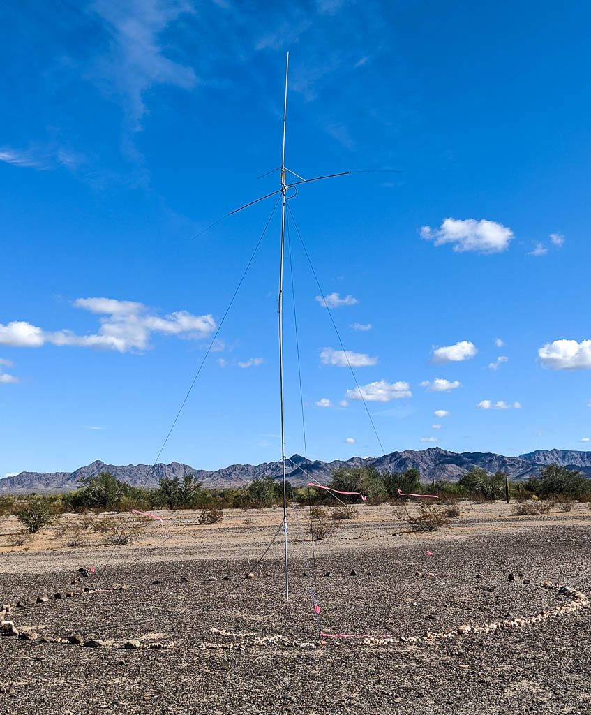
We have also returned to an old favorite hobby: amateur radio. You may know it as ham radio. We are in the process of putting up some antennas that will make it possible for us to make contacts not only locally but also around the country and hopefully, internationally. Kathe made three contacts yesterday — her first in more than ten years!
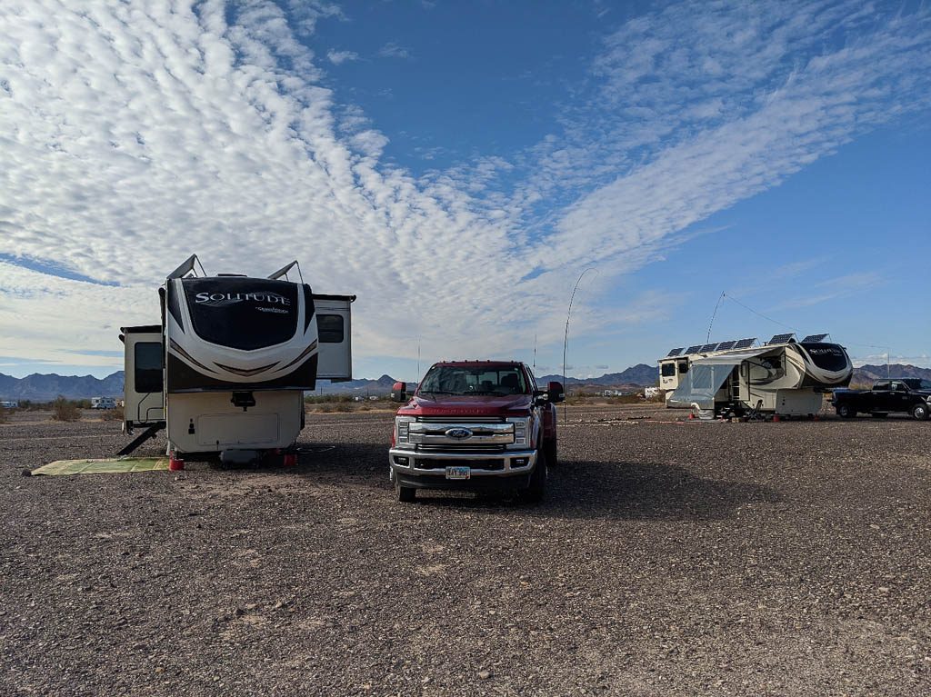
This year’s site on the desert is a bit of a “neighborhood” — we’re camped next to our friends James and Gloria. We’re farther back from the main road which means far less dust. We’ve edged our large “sites” with rocks and the areas around the antenna poles (we both have one) are landscaped with white quartz rocks. After all, this is Quartzsite; there are plenty available!
Our current ham antenna “farm”: a 40 meter dipole antenna for Kathe, and a 2m / 70cm vertical antenna for Al.(L to R) Rhett, Scarlet, James’ ham antennas, James and Gloria’s Solitude (our antennas are just out of frame, to the left).
Astronomy and night photography are very well-suited for desert skies. We are keeping better updated on meteor showers, etc. If we can successfully stay up late (always a challenge!) or get up during the night (even MORE of a challenge) to hit a the peak of a shower, we’re sure to be rewarded. It’s dark out here!
We also plan to do some exploring of the southwest this winter. We only did one local trip all of last winter, to Joshua Tree NP. We hope to do many more than that, and already have a trip planned to Death Valley in February.
Thank goodness for airplanes, cell phones, and the Internet. We’ve really felt the distance from family this fall and it’s been difficult at times. Fortunately, we were able to easily return to New England for some much needed family time last month. Before and after that visit, we’ve kept in touch throughout each day; the coverage here on the desert is pretty darned good right now. Distance is never insurmountable when love for family is of utmost importance.
As we look ahead to the holidays, it’s still kind of weird to see decorations available (including snowmen, icicle lights, etc.) at Lowe’s and Walmart alongside huge greenhouses spilling over with flowering shrubs, hanging baskets, and cacti—especially when the temps are in the high 80’s and low 90’s!
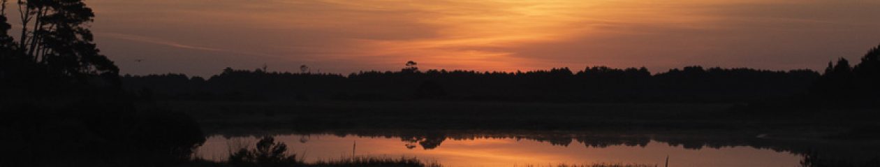
We know that the MDI area has been having some pretty spectacular sunsets recently, but this wouldn’t be a “Lobsters” post without one of ours.
OK… Without two of ours!
As always, we hope that this finds you well and enjoying life. Thanks for traveling with us, and keep in touch!
We’re finally reunited with Scarlett and Rhett! We were gone for exactly eight, very busy weeks, and it is good to be back!
Reunited! That’s the Grand Design service facility in the background.
With the help of friends, and through a combination of sales, gifts, donations to charities, and (many) trips to the town transfer station (no longer called a “dump”), our house on Mount Desert Island is completely empty and on the market. Do you want a house in great shape on the coast of Maine, right outside Acadia National Park??? Hey, you can’t blame me for trying. Both of our cars were sold.
So strange to see the house completely empty!Echo…echo…echo
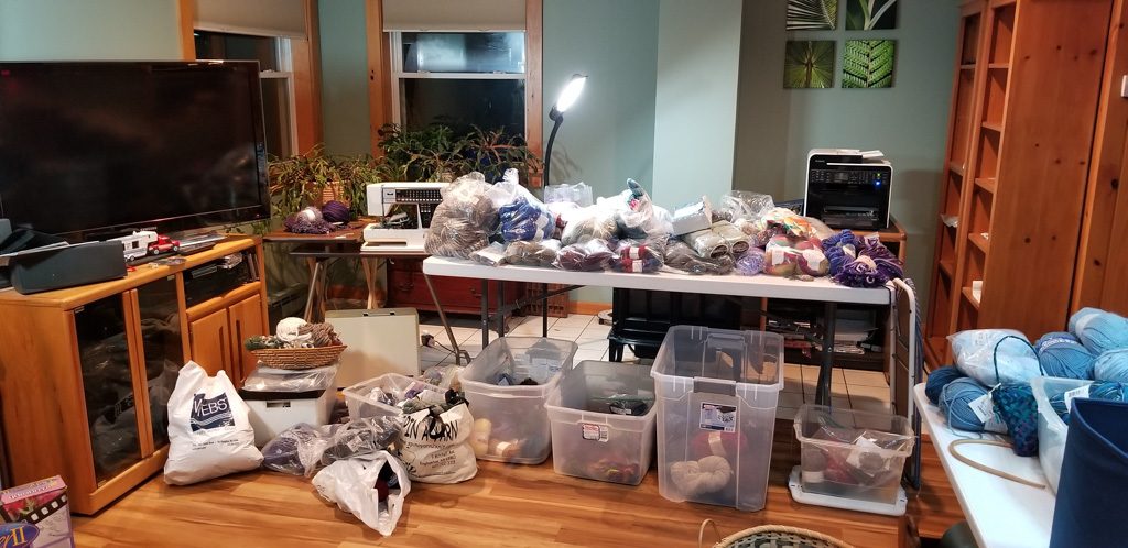
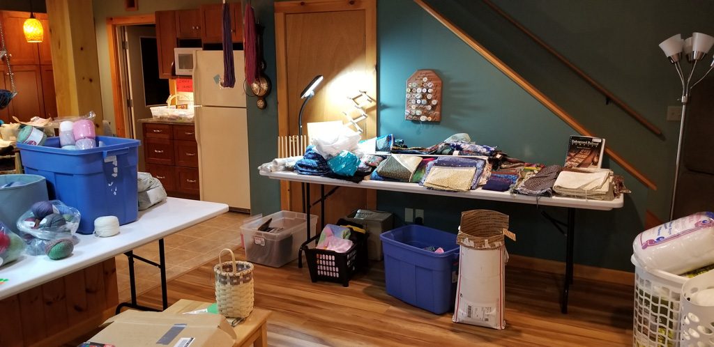
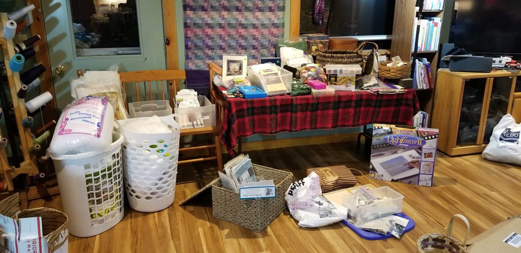
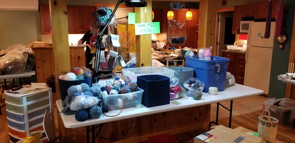
A highlight of the “sale” part of cleaning the house was Kathe’s MEGA fiber sale! Imagine 40+ years of “stash,” for spinning, weaving, knitting, and traditional rug hooking.
Yarns galore!Fabric for all you quiltersMiscellanyDid we mention yarn?
We saw many of our Maine friends, but certainly not all that we would have liked to. To those we weren’t able to see, we’re sorry; we simply ran out of time. On September 19 we started our trip back to Indiana to get back to our truck and rig. Why Indiana, the world capital of RVs?
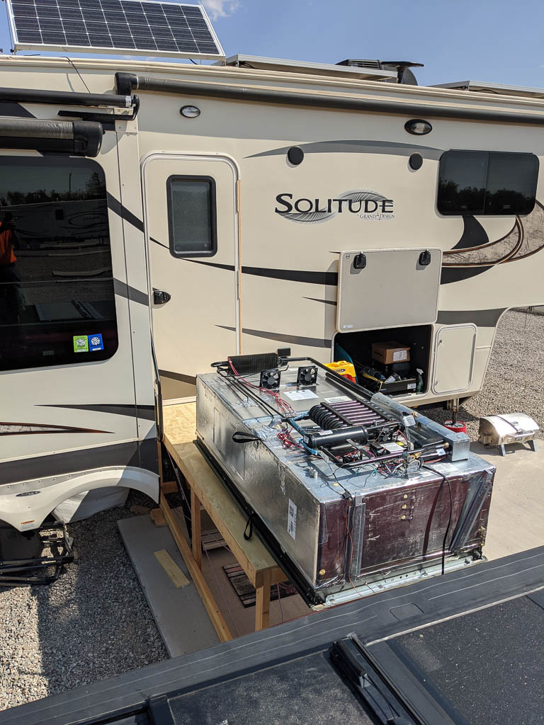
Well, we didn’t exactly blab about this at the time, although some of you know it by now. Back in late May, we had an accident with the trailer that damaged the left side pretty severely, but didn’t affect the driveability or operation at all. Since we had our Utah extravaganza with grandsons Graham and Dean coming up, we elected to defer repair until after their visit was over. Due to the extent of the damage, we asked the manufacturer, Grand Design RV, if they would put us in their repair queue. They agreed, so rather than leave the rig out west when we returned to Maine to get the house ready for the market as we had planned, we drove it to Indiana.
Repairs made, the trailer is as good as (actually, better than) new! We’re ready for more adventures!
When emptying the house, we were guided by the thought behind this strategy for de-cluttering. You may know it. Make three piles:
Things to keep,
Things to sell or give away, and
Things that should be thrown out.
All piles must be equally sized.
We did that, pretty successfully… But we were pretty aggressive—as if we had taken pile 1, and made three piles.
Some of the items from the small pile 1 we wanted to have with us, despite not having needed them over the past year—for instance, outplacing similar items we had acquired over the year when we noticed they were missing.
Other things in pile 1 were kept because we wanted to be able to save some memories for when we eventually come off the road and set up housekeeping in another “sticks and bricks” house. What to do with those? Fortunately, our son, Mike, agreed to store those at his family’s house. Thank you, Mike! So, rental van loaded, we started back to Indiana via Nashua, NH to see some of our “pre-Maine” friends, and Corning, NY to spend a week with Mike’s family (and drop off some of pile 1).
We’re going through the things we have in the camper, judging whether each has paid its “rent,” i.e., been useful / used enough to warrant the space and weight it has consumed. Books can be donated to the wonderful library in Quartzsite; we have our Kindle readers. Some fabric can be shared with the quilting group. We’re about to dramatically cull through our clothes, too; we’ve got much more than we need. It’s actually quite liberating to find ROOM in the RV as we get rid of things.
So here we are, heading back to Arizona for the winter even though the camper isn’t completely reorganized yet to accommodate the things we have bought with us but we’re making great progress. This brings back memories of our original game of RV Tetris.
Still lots of things which need a “permanent” storage place. Tetris, V2.
So…
Make three piles…
The start of a new “Pile 2,” in our truck’s back seat. Looking for a Goodwill store along our route…
Things are strange right about now. We’ve come off the road and are back on MDI, long enough to put our house on the market. (Anyone want a house on the Maine Coast, right outside Acadia National Park? Anyone?)
We’ve had a great time this past year and are looking forward to more adventures to come! But it is time for a bit of retrospection and possibly introspection.
How to describe the year? We can put some numbers on it:
359 days, door to door
858 hours of driving
27,851 total miles driven (Kathe has well over 25,000 of our miles!)
20,070 miles with the trailer. It is hard to believe that we roamed over 7,000 miles without the trailer. That was all day trips!
2 wonderful grandchildren for 3 weeks
28 National Parks, Wildlife Refuges, Monuments, etc.
30,206 pictures (And you thought we had posted a lot of pics!)
But those don’t really give a flavor of what we have experienced. If you have been following the blog you’ve seen many of the things we’ve seen, but not felt the impact of the openness of the west, nor had the many conversations we’ve had along the way.
The people we have met have been uniformly friendly, helpful, and as willing to share their journey with us as we have with them. Need a tool? Sure! Just put it on the table when you’re done.
Occasionally we’ve run across people who try to get into politics, but it has been very rare. Mostly, conversations have been about travel, enjoying the outdoors, families, rigs, and life experiences.
This country is huge! Having lived our entire lives in the Northeast, we had never known anything but the relatively dense population there. Once across the Mississippi river, you start to be aware that you’re driving for many miles without seeing any structure or other evidence of people.
Our country is beautiful, and varied (witness the 30,206 pictures)! We kept commenting to each other about beautiful scene after beautiful scene as we drove along . We had to be careful not to stop too frequently for photography, or we would have never gotten to our next destination.
When we started, we wondered what it would be like, to be sharing a roughly 300+/- square foot “house” with basically two rooms. We’re happy to report that it hasn’t been a problem at all.
When we started, we said that we’d live full time in our RV for a year before deciding whether to sell our house on Mount Desert Island. The six-month mark came, and we started to make those plans. Now that we’re at the year point and back on the island, we know that it is still the right answer for us.
We’re rattling around in our “large” (compared to the trailer) house, wondering why we ever thought we need so much space—and stuff. As we get ready to sell our house we have to part with things from our past. Most of that seems to not be a problem, but other things, like about 50 years of pictures… well, that is a bit harder. And as most men who have made this transition will tell you… “My tools!” Yeah, I won’t have all my tools! Being brought up with the viewpoint that it was important to have the right tool for whatever it is you’re trying to do, it is really hard to get rid of my tools.
Hard to get rid of in another way is all of our ham radio equipment. There’s just not much of a market for it. While we (especially Kathe) will still be involved in ham radio on the road, it will be done in a different way. Small radios. Small antennas (a bit of an oxymoron, that). There is no room in our 36′ trailer for a ninety foot plus antenna tower, and antennas that measure over 40′ by 20′ on top of the tower. So a lot to get rid of.
We know that we’ll need to come off the road at some point, determined either by health (no news there!) or by a yearning to settle down. But right now, that seems like a long way off. We’ve absolutely loved our past year and are looking forward to continuing for the foreseeable future. We hope that you’ve enjoyed traveling along with us, and that you’ll continue to share our adventure.
We’re still the Lobsters, but, for a while at least, we’re no longer “on the loose.” So we’ll take a break from the blog and pick it up again when we’re back on the road—probably in early October.


")