Category Archives: Nature

Posts about places showing the beauty of the natural world.

Sunrise, Sunset: swiftly FLY the days

Each sunset marks another day of our adventure together.

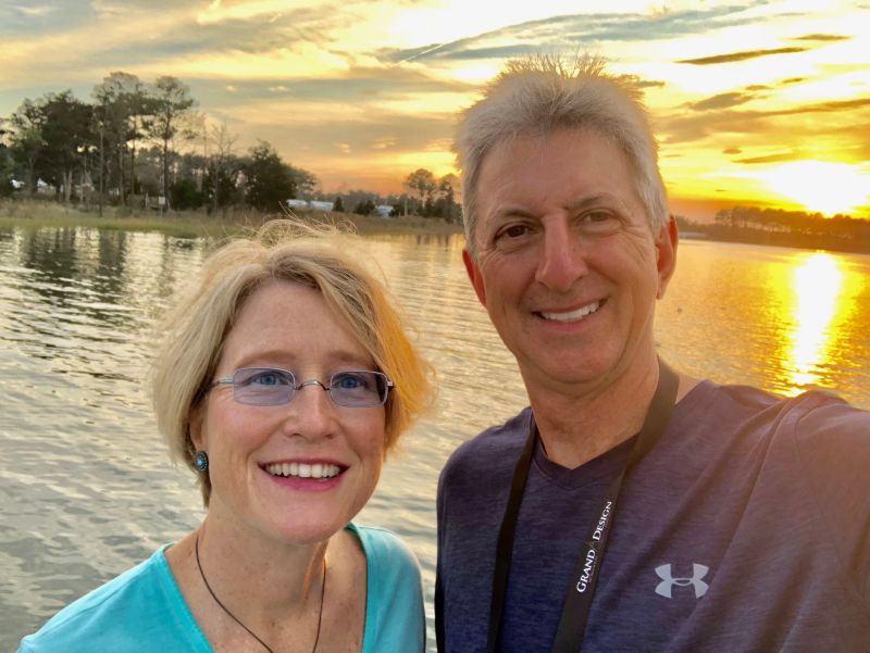
Al: “I retired seven months ago today.”

Kathe: “That’s not possible!”

We’ve been living here on the desert for over three months. The time has gone by so quickly. We are now starting to plan our spring and summer travel; it is almost time to leave.

We’ve come to love it here on the desert. At our own choosing, we can be quiet or busy—with friends or on our own.  And, with apologies to all our family and friends still in the colder climes, the weather hasn’t been too bad, either!

Palm Canyon

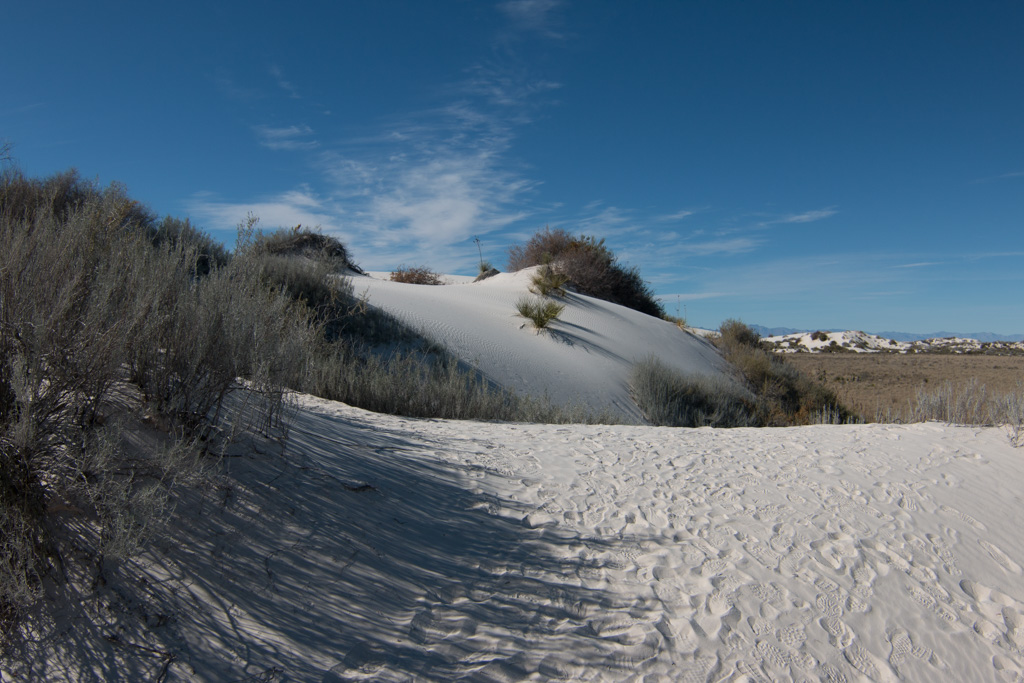
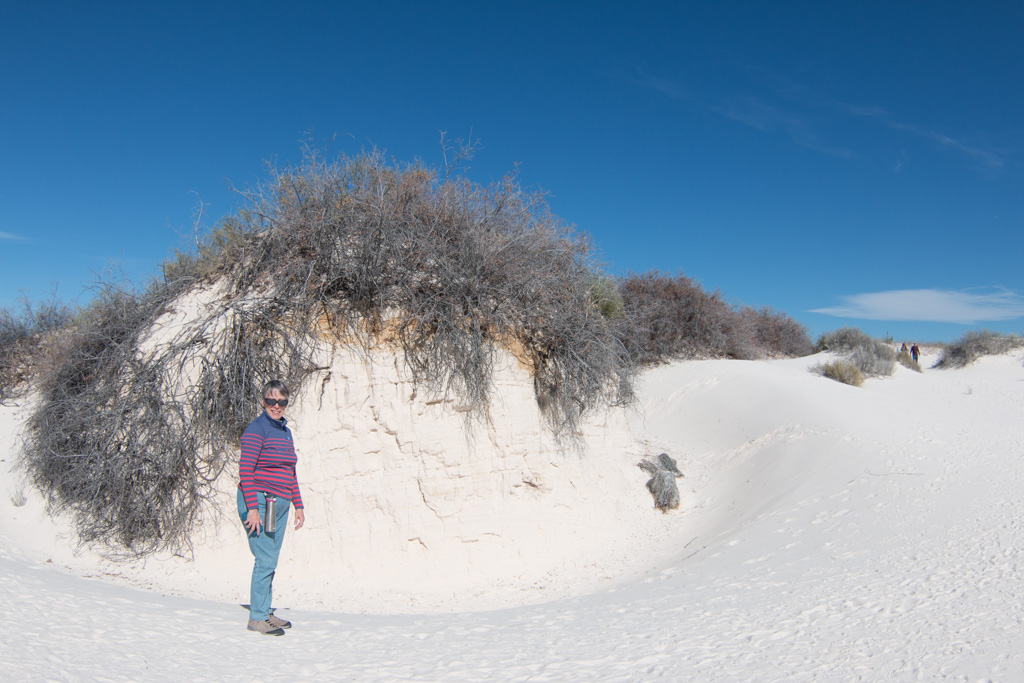
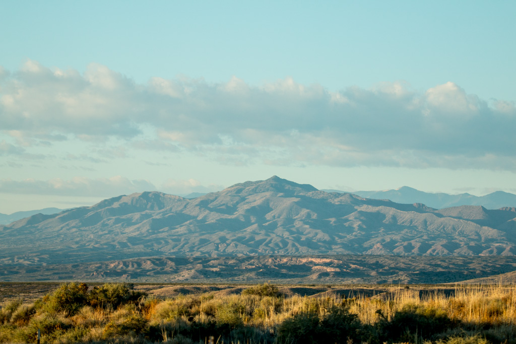
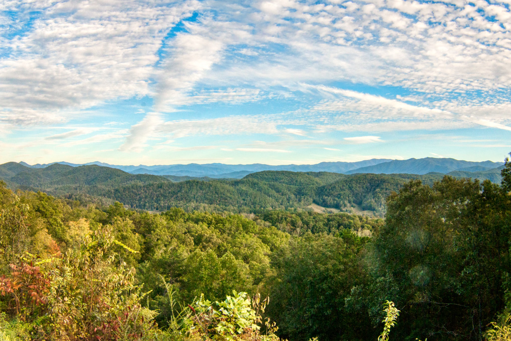
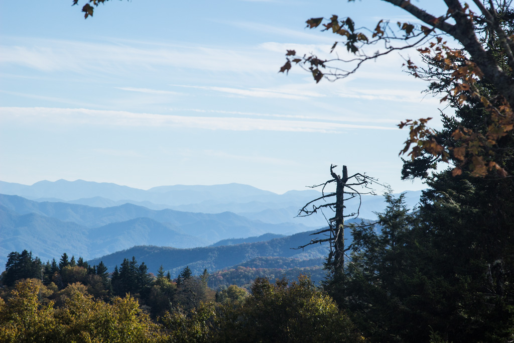
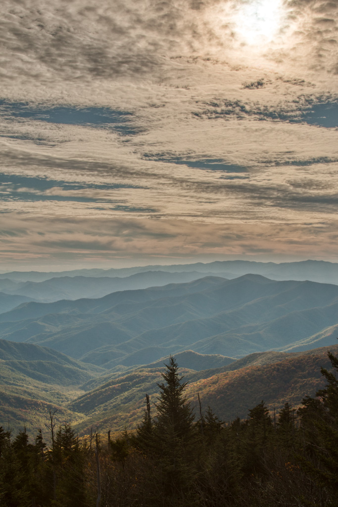
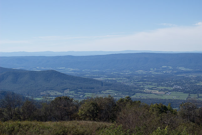
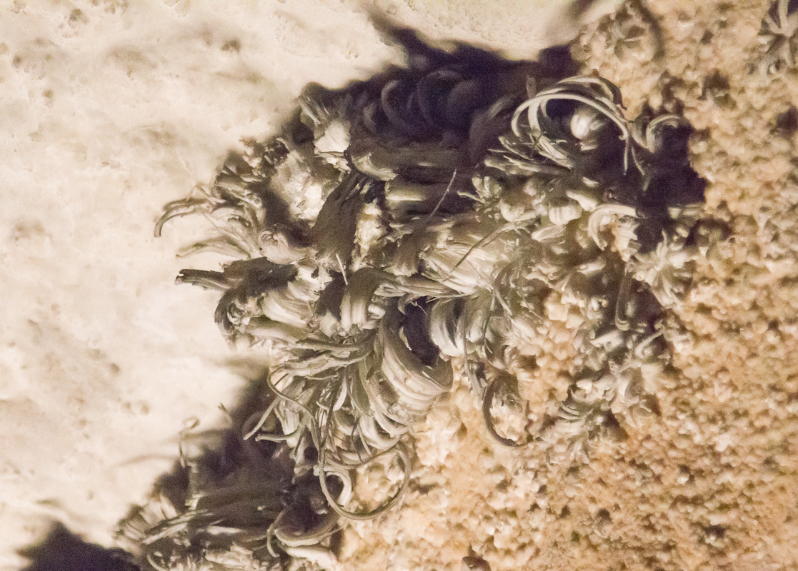
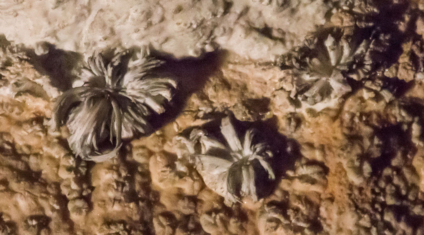
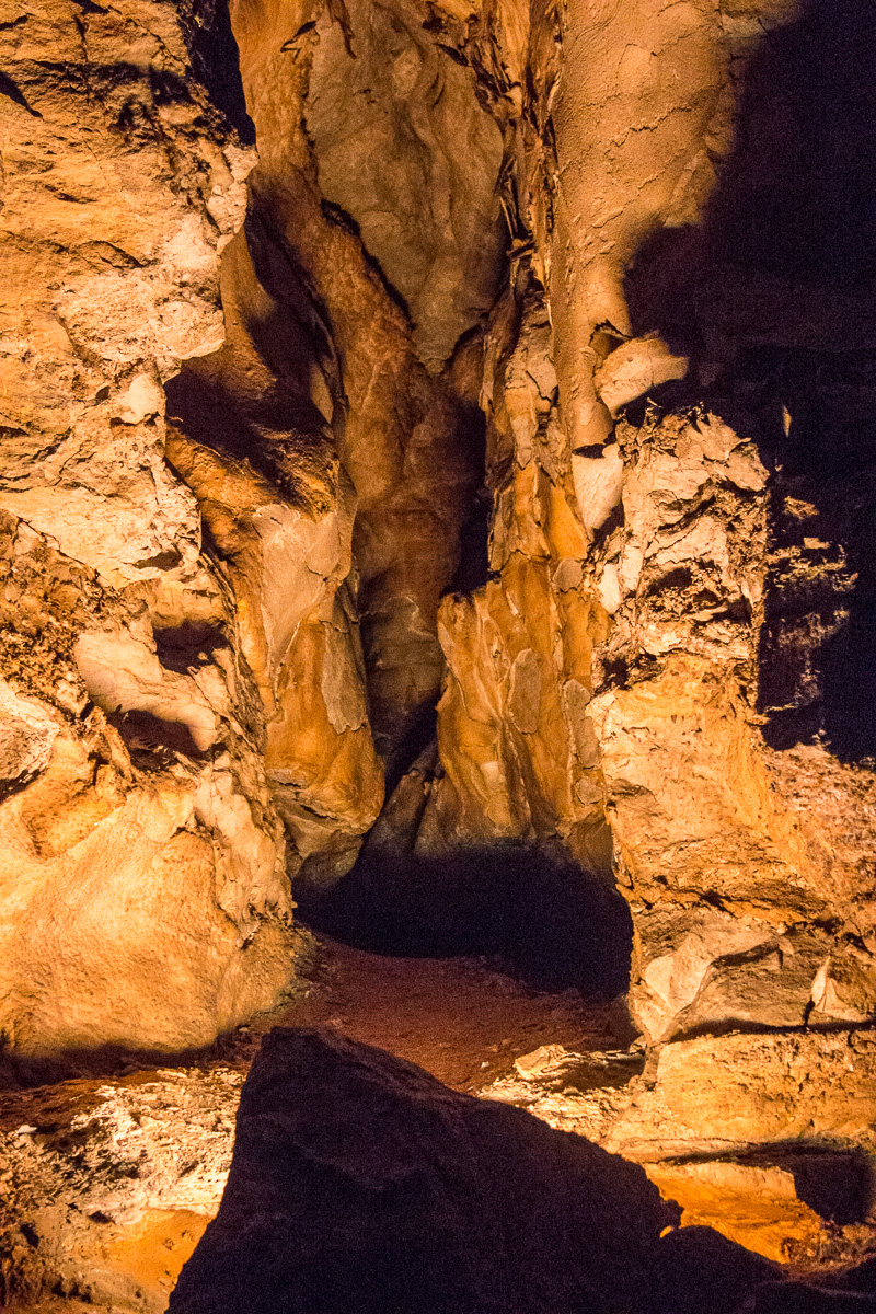
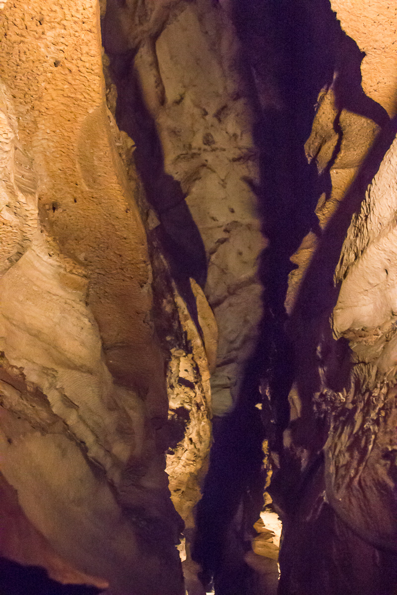
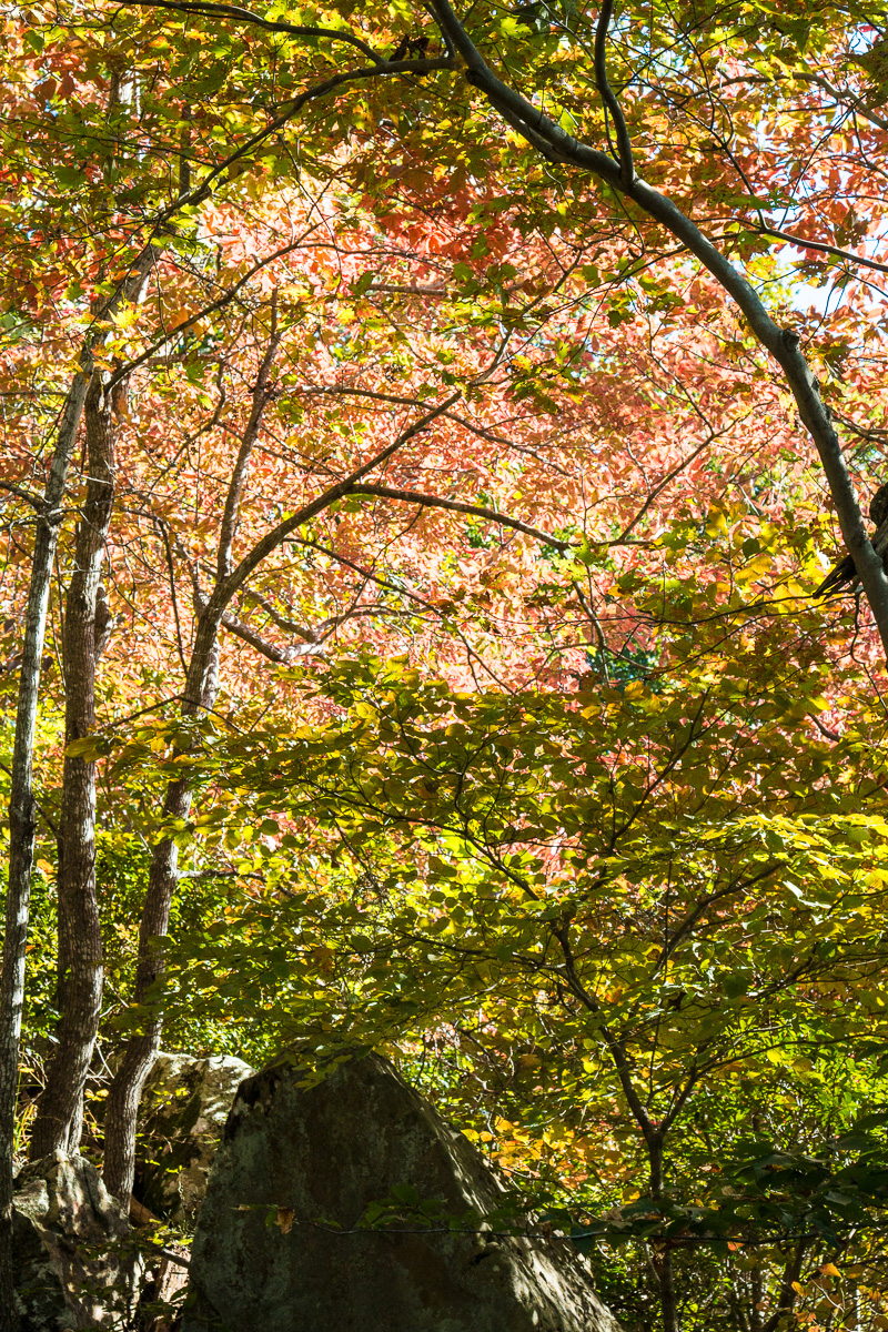
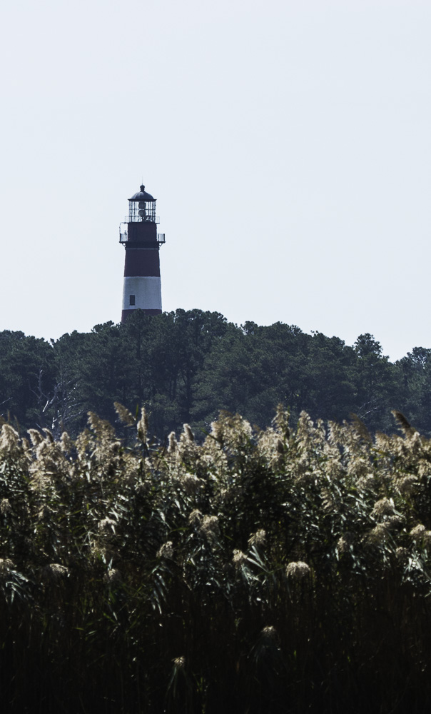
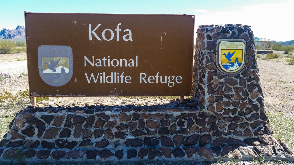
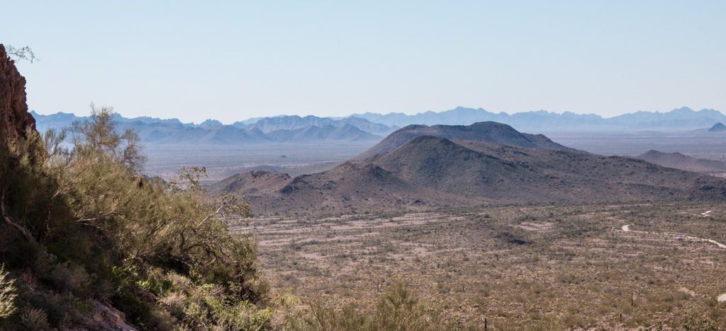
Last week, we went with some friends to Palm Canyon, in the Kofa National Wildlife Refuge. According to this, it is the last place in Arizona that California palm trees grow in their native environment. A nice one-mile in-and-out walk, it was our first time up actually near the mountains that surround us.

Entrance to the NWR: Several miles down a dirt road.
We’re walking back in there! The start of the Palm Canyon trail, yet several more miles down the dirt road.
Kathe, on the trail!
Surrounded by the remains of volcanos

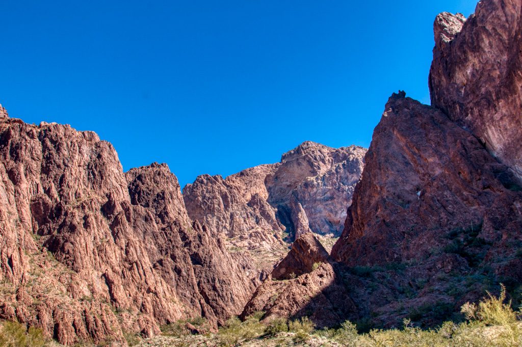
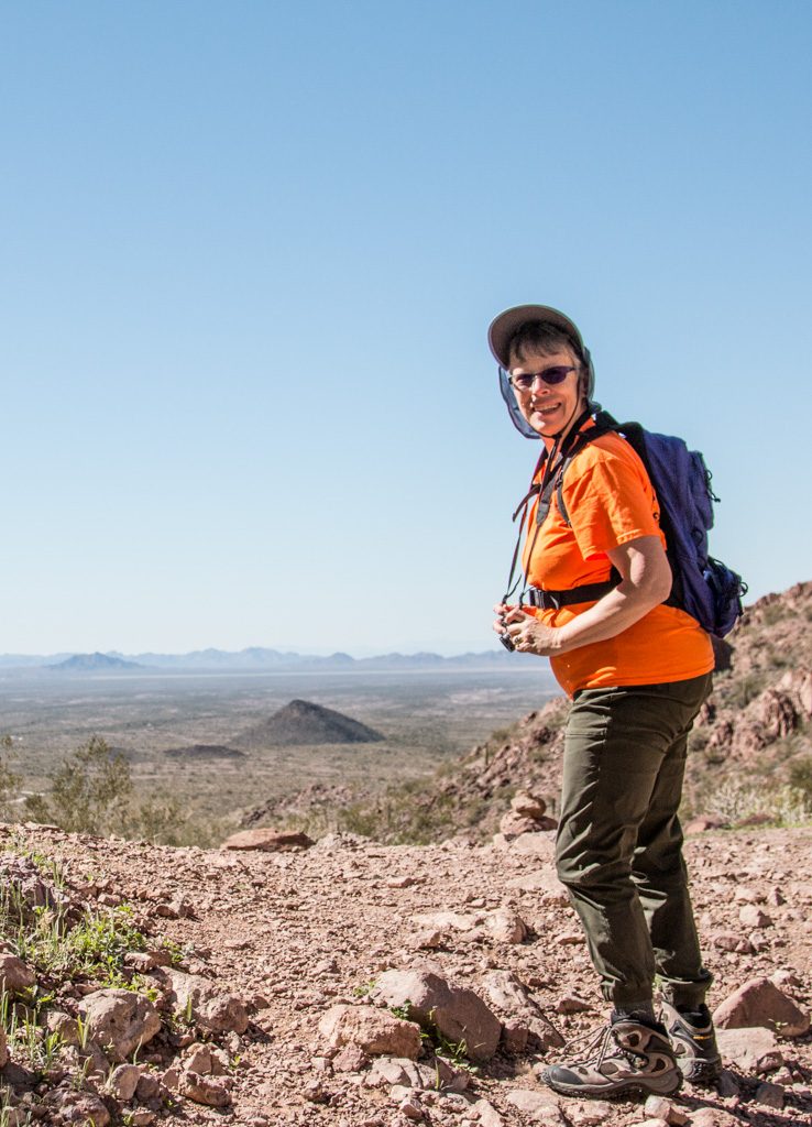
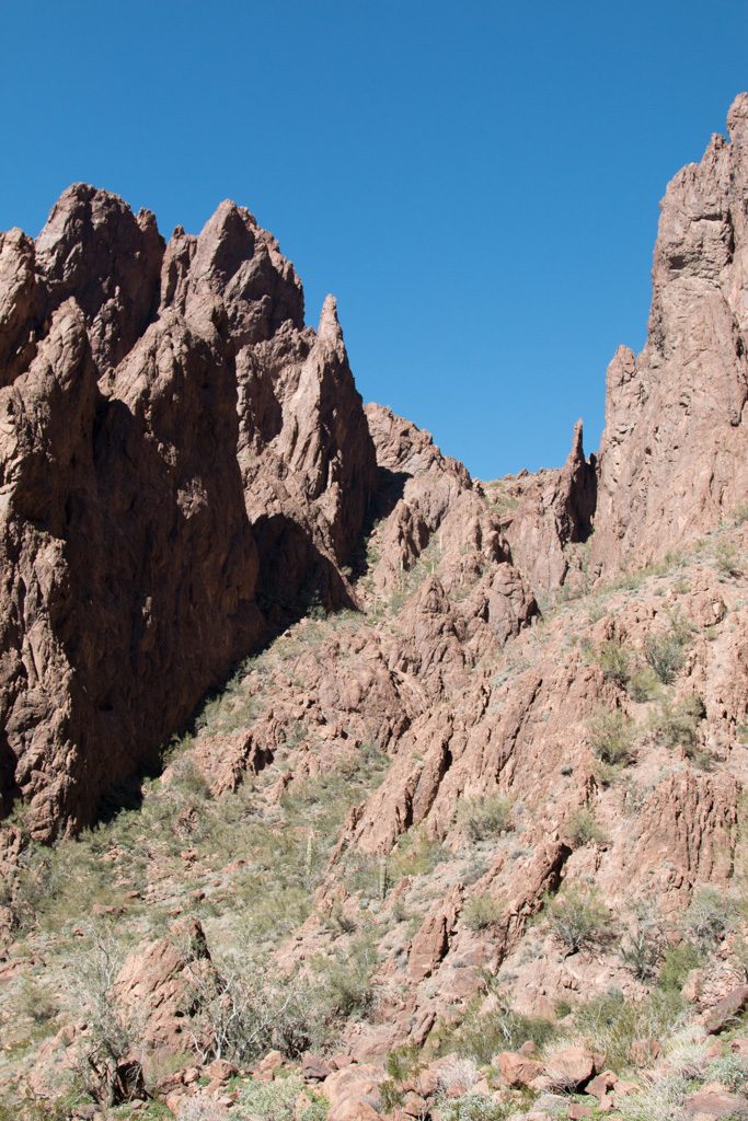
A comment I had read on the net said that the viewing point was a half mile up the trail, but that the palms themselves could be reached in an additional third of a mile “up a fairly steep trail.”

Yeah. Got rope?

At the viewing point.
“Up a fairly steep trail.” Yeah.
A closer view. Longer lens; we didn’t go toward the palms past the viewing point!

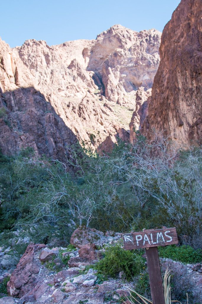
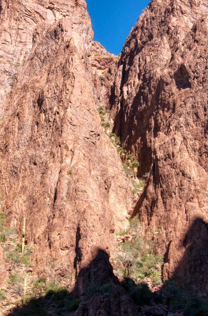
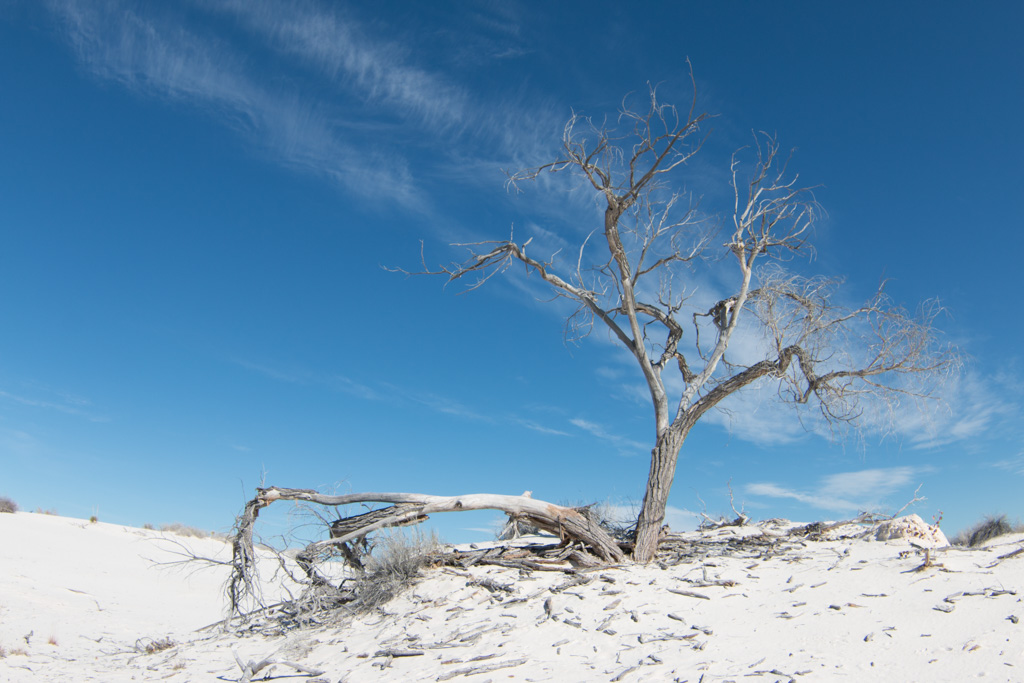
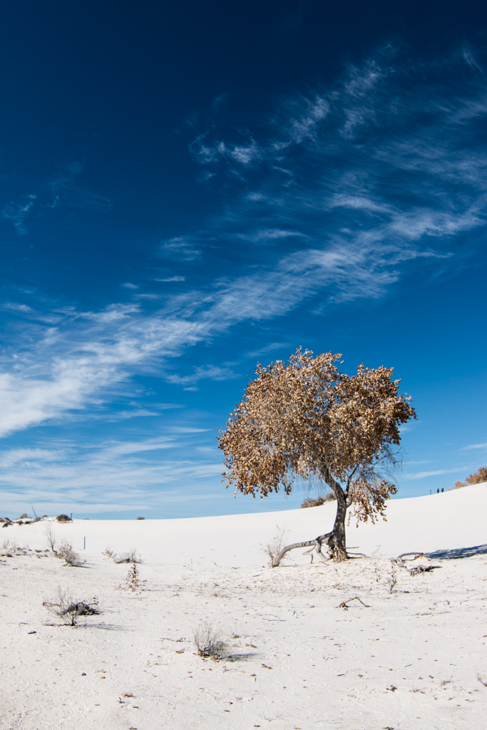
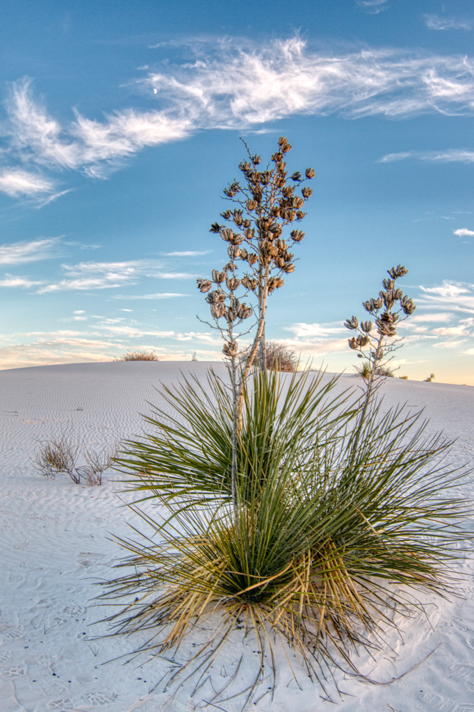
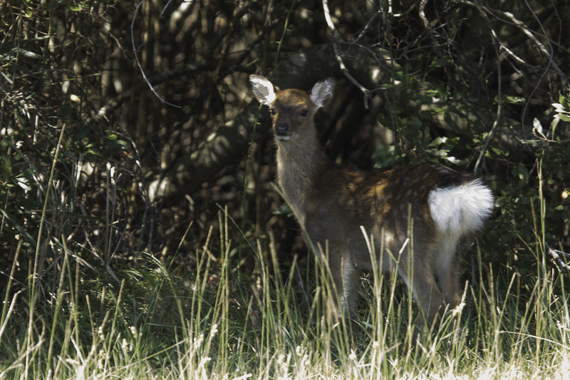
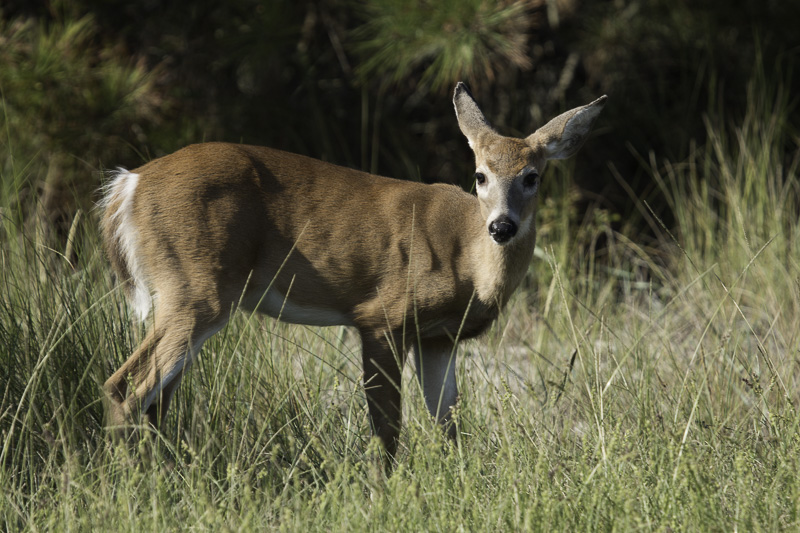
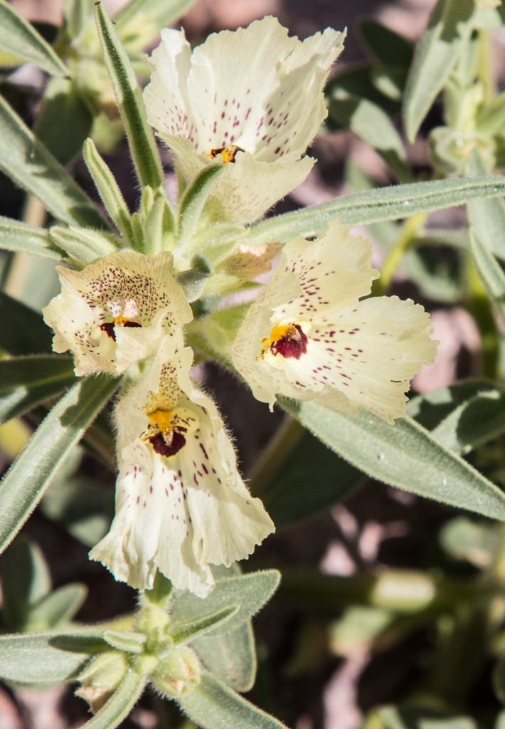
The desert is greening up. We’ve apparently had an unusually large amount of rain this winter. A person we met on the trail said that in a normal year, this scenery would be brown.

Not lush like in non-desert areas, but there is green there!

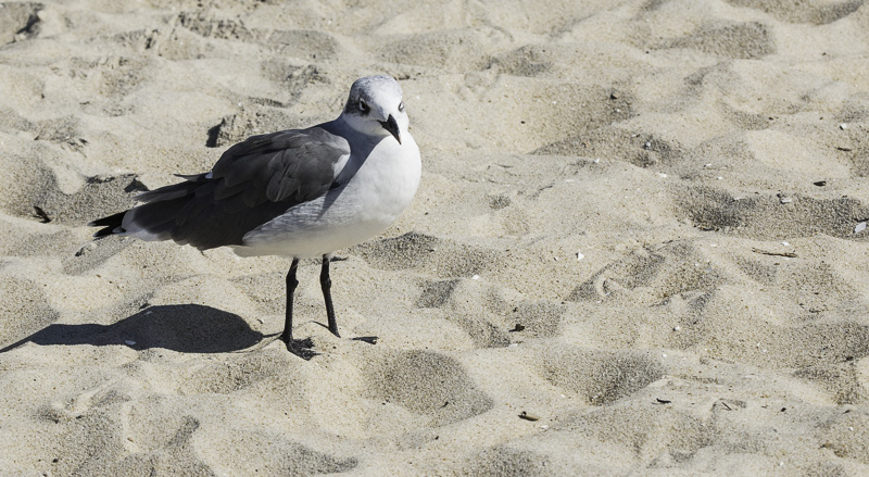
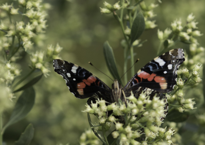
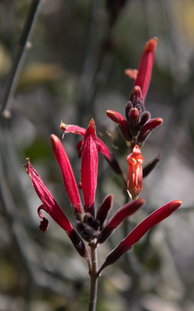
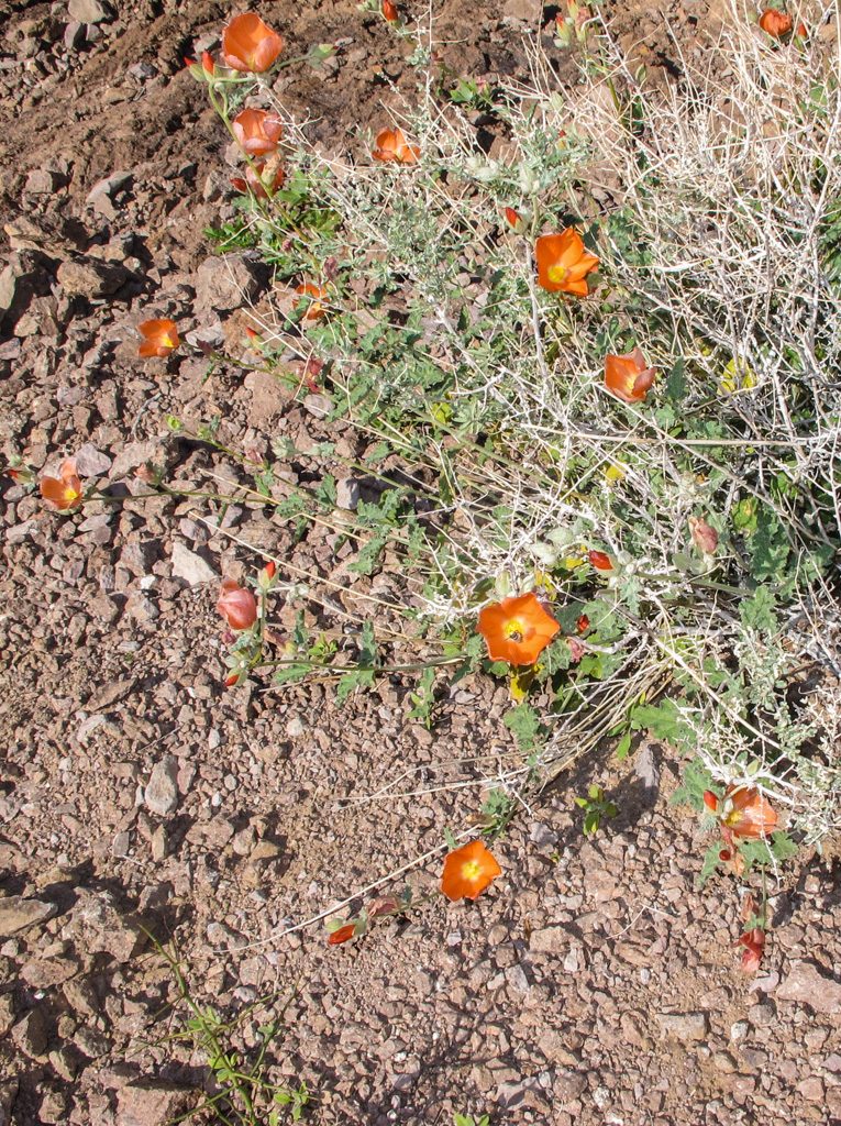
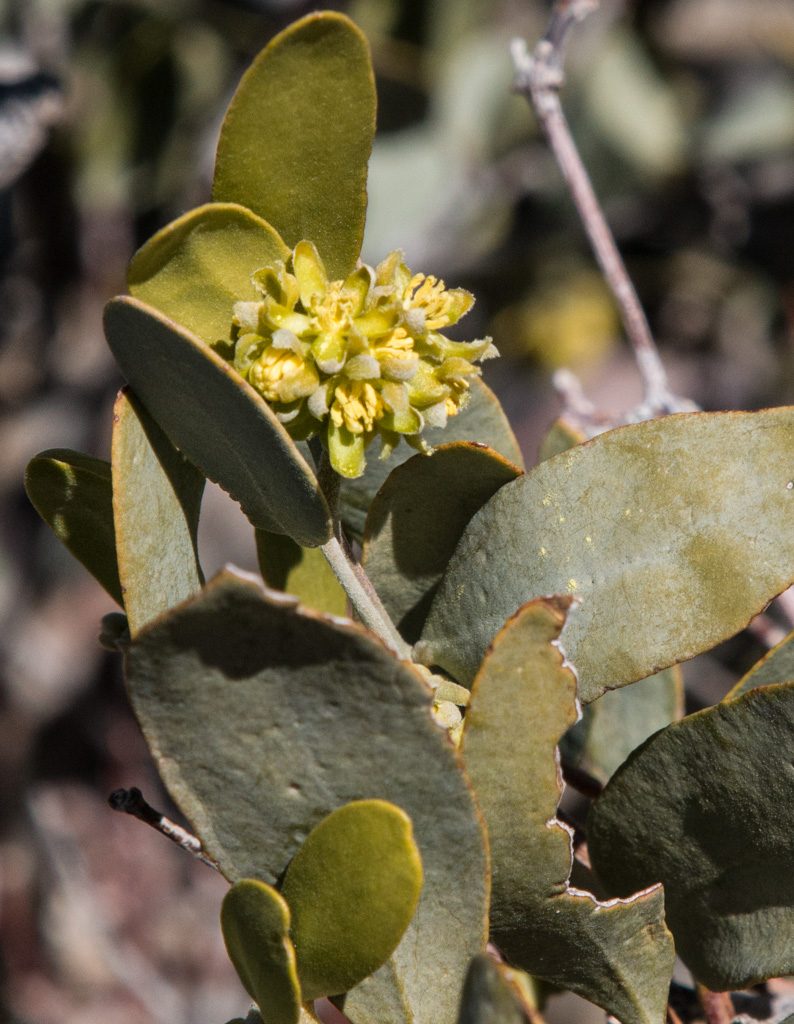
And we’re starting to see some flowers blooming. We hope to see more of the “desert bloom” when we go to Joshua Tree National Park in California for a few days this week.

The “ghost flower” (Mohavia Confertiflora). The petals are translucent!

Et cetera

So what else have we been doing these “desert days?” Some of it we’ve written about before, like Kathe’s quilting, the rock and gem shows, and our trip to visit Mike’s family over Christmas.

Out of town

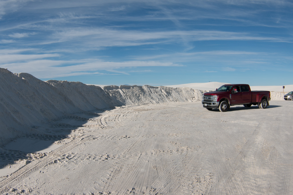
We had been warned that for a few weeks in January Quartzsite is an overcrowded madhouse with long lines, terrible traffic in town and so on due to multiple rock and gem shows, and a big RV show. Additionally, the population on the LTVA (BLM’s Long Term Visitors Area), where we are living, swells. We wanted to avoid all that humanity if we could.

Fortunately in addition to the LTVA, the BLM has six “fourteen day” camping locations in the Quartzsite area. These sites have no services whatsoever, but are free to camp in for 14 days. After that you have to leave for at least fourteen days. If you want to continue to use free BLM land in that time period, you must move at least 25 miles away.

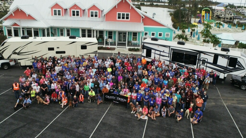
We were fortunate that we had two back-to-back events at a fourteen day area three miles farther out of town than we normally reside: a (yes, another) Grand Design RV owners’ rally, and a ham radio gathering, “Quartzfest.” These allowed us to avoid the worst of the Q-crush. Just to experience the big RV show in town we did ride our bikes there one afternoon; no way we were going to try to drive in and find a parking space. For all the hype surrounding the “big tent” show, we were unimpressed.
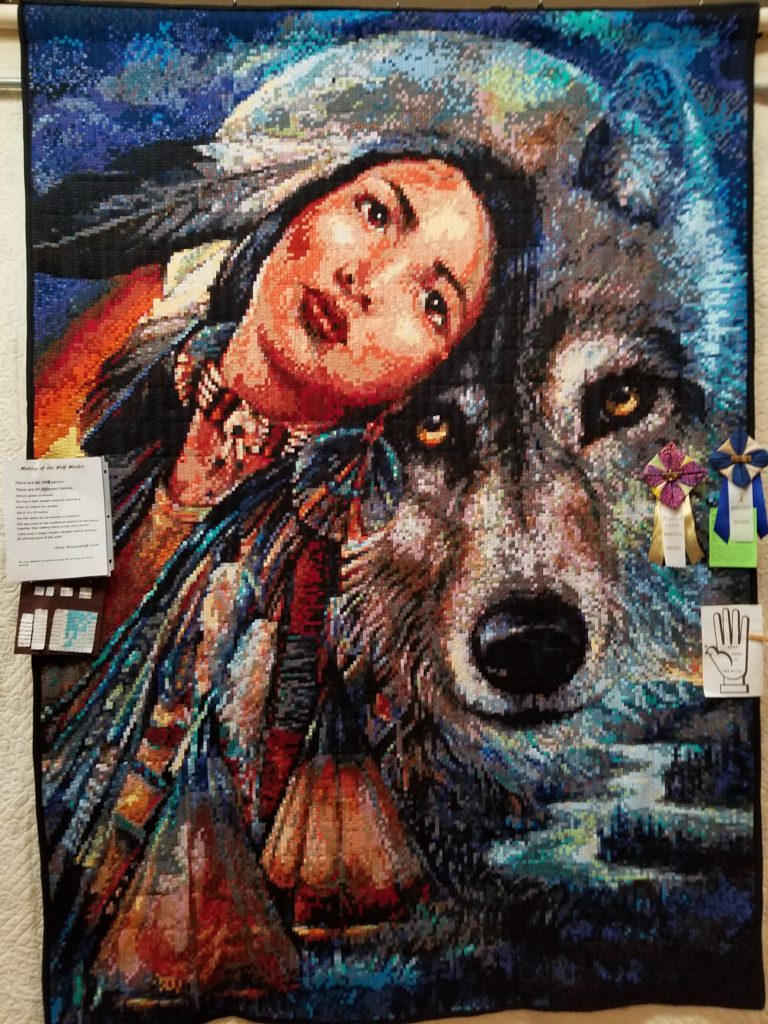
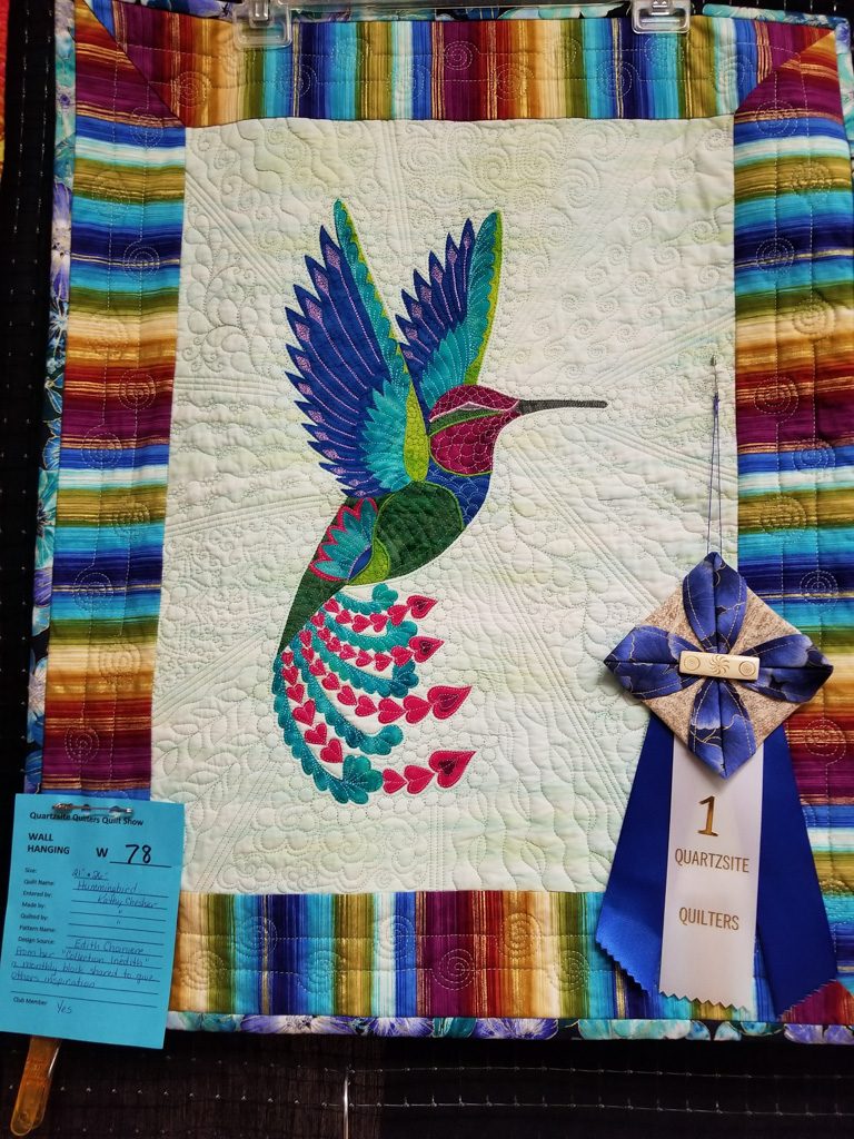
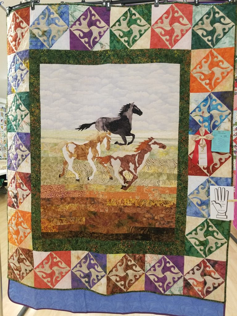
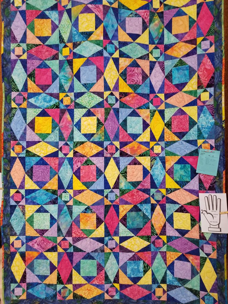
Quilt Show!

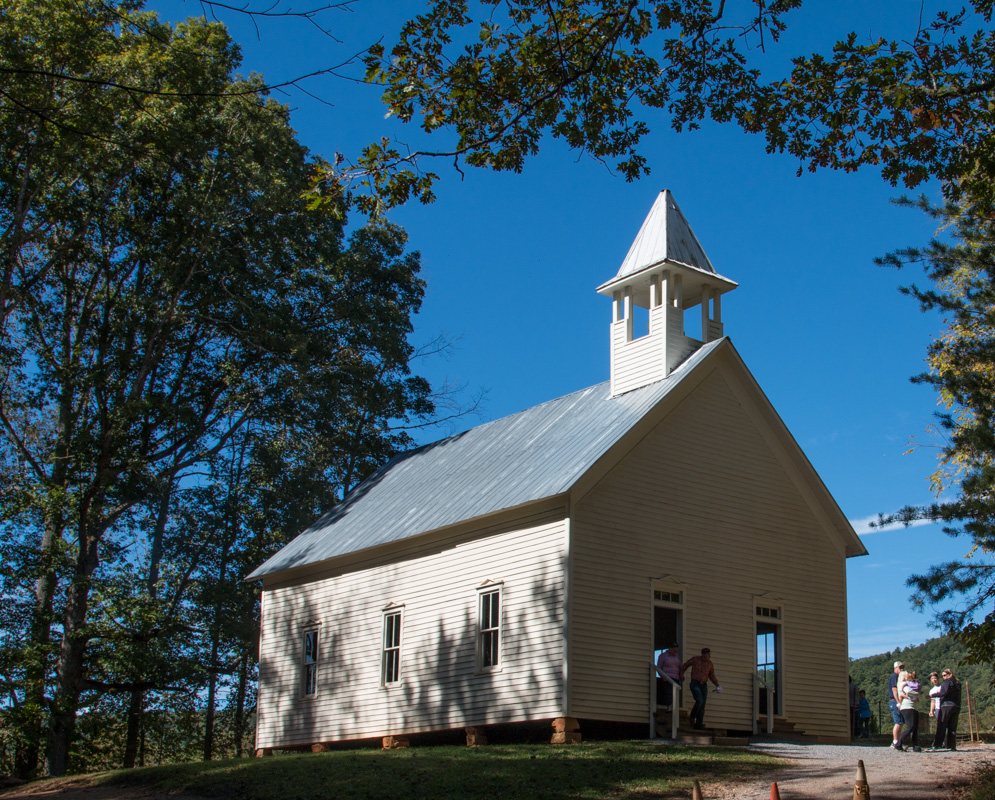
We had fun helping with the Quartzsite Quilt Show put on by the local quilting group Kathe is part of! I helped set up (and tear down) the exhibit space, and Kathe was busy before, during, and after the show. The quilts were quite impressive.

“Wolf Maiden” by Janet Nieuwenhoff. More than 68,000 1/4-inch squares.
“Hummingbird” by Kathy Chesher
“Running Free” by Kathy Chesher and granddaughter Kaylee Wilcox
“Storm at Sea” by Cara Osmin

Road Trip: Yuma

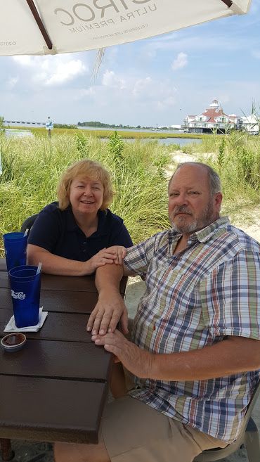
We spent a week in the Yuma area, staying at BLM’s Imperial Dam LTVA in California with “blast from the past” friends, Henk and Mary.

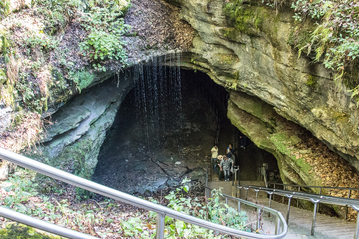
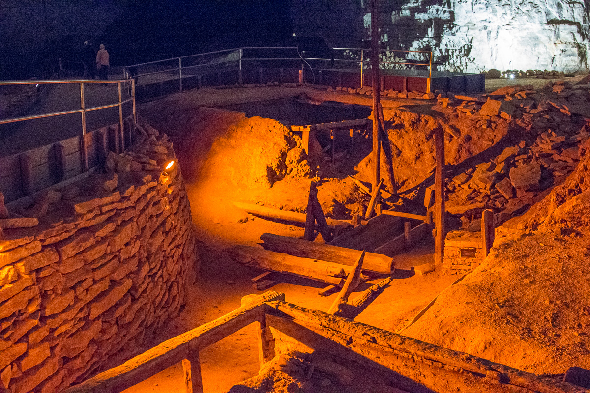
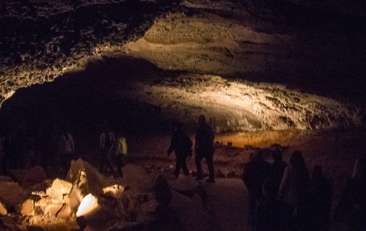
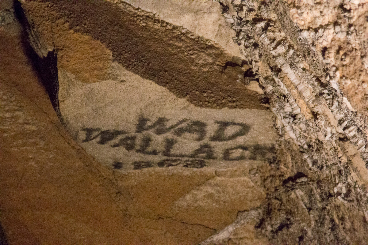
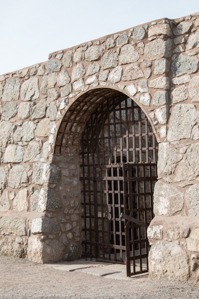
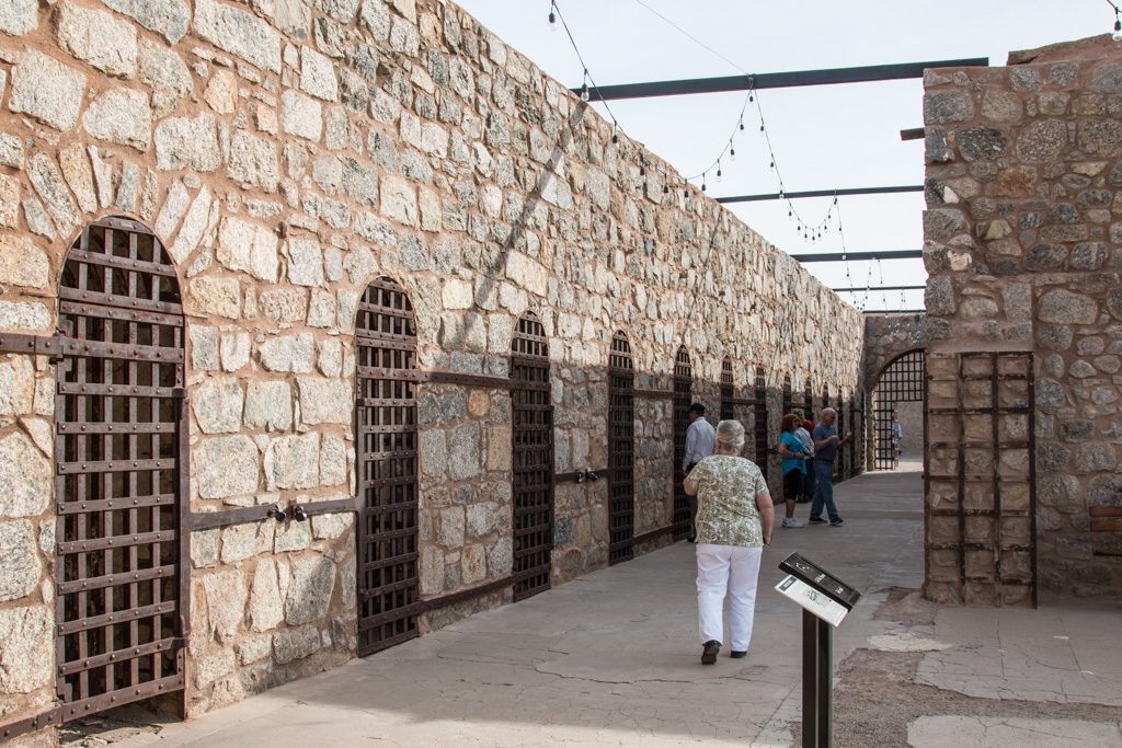
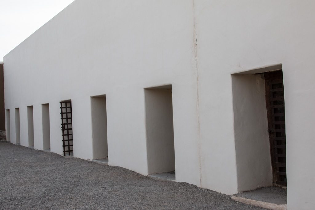
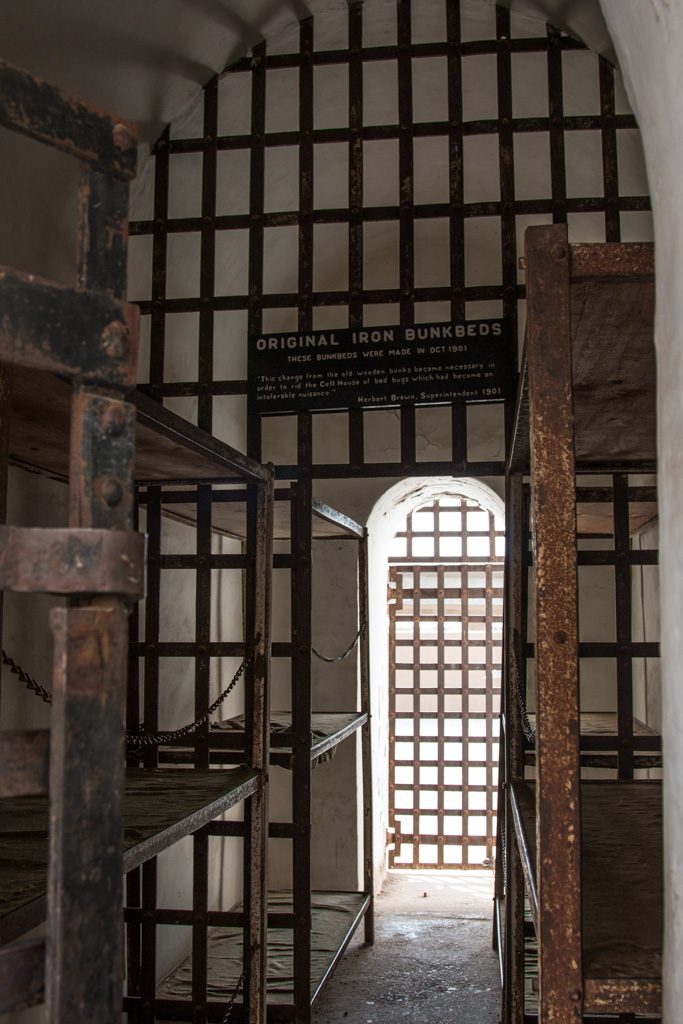
Arizona didn’t become a state until 1912; Yuma had Arizona’s first prison, in use from 1876 to 1909. A portion of the prison, now called the “Territorial Prison,” is preserved as a state park (part was long ago demolished to make way for a railroad line). There is a museum with many displays about prison life. One showed interesting information about the prisoner demographics; some that stuck out to me were that most of the prisoners were considered to be literate, and virtually all used tobacco of one form or another.

Entrance sally port into the prison.
Some of the timeline stones…
The original cell block. The doors had a second identical grate about 18″ inside; the two were interlocked so that it was impossible to open both at the same time. Only a few of the cells still have this mechanism intact.
The “new” cell block. The interlocked double-gate mechanism seen in the old cell block did not seem to be used here. (Remember, the prison was shut down in 1909.)

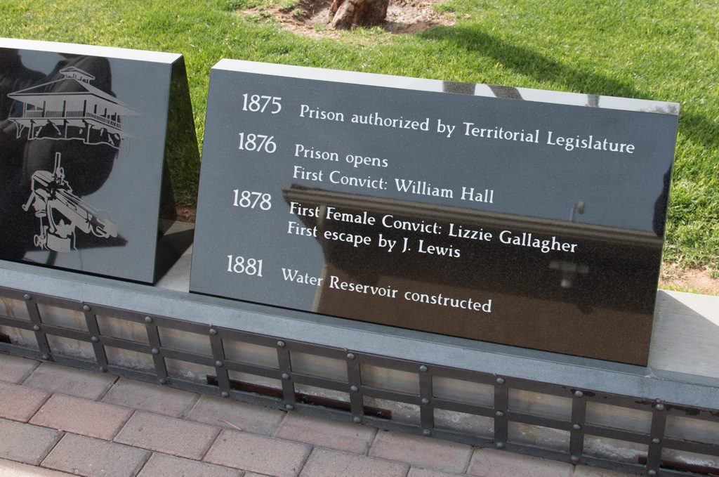
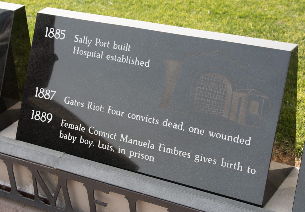
The territorial prison had enlightened leadership. From one of the museum displays:

The Prison had more modern amenities than most homes in Yuma, and Yumans resented that.

  • Electricity
  • Forced Ventilation
  • Sanitation, including two bathtubs and three showers
  • A library with 2,000 books, the most in the Territory at the time
  • Enlightened, progressive administration
  • Even a Prison Band!

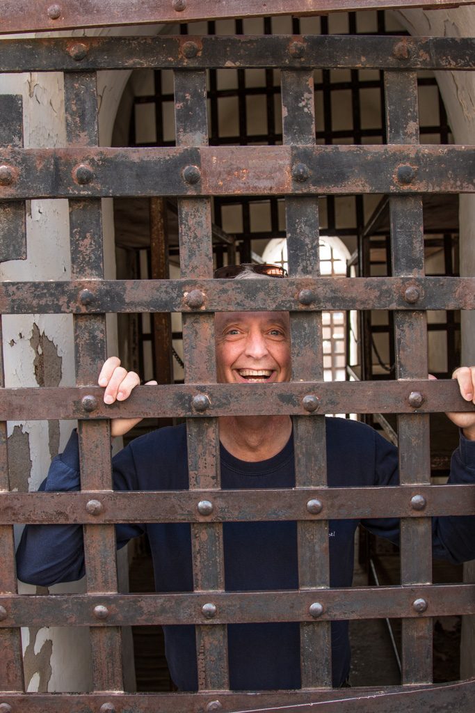
Some of the cells are open to enter, and, of course, pretend to lock your friend in!

Each cell housed twelve inmates, and was exposed to the weather. Note the steel bunks. Ouch!
Prisoner Al!

From Yuma, Kathe went to Corning to play Grandma Lobster, giving Mike and Laurelyn the opportunity to travel during school vacation week. While Kathe was gone, I went to another ham radio gathering in Yuma.

By the time we got back to Quartzsite it was obvious that the exodus had begun. The desert is emptier again; so is the town. People have started heading north preparing the way for us.

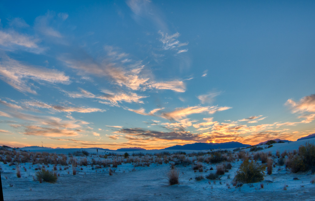
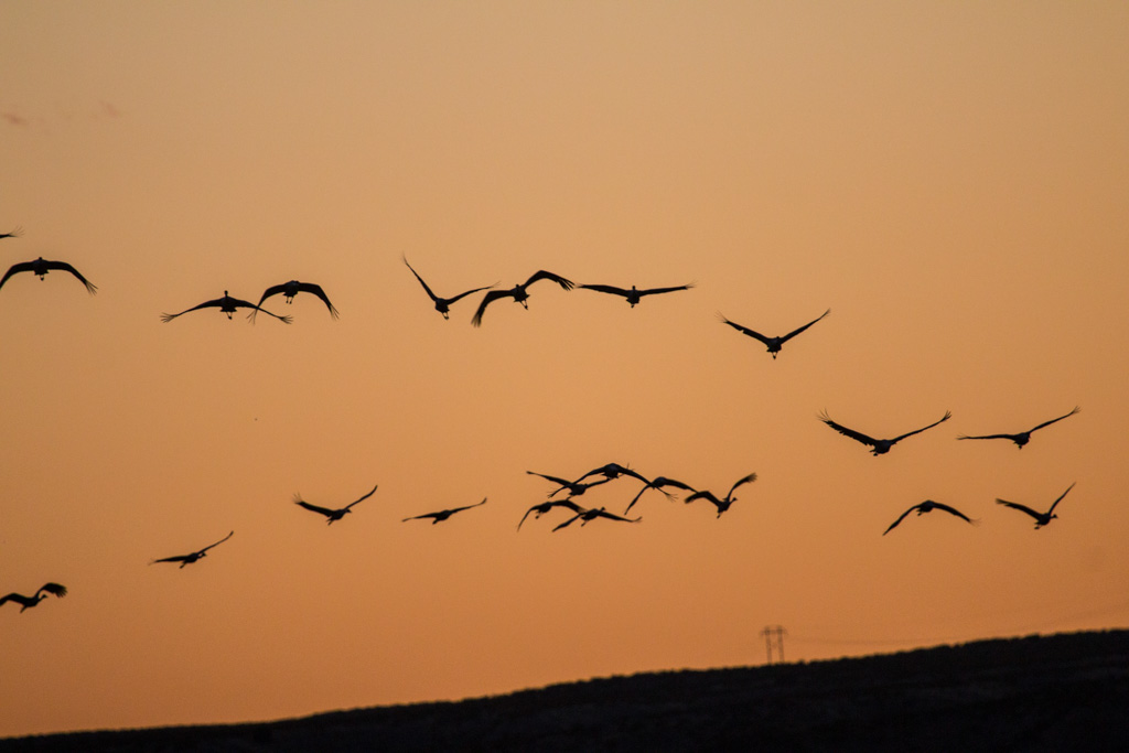
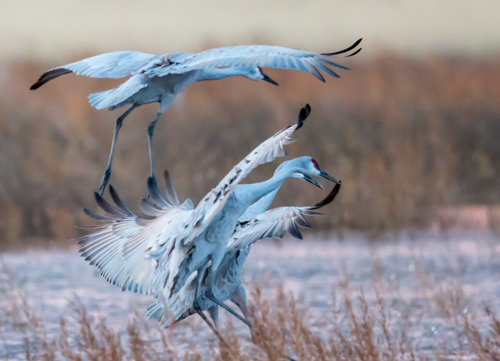
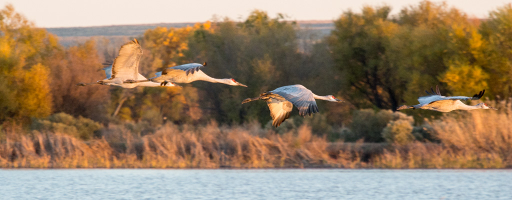
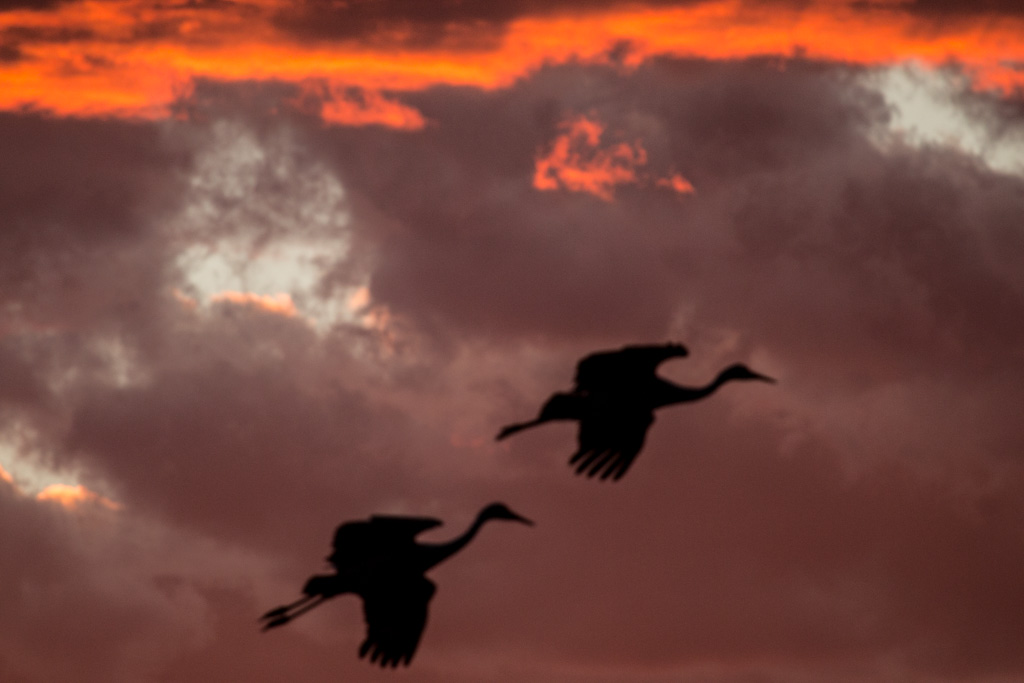
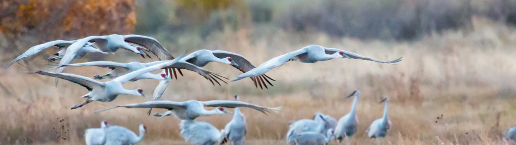
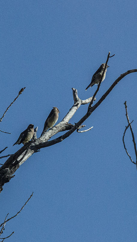
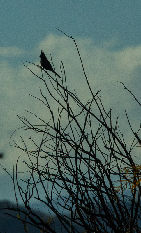
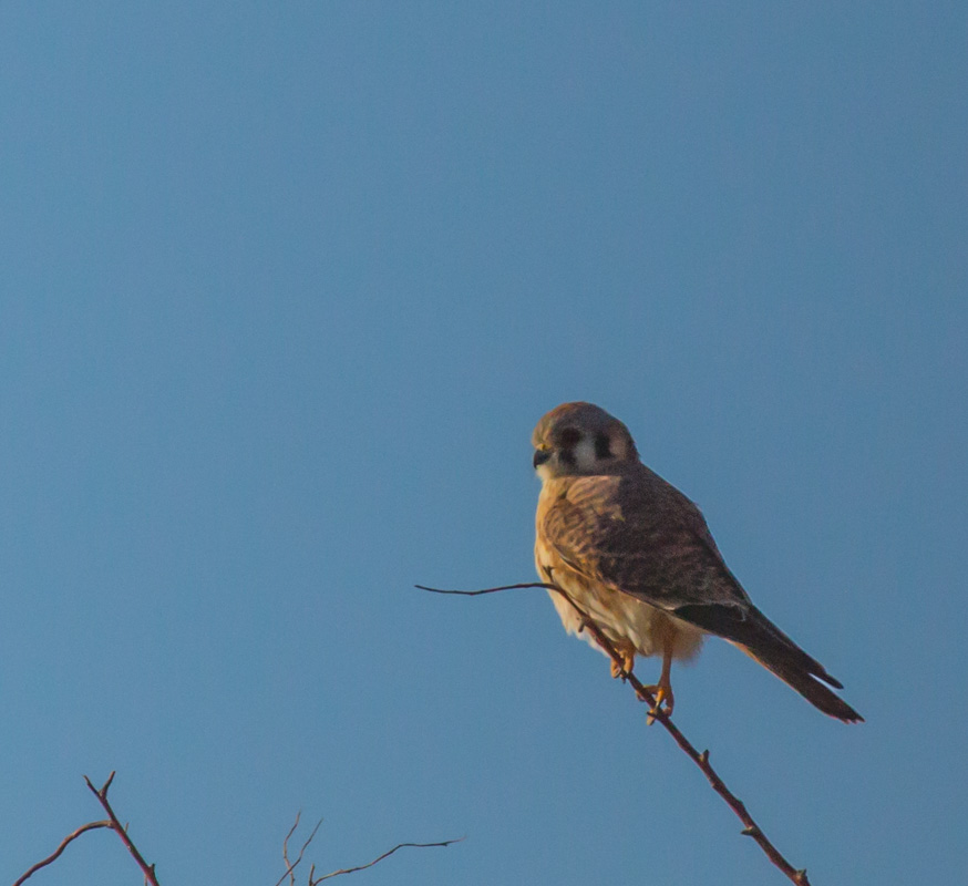
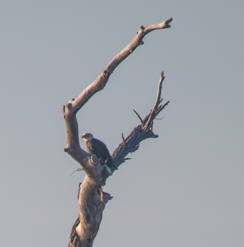
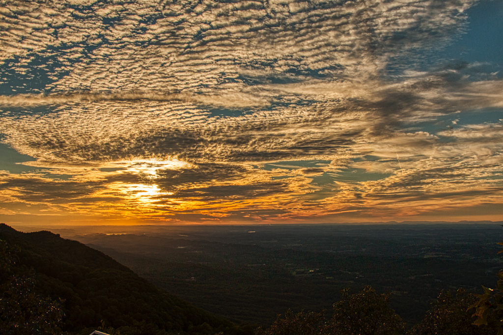
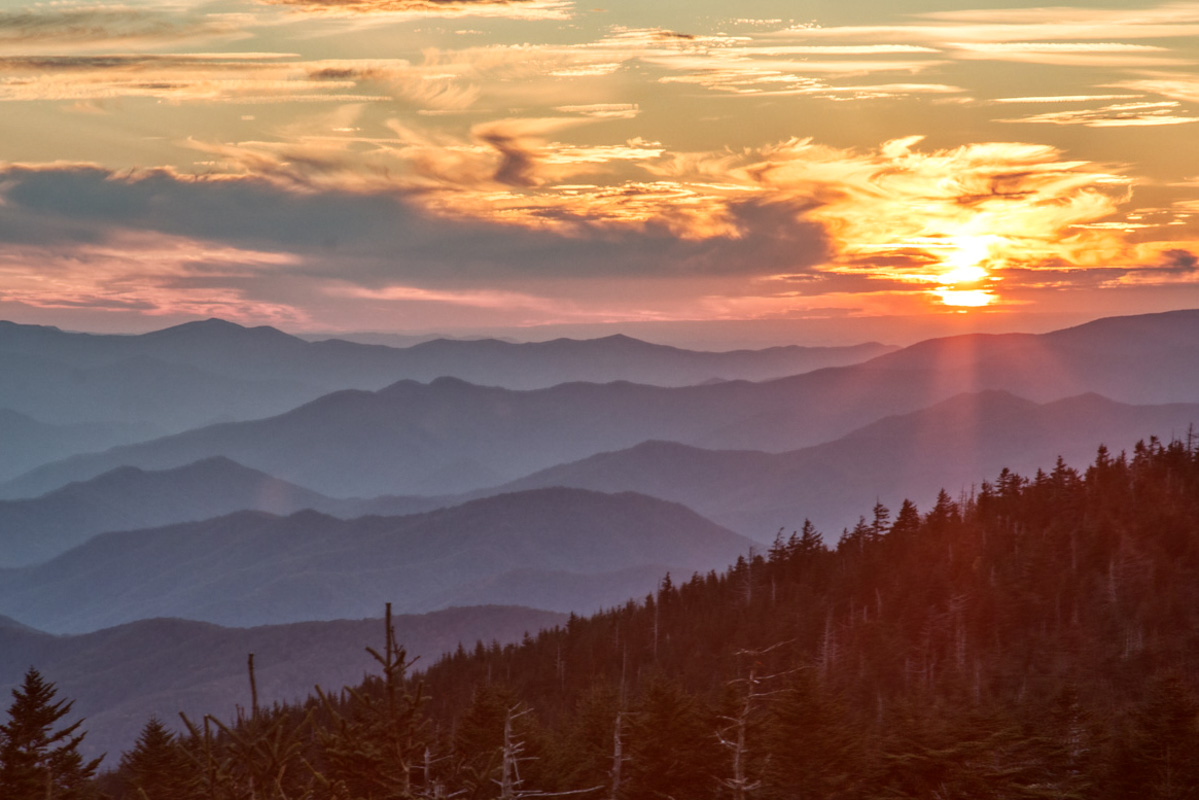
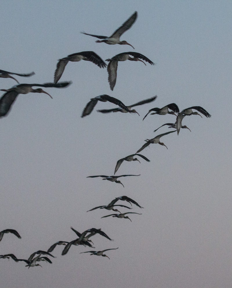
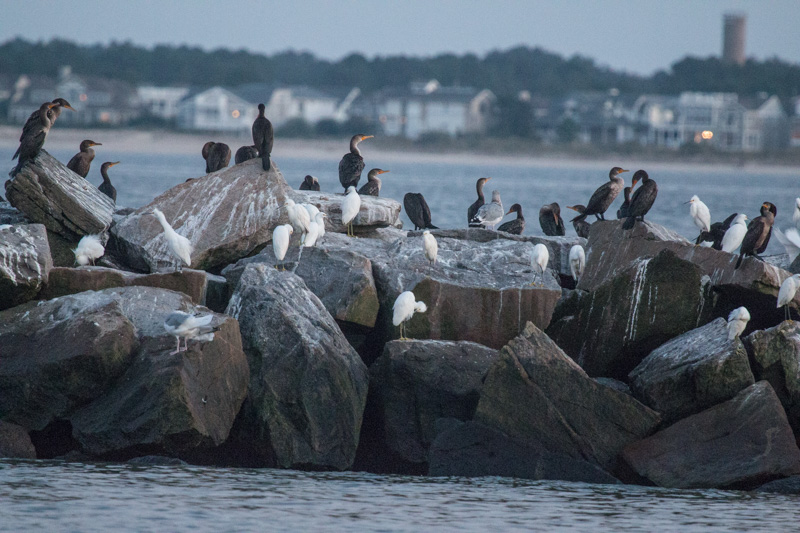
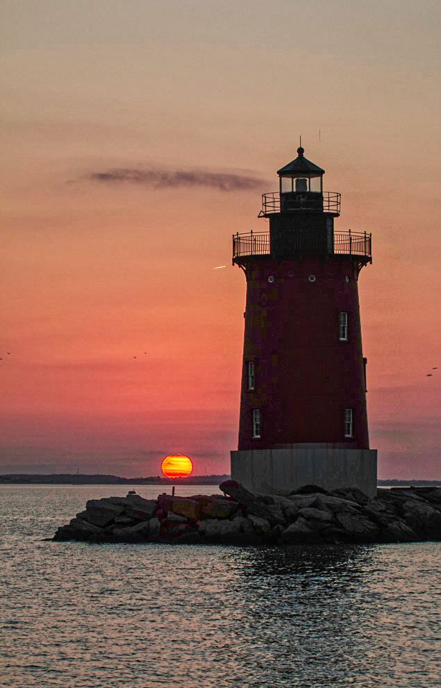
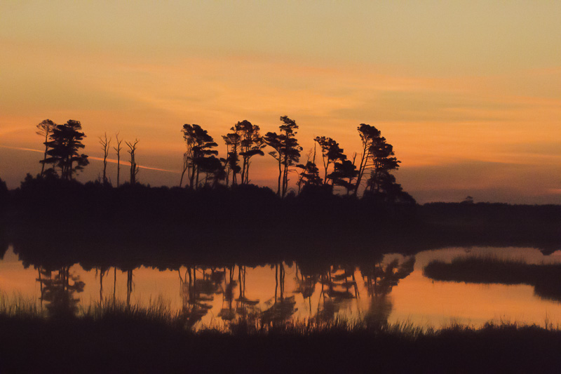
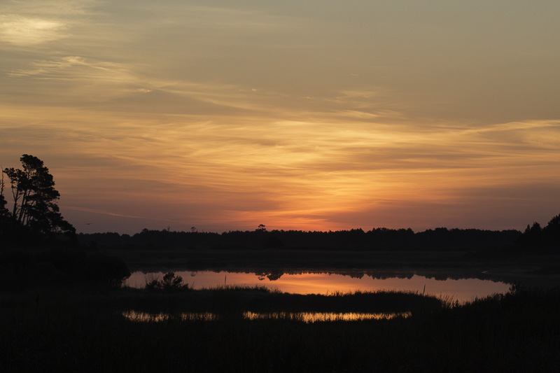
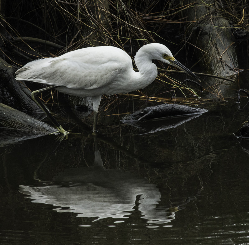
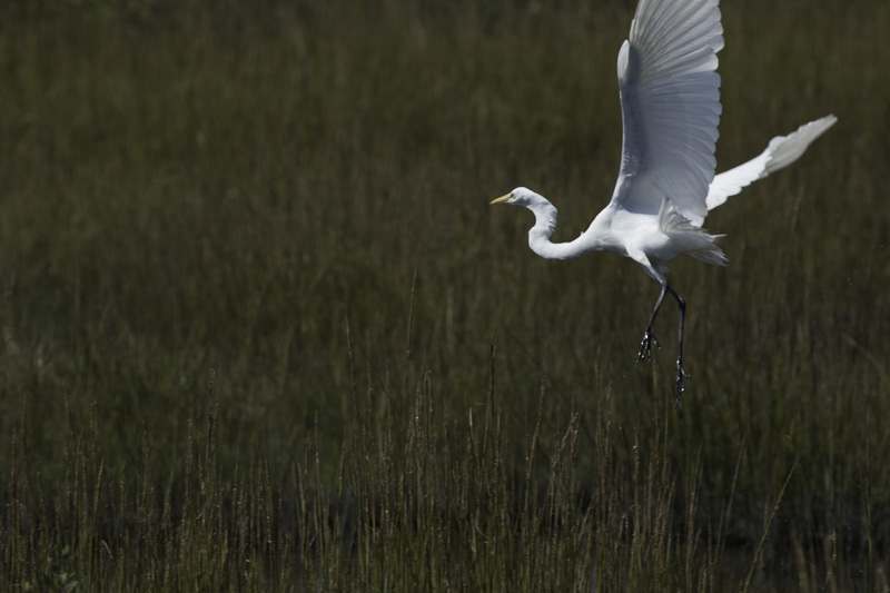
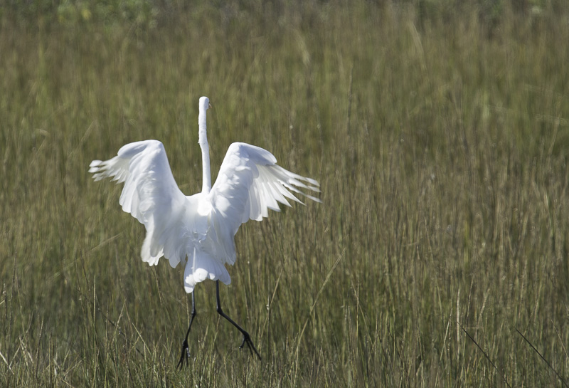
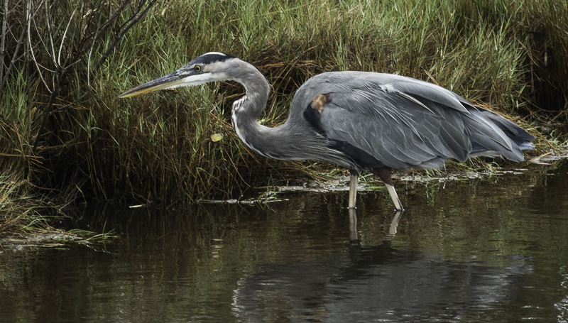
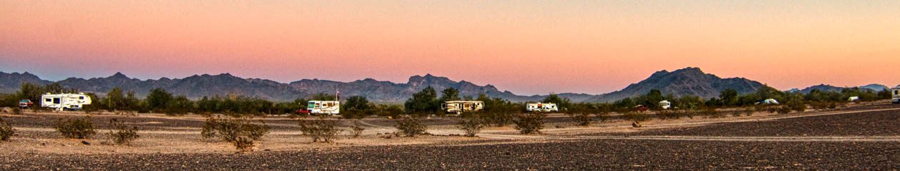
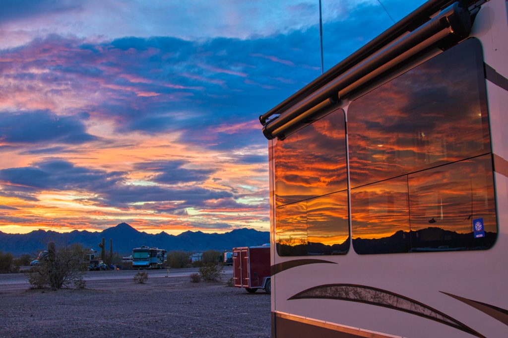
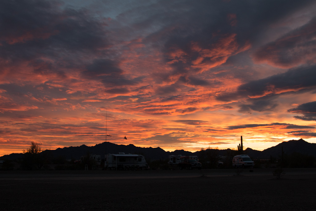
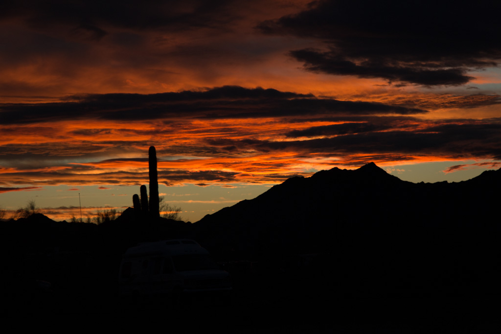
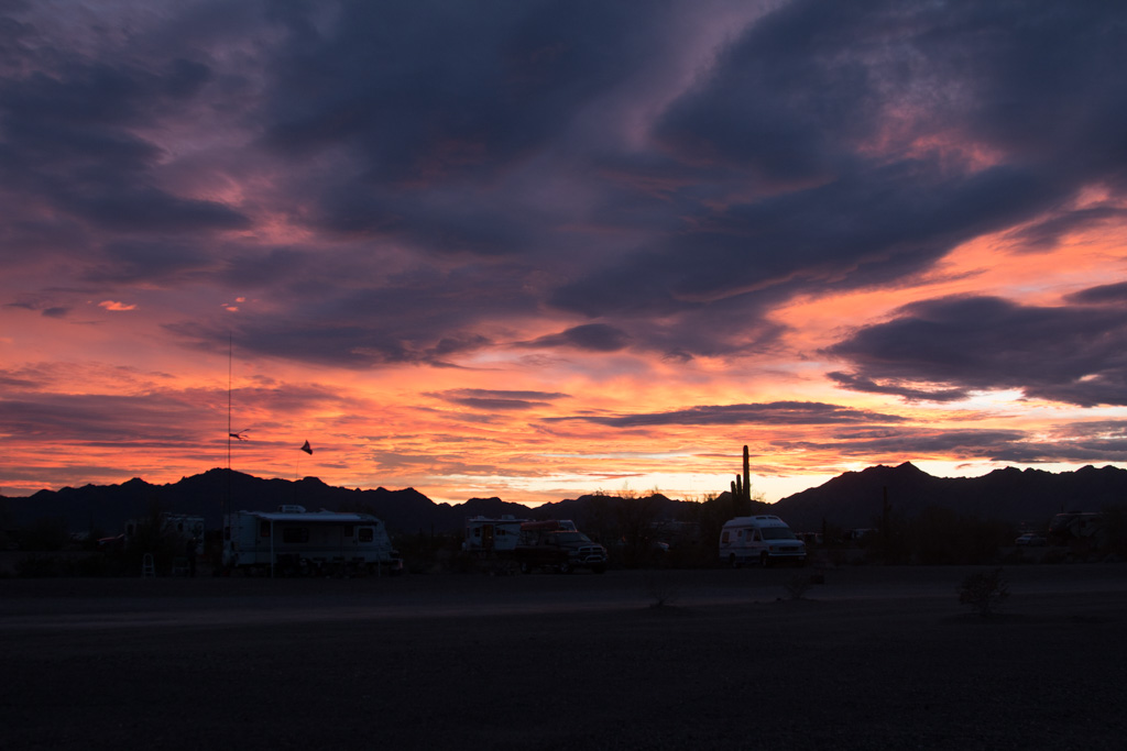
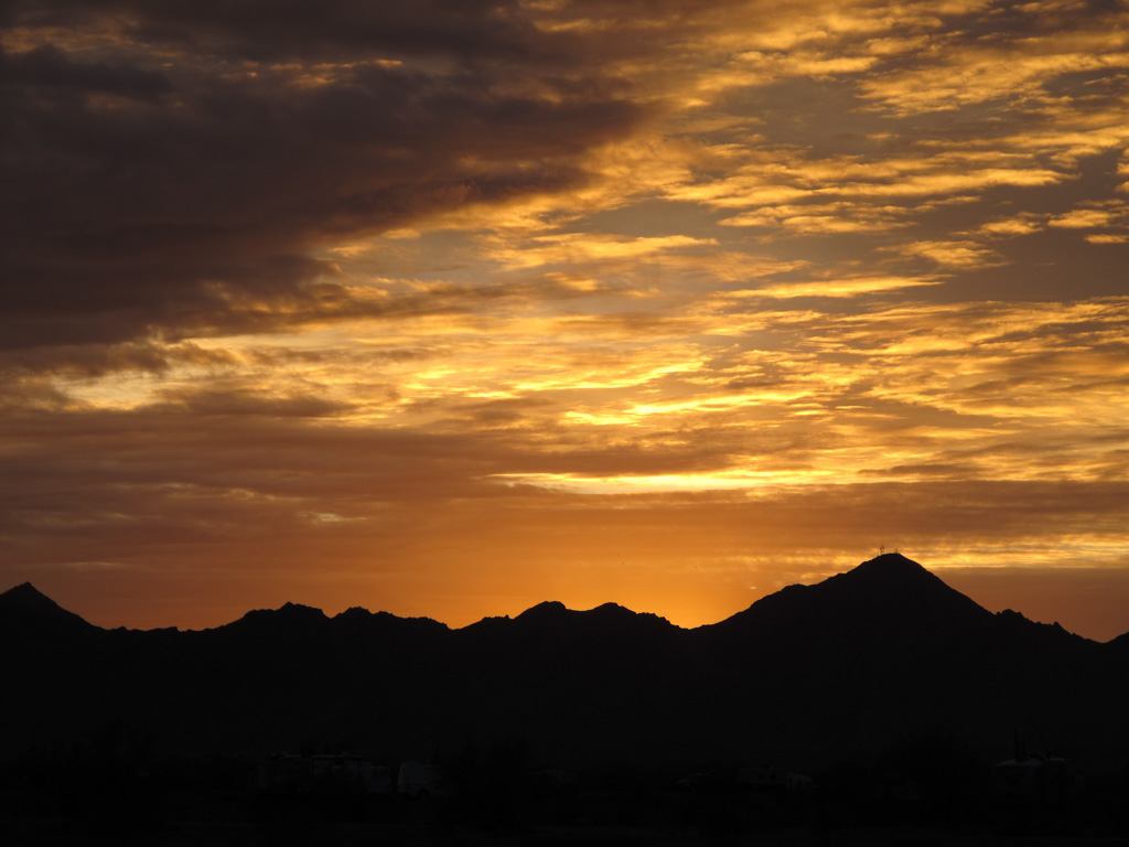
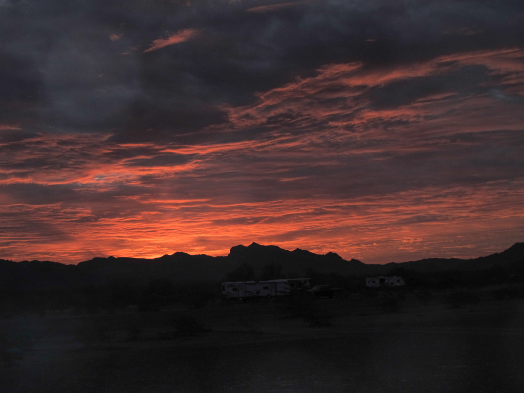
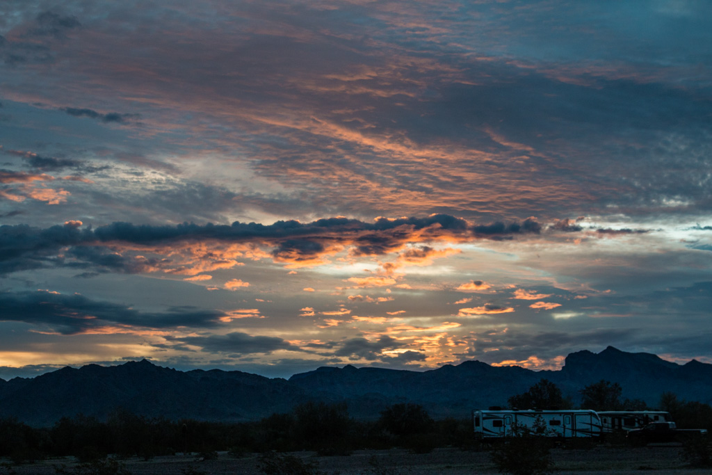
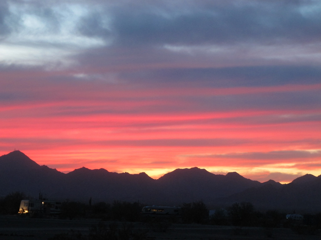
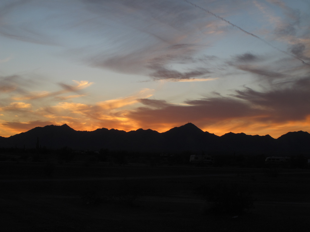
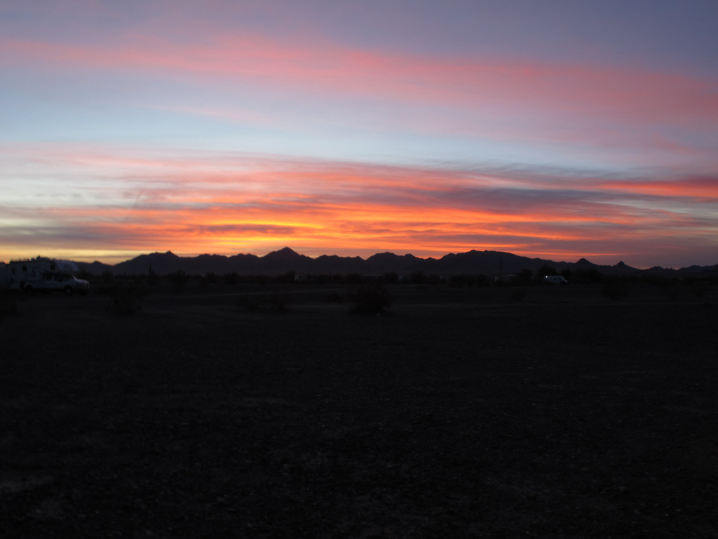
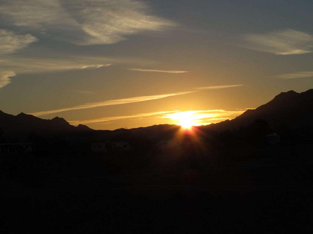
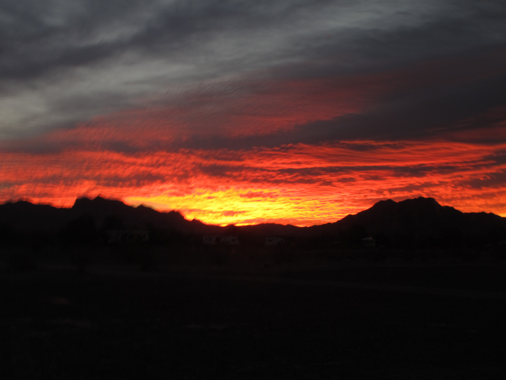
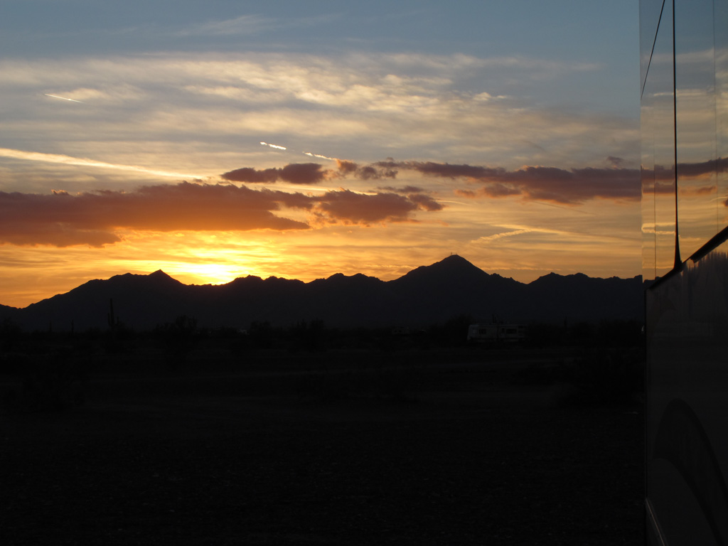
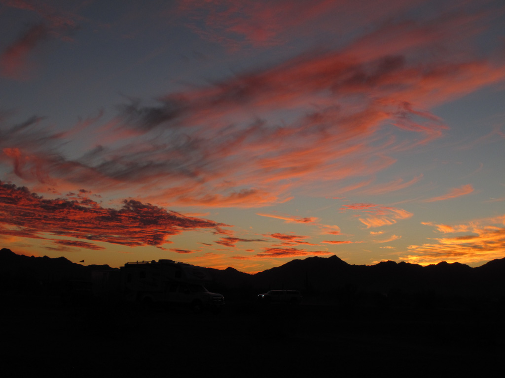
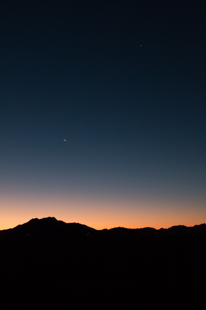
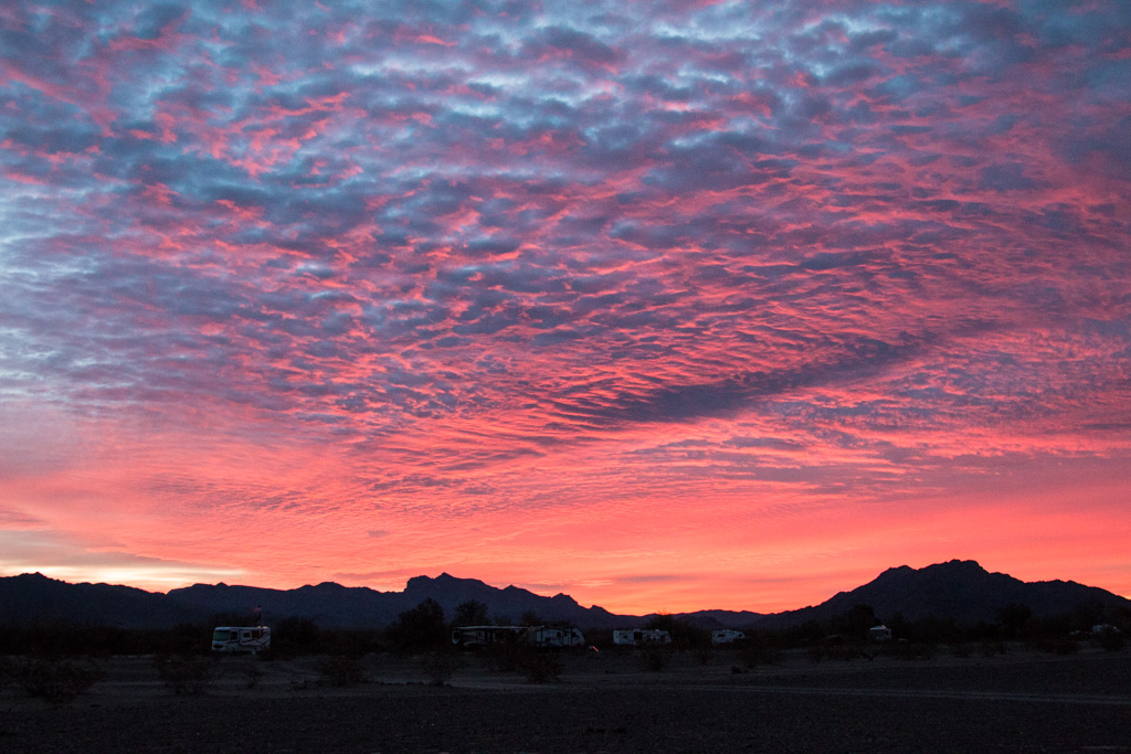
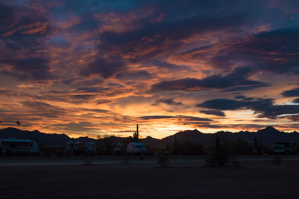
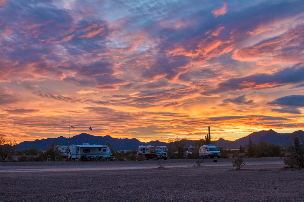
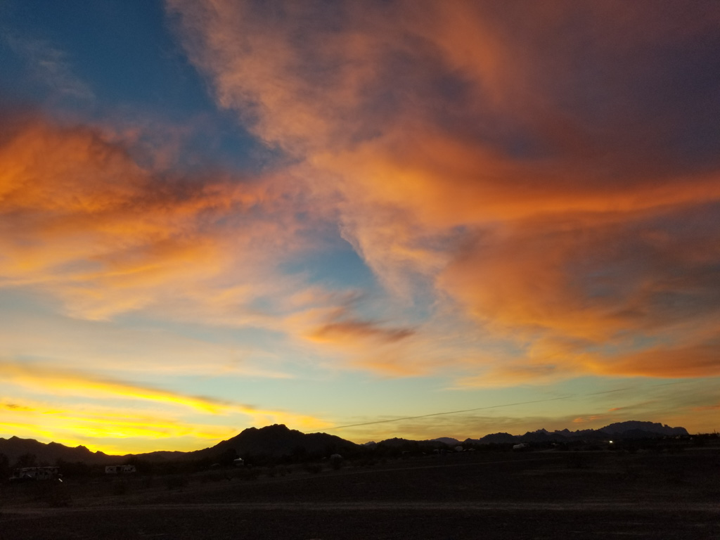
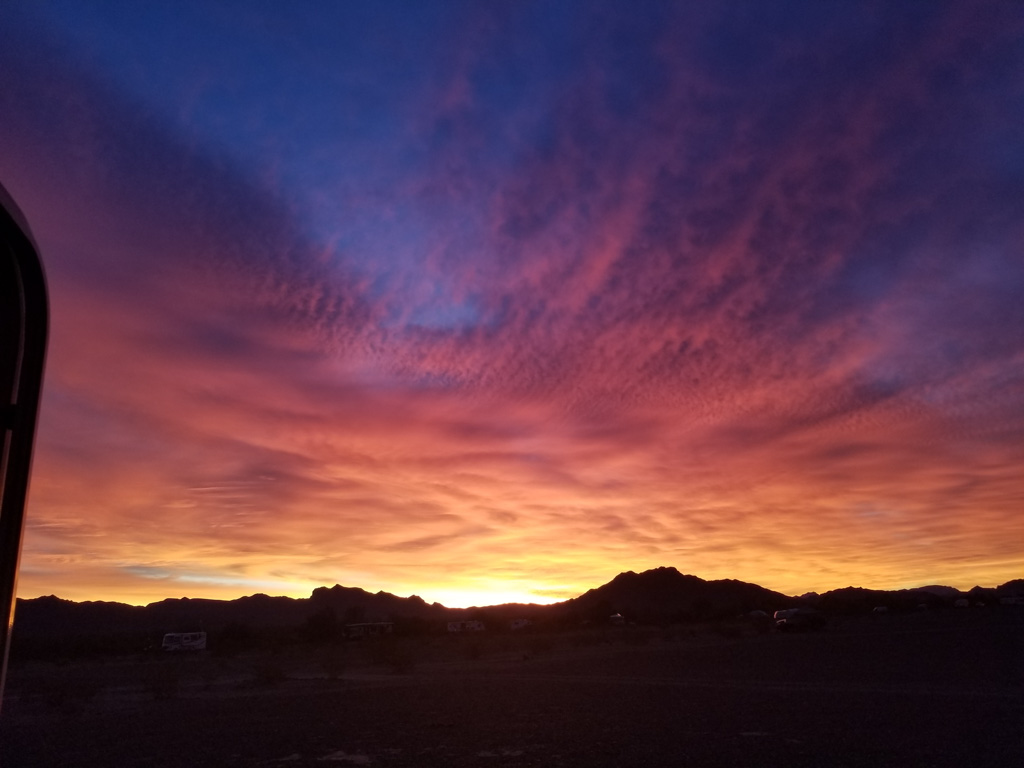
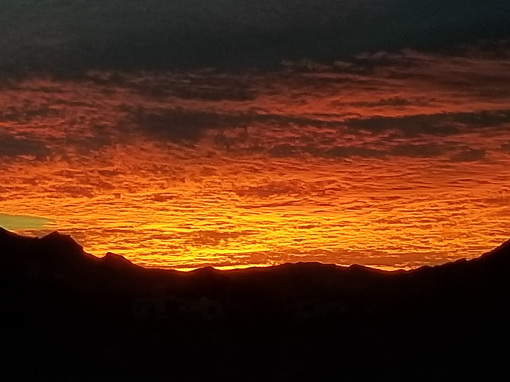
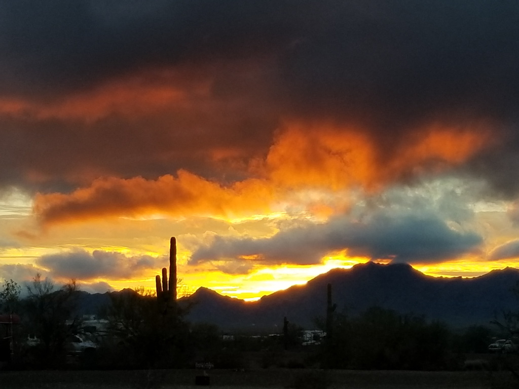
Sunrises and Sunsets

One of the advantages of living on the desert is the essentially unrestricted view of the horizon, especially compared to New England. We have been (usually!) waking up before sunrise, and have gotten in the habit of looking for the sunrise, and again for the sunset every day.

Click on any of the pictures below to see them all as a slideshow of larger versions, and remember you can always right click on any picture in our blog and choose “open image in new tab” or similar, to see the largest resolution that we uploaded..

One other thing…

Drum roll please! When we set out on our adventure, we told ourselves that we would try RV “full-timing” for a year before deciding whether to sell our house on Mount Desert Island.

Well, it hasn’t been a year, but we’ve made the decision! We want to continue this adventure for the foreseeable future, so we will be putting the house on the market this summer. We’ll fly back to MDI to take care of all that has to be done to get a house ready for new occupants.

That’s about it for now. Life has been fairly quiet so we haven’t been posting frequently. Rest assured that as we start to travel again we’ll be keeping you up to date with the activities of your favorite lobsters!

On the moon?

Early on in our trip planning, White Sands National Monument was on our list.  But then we decided that we’d like to see some of Utah “before it got too cold,” so we planned to go west on I-40 all the way into Flagstaff and then north.  We decided that we’d do White Sands, NM some other time.

Well, “too cold” seemed to be following us all the way across the country (local temperatures were often 15° to 20° below normal—we started to think that it was our fault!).  We decided that we would drop down to a more southerly, i.e., warmer, route—I-10—after Bosque del Apache.  Yea!  White Sands was back on the route!

White Sands National Monument visitors’ center, built in the 1930s.

We knew that there are basically two “White Sands” things.  There is White Sands National Monument, and also White Sands Missile Range, the largest military base in the country in terms of area. The Missile Range is closed to the public (of course), so we focused our imaginations on the Monument, which we thought was completely separate.

It turns out, it isn’t so separate.  The Monument is completely inside the missile range; it closes to public access any time the military launches a missile. Phew!

The other thing we didn’t know was that the missile range has a museum open to the public! Did I mention in a previous post that I like space-oriented things?

White Sands Missile Range Museum

The first day, we went to the museum.  Since you’re entering a military base (by all of about 100 yards), you must present ID, and they run a quick check with the FBI to see if you’re a baddie. (Sorry, no pics of the entrance station where we had to register.  That is apparently a serious no-no.)

Outdoors display

We spent most of the time at the museum outside at the rocket display.  It was neat to actually see some of the rockets whose names I knew from the ’60s.

The Patriot, launched from a truck

Some of the missiles in the outdoor portion of the museum


The OH-50, an unmanned helicopter developed in the 1950s for anti-submarine warfare. Drones aren’t new! Although it is no longer in use in combat, it is still the only unmanned helo to be combat certified.  The OH-50 is still used at the Missile Range to tow targets.

WSMR is an Army base, but used by all branches of the military. This is a Navy guided missile launcher tested here.

The rockets on display here were almost all developed for the military, but they also enabled our manned space program.  Until the Apollo program’s use of the Saturn V booster, all of the rockets used for our manned space flights were repurposed military rockets—Redstone, Atlas, and Titan.  The Redstone held a special place in my memory because it was used for Alan Shepard’s and Gus Grissom’s sub-orbital flights at the start of Project Mercury, the beginning of the US manned space program.

I didn’t know that the Redstone was designed to be “transportable.”  From the information sign in front of the rocket:

As a field-artillery missile, Redstone was mobile and transportable by plane, truck, or train. However, when on the move, it needed a convoy  eighteen miles long, with 200 vehicles carrying approximately 10,000 individual pieces of equipment and more than 600 men.  The Redstone itself was carried on three trucks—its nose section (warhead), midsection (power plant and fuel tanks), and tail section—to be assembled in the field.

Transportable?  Maybe.  Stealthy? No way!

Indoors

There was also a nice indoor portion of the museum. Part of it covered the computing resources used in the early days of the missile age.  Here is a “patch panel” used to program a computer in the days before software.  This is from a computer used into the ’70s!

A quote on the information card: “You had to be a bit crazy to work on the patch panels!”

One way of gathering data about test flights is to track the rockets visually, with “cinetheodolites.”  Each of these required two operators, and many were used around the range.

A cinetheodolite ($75,900 on eBay!  Get yours today!)

Housing for a cinetheodolite

Trinity

There are moments that change the course of history forever; one happened here. On June 16, 1945, the world’s first atomic explosion happened on White Sands Missile Range, at the Trinity Site.  The Trinity Site is only open to visitors twice a year so we weren’t able to see it first hand, but a good portion of the museum’s indoors display space is devoted to it.

A one-third scale model of the bomb that was detonated at the Trinity Site.

The Trinity bomb was the same design as the second bomb, dropped on Nagasaki, Japan, to end World War II.

White Sands National Monument

On the second day, we went to the National Monument.  Mile after mile of white “sand,” actually gypsum.  After having seen the delicate gypsum florets in Mammoth Cave, it was amazing to see this much gypsum, literally piled up.  Kathe thought it looked like we were on the moon!

This plant’s root system causes these hills to remain even after the dune has moved on.

The leaves of this tree are thick and very waxy

It was interesting to walk on the dunes.  I have lived near the water all my life except for our time in New Hampshire, and am used to walking on sand—including the sand dunes on North Carolina’s Outer Banks.  The gypsum packs much more tightly than sand,  and is very easy to walk on in comparison.

We went sledding down the dunes on a plastic saucer (like would be used on snow).  Despite waxing the bottom of the saucer, other than the color of the dune’s surface, it wasn’t anything like sledding on snow!  It was quite sticky, but once you got going, it was fun riding down the dune.  Kathe got some good rides, but I fell out of the saucer each time! Unfortunately, I didn’t get any good video of me tumbling down the dune. (Sand-sky-sand-sky-sand-sky…)

The dunes are always moving, driven by the wind.  Keeping the tourist area road open is a constant problem.

Harder than plowing snow? I don’t know…

We had a really good day there, walking some trails and seeing the scenery.  Al finished with a ranger-led walk just before sunset.  The guide is an astronomer by training,  working as a paleo-geologist.  He described some of the research going on at the whole White Sands site, much of it outside the bounds of the Monument.

On the desert floor (where there isn’t currently a dune), the water table is only a foot or two below the surface. The geology  of the area depends on this.

A wet stick shows that there is water about 18 inches down this hole. The water table (the level of the water below the ground) is closely monitored.

The yucca plant below may be 30 or more feet tall.  It is rooted on the desert floor, and as a dune comes along it grows to keep its leaves and flowers above the level of the dune.  Unfortunately, when the dune passes, the yucca can’t support its long stem.  It collapses and dies.

You didn’t think I’d leave without a sunset shot, did you?

Blue sands at sunset

If you get a chance, do plan to go.  White Sands National Monument is other-worldly.  (Lunar?)

Bucket list: √ and √

Go get your bucket list. I’ll wait while you go find it.

Now add these two items which are in New Mexico, if they’re not already on your list:

  1. The Very Large Array,  otherwise known as the VLA, and
  2. Bosque del Apache National Wildlife Refuge.

√ and √!  Our bucket lists are now two items shorter!

The Very Large Array

I’ve been a space fan since the late ’50s, when my dad took me out in the yard and showed me one of our first two satellites—Explorer or Vanguard—at this point I don’t remember which.  I remember watching all of the Project Mercury launches on TV with him.

I’ve known about the VLA for a long time (yes, even before the movie Contact!), but I had never been there.  Now we have!  It is even more impressive in person.

The VLA is a radio telescope, one of the most sensitive in the world.  From the National Science Foundation website:

Among a broad range of scientific capabilities, the VLA addresses four primary science themes: measuring the strength and topology of cosmic magnetic fields; imaging young stars and massive black holes in dust-enshrouded environments; following the rapid evolution of energetic phenomena; and studying the formation and evolution of stars, galaxies and active galactic nuclei.

Phew!

The VLA is open to scientists all over the world who must submit research proposals to compete for telescope time.  The proposals are reviewed for scientific worth and feasibility. It is so highly competitive that, “Even highly ranked proposals are not guaranteed to receive observing time.

The VLA is a long way from anywhere.  We approached from the east, from I-25, and it is over 50 miles away—50 miles of passing almost nothing but beautiful scenery!

Typical central New Mexico scenery (not actually on the way to VLA–where I neglected to take pics!)

Located on the Plains of San Augustin, the site is both high at approximately 8,000 feet, and ringed by mountains. The height reduces the amount of atmosphere-induced distortion of the radio waves, something I had never considered.  The mountains block most of the man-made radio interference.  Any electronic devices you may have with you like cell phones, tablets, fitness trackers, smart watches, etc. must be turned off—completely. Digital cameras are (surprisingly) OK.  Needless to say, having your cell phone off doesn’t matter as there is absolutely NO coverage!

Approaching the VLA—still a fair distance away

The 28 antennas are huge!  The dishes are 25 meters (82 feet) across, and they over 200 tons each. When pointed up, they are 90 feet to the apex. You can’t really get an idea of how big until you have something to use for scale.

Four flights of stairs and we’re not even up to the pivot!

Twenty seven are in active use; there is always one in maintenance; they rotate through all the antennas to keep them all in good condition.

The VLA has four configurations, called “A” (far Apart), “B”, “C”, and “D” (Darned close together).  The configuration is changed every four months, and we were very fortunate to visit when the telescope was in configuration D.  In configuration A, each of the three arms of the telescope is thirteen miles long, and photography wouldn’t have been nearly as much fun!

Antennas close together! The beauty of Configuration D.

The VLA is laid out in three legs radiating out from the center, spaced at 120°.

Looking out the north leg, currently comprising 11 of the 27 antennas.

To reconfigure the array, and to bring antennas in for maintenance, they use a transporter. Top speed is 5 MPH; however when transporting an antenna, it usually moves about 2 MPH.

Zero to two in… several minutes.

The reason for the different configurations is that antenna spacing controls the field of view, how wide a portion of the sky it can view, and resolution, how small a feature it can distinguish.  Close spacing (like now) offers a very wide field of view, but relatively poor resolution.  The widest spacing, configuration A, views a much smaller portion of the sky, but can distinguish much smaller features.

At its widest spacing, the telescope is about 22 miles across.  To allow even finer resolution, the VLA is one component of the VLBA, the Very Long Baseline Array, which has a maximum distance between antennas of 4971 miles (8000 km).  The VLBA is controlled from the same building as the VLA, in Socorro, New Mexico; the antennas are spread out from Hawaii to the U.S. Virgin Islands and points in between.

If you want to see the VLA, go soon.  Its replacement is currently in the works, called ngVLA, which will increase its power and its resolution at least tenfold. The individual dishes will be smaller, but there will be many, many more! More information is here, and here (FAQ).

√ The Bosque del Apache NWR

Several years ago I heard about a great place for bird photography, especially for sandhill cranes and snow geese.  It wasn’t over-hyped! In the two days we spent there, we took on the order of 3,000 pictures!

The peak of the bird population happens during the depth of the winter in December. At that point they have approximately 20,000 sandhill cranes, 50,000 snow geese, and 50,000 ducks of various species.

The refuge is heavily managed.  The staff plant several food crops during the summer to feed the birds through the winter—mostly corn.  They plan to feed 100 pounds of corn per bird across the winter.  That is a LOT of corn! They also flood fields with water from the Rio Grande river to give more shallow water areas so the birds have safe places to spend the night. When we were there,  only a few of the fields were flooded; more to come!

Even now in November, there are a phenomenal number of birds here. During the day, the birds are spread out widely across the 58,000 acres of the refuge.  Even so dispersed, the density on any of the feeding areas is pretty high!

Sandhills feeding

Snow geese soaking up the rays.

At night they congregate in a few, relatively small wet areas—being in shallow water protects them from many predators.  This congregation into a few areas results in massive “fly-ins” and “fly-outs” at sunset and sunrise. Photographic heaven!

Go ahead! Count the sandhill cranes. I dare you!

Predator spotted! Snow geese flying out.

Incoming! Sandhills arrived in groups like this continuously for over a half hour.

Three sandhills landing simultaneously.

During the second day, we took two  (free!) tours with naturalists to find other birds which were located on the Reserve. Many were too far away to get good pictures of, but here are a few of the birds we saw.

A trio of cedar waxwings – one of Kathe’s favorites!

Phainopepla, the desert black cardinal.

We think this is an American Kestrel, a small falcon.

A bald eagle, in a snag.

In addition to so many birds including quail and turkey, there are many other species of animals on the refuge including mountain lion, bobcat, jackrabbits, and lizards.

It will take us weeks to work through all of our refuge photographs! Based on this fabulous experience, we’ve decided we’d be thrilled to visit as many wildlife refuges around the country as possible. Fortunately, there are quite a few in Arizona where we will spend the winter. Yahoo!

Smoky Mountains and Sunsets

From Shenandoah we went to Great Smoky Mountains National Park (GSMNP).  We stayed in Big Meadow Family Campground, in Townsend, TN—about two miles from an entrance to the park. The park owners were very friendly and accommodating (we had several large packages delivered there), and the park was maintained meticulously.  Highly recommended if you travel that way.

I (Al) had been to GSMNP many times, always the weekend before Memorial Day weekend, and had several places I wanted to go with Kathe.  Late May was usually somewhat crowded, but not so much as to make getting to what you wanted to see difficult.  I was hoping that the park would again be fairly quiet now, being “after season.”  Maybe it was fairly quiet with respect to the summer crowds, but it certainly wasn’t quiet.

On our first day in the park, we went to Cades Cove.  This is a roughly 11 mile one-way loop through an area that was settled for about 100 years before the creation of the park.  Kathe and I enjoy trying to understand something of small communities by looking at their graveyards.  There are several in the Cades Cove area, along with several small churches.

There are three churches in the cove:  Primitive Baptist, Missionary Baptist, and Methodist.

We think that the Primitive Baptist church is the oldest in the cove.

The steeple and bell of the Primitive Baptist church

Interior of the Primitive Baptist church

Pulpit Bible in the Primitive Baptist Church. Note the vandalism / graffiti on the inside back cover.

Traditionally, Methodist churches had two doors, one for men and one for women.  Although the Methodist church in the cove has two doors, the practice of separating men and women was not practiced in this church.

The Methodist Church

The Methodist cemetery

We were able to see several generations of the cove’s families, and marriages between them.  We noticed that families would sometimes switch denominations with part of the family being buried in the Baptist cemetery and others in the Methodist.

The Oliver family was one of the founding families of this settlement, and remained a presence there. (Click on a picture in the gallery to see the larger, uncropped, version.)

It was hard to see the infant graves with only a single date on the headstone, or a span of only a few weeks or months.

Especially heartbreaking was to find several groupings of three infant headstones from the same family.

The cemeteries are still active, despite being in a National Park. People who lived in the cove before the creation of the park are still able to be buried there.

Two of the things we wanted to see in the cove—Abrams Falls and the mill—we had to pass on due to the crowding.  By the time we got to the parking area for the falls we didn’t have enough time for the hike, and when we got to the mill area, there was no available parking. So we headed back to camp.

Afternoon in the Smoky Mountains

After dinner we went to Look Rock to see the sunset.  This is several miles out the Foothills Parkway, a separate part of the park.  Right at the parking lot, there is a short walk to a viewpoint to the south.  While very pretty, it wasn’t going to be the best for sunsets.  As we were walking back to the car to try to find another place, a young couple asked if we were looking for the tower.  Yes!  They showed us the start of the path across the road from the parking.  After a short (uphill!) hike, we were set for some good sunset photography.

The next day we decided to drive to Clingmans Dome for sunset.

The first part of the drive is along the Little River, which has many cascades and is quite pretty.  One of the disadvantages of driving a large pickup truck is that there are very few places you can pull over for a photo stop.  We did find a few though.

A small cascade along the Little River

The Little River can also be serene

Eventually the road leaves the river and heads into the mountains.  Here we saw our first hints of fall colors, although we missed the bright reds of Maine.

This is a long drive (the Dome is in North Carolina, and the road is a twisty mountain road). The drive was worth it! At many points there are good views of the mountain range that we are in.

The Appalachian Trail passes directly under the tower we watched the sunset from, so I guess I can now say I’ve been on the AT!  (Nah.  I wouldn’t do that to my friends who have hiked the AT.)

Row after row of Appalachian mountains at sunset

In addition to sampling sunsets wherever we land, we love to eat, too! We eat out fairly often, possibly more than we should.  But here we “had” to eat lunch twice at the Black Bear Cafe in Townsend.  Their fried grouper sandwich was outstanding!

We continue to find that meeting people is one of the most enjoyable aspects of RV life.  At Big Meadow, we met Joe and Judy, and two of Judy’s sisters, Jo and Rachel.  We enjoyed comparing our RVs and the modifications we each have made (their rig is a larger version of ours), and talking about favorite places to visit. The sisters are three of seven sisters.  When we left the park the three, who were roughly in their late 70s, were heading out to have lunch with some of their friends…they hadn’t seen since elementary school!

From here, we went to Mammoth Cave, which Kathe already covered in her spelunking post.  We’ll catch you again from Memphis!

Caverns, Caves, and Bats, Oh, My!

I remember a small cave in the woods out behind my Nanny and Pop-pop’s house when I was a little girl. My brother told me about it; I decided to take his word for it.

Two weeks ago, while in the Shenandoah Valley (Virginia), we visited Luray Caverns. Luray is a commercial attraction and not part of Shenandoah National Park. We signed up for a tour and were led down a long, fairly steep staircase to an amazing underground world. I remember seeing stalactites and stalagmites in Howe Caverns in New York State as a youngster. But these…

Stalactites hang ‘tight’ to the ceiling.

Stalagmites (bottom left) ‘might’ reach the ceiling some day.

The young man who toured us thru the caverns seemed to be in training for some kind of footrace; we wanted to take lots of photographs but he kept insisting that we stay together and keep up with him. It was frustrating and we finally decided we’d take our time and take the photos we wanted to—we had paid dearly for the tour and wanted our money’s worth.

Sometimes the stalagmites reach up to join the stalactites to form pillars or columns.

The stalactites are formed by water coming down through the roof of the cavern carrying dissolved limestone. The limestone is left behind when the water evaporates.  Stalagmites are formed when those drips of water drop off and hit the ground; as the water evaporates, the stalagmites grow upward. Many experts claim that the stalactites and stalagmites grow as slowly as 10cm every 1000 years. They are precious.

We were fascinated to learn that until the 1920s, tourists were allowed to snap off the end of a stalactite as a souvenir. Once the tip is broken off, the stalactite will cease to grow. It was sad to see so many broken, flat ends as we worked our way through the passages.

The old expression “A picture just doesn’t do it justice!” came to mind when we downloaded our pictures of the reflecting pool. It was pure magic; footsteps ceased and all you could hear was the intake of air as each tourist rounded the passage and gasped as they faced the pool head-on.

Can you find the waterline? See the perfect other-worldly reflection?

On our way to Luray, we passed dozens of billboards (and I mean dozens!) advertising the caverns. Many of them called attention to ‘The Great Stalacpipe Organ’—what could that be?

Sure enough as we were nearing the end of our tour, we came into a huge room within the cave that had an organ console up on a landing. Apparently you can make arrangements to get MARRIED in this room, complete with a pipe organ accompaniment. (It’s a bargain at $1900 for just 12 guests!)

The famous stalacpipe organ in Luray Caverns.

The organ is actually an electrically actuated lithophone that produces tapping of a large number of pipes (stalactites)  throughout 3-1/2 acres of the cave. You can see the wires along the walls, weaving in and out of the limestone appendages. The tour guide pushed a button and we were regaled with the limestone version of “A Mighty Fortress is Our God”—you could almost make out the tune! Because of the enclosed space of the cavern itself, the song can apparently be heard throughout the entire cavern.

One of the most magnificent features in Luray Caverns are the ‘curtains’— they are beautifully translucent stalactite formations that drape down from the ceiling —almost like long sheets of beautiful linen. Glorious!

Stalactite curtains

During our stop in the Shenandoah Valley, we had the solar panels installed which required Al to be at the campsite all day. He encouraged me to go out into Shenandoah National Park by myself.  The first day I went out, I missed a sign and ended up driving across the width of the park into the next town before I realized what I’d done (without my trusty navigator with me). So I turned around (I’m getting really good at those twisty-turny mountainside roads) and found the turn I’d missed.

When I finally got through the gate, I drove up to the first viewpoint. It actually involved a 4 mile loop hike and it was not something I was up for. So I stopped into the ladies’ room—The woman at the sink reminded me of someone from back home. “Wait! I know you!” I exclaimed. It was Dot—I’ve known her for a couple of decades — we attended the same rughooking retreat for many, many years back in Maine. What were the chances? We had a great time catching up for a few minutes. Back to the park . . .

Shenandoah NP boasts its centerpiece Skyline Drive as one of the VERY BEST places to see beautiful fall foliage (don’t worry, Mainers —I don’t believe anything can top autumn in Maine); it runs the entire length of the park. Unfortunately, there was not a smidgen of fall color. There were, however, some beautiful overlooks with views that reminded me of the Great Smokies—I stopped a number of times and made a stop at the Visitor’s Center just as a few spritzes of rain appeared on my windshield.

From Skyline Drive in Shenandoah NP–no fall foliage in sight

By the time I got back to the truck, the clouds and fog had really socked in—and it was raining more steadily. Yeah, doing twisty roads—steep and downhill—and not being able to see past a very few feet in front of my bumper was NOT FUN.

I went back to the national park on the second day of the solar install and was able to spot just a few more leaves giving way to a touch of dark yellow. Many leaves appeared just brown and shriveled. Disappointing. We’ll go back another year— and for Al, it will be his first time IN the park.

Fast forward five days — poof! We’re in Cave City, Kentucky, the home of Mammoth Cave National Park.

Imagine a series underground caves and tunnels that layer, twist, and intersect for more than 400 miles! We stopped at the stunning visitors’ center and learned quite a bit about the cave system. O.K., I knew about the bats but not about the cave crickets and cave rats!

The descent into the Historic Entrance

We had pre-purchased tour tickets online for the Grand Avenue Tour for the next day so this first day in the park, we decided to venture into the self-guided “Historic Entrance.” It comprises two huge rooms with numerous placards with all kinds of information; you can read your way right through. There were lights — just enough so you could see your way around and read the signage (kind of). There were three rangers on duty. Al’s great about asking questions and learning as much as he can from the rangers. Interestingly, one of the rangers told us that since those placards have gone up, it’s rare for anyone to talk to the rangers anymore. How sad! She explained that they have so much knowledge to share but if no one approaches them . . .

During the revolutionary war, much saltpeter was mined from the cave to make gunpowder.

We stopped to speak to another ranger on the way out. I asked about the bats. They’ve lost about 90% of the bat population due to the White Nose Syndrome; it’s a fungus that has killed millions of bats across the U.S. It came from Europe and Howe Caverns was where it was first detected here. The ranger said he’d only spotted two bats today and he pointed his flashlight to a tiny black spot high up on the cavern wall. So small.

The next day’s Grand Avenue Tour comprised four miles of strenuous walking and climbing—-all at 260+ feet underground!
Two rangers accompanied us —one at the front who flipped light switches ahead of us and who taught us so much along the way. The second ranger brought up the rear and switched lights off as we moved on.

It was magnificent—see for yourself!

Notice no stalactites or stalagmites! A sandstone layer above the cave’s limestone prevents water infiltration through most of the cave.

Gypsum (calcium sulfate) “flowers” grow throughout the cave.

The gypsum takes on many different appearances but yes, it’s the same gypsum that is in the wallboard of our homes.

Sometimes the passages are wide and low; other times tall and (very) narrow.

They reminded us of the slot canyons we saw in Arizona.

The cave was a commercial attraction in the 1800s. People were encouraged to put their names on the cave ceiling, using candle soot!

At one point during the tour, the rangers had us sit at on benches along the sides of the path. They wanted us to experience TOTAL DARKNESS and turned off all the lights and just listen. It was amazing.

Can you see my hand? Neither could I!

There were side passages everywhere!

As we neared the end of our Grand Avenue Tour, I asked the lead ranger what the difference is between a cave and a cavern; having visited both, I was curious. He gave me a very simple answer: “RN!”

Toward the end of the tour we reached a section without the sandstone cap, resulting in some stalactites. Places that are moist are lit with amber light to cut down on algae growth.

As we approached the exit, the ranger stopped us and shined his light on the ceiling so we could see a large group of cave crickets. They hang out there and only leave the cave every 7-14 days to eat. Cute little critters, eh? I told the ranger I was glad to see the crickets and was REALLY glad I HADN’T seen any cave rats. “Don’t look over to your right then,” he told me. “I can’t guarantee they’re aren’t some over there.” Aaaaaand, I made a very quick exit!

The cave crickets are about 1.5 to 2 inches across.

Water, water, everywhere! It’s what carved the magnificent cave system. The Green River and its tributaries did most of the work and it still runs several layers below the tunnels that we traveled.

We hiked a trail near the historic entrance, and found river height / flood gauges…

Don’t want to be anywhere near here when there is a 56 foot flood!

Finally starting to see some color!

The cave systems we visited were magnificent and very different from each other; Luray was commercialized with a very quick, pricey tour while Mammoth Caves had a huge range of tours and with our Senior Park Pass, it was a steal! We’re so glad that we got to experience both of these amazing places. And, yes, we’re still on the prowl for some fall foliage!

Fire, Friends, and Dolphins

Another rally – yay! This time we were at the Massey’s Landing RV Resort in Millsboro, Delaware.  Set on the Rehoboth Bay, this gem of a campground was a perfect spot for the Grand Design Northeast Owner’s Rally (can you say white sand, lagoons, pool bar, and ice cream sundaes?).  There were approximately 200 rigs and about 500 attendees; we broke a record for an owner’s rally (a rally not sponsored by the manufacturer, but organized by a community of owners).

A record-breaking owner’s rally

Once again, a number of workshops were offered. We didn’t attend too many this time since they were ones we’d already attended at the Hershey RV Show last fall or at the recent Indiana rally. However, there was a really important session on RV fire safety which was sobering.  A husband/wife team both of whom are firefighters shared the story of a recent RV trip they took. Upon arrival at their campsite, they discovered a drawer in their kitchen that was completely charred as were the two drawers above it! This was the results of loose batteries in the drawer that had sparked a fire while they were bouncing around while underway—yikes! You can bet that every one of us went right back to our RV to tape the ends of every battery that wasn’t in its original package — I know I did!

The best part of this rally was the new friends we made! THIS is the best part of traveling the country — meeting wonderful, interesting people who share a sense of wanderlust. We spent plenty of time sitting around the campfire or picnic table sharing ideas about modifications we’ve made to our RV,  making suggestions about where to camp, and just getting to know each other. Here are some of the folks we met …

Patti and Steve

Patti and Steve have recently ordered a new Grand Design RV (their second!) and were trying to decide on what brand of truck to purchase; this is a common quandary. And RV owners are often eager to shareopinionated, pushy, overbearing, obnoxious, enthusiastic about which brand of truck to purchase. Patti had lots of questions and took lots of notes. She was looking for as many ideas, suggestions, and tips as she could. It was great fun to show her a few of the modifications we’ve already made.  Steve has a wicked sense of humor and we had a great time visiting and laughing with them both!

Paula and Chuck

Here are Paula and Chuck. We got to know them when we went on an evening cruise up the Broadkill River. We really *clicked* and enjoyed our time together throughout the weekend. It turns out that Paula had actually discovered us on the Grand Design Owner’s Forum online—Al’s been very active on the forum for a year and  lists our address as Bass Harbor, ME. She was searching for us at the rally because they’ve vacationed in Maine, in fact in BAR HARBOR for many, many years. We had fun comparing notes (and we couldn’t help but mention that we may have a home for sale there next year!).

We went out for breakfast together and on our last evening at the rally, Paula and Chuck invited us over to their RV to watch a beautiful slide show of their walk on the Camino. They encouraged us to think about it.  Paula and I have so much in common (separated at birth?) and have already texted each other a couple dozen times since we left Delaware. Such fun to make new friends!

Cruisin’

As we travel to new places, we try to take advantage of as many new activities as we can—who knows if we’ll ever be back this way?  There were several offerings at the rally (shopping trip, casino visit, and boat trips) and we signed up for two evening cruises — the first was on the Broadkill River and the second was on the Delaware Bay.

A flock of ibis overhead

We were thoroughly entertained by some dancing dolphins!

Breakwater birds serenade us

Sunset at Delaware Breakwater East End Light

Making new friends as we travel — it’s like finding a lighthouse out on the bay. It’s a beacon that reassures us that we’re on the right course. Full speed ahead!

Let the Wild (Pony) Rumpus Begin!

When we first started building our itinerary and knew we’d want to be in Delaware early in October, I thought it would be fun to get back to Assateague Island — and maybe my brother, Richard and sister-in-law, Carol could join us! They made hotel reservations as soon as we told them our plans. They come to Chincoteague Island annually and were just looking for a good excuse to come back this fall. We’re SO glad they did!

Chincoteague National Wildlife Refuge is on Assateague Island, abutting Assateague Island National Seashore. One of the  primary draws to come here was the two herds of Assateague ponies, one in Maryland and one in Virginia. We remembered coming here about 30 years ago when our kids were young. Of course, neither of us remembered too many details. It was great to return.

The refuge has much to offer in addition to the ponies, with many varieties of birds, sika deer–actually a small type of elk, not a deer–rabbits, and many other species.

We stayed at a campground a very short distance from the refuge on Chincoteague Island (VA) so we could bike in.  We can see the Assateague light from our “living room” (and kitchen, and dining room, since they’re all the same).

Assateague light from our campsite

Assateague Light was built at the southern tip of Assateague Island, but the island is basically a sand dune, and every storm moves it.  It is now significantly south and west of where it was when the light was built, so the light is now 1.5 miles from the current southern tip of the island.

Southern Herd

The southern pony herd in Virginia is the larger of the two, at about 150 ponies.  They are owned by the Chincoteague Volunteer Fire Department.  The department has a special use agreement with the  Wildlife Refuge to use a large fenced-off marshy area where the horses are kept.  This area is so large that even with a 540mm lens, the horses at the far side are not able to be reasonably photographed.  These horses are less than 1/2 way across the marsh.

Ponies at dawn (540mm lens)

Same area, later in the day.

Sometimes they do indeed come closer.  The road into the refuge goes along one side of the marsh where I got the pictures below, and there is a mosquito-infested trail that goes along another.  We didn’t last long on that one.

Chincoteague Pony

Whether they’re in the Chincoteague or Assateague herds, the breed is Chincoteague Pony.  The reference I saw said “All colors.”

Another that came close-ish.

I called this one, “Black Beauty”

Mare and foal

And sometimes they get even closer.  Notice the brown and white mare and the smaller pony just to the right in the picture below. They are the same as in the picture above, but somehow they got out of the enclosed marsh area!

When out early one morning getting some of these pony pictures, I saw a wonderful sunrise across the street from the marsh area.

A few minutes before sunrise

Panning to the right a little bit…

“Our” Herd

We hadn’t made too many plans ahead of time with Richard and Carol but knew we’d be sharing many restaurant meals together, and boy, DID we! Our first day together, I offered to drive us all to the northern end of the island so we could visit both the Assateague State Park (run by MD) and the Assateague National Seashore. (Don’t worry — it took us all week to be able to get it all straight!).

We piled into Scarlett (our F350) and headed out. It only took a bit over an hour to get there and with all the conversation in the car, it seemed like a very short ride. The Visitor’s Center for the national park is quite large and just before the bridge that heads onto the actual island. And of course, there were ponies on the side of the road as we approached the bridge —- Move on! Move on! No stopping! scolded a park employee. We ducked  briefly into the state park and then onto the adjoining road into the national park.

The speed limit is only 25 MPH so it allows you to peer into the woods and toward the beach looking for ponies. We found a beautiful long (!) boardwalk that lead out over a brackish marsh in one direction and out to the bay on the other. It was so peaceful.

We spotted quite a few RV’s parked (camping) in the parking lots adjacent to the beach. It piqued our curiosity and it looks like we’ve put camping at either the state park or the national seashore in the future.

Richard and Carol suggested we share dinner at one of their favorite restaurants followed by amazing ice cream! Who can say no to fresh crab cakes and an ice cream sundae? And so, over the next few days, we shared dinner at a different restaurant each evening. Wow!

The next day, Al and I returned to the northern side of the island but brought our bikes. The part of the park that you can access by car and bike isn’t all that long (maybe 3 or 4 miles) and beyond that, it’s all OSV (over-sand vehicles) —- a permit is required, and alas, Scarlett weighs too much. The biking was perfect and we had our PB&J sandwiches at the beach. A mare and foal were there along with many surfers!

Northern Herd

The ponies in the northern herd in Maryland are owned by the US Government, and are free to roam wherever they want to in the Maryland section of the island; there is a fence at the state line to keep the two herds separate.  This herd is smaller, estimated at 70-80 ponies.  They can be hard to find, but there are “leavings” everywhere!

There are “Pony Patrols,” volunteers who are charged with keeping visitors at least 40′ away from the ponies when they roam into heavy tourist areas like the beach.  But a long lens can bridge that 40′ gap pretty easily!  Since these are wild animals, I didn’t want to be any nearer—but I guess there are a lot of people who aren’t as smart.

We saw this mother and colt pair next to a restroom at the beach of the National Seashore.

Mother, ever so sanguine.

The colt seemed to be bothered by the bugs in the area (mosquitoes and biting flies), and was squirming on the sand.

Man, quit bugging me!

Aaahhhhhh!

Birds on the island

This island is on a major migration flyway for many species of birds.  Later in the fall, apparently the ground looks like it has snowed when several tens of thousands of snow geese congregate on the island!

Here are some of the birds we saw on the island.  Egrets of several subtypes are everywhere!

Why don’t sailboats have an egrets’nest instead of a crows nest?

Not sure what this one is looking at or for!

Fishing, definitely fishing!

Flying too fast for me to keep framed properly. Oh, well.

Flight attendants, prepare for landing!

We saw several other species too.

Great Blue Heron

Osprey; look at the talons!

Bald Eagle

Great Blue Heron

Turkey Vulture

And of course, we have the ever-present seagulls and Canada Geese.

Don’t even think about taking my sandwich!

Geese at our campground

We spent a couple of days at the beach with Richard and Carol on the Chincoteague Island side. It was lovely! So much long-overdue visiting while being serenaded by the surf and warmed by the sun.
Having never vacationed with any of our siblings as adults, we were so happy to get so much time with Richard and Carol. We had a blast and we’re already making plans for the next time!

Other animals in the Refuge and at the Seashore

Lo and behold, there are animals other than ponies and birds here! Some are very well hidden like this crab.

Maryland crab hiding in the grasses.

Don’t know what kind of butterfly this is…

Sika “deer,” actually a type of small elk

Homo Sapiens Surfaris

Anyone know what this moth is?

White tailed deer

Camping, the beach, wildlife, photography, and family — what a winning combination! We look forward to returning to Assateague and hope that Richard and Carol can join us the next time.