The saying is, “You can pick your friends, but you can’t pick your family.”
We’re lucky, though. Our family members are our friends!
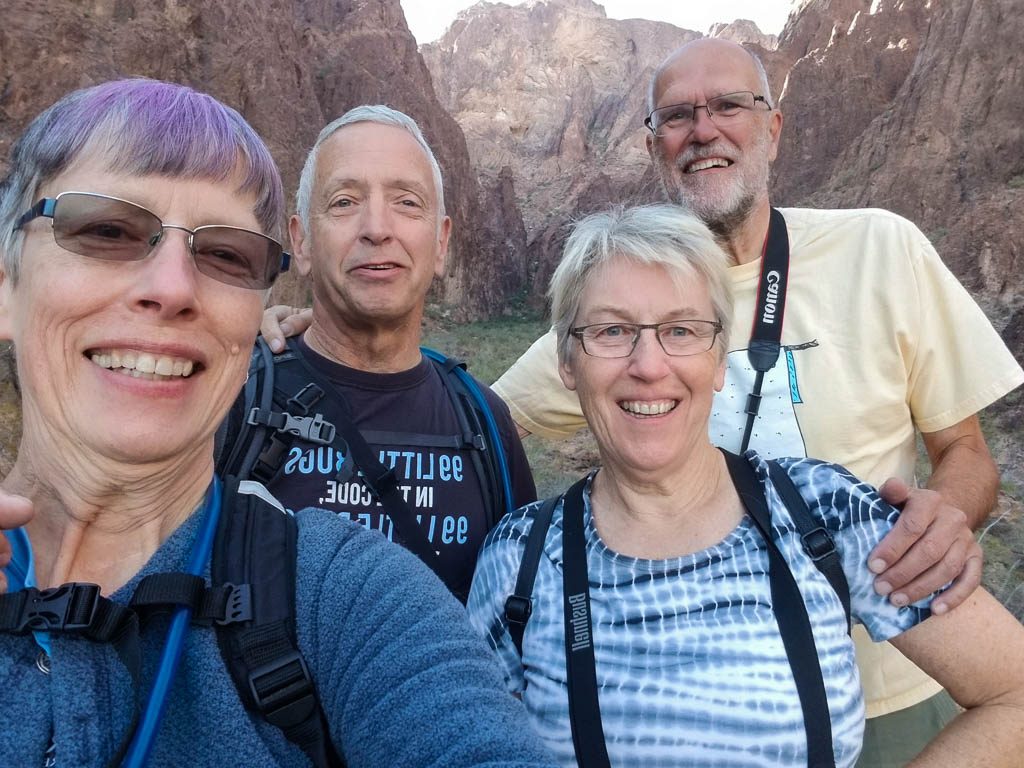
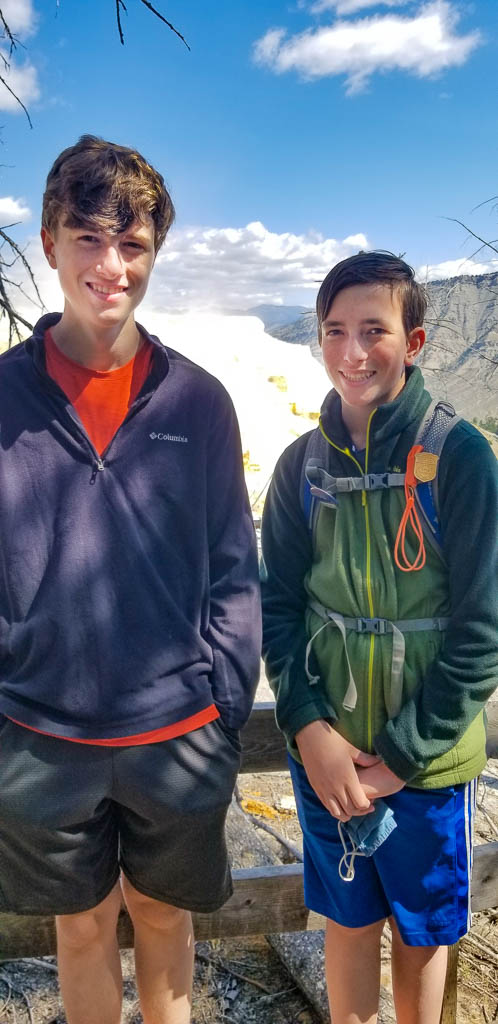
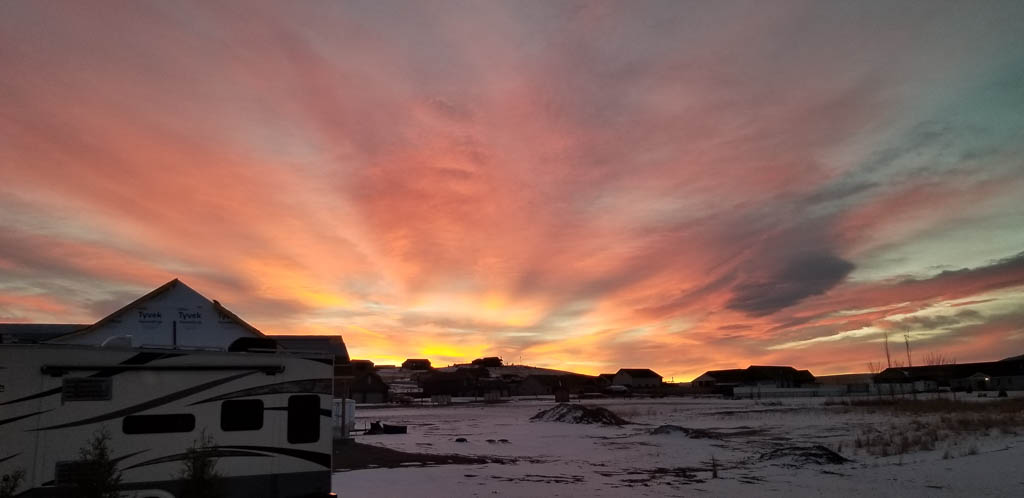
It is hard to believe that it has been over eight months since we last wrote. When I started writing, my intention was to cover both what has been going on in our lives since January, and also our great visit with our son Mike’s and Laurelyn’s family from New York. It quickly became apparent that would be WAY too long, so herewith: our visit with the NY clan. It’s way more interesting!
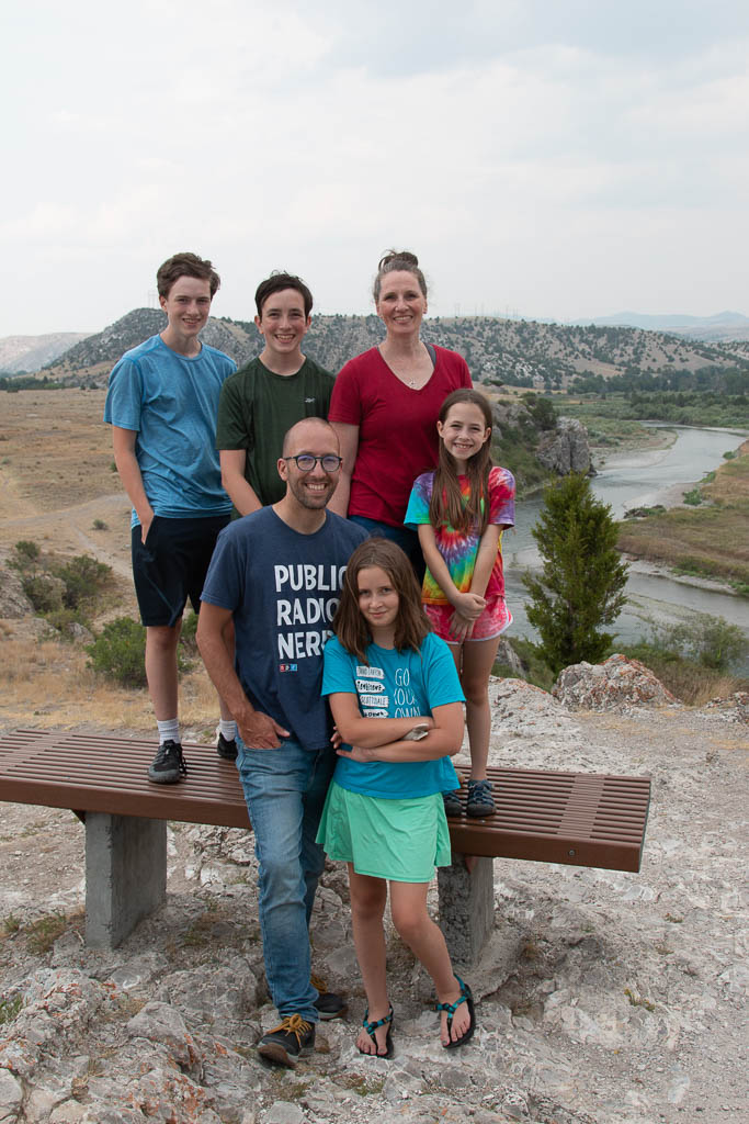
It had been over two years since Kathe had seen them, and almost three years since I had seen the whole family. The high point of our visit was three days in Yellowstone National Park.
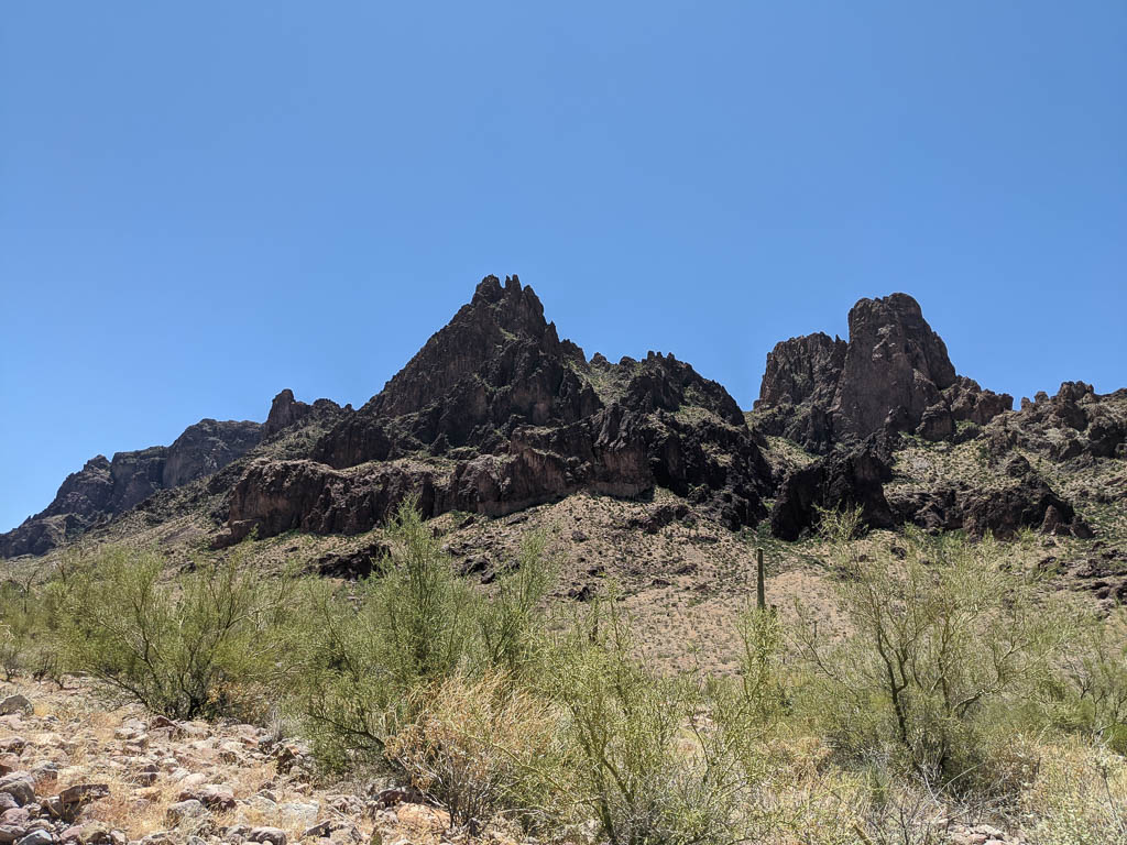
Yellowstone National Park
(We’ve also written about a previous visit to Yellowstone.)
Kathe and I had been to Yellowstone twice, but Laurelyn was the only one of her family who had ever been—and that had been when she was about six! So new experiences all around.
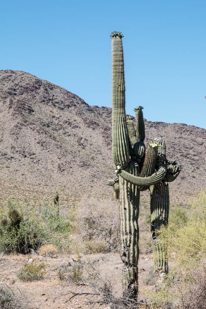
Of the four large animals in Yellowstone, we saw two: elk and bison. (The other two are moose and brown / grizzly bears.) And we saw many geothermal features, including, of course, the geysers for which Yellowstone is famous.
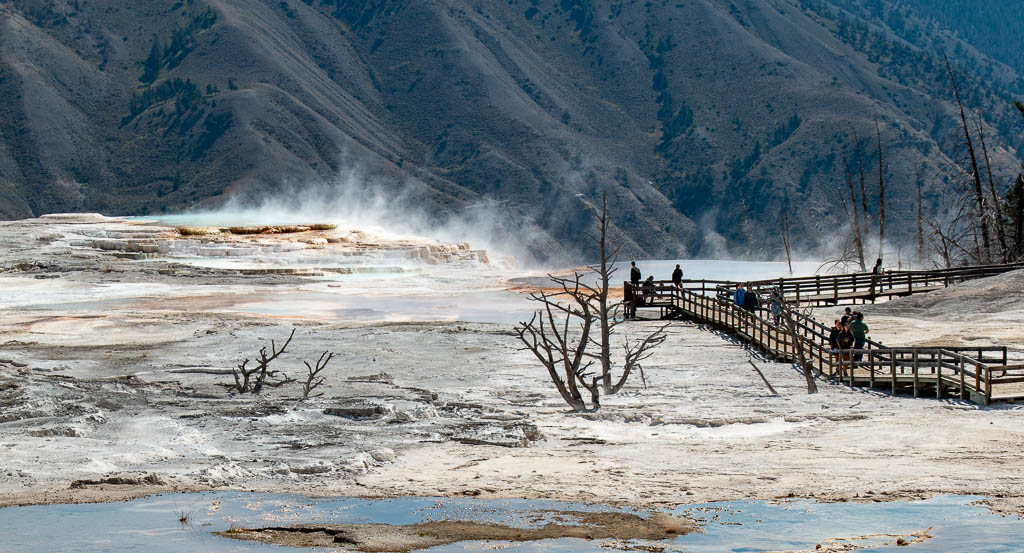
Mammoth Hot Springs and Norris Geyser Basin
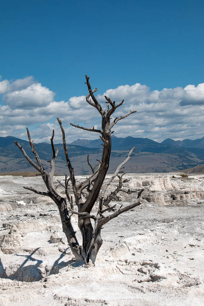
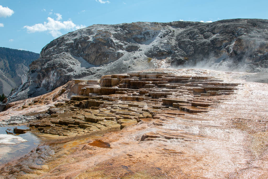
Coming into Yellowstone from the north, the first thing we hit was the Mammoth Hot Springs area. The most visually striking things here (aside from the number of cars trying to find a parking place!) are the travertine (a form of limestone) flows. There are few if any geysers in this area.
I’ve seen a report that the springs deposit about two tons of travertine daily (https://www.yellowstonepark.com/things-to-do/geysers-hot-springs/yellowstone-geyser-basins-map/), but have been unable to confirm that from an NPS source.
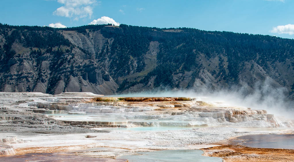
The deposits form beautiful structures, and will consume anything that gets in their way.
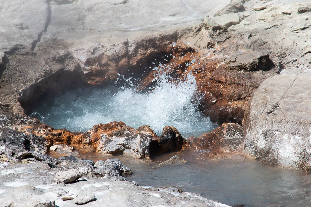
Norris Geyser Basin
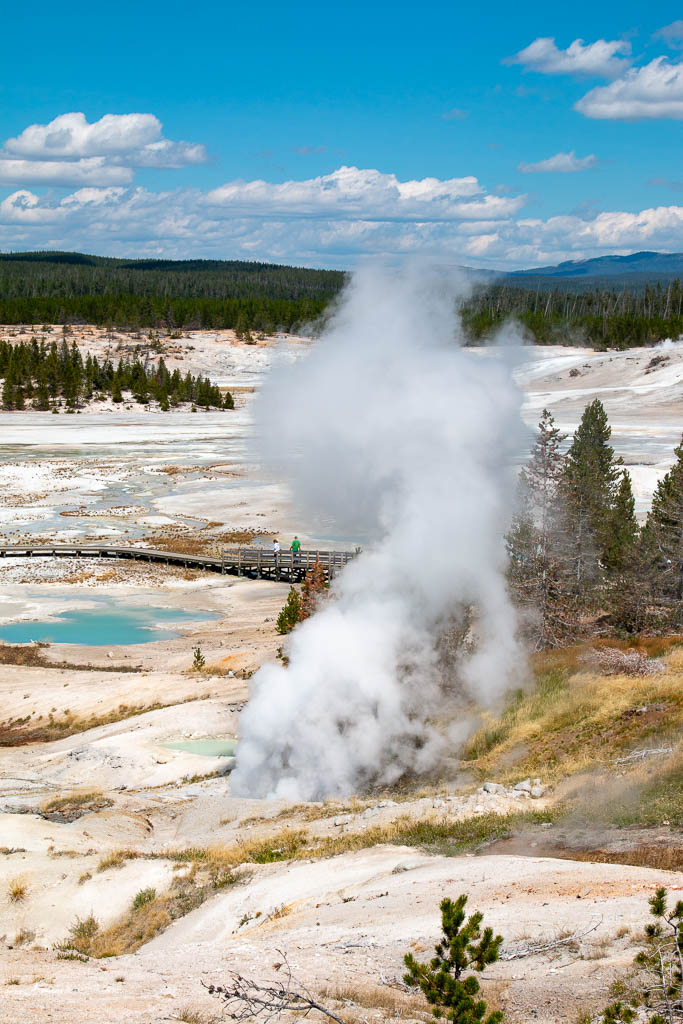
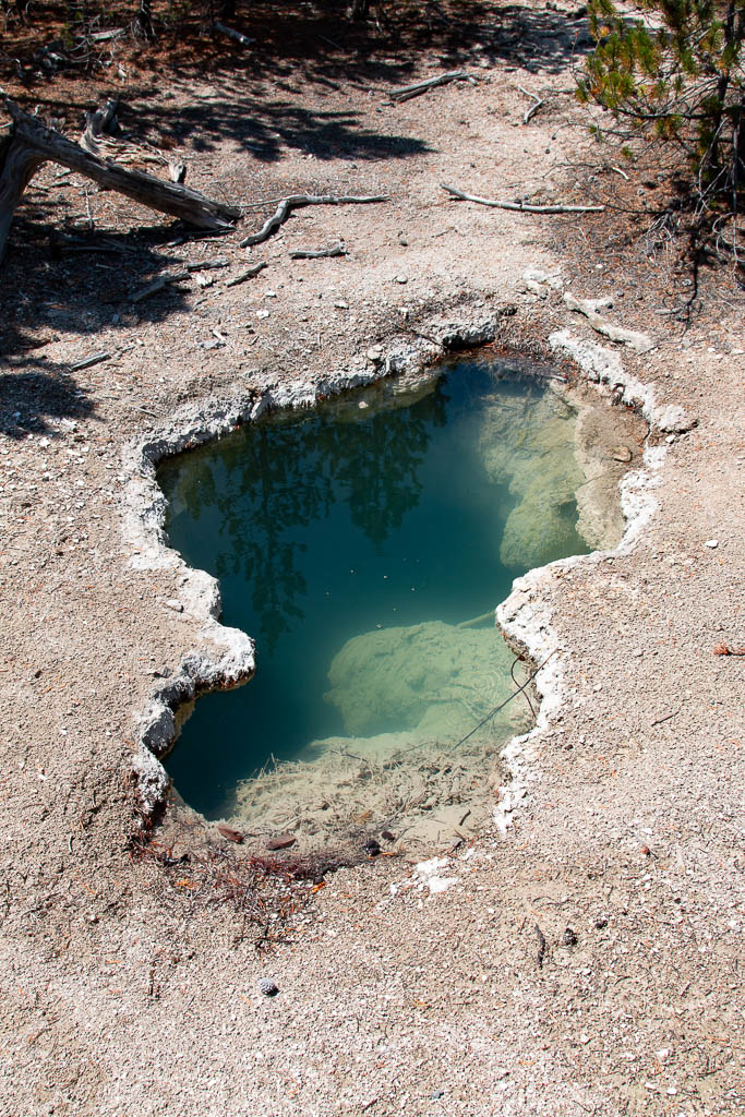
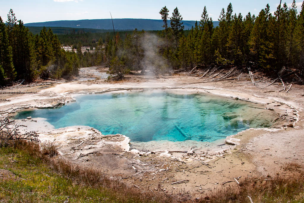
We proceeded down to Norris Geyser Basin, parking on the road with a moderate walk in. Norris has geysers, as well as travertine flows, and many pools: pretty to look at, but don’t touch!
The first feature we came to was a fumarole, a continuous, loud, jet of steam. The amount of energy being released each second is hard to grasp.
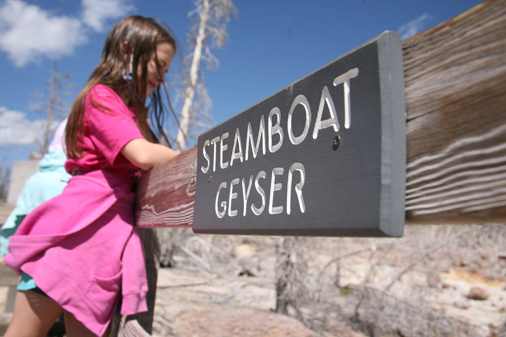
Norris is home to Steamboat geyser, the world’s tallest active geyser with eruptions in the 300 to 400 foot range. Unfortunately, its eruptions are relatively rare, with intervals varying between several days to almost a month. When we were there, it had erupted 32 days previously. While it would have been nice to wait around for it, we were not able to.
Signs everywhere warn visitors to stay on the boardwalks. The surface is frequently thin and a person could fall through. We did see places where bison had walked on the surface (they didn’t read the signs). The problem is we can’t tell where the surface is solid and where not. Not worth the risk.
Note to self: stay UPWIND! Always upwind…
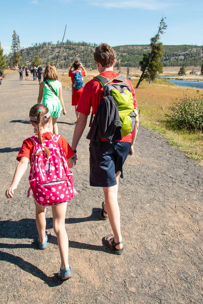
The next day we drove farther south, to the Old Faithful geyser field.
It is not often that Old Faithful is upstaged.
The Beehive geyser is taller than Old Faithful. It erupts somewhat irregularly, but about twice a day. Sometimes you get lucky! As we were walking the path through the Old Faithful geyser field, a ranger told us that the Beehive was about to erupt so we picked up our pace and went over to it. Mike was in the lead with Mira and Brynn, Graham was somewhere in the middle, and Laurelyn, Dean and we trailed. The geyser was beautiful when it erupted!
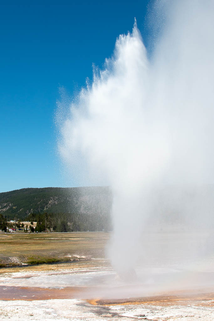
Shortly after it started, we spotted Graham coming toward us, soaked! He had been in the spray area.
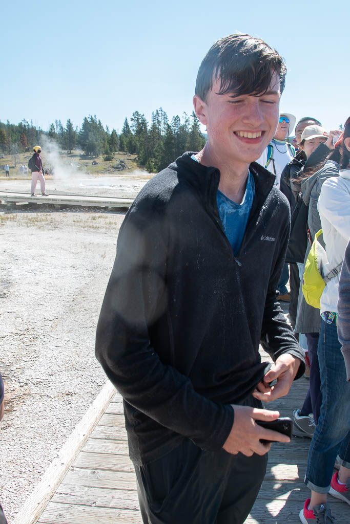
As we were enjoying his misfortune (nicely, of course!), the wind shifted. And we were… soaked! Karma, you know… We moved away, but it was a while before we were out of range; all the while I was trying to protect my camera from the acidic water. (I seem to have succeeded—it still works fine!) Mike, Mira, and Brynn had been on the upwind side. I’m sure that they are still chuckling about the rest of us getting drenched. Fortunately, it was a warm day and we were all soon comfortable again, if not quite dry yet.
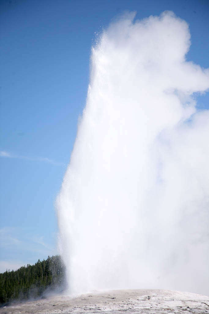
We were actually able to catch Old Faithful three times! It is always fun to watch even if you’ve seen it before. While it is not the highest geyser in the park, it is the most regular in its schedule with eruptions that can be predicted to within a few minutes—so it is the most famous and the one most people see.
Some of the geysers had prediction windows that spanned six hours or more (and we saw people waiting for them). Others, like Steamboat are simply considered not predictable. Some (former? inactive?) geysers noted that their last eruption was in the 1800s. (When) will they erupt again? Who knows!
Perspective! (i.e., Talk to the Rangers)
I’ve always been a bit disappointed with Grand Prismatic Spring. The pictures in the brochures are beautiful, and taken from above (drone shots?). But from the walkway by the spring (always stay on the walkways!), it has always been shrouded in mist. Also, being at the level of the surface, you are looking across the spring not down on it.
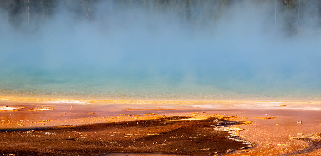
I think Mike has never met a person he didn’t want to chat with. True to form he started talking with a ranger: “See that group of people across the way up on the mountain? That’s where you want to be!” Mike got the directions and off we went.
NOW I know why people like the Grand Prismatic Spring so much.
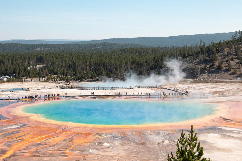
Like so many things in life, it is all a matter of perspective.
Yellowstone is a wonderful place to teach and learn photography. Mike is teaching Mira, and using full manual for all the settings! Way to go, Mira!
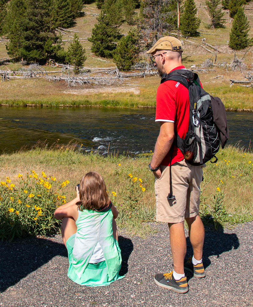
Several of the pictures in this blog post were taken by Mira. (Check for the “Photo credit” attributions.)
Animals
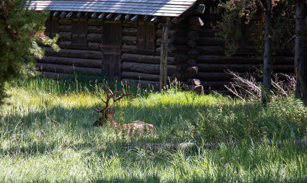
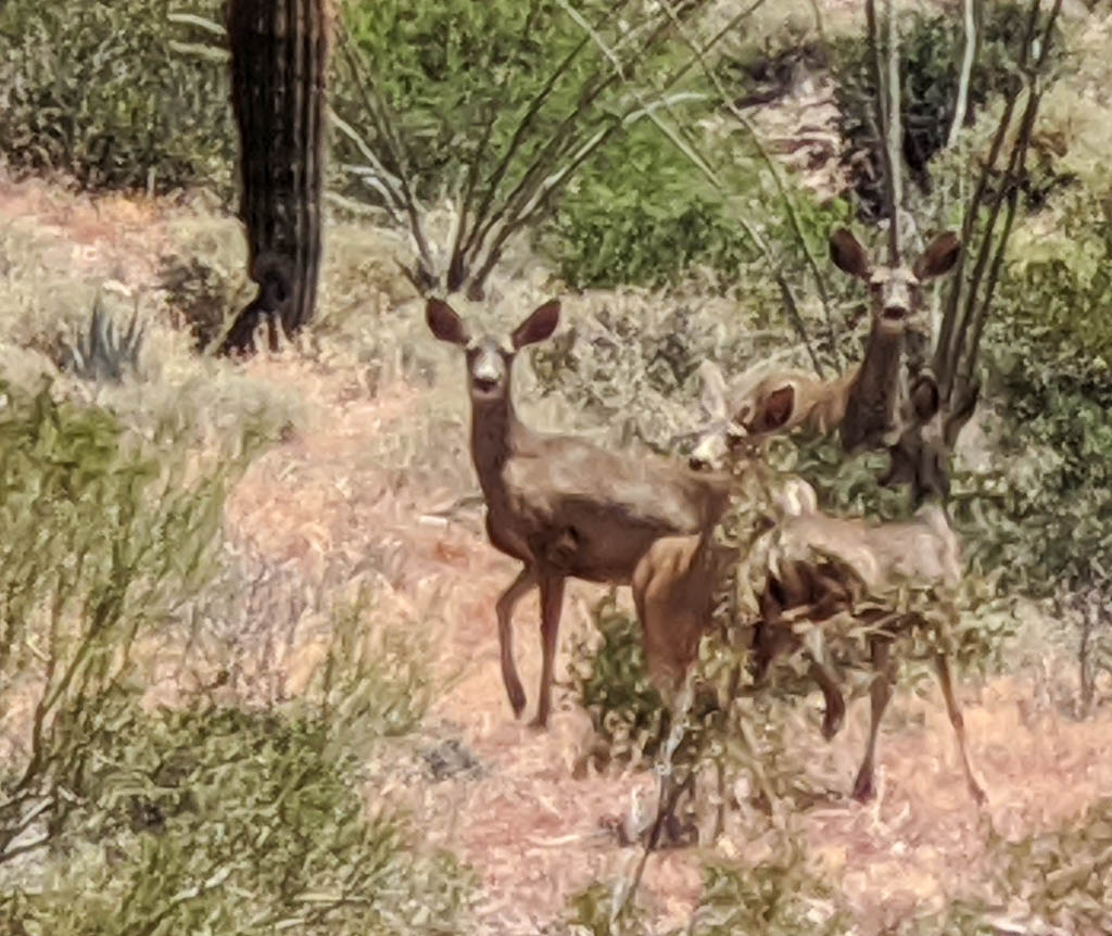
When we first drove into the park through the North entrance and got to Mammoth, there were several elk browsing and resting in the open areas, quite used to people and cars in the area. We all enjoyed them being just tens of feet away, especially Brynn and Mira. I thought their excitement would fade as we saw them more and more times through our visit, but I was wrong!
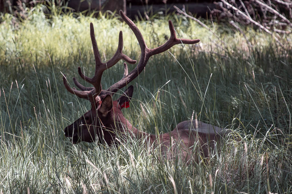
When you see a lot of cars parked alongside of the road, you know that you should stop too, and see whatever the attraction is. One time we did this, we were rewarded with this elk stag resting in the shade.
Sometimes I have to laugh at myself. I was thinking, “Sometimes, a 100mm lens just isn’t long enough.” Then, “Wait! I have a 400mm lens in the car!” Run back to the car…
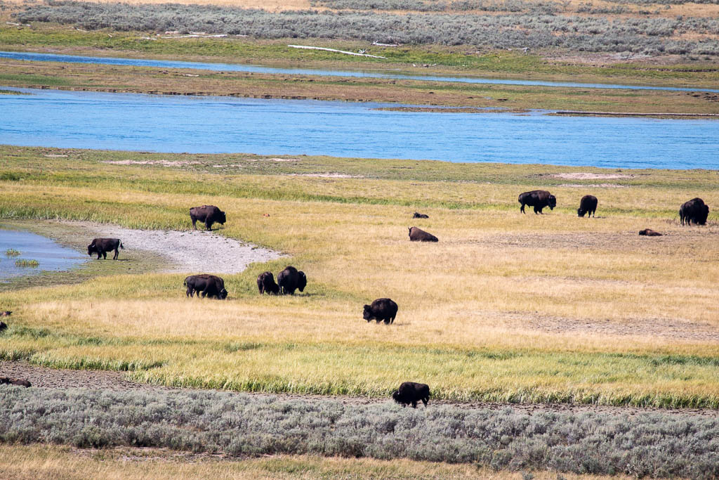
We were winding down our last day in the park, a little disappointed that we had not seen any bison up close (we had seen one the better part of a mile away in a huge field). Once again, cars parked alongside of the road…
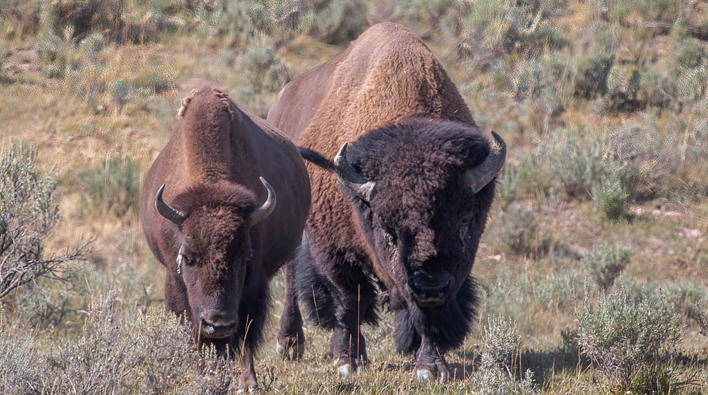
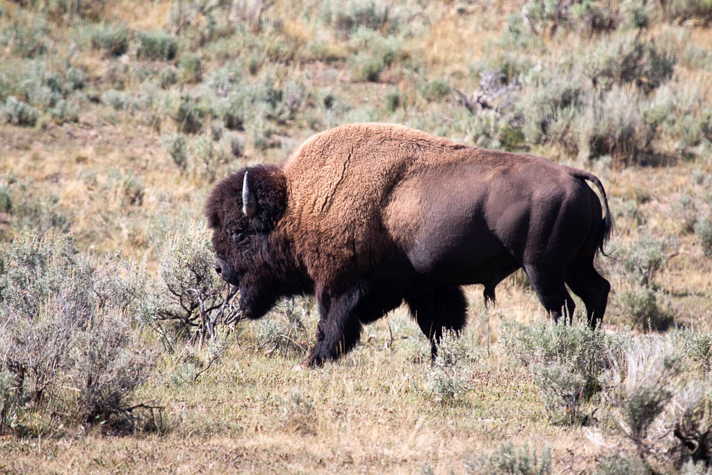
It was a great way to close out our visit to Yellowstone!
Lewis & Clark Caverns
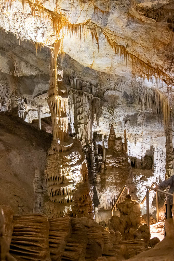
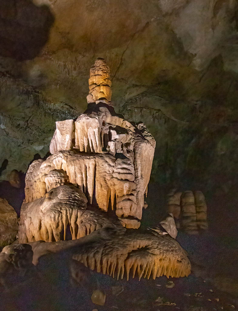
Western Montana has a strong affinity with the Lewis and Clark expedition, the Corps of Discovery. (We live in Lewis and Clark County.) We went to Lewis & Clark Caverns State Park, and took a two mile tour of the cavern (one mile underground). While not as big as other caverns we have been in (Mammoth Cave, Wind Cave, and Luray Caverns), it was, nonetheless beautiful and fun. It makes you appreciate the power of water over time, both to destroy, eroding the rock to form the cave, and to build, creating the stalagmites, stalactites, and other formations.
Note: all the light for these photos is artificial; we’re far underground. At one point the guide turned off all the lights. The darkest night above ground does not compare with this absolute lack of light.

Lewis and Clark were presumably unaware of the cavern (they kept detailed journals, and there is no mention of it), but they did go up the Jefferson River, which passes the base of the mountain containing the cavern. Close enough to use the name!
In fairness, I have to say that Montana isn’t the only state with an affinity for Lewis and Clark. There are also Lewis and Clark state parks or recreation areas in Washington, Oregon, North Dakota, South Dakota, Nebraska, Iowa, and Missouri, and I probably missed a few.
Missouri Headwaters State Park
Coming back home from the Cavern, we stopped at Three Forks (marvelous pies!), and the Missouri Headwaters State Park. This is where the Jefferson, Madison, and Gallatin rivers join to form the Missouri.
Museum of the Rockies
We also went to the Museum of the Rockies, which we all enjoyed. It has some major dinosaur skeletons, as indicated by this brass casting of a Tyrannosaurus Rex named “Big Mike.”
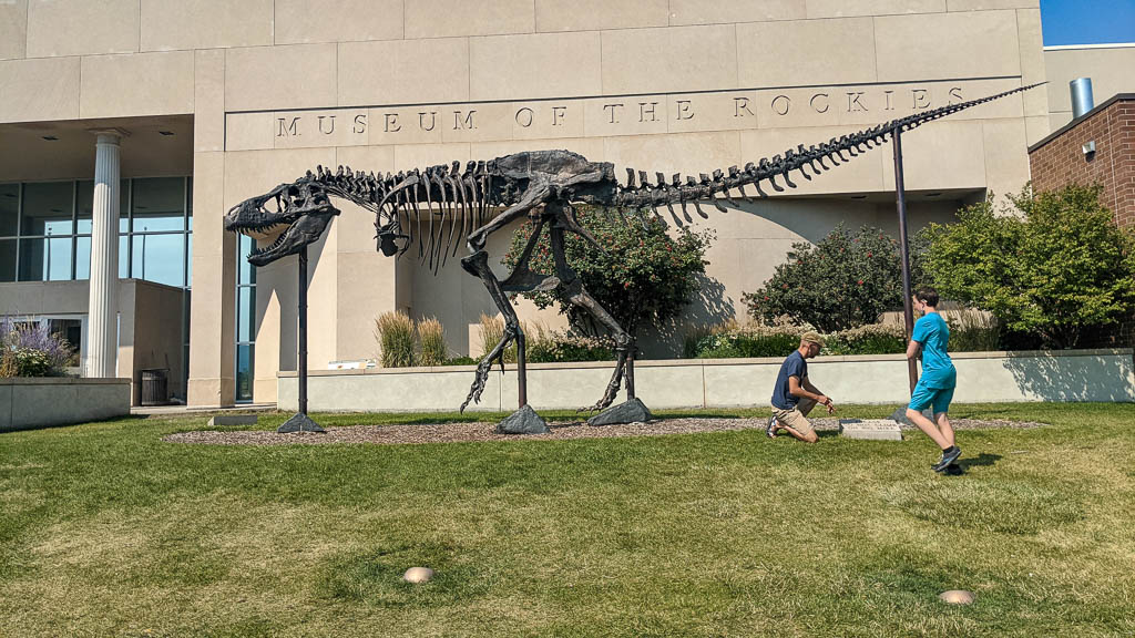
Of course, there is a sign asking people to not climb on Big Mike… so what are kids to do?
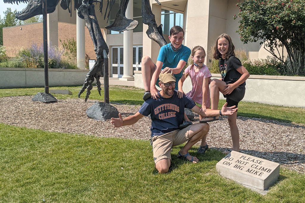
Of course.
Climbing!
Speaking of climbing, Mike found a climbing gym that looked nice down in Bozeman: Spire Climbing Center. So we went to check it out. Oh, yeah…
It’s massive.
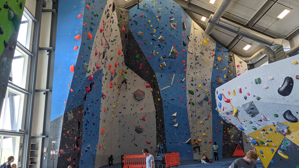
Grandma chose to stay home, but everyone else got some elevation.
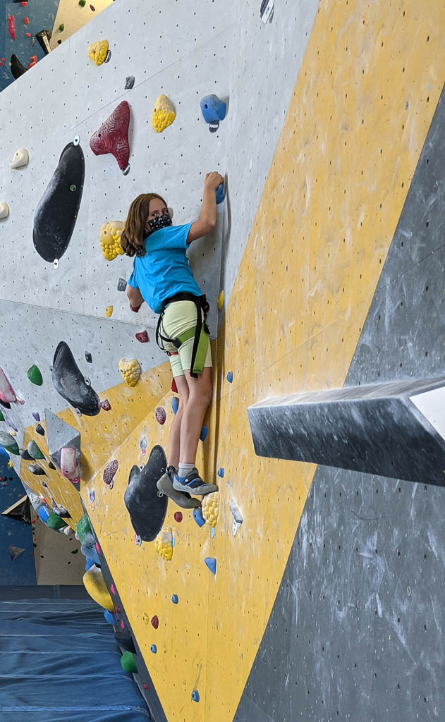
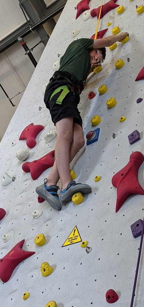
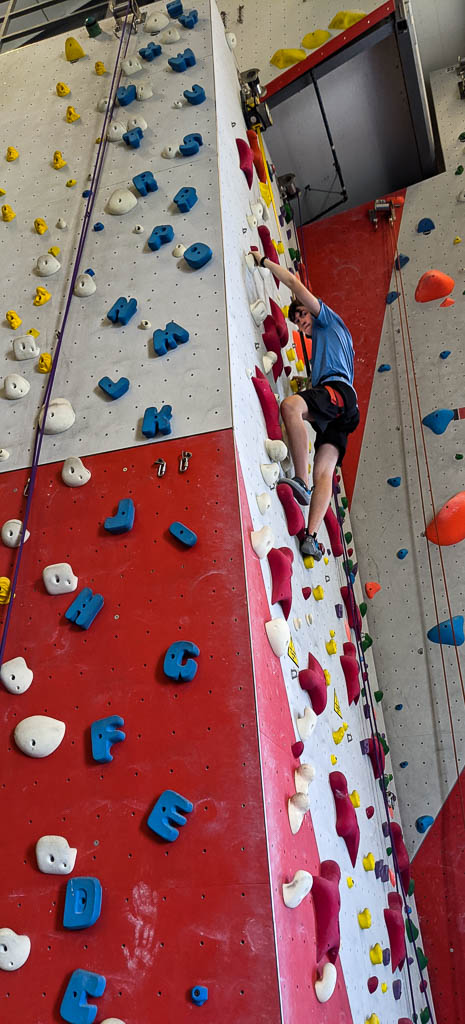
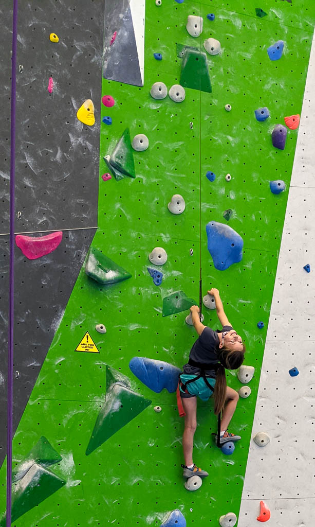
The top of every route had a big red Staples “That was easy!” button. Yeah. Right.
There were several other activities that we considered such as a rodeo but chose to not do because of Covid—the youngest two are currently too young to be vaccinated. So we spent the rest of the visit hanging with good friends, cooking (mostly Mike on the grill, and Mira making great cookies), building a jigsaw puzzle, and… Oh, yes! And watching fire fighting planes and helicopters.
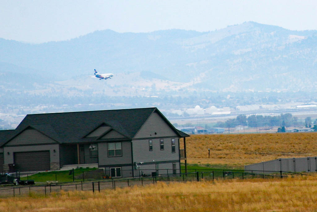
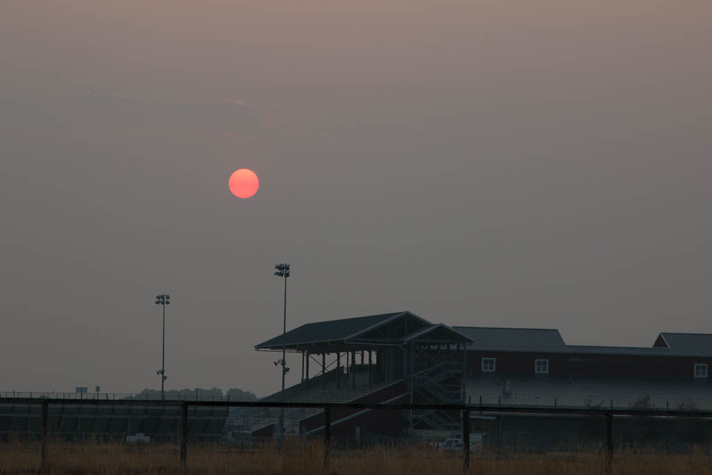
As you undoubtedly know, much of the west is on fire now. We are about 5 miles from Helena Airport which is a base for fire aircraft. There were a wide variety of aircraft in and out of the airport continually: DC-10s, Chinooks, Blackhawks, and a Sikorsky Sky Crane, among others. The sky crane had a large hose dangling down so it could refill its water by hovering over a nearby lake; we called it Snuffleupagus. Graham, particularly, watched their comings and goings on the Flight Aware app, and spotted several new fires based on the aircrafts’ flight paths and a satellite-based fire spotting site before the fires were announced in the daily briefings or posted on the several fire mapping websites.
Speaking of the fires, we are lucky to have had none in the immediate area, but we have had dense smoke on a fairly regular basis since early July, with occasional clear days. We are surrounded by mountains, and frequently we couldn’t see them at all. This was a disappointment for Mike and Laurelyn, but one of the great things was that in Yellowstone we had no smoke problems at all.
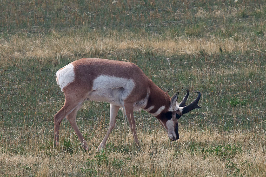
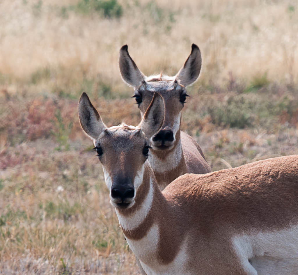
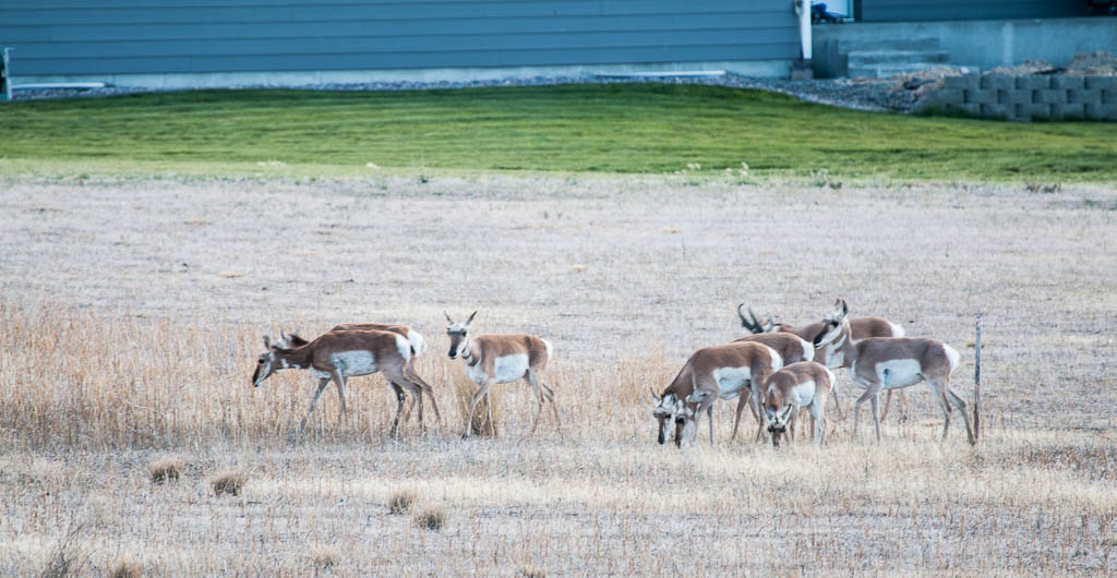
Pronghorn
A small (11) herd of pronghorn is in the area again, as some were last fall when we moved in. Because of size differences, we think that there are yearlings in the group. Their timing just overlapped with the visit, so everyone was able to see them! Another animal you can’t see in New York State.
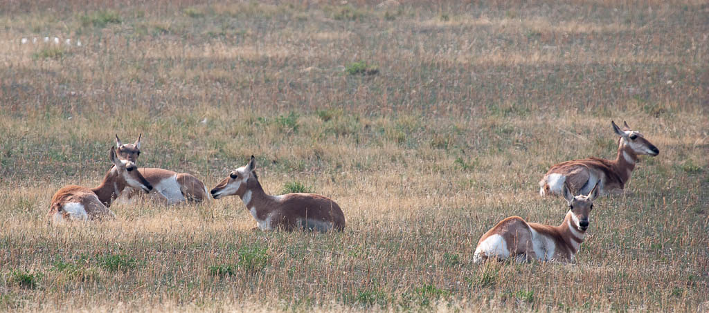
We think that there was one adult buck because it had horns, but pronghorn horns are odd. The difference is between antlers and horns is that antlers are shed each year and horns are not. Except for pronghorn horns which are??? And female pronghorn also have horns but they are much smaller. These are in the size range for males from what we’ve read.
Unfortunately all good things come to an end, and our visit ended far too soon. We hope that they will find their way back west again in the not-distant future! We miss them all already.

More friends and family!
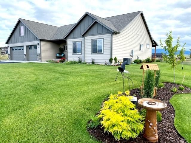
We’re still enjoying the glow from Mike & Laurelyn’s family’s visit, but we’re also excited about finally getting a chance to visit Beth & Jon’s family at their new home in Canada! The border is open again! Yea!


")