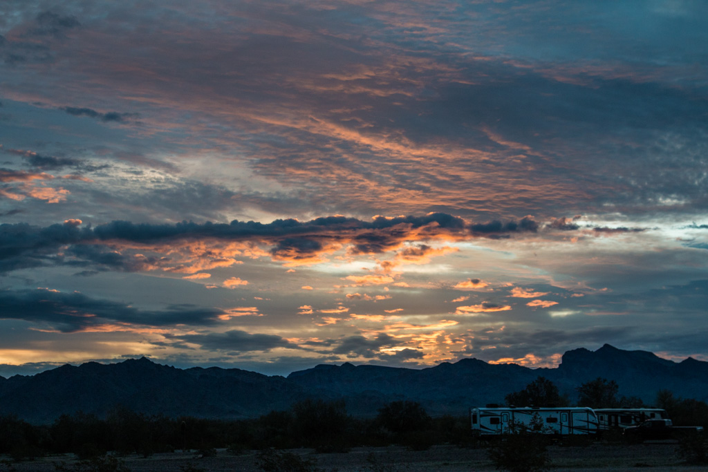
A long-planned highlight of our spring was our visit to Beth and Jon’s family in Vancouver, BC. Planned in two parts, it exceeded our already high expectations. We had a wonderful time!
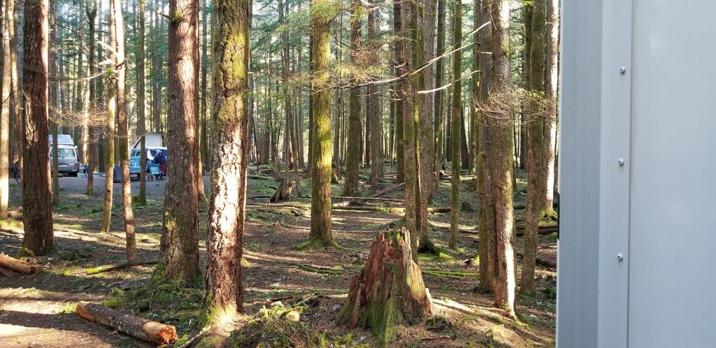
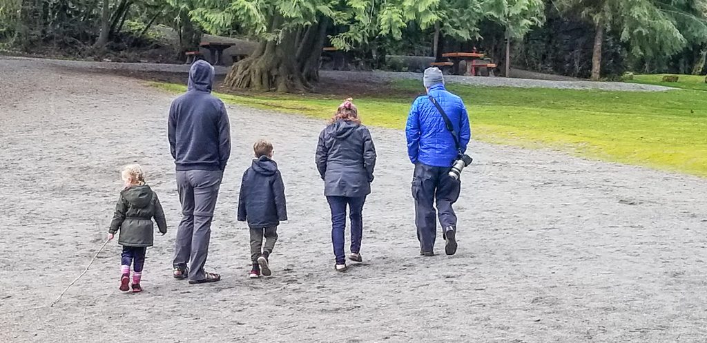
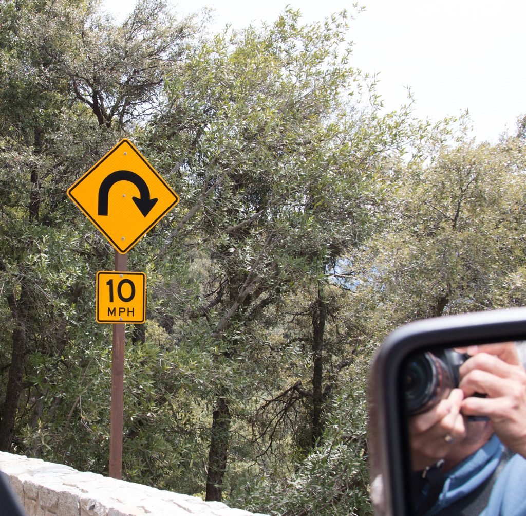
The first part of our visit was a weekend joint camping trip to Alice Lake Provincial Park. We arranged for two adjacent campsites so that we would all be together. An idea that we haven’t seen in US parks is to have a subset of campsites set up as pairs, and reservable only as a pair. It makes family camp outs much easier to arrange.
Our plan was that Kasper and Nyssa sleep with us in the RV, and Jon and Beth would be in their tent. They had primarily camped in the summer before; we all found out that late April was not quite the same. EVERYONE ended up sleeping in the camper, to stay warm!
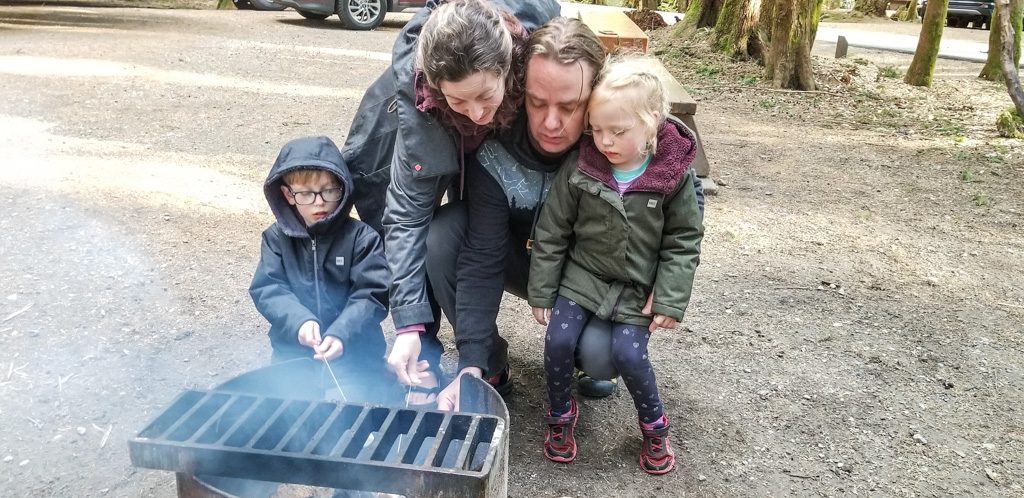
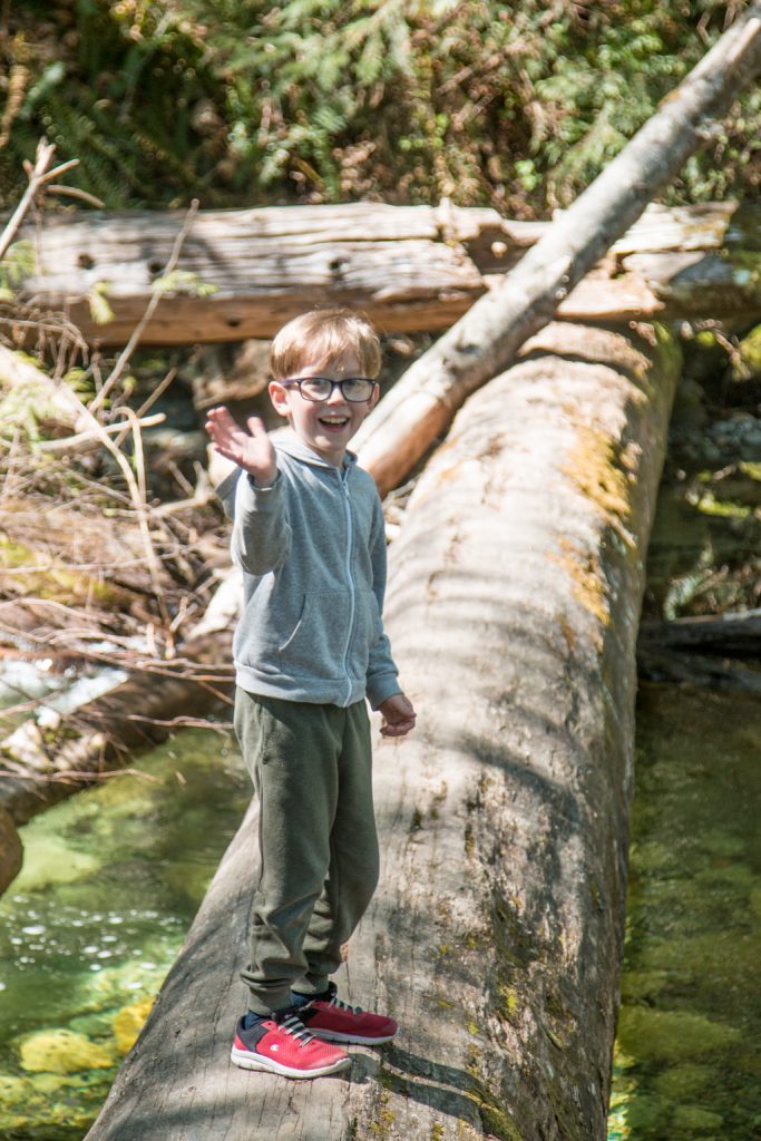
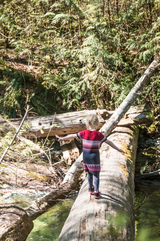
Nicely spaced out wooded sites.What is a camp out without s-mores???!!!A family stroll on the beachIf there is a log across a stream, well… Ya just gotta!Sing it with us: “Anything you can do, I can do…”
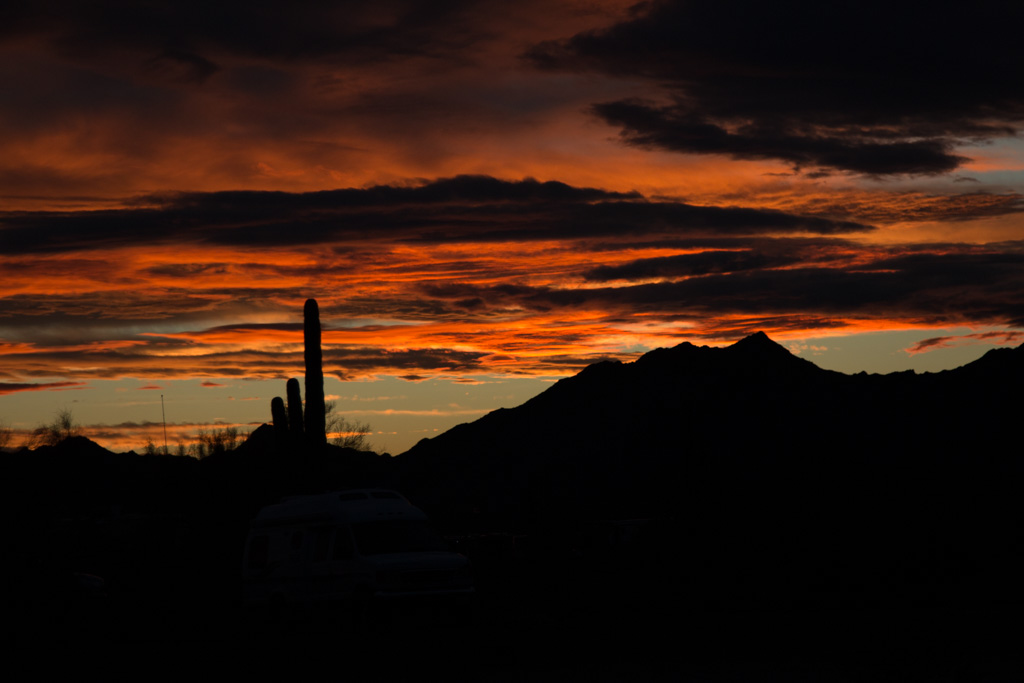
After our stay at Alice Lake, we all went back to Vancouver; we stayed at the only campground actually in Vancouver proper, just north of the wonderful Stanley Park, and about 20 minutes from Beth and Jon’s apartment via Vancouver’s excellent public transportation system. (We were not about to try to drive our truck, Scarlett, in Vancouver!)
Note to selves: Do NOT put your transit card, loose, in the same pocket with your phone in a sticky Otter case. We each lost a card when we pulled our phone out.
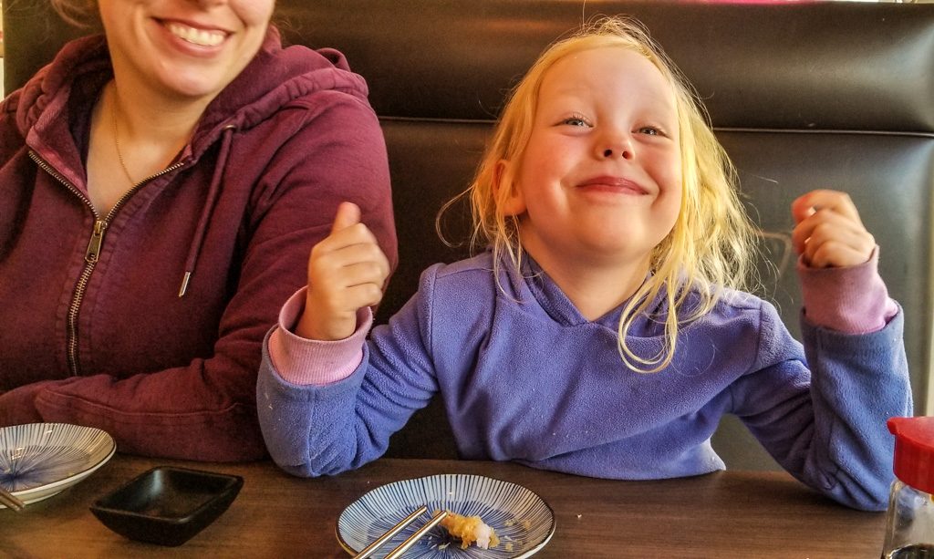
One of the things that we missed living on the coast of Maine was a variety of cuisines, particularly Asian. Vancouver has plenty! We had Japanese (Sushi) (twice!), Afghani, and several others. Unfortunately, we ran out of nights before we could make a dent in the variety.
Sushi in the Pacific Northwest and Canadian southwest is hard to beat!… as witnessed by THIS smile!
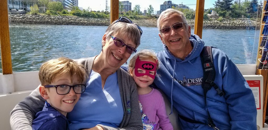
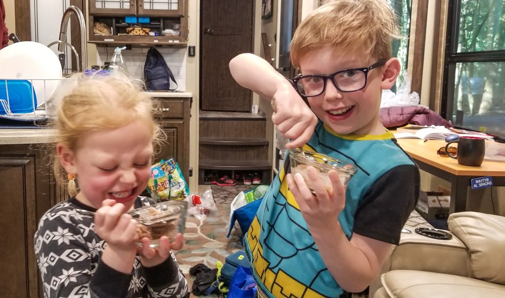
Kasper and Nyssa spent two more nights with us while in Vancouver. For those who don’t already know it, one of a grandparent’s most important duties is spoiling the grandkids. We take our duties seriously! What better way to do it than by having chocolate ice cream for breakfast!
Memory with Grandma Lobster. What could be better?
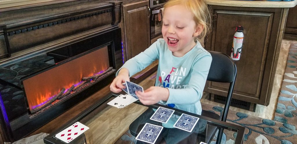
Kasper and Grandpa also shared some good time together, working on K’s first book of logic puzzles, e.g., “Rita married Joe, but not on Wednesday. Carla was married on Sunday on the village green. Who did Tess marry?” The major learning from this was that Grandpa needs to (re-)start doing these as well! I loved these as a kid, but I’ve lost the knack. We also worked on ways to present data… How to graph seven different aspects of each of 12 chapters in Roald Dahl’s “Danny the Champion of the World.”
Multi-color line graph anyone?
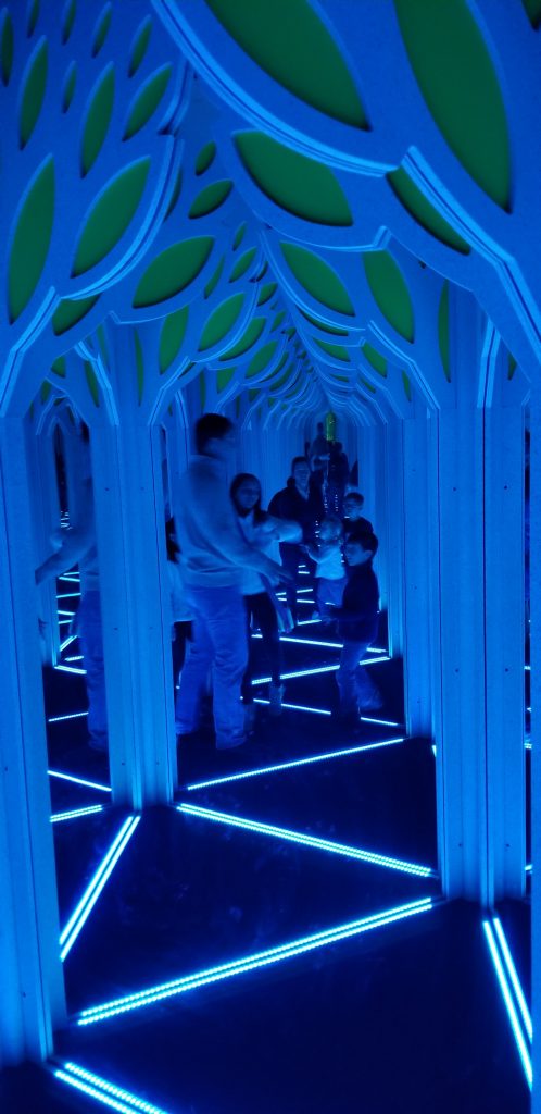
We visited Science World, a must-stop on each of our visits. Their current featured exhibit is a hall of mirrors… No, you can’t just walk straight ahead in the picture below!
Anyhting but straight!
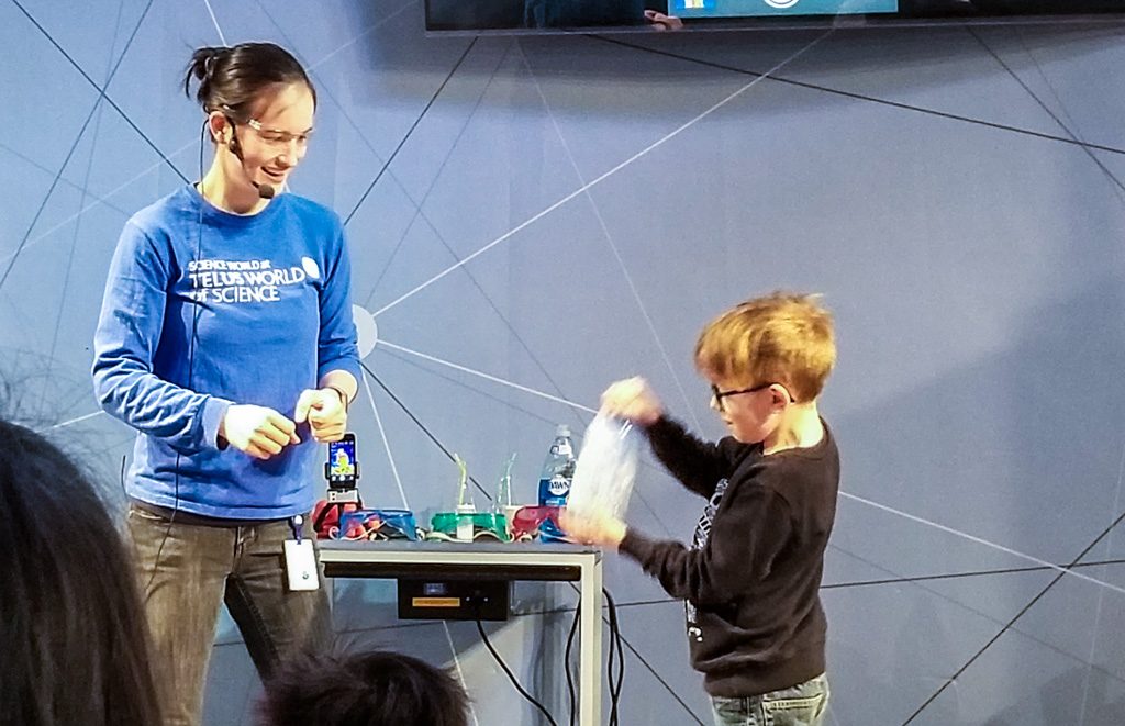
And Kasper got to be part of the presentation team in a chemistry demonstration!
Shake, shake, shake! What is going to happen?
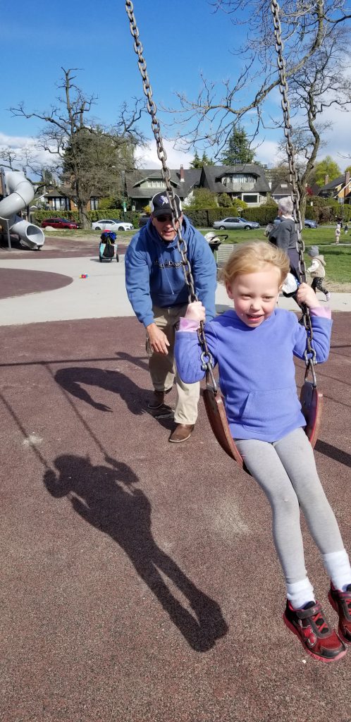
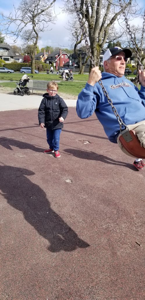
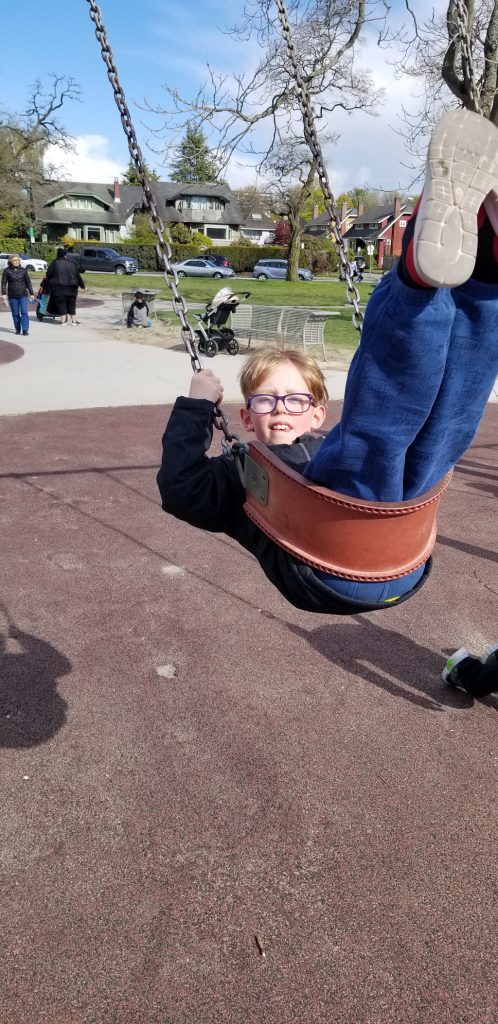
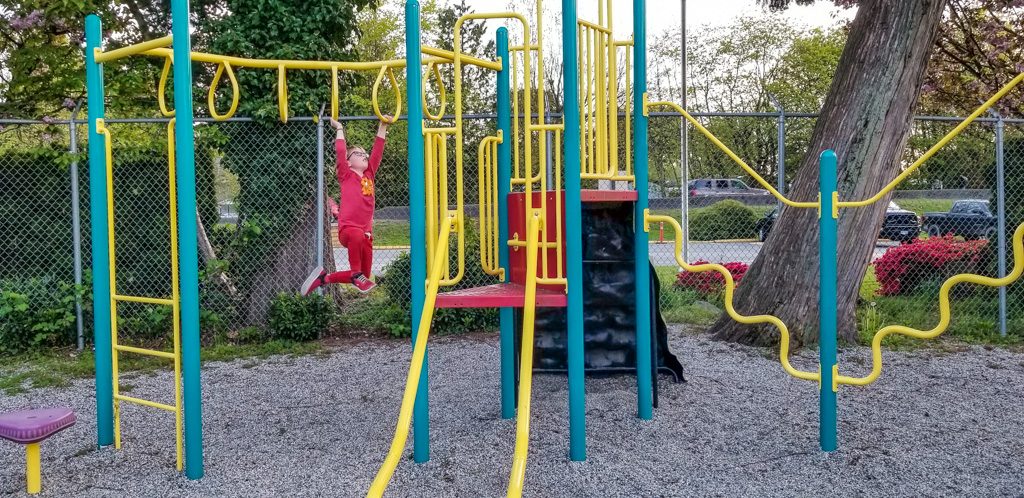
Vancouver also has many playgrounds scattered around the city…
The young sometimes need (want) help on the swings.(As do—sometimes—the old(er))While others do just fine by themselves!Do you remember your adventures on the monkey bars? I sure do! Mine weren’t this fancy…
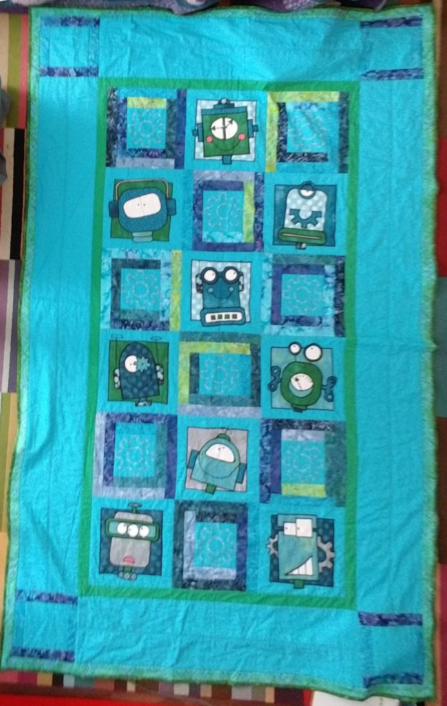
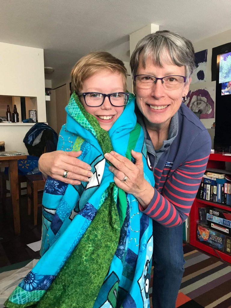
Kasper had a birthday very near our visit, and Grandma had a VERY special birthday present ready for him. A handmade robot quilt!
We won’t count the hours…Happy, and happy!
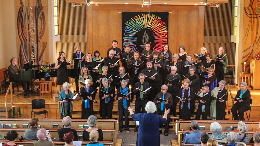
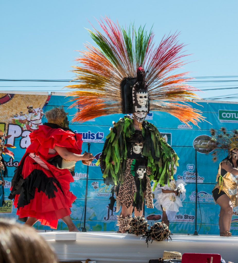
One of the (many) highlights of our visit was being able to attend Beth’s concert. Celebrating the director’s twenty years with the choir, it was titled simply, “Donna’s Favorites.”
In a surprise ending, a sextet from the choir gave the premiere performance of a commission using Emily Dickinson’s poem, “It’s All I Have to Bring Today” as the text. Set to music by Donna’s favorite composer, Larry Nickel, it is dedicated to Donna Brown.
Our visit ended all too soon; it was time to head to Washington’s Olympic Peninsula.
In a workshop we took with the amazing photographer/writer Colleen Miniuk, I learned that before I capture the image, I should title it. Yup. Before I even push the button.
That has stuck with me.
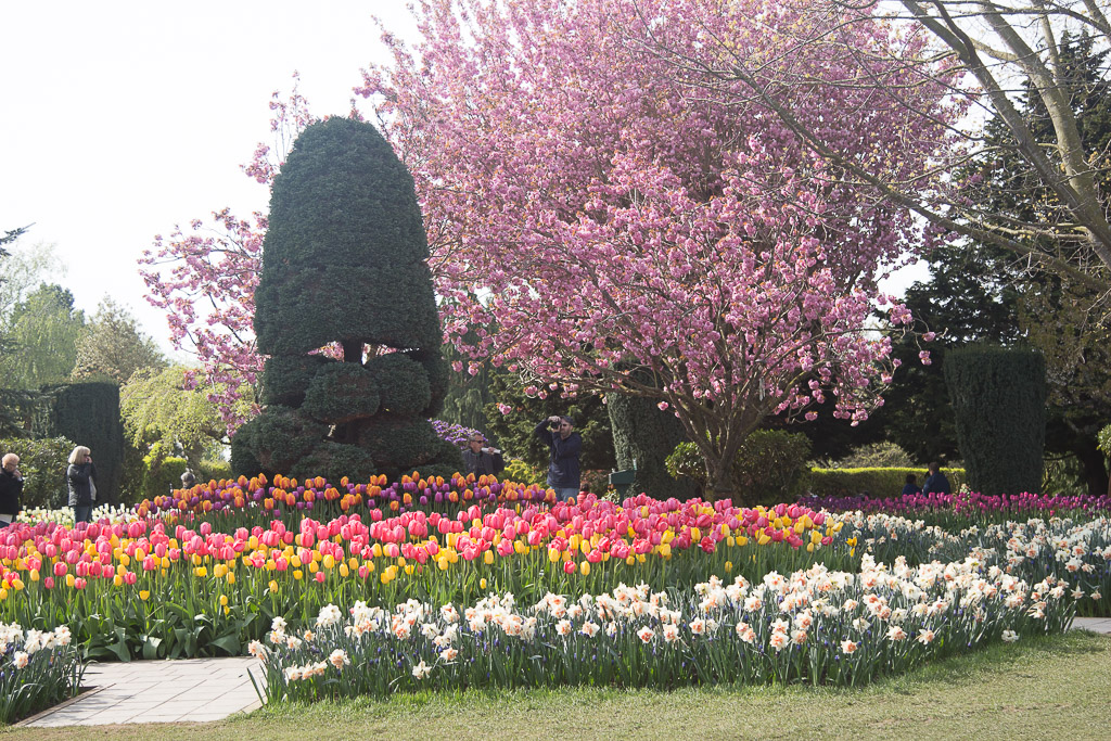
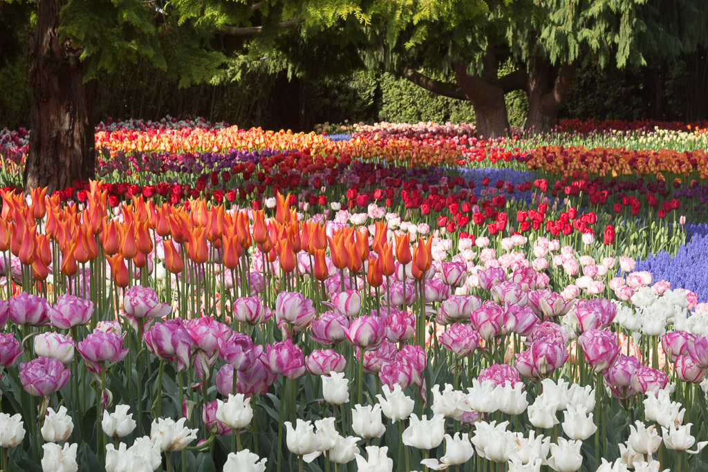
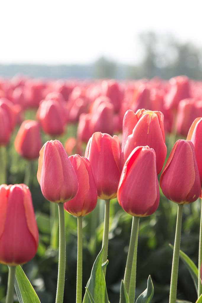
We camped recently in Mount Vernon, Washington. When we made our reservation, the campground owner made mention of the fact that since we’d be there “after the big crowds,” he had space for us.
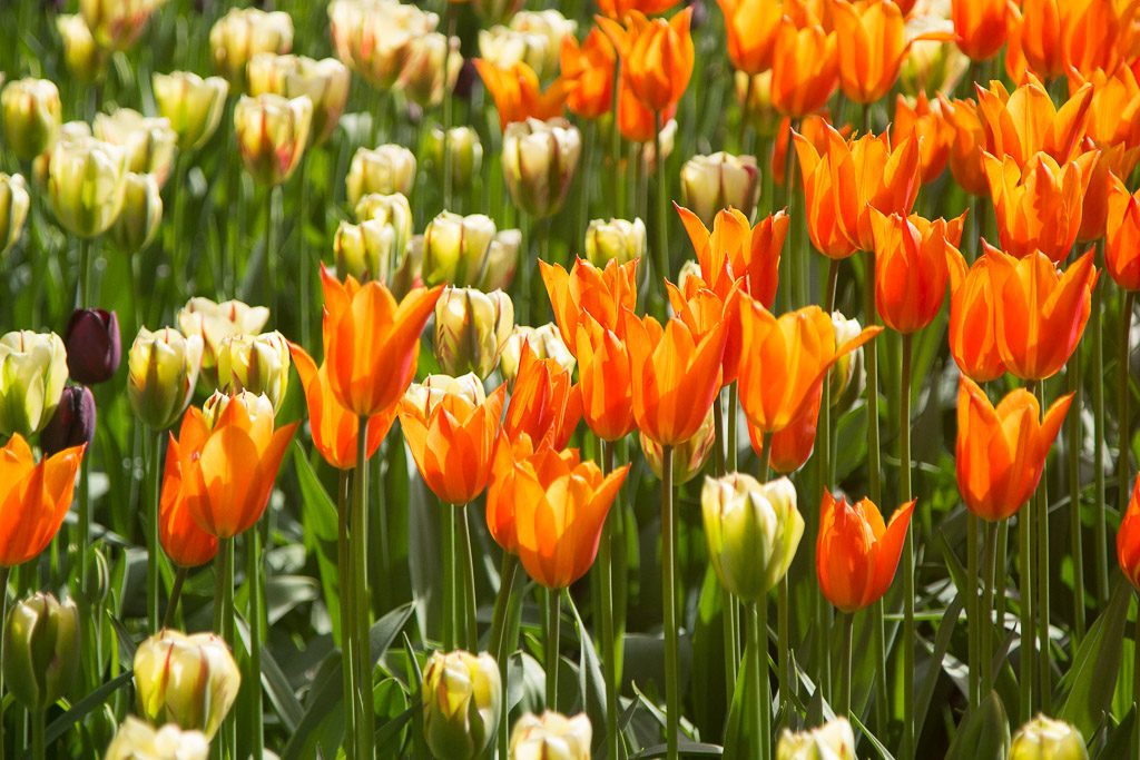
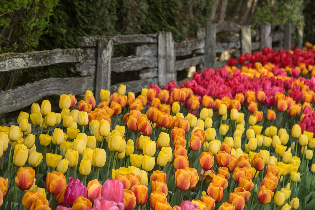
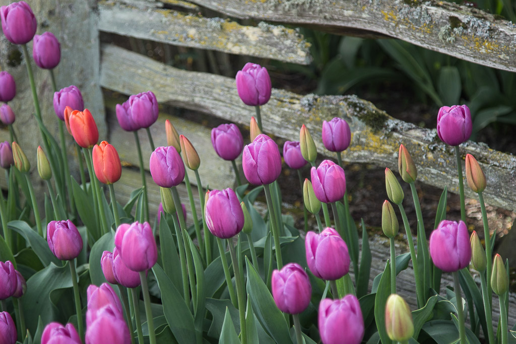
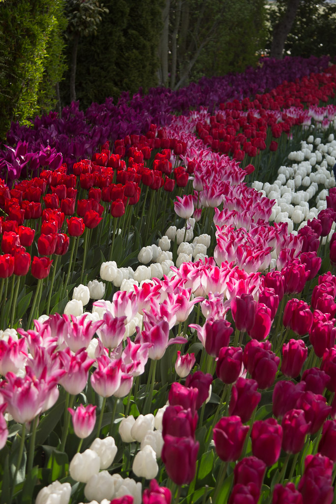
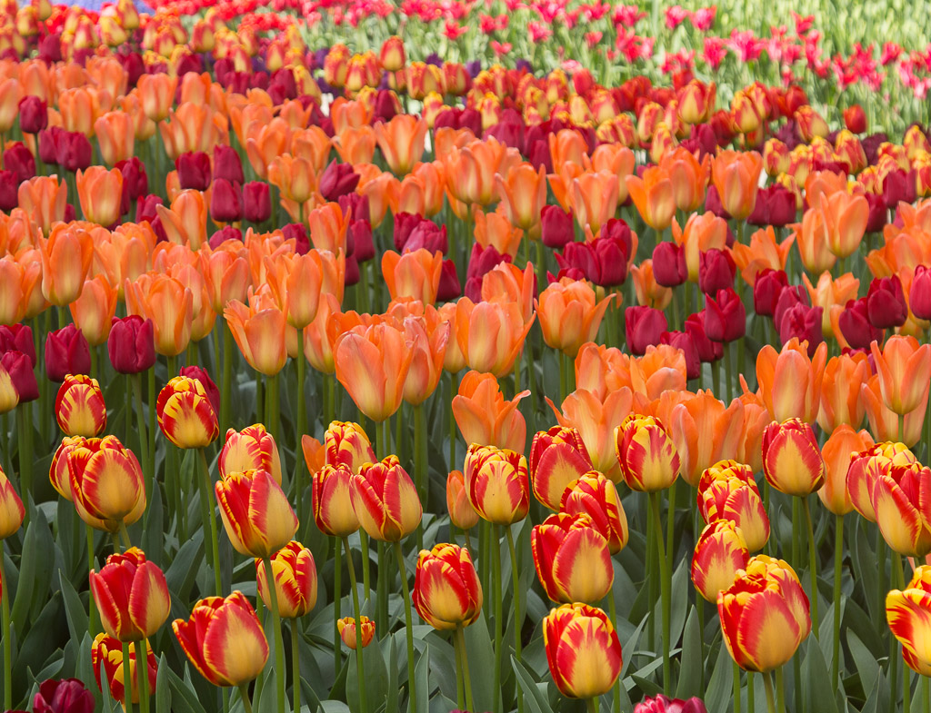
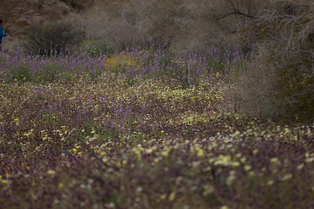
Imagine our thrill when we learned upon checking in, that the Skagit Valley Tulip Festival was ongoing! The busiest time was the weekend just before we arrived but there were still fields and fields of tulips to enjoy (and far smaller crowds).
After we settled in, we grabbed our cameras and took off in the truck to take in tons of terrific tulips. It was totally astonishing!
Roozengaarde features a five acre display garden planted with over a half million bulbs, a 25 acre tulip field and 20 acre daffodil field. Tulip Town has another half million bulbs planted. The entire event goes on for the entire month of April (but sometimes the tulips are a bit early or late). The festival includes dozens and dozens of coordinated events in the region, everything from parades to fun runs, art shows to salmon barbecue dinners, and classes of all kinds.
We enjoyed a scrumptious salmon dinner sponsored by the local Kiwanis Club; it’s their biggest fundraiser of the year. It was a great way to meet and support the locals.
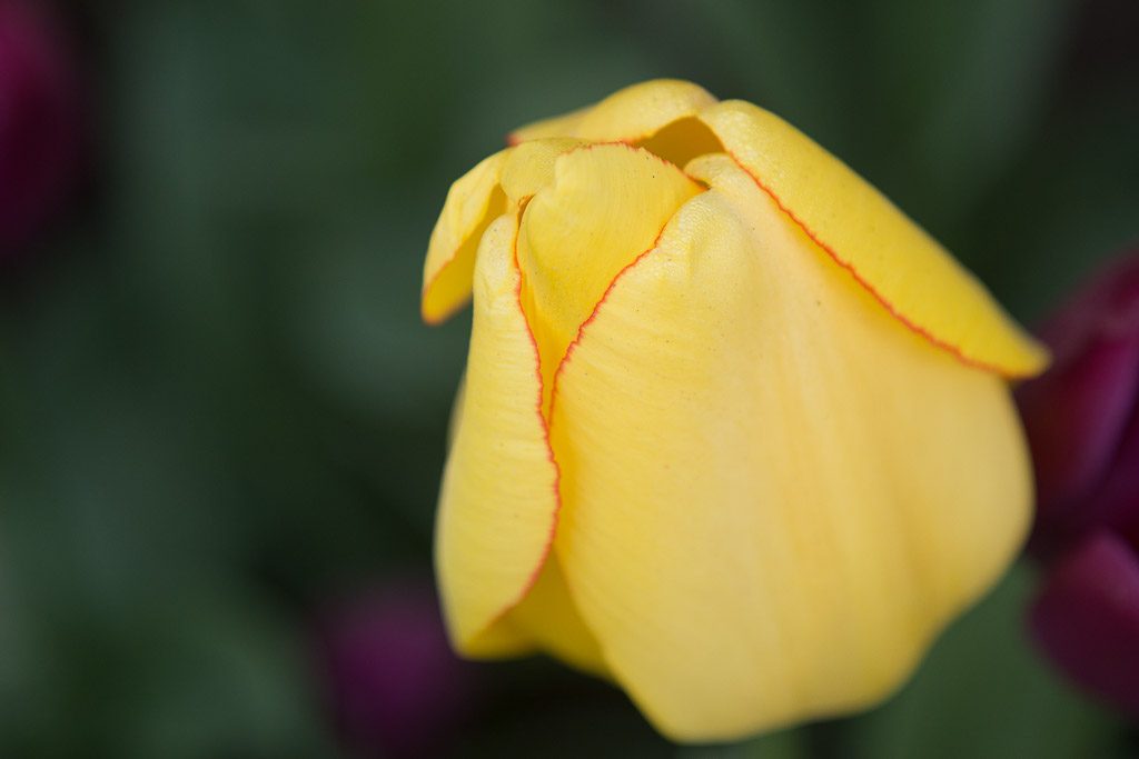
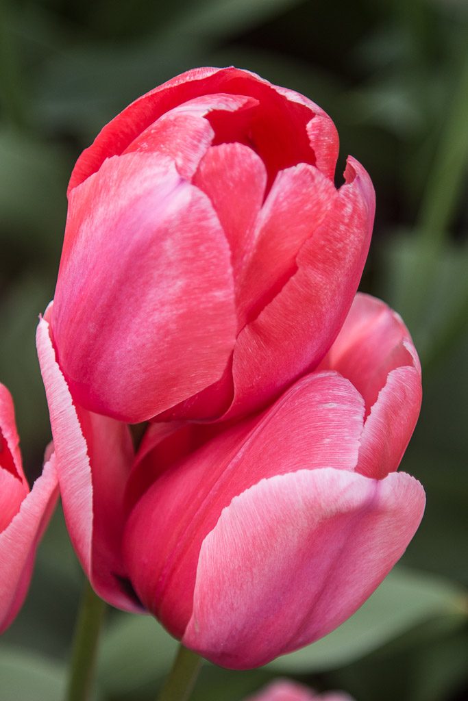
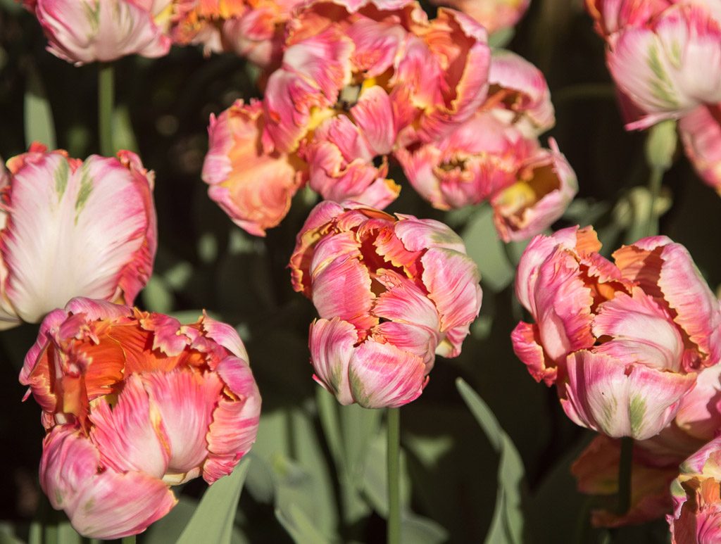
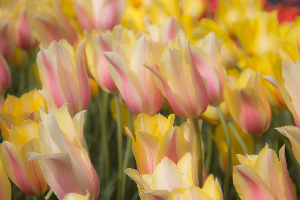
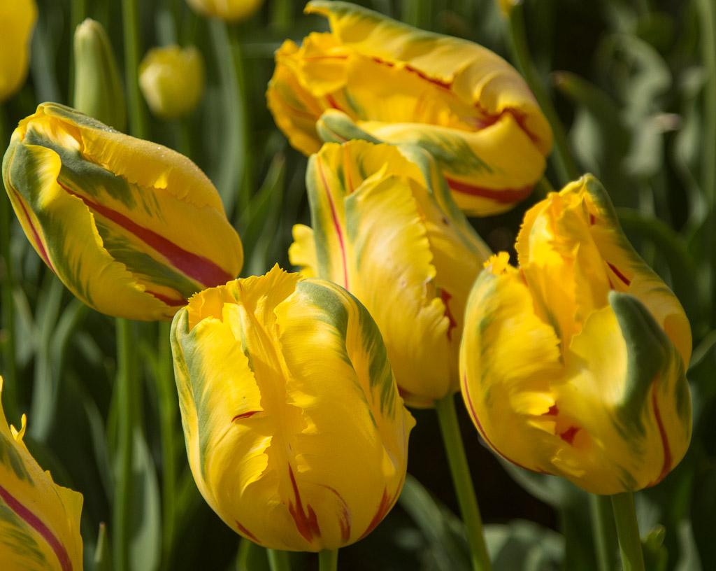
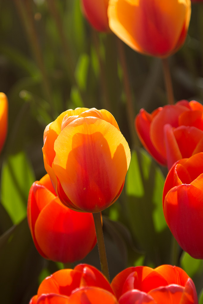
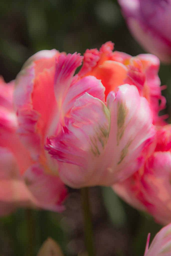
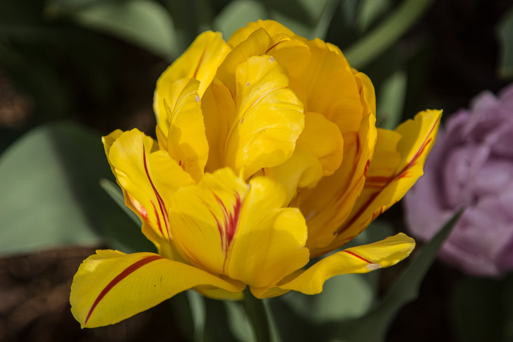
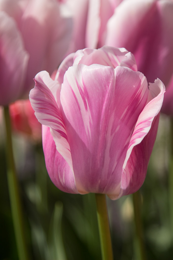
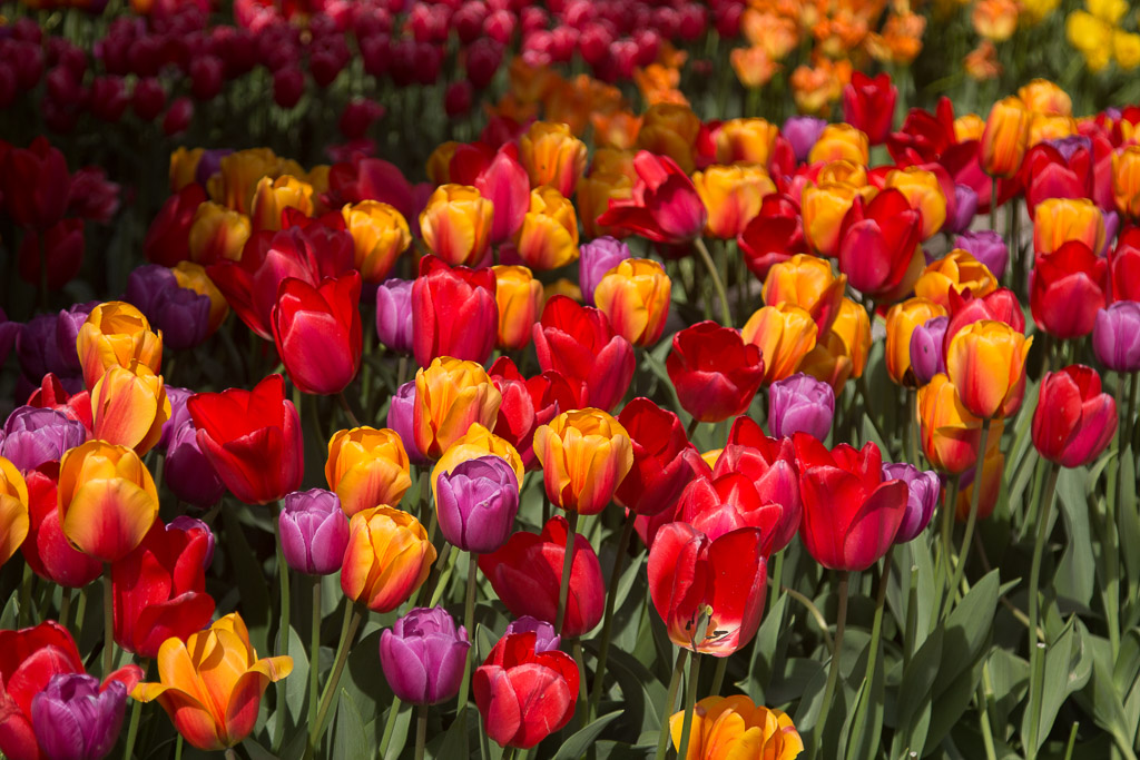
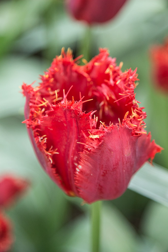
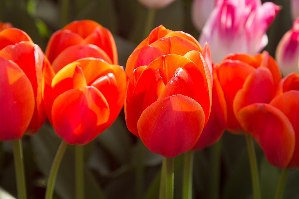
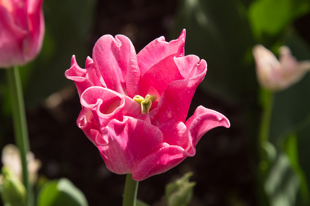
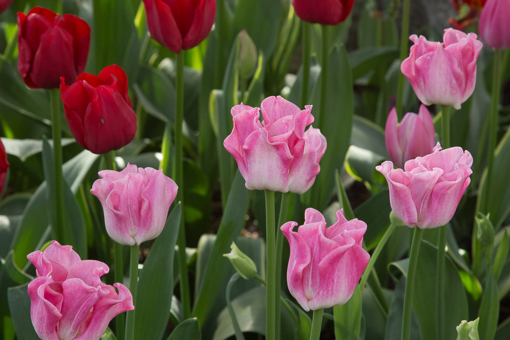
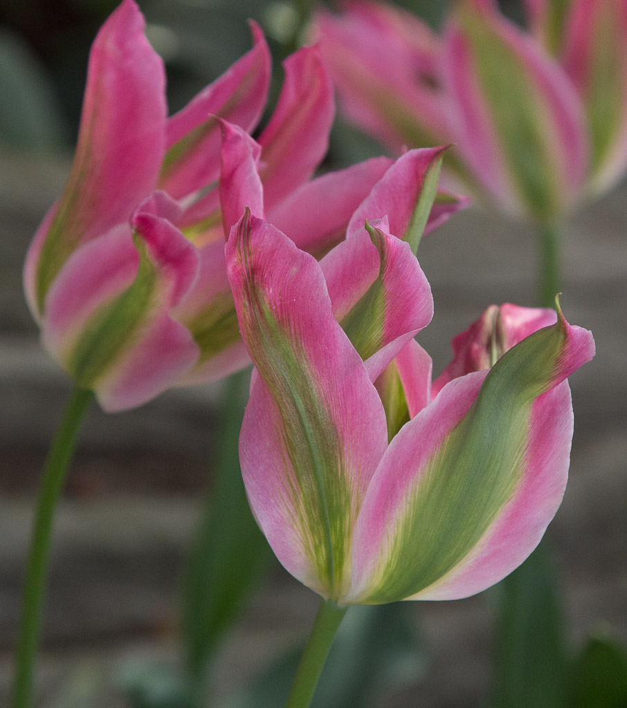
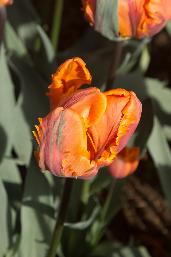
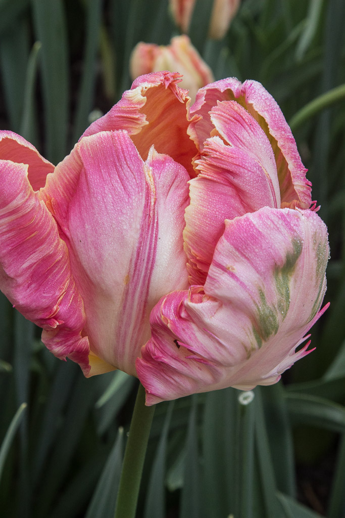
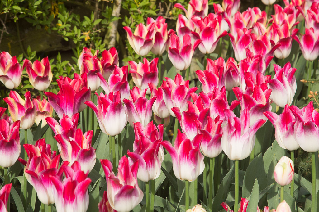
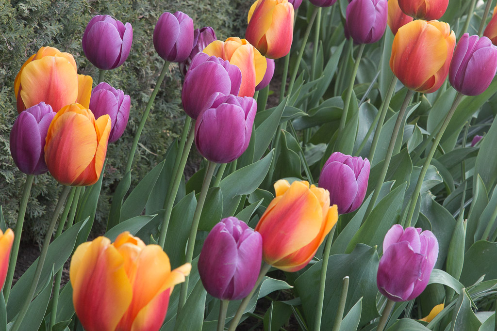
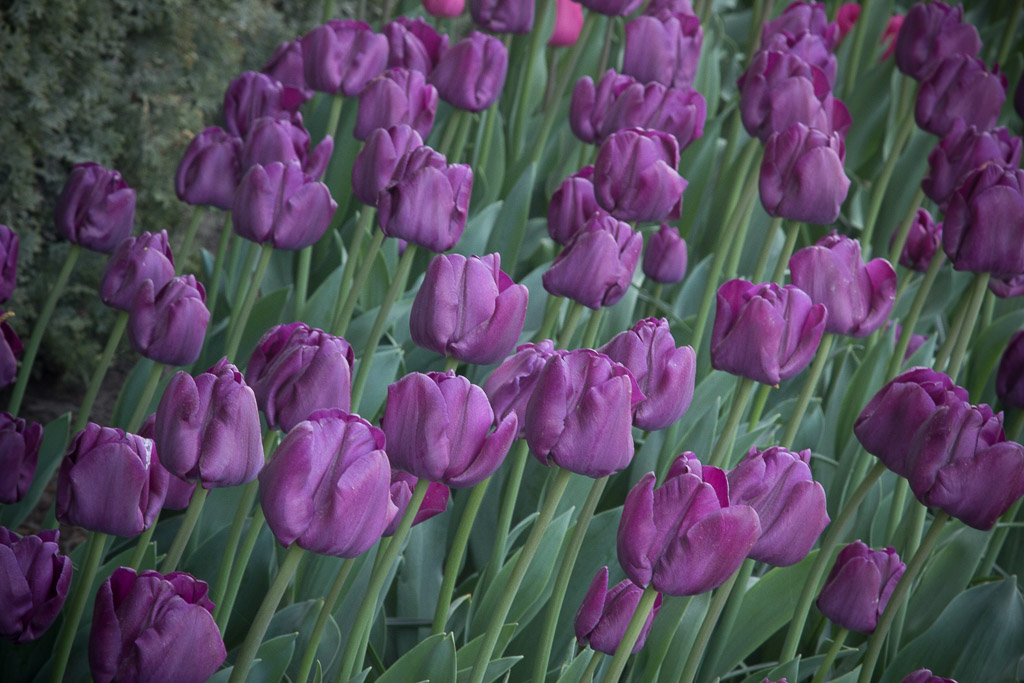
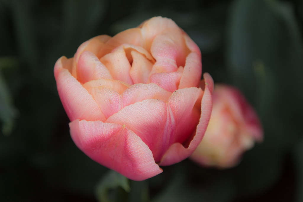
Back to the tulips. Here are a few of my favorites.
Whisper
Shadow PlayLean on MeA River Runs Through ItParrot Song
Roozengaarde was founded when William Roozen emigrated from Holland in 1947. The family began raising tulips in Holland in the mid-1700’s and has continued through at least six generations. It is now the largest tulip-bulb grower in the country and farms 2000 acres!
Fancy Fence
Here is a gallery of the rest of my favorites — hope you enjoy them! Click on any picture to view them all as a slide show.
From Sequoia National Park, we boogied pretty quickly up to the Oregon coast. We wanted to encapsulate this part of the adventure into one post rather than sending several with only a day or two apart, so it is a bit long. Go get a cup of tea or other beverage of your choice.
Here’s what I really wanted the title of this post to be, but it is (way) too long!
The Oregon Coast: Waves, Windy, Winding Roads, Weed…
Let’s get the “Weed” out of the way. Oregon was the first state to decriminalize marijuana possession in 1973, although it didn’t legalize recreational marijuana until 2014—two years after Colorado and California. There are “Cannabis Dispensaries,” “Bud Barns,” and “Pot Shops” everywhere you look. It seems every small town has one or two. No, we didn’t partake.
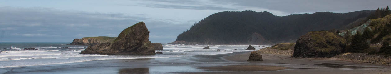
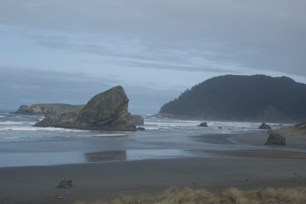
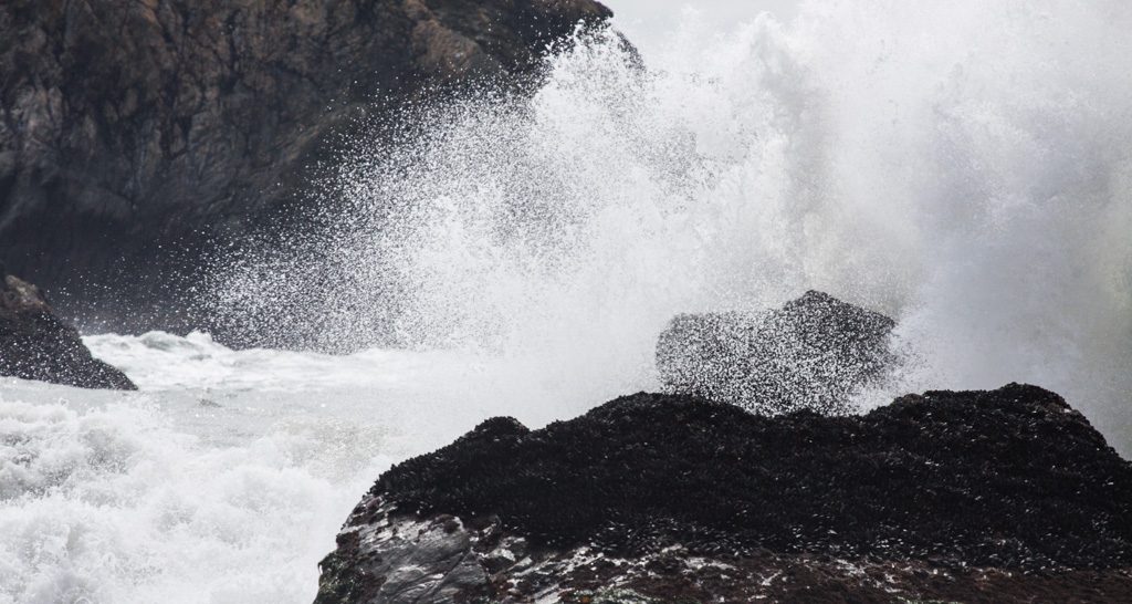
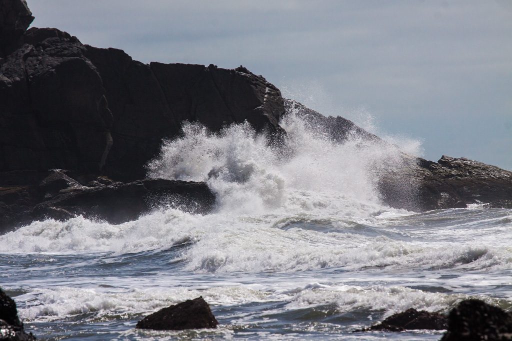
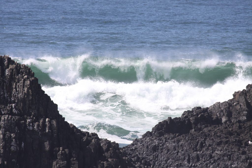
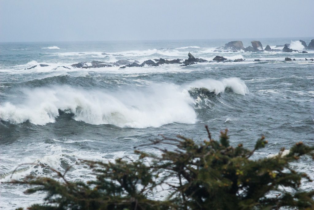
The Oregon coast is amazingly beautiful. We went up US 101, which runs near the coast—at times, right along it. There are many sea stacks (very large rocks out in the water), which together with frequent cliffs on the shoreline make excellent targets for the waves to crash against. It is frequently very foggy!
Sea stack through the fogWaves crashing… minute after minute, hour after hour, year after year.
In the sections below, you can paste the latitude and longitude into Google maps to see where we camped…
Gold Beach: 42.536509 -124.396648
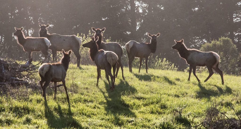
We had been advised to check out the area around Gold Beach by many people. We found Honey Bear RV Resort and Campgrounds a little north of there. As we drove in the campgrounds’s driveway, I noticed two small elk in a field. Cool! We decided to have dinner in the campground’s restaurant (is that what makes it qualify as a “resort?” I still don’t understand the distinctions…), and I was carrying my camera with me as I often do in new places. A man came up to us, and asked if we’d like to get some pictures of elk. Of course! Our order had just gone into the kitchen so we had some time.
We followed the man out of the restaurant, down the road a bit, and then he turned and said, “I normally don’t let campers in here, but this is the best place to get elk pictures.” He was the campground owner!
Part of the campground’s herd… wild elk that happen to graze here.
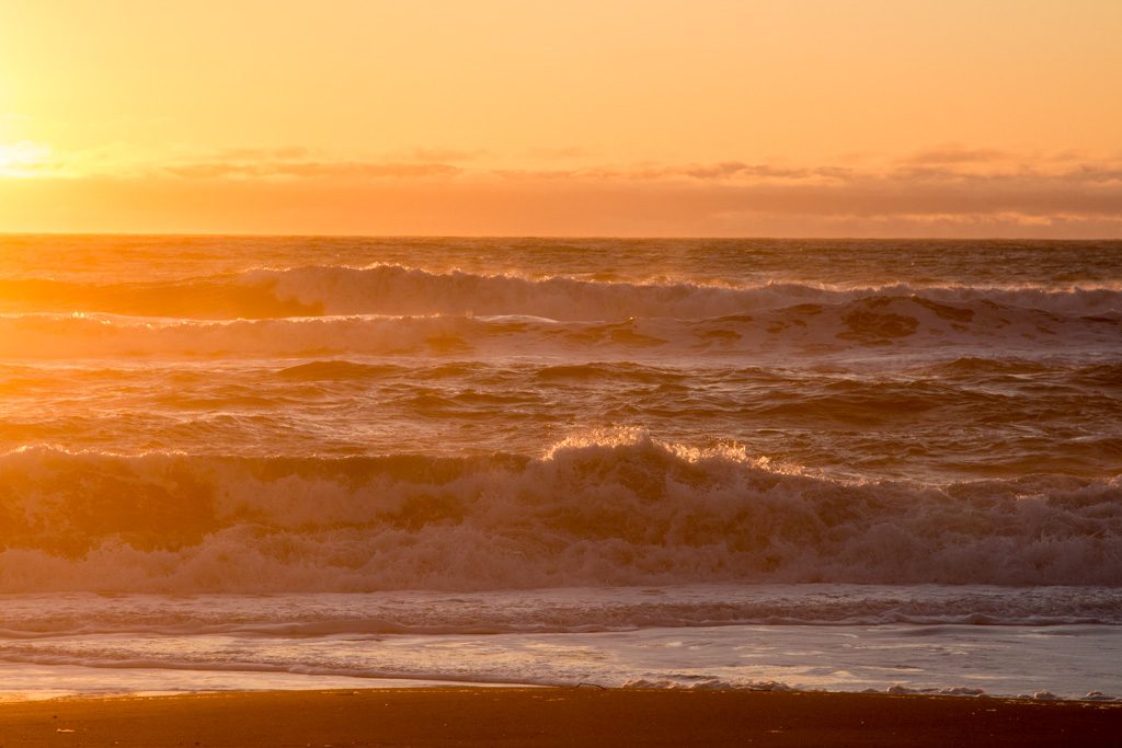
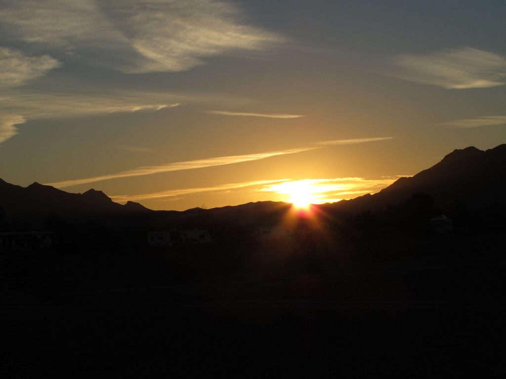
Kathe and I walked down to the beach just before sunset. Our first night on the coast…
Sunset over the ocean. A Pacific Ocean treat.
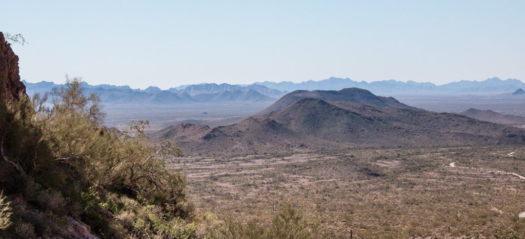
Gold Beach is just past the north end of the Samuel H. Boardman State Scenic Corridor. Coming north from California, we had decided that we would drive past the sights to get to the campground, and then return south without the trailer on our first day at Honey Bear to see all (OK, “some of”) the scenic pull outs the state has marked. We had divided the coast roughly into fourths, with the idea that we’d day trip up and down the coast from our campsites in order to see the sights. Rocks and water! The same draw that made us love Acadia so much.
Aside… Oregon has a crazy number of State Parks—255, to be exact. Incredibly, 93 of those state parks are along the coast! Granted, many of are very small with some being little more than a parking lot for beach or view access. But fifty seven of them have campgrounds, and we made use of two of them.
The Oregon Beach Bill was signed into law in 1967 and established a permanent public easement for access and recreation along the ocean shore seaward of the existing line of vegetation, regardless of ownership. A policy soon followed that provided for public access to the 362 miles of beach at regular intervals.
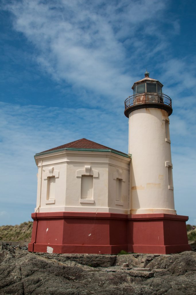
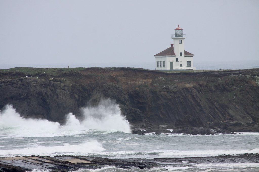
The next day we headed north on the coast for another day of sea-gazing… This brought us past three of the nine lighthouses on the coast, and many more spectacular shore vistas!
Coquille River LightArago LightCape Blanco Lighthouse
Florence: 43.922106 -124.113042
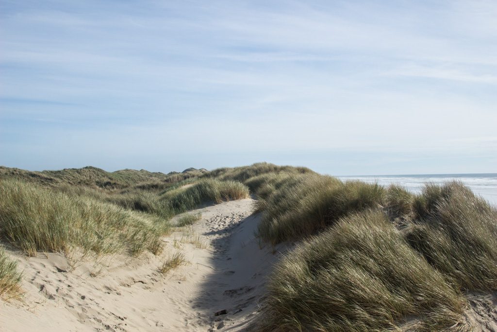
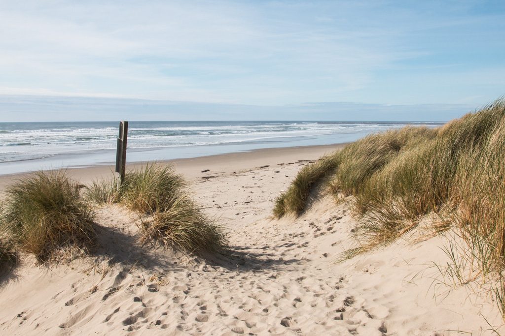
Dunes… The only sand dunes I had experienced were on the Outer Banks of North Carolina’s shore. They were big! Ummm… Not as big as Oregon’s dunes.
The Oregon Dunes National Recreational Area stretches for over 40 miles, and encompasses 31,500 acres. For part of its stretch near Florence, it is bordered by the Honeyman State Park, our next stop. The dunes near Florence are not the tallest in this huge dune field, so where we saw them they weren’t as tall as in NC. Our particular campsite was backed by a steep, thickly vegetated hillside. I’ll guess it was 50 to 60 feet high. I found a nearby trail and went up. When I got to the top, the other side was sand dunes! We were right on the edge of the recreational area.
Kathe and I hiked into the dunes in another spot a few miles away. There, the dunes were heavily grassed, and the dunes went right down to the beach.
The grasses are now considered an invasive species.
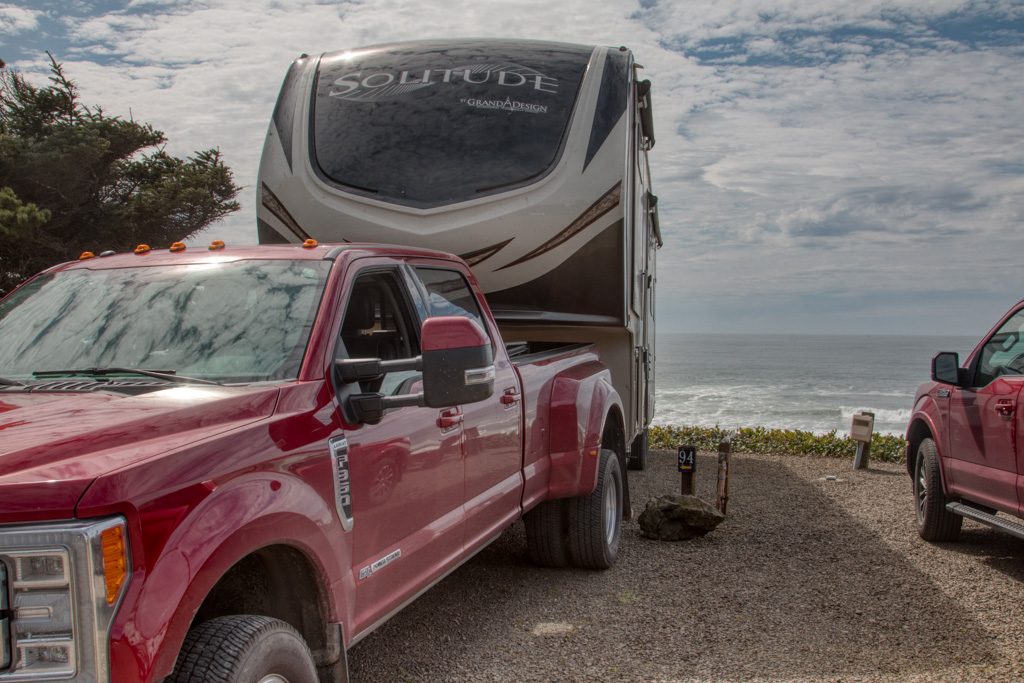
Depoe Bay: 44.860257 -124.04309
They advertise the Sea and Sand RV Park as “Camping on the beautiful Oregon Coast.” They aren’t kidding! Driving to our campsite we thought we were going to drive right into the ocean.
Come ride with us, and remember that we have over seven tons of trailer pushing us down the hill.
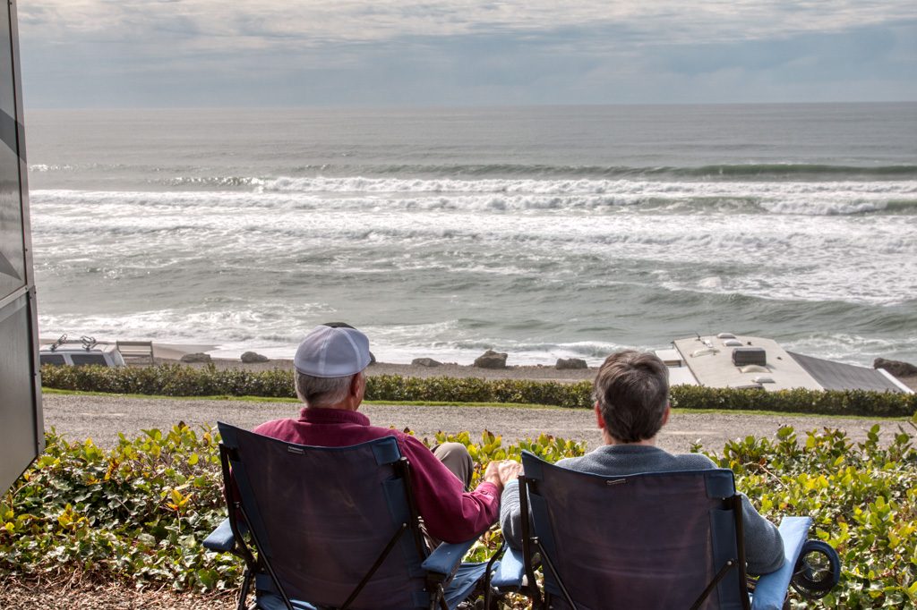
We had possibly the best space in the campground (94, if you want to book it). There were no more sites on our door side, so no neighbors there, and we were on the third of three tiers, about 60 feet above the ocean with a completely unobstructed view! Simply amazing. Apparently this site is usually booked a year ahead of time; we had called about a week and a half before, so someone must have just cancelled! Hooray for us! (As we were getting ready to leave, another camper stopped by to tell us that they had just booked the site for this same week, next year…)
Hard not to love this campsite!This is the life…
There is a downside to camping this near the ocean. The waves make a lot of noise all night. I know… poor me.
Someone turn the waves off! I can’t sleep!
Tillamook: 45.428327 -123.937862
This was the least picturesque stop on our trip up the Oregon coast. There is a large dairy processing plant which produces mostly cheese but also ice cream and yogurt, known locally as “The Cheese Factory.”
“Are you going to the Cheese Factory??” “Have you been to the Cheese Factory?” Everyone in the area wants to know… Apparently it is The Big Thing in the area.
They have an interesting self-guided tour via a glass-walled walkway above the factory floor. I was surprised to learn that it takes less than 24 hours for the milk arriving in the tanker truck to be turned into a block of cheese ready for aging. According to a Tillamook website, the warehouse next door where they age the cheese accounts for about ten percent of the nation’s cheese supply. I guess it is a Big Thing!
Coastal scenery wise, there is a “three capes drive,” which held promise. But most of the time the road was behind trees, and the access to the capes was via hikes of a mile or more. It was cold and raw, and we decided to not hike it.
We did get to one part where we could drive to the shore. We almost got stuck one more time in deep loose sand! Fortunately, we didn’t have the trailer with us this time…
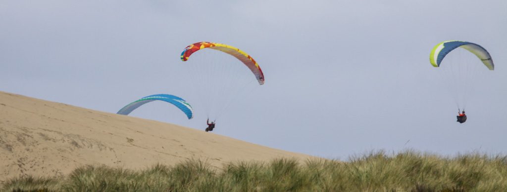
There at the beach we saw these folks having fun on the winds from the ocean hitting the dunes to give them lift.
I’m wishing that it were me up in the parachute! It looks like so much fun…
Wildlife
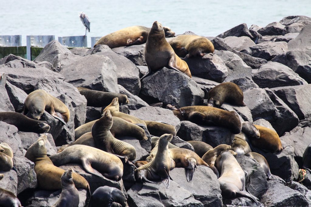
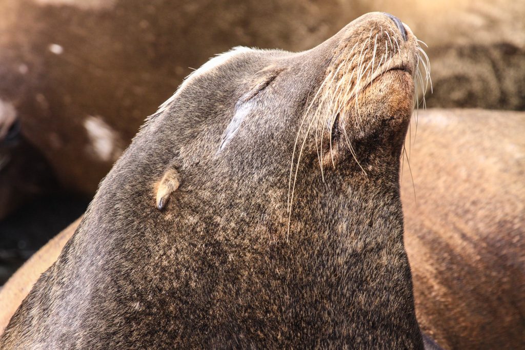
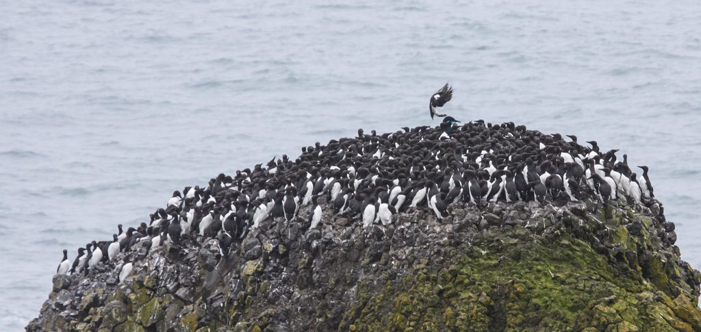
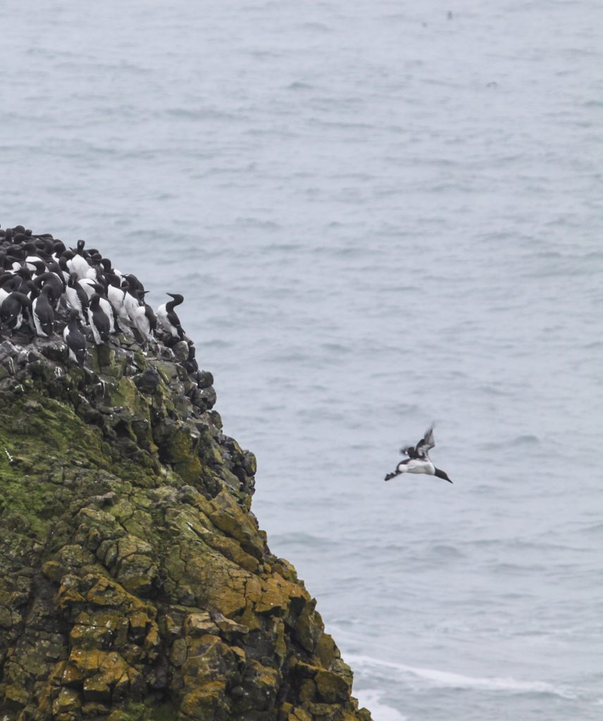
In addition to the elk, above, we saw sea lions at several locations, as well as large colonies of birds.
Soaking up those rays…Incoming! Common murres, a relative of the penguin but in the northern hemisphere. Unlike penguins, they can fly!… and outbound.
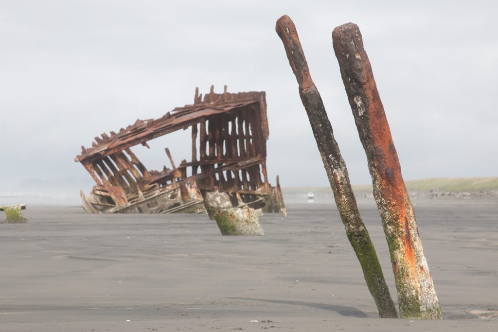
Astoria / Fort Stevens: 46.181835 -123.965693
Fort Stevens is the farthest north state park in Oregon, and also the largest. We were in a very nice campground of over 500 sites, which actually had full hookups for RVs: 50 amps, water, and sewer. Sewer hookups are very rare in state parks! We saw another Solitude (our type of trailer) with a different floor plan and much more storage capacity. That—or something like it—might be a next camper… but certainly not this year. We’re just getting this one the way we like it!
The address of the park is on Peter Iredale Rd., which got me wondering… “Who was Peter Iredale?”
Peter Iredale
That was the wrong question. Not who, but what.
The Peter Iredale was a four-masted, steel hulled sailing ship around the turn of the 20th century that carried grain from this area to Australia. (Peter Iredale was one of the owners of the company that owned the ship, so there is also a who—but he’s not the reason that “Peter Iredale” is a common place name in the area.)
The Peter Iredale
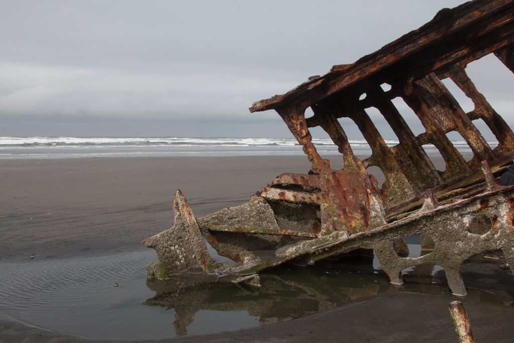
The ship was wrecked here during a storm in 1908. Much of her hull was cut up and sold for scrap, but the forward part was left on the beach. Nature will eventually reclaim her, but for now she is an interesting subject for photography.
The steel plating of the hull is gone to scrap, but a small amount of the iron framing remains.
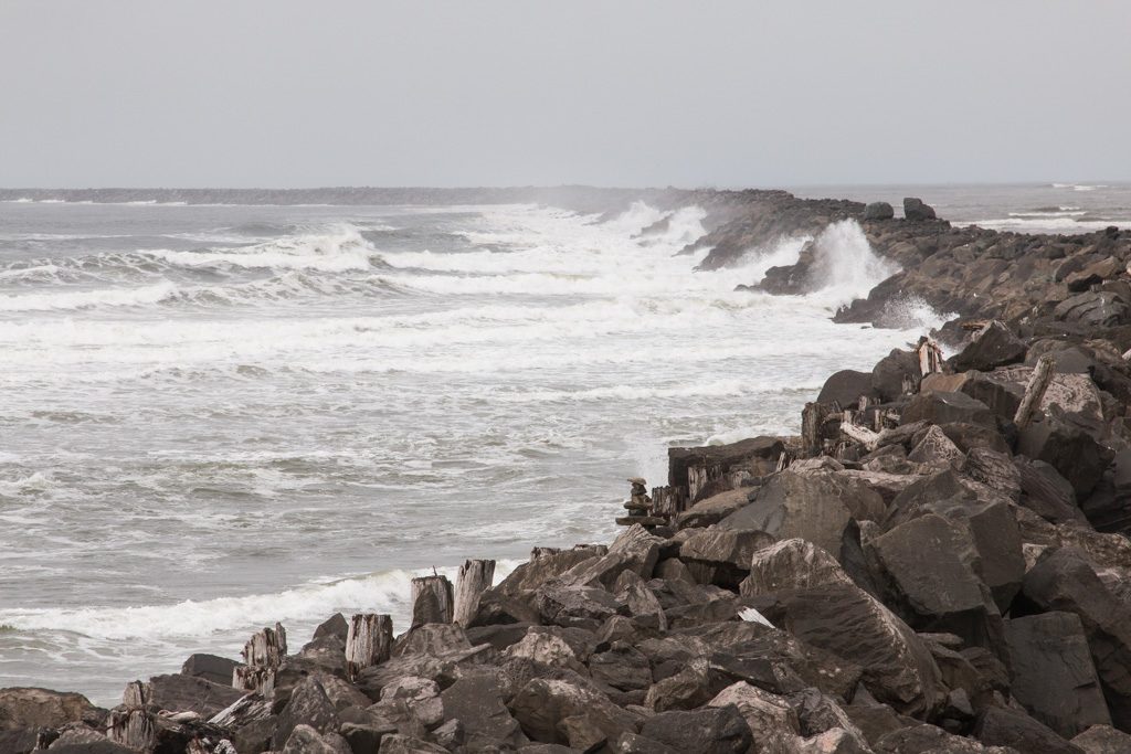
South Jetty
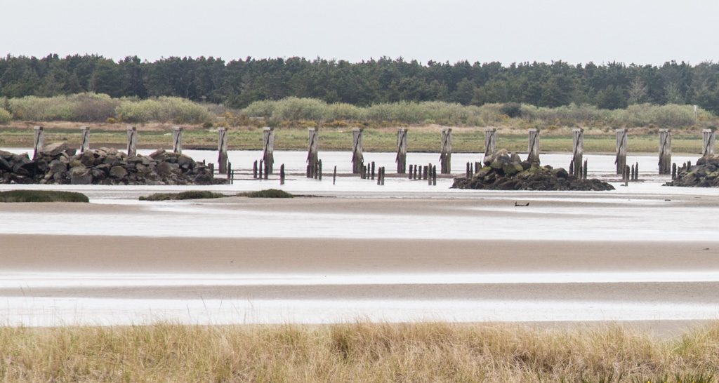
The land currently occupied by Fort Stevens forms the southern portion of the mouth of the Columbia River, a vital, but very dangerous shipping lane.
The geography was constantly changing as storms moved the land, and deposited much of it on the bottom of the channel, increasing the navigational challenges. The area needed to be stabilized.
There were three jettys built by the US Army Corps of Engineers at the mouth of the river, of which the south jetty is one. It was started in 1885, and the whole project of controlling the mouth of the Columbia took 50 years.
The jetty is four and a half miles long and projected into the ocean one mile; at the time of its completion it was the longest in the world. To build it, they had to first build a railroad track on trestles out into the ocean to transport the rocks.
The South Jetty of the Columbia River. It still extends far into the ocean.Some of the pilings remaining from the many miles long trestle built to create the south jetty.
The Fort
So why is this “Fort Stevens” State Park?
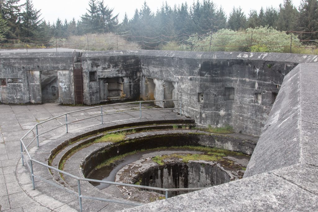
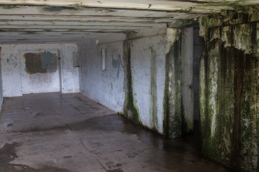
Fort Stevens was the primary installation of three forts guarding the mouth of the Columbia River. The fort saw duty in the Civil War, Spanish-American war, and World Wars I and II. It started as an earthen construction in the Civil War and was enhanced with large concrete installations for several batteries of ten inch rifles by the First World War. Improvements in ship construction (thicker hulls and steel decks) made those guns largely obsolete by WWII, at which point the river was primarily guarded by a mine field comprising up to 148 mines that were electrically controlled from Fort Stevens. (I had assumed that they were contact mines, but not so.)
Fort Stevens holds the distinction of being one of only two places in the continental US to be fired upon by a foreign power. On June 22, 1942, a Japanese submarine fired nine five inch projectiles at the fort. They landed without harm, and the fire was not returned from the fort. Later, the captain of the sub was quoted as saying that if he had known how many large rifles were at the fort, he would not have been anywhere in the area!
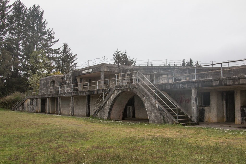
The guns are long gone and the emplacements are deteriorating, but some are still open to be wandered in and on.
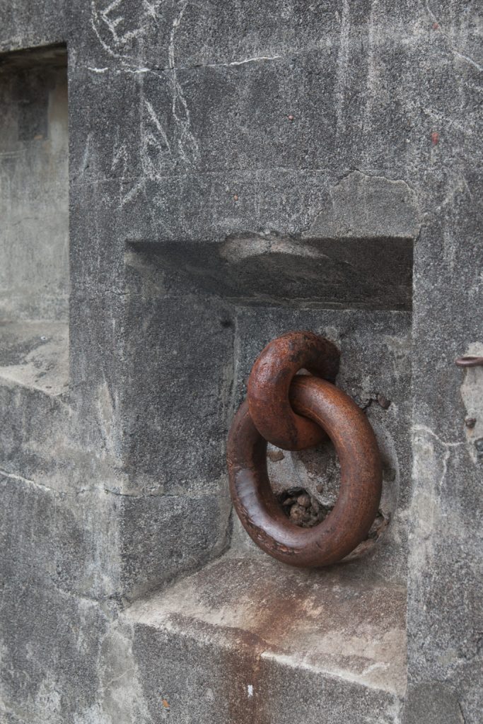
A gun emplacement; the circular structure allowed aiming the gun through an arc of about 200 degrees.Fixtures like this one allowed pulling the gun mount to aim it.The back side of one of the batteries.A magazine for storing projectiles and powder, immediately below the gun deck.
What’s next?
We have one more stop before we cross into Canada, to visit with Beth, Jon, and the kids. Can’t wait to get there!
We’re starting to plan our travel after we visit with Beth’s family, and are starting to run into problems finding a campground with available space. We had heard about this, but hadn’t experienced it up until now. We’ve plotted our travels up through the second week of June, and now have to slot in the remaining two weeks until our grandsons Graham and Dean join us to visit National Parks in Utah! Lots of possibilities…
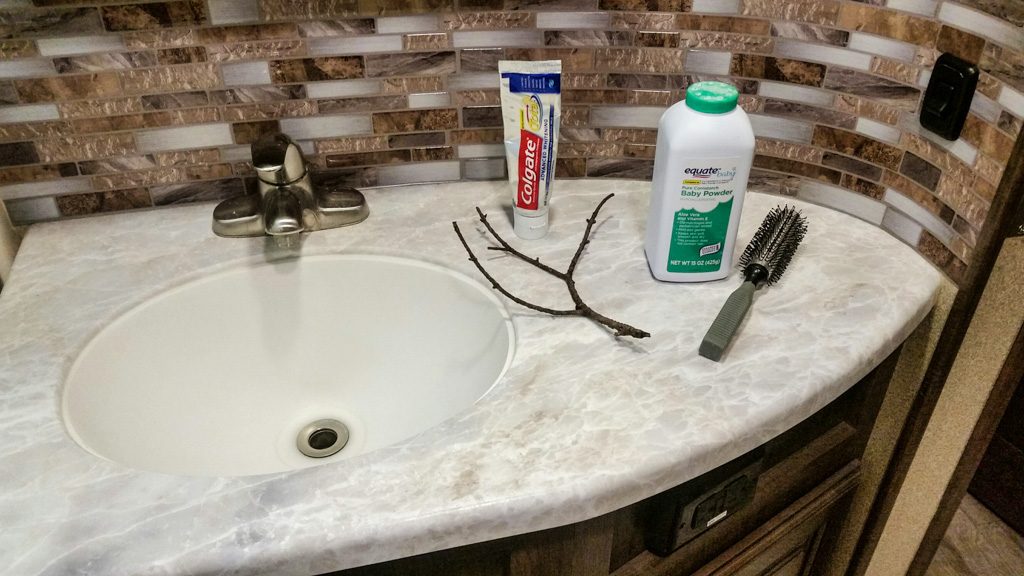
When we first starting considering getting an RV, Al was quite excited about the possibility of dry camping, i.e., living ‘off the grid.’
I wasn’t so sure. All I could picture was Little House on the Prairie: brushing my teeth with a twig, beating my dirty clothes on a rock (while it’s raining, of course), combing baby powder through my hair every week or so, and dragging myself across the dry desert in search of an oasis.
You get the idea.
Will Al REALLY make me do this?
“It’ll be fun!” “It’ll save us money!” and “We can DO it!” just didn’t cut it for me.
Last year, after we’d made our purchase, but before we had taken ownership of our RV, we flew out to Arizona for one last time sans RV. Al had read extensively about a wide variety of dry camping locations, most of it land owned/managed by the US government: Bureau of Land Management (BLM), US Forest Service, Army Corps of Engineers (COE), and lots more. We wanted to explore our options.
Think of it as ‘shopping for land’ if you were building a house. Kind of.
It was late winter/early spring. We drove through some US Forest Service mudsludgewetlandslogging roads woods. We spotted a couple of campers set some distance off the road beaten path. I couldn’t see a soul. I was convinced that those RVs were set there as a come-on for would-be camping enthusiasts.
Too isolated for me.
We couldn’t find any COE areas near us. We did drive along a stretch of the Colorado River where we saw quite a few campgrounds. RVs were literally inches apart from each other. So close that you could borrow a cup of milk from your neighbor by leaning out the window — never having to leave your rig!
Too crowded for me.
We had read about Quartzsite. An RV mecca in the winter. Snowbird country. Home of a HUGE RV show (the BIG TENT) each year. Rock Capital of the World.
And desert. LOTS and LOTS of desert.
Lots and lots of empty desert!
Not that Lawrence of Arabia kind of desert with blowing white dunes. No oases either. And actually a bit more vegetation than I expected.
We had read about the BLM land in Quartzsite where many snowbirds park their rigs and boondock (dry camp) for most of the winter. We stopped at the small brick building at the entrance to LaPosa West; there we found a very friendly host couple volunteering their time to answer questions and register newly-arrived campers. They couldn’t say enough about what a fabulous time they’d had in Q during this, their second winter onsite.
I remember peering out the small window. There were RVs but they were spaced at quite a distance from each other. And I saw people! In a few spots, I could see a group of 3 or 4 campers near each other—a neighborhood!
The hosts encouraged us to hop back into our rental car and drive through the area to check it out. It turns out that this Long-Term Visitor Area (LTVA) is one of a network of seven winter LTVAs across southwestern Arizona and southern California. They pointed out that the BLM area in Q comprises four large areas (LaPosa West, North, South, and Tyson Wash). AND…(drum roll please!) that there are actually a dump station, waterfills, and trash dumpsters at LaPosa South!
Maybe my teeth and hair could possibly be very happy here.
We drove into “town” and it seemed fairly peacefulquiet deserted. Turns out that it was late in the season and many of the snowbirds had left for points north. Knowing all too well about the craziness of ‘tourist season’ (summertime in Acadia National Park), we had a hunch that Q might be just the right spot for us. And all that desert!
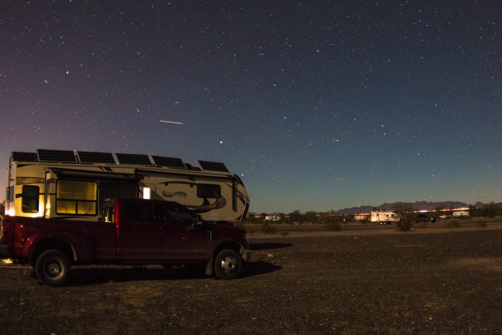
Fast forward seven months. We get our eight solar panels installed on the RV (details in this earlier post) along with all of the thingamabobs that will sustain us electrically while on the desert.
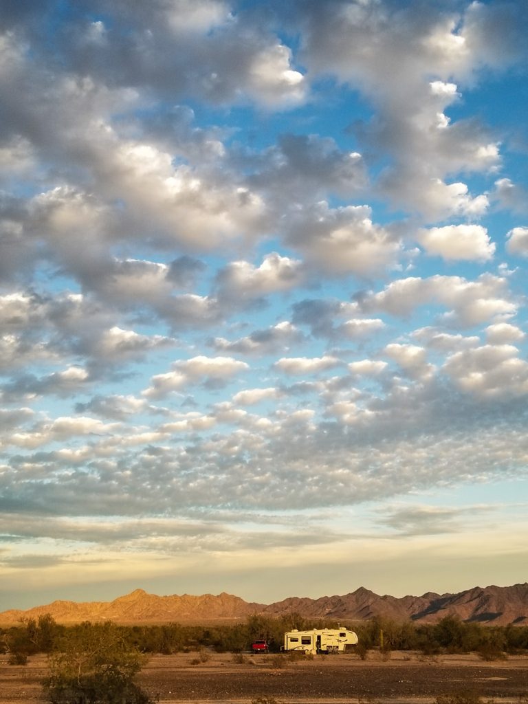
Fast forward another six months. We recently left LaPosa South where we spent just over four months. And…WE LOVED IT!
How did we fare? Just great! We learned that:
Having nearly four acres of desert all to ourselves is AMAZING! There are literally miles of land available for camping. Having stayed at so many campgrounds with TIGHT spaces as we came across the US, camping on the desert was a dream.
Desert twilight
Paying $180 for an entire SEASON of camping is a sweet deal. You can park on an LTVA — and move from one LTVA to another within the system in SW AZ and SO CA — from Sept 15 thru Apr 15 for just $180.
Navy showers aren’t so bad. Short and sweet.
If you are careful, you can easily go a week before needing to refill your water tank and dump your black/grey tanks.
Wiping off dishes with a paper towel just after eating greatly reduces the amount of water you’ll need for dishwashing.
Pouring your dirty dishpan water down the toilet helps to maintain the black tank.
Eight solar panels can sustain you every day! We only ran our generators 2 or 3 times across the four months we were there (and that was when we’d had two cloudy/rainy days in a row.
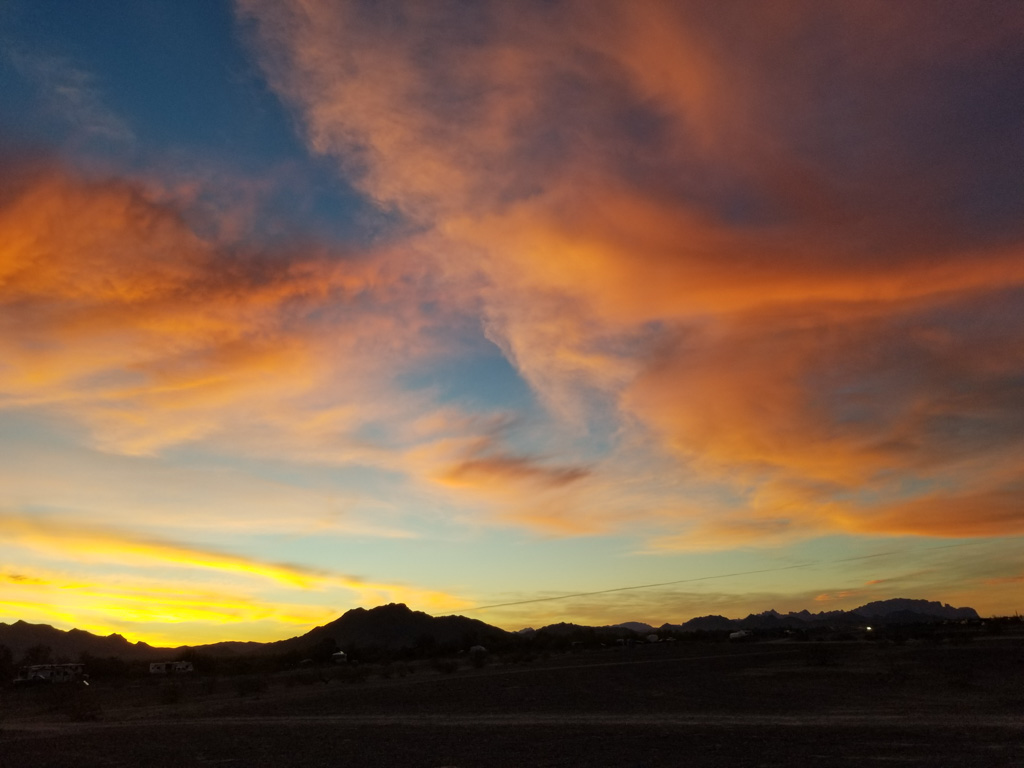
You can NEVER get tired of desert sunrises and sunsets.
People are very trustworthy. You can LEAVE your camper on the desert (while you fly to see your kids and grandkids over Christmas) and not a thing is disturbed.
Not our site; this one was like this for well over a month. Their gear was never touched!
The desert can be VERY windy and dusty; I became quite proficient at wiping down counters and windowsills frequently.
It’s easy to meet new people on the desert.
The rattlesnakes don’t reappear until very late in March.
Many, many people who spend the winter on the desert own and ride their side-by-sides, jeeps, or ATVs all over the desert.
Bicycling on the desert works best if you add an extra-thick gel seat to your bike. It’s also a good idea to wear a stretchy nylon cowl or bandanna over your mouth and nose in case a side-by-side passes by and kicks up dust.
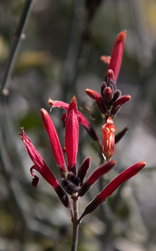
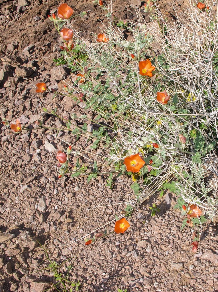
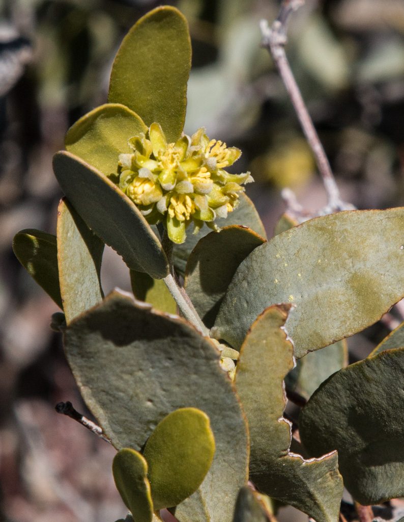
Following the desert bloom is thrilling!
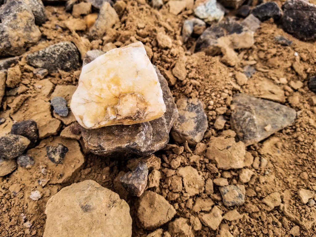
Rockhounding in the Q area is a nearly full-time hobby for many snowbirds. The Q Gem and Mineral Club has so many resources available for novice and experienced rockhounds and lapidarists including classes, use of equipment, rock/gem shows, and lots of rockhounding field trips.
Quartzsite quartz!
Quartzsite is a hub for so many fabulous things: an incredible public library (large supported by snowbirds); a very active quilting club (my peeps!); welcoming churches; one of the best game stores we’ve ever seen; an amazing number of fairs, festivals, rallies, concerts, hobby clubs, gatherings; and best of all, some fabulous new friends who are certain to be traveling companions.
It was just right. And we’re going back next fall.
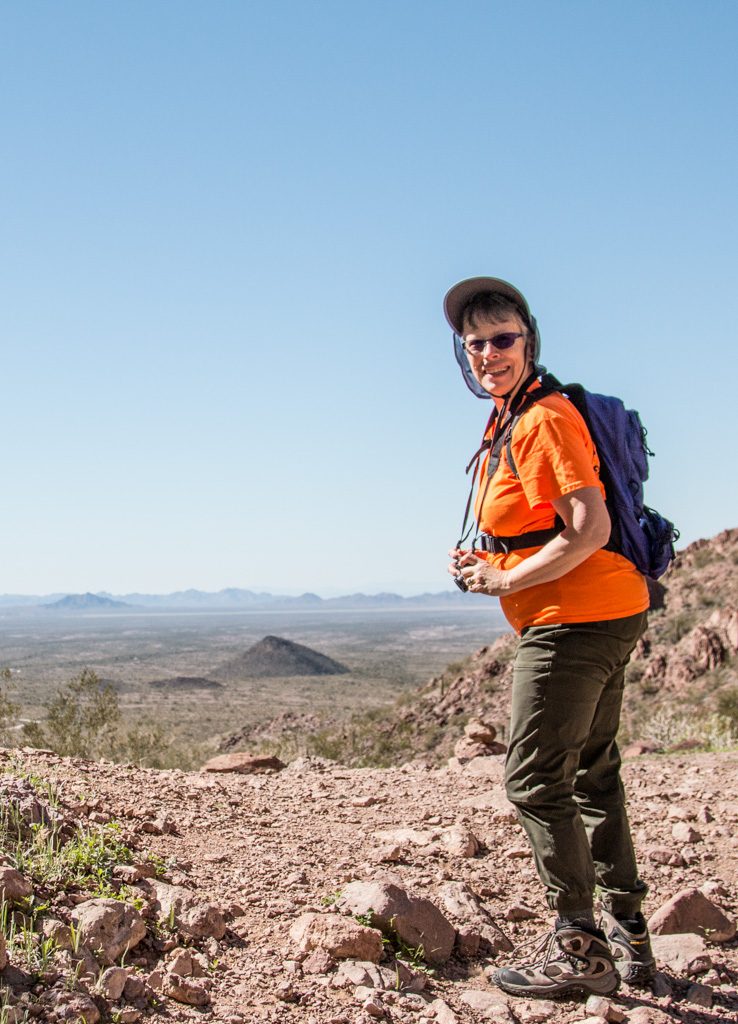
We’ve left our winter home of Quartzsite, AZ, and are headed north—initially to Vancouver, BC, to visit our daughter Beth’s family. Can’t wait! As much as we enjoyed being in the desert in Quartzsite (thank you BLM!), it is good to be on the road again and seeing new things.
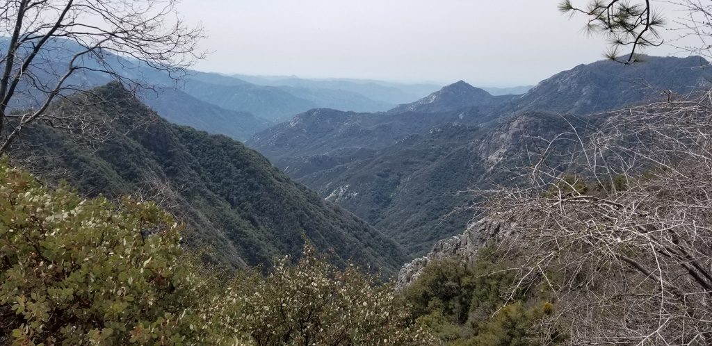
Our second stop was in Three Rivers, CA, just outside the southern entrance to Sequoia National Park, the second National Park (what was the first???). Nestled in the western flank of the Sierra Nevada mountains, the scenery was gorgeous!
There is a downside to being surrounded by mountains… No cell signal. Nada. Zilch. Zip. It made us long for the very slow connectivity in Quartzsite! However, the campsite had a poor WiFi signal—I think through a satellite—so we could occasionally check our mail / Facebook messages. Sigh. We’re addicted to the net.
The restaurant we went to for breakfast was using dial-up to tie into their credit card system. When was the last time you heard the dulcet (!?) tones of a dial-up modem?
The reason for being here was to go into Sequoia NP, so let’s get to it!
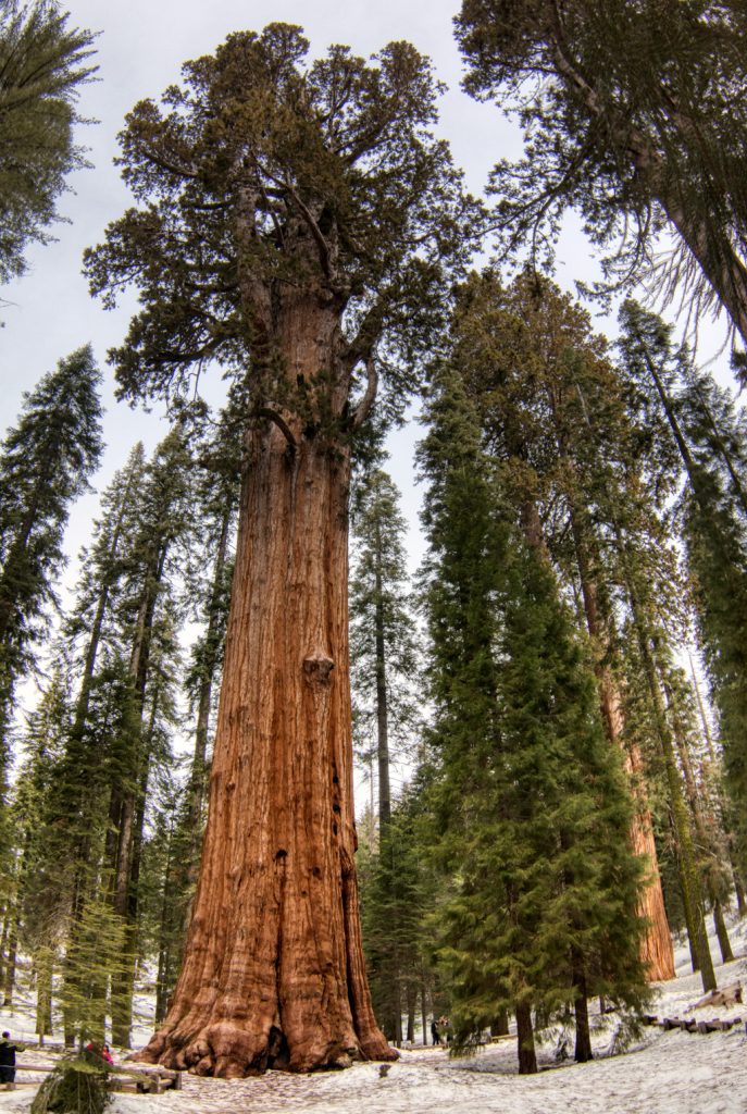
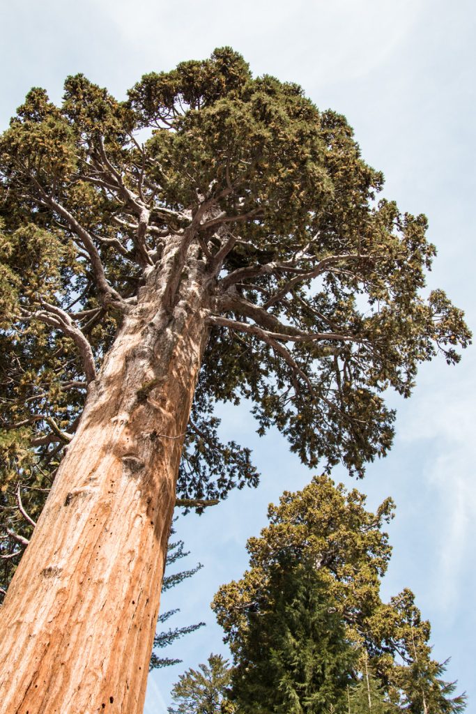
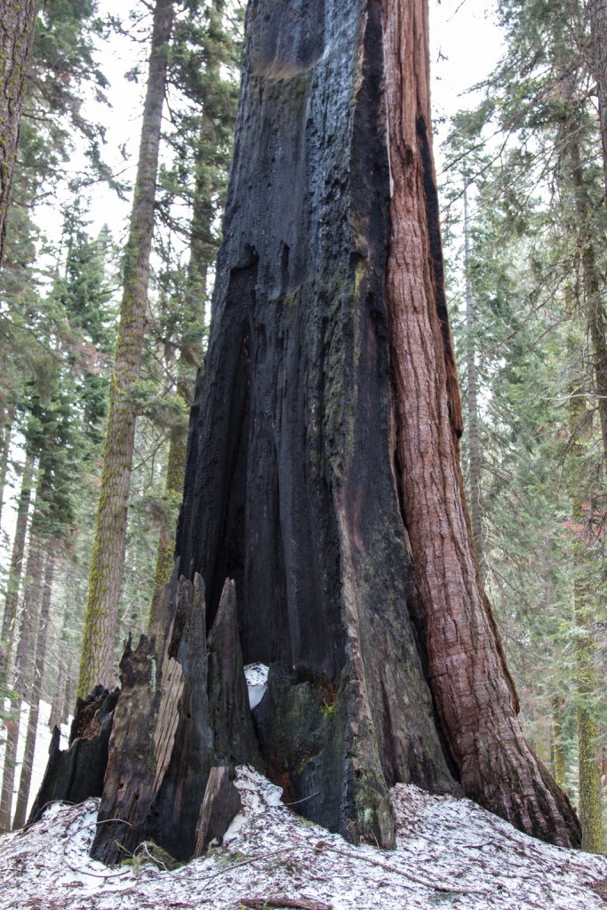
The major attraction here is the trees, of course. In terms of volume (mass), the giant sequoias are the largest living trees. Coastal redwoods can grow taller, but they have a smaller diameter, and don’t retain that diameter at higher heights as much as sequoias do. The sequoias are limited in height due to limits on the capillary action which brings water and nutrients up from the root system. The redwoods can take in moisture through their leaves more efficiently, and thus grow higher than capillary action by itself would allow. (The ranger giving the talk accused the redwoods of “cheating!”—he must be a sequoia fan)
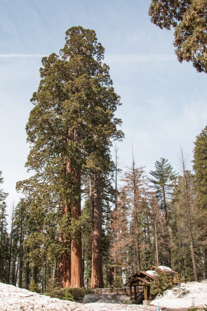
Note the building for scale!
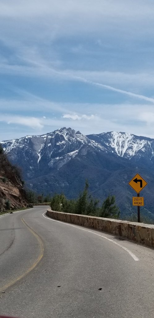
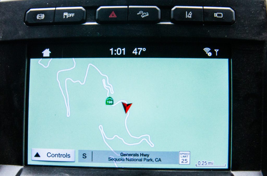
We went up into the mountains to see the tree named “General Sherman,” the largest known living tree in the world, in terms of volume. The diameter at the base is greater than 36 feet! And the volume of its trunk is more than 52,000 CUBIC FEET. It is up at around 6,900 feet elevation; getting there was fun. Vehicles over 22 feet long are prohibited from making the drive. Our truck is exactly 22 feet; we can see why longer vehicles are excluded!
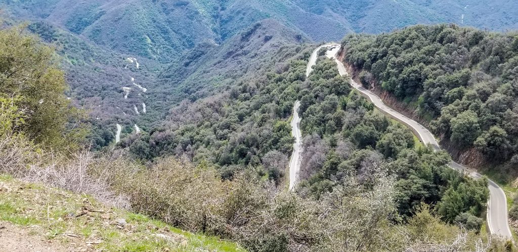
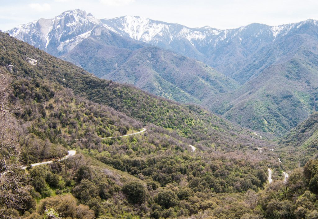
Unfortunately, I forgot to dump the dashcam that evening, and the video of the drive got overwritten. However, here are a few pics showing the road.
I don’t want to think about the effort it took to create the road! The designers did an excellent job of siting it; with very few exceptions the road above you is invisible. Looking down (way down), you can occasionally see the path ahead of you.
Yes. That’s road WAAAY down there! All those sections of road that you can see are one road, back and forth and back and …A portrait of the artist.
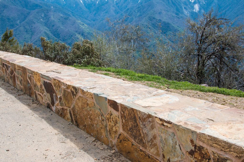
We were particularly taken with this roadside wall construction; it is so different from what we were used to at Acadia!
Smooth, flat walls, with a precise 90° corner to the smooth, flat top.
What were we talking about? Oh, yes. The trees!
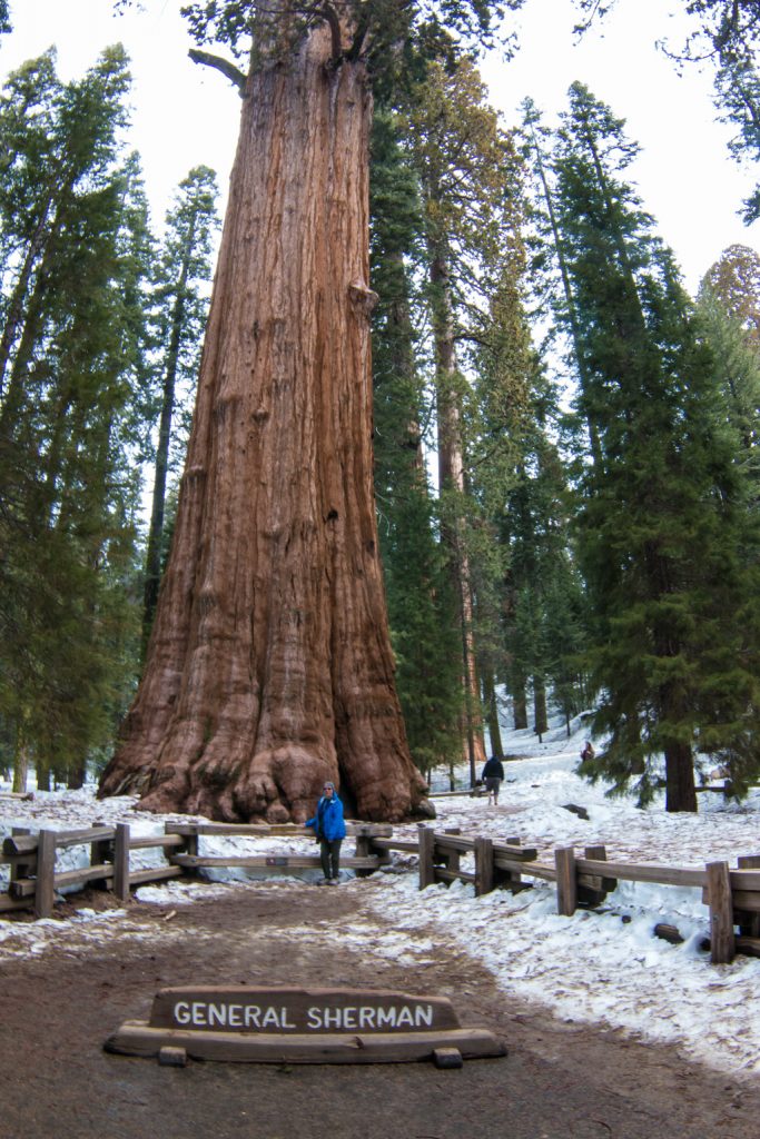
General Sherman. World’s largest living treeCan you find Kathe?
There are 75 known groves of giant sequoias in the world. The adjacent Sequoia and Kings Canyon National Parks protect “over 30” (NPS statistic) of those groves. (Three more groves are protected in nearby Yosemite NP.) General Sherman is in the grove named Giant Forest, an apt name if ever there was one. It contains 2,161 sequoias with a base diameter of over ten feet.
The sequoias live for a very long time. The ages of General Sherman and “The Sentinel” (near the museum in Giant Forest) are both estimated to be 2,200 years (“plus or minus 600 years,” according to one research article, we were told by a ranger). A page in the Yosemite NP site refers to a sequoia 3,266 years old, but is written in the past tense, so it may not still be living. Yes, you can buy giant sequoia seeds in the gift shop, but you’d better will them to your great-great-great-great-great-great-great-grandchildren!
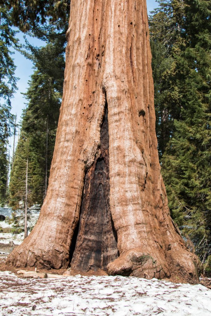
The Sentinel—at least, a part of it!The base of The Sentinel, showing fire damage.
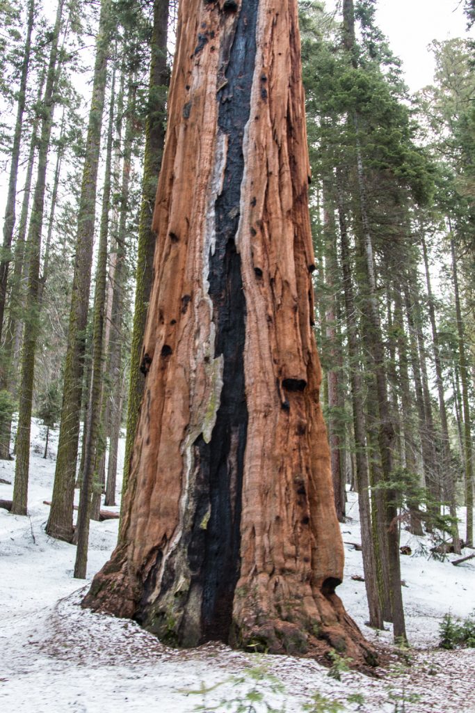
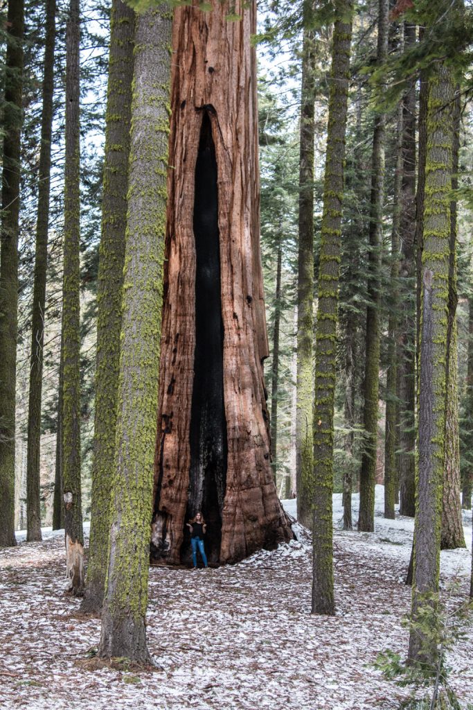
Giant sequoias require fire to reproduce! The fire does two things. It causes the seed cones (should these be called “sequoia cones,” like “pine cones?”) to open and release their seeds, and it removes the debris covering the forest floor so that the seeds can reach the soil and take root. A decades-long policy of complete fire suppression resulted in unhealthy groves with dense underbrush of other trees. That policy has been reversed, allowing some fires to take their natural course; the groves are regaining their health and there are now immature giant sequoias of different ages growing in the forest. There are few trees in the Giant Forest that do not bear signs of fire. Fortunately, they are able to withstand the fires, in part due to a bark that is up to two feet thick.
With a person for scale.Amazingly, still alive!
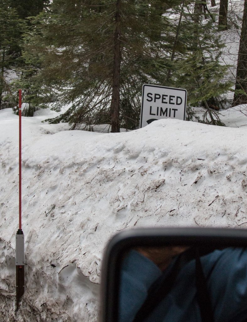
A good portion of the park is still closed due to snow. It is hard to believe that only a few days ago we were in the desert, with the temps in the high 80’s. When we drove through the park gate, the ranger told us, “You can’t go through to King’s Canyon. The road is closed due to last night’s avalanche.” Never been told that before!
Speed limit…. BLANK? Let’s go fast!
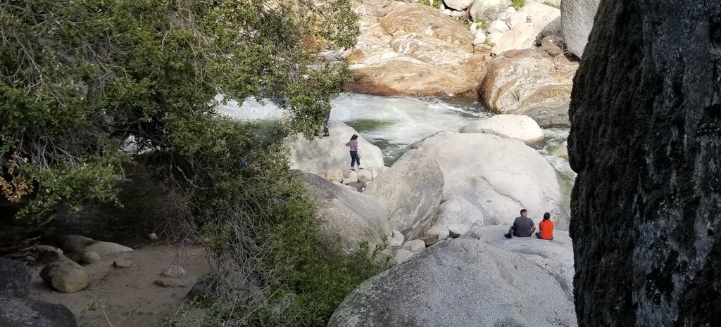
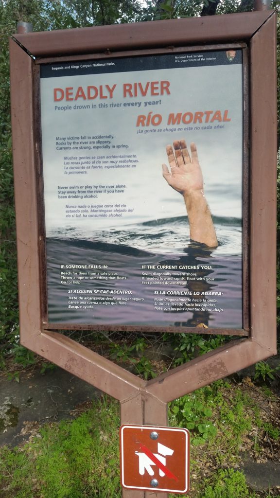
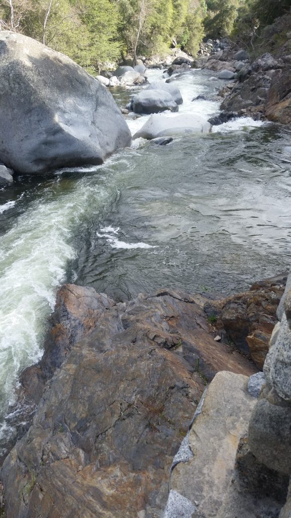
In addition to the trees, the park has high mountains, deep valleys, and fast flowing streams.
Do they really need to say this?We’re really both still traveling together!
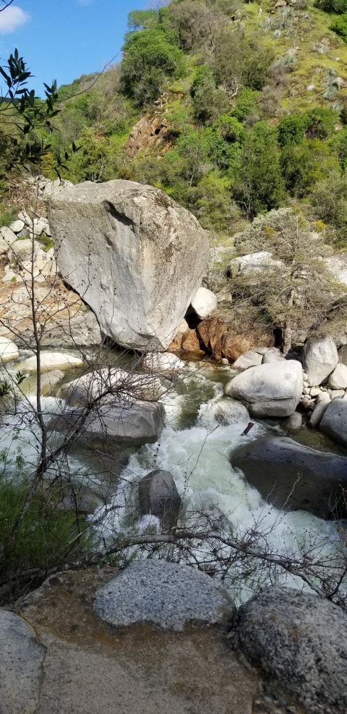
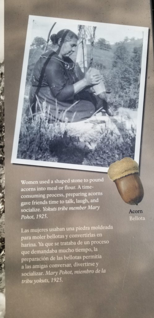
Before Europeans discovered this area, indigenous people were here. There is at least one site with pictographs; quite possibly more that they don’t tell visitors about.
Pictographs at Hospital Rock
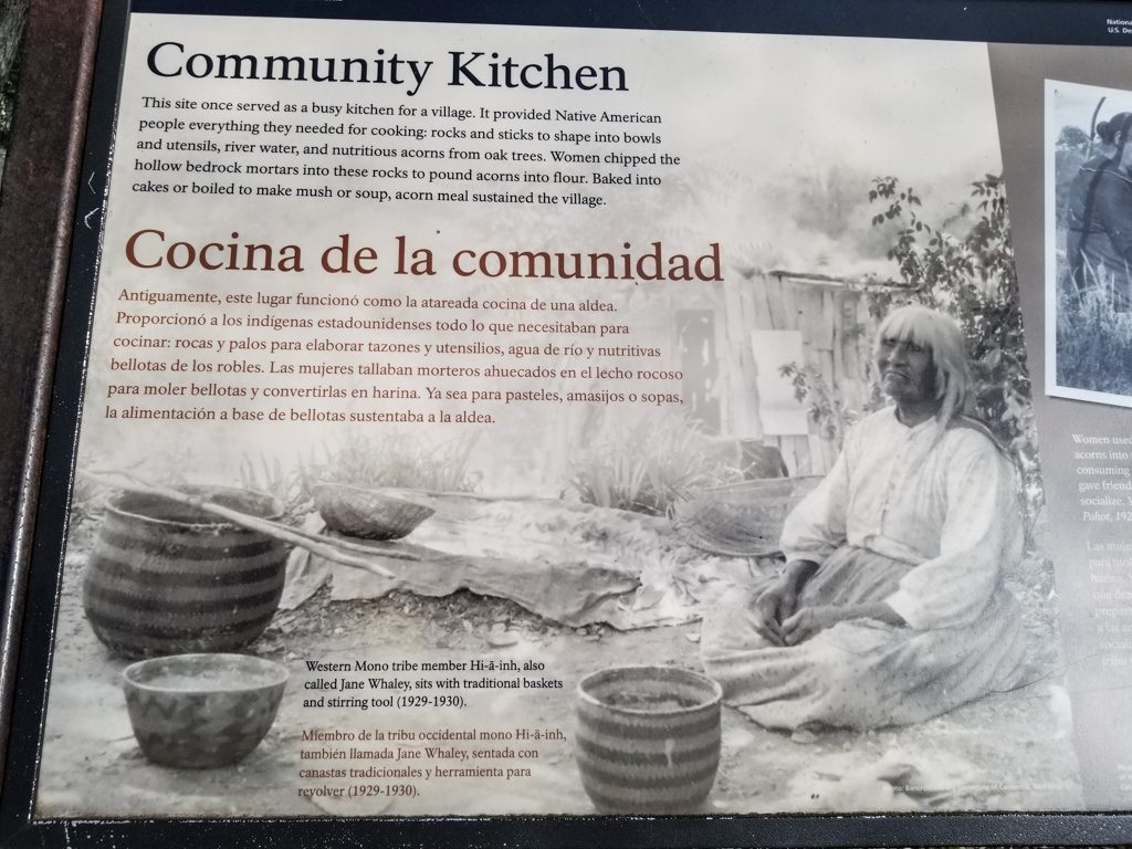
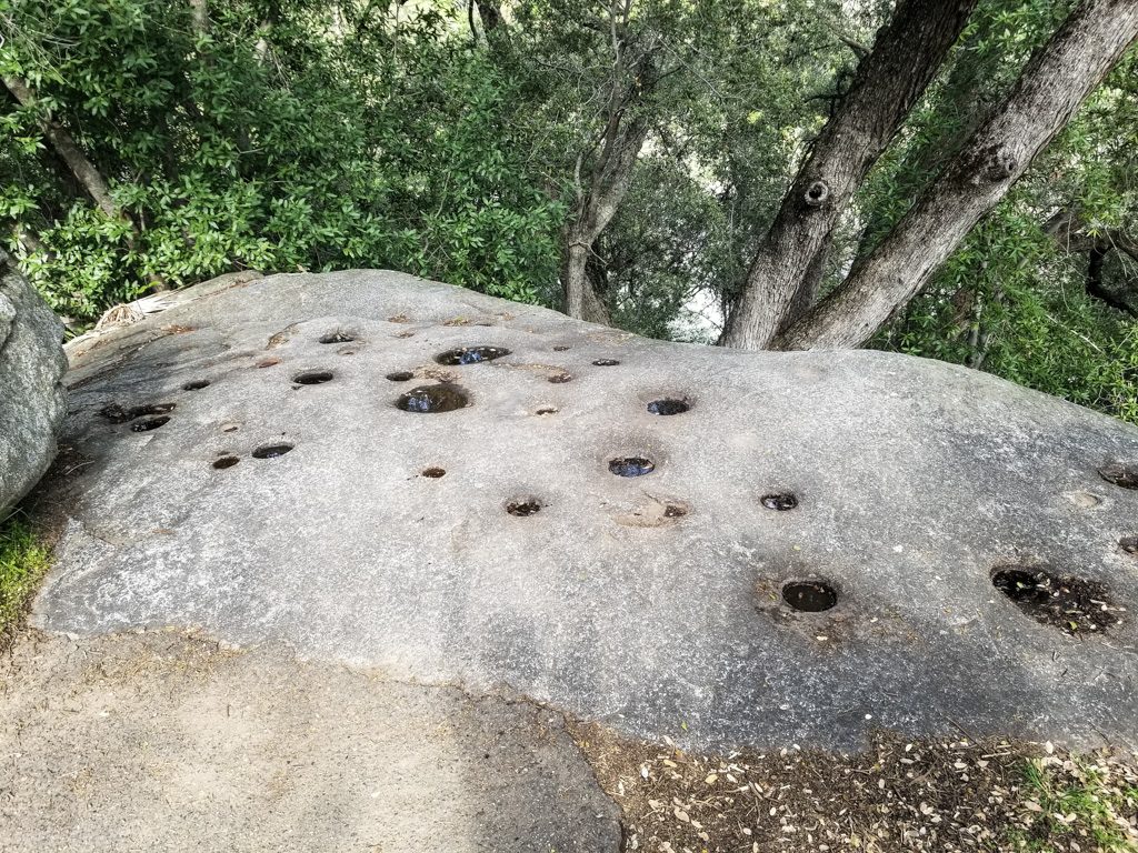
And we found this “community kitchen” fascinating.
Grinding holes worn into the rock in the kitchenCan you get acorn flower at Whole Foods?
We enjoy visiting parks “out of season;” not only are the crowds thinner (sometimes non-existent), but it also forces you to come back again to see the parts that are currently closed! Lots more to see here.
Our next post will probably be from the Oregon coast… See you there!
More than anywhere else in the world is a pretty bold claim. But that is just what Los Algodones, Mexico claims. More dentists in a four-block area (the size of the town center / business district) and more dentists per-capita than anywhere else on the face of the earth. According to one report, more than 350 dentists.
Going from just outside Yuma, AZ to Los Algodones Mexico is fairly simple. You walk through a turnstile. No checks, no passports, no guards (at least no visible guards). We crossed the border just to take a look see; we had nothing in mind that we needed to get there.
I tend to believe the claim about dentists! The montage below is a small sampling of the photos I took of the dental storefronts.
Just SOME of the dentist shop-front signs! Yes, an ad for honey was on one of the dentist signs. Drumming up business?
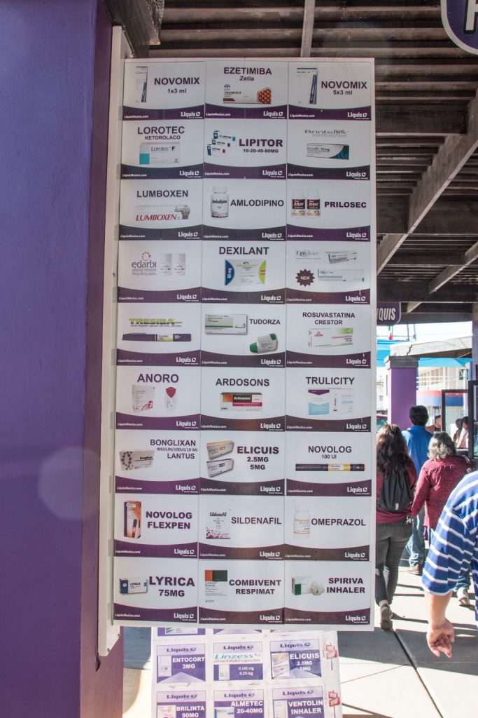
And it isn’t just dentists. Los Algodones is a mecca for American and Canadian snowbirds, for dentists, drugs (prescription), and glasses (couldn’t think of an alliterative “d” word for vision things). It is said that on a typical winter day, there are more Canadians in Los Algodones than Mexicans. I’m sure that the same could be said for the Americans.
As you can see from the montage, the dentists offer everything from simple cleanings to implants, the optical stores go from vision tests through delivery of the glasses, and in the pharmacies, no prescriptions are apparently needed. We didn’t make use of them (our medicare drug plan is great), but a neighbor here in Quartzsite told us you just tell them what you’re taking. Simply ‘mazing.
The usual caveats apply. Do your homework. Get recommendations. Talk to your doctor about using Mexican drugs. But we know someone who has been using a dentist there for 15 years, and have been told of a retired dentist who goes there (“a friend of a friend,” so apply judgement). Are Mexican cleanings in our future next year? Maybe. Implants? That would take a lot of convincing.
The prices are much, much lower than in the states and Canada, and everything is negotiable. “How much is this?” “Forty dollars.” “Sorry, too much; have a nice afternoon.” “Wait! How much do you want to pay?” And so it begins.
Let me tell you, Kathe is one good bargainer! One item she got was a dollar over half the original price.
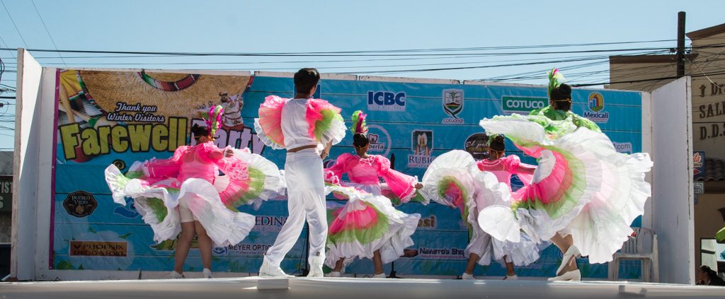
Los Algodones has one business: selling to the snowbirds. We happened to go there on the day they were having a “Goodbye and thanks, snowbirds” party. There were tent booths on the streets with free food and booze… and lines… which we didn’t partake of. But they also had a stage with performances by several dance schools. We stayed there for a while.
In addition to the high profile items (dentists, drugs, and glasses), the people of Los Algodones are happy to sell you other things as well! Leather goods, hats, clothes, jewelry, etc. In addition to the stalls on every sidewalk, there are merchants walking the streets and the restaurants offering you items to buy. “No, thank you.” … “No, thank you.” … “No, thank you.”
“Shoeshine mister? Ten bucks.” “No thanks.” “They need it.” Well, yeah, they did, but I wasn’t in the mood.
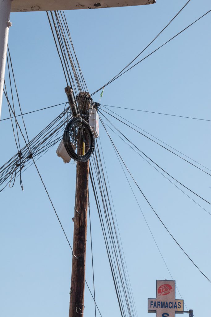
Being a geek, one of the things that struck me was the tangle of overhead wires (phone and power). As much as I dislike “telephone” poles and overhead wires in the US, this was overhead wiring of an entirely other order!
We only spent about three hours there; we just wanted to see what all the talk was about. We did have a nice shrimp taco lunch (not all that much cheaper than it would have been in Quartzsite), and then we headed back.
Remember how simple it was to get into Mexico? Well, to come back to the US, we walked across the border, too. But that’s where the similarity ended. Passports, Customs and Border Protection personnel, and a 38-minute line. Can’t complain though. We’re told that later in the day the line can be two hours!
Trivia: Los Algodones is the nickname for Vicente Guerrero. It means “Molar City.”
Sorry, no sunset for this post; we were back in the US and our car by 1:00 PM!
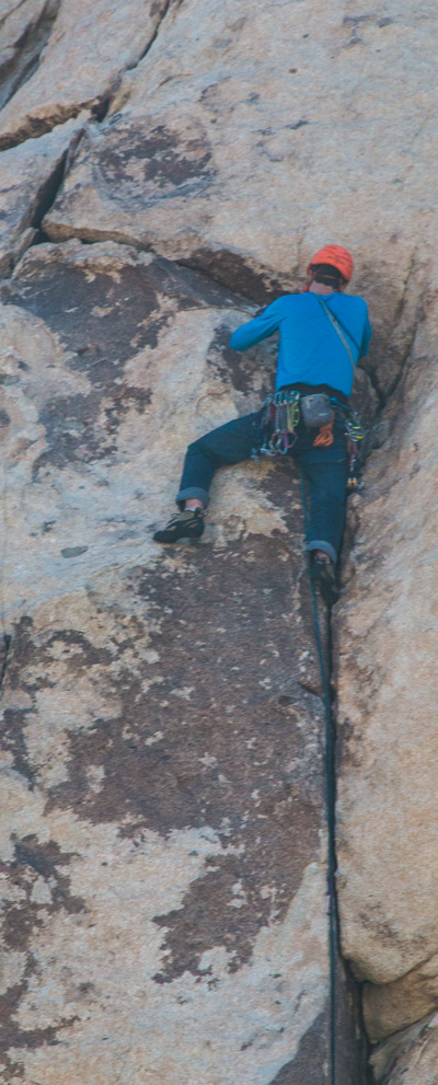
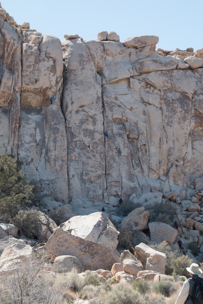
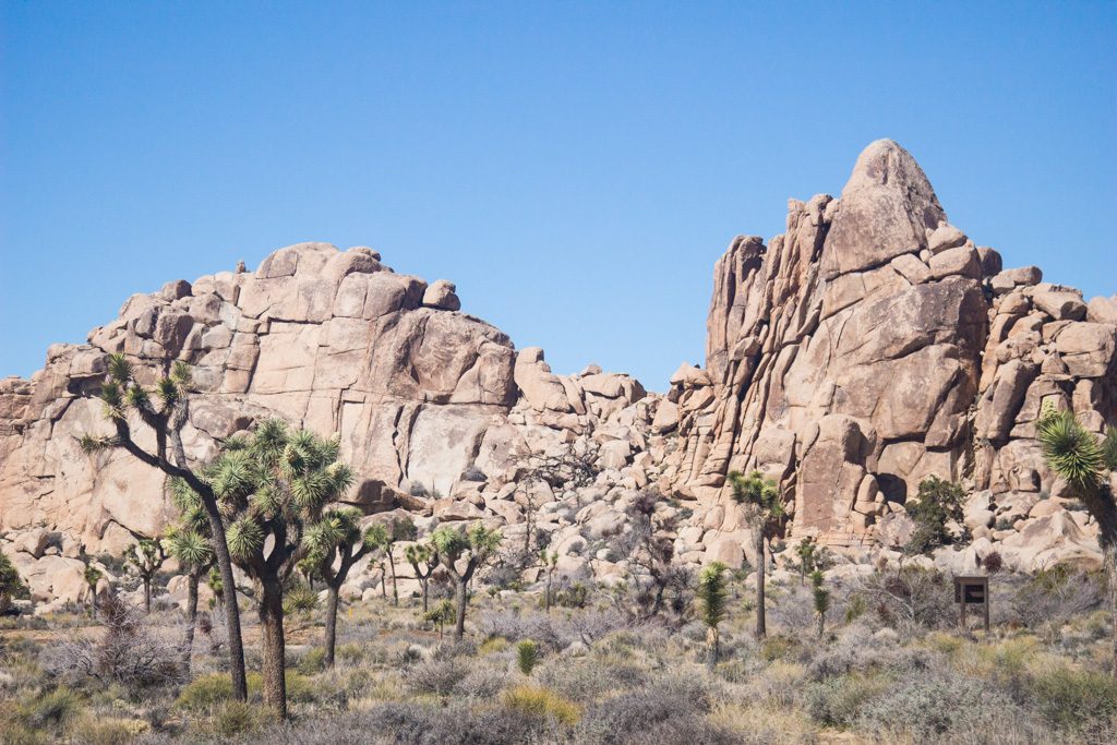
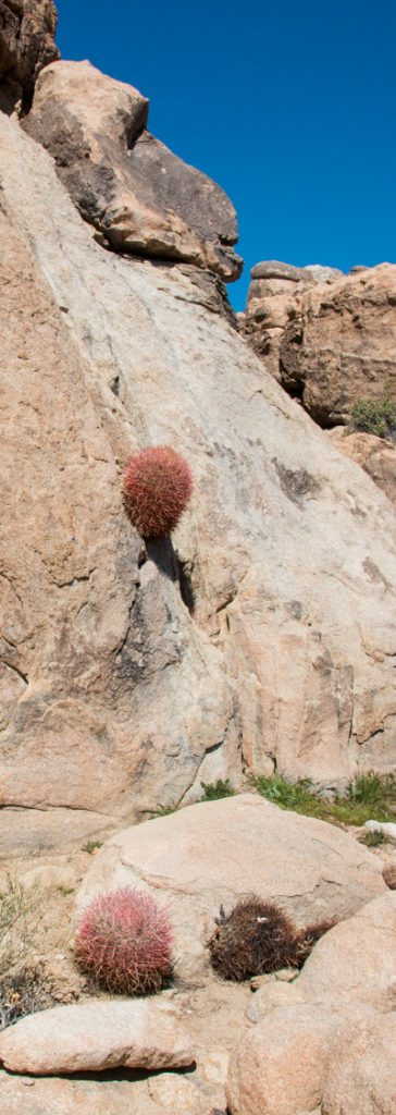
Joshua Tree National Park is a great playground with varied terrain; large portions are covered with myriad granite structures. Some are weathered and rounded, with large smooth (-ish) boulders in the area. Some are jagged with rubble scree at their base instead of the boulders. The geology of the area is complex. From what I’m reading, some of that difference depends on the depth of the magma that was the source. The crystalline structure of much of the granite is quite large and rough; this draws rock climbers from all around the world. We saw many there.
We traveled to Joshua Tree NP with friends James and Gloria, whom we met first at the Grand Design RV Owners’ rally back in January. James is a ham radio operator, so we also went to the Quartzfest gathering together.
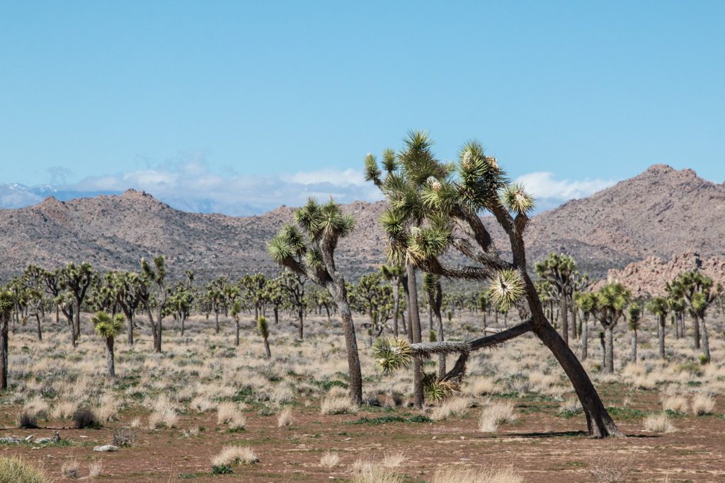
The park has two very different ecosystems, the Mojave desert and the Colorado desert; they are distinguished by elevation with the Mojave much higher than the Colorado. Vegetation and animals are different between the two, with the higher Mojave being both wetter and more vegetated, and the Colorado more arid. We spent our first two days in the Mojave desert on the north side of the park, which contains the majority of the Joshua Trees.
The northern part, Mojave desert
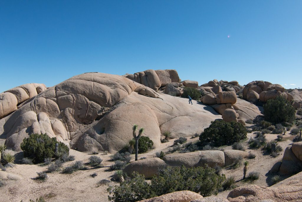
The scale of some of the rock formations is hard to get across in pictures, until you see some with people in them. Can you find the four climbers in the picture below? Hint: one of them is the climber in the picture above.
Climbers’ playground! And a nice place for us to pause for lunch and to watch. No people in this one (to the best of my knowledge!) But trust me; it is big. Larger than the surfaces the climbers were using.Can you find Kathe?With rocks like these, who needs a gym???
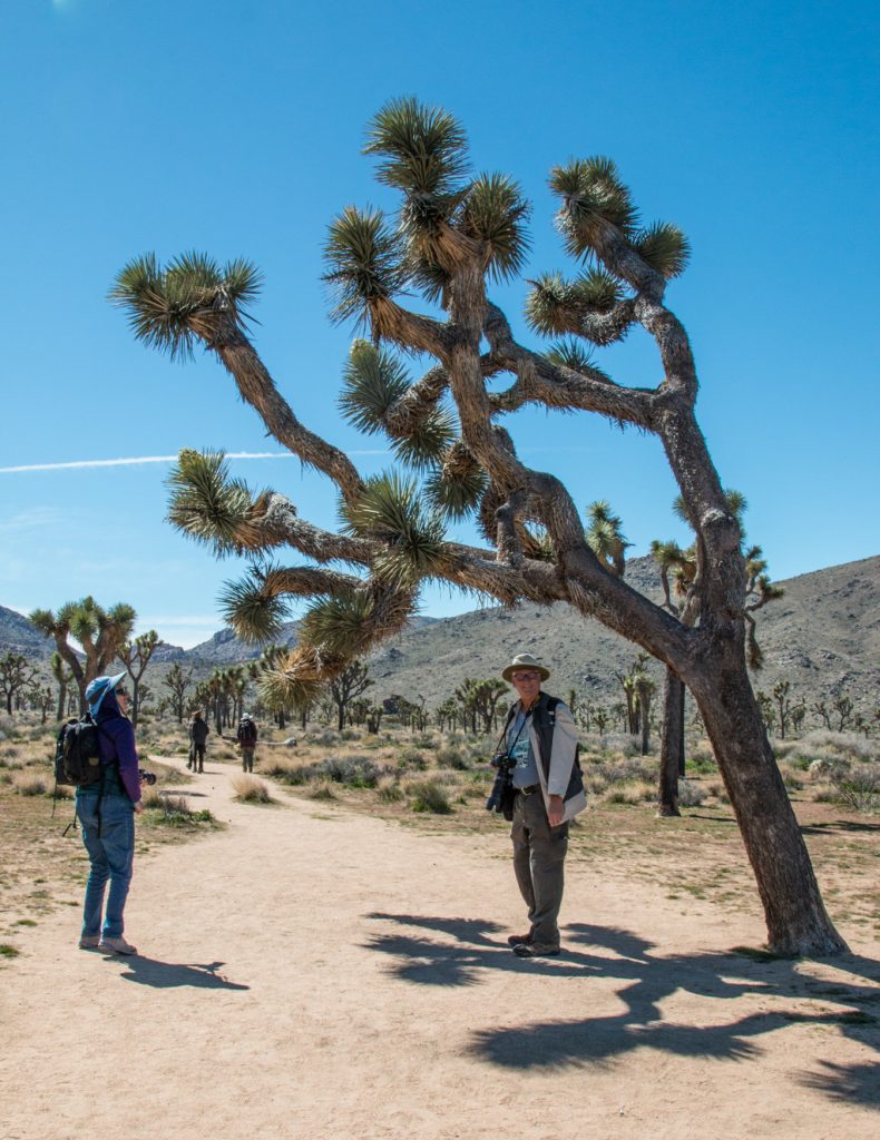
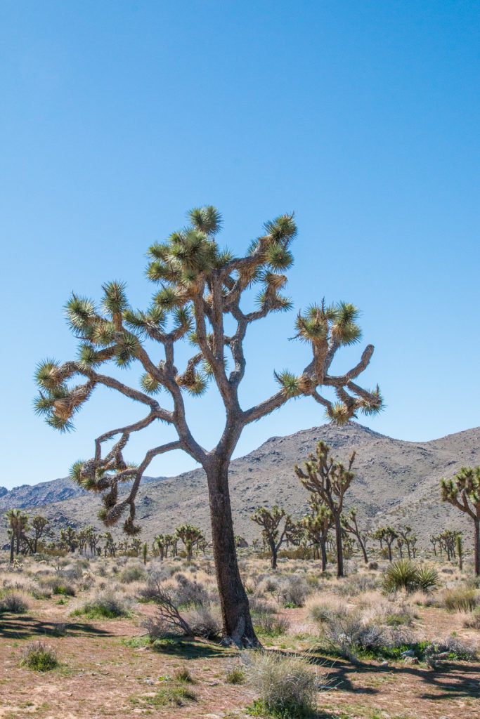
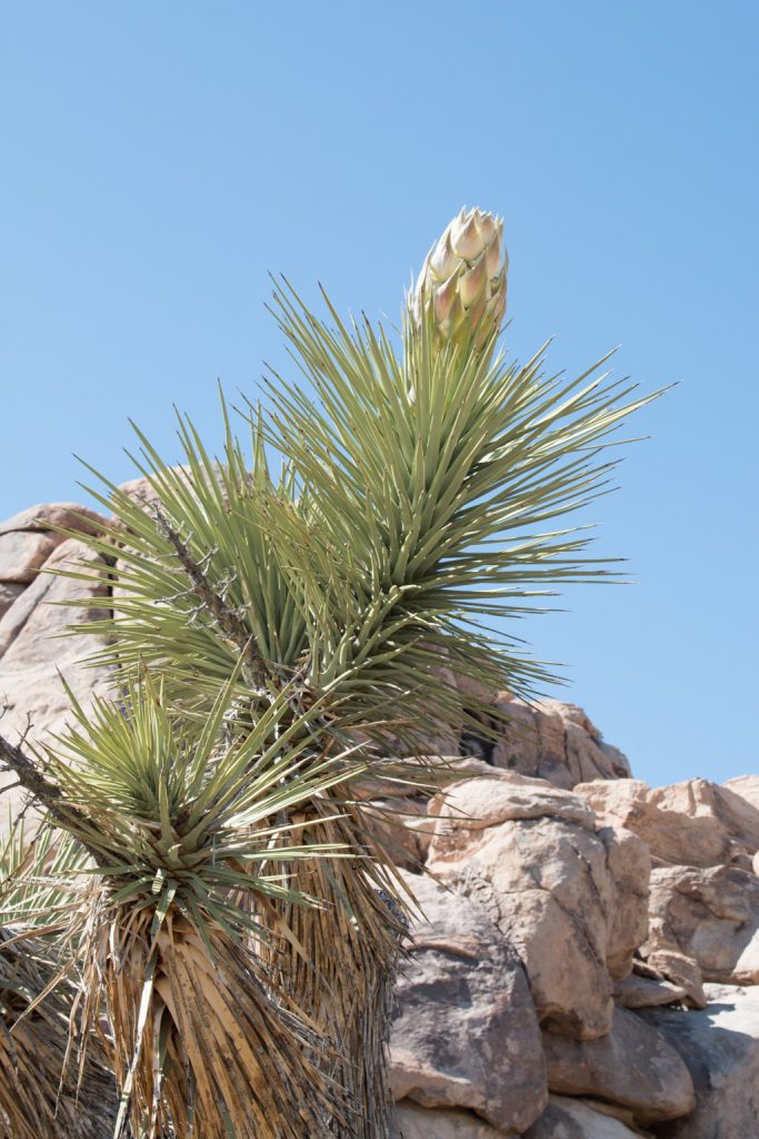
Joshua trees
Have you ever looked at the trees in Dr. Seuss’ books, such as the cover of The Lorax? It is said that the Joshua trees are the inspiration for his Truffula trees; he lived and worked in the southern California area.
They are oddly shaped! Twisty and gnarly. But oh, so cool to look at.
Kathe and James, both looking for the best picture of this tree.
Technically, Joshua Trees aren’t trees, but related to the agave. They are long lived, typically living several hundred years. The visitor center was selling Joshua Tree seeds and a little, itty-bitty pot to plant them in. Might work, if the person buying them can wait a few hundred years!
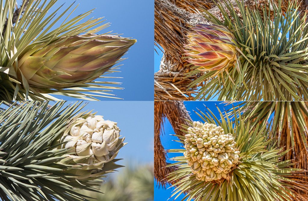
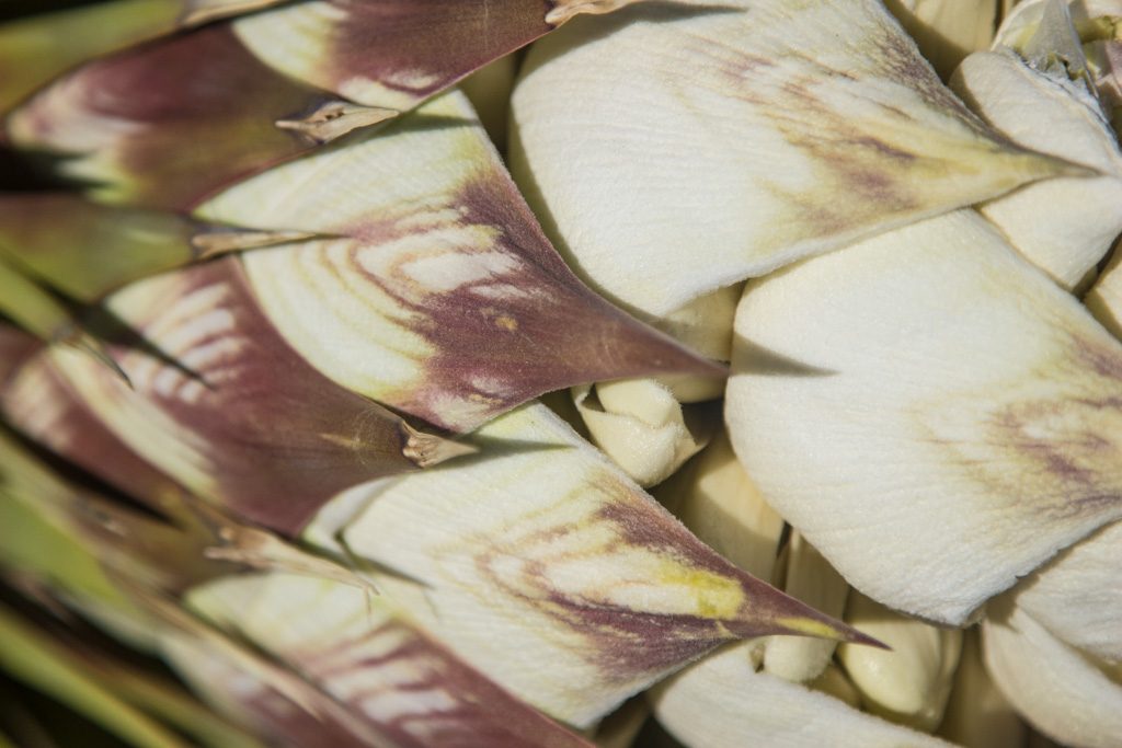
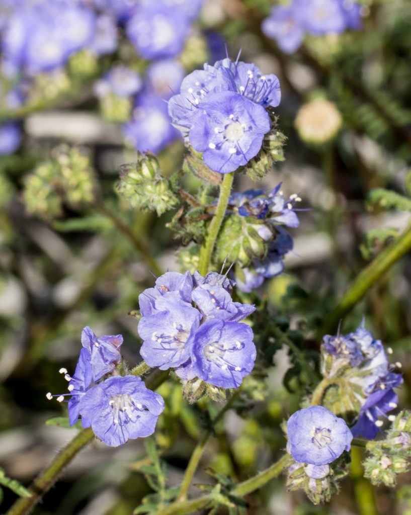
We were very lucky to be there while the Joshua Trees were blooming. There are several fairly distinct stages to the bloom cycle.
The lower right picture is a fully formed bloom. Not a usual “flower” structure!Art in nature!Joshua tree bloomsAnother tree in bloom. It seems to be a young tree, but that’s a guess.
A part of the Mojave desert portion of the park holds a Joshua tree forest. It isn’t a dense forest, but there sure are a lot of Joshua trees!
A view of the forest; the tree in the foreground is blooming.
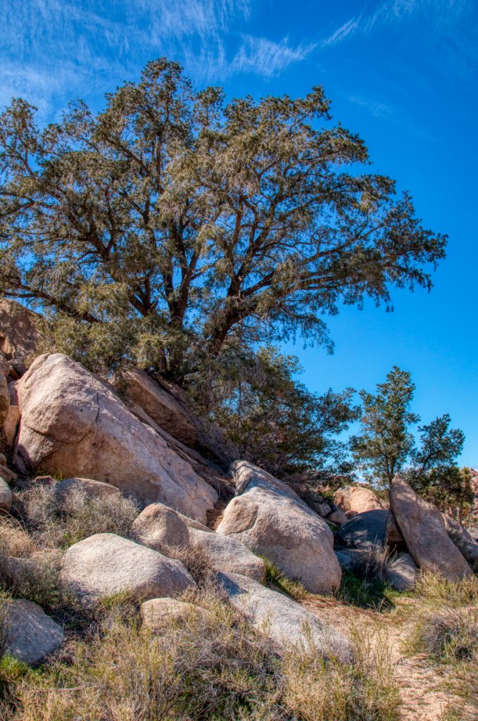
A few more pictures of scenes from the Mojave part of the park that I just found visually magnetic.
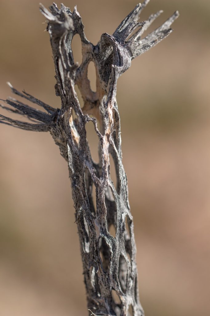
Yes, there is vegetation other than Joshua trees//
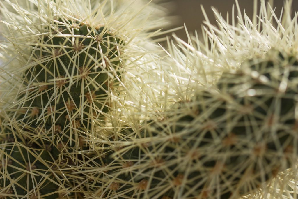
Life in the desert is hard. Even for the cholla (CHOY-ah) cacti. The lace-like skeleton of the cholla is interesting.
Do you know the purpose of this mesh-like construction? I don’t. Another year’s free subscription to our blog to whoever dreams up the funniest answer.
But life tries hard to find a foothold! (“roothold”?)
The transition zone
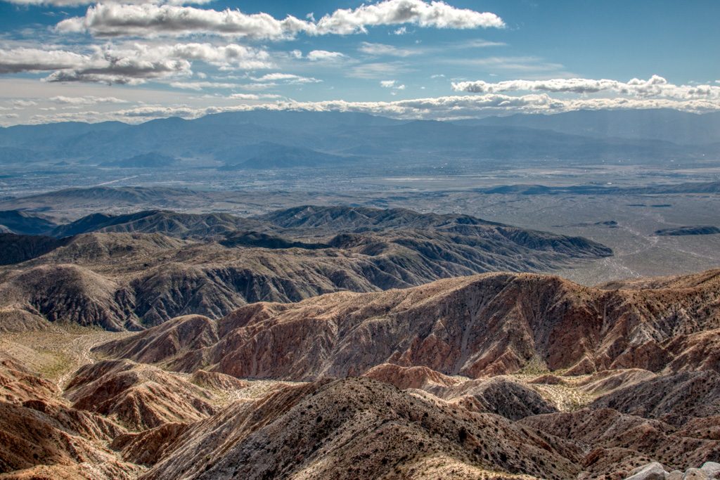
Where the two deserts meet is called the “transition zone.” Overlooking the transition zone is the highest point in the park reachable by vehicle, Keys View.
Looking southwest, toward the Colorado desert. The Coachella Valley in the midground is nearly a mile below us. The dark stripe on the right a little above the midpoint is a section of the San Andreas fault which runs through the valley. Just to the left of the picture is the Salton Sea, at 230 feet below sea level.
Although the transition zone contains animals from both sections, we saw very little wildlife in the park at all, just a few lizards. We’re just as glad that we didn’t see any of the rattlesnakes which are starting to come out as the days grow warmer. (People camping near us in Quartzsite have seen them!)
The Colorado desert
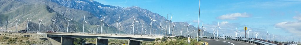
It is possible to drive from the northern part of the park to the southern part through the park but it is an approximately two hour drive due to the speed limit in the park. We opted to pick up our stakes and bring our rigs to the southern entrance, going around the west side of the park. Part of the reason for moving instead of just doing the southern part as a day trip from the north is that this brought us that much closer to “home,” i.e., Quartzsite.
Going around the park that way on I-8 (or, “the 8,” out here) one comes across this.
Think this is a windy stretch of road?
If you’re hauling an RV as we were, you better hope it isn’t a windy day! But we’re really glad to see large wind and solar farms. This one went on for miles; it is the largest we had seen since Texas.
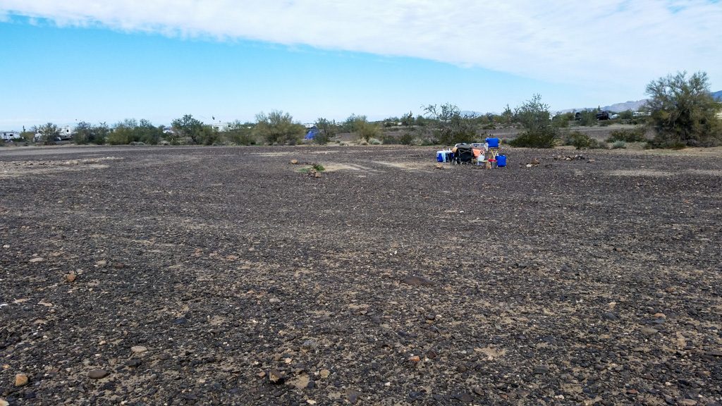
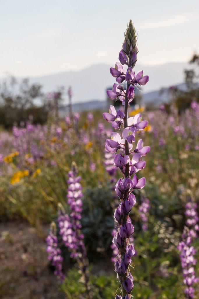
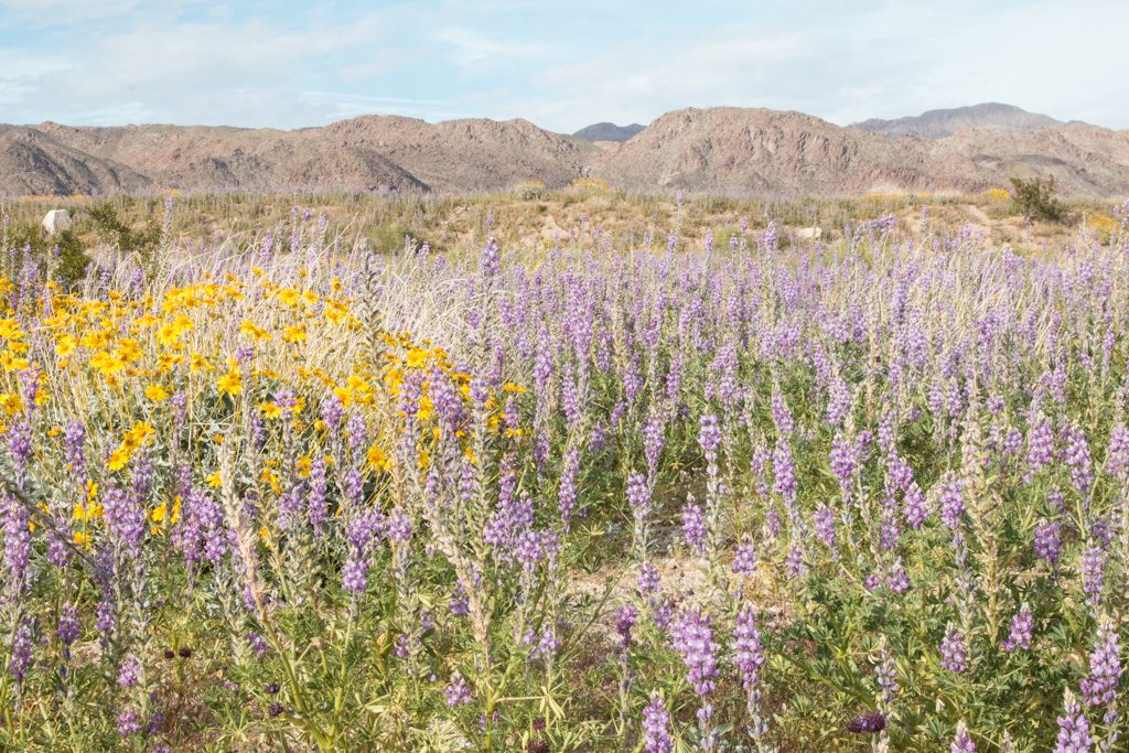
There is a BLM dry camping area immediately outside the park at the southern entrance (the area abuts the park). This turned out to be one of the prettiest places we have ever camped, with desert flowers blooming right alongside our camper and all around us, and mountains in the background. We would go back there in a heartbeat!
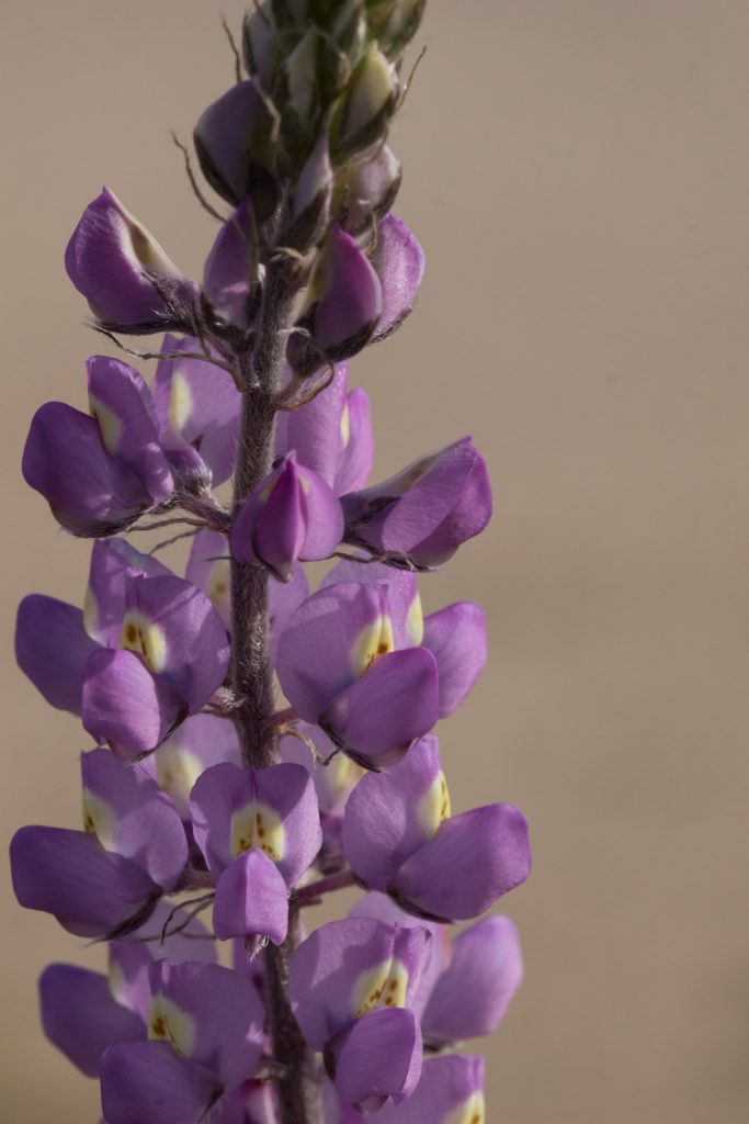
Desert lupine, smaller than the kind we have in Maine. Nice campsite!
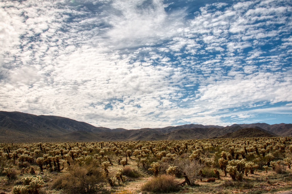
The southern part of the park has few Joshua Trees. Being more arid, the main vegetation here is various types of cacti. The main draw there, especially this time of year, is the desert bloom—at least it was for us.
This has been an exceptional year for the bloom. We didn’t go to two highly reported areas, one near Tucson and one in Southern California where the authorities had to close a town of 60,000 people when 100,000 people tried to come photograph the flowers one Sunday.
But Joshua Tree was really pretty!
Fields of flowers in the desert.
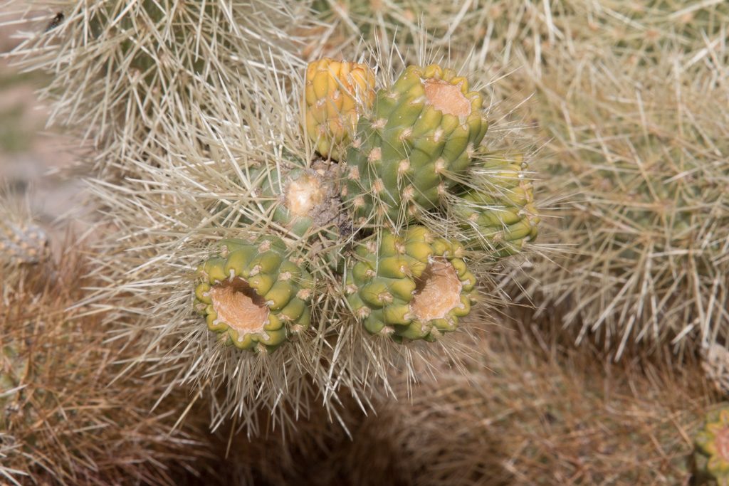
The Cholla Garden
“Be careful! They’ll jump out at you and attack you!” Gloria warned us as we were getting out of the car at the Cholla (CHOY-ah) Garden section of the park.
The Cholla Garden
“Yeah. Ha ha ha ha.” That’s me, of course. (You’d think I would have learned by now…)
Cholla are well guarded, but those needles are for transportation, not protection!
I was walking through the garden being careful to not brush against cacti. Then the wind blew a small dropped section against my boot. Instantly about twenty needles were stuck in the leather (thank goodness that I wasn’t wearing sandals or even regular low shoes)! Did I mention that the needles are barbed? Trying to pull the needles out of my boot’s heavy leather simply resulted in them breaking off.
The cholla bloom isn’t a typical flower.
We really enjoyed our three days in JTNP. There is much more to do there, including several hikes we’d like to take. We’ll be back.
So closes another portion of our adventure. We wish you the best on your own adventure through life, whatever it may be!
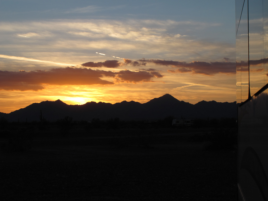
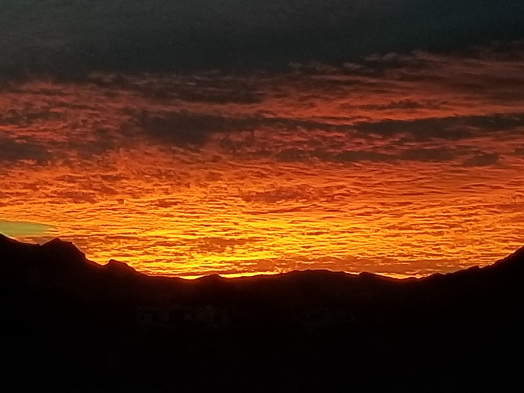
Camping is tough when you have to put up with scenes like this every evening! The view from our BLM campsite south of Joshua Tree NP.
Each sunset marks another day of our adventure together.
Al: “I retired seven months ago today.”
Kathe: “That’s not possible!”
We’ve been living here on the desert for over three months. The time has gone by so quickly. We are now starting to plan our spring and summer travel; it is almost time to leave.
We’ve come to love it here on the desert. At our own choosing, we can be quiet or busy—with friends or on our own. And, with apologies to all our family and friends still in the colder climes, the weather hasn’t been too bad, either!
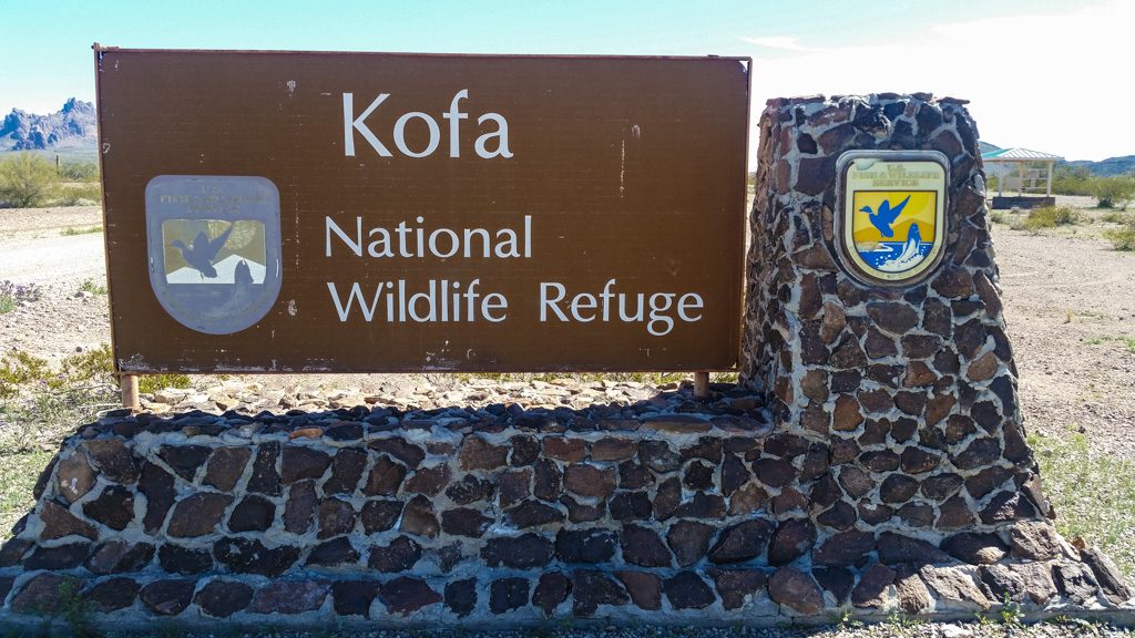
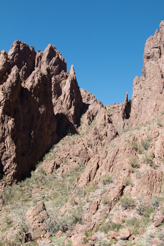
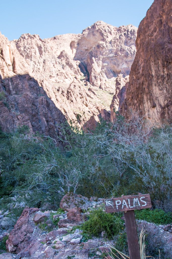
Palm Canyon
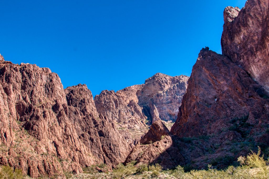
Last week, we went with some friends to Palm Canyon, in the Kofa National Wildlife Refuge. According to this, it is the last place in Arizona that California palm trees grow in their native environment. A nice one-mile in-and-out walk, it was our first time up actually near the mountains that surround us.
Entrance to the NWR: Several miles down a dirt road.We’re walking back in there! The start of the Palm Canyon trail, yet several more miles down the dirt road. Kathe, on the trail!Surrounded by the remains of volcanos
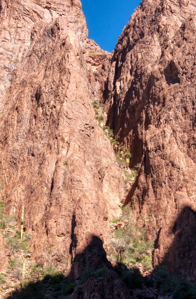
A comment I had read on the net said that the viewing point was a half mile up the trail, but that the palms themselves could be reached in an additional third of a mile “up a fairly steep trail.”
Yeah. Got rope?
At the viewing point.“Up a fairly steep trail.” Yeah.A closer view. Longer lens; we didn’t go toward the palms past the viewing point!
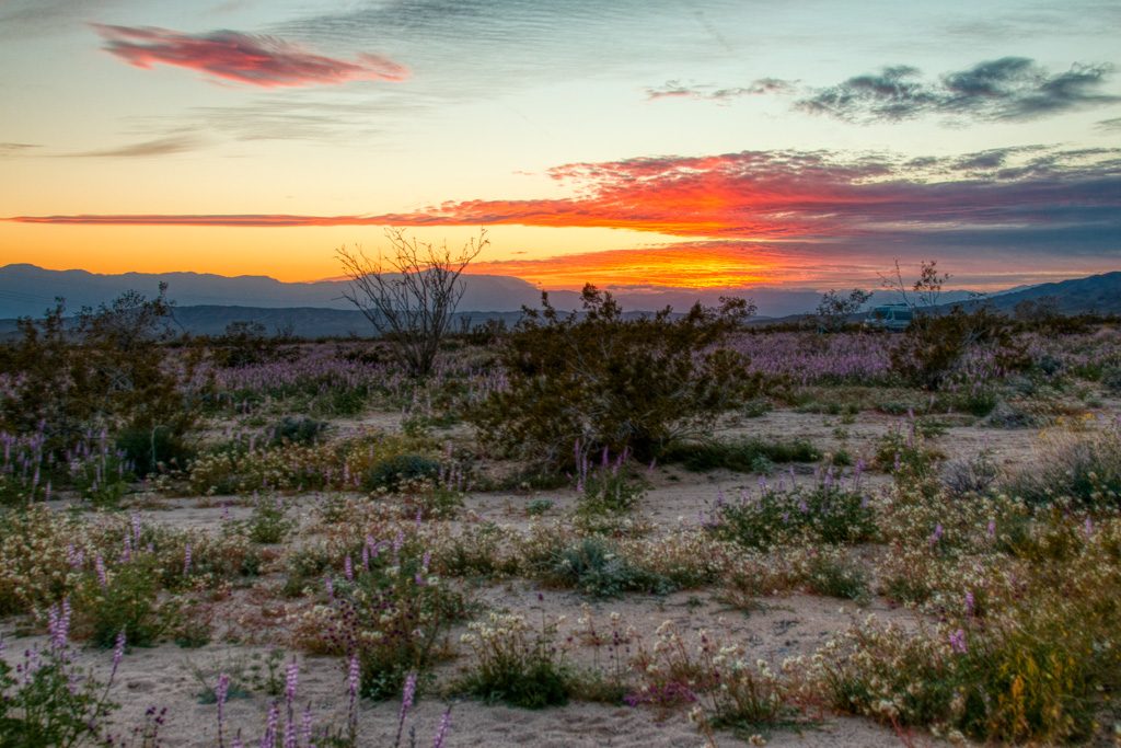
The desert is greening up. We’ve apparently had an unusually large amount of rain this winter. A person we met on the trail said that in a normal year, this scenery would be brown.
Not lush like in non-desert areas, but there is green there!
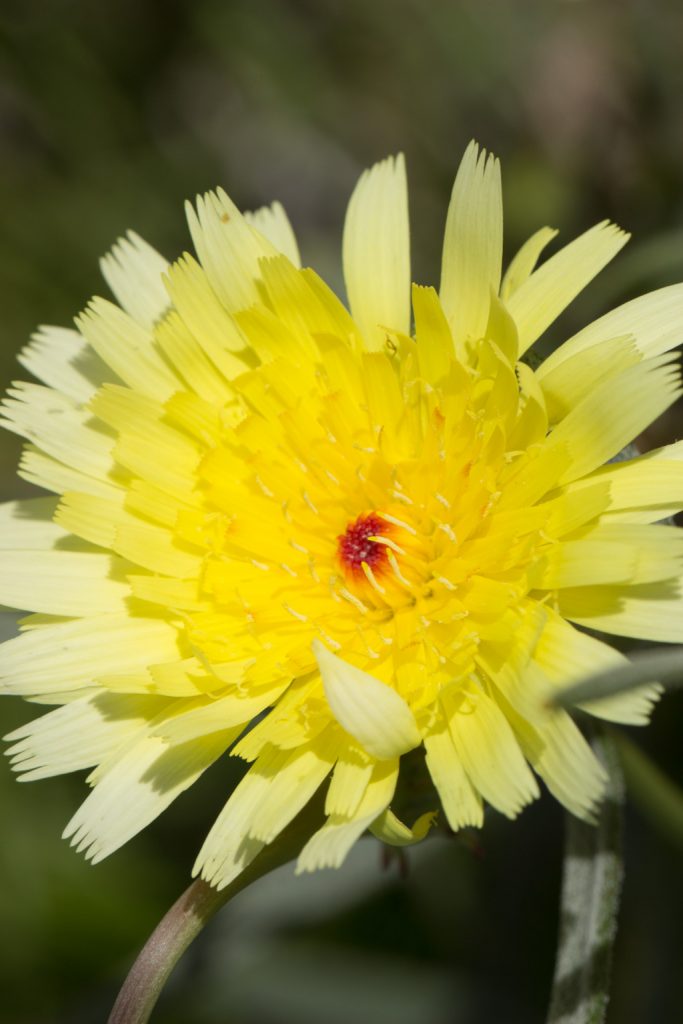
And we’re starting to see some flowers blooming. We hope to see more of the “desert bloom” when we go to Joshua Tree National Park in California for a few days this week.
The “ghost flower” (Mohavia Confertiflora). The petals are translucent!
We had been warned that for a few weeks in January Quartzsite is an overcrowded madhouse with long lines, terrible traffic in town and so on due to multiple rock and gem shows, and a big RV show. Additionally, the population on the LTVA (BLM’s Long Term Visitors Area), where we are living, swells. We wanted to avoid all that humanity if we could.
Fortunately in addition to the LTVA, the BLM has six “fourteen day” camping locations in the Quartzsite area. These sites have no services whatsoever, but are free to camp in for 14 days. After that you have to leave for at least fourteen days. If you want to continue to use free BLM land in that time period, you must move at least 25 miles away.
We were fortunate that we had two back-to-back events at a fourteen day area three miles farther out of town than we normally reside: a (yes, another) Grand Design RV owners’ rally, and a ham radio gathering, “Quartzfest.” These allowed us to avoid the worst of the Q-crush. Just to experience the big RV show in town we did ride our bikes there one afternoon; no way we were going to try to drive in and find a parking space. For all the hype surrounding the “big tent” show, we were unimpressed.
Quilt Show!
We had fun helping with the Quartzsite Quilt Show put on by the local quilting group Kathe is part of! I helped set up (and tear down) the exhibit space, and Kathe was busy before, during, and after the show. The quilts were quite impressive.
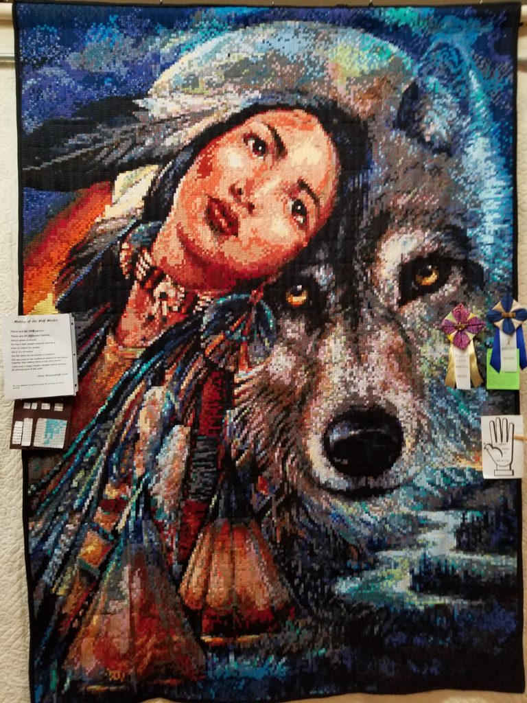
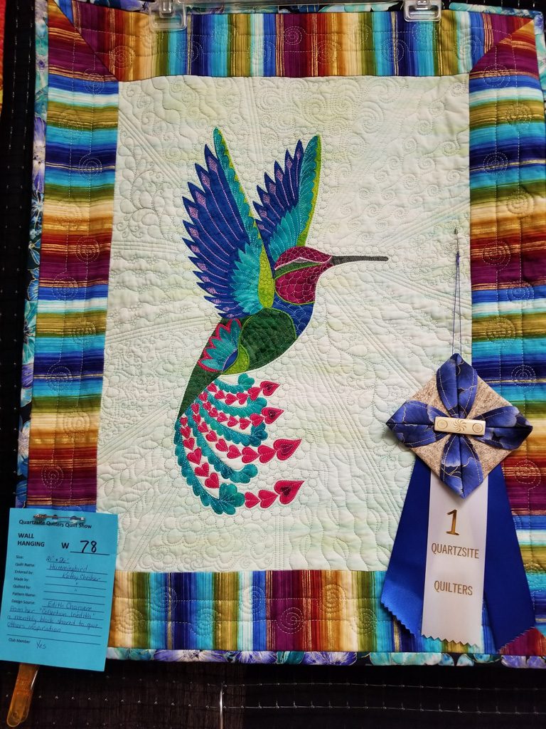
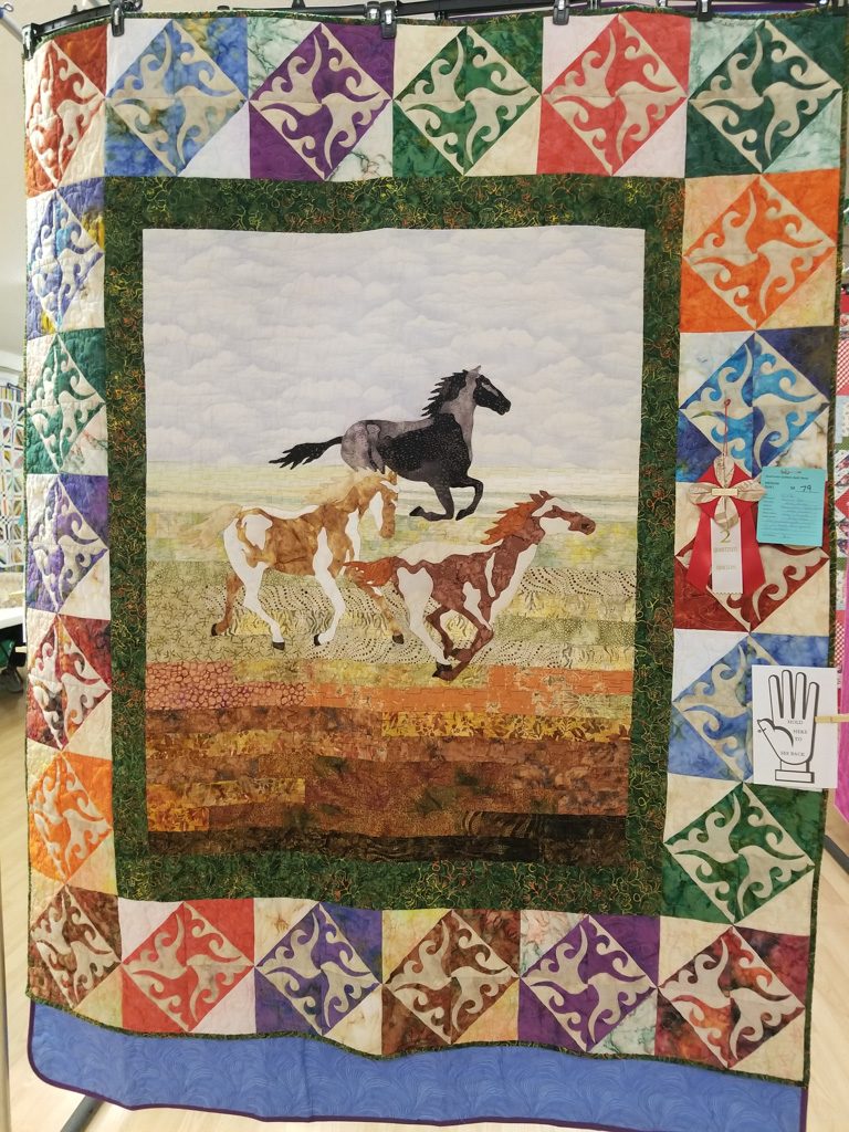
“Wolf Maiden” by Janet Nieuwenhoff. More than 68,000 1/4-inch squares. “Hummingbird” by Kathy Chesher“Running Free” by Kathy Chesher and granddaughter Kaylee Wilcox“Storm at Sea” by Cara Osmin
Road Trip: Yuma
We spent a week in the Yuma area, staying at BLM’s Imperial Dam LTVA in California with “blast from the past” friends, Henk and Mary.
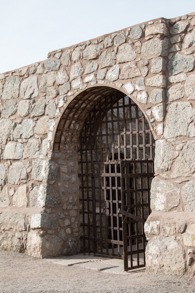
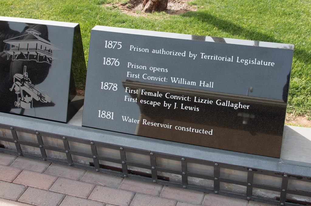
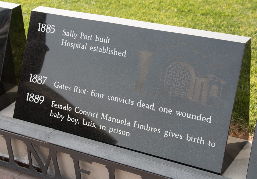
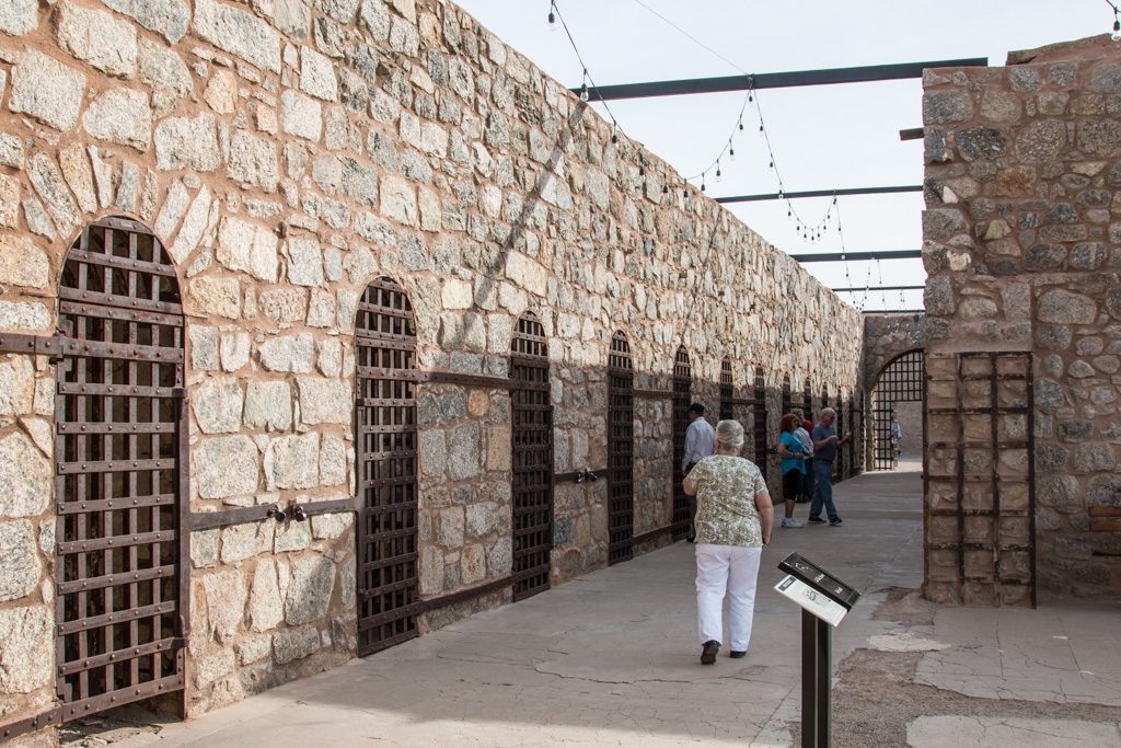
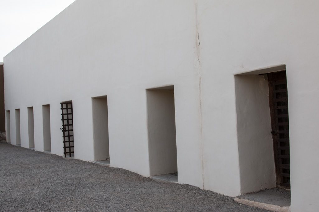
Arizona didn’t become a state until 1912; Yuma had Arizona’s first prison, in use from 1876 to 1909. A portion of the prison, now called the “Territorial Prison,” is preserved as a state park (part was long ago demolished to make way for a railroad line). There is a museum with many displays about prison life. One showed interesting information about the prisoner demographics; some that stuck out to me were that most of the prisoners were considered to be literate, and virtually all used tobacco of one form or another.
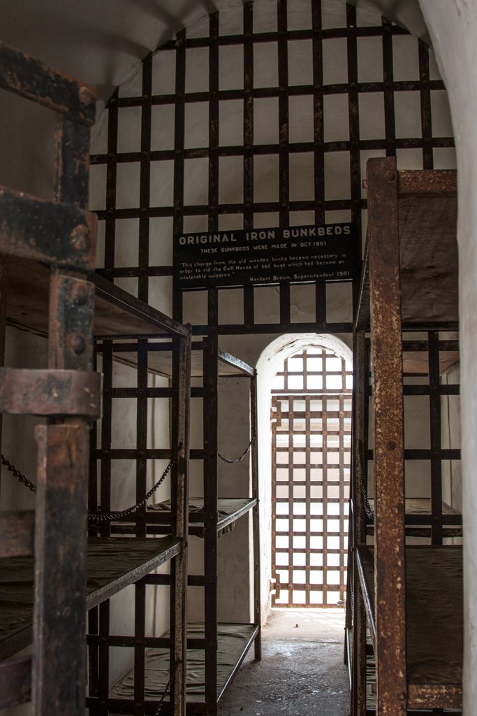
Entrance sally port into the prison.Some of the timeline stones…The original cell block. The doors had a second identical grate about 18″ inside; the two were interlocked so that it was impossible to open both at the same time. Only a few of the cells still have this mechanism intact.The “new” cell block. The interlocked double-gate mechanism seen in the old cell block did not seem to be used here. (Remember, the prison was shut down in 1909.)
The territorial prison had enlightened leadership. From one of the museum displays:
The Prison had more modern amenities than most homes in Yuma, and Yumans resented that.
Electricity
Forced Ventilation
Sanitation, including two bathtubs and three showers
A library with 2,000 books, the most in the Territory at the time
Enlightened, progressive administration
Even a Prison Band!
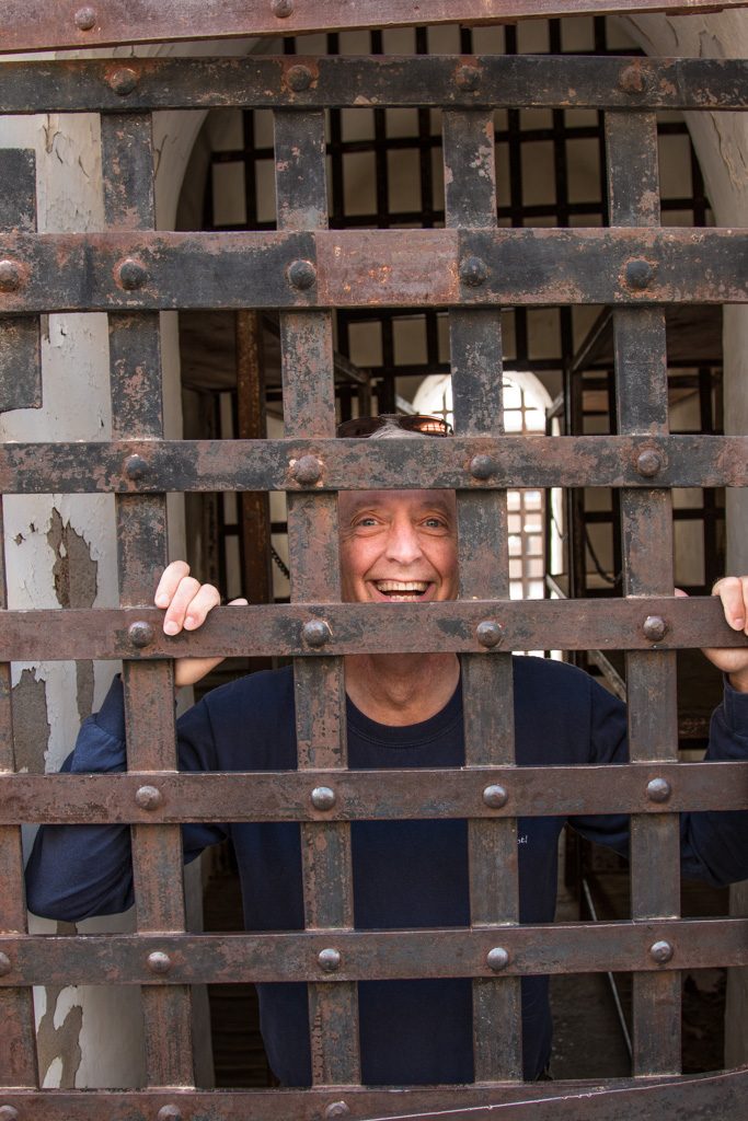
Some of the cells are open to enter, and, of course, pretend to lock your friend in!
Each cell housed twelve inmates, and was exposed to the weather. Note the steel bunks. Ouch!Prisoner Al!
From Yuma, Kathe went to Corning to play Grandma Lobster, giving Mike and Laurelyn the opportunity to travel during school vacation week. While Kathe was gone, I went to another ham radio gathering in Yuma.
By the time we got back to Quartzsite it was obvious that the exodus had begun. The desert is emptier again; so is the town. People have started heading north preparing the way for us.
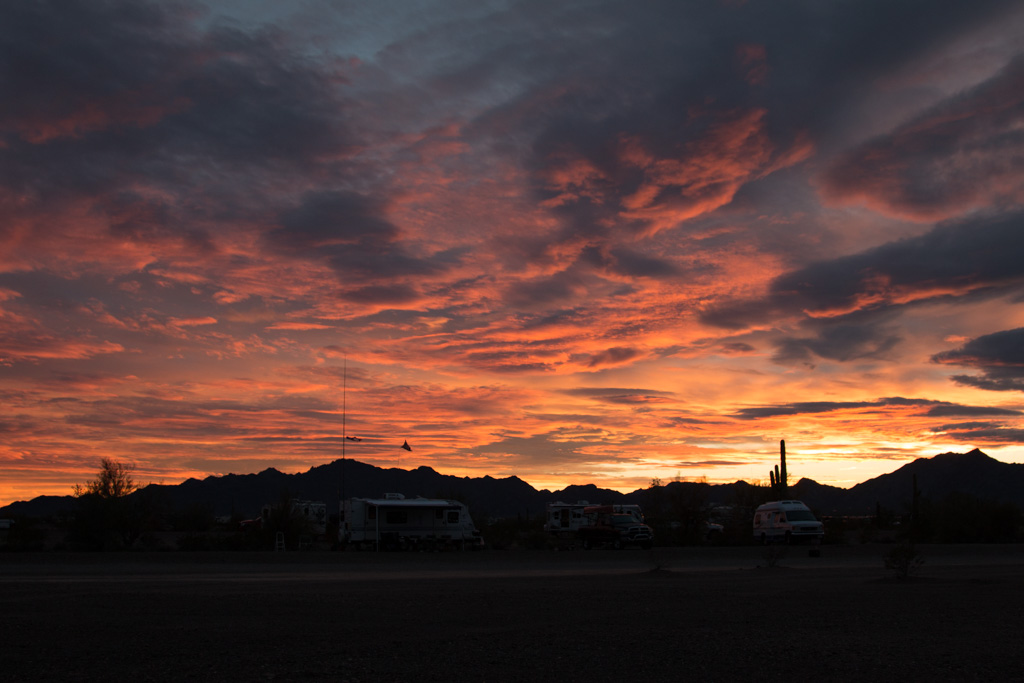
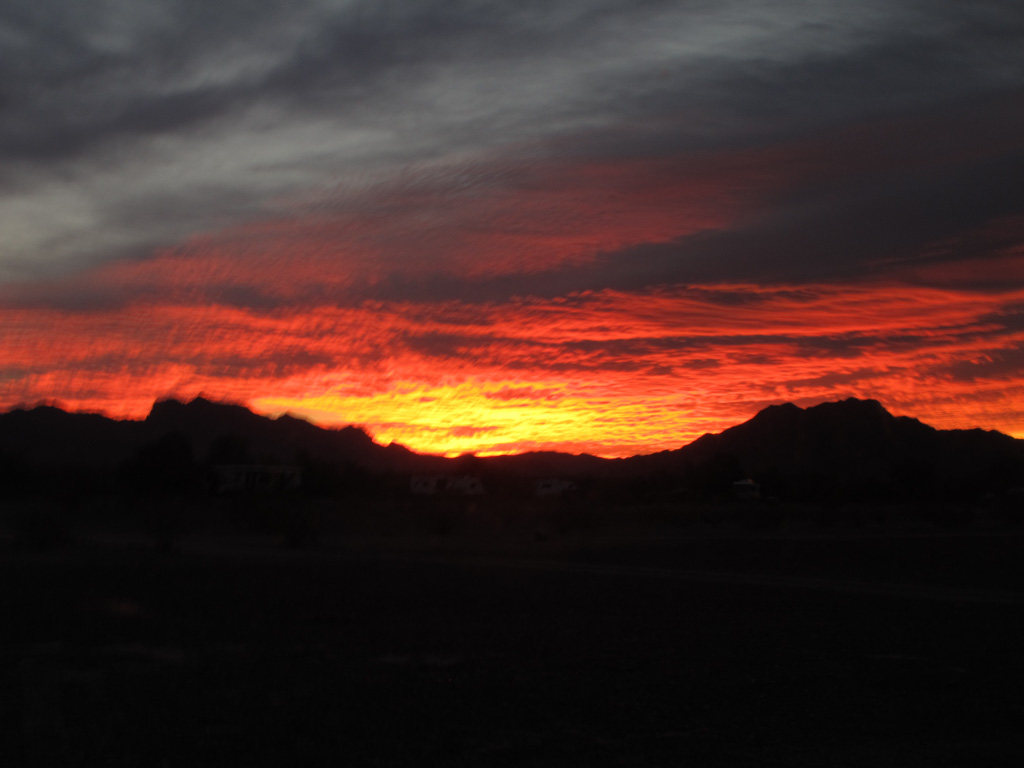
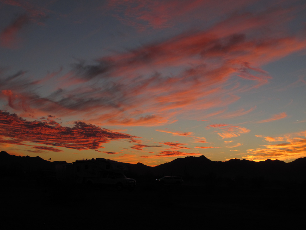
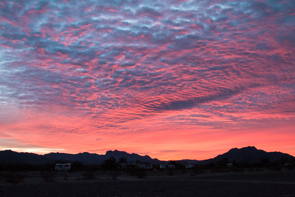
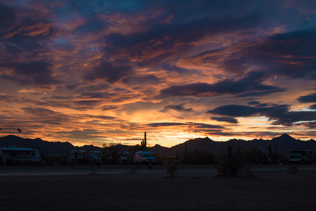
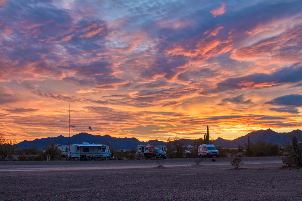
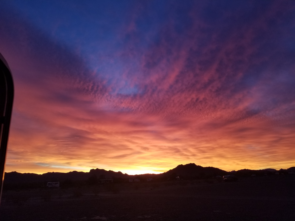
Sunrises and Sunsets
One of the advantages of living on the desert is the essentially unrestricted view of the horizon, especially compared to New England. We have been (usually!) waking up before sunrise, and have gotten in the habit of looking for the sunrise, and again for the sunset every day.
Click on any of the pictures below to see them all as a slideshow of larger versions, and remember you can always right click on any picture in our blog and choose “open image in new tab” or similar, to see the largest resolution that we uploaded..
One other thing…
Drum roll please! When we set out on our adventure, we told ourselves that we would try RV “full-timing” for a year before deciding whether to sell our house on Mount Desert Island.
Well, it hasn’t been a year, but we’ve made the decision! We want to continue this adventure for the foreseeable future, so we will be putting the house on the market this summer. We’ll fly back to MDI to take care of all that has to be done to get a house ready for new occupants.
That’s about it for now. Life has been fairly quiet so we haven’t been posting frequently. Rest assured that as we start to travel again we’ll be keeping you up to date with the activities of your favorite lobsters!
I’ll start off with a warning. Rodeos celebrate western life on the range. Romanticized and stylized, sure. Exaggerated? Maybe. Rodeos are action filled and exciting.
Rodeos are not kind to animals.
However, sanctioned rodeos are subject to regulations about the treatment of their animals, and this was a sanctioned rodeo. I found this write-up interesting.
This post may not be for all of our readers. There are pictures below of the rodeo we attended. Some are cute; others may upset some people. Please use your discretion as to whether you want to continue reading.
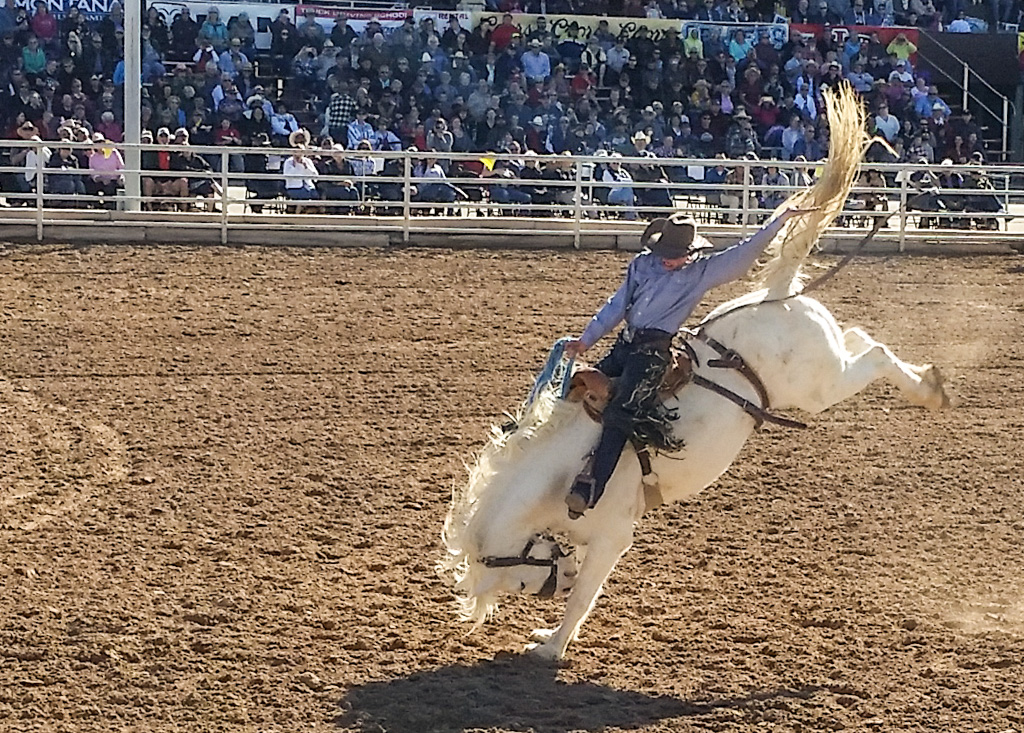
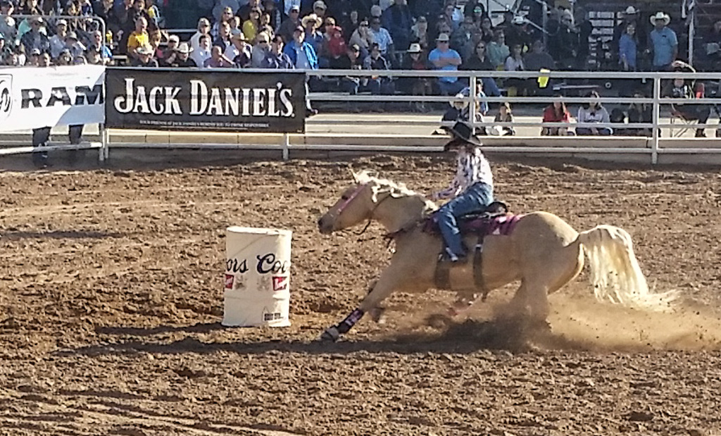
The Yuma Silver Spur Rodeo was our first rodeo. It was entertaining to watch the events and the audience!
I had my good camera with a 400mm telephoto lens with me. “I’m going to get some GREAT pictures today!”
At the entrance gate was a large sign… cameras and photography prohibited. Yuck! Stowed the camera away in a pack. When we got in, I looked around and people seemed to be following the cameras portion of the rule, but were using their phones to capture some pics. OK, I guess they can throw us all out if they want to. So I used my phone. I didn’t get the pictures I had hoped for, but hopefully they’ll give you a sense of what we saw.
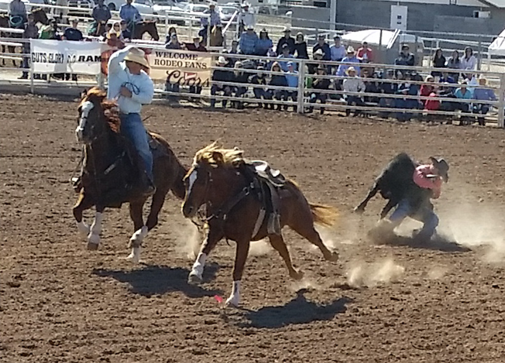
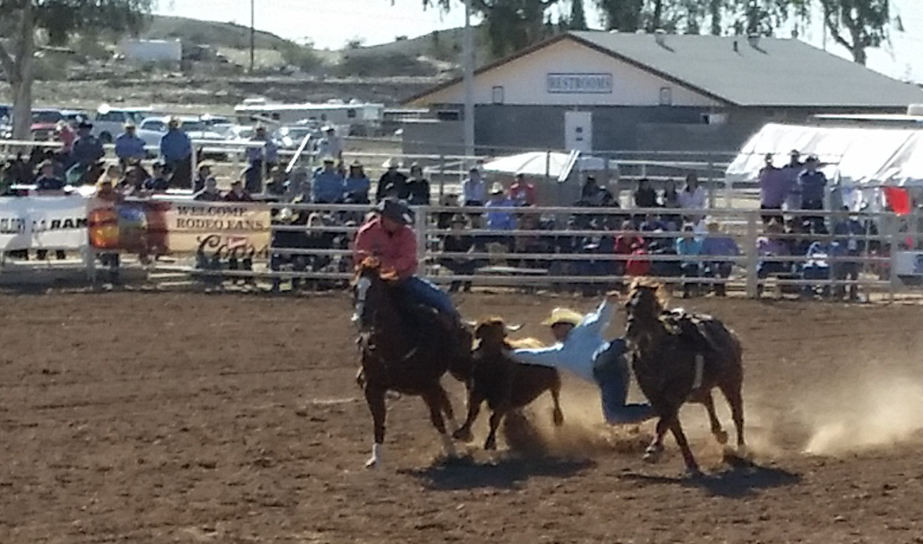
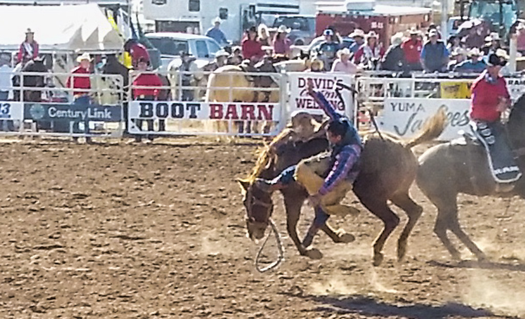
First up was tying cattle. This is a timed event; the goal is to grab a calf while it is on the run, get it down on its side, and tie three of its legs together. I can imagine that this was useful when trying to brand the calf, but don’t really know. The calf and the cowboy enter the arena through the same gate at the same time. The cowboy chases the calf on horseback, jumps off the horse onto the calf and wrestles it to the ground.
Is the cowboy taking the calf down, or the other way around? Looks like the calf will end up on top. Uh-oh!
The second horse and rider are only to bring the competitor’s horse back; they are not part of the competition.
At least the goal is for the cowboy to end up holding onto the calf when he jumps off his horse. Doesn’t always work out that way!
Sometimes the cowboy ends up wrestling the dirt…
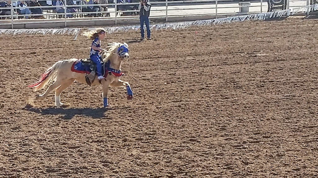
There were also two events in the rodeo featuring women. The first of these was trick riding, demonstrated by two women. Unfortunately, we were sitting across the arena from the grandstand; the tricks were mostly staged there, so I wasn’t able to get very good pictures.
Sing it with me… “I’m out of… the saddle… again.”
Actually, the trick riding was by one woman… and one eight-year-old girl!
A young trickster!
Next up was the bronc riding. I have a bad back. I can’t imagine the pain these guys must endure getting thrown around like this.
One of the longer rides. The cowboy can only hold on with one hand.
Exit, stage left!
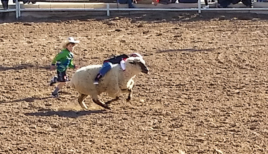
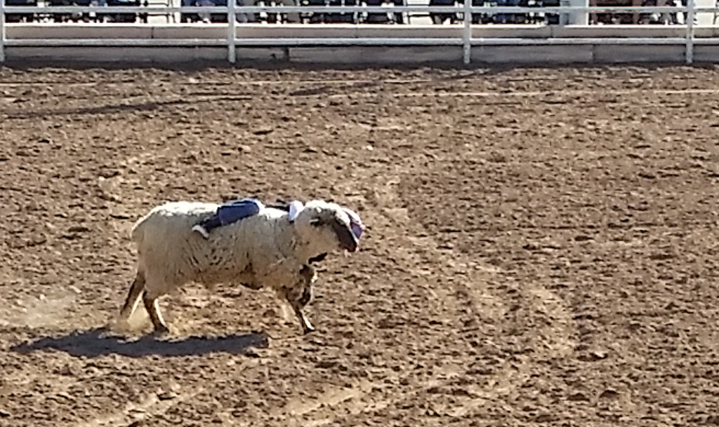
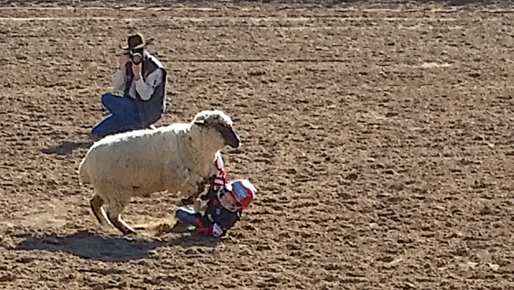
So how do the cowboys learn how to ride these animals? Well, there are schools, but you could also start by riding sheep!
Here is one participant’s ride…
Hold on! Hold on! Hold on! Hold on!
Uh-oh!
I’ve still got a leg on her!
Touchdown!
Aiieeeeee!
They are wearing helmets and flack jackets, but that still has to hurt! I would not want to be the parent of one of these kids. Hard to tell because of the helmets, but I’m pretty sure that the riders were both boys and girls.
The kid in the green shirt running alongside was there to console the rider after the inevitable “dismount,” to give words of encouragement etc.
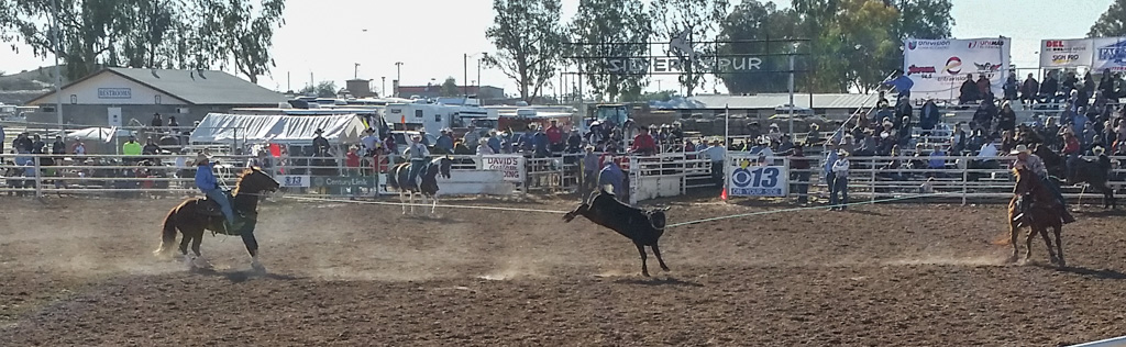
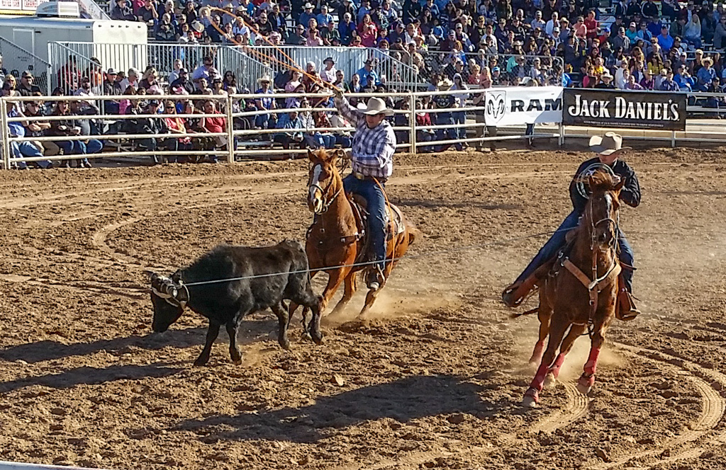
Next up was the calf roping. This is a two cowboy event, with one putting a lasso on the calf’s head and the other then lassoing the hind legs. I was impressed that they could time their throws such that the calf’s hind legs would both be in the air.
A “successful” roping. Kathe couldn’t watch this part.
After successfully roping the calf, the ropes were immediately slacked and the calf released.
Head is roped, about to try for the hind legs!
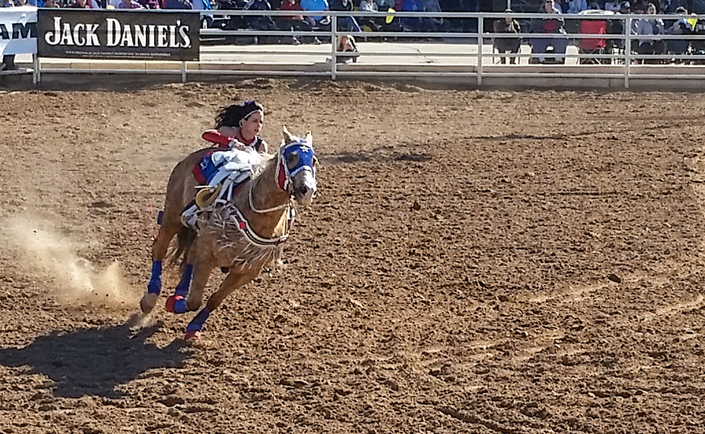
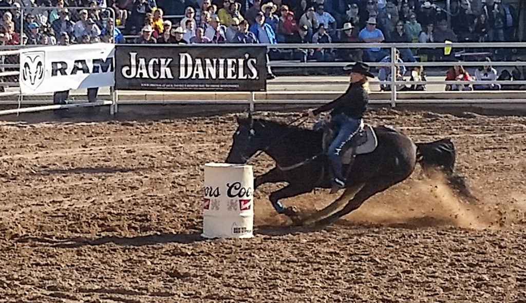
The penultimate event was barrel racing, the other women’s event. This is a timed event, where the riders go around a triangle of barrels. They must round each barrel so that they are going more than 180° around each. The horses are as much the stars of this as the women, with sudden decelerations and changes of direction. Apparently the horse and rider are allowed to touch the barrel, but not knock it over. There is a time penalty assessed for each barrel knocked over, effectively moving them out of competition.
Whoa, Nellie! Slowing down to round the barrel.
Braking hard.
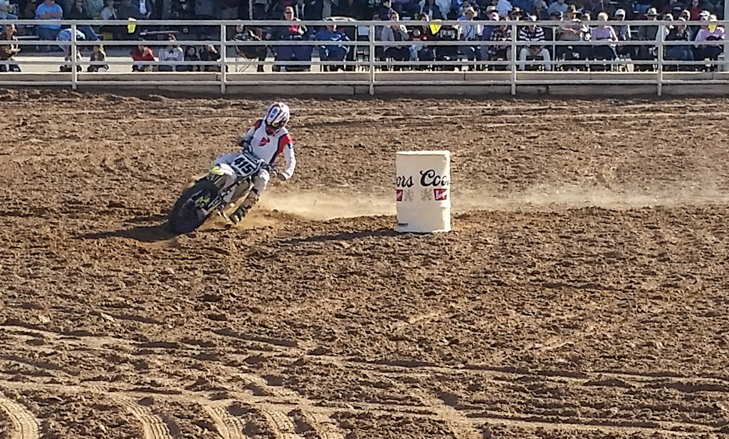
After the horses raced the barrels, it was time for mechanical “horses” (motocross cycles)! And one 4×4. None of the horses in the barrel race threw their rider. Can’t say as much for the motorcycles!
This one managed to stay on the bike. Barely!
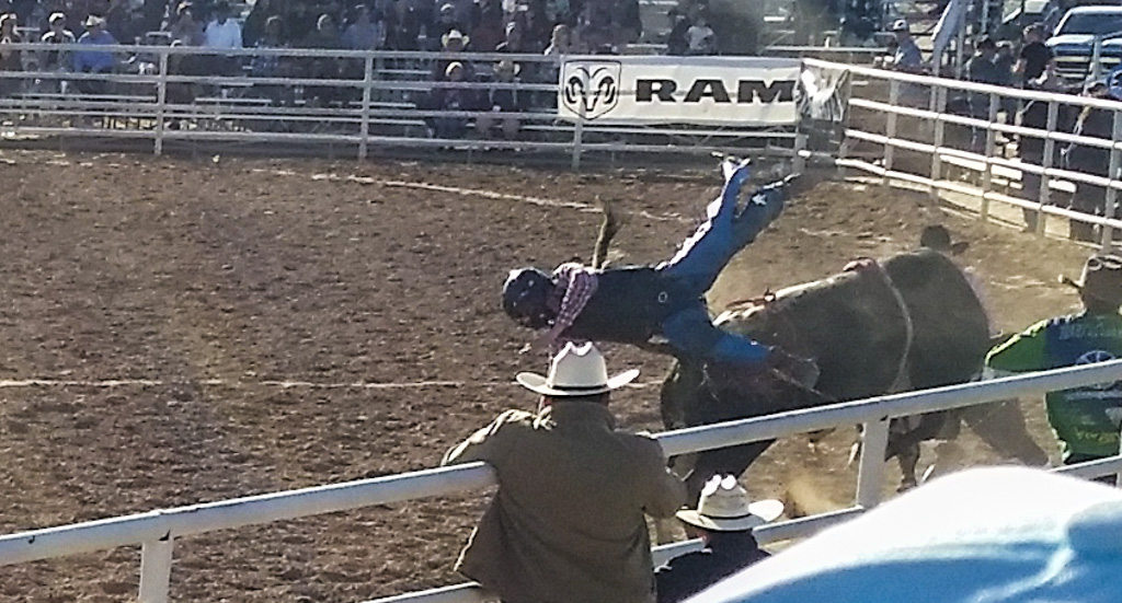
The last event of the day was a bit of a disappointment photographically, due to a combination of where we sat and the time of day. It was the bull “riding.” Riding is in quotes because several of the riders barely made contact with the bull before they were on the ground. We chose to sit on the back side of the field because the grandstand was already full when we arrived, and the hour was late in the afternoon. These combined to make me take pictures straight into the sun. Not optimal. But at least one came out passably.
“Yer OUT!” (Oops, sorry. Wrong sport.)
All in all, we had a good time, made more enjoyable by attending with our friends Henk and Mary, whom we hadn’t seen in several years.
Will we go to more rodeos in the future? Don’t know… So much to do, so little time!
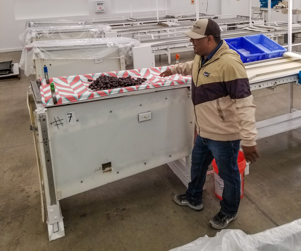
Since ancient times, date palm trees are propagated from offshoots, not from seeds. Material I have read on the web indicate that trees grown from seeds produce inferior fruit. Of course, there is the possibility that some would produce superior fruit due to random genetic mutation, but that isn’t being explored—at least not commercially. So all the Medjool date trees are clones of each other! (That ought to make my friends at JAX happy!)
Dates have been cultivated for over six thousand years, starting in the area of present day Iraq. The claim is made that it is the oldest cultivated crop. Medjool dates originated in Morocco. In the 1920s, the fungal “bayoud disease” was wiping out the date trees in Morocco; eleven offshoots were shipped to the Coachella Valley area in southern California in 1927, both for preservation of the Medjool date strain and for research into the disease. All of the Medjool date trees in the US derive from those eleven offshoots—and there are many! In the ’40s, four offshoots were moved to the Bard Valley, north of Yuma. Those “four sisters” are still producing fruit, and their offshoots are everywhere in the valley!
The dinner, which was organized by the “Visit Yuma” organization, was held at the Imperial Date Gardens, one of the largest Medjool growers in the Bard Valley area. Last year, Imperial produced many million pounds of Medjool dates; it is an amount I can’t imagine! They are the only grower in this area that packages their own dates; all the other growers send their crop to a co-operative packaging facility. Even so, Imperial still sends the majority of its crop to the co-op.
The cultivation, care, and harvesting of the dates is very labor intensive. When we were there (February 1), the tree our guide was using for demonstration purposes was just showing the very first signs of budding. The harvesting finishes in late October or early November—so the cycle takes most of the year.
The male trees are kept separate from the female (fruit-producing) trees. All the pollination is done by hand—and there are thousands of trees! The pollen is produced in pods, which are opened and the pollen collected in jars. Over the course of weeks, this pollen is spread, tree by tree, over the female trees that make up the bulk of the large grove. Up… Pollinate… Down… Move. Repeat.
One of the major aims of date cultivation is to produce large, high-quality fruit. But the tree’s survival-based evolution has caused it to produce many fruit… quantity, not quality. The growers want to focus the tree’s energy into a few fruit. The fruit bearing shoots are like rudimentary brooms, with one stalk coming from the tree which sends out finer branches which bear the fruit. One of the first things the growers do is to cut off most of those finer branches. Then they remove most of the fruit on each of the remaining branches. According to our guide, only about 10% of the fruit is allowed to mature. Even so, the stalks will become so heavy that they have to be tied up to keep them from breaking. Small trees will produce 150 to 200 pounds of dates; larger trees will produce 250 pounds or more. Overall, Imperial Date Gardens produces around thirteen thousand pounds of dates a day.
On a plant like a blueberry bush, or even an apple tree, all of this care would be relatively easy (if we forget about the thousands of trees part). But the dates are 30 to 50 feet up in the air! All of the care is performed from telescoping boom lift trucks. The work platforms are U-shaped, so that the workers can access all of the tree without repositioning the truck.
When the fruit gets to the point that it would soon be interesting to birds, each stalk is enclosed in a mesh bag, with an openable end. At first the end is left open, to allow the most air possible into the fruit. However, just like apples, when the fruit nears maturity some will fall from the tree. Therefore, the bag’s end is closed just before that point, to capture all the dates. Wonder if the apple growers should start bagging all of their branches?
The harvest per se starts in August, and will extend to late October or early November. Just from a point of logistics, each tree is harvested once. That means that there will be some fruit not at the perfect stage of maturity. Some may still be green, or too moist. These are separated in the first, sorting, stage of production, which also removes twigs and other debris. These dates will be allowed to ripen or dry off the tree.
So how do you process 12 million pounds of dates, or even the 1.5 million pounds that they package on-site? With large warehouses, LOTS of trays, and HUGE freezers. I’ve never before seen a -10° F freezer the size of a warehouse! Gives “walk in freezer” a whole new meaning. Imperial Date Gardens uses no chemicals on its trees; the freezing process kills any pests (they are part way through the process of becoming completely organic-certified). We were told that any dates you eat will have been frozen. One interesting side note is that dates may be frozen and thawed repeatedly without any loss in quality. But even if you don’t freeze them, dates will still be good after eight months in your refrigerator, or a month or so at room temperature!
There is a cleaning and secondary sorting and inspection process. Here the dates are shaken on a clean wet cloth and then dropped onto a conveyor belt where inspectors look for the correct amount of skin wrinkling (a sign of moisture content), ripeness, size, etc.
Our guide showing us the cleaning and inspection area.
Is anyone else thinking about Lucy and Ethel? I know I did when I saw the conveyor!
Dates which pass this inspection drop off the end of the conveyor, into a tray. The tray is given a final inspection. If any dates don’t pass, the entire tray is simply put back into the cleaning and inspection process!
One of the other attendees asked about the people who work in the grove. Most of the farm’s laborers are seasonal migrant workers, but about 95% of them come back year after year. They have some workers who have been with them for 30 years or more. Apparently, the date harvest season meshes well with some of the other crops grown in the area.
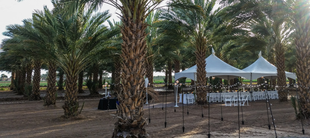
The dinner!
I haven’t talked about the dinner yet; I hope you’ve been anticipating it as much as we did!
Our “dining room!”
Our meal was prepared by chef Alex Trujillo, a graduate of Le Cordon Bleu. He also runs the Patio Restaurant in Yuma. One of the aspects of the meal was that all five courses would contain dates in one form or another.
We started with appetizers, which included corn fritters with dates in the mix. A wonderful twist! They were much more flavorful than usual, and sweeter. Another appetizer was bacon-wrapped Medjool dates. I was so disappointed that none of the servers wandering with the appetizers would leave her plate at my place. I could have very happily eaten the entire plate!
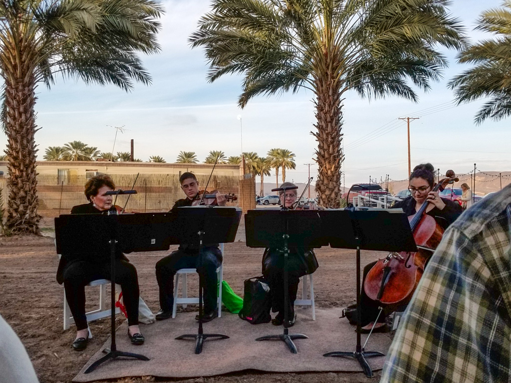
All through the meal, we were serenaded by a string quartet, playing some classical music and some adaptations of popular music.
Fine sound for a fine meal.
Here’s a quick look around, during appetizers.
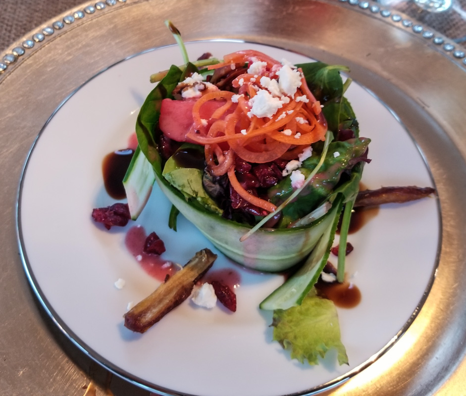
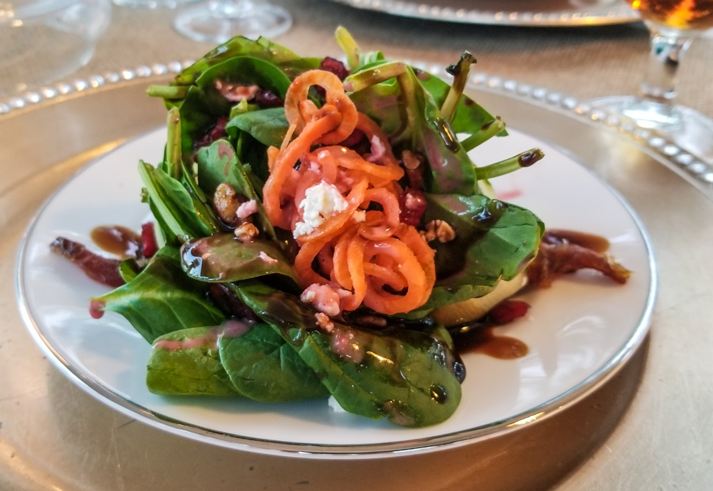
After the appetizer course, we had our informative tour of the facility. When we got back to the dining tent our places had been set with a green salad. The greens were wrapped with a perimeter of very thinly sliced long cucumbers. It almost resembled a large ramekin. Dates in the salad, dates in the dressing!
Salad, with raspberry-date dressing.
There were a variety of salads!
Next, we had a creamy carrot and date soup. Need I say it? Delicious! Need to find a recipe for that…
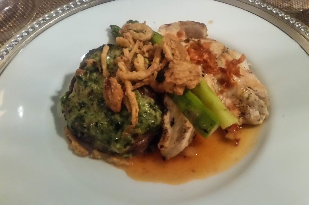
The main course included a steak (nicely rare) and a chicken breast, accompanied by mashed potatoes and asparagus. The sauces were date-based, and yummy.
It tasted as good as it looks!
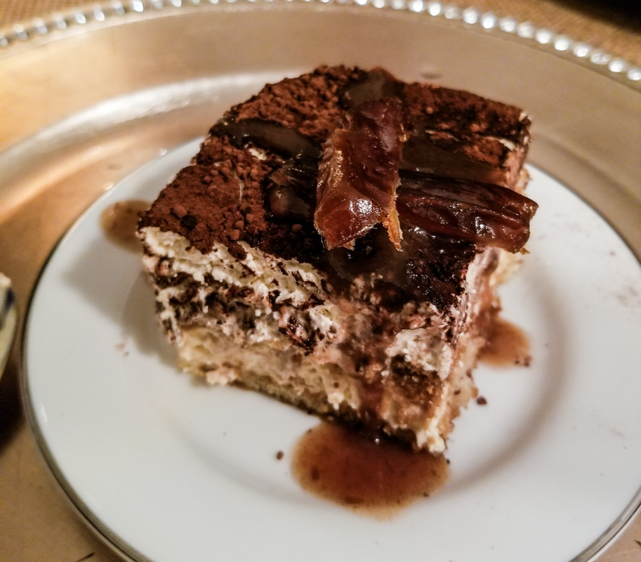
Kathe wasn’t quite able to finish all of the main course, and said she was finished. No dessert for her!
But the fates laugh at people who make statements like that.
Dessert came out and it was tiramisu! Her absolute favorite dessert. Oh, well. “We’ll be good starting tomorrow.” The dates put a nice spin on the traditional dessert. Even Al, who doesn’t normally like tiramisu, enjoyed it!
Date on top, and date sauce!
One of the great things about travel, and we think especially RV travel, is getting to meet new people and hear their stories. That was certainly true at this dinner, where we shared a several hour-long visit with a couple from interior British Columbia.
When we left, Imperial Date Gardens gave us each a one-pound box of Medjool dates. We’re still enjoying that reminder of the evening.
All-in-all, a great night! Thanks so much, Mike and Laurelyn; we loved it!