“You’re going on a DATE NIGHT!”
Our son and daughter-in-law’s Christmas gift certificate promised us a date night. Cool!
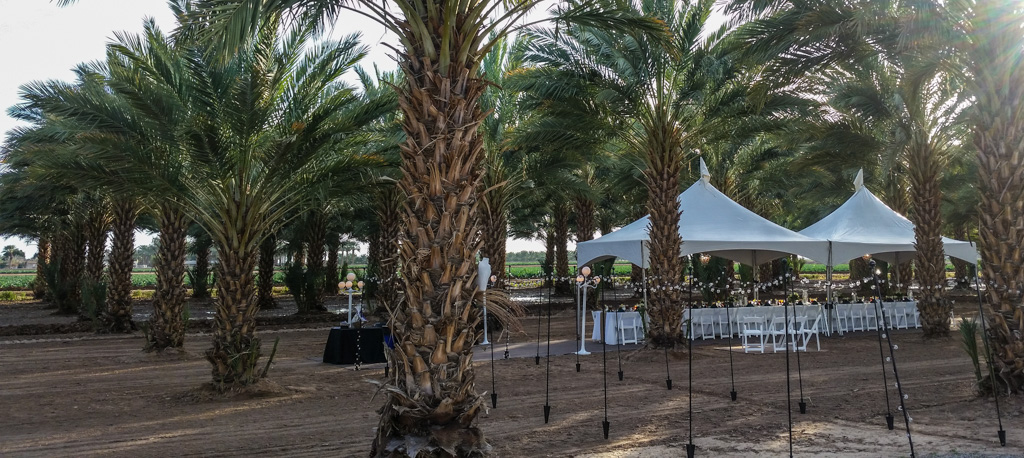
Then we read a little more closely. This “date night” would be a gourmet dinner in a Medjool date grove, just outside of Yuma AZ (actually just over the state line in CA). Fodor’s rates it as one of the top 20 unique dining experiences in the world (#9)!
It lived up to its advertising.
Some background
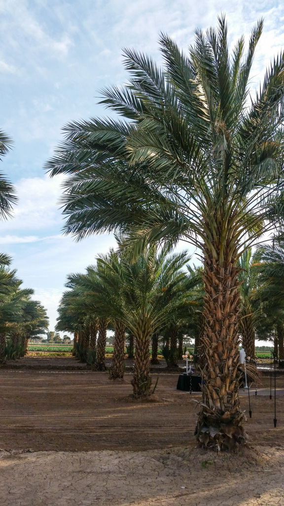
Since ancient times, date palm trees are propagated from offshoots, not from seeds. Material I have read on the web indicate that trees grown from seeds produce inferior fruit. Of course, there is the possibility that some would produce superior fruit due to random genetic mutation, but that isn’t being explored—at least not commercially. So all the Medjool date trees are clones of each other! (That ought to make my friends at JAX happy!)
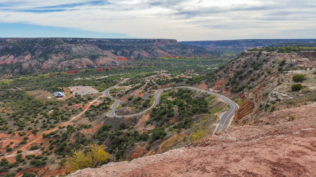
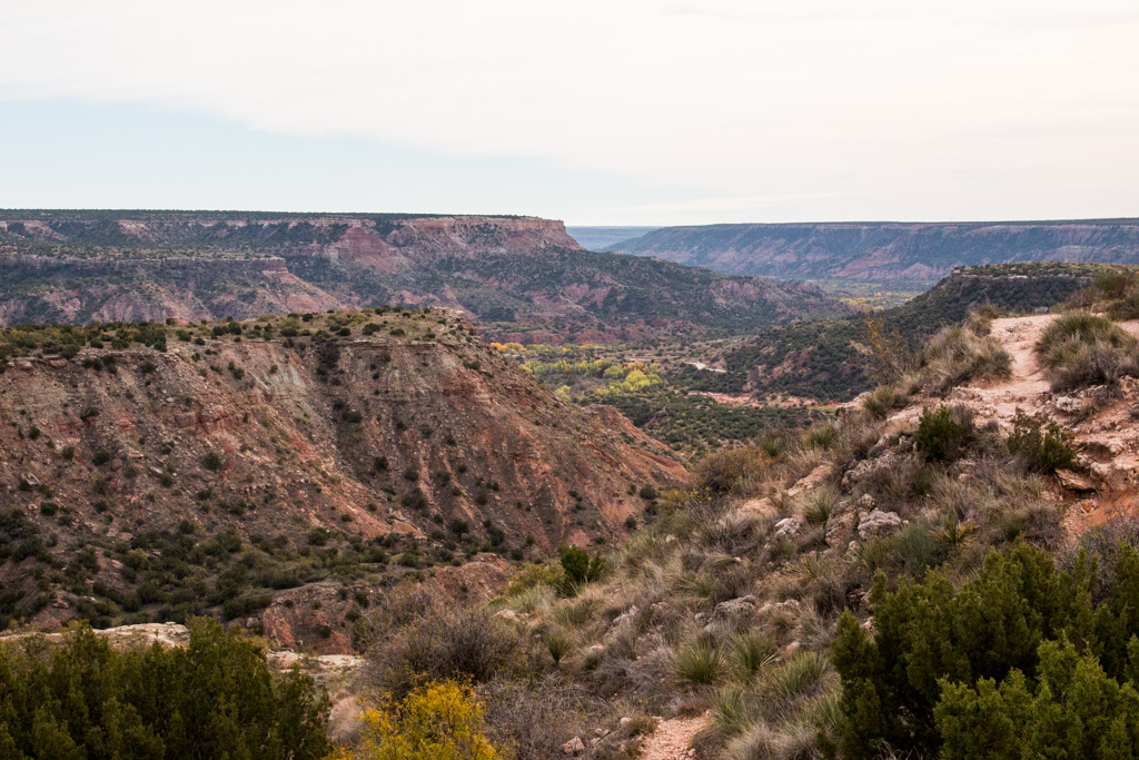
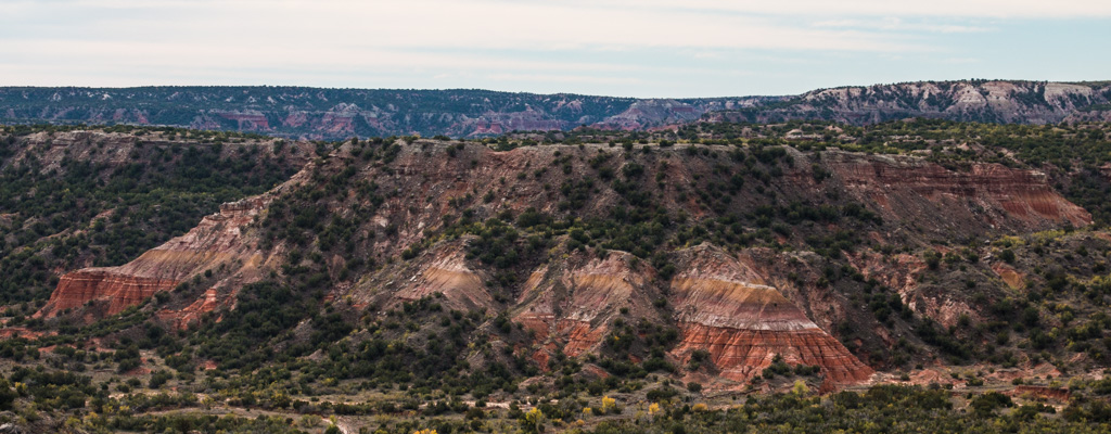
Dates have been cultivated for over six thousand years, starting in the area of present day Iraq. The claim is made that it is the oldest cultivated crop. Medjool dates originated in Morocco. In the 1920s, the fungal “bayoud disease” was wiping out the date trees in Morocco; eleven offshoots were shipped to the Coachella Valley area in southern California in 1927, both for preservation of the Medjool date strain and for research into the disease. All of the Medjool date trees in the US derive from those eleven offshoots—and there are many! In the ’40s, four offshoots were moved to the Bard Valley, north of Yuma. Those “four sisters” are still producing fruit, and their offshoots are everywhere in the valley!
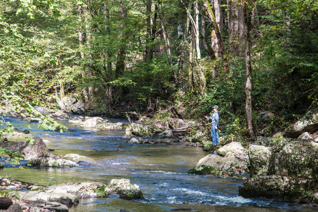
The dinner, which was organized by the “Visit Yuma” organization, was held at the Imperial Date Gardens, one of the largest Medjool growers in the Bard Valley area. Last year, Imperial produced many million pounds of Medjool dates; it is an amount I can’t imagine! They are the only grower in this area that packages their own dates; all the other growers send their crop to a co-operative packaging facility. Even so, Imperial still sends the majority of its crop to the co-op.
The cultivation, care, and harvesting of the dates is very labor intensive. When we were there (February 1), the tree our guide was using for demonstration purposes was just showing the very first signs of budding. The harvesting finishes in late October or early November—so the cycle takes most of the year.
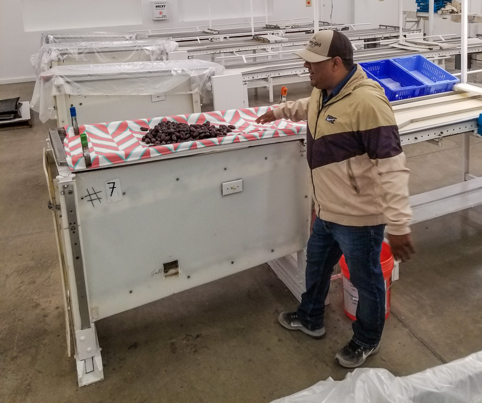
The male trees are kept separate from the female (fruit-producing) trees. All the pollination is done by hand—and there are thousands of trees! The pollen is produced in pods, which are opened and the pollen collected in jars. Over the course of weeks, this pollen is spread, tree by tree, over the female trees that make up the bulk of the large grove. Up… Pollinate… Down… Move. Repeat.
One of the major aims of date cultivation is to produce large, high-quality fruit. But the tree’s survival-based evolution has caused it to produce many fruit… quantity, not quality. The growers want to focus the tree’s energy into a few fruit. The fruit bearing shoots are like rudimentary brooms, with one stalk coming from the tree which sends out finer branches which bear the fruit. One of the first things the growers do is to cut off most of those finer branches. Then they remove most of the fruit on each of the remaining branches. According to our guide, only about 10% of the fruit is allowed to mature. Even so, the stalks will become so heavy that they have to be tied up to keep them from breaking. Small trees will produce 150 to 200 pounds of dates; larger trees will produce 250 pounds or more. Overall, Imperial Date Gardens produces around thirteen thousand pounds of dates a day.
On a plant like a blueberry bush, or even an apple tree, all of this care would be relatively easy (if we forget about the thousands of trees part). But the dates are 30 to 50 feet up in the air! All of the care is performed from telescoping boom lift trucks. The work platforms are U-shaped, so that the workers can access all of the tree without repositioning the truck.
When the fruit gets to the point that it would soon be interesting to birds, each stalk is enclosed in a mesh bag, with an openable end. At first the end is left open, to allow the most air possible into the fruit. However, just like apples, when the fruit nears maturity some will fall from the tree. Therefore, the bag’s end is closed just before that point, to capture all the dates. Wonder if the apple growers should start bagging all of their branches?
The harvest per se starts in August, and will extend to late October or early November. Just from a point of logistics, each tree is harvested once. That means that there will be some fruit not at the perfect stage of maturity. Some may still be green, or too moist. These are separated in the first, sorting, stage of production, which also removes twigs and other debris. These dates will be allowed to ripen or dry off the tree.
So how do you process 12 million pounds of dates, or even the 1.5 million pounds that they package on-site? With large warehouses, LOTS of trays, and HUGE freezers. I’ve never before seen a -10° F freezer the size of a warehouse! Gives “walk in freezer” a whole new meaning. Imperial Date Gardens uses no chemicals on its trees; the freezing process kills any pests (they are part way through the process of becoming completely organic-certified). We were told that any dates you eat will have been frozen. One interesting side note is that dates may be frozen and thawed repeatedly without any loss in quality. But even if you don’t freeze them, dates will still be good after eight months in your refrigerator, or a month or so at room temperature!
There is a cleaning and secondary sorting and inspection process. Here the dates are shaken on a clean wet cloth and then dropped onto a conveyor belt where inspectors look for the correct amount of skin wrinkling (a sign of moisture content), ripeness, size, etc.
Is anyone else thinking about Lucy and Ethel? I know I did when I saw the conveyor!
Dates which pass this inspection drop off the end of the conveyor, into a tray. The tray is given a final inspection. If any dates don’t pass, the entire tray is simply put back into the cleaning and inspection process!
One of the other attendees asked about the people who work in the grove. Most of the farm’s laborers are seasonal migrant workers, but about 95% of them come back year after year. They have some workers who have been with them for 30 years or more. Apparently, the date harvest season meshes well with some of the other crops grown in the area.
The dinner!
I haven’t talked about the dinner yet; I hope you’ve been anticipating it as much as we did!
Our meal was prepared by chef Alex Trujillo, a graduate of Le Cordon Bleu. He also runs the Patio Restaurant in Yuma. One of the aspects of the meal was that all five courses would contain dates in one form or another.
We started with appetizers, which included corn fritters with dates in the mix. A wonderful twist! They were much more flavorful than usual, and sweeter. Another appetizer was bacon-wrapped Medjool dates. I was so disappointed that none of the servers wandering with the appetizers would leave her plate at my place. I could have very happily eaten the entire plate!
All through the meal, we were serenaded by a string quartet, playing some classical music and some adaptations of popular music.
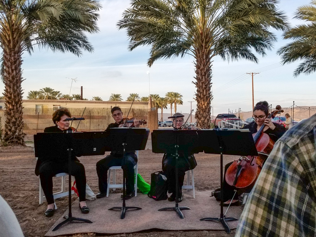
Here’s a quick look around, during appetizers.
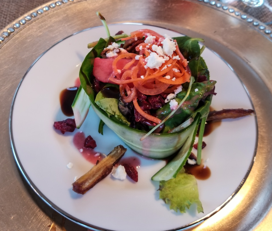
After the appetizer course, we had our informative tour of the facility. When we got back to the dining tent our places had been set with a green salad. The greens were wrapped with a perimeter of very thinly sliced long cucumbers. It almost resembled a large ramekin. Dates in the salad, dates in the dressing!
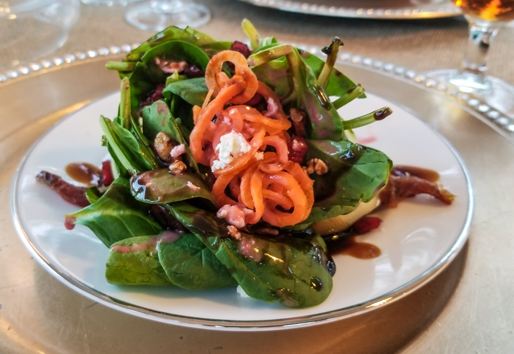
Next, we had a creamy carrot and date soup. Need I say it? Delicious! Need to find a recipe for that…
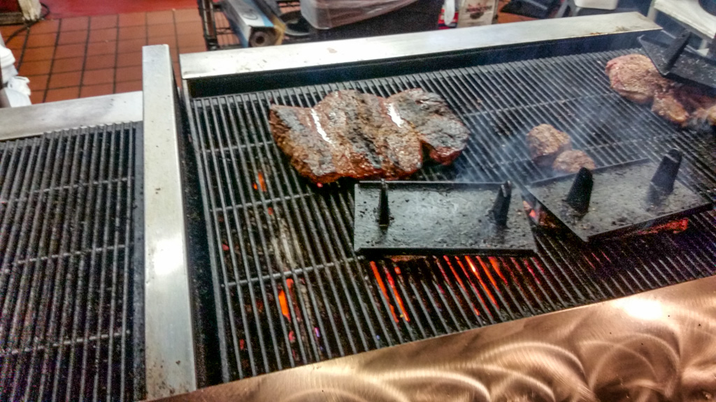
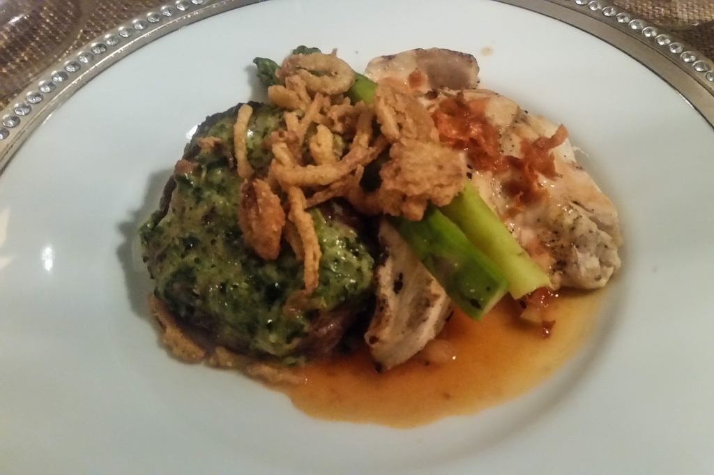
The main course included a steak (nicely rare) and a chicken breast, accompanied by mashed potatoes and asparagus. The sauces were date-based, and yummy.
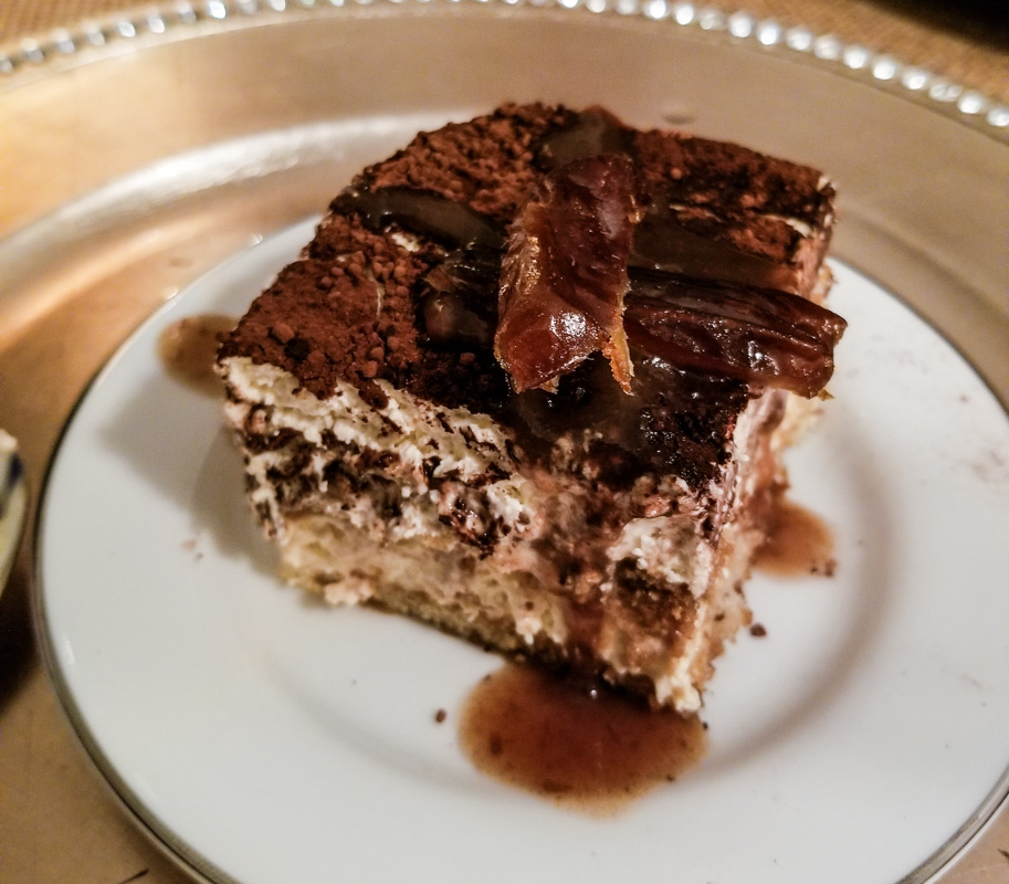
Kathe wasn’t quite able to finish all of the main course, and said she was finished. No dessert for her!
But the fates laugh at people who make statements like that.
Dessert came out and it was tiramisu! Her absolute favorite dessert. Oh, well. “We’ll be good starting tomorrow.” The dates put a nice spin on the traditional dessert. Even Al, who doesn’t normally like tiramisu, enjoyed it!
One of the great things about travel, and we think especially RV travel, is getting to meet new people and hear their stories. That was certainly true at this dinner, where we shared a several hour-long visit with a couple from interior British Columbia.
When we left, Imperial Date Gardens gave us each a one-pound box of Medjool dates. We’re still enjoying that reminder of the evening.
All-in-all, a great night! Thanks so much, Mike and Laurelyn; we loved it!